1820s Maps
to
19
26
1
27
1
2,974
2,232
473
3
288
34
9
126
8
36
9
2
5
4
3
2
27
2
1
1
7
6
6
1
1
27
27
27
1
Period: 1820s
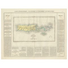
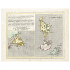
1825 Buchon Map of Puerto Rico & Virgin Islands with Detailed Colonial History
Located in Langweer, NL
This map of Puerto Rico and the Virgin Islands, published by Jean Alexandre Buchon in 1825, offers a unique look at the Caribbean during a time of E...
Category
Antique 1820s Maps
Materials
Paper
$434 Sale Price
20% Off
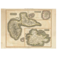
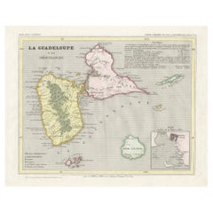
1821 Thomson Map of Guadeloupe, Marie-Galante and Antigua in the West Indies
Located in Langweer, NL
This map, published in 1821 by John Thomson, showcases Guadeloupe, Marie-Galante, and Antigua from the *West India Islands* collection. Part of Thomson's *New General Atlas*, it prov...
Category
Antique 1820s Maps
Materials
Paper
$548 Sale Price
20% Off
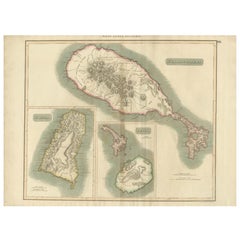
Hand-Colored Map of West India Islands: St. Christopher's, St. Lucia and Nevis
Located in Langweer, NL
This map, titled "West India Islands," was published by John Thomson & Co. in 1821 as part of *Thomson's New General Atlas.* The map offers detailed depictions of three key islands i...
Category
Antique 1820s Maps
Materials
Paper
$548 Sale Price
20% Off
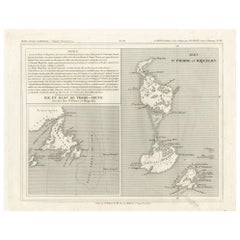
Newfoundland and St. Pierre & Miquelon: Uncoloured French Map of circa 1820
Located in Langweer, NL
The map is titled "Île et Banc de Terre-Neuve avec les Îles St. Pierre et Miquelon", depicting Newfoundland and the French islands of St. Pierre and Miquelon. It is from the Petit Atlas National series.
Features:
- The map is divided into two sections:
1. The left side shows Newfoundland (Terre-Neuve) and its surrounding waters, including important locations such as the Île du Cap Breton and Grand Bank fishing areas.
2. The right side focuses on St. Pierre and Miquelon, a French overseas territory near Newfoundland.
- Administrative divisions and key geographic features, such as capes, bays, and towns, are labeled on the map.
Historical Context:
- This map is part of a collection meant to showcase France's overseas colonies and territories, including the small but significant St. Pierre and Miquelon, which has been under French control for centuries and was a critical fishing and trading hub.
- The Petit Atlas National series was typically published in the early 19th century, and this map likely dates from the same period, around 1815–1820.
Here the text transalated:
Here is the translation of the text from French to English:
---
**NOTICE.**
The islands of St. Pierre and Miquelon, the only remaining French possession in this part of America since the loss of Canada, are located a few miles from the southern coast of Newfoundland, which belongs to the English. Their relatively fertile soil is broken up by hills that give rise to small streams.
**Grande Miquelon**, the northernmost of the two islands, has a circumference of about 9 to 10 leagues. It offers a convenient port for fishing boats.
**Petite Miquelon**, to the south of Grande Miquelon, has a circumference of about 6 leagues. It is well-watered and well-wooded.
**Saint Pierre**, to the south-southwest of the two other islands, presents a somewhat similar appearance but is devoid of trees. Although it is the smallest of the three islands, it is the most important due to the size of its harbor, which can accommodate 30 to 40 ships of various sizes, and because of its favorable coastline for the preparation, preservation, and export of cod. On its eastern coast, at the bottom of a beautiful bay, lies the town of Saint Pierre, the only notable settlement on the three islands. It is the residence of a naval officer who, under the title of Commander, governs the colony.
The permanent population is about 2,000 souls, of which 800 reside in Saint Pierre. However, sailors come to the islands from the coasts of Brittany and Normandy during the cod fishing season on the Grand Banks of Newfoundland and the Gulf of St. Lawrence. In 1833, it was estimated that about 14,000 sailors were employed in this fishery, and the purchase of supplies required by the colony was valued at over one million francs.
---
This translation reflects the original notice describing the French islands of St. Pierre and Miquelon, with details about their geography, population, and economic activities related to the fishing industry.
People searching for maps or information about Newfoundland and the French islands of St. Pierre and Miquelon use the following keywords:
1. Newfoundland map...
Category
Antique 1820s Maps
Materials
Paper
$151 Sale Price
20% Off
Newfoundland and St. Pierre & Miquelon: Early 19th Century French Map
Located in Langweer, NL
The map is titled "Île et Banc de Terre-Neuve avec les Îles St. Pierre et Miquelon", depicting Newfoundland and the French islands of St. Pierre and Miquelon. It is from the Petit Atlas National series.
Features:
- The map is divided into two sections:
1. The left side shows Newfoundland (Terre-Neuve) and its surrounding waters, including important locations such as the Île du Cap Breton and Grand Bank fishing areas.
2. The right side focuses on St. Pierre and Miquelon, a French overseas territory near Newfoundland.
- Hand-colored outlines mark the territories, with color distinctions for the different islands.
- Administrative divisions and key geographic features, such as capes, bays, and towns, are labeled on the map.
Here the text translated:
Here is the translation of the text from French to English:
**NOTICE.**
The islands of St. Pierre and Miquelon, the only remaining French possession in this part of America since the loss of Canada, are located a few miles from the southern coast of Newfoundland, which belongs to the English. Their relatively fertile soil is broken up by hills that give rise to small streams.
**Grande Miquelon**, the northernmost of the two islands, has a circumference of about 9 to 10 leagues. It offers a convenient port for fishing boats.
**Petite Miquelon**, to the south of Grande Miquelon, has a circumference of about 6 leagues. It is well-watered and well-wooded.
**Saint Pierre**, to the south-southwest of the two other islands, presents a somewhat similar appearance but is devoid of trees. Although it is the smallest of the three islands, it is the most important due to the size of its harbor, which can accommodate 30 to 40 ships of various sizes, and because of its favorable coastline for the preparation, preservation, and export of cod. On its eastern coast, at the bottom of a beautiful bay, lies the town of Saint Pierre, the only notable settlement on the three islands. It is the residence of a naval officer who, under the title of Commander, governs the colony.
The permanent population is about 2,000 souls, of which 800 reside in Saint Pierre. However, sailors come to the islands from the coasts of Brittany and Normandy during the cod fishing season on the Grand Banks of Newfoundland and the Gulf of St. Lawrence. In 1833, it was estimated that about 14,000 sailors were employed in this fishery, and the purchase of supplies required by the colony was valued at over one million francs.
---
This translation reflects the original notice describing the French islands of St. Pierre and Miquelon, with details about their geography, population, and economic activities related to the fishing industry.
Historical Context:
- This map is part of a collection meant to showcase France's overseas colonies and territories, including the small but significant St. Pierre and Miquelon, which has been under French control for centuries and was a critical fishing and trading hub.
- The Petit Atlas National series was typically published in the early 19th century, and this map likely dates from the same period, around 1815–1820.
People searching for maps or information about Newfoundland and the French islands of St. Pierre and Miquelon use the following keywords:
1. Newfoundland map...
Category
Antique 1820s Maps
Materials
Paper
$151 Sale Price
20% Off
Guadeloupe and Dependencies: 19th Century French Map and Inset of Pointe-à-Pitre
Located in Langweer, NL
This map titled "La Guadeloupe et ses Dépendances" (Guadeloupe and its Dependencies) is from a Petit Atlas National series, focusing on the French Caribbean islands of Guadeloupe, Ma...
Category
Antique 1820s Maps
Materials
Paper
$132 Sale Price
20% Off
Map of French Guiana, Suriname and Cayenne: Plan from Petit Atlas National, 1820
Located in Langweer, NL
This map, titled "Guyane" (French Guiana), is part of the Petit Atlas National series, focusing on French colonies. Here are the key elements of the map and its context:
Features:
-...
Category
Antique 1820s Maps
Materials
Paper
$151 Sale Price
20% Off
Original Antique Map of Europe, Arrowsmith, 1820
Located in St Annes, Lancashire
Great map of Europe
Drawn under the direction of Arrowsmith.
Copper-plate engraving.
Published by Longman, Hurst, Rees, Orme and Brown, 1820
...
Category
English Antique 1820s Maps
Materials
Paper
Terrestrial Table Globe by Félix Delamarche, Paris, 1821
By Félix Delamarche
Located in Milano, IT
Terrestrial table globe
Félix Delamarche
Paris, 1821
It measures 20.47 in height, Ø max 14.17 in; the sphere Ø 9.44 in (h 52 cm x Ø max 36.5 cm; the sphere Ø 24 cm)
Wood, printed...
Category
French Restauration Antique 1820s Maps
Materials
Metal
Old Map of the Russian Empire, with English Language Text, Ca.1820
Located in Langweer, NL
Antique map titled 'Geographical, Statistical and Historical Map of Russia'.
Old map of the Russian Empire, encompassed on three sides by English language text. Originates from L...
Category
Antique 1820s Maps
Materials
Paper
$510 Sale Price
20% Off
1826 Antigo Impero Messicano Mexico Hand Colored Framed Map
Located in Stamford, CT
1826 Antigo Impero Messicano Mexico Hand Colored Framed Map. As found black wood frame.
Category
Mexican Spanish Colonial Antique 1820s Maps
Materials
Glass, Wood, Paper
Antique Geographical, Historical and Statistical Map of Massachusetts, 1822
Located in Langweer, NL
This attractive map of Massachusetts presents a finely detailed overview of the state in the first quarter of the 19th century.
Transportation ...
Category
Antique 1820s Maps
Materials
Paper
$359 Sale Price
20% Off
Detailed Map of the Madura Strait, between Java & Madura Island, Indonesia, 1825
Located in Langweer, NL
Antique map titled 'Plan du Détroit de Madura'.
Detailed map of the Madura Strait in Indonesia. The eastern part of the island Java with the city of Gresik and the western part o...
Category
Antique 1820s Maps
Materials
Paper
$1,108 Sale Price
24% Off
Original Antique Map of China, Arrowsmith, 1820
Located in St Annes, Lancashire
Great map of China
Drawn under the direction of Arrowsmith
Copper-plate engraving
Published by Longman, Hurst, Rees, Orme and Brown, 1820
Unfr...
Category
English Antique 1820s Maps
Materials
Paper
Detailed Antique Map of Jamaica - Published in Weimar, 1825
Located in Langweer, NL
This map of Jamaica is an interesting historical document.
This map is part of an atlas that was issued in six editions in English, French, and German ...
Category
Antique 1820s Maps
Materials
Paper
$510 Sale Price
20% Off
Original Antique Map of Hungary, Arrowsmith, 1820
Located in St Annes, Lancashire
Great map of Hungary
Drawn under the direction of Arrowsmith.
Copper-plate engraving.
Published by Longman, Hurst, Rees, Orme and Brown, 1820
Unframed.
Category
English Antique 1820s Maps
Materials
Paper
Original Antique Map of South Africa, Arrowsmith, 1820
Located in St Annes, Lancashire
Great map of South Africa.
Drawn under the direction of Arrowsmith.
Copper-plate engraving.
Published by Longman, Hurst, Rees, Orme and Br...
Category
English Antique 1820s Maps
Materials
Paper
Original Antique German Map of the Russian Empire in Europe, ca.1825
Located in Langweer, NL
Antique map titled 'Des Russischen Reichs - Europäische Theil'.
Original antique map of the Russian Empire in Europe. This map originates from 'Stielers Handatlas'. Published circa...
Category
Antique 1820s Maps
Materials
Paper
$170 Sale Price
20% Off
Original Antique Map of Central America / Florida, Arrowsmith, 1820
Located in St Annes, Lancashire
Great map of Central America.
Drawn under the direction of Arrowsmith.
Copper-plate engraving.
Published by Longman, Hurst, Rees, Orme and Brown, 1820
Unframed.
Category
English Antique 1820s Maps
Materials
Paper
Antique Map of Russia in Europe on Two Sheets from an Old German Atlas, Ca.1825
Located in Langweer, NL
Description: Antique map titled 'Europäisches Russland'.
Two individuel sheets, joined together they depict Russia in Europe. These maps originate from 'Stielers Handatlas'. Publis...
Category
Antique 1820s Maps
Materials
Paper
$425 Sale Price
20% Off
Rare Antique Map with Timor and Nearby Islands Plus an Inset of Hawaii, 1825
Located in Langweer, NL
Antique map titled 'Essai sur la Geographie de l'Ile Timor.'
A map showing Timor and the surrounding nearby islands (Floris, Sabrao, Solor, Lomblem, Panter, Ombai and Wetter. Wit...
Category
Antique 1820s Maps
Materials
Paper
$803 Sale Price / set
20% Off
Map of Winter Harbour on Melville Island, Australia by Parry's Expedition, 1821
Located in Langweer, NL
Antique print titled 'Survey of Winter Harbour Melville Island, June 1820'.
Chart of the bay or harbor on Melville Island where William Parry's expedit...
Category
Antique 1820s Maps
Materials
Paper
$245 Sale Price
20% Off
Original Antique Map of Pennsylvania Showing Interesting Statistics Etc, 1825
Located in Langweer, NL
Attractive map of Pennsylvania with bordercoloring of the county and showing the various towns, roads, rivers, bridges, and a host of other details...
Category
Antique 1820s Maps
Materials
Paper
$330 Sale Price
20% Off
French Geographical, Statistical and Historical Map of Pensylvania, 1825
Located in Langweer, NL
Title: Carte geographique, statistique et historique de la Pensylvanie.
Beautiful Hand-Colored 1825 French Map of Pennsylvania, with a List of Prominent Rivers, Descriptions of Mountains, Climate and Government as well as a list of Colonial and post-American Revolution Governors
Produced by: J. Carez in Paris. (1825)
Hand colored engraved map. Relief shown by hachures. Text and tables at sides and bottom. Prime meridians: Washington and Paris.
A very interesting 1825 French hand-colored map of Pennsylvania from Lucas' 1822 map, which breaks down county populations by Whites and Free Blacks. "Carte Geographique, Statistique et Historique de la Pensylvanie" Originally published in 1822 by Carey and Lea and then revised and republished in 1825 by J. A. C. Buchon (1791-1846 ) in a French edition entitled Atlas Geographique des Deux Ameriques, printed by J. Carez. Fielding Lucas, Jr. (1781-1854), a Baltimore mapmaker and publisher, drew the map. original hand-coloring.
Shown on the map are parts of Maryland, Delaware, New York and New jersey. Printed on the same page as the map is geographical, statistical, and historical information about Pennsylvania, such as descriptions of the state's important rivers, a list of Governors since its founding as well as important French and Indian...
Category
Antique 1820s Maps
Materials
Paper
$453 Sale Price
20% Off
Hand-Colored Print of Folkestone 'United Kingdom' as Seen from the East, 1822
Located in Langweer, NL
Antique print titled 'Folkestone'.
This print depicts the town of Folkestone (United Kingdom) as seen from the East, the viewpoint high on the cliffs above the Warren, with cattl...
Category
Antique 1820s Maps
Materials
Paper
$368 Sale Price
20% Off
Antique Chart of the Straits of Makassar, Indonesia with Borneo and Celebes-1820
Located in Langweer, NL
Description: Antique map titled 'A New Chart of the Straits of Macassar with various additions & improvements by J.W. Norie'.
Rare and beautifully engraved chart of the Straits of Makassar showing Eastern Borneo and Celebes coast lines. With various smaller inset maps including a plan of the shoals off ragged and shoal points in Borneo, the Bay of Bonthain and the Straits of Salayr.
Artists and Engravers: John William Norie (1772-1843), acquired the chart publishing business of William Heather after he died in 1812. He went into partnership with George Wilson...
Category
Antique 1820s Maps
Materials
Paper
$2,599 Sale Price
20% Off
Map Hanging Wall County of Devon C&J Greenwood 1827 Exeter Cathedral Lundy Isle
Located in BUNGAY, SUFFOLK
C & J GREENWOOD MAP OF THE COUNTY OF DEVON, FROM AN ORIGINAL SURVEY, PUBLISHED 1827, WITH ENGRAVING OF EXETER CATHEDRAL AND MAP OF LUNDY INSET, 6ft 2 ...
Category
English Early Victorian Antique 1820s Maps
Materials
Paper
Related Items
1864 Map of North America, Antique Hand-Colored Map, by Adolphe Hippolyte Dufour
Located in Colorado Springs, CO
Offered is a map of North America entitled Amerique du Nord from 1864. This rare, separately published wall map was produced by Adolphe Hippolyte Dufour. This map includes vibrant an...
Category
French Antique 1820s Maps
Materials
Paper
$4,500
H 44.5 in W 33 in D 1.5 in
French Late 19th Century Louis XVI St. Giltwood Barometer
Located in West Palm Beach, FL
A very handsome and decorative French late 19th century Louis XVI st. giltwood barometer. Fine carvings of scrolls and foliate throughout with a lyre shape above the painted barometer...
Category
French Louis XVI Antique 1820s Maps
Materials
Giltwood
Four 18th Century Engraved and Hand-Colored Maps by Weigel
By Christoph Weigel
Located in Copenhagen, K
Small collection of four engraved maps of Italy, Balkan and of Central Asia.
Two are of Italy, one Corsica and Northern Italy and the other of the Southern Italian boot...
Category
German Antique 1820s Maps
Materials
Paper
$450 / item
H 15.75 in W 18.12 in D 0.79 in
English Campaign Trunk of Brass-Bound Leather and Camphor Wood, circa 1820
Located in Austin, TX
A handsome medium-sized British officer's military Campaign camphor trunk or chest of brass-bound and studded leather over camphor wood, circa 1820.
Manufactured by the British East India...
Category
English Campaign Antique 1820s Maps
Materials
Brass, Metal
$3,495
H 13.13 in W 31.5 in D 16 in
19th C. Spanish Colonial Carved Giltwood Triptych of Virgin Mary & Christ Child
Located in West Palm Beach, FL
19th century Spanish Colonial carved giltwood Triptych of Virgin Mary & Christ Child
Late 19th century, South America
Of exceptional quality, the hinged three panel devotional ic...
Category
South American Spanish Colonial Antique 1820s Maps
Materials
Canvas, Giltwood
$1,180 Sale Price
20% Off
H 12 in W 16 in D 1 in
1868 Map of the Upper Part of the Island of Manhattan Above 86th Street
Located in San Francisco, CA
This wonderful piece of New York City history is over 150 years old. It depicts 86th street and above. It was lithographed by WC Rogers and company. It was made to show what was the Battle of Harlem during the Revolutionary war...
Category
American American Colonial Antique 1820s Maps
Materials
Paper
$475
H 15.5 in W 24.6 in D 1 in
In the American West, Richard Avendon, 1985, Signed
Located in Philadelphia, PA
Author: Text by Laura Wilson
Book: Commissioned in 1978 by the Amon Carter Museum of American Art in Fort Worth, this series of photographs is...
Category
Modern Vintage 1820s Maps
Materials
Paper
Early 19th Century Italian Altar
Located in Baton Rouge, LA
This early 19th century Italian altar is made of worn painted wood and worn fabric details. This is a highly decorative altar for the unknown Catholic saint...
Category
Italian Antique 1820s Maps
Materials
Fabric, Wood, Paint
Early 19th Century French Leather Books, Set of 6
Located in Ross, CA
Set of six French language leather bound books, gold foil stamped and embossed. Titled Oeuvres de Crebillion by Sterne, printed in Paris in 1802 and 1818.
Category
French French Provincial Antique 1820s Maps
Materials
Leather
19th Century French Automaton
Located in San Francisco, CA
Fabulous rare 19th century automaton. Most likely made in France at the end of the 19th century. She is a real beauty and in remarkable condition for her age. She is made of porcelain and cloth. When you wind her she bends her head and raises bouquet to smell the flowers. With the stand she is 15 1/2 inches high. Just herself measures 11 1/2 inches high. Approximately 5 1/2 inches in width and depth. There is a monogram on the back of her neck that appears to be the letter C...
Category
French Victorian Antique 1820s Maps
Materials
Porcelain
Early 19th Century Marionette Puppets
Located in London, GB
Early 19th Century Marionette Puppets
A rare untouched example of two hand crafted early 19th century marionette puppets, likely to be French in...
Category
French Antique 1820s Maps
Materials
Fabric, Pine, Paper
A History of Ballet and Dance
Located in Richmond, VA
Hardback coffee table book discussing the history of ballet and dance in the western world. By Alexander Bland, published in 1976. Second edition, 191 pages.
"Dance is universal and...
Category
Vintage 1820s Maps
Materials
Paper
Previously Available Items
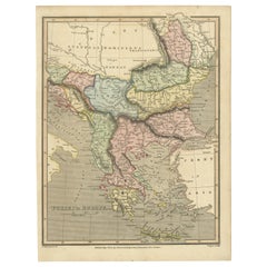
Early 19th Century Map of Ottoman Europe and Surrounding Regions, 1821
Located in Langweer, NL
The map is titled "Turkey in Europe" and was published in the early 19th century. It depicts the geopolitical divisions of Southeastern Europe during the time of the Ottoman Empire's...
Category
Antique 1820s Maps
Materials
Paper
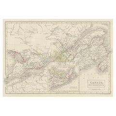
Antique Map of South-West Canada incl Quebec, New Brunswick & Nova Scotia, c1820
Located in Langweer, NL
Antique map titled 'Canada, New Brunswick &c.'
Map of the South-West of Canada. This includes Quebec, New Brunswick, and Nova Scotia. Major cities in...
Category
Antique 1820s Maps
Materials
Paper
H 11.97 in W 17.33 in D 0 in
1828 "Map of the United States" by T. Ensign
Located in Colorado Springs, CO
Presented is Timothy Ensign’s “Map of the United States,” published in 1828. The map is one of the first to show the United States stretching all the way to the Pacific Ocean. The map’s area covers Oregon to the Atlantic Ocean and Canada to Mexico. It also features a very prominent engraved portrait of George Washington, with inset views and maps of the Capitol, Washington, DC, Boston and a small map of North America.
Because this map predates the Texas Revolution, the Mexican American War, and the 1846 Treaty of Guadalupe Hidalgo, Mexico comprises much of the southwest, including California, Arizona, New Mexico, Nevada, Utah, and Texas. And yet, by including the large expanse of territory between the Mississippi River and the Pacific, the map is a mirror of American expansionist ambitions of the time.
Territorial expansion of the boundaries of the United States westward to the Pacific and beyond was at its peak at the time of this map’s publication. In 1803, President Thomas Jefferson’s Louisiana Purchase doubled the size of the country and the Lewis & Clark expedition of 1803-1806 sparked interest in the exploration and settlement of the newly acquired land. Expansionists eager to acquire Spanish Florida were part of the drive for the War of 1812 and Andrew Jackson’s invasion of Florida in 1818 and the subsequent Adams-Onís Treaty established an American claim to the Pacific Northwest as Spain renounced its claim to the Oregon Country...
Category
American Antique 1820s Maps
Materials
Paper
English Pocket Globe by Lane, London, between 1817 and 1833
By Lane's
Located in Milano, IT
Pocket Globe
Lane, London, between 1817 and 1833
The globe is contained in its original case covered with black leather.
Diameter: globe 2.75 in (7 cm); case 3.26 in (8.3 cm).
Weight: 0.28 lb (128 g)
State of conservation: almost excellent. It has some slight abrasions and some signs of use.
The globe is made up of twelve printed paper gores aligned and glued to the sphere. Two pins are inserted on the poles.
In the North Pacific Ocean, above the Tropic of Cancer, the globe bears a cartouche with the inscription:
LANE’S
Improved
GLOBE
LONDON
and, under cartouche
J. Mynde Sc[ulpsit]
On the globe, much of central Africa is empty and the great lakes Tanganyika and Victoria are not marked (Europeans would begin to explore the area after 1858). Australia is still called New Holland (the new name would be introduced in 1829); Tasmania is listed as an island (Matthew Flinders circumnavigates it in 1798). The routes of Cook's and Anson's various voyages are plotted; on the island of Sandwich, between Guinea and Mexico, in the middle of the Pacific Ocean, the place and date of Cook's killing are reported.
The antipode of London is marked in the south of New Zealand.
The pocket globe was made between 1817 and 1833.
The reconstruction of the history of this dating is due to Elly Dekker (E., Dekker, Globes at Greenwich, Oxford 1999, pp. 128-129).
Around 1757 James Ferguson...
Category
English George IV Antique 1820s Maps
Materials
Shagreen, Paper
Original Antique Map of India, circa 1820
Located in St Annes, Lancashire
Super map of India
Copper plate engraving
Published, circa 1820.
Unframed.
Category
English Other Antique 1820s Maps
Materials
Paper
Original Antique Map of Persia, circa 1820
Located in St Annes, Lancashire
Super map of Persia
Copper plate engraving
Published, circa 1820.
Unframed.
Some minor creasing.
Category
English Other Antique 1820s Maps
Materials
Paper
English Regency Mahogany 1820s Era Map Cabinet with Antique Maps of the World
Located in Swedesboro, NJ
This is a highly unique item. This antique 1820s mahogany map cabinet comes complete with sleeves containing mounted antique maps of North America, Africa,...
Category
English Regency Antique 1820s Maps
Materials
Mahogany
H 38.25 in W 40 in D 12 in
"Plan of the City of Washington" Antique Washington D.C. Map, circa 1829
Located in Colorado Springs, CO
This is an 1829 engraved and hand-colored booklet map of Washington City (Washington, D.C.) by William Elliot. The map was printed by O. H. Throop and ...
Category
American Antique 1820s Maps
Materials
Paper
H 25.63 in W 30.38 in D 1.5 in
1829 Map of Virginia and Maryland by Anthony Finley
Located in Colorado Springs, CO
This intriguing hand-colored map shows the counties, County seats, roads, and rivers in both Maryland and Virginia from 1829. Originally drawn by D.H. Vance and engraved by J.H. Youn...
Category
American Antique 1820s Maps
Materials
Paper
George IV George Smith Terrestrial Globe
Located in Lymington, Hampshire
A George IV 18 inch George Smith terrestrial globe, set in a mahogany tripod Stand with a turned baluster support and slender square-section legs with the original castors. Compass d...
Category
English George IV Antique 1820s Maps
Materials
Mahogany
19th Century Map Imperial Court of Austria Habsburgs
Located in London, GB
This is an antique map of the State of the Imperial Court and the hereditary states of the House of Austria, with their various chancelleries, circa 1820.
The map is very detailed and shows the various branches of the Habsburgs territory.
It is very clean and in good condition and is in a beautiful gilded frame.
Provenance:
I bought this on my last buying trip to Madrid, and it bears the stamp, on the rear, of the " Libreria Margarita de Dios" of Madrid.
Condition:
In excellent condition, please see photos for confirmation of condition.
Dimensions in cm:
Height 61 x width 69.5 x depth 3
Dimensions in inches:
Height 2 feet, 0 inches x width 2 feet, 3 inches x depth 1 inch
The House of Habsburg, also spelled Hapsburg, was one of the most important royal houses of Europe. The throne of the Holy Roman Empire was continuously occupied by the Habsburgs between 1438 and 1740. The house also produced emperors and kings of the Kingdom of Bohemia, Kingdom of England, Kingdom of France, Kingdom of Germany, Kingdom of Hungary, Empire of Russia, Kingdom of Croatia, Second Mexican Empire...
Category
Spanish Antique 1820s Maps
1824 Massachusetts, Connecticut and Rhode Island Antique Wall Map by E. Ruggles
Located in Colorado Springs, CO
This rare and detailed 1824 wall map by Edward Ruggles depicts eastern New York to Cape Cod, southern Vermont, and New Hampshire to Long Island. Delineated in hand color by County, t...
Category
American Antique 1820s Maps
Materials
Paper
H 47 in W 52 in L 47 in
