Mid-19th Century Maps
to
578
840
36
876
56
8
2
2,971
2,281
474
3
290
34
10
126
10
37
9
2
5
4
3
3
852
55
28
4
4
229
106
63
58
55
876
876
876
104
4
2
1
1
Period: Mid-19th Century
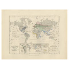
Antique Map Showing the Distribution of Plants by Johnston '1850'
Located in Langweer, NL
Antique map titled 'Geographical plants which are used as food for man'. Original antique map showing the distribution of plants. This map originates from 'The Physical Atlas of Natu...
Category
Antique Mid-19th Century Maps
Materials
Paper
$189 Sale Price
20% Off
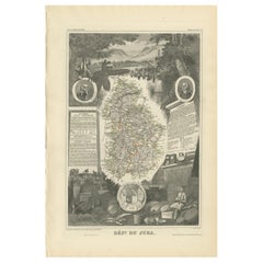
Antique Map of Jura ‘France’ by V. Levasseur, 1854
Located in Langweer, NL
Antique map titled 'Dépt. du Jura'. Map of the French department Jura, France. The Jura wines are very distinctive and unusual, such as Vin Jaune, which is made by a similar process ...
Category
Antique Mid-19th Century Maps
Materials
Paper
$170 Sale Price
20% Off
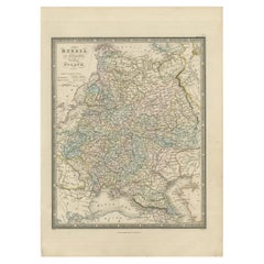
Antique Map of Russia in Europe and Poland by Wyld '1845'
Located in Langweer, NL
Antique map titled 'Russia in Europe including Poland'. Original antique map of Russia in Europe and Poland. This map originates from 'An Atlas of the World, Comprehending Separate M...
Category
Antique Mid-19th Century Maps
Materials
Paper
$189 Sale Price
20% Off
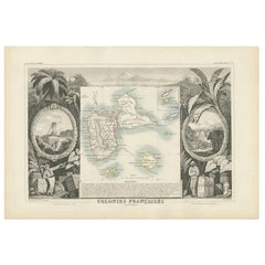
Antique Map of the French Colony Guadeloupe by V. Levasseur, 1854
Located in Langweer, NL
Antique map titled 'Colonies Françaises (en Amerique). Detailed map of the island of Guadeloupe in the Caribbean Sea, with decorative frame containing views of the island. This map o...
Category
Antique Mid-19th Century Maps
Materials
Paper
$189 Sale Price
20% Off
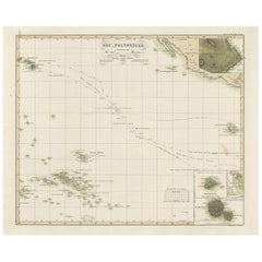
Antique Map of Eastern Polynesia, 1849
Located in Langweer, NL
Antique map titled 'Ost-Polynesien'. Interesting variant issue, with large detailed insets top right of Hawaii volcanos near Kilauea. Insets lower right of Honolulu harbour, island o...
Category
Antique Mid-19th Century Maps
Materials
Paper
$165 Sale Price
30% Off
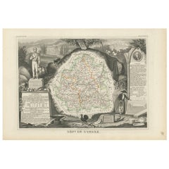
Antique Map of Indre ‘France’ by V. Levasseur, 1854
Located in Langweer, NL
Antique map titled 'Dépt. de l'Indre'. Map of the French department of Indre, France. Part of the Loire Valley wine region, this area is known for its production of Chinon wines, typ...
Category
Antique Mid-19th Century Maps
Materials
Paper
$170 Sale Price
20% Off
Antique Map of the Hautes Pyrenees 'France' by V. Levasseur, 1854
Located in Langweer, NL
Antique map titled 'Dépt. des Htes. Pyrénées'. Map of the French department of Hautes Pyrenees, France. This area is home to the wine producing region, Madiran. Madrian is best known...
Category
Antique Mid-19th Century Maps
Materials
Paper
$189 Sale Price
20% Off
Antique Map of Côtes du Nord ‘France’ by V. Levasseur, 1854
Located in Langweer, NL
Antique map titled 'Dépt. des Côtes du Nord'. Map of the French department of Cotes du Nord, a maritime region in Brittany, France. The whole is surrounded by elaborate decorative en...
Category
Antique Mid-19th Century Maps
Materials
Paper
$189 Sale Price
20% Off
Antique Physical Chart of the Atlantic Ocean by Johnston '1850'
Located in Langweer, NL
Antique map titled 'Physical Chart of the Atlantic Ocean showing the form and direction of the currents'. Original antique chart of the Atlantic Ocean. This map originates from 'The ...
Category
Antique Mid-19th Century Maps
Materials
Paper
$189 Sale Price
20% Off
Antique Map Showing the Distribution of Plants by Johnston, '1850'
Located in Langweer, NL
Antique map titled 'Geographical Distribution of Plants'. Original antique map showing the distribution of plants. This map originates from 'The Physical Atlas of Natural Phenomena' ...
Category
Antique Mid-19th Century Maps
Materials
Paper
$189 Sale Price
20% Off
Antique Map showing Isotherm Lines throughout the World by Johnston '1850'
Located in Langweer, NL
Antique map titled 'Humboldt's System of Isothermal Lines'. Original antique map showing isotherm lines throughout the world. This map originates from 'The Physical Atlas of Natural ...
Category
Antique Mid-19th Century Maps
Materials
Paper
$189 Sale Price
20% Off
Antique Map of the Western Hemisphere by Wyld '1845'
Located in Langweer, NL
Antique map titled 'Western Hemisphere'. Original antique map of the western hemisphere. This map originates from 'An Atlas of the World, Comprehending Separate Maps of its...
Category
Antique Mid-19th Century Maps
Materials
Paper
$331 Sale Price
20% Off
Antique Map of the British Possessions in North America by Wyld '1845'
Located in Langweer, NL
Antique map titled 'Map of The British Possessions in North America'. Original antique map of the British Possessions in North America. This map originates from 'An Atlas of the Worl...
Category
Antique Mid-19th Century Maps
Materials
Paper
$189 Sale Price
20% Off
Antique Map of British North America by Lowry, '1852'
Located in Langweer, NL
Antique map titled 'British North America'. Original map of British North America. This map originates from 'Lowry's Table Atlas constructed and engrave...
Category
Antique Mid-19th Century Maps
Materials
Paper
$94 Sale Price
20% Off
Antique Map of South America by Lapie '1842'
Located in Langweer, NL
Antique map titled 'Carte Générale de l'Amérique Meridionale'. Map of South America. This map originates from 'Atlas universel de géographie ancienne et moderne (..)' by Pierre M. La...
Category
Antique Mid-19th Century Maps
Materials
Paper
$568 Sale Price
20% Off
Antique Map of Sarthe 'France' by V. Levasseur, 1854
Located in Langweer, NL
Antique map titled 'Dépt. de la Sarthe'. The north-west France Department of Sarthe is in the Pays de la Loire region of Le Mans, the location of the great endurance sports car road-...
Category
Antique Mid-19th Century Maps
Materials
Paper
$170 Sale Price
20% Off
1850 Old French Map Depicting the Entire Earth's Surface Divided into Two Parts
Located in Milan, IT
Geographical map depicting the entire earth's surface divided into two parts that correspond to the two hemispheres where the emerged lands are depicted which have been classified wi...
Category
French Antique Mid-19th Century Maps
Materials
Glass, Wood, Paper
Antique Map of Holland and Belgium by Lowry, '1852'
Located in Langweer, NL
Antique map titled 'Holland and Belgium'. Original map of the Netherlands and Belgium. This map originates from 'Lowry's Table Atlas constructed and engraved from the most recent Aut...
Category
Antique Mid-19th Century Maps
Materials
Paper
$94 Sale Price
20% Off
Antique Map of China and the East Indies by Lowry, 1852
Located in Langweer, NL
Antique map titled 'China & Indian Archipelago'. Two individual sheets of China and the East Indies. This map originates from 'Lowry's table Atlas constructed and engraved from the m...
Category
Antique Mid-19th Century Maps
Materials
Paper
Antique Map of Canada, New Brunswick and Nova Scotia by Lowry, 1852
Located in Langweer, NL
Antique map titled 'Canada, New Brunswick & Nova Scotia'. Two individual sheets of Canada, New Brunswick and Nova Scotia. This map originates from 'Lowry...
Category
Antique Mid-19th Century Maps
Materials
Paper
$189 Sale Price / set
20% Off
Antique Map of New South Wales by Lowry, 1852
Located in Langweer, NL
Antique map titled 'New South Wales and part of Victoria'. Two individual sheets of New South Wales and part of Victoria. This map originates from 'Low...
Category
Antique Mid-19th Century Maps
Materials
Paper
$142 Sale Price / set
20% Off
Antique Map of Europe by Lowry, 1852
Located in Langweer, NL
Antique map titled 'Europe'. Original map of Europe. This map originates from 'Lowry's Table Atlas constructed and engraved from the most recent authorities' by J.W. Lowry. Published...
Category
Antique Mid-19th Century Maps
Materials
Paper
$142 Sale Price
20% Off
Antique Map of Drôme ‘France’ by V. Levasseur, 1854
Located in Langweer, NL
Antique map titled 'Dépt. de la Drôme'. Map of the French department of Drome, France. This area is known for its production of Picodon, a spicy goats-milk ch...
Category
Antique Mid-19th Century Maps
Materials
Paper
$170 Sale Price
20% Off
Antique County Map, Norfolk, English, Framed Lithography, Cartography, Victorian
Located in Hele, Devon, GB
This is an antique lithography map of Norfolk. An English, framed atlas engraving of cartographic interest, dating to the mid 19th century and later.
Superb lithography of Norfolk a...
Category
British Victorian Antique Mid-19th Century Maps
Materials
Glass, Wood
Antique Map of South America by V. Levasseur, 1854
Located in Langweer, NL
Antique map titled 'Amérique Méridionale'. Map shows South America, beautiful surrounded by typical scenes of natives and their life. Depicting Colombia, Brazil, Chile, Bolivia and m...
Category
Antique Mid-19th Century Maps
Materials
Paper
$284 Sale Price
20% Off
Antique Map of Africa by Dufour, circa 1834
Located in Langweer, NL
Antique map titled 'Afrique'. Uncommon map of Africa. Published by or after A.H. Dufour, circa 1834. Source unknown, to be determined.
Category
Antique Mid-19th Century Maps
Materials
Paper
$189 Sale Price
20% Off
Antique Nautical Portolano of Port St. Antoine by Antoine Roux, France, 1844
By Antoine Roux
Located in Milan, IT
Antique portolano, nautical map of Port St. Antoine engraved on a copper plate by Antoine Roux, Marseille, France, 1844, from his work Recueil des principaux plans des ports et de Ra...
Category
French Antique Mid-19th Century Maps
Materials
Paper
Antique Leicestershire Map, English, Framed Cartographic Interest, Victorian
Located in Hele, Devon, GB
This is an antique lithography map of Leicestershire. An English, framed atlas engraving of cartographic interest, dating to the mid 19th century and later.
Superb lithography of Le...
Category
British Victorian Antique Mid-19th Century Maps
Materials
Wood
Antique Map of Calvados ‘France’ by V. Levasseur, 1854
Located in Langweer, NL
Antique map titled 'Dépt. du Calvados'. Map of the French department of Calvados, France. This area of France is known for its production of Calvados, the world's fines apple brandy....
Category
Antique Mid-19th Century Maps
Materials
Paper
$189 Sale Price
20% Off
Antique Map of Mayenne ‘France’ by V. Levasseur, 1854
Located in Langweer, NL
Antique map titled 'Dépt. de la Mayenne'. Map of the French department of Mayenne, France. This area is part of the Loire Valley wine region. The map is surrounded by elaborate decor...
Category
Antique Mid-19th Century Maps
Materials
Paper
$170 Sale Price
20% Off
Antique Map of China and Japan by A.K. Johnston, 1865
Located in Langweer, NL
Antique map titled 'China and Japan'. Depicting Eastern China, the Islands of Japan and more. This map originates from the ‘Royal Atlas of Modern Geography’ by Alexander Keith Johnst...
Category
Antique Mid-19th Century Maps
Materials
Paper
$284 Sale Price
20% Off
Antique Map of the East Indies by Van der Aa '1849'
Located in Langweer, NL
Antique map titled 'Kaart van Nederlands OostIndie door A.J. van der Aa'. Old map of the Dutch East Indies. This map originates from 'Nederlands Oost-Indië, of beschrijving der Neder...
Category
Antique Mid-19th Century Maps
Materials
Paper
$379 Sale Price
20% Off
Antique Map of Aude ‘France’ by V. Levasseur, 1854
Located in Langweer, NL
Antique map titled 'Dépt. de 'l'Aude'. Map of the French department of Aude, France. This area of France is famous for its wide variety of vineyards and wine production. In the east ...
Category
Antique Mid-19th Century Maps
Materials
Paper
$170 Sale Price
20% Off
Antique Map of South America by Dower, ‘circa 1845’
Located in Langweer, NL
Antique map titled 'South America'. Old map of South America. Published by Orr & Company, Amen Corner, Paternoster Row, London.
Category
Antique Mid-19th Century Maps
Materials
Paper
$142 Sale Price
20% Off
Antique Map of Southeastern Australia by F. von Stülpnagel, 1850
Located in Langweer, NL
Antique map titled 'Süd-Östlichen Australien'. Map of southeastern Australia with inset maps of southwest Australia and Tasmania compiled by the military cartographer Friedrich von S...
Category
Antique Mid-19th Century Maps
Materials
Paper
$169 Sale Price
35% Off
Antique Lithography Map, Buckinghamshire, English, Framed Cartography, Victorian
Located in Hele, Devon, GB
This is an antique lithography map of Buckinghamshire. An English, framed atlas engraving of cartographic interest, dating to the mid 19th century and later.
Superb lithography of B...
Category
British Victorian Antique Mid-19th Century Maps
Materials
Wood, Paper
Antique Map of Loire Inferieure ‘France’ by V. Levasseur, 1854
Located in Langweer, NL
Antique map titled 'Dépt. de la Loire Inferieure'. Map of the French department of Loire Inferieure, France (currently known as Loire-Atlantique.) This area of France is part of the ...
Category
Antique Mid-19th Century Maps
Materials
Paper
$189 Sale Price
20% Off
Antique Map of Creuse ‘France’ by V. Levasseur, 1854
Located in Langweer, NL
Antique map titled 'Dépt. de la Creuse'. Map of the French department of Creuse, France. This region is well known for its apple cider made from Limousin apples and its international...
Category
Antique Mid-19th Century Maps
Materials
Paper
$170 Sale Price
20% Off
Antique Map of Tarn 'France' by V. Levasseur, 1854
Located in Langweer, NL
Antique map titled 'Dépt. du Tarn'. Map of the French department of Tarn, France. This area produces a variety of traditional wines, including Cahors, Mauzac, Loin de l'Oeil and Onde...
Category
Antique Mid-19th Century Maps
Materials
Paper
$170 Sale Price
20% Off
Antique Map of North-Western and South Africa by A.K. Johnston, 1865
Located in Langweer, NL
Two maps on one sheet titled 'North-Western Africa' and 'Southern Africa'. Depicting Morocco, Algeria, Tunis, Cape Colony, Natal and more. This map originates from the ‘Royal Atlas o...
Category
Antique Mid-19th Century Maps
Materials
Paper
$284 Sale Price
20% Off
Antique Map of Oise ‘France’ by V. Levasseur, 1854
Located in Langweer, NL
Antique map titled 'Dépt. de l'Oise'. Map of the French department of Oise, France. The map is surrounded by elaborate decorative engravings designed to illustrate both the natural b...
Category
Antique Mid-19th Century Maps
Materials
Paper
$170 Sale Price
20% Off
Antique Map of Turkey in Asia by A.K. Johnston, 1865
Located in Langweer, NL
Antique map titled 'Turkey in Asia (Asia Minor) and Transcaucasia'. This map originates from the ‘Royal Atlas of Modern Geography’ by Alexander Keith Johnston. Published by William B...
Category
Antique Mid-19th Century Maps
Materials
Paper
$260 Sale Price
20% Off
Antique Map of South Australia by A.K. Johnston, 1865
Located in Langweer, NL
Antique map titled 'South Australia, New South Wales, Victoria & Queensland'. This map originates from the ‘Royal Atlas of Modern Geography’ by Alexander Keith Johnston. Published by...
Category
Antique Mid-19th Century Maps
Materials
Paper
$284 Sale Price
20% Off
Antique Map of Isère ‘France’ by V. Levasseur, 1854
Located in Langweer, NL
Antique map titled 'Dépt. de l'Isère'. Map of the French department Isere. It is presented with a statistic description, information about the territory, curiosities and famous peopl...
Category
Antique Mid-19th Century Maps
Materials
Paper
$170 Sale Price
20% Off
Antique Map of Western Polynesia, 1849
Located in Langweer, NL
Antique map titled 'Ost-Polynesien'. Detailed map of the western Pacific extending from the Celebes to Samoa and including part of Australia. Insets of...
Category
Antique Mid-19th Century Maps
Materials
Paper
$165 Sale Price
30% Off
Antique Map of Seine Inférieure, France by V. Levasseur, 1854
Located in Langweer, NL
Antique map titled 'Dépt. de la Seine Inférieure'. Map of the French department of Seine Inferieure, France. Centered around its capital of Rouen, this area is known for its producti...
Category
Antique Mid-19th Century Maps
Materials
Paper
$189 Sale Price
20% Off
Antique Map of Cher in France, 1854
Located in Langweer, NL
Antique map titled 'Dépt. des Bses. Pyrénées'. Map of the French department of Basses Pyrenees, France. This department includes the Jurancon wine region, famous for its production d...
Category
Antique Mid-19th Century Maps
Materials
Paper
$170 Sale Price
20% Off
Antique Map of the Province of Canada 'East' by A.K. Johnston, 1865
Located in Langweer, NL
Antique map titled 'Province of Canada (Eastern Sheet)'. Depicting New Brunswick, Newfoundland, Cape Breton Island, Prince Edward Island, Nova Scotia and m...
Category
Antique Mid-19th Century Maps
Materials
Paper
$246 Sale Price
20% Off
Antique Map of England and Wales by A.K. Johnston, 1865
Located in Langweer, NL
Antique map titled 'England and Wales (Southern Sheet)'. With an inset map of the Scilly Islands. This map originates from the ‘Royal Atlas of Modern Geography’ by Alexander Keith Jo...
Category
Antique Mid-19th Century Maps
Materials
Paper
$260 Sale Price
20% Off
Antique Map of England and Wales 'North' by A.K. Johnston, 1865
Located in Langweer, NL
Antique map titled 'England and Wales (Northern Sheet)'. This map originates from the ‘Royal Atlas of Modern Geography’ by Alexander Keith Johnston. Published by William Blackwood an...
Category
Antique Mid-19th Century Maps
Materials
Paper
$260 Sale Price
20% Off
Antique Map of the Islands of the Atlantic by J. Tallis
Located in Langweer, NL
A highly decorative and detailed mid-19th century map of the Islands of the Atlantic -- including the Azores, Madeira, Bermuda, the Canary Islands and the Cape Verde Islands -- which...
Category
Antique Mid-19th Century Maps
Materials
Paper
$284 Sale Price
20% Off
Antique Map of Asia Minor by J. Tallis, circa 1851
Located in Langweer, NL
A highly decorative mid-19th century map of 'Asia Minor' (modern day Turkey) which was drawn and engraved by J. Rapkin and published in John Tallis's Illust...
Category
Antique Mid-19th Century Maps
Materials
Paper
$260 Sale Price
20% Off
Antique Map of Russia 'in Europe' by W. & A.K. Johnston, circa 1850
Located in Langweer, NL
Antique Map: Russia in Europe by W. & A.K. Johnston, Circa 1850
This highly detailed antique map, titled *Russia in Europe,* was created by the esteemed Scottish cartographers W. ...
Category
Antique Mid-19th Century Maps
Materials
Paper
$227 Sale Price
34% Off
1850 Old French Map Depicting the Entire Earth's Surface Divided into Two Parts
Located in Milan, IT
Geographical map depicting the entire earth’s surface divided into two parts that correspond to the two hemispheres or globes, the map deals with the latitudes and longitudes, the me...
Category
French Antique Mid-19th Century Maps
Materials
Glass, Wood, Paper
Antique Lithography Map, Hertfordshire, English, Framed Engraving, Cartography
Located in Hele, Devon, GB
This is an antique lithography map of Hertfordshire. An English, framed atlas engraving of cartographic interest, dating to the mid 19th century an...
Category
British Victorian Antique Mid-19th Century Maps
Materials
Wood
Antique County Map, Rutlandshire, English, Framed, Cartography, Victorian, 1860
Located in Hele, Devon, GB
This is an antique lithography map of Rutlandshire. An English, framed atlas engraving of cartographic interest, dating to the mid 19th century and later.
Superb lithography of Rutl...
Category
British Victorian Antique Mid-19th Century Maps
Materials
Wood
Antique Lithography Map, Isle of Thanet, Kent, English, Cartography, Victorian
Located in Hele, Devon, GB
This is an antique lithography map of The Isle of Thanet in Kent. An English, framed atlas engraving of cartographic interest, dating to the mid 19th century and later.
Superb litho...
Category
British Victorian Antique Mid-19th Century Maps
Materials
Wood
Antique Lithography Map, Black Sea, English, Framed, Cartography, Victorian
Located in Hele, Devon, GB
This is an antique lithography map of the Black Sea region. An English, framed atlas engraving of cartographic interest by John Rapkin, dating to the early Victorian period and later...
Category
British Early Victorian Antique Mid-19th Century Maps
Materials
Wood
1830 Map of Northern England and Durham, Cumberland, Westmorland, Northumberland
Located in Langweer, NL
Title: Antique 1830 Map of Northern England with Durham, Cumberland, Westmorland, and Northumberland
Description: This 1830 German-language map, titled Britisches Reich – A. Kon...
Category
Antique Mid-19th Century Maps
Materials
Paper
Antique Map of French Guiana and Cayenne – Circa 1835
Located in Langweer, NL
Antique Map of French Guiana and Cayenne – Circa 1835
This rare 19th-century map of French Guiana, published around 1835, provides a detailed overview of the region, including the...
Category
Antique Mid-19th Century Maps
Materials
Paper
Recently Viewed
View AllMore Ways To Browse
Bavarian Porcelain Vases
Beer Tankard
Bjorn L
Black Cabinet With Flowers And Birds
Black Tansu Chest
Blue Morpho
Blue Opaline Crystal Vases
Bow Front Buffet
Boy And Girl Statues
Brass Donkey
Brass Hound
Bread Oven
Bronze Atlas Sculpture
Bronze Door Stop
Bronze Shakespeare Sculpture
Buddha Bell
Bull Terrier
Butlers Chest
