Mid-19th Century Maps
to
579
824
32
856
56
4
2
2,928
2,257
475
3
290
34
10
126
10
37
9
2
5
4
3
3
832
51
24
4
4
210
104
56
55
46
856
856
856
104
4
2
1
1
Period: Mid-19th Century
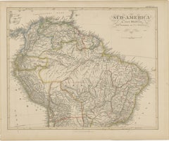
1857 Map of Northern South America – Brazil, Colombia, Peru by Stülpnagel
Located in Langweer, NL
1857 Map of Northern South America – Brazil, Colombia, Peru by Stülpnagel
Antique map titled “Süd-America in zwei Blättern” (South America in Two Sheets), newly edited by V. v. Stül...
Category
German Antique Mid-19th Century Maps
Materials
Paper
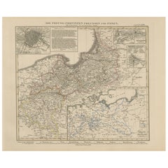
Antique Map of Prussia & Posen – Insets of Berlin, Königsberg & Danzig, 1858
Located in Langweer, NL
Antique Map of Prussia & Posen – With Insets of Berlin, Königsberg & Danzig, 1858
Highly detailed and information-rich map titled "Die Preuss: Provinzen Preussen und Posen", publish...
Category
German Antique Mid-19th Century Maps
Materials
Paper
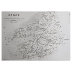
Original Antique Map of Ireland- Kerry. C.1840
Located in St Annes, Lancashire
Great map of Kerry
Steel engraving
Drawn under the direction of A.Adlard
Published by How and Parsons, C.1840
Unframed.
Category
English Antique Mid-19th Century Maps
Materials
Paper
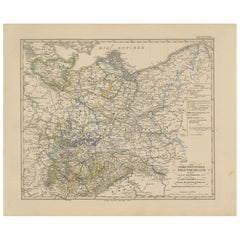
Antique Map of Northeastern Germany – Saxon & Prussian States, 1858
Located in Langweer, NL
Antique Map of Northeastern Germany – Saxon & Prussian States, 1858
Detailed and finely engraved map titled "Nord-Östliches Deutschland enthaltend die Sächsischen Länder und die Pre...
Category
German Antique Mid-19th Century Maps
Materials
Paper
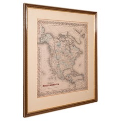
Antique North America Map, USA, Canada, Mexico, Cartography, Colton, Victorian
Located in Hele, Devon, GB
This is an antique North America map. A USA, framed lithography atlas engraving of the continent by JH Colton, dating to the Victorian period and later, circa 1860.
Fascinating, large framed map...
Category
American Victorian Antique Mid-19th Century Maps
Materials
Paper
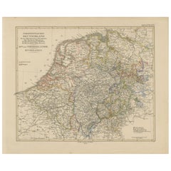
Antique Map of Prussia, Hanover, Netherlands & Belgium – 1858
Located in Langweer, NL
Antique Map of Northwestern Germany, Netherlands & Belgium – 1858
Detailed 19th-century engraved map titled "Nordwestliches Deutschland, Kgr. der Niederlande, Kgr. Belgien" (Northwe...
Category
German Antique Mid-19th Century Maps
Materials
Paper
Antique Map of Germany & Railways – Transport Network Overview, 1857
Located in Langweer, NL
Antique Map of Germany & Railways – Transport Network Overview, 1857
Striking 19th-century map titled "Deutschland und angränzende Länder zur Übersicht der Eisenbahnen und Hauptstra...
Category
German Antique Mid-19th Century Maps
Materials
Paper
England & Wales in 1857 – Decorative Antique Map with Rail Routes
Located in Langweer, NL
Antique Map of England & Wales – Hand-Colored Engraving by Stülpnagel, 1857
Fine 19th-century map titled "England und Wales", drawn and engraved by Friedrich von Stülpnagel and publ...
Category
German Antique Mid-19th Century Maps
Materials
Paper
Antique Map of Southwestern France – With Insets of Paris & Lyon, 1858
Located in Langweer, NL
Antique Map of Southwestern France – With Insets of Paris & Lyon, 1858
Detailed copperplate map of "Südwestliches Frankreich" (Southwestern France), created by Friedrich von Stülpna...
Category
German Antique Mid-19th Century Maps
Materials
Paper
1858 Map of South France with Corsica – Marseille to Italian Border
Located in Langweer, NL
Antique Map of Southeastern France & Corsica – Stülpnagel Engraving, 1858
Highly detailed 19th-century map titled "Südöstliches Frankreich"(Southeastern France), engraved by Friedri...
Category
German Antique Mid-19th Century Maps
Materials
Paper
Antique Map of Northeastern France – Alsace, Lorraine & Champagne, 1858
Located in Langweer, NL
Antique Map of Northeastern France – Alsace, Lorraine & Champagne, 1858
Detailed 19th-century engraved map titled "Nordöstliches Frankreich", drawn by Friedrich von Stülpnagel and p...
Category
German Antique Mid-19th Century Maps
Materials
Paper
Hand-Colored Map of Northwest France – Brittany to Loire, 1858
Located in Langweer, NL
Antique Map of Northwestern France – Stülpnagel Engraving, Justus Perthes 1858
Impressively detailed mid-19th-century map of northwestern France titled "Frankreich in IV Blättern – ...
Category
German Antique Mid-19th Century Maps
Materials
Paper
Antique Map of Spain and Portugal – Hand-Colored Engraving by Stülpnagel, 1857
Located in Langweer, NL
Antique Map of Spain and Portugal – Hand-Colored Engraving by Stülpnagel, 1857
Fine 19th-century engraved map of the Iberian Peninsula titled "Spanien und Portugal", designed by F. ...
Category
German Antique Mid-19th Century Maps
Materials
Paper
Antique Map of Germany, Netherlands, Belgium & Switzerland – Stülpnagel, 1857
Located in Langweer, NL
Antique Map of Germany, Netherlands, Belgium & Switzerland – Stülpnagel, 1857
Fine mid-19th century map of Central Europe titled "Deutschland, Niederlande, Belgien, Schweiz", drawn ...
Category
German Antique Mid-19th Century Maps
Materials
Paper
1855 Relief Map of Germany and the Alps Showing Rivers and Terrain
Located in Langweer, NL
1855 Engraved Map of Switzerland with Cantonal Borders by Stülpnagel
This finely detailed antique map of Switzerland, titled "Die Schweiz," was published in 1855 by the renowned Ger...
Category
German Antique Mid-19th Century Maps
Materials
Paper
Historic 1858 Map of South America – Pre-Border Consolidation
Located in Langweer, NL
Antique Map of South America – Stülpnagel Engraving Published by Perthes, 1858
Detailed 19th-century engraved map titled "Süd-America", designed and drawn by F. von Stülpnagel and p...
Category
German Antique Mid-19th Century Maps
Materials
Paper
1856 Engraved Map of Switzerland with Cantonal Borders by Stülpnagel
Located in Langweer, NL
1856 Engraved Map of Switzerland with Cantonal Borders by Stülpnagel
This finely detailed antique map of Switzerland, titled "Die Schweiz," was published in 1856 by the renowned Ger...
Category
German Antique Mid-19th Century Maps
Materials
Paper
1856 France and Switzerland Map with Mountain Profiles
Located in Langweer, NL
1856 Map of France and Switzerland with Paris Inset by Stülpnagel
This finely detailed antique map of France and Switzerland was published in 1856 by the esteemed German cartographe...
Category
German Antique Mid-19th Century Maps
Materials
Paper
Antique Map of Britain & Ireland with North Sea Detail – 1856 Stülpnagel
Located in Langweer, NL
Antique Map of the British Isles & North Sea by Stülpnagel, 1856
This beautifully detailed 1856 map titled *"Die Britischen Inseln und die Nord-See"* was drawn by F. von Stülpnagel ...
Category
German Antique Mid-19th Century Maps
Materials
Paper
Antique Map of Australia, New Zealand & Polynesia – Stülpnagel, 1857
Located in Langweer, NL
Antique Map of Australia, New Zealand & Polynesia – Stülpnagel, 1857
Description:
This finely engraved and delicately hand-colored map titled "Australien und Polynesien in Mercator'...
Category
German Antique Mid-19th Century Maps
Materials
Paper
Antique Map of the Caribbean & Central America – West Indies, 1857
Located in Langweer, NL
Antique Map of the Caribbean & Central America – West Indies, 1857
This finely engraved and hand-colored map titled "West-Indien und Centro-America" was published in 1857 by Justus ...
Category
German Antique Mid-19th Century Maps
Materials
Paper
Colorfull Antique Map of Africa with Algeria Inset – Stieler Atlas 1858
Located in Langweer, NL
Antique Map of Africa with Algeria Inset – Stieler Atlas 1858
This antique map of Africa, engraved by F. von Stülpnagel and published by Justus Perthes in 1858, is a finely detailed...
Category
German Antique Mid-19th Century Maps
Materials
Paper
1857 Engraved Map of Russia, Finland & Scandinavia – Historic Print
Located in Langweer, NL
Antique Map of European Russia Including Scandinavia – Stieler Atlas 1857
This antique map titled "Europäisches Russland nebst Schweden und Norwegen" (European Russia together with ...
Category
German Antique Mid-19th Century Maps
Materials
Paper
Antique Map of West and Central Africa – Stieler Atlas, Justus Perthes 1857
Located in Langweer, NL
Antique Map of West and Central Africa – Stieler Atlas, Justus Perthes 1857
This finely engraved map titled "Mittel- und Nord-Africa. Westl. Theil." was published in 1857 by Justus ...
Category
German Antique Mid-19th Century Maps
Materials
Paper
Plan of Paris, France, by A. Vuillemin, Antique Map, 1845
Located in Colorado Springs, CO
This large and detailed plan of Paris was published by Alexandre Vuillemin in 1845. The map conveys a wonderful amount of information and is decorated throughout with pictorial vigne...
Category
American Antique Mid-19th Century Maps
Materials
Paper
Antique Map of Denmark 1858 – Includes Iceland & Copenhagen Plan
Located in Langweer, NL
Antique Map of Denmark 1858 – Includes Iceland & Copenhagen Plan
This finely detailed antique map of Denmark was published in 1858 by Justus Perthes in Gotha, as part of the renowne...
Category
German Antique Mid-19th Century Maps
Materials
Paper
Antique Map of Scandinavia 1857 – Sweden & Norway in Detail
Located in Langweer, NL
Sweden and Norway Map – Stieler Atlas Engraving, 1858
This fine antique map titled Schweden und Norwegen (Sweden and Norway) was published in 1858 by Justus Perthes of Gotha and dra...
Category
German Antique Mid-19th Century Maps
Materials
Paper
Antique Map of the Pyrenees Orientales 'France' by V. Levasseur, 1854
Located in Langweer, NL
Antique map titled 'Dépt. des Pyréneés Orles'. Map of the French department of Pyrenees Orientales, France. This area is a well-known wine producing region. A wide variety of wines c...
Category
Antique Mid-19th Century Maps
Materials
Paper
$190 Sale Price
20% Off
1862 Johnson's Map of the Vicinity of Richmond & Peninsular Campaign, Virginia
Located in Langweer, NL
Title: 1862 Johnson's Map of the Vicinity of Richmond & Peninsular Campaign, Virginia
Description: This 1862 map titled "Johnson's Map of the Vicinity of Richmond and Peninsular Cam...
Category
Antique Mid-19th Century Maps
Materials
Paper
$304 Sale Price
20% Off
A 19th-Century Map of West Canada with Niagara Falls and Indigenous Scenes
Located in Langweer, NL
Decorative 19th-Century Map of West Canada with Niagara Falls and Indigenous Scenes
This detailed 19th-century map of West Canada, drawn and engraved by J. Rapkin and published by...
Category
Antique Mid-19th Century Maps
Materials
Paper
Biblical Journeys: Apostle Paul's Voyages and the Israelites' Exodus, 1856
Located in Langweer, NL
Two maps in matting board. From the Pictorial Bible Atlas, published in 1856.
Title for Map 1: Voyages and Travels of Apostle Paul – Illustrated Antique...
Category
Antique Mid-19th Century Maps
Materials
Paper
1864 Johnson's Map of the West Indies and Bermuda
Located in Langweer, NL
Title: 1864 Johnson's Map of the West Indies and Bermuda
Description: This is an 1864 map titled "Johnson's West Indies," published by Johnson and Ward. The map provides a detailed ...
Category
Antique Mid-19th Century Maps
Materials
Paper
$304 Sale Price
20% Off
German Globe by C. Abel-Klinger, Nuremberg, circa 1860
Located in Milano, IT
Terrestrial globe
Artistic company C. Abel - Klinger
Nuremberg, circa 1860
H cm 31 x 22 cm (12.20 x 8.66 in); sphere 14 cm (5.51 in) in diameter
lb 2.30 (kg 1.04)
State of conservation: good. On the sphere there are slight visible signs of accidental bumping at the poles, as well as on New Guinea and England (vertical and more visible); some ink stains, especially at the South Pole and on the meridian that crosses North America.
The globe is composed of twelve whole gores of printed paper, juxtaposed and glued on a sphere made with a chalky base mixture.
The circle of the meridian, made of brass...
Category
German Other Antique Mid-19th Century Maps
Materials
Wood, Paper
Old World Map Featuring Captain Cook's Exploration Routes and Polar Views, 1787
Located in Langweer, NL
1786 World Map with Polar Projections - "Globo Terrestre" by Giovanni Maria Cassini
This 1786 map titled "Globo Terrestre" by Giovanni Maria Cassini offers a fascinating and detai...
Category
Antique Mid-19th Century Maps
Materials
Paper
$1,808 Sale Price
20% Off
Map of French Colonies in the Americas: St. Martin, French Guiana and St. Pierre
Located in Langweer, NL
This is an intricately detailed map from 1852 titled *Colonies Françaises en Amérique*, depicting several key French colonies in the Americas.
The map focuses on regions such as Fr...
Category
Antique Mid-19th Century Maps
Materials
Paper
$180 Sale Price
20% Off
Old Print of Anjer or Anyer, Coastal Town in Banten, West Java, Indonesia, 1844
Located in Langweer, NL
Antique print titled 'Anjer - Anjer'. View of Anyer (also known as Anjer or Angier), a coastal town in Banten, formerly West Java, Indonesia. This print originates from 'Gezigten uit...
Category
Antique Mid-19th Century Maps
Materials
Paper
$428 Sale Price
20% Off
Antique Map of Scandinavia: Norway, Sweden and Denmark
Located in Langweer, NL
Antique map titled 'Suède, Norwège & Danemark'. Attractive map of Scandinavia, with Sweden, Norway and Denmark. With an inset map of Iceland and th...
Category
Antique Mid-19th Century Maps
Materials
Paper
$114 Sale Price
20% Off
1864 Johnson's Map of Virginia, Delaware, and Maryland with Fort Monroe Inset
Located in Langweer, NL
Title: 1864 Johnson's Map of Virginia, Delaware, and Maryland with Fort Monroe Inset
Description: This 1864 map titled "Johnson's Virginia, Delaware, and ...
Category
Antique Mid-19th Century Maps
Materials
Paper
$285 Sale Price
20% Off
Map of New Zealand Showing Maori Culture and Early Colonial Settlements, 1851
Located in Langweer, NL
John Tallis & Company were renowned for their ornate and detailed maps in the mid-19th century. Their works often featured elaborate borders, decorative motifs, and insets of vignett...
Category
Antique Mid-19th Century Maps
Materials
Paper
$180 Sale Price
20% Off
Antique Map of the Northern Hemisphere by Lowry, '1852'
Located in Langweer, NL
Antique map titled 'Perspective Projection of the World on the horizon of London'. Original map of the northern hemisphere. This map originates fro...
Category
Antique Mid-19th Century Maps
Materials
Paper
$142 Sale Price
20% Off
Gateway to the Steppes: Tallis's Masterpiece Map of Indepent Tartary, 1851
Located in Langweer, NL
The map is of "Independent Tartary," a historical region in Central Asia that covered parts of what are now Kazakhstan, Uzbekistan, Turkmenistan, and surrounding areas. The map was p...
Category
Antique Mid-19th Century Maps
Materials
Paper
$314 Sale Price
20% Off
Turkey in Asia: Biblical Regions and the Holy Land from The Royal Atlas (1856)
Located in Langweer, NL
This antique map titled "Turkey in Asia (Biblical Regions) The Holy Land and its Borders" comes from "The Royal Illustrated Atlas", which was published in 1856 by A. Fullarton & Co. ...
Category
Antique Mid-19th Century Maps
Materials
Paper
$628 Sale Price
20% Off
Decorative 1850s Map of Eastern Canada and New Brunswick with Historic Vignettes
Located in Langweer, NL
Decorative 1850s Map of Eastern Canada and New Brunswick with Historic Vignettes
This beautifully crafted 19th-century map of Eastern Canada and New Brunswick, drawn and engrave...
Category
Antique Mid-19th Century Maps
Materials
Paper
1864 Johnson's Map of New York State with City Insets
Located in Langweer, NL
Title: 1864 Johnson's Map of New York State with City Insets
Description: This 1864 map, titled "Johnson's New York," was published by Johnson and Ward and features a detailed depic...
Category
Antique Mid-19th Century Maps
Materials
Paper
$266 Sale Price
20% Off
Antique Map of the Region of Algiers, Algeria
Located in Langweer, NL
Antique map titled 'Alger'. This map shows the region of Algiers, Algeria. With a small inset map of the region of Algiers and a decorative vignette with a harbor view. Originates fr...
Category
Antique Mid-19th Century Maps
Materials
Paper
$161 Sale Price
20% Off
Miniature Terrestrial Globe Newton & Son London, Post 1833, Ante 1858
Located in Milano, IT
Miniature Terrestrial Globe
Newton & Son
London, post 1833, ante 1858
Paper, papier-mâché, bronze and wood
It measures: sphere diameter 2.95 in (7.6 cm); diameter of the wooden base 6.02 in (15.3 cm); height 8.36 in (21.24 cm).
Weight: 2,067 lb.
State of conservation: the globe still bears its original paint, but has various small gaps, abrasions and stains on the surface.
The globe is hinged with two pins at the meridian circle, which is in turn inserted perpendicular to the horizon circle; this is supported by four semi-arches connected at the bottom by a small goblet-shaped foot, resting on a wooden bell-shaped base.
Apart from the wooden base, the entire support structure is made of bronze; on the foot there are the scale reproductions of a compass, a telescope and an open book.
The sphere is made of papier-mâché and is covered with twelve printed paper gores.
In the North Pacific Ocean the globe bears a cartouche with the inscription (about 30% of the writing is illegible, but the missing parts can be easily integrated based on the rest):
NEWTON’S
New & Improved
TERRESTRIAL
Globe
Published by Newton & Son
66 Chancery Lane
LONDON
On the globe, much of central Africa is empty and the great lakes Tanganyika and Victoria are not marked (Europeans would begin to explore the area after 1858). Canada is called "British Territory" and Alaska "Russian Territory" (it would become part of the United States in 1867). Australia already bears its modern name (until 1829 it had been called New Holland) and its coasts are completely designed; Tasmania is listed as an island (Matthew Flinders circumnavigated it in 1798). The routes of Cook's various voyages are plotted; both the route followed by Biscoe in 1831 and the "Land of Enderby" which he discovered on the coast of Antarctica, south of Africa, are marked.
Bibliography
P. Van der Krogt, Old Globes...
Category
English Early Victorian Antique Mid-19th Century Maps
Materials
Bronze
Antique Map of the region of Siberia, Mongolia and Manchuria
Located in Langweer, NL
Antique map titled 'Siberia and Chinese Tartary'. Detailed antique map of the region of Siberia, Mongolia and Manchuria. Engraved by J. & C. Walker. Published 1838.
Category
Antique Mid-19th Century Maps
Materials
Paper
$361 Sale Price
20% Off
Decorative 1864 Civil War Era Map of Indiana with Lake Michigan Detail
Located in Langweer, NL
Title: Rare 1864 Civil War Era Map of Indiana with Lake Michigan Detail
Description: This finely detailed antique map, titled "Johnson's Indiana," was published in 1864 by Johnson a...
Category
Antique Mid-19th Century Maps
Materials
Paper
Map of Independent Tartary with Vignettes of the Region's Culture, 1851
Located in Langweer, NL
The map of Independent Tartary is part of the collection by John Tallis & Company, which were unique for their elaborate decorative elements and detailed illustrations.
**The Maker ...
Category
Antique Mid-19th Century Maps
Materials
Paper
$276 Sale Price
20% Off
Map of Rhône: Culture and Commerce in Lyon's Silk and Wine Legacy, 1852
Located in Langweer, NL
This original hand-colored map is from the "Atlas National Illustré," a work by Victor Levasseur, a French geographer and cartographer known for his richly illustrated maps.
The map...
Category
Antique Mid-19th Century Maps
Materials
Paper
$323 Sale Price
20% Off
Antique Map of The World in Hemispheres by W. G. Blackie, 1859
Located in Langweer, NL
Antique map titled 'The World in Hemispheres with other projections'. Original antique map of The World. This map originates from ‘The Imperial Atlas of Modern Geography’. Published ...
Category
Antique Mid-19th Century Maps
Materials
Paper
$291 Sale Price
30% Off
1855 Colton's Map of Patagonia with South Atlantic Islands Insets
Located in Langweer, NL
Title: 1855 Colton's Map of Patagonia with South Atlantic Islands Insets
Description: This is an 1855 map titled "Colton's Patagonia," published by J.H. Colton & Co. in New York. Th...
Category
Antique Mid-19th Century Maps
Materials
Paper
$190 Sale Price
42% Off
Gold Rush Era Masterpiece: The Tallis & Rapkin Rare Map of Pre-Queensland, 1851
Located in Langweer, NL
The image is an original historical map of Australia from the year 1851, created by John Rapkin with illustrations by J. Marchant and engravings by J. B. Allen. The map was published...
Category
Antique Mid-19th Century Maps
Materials
Paper
$552 Sale Price
20% Off
Map of Tasmania with Illustrations of Local Fauna and Colonial Landmarks, 1851
Located in Langweer, NL
John Tallis & Company was renowned for their detailed and ornate maps during the 19th century. Their maps are distinguished by the intricate borders and vignettes that are as informa...
Category
Antique Mid-19th Century Maps
Materials
Paper
$276 Sale Price
20% Off
French Guiana and Cayenne: Mid-19th Century Map from France Pittoresque Series
Located in Langweer, NL
This map titled "Guyane" is part of the France Pittoresque series and provides a detailed view of French Guiana along with a plan of the city of Cayenne.
Features:
- The map showcases the broader region of French Guiana, indicating key rivers, settlements, and the coastline along the Atlantic Ocean.
- To the left, there's an inset labeled "Plan de la Ville de Cayenne", which shows the street layout, squares, and main buildings of the capital city, Cayenne. This inset provides a more detailed view of the urban area, highlighting its geometric grid layout near the coast.
- The larger map outlines geographical features such as rivers (e.g., Oyapock and Maroni), forests, and territories in the surrounding area, including the neighboring Brazilian Empire...
Category
Antique Mid-19th Century Maps
Materials
Paper
$114 Sale Price
20% Off
Antique Map of the United States of America, also showing the Caribbean
Located in Langweer, NL
Antique map titled 'Verein-Staaten von Nord-America, Mexico, Yucatan u.a.'. Very detailed map of the United States of America showing the ...
Category
Antique Mid-19th Century Maps
Materials
Paper
$780 Sale Price
20% Off
Rare 1864 Civil War Era Map of Arkansas, Mississippi, and Louisiana
Located in Langweer, NL
Title: Rare 1864 Civil War Era Map of Arkansas, Mississippi, and Louisiana
Description: This captivating antique map, titled "Johnson's Arkansas, Mississippi, and Louisiana," was pu...
Category
Antique Mid-19th Century Maps
Materials
Paper
Antique Map of the Southern United States with Inset Map of New Orleans
Located in Langweer, NL
Antique map titled 'Die Staaten von Arkansas Mississippi, Louisiana & Alabama'. Detailed map of the region, which includes the Florida Panhandle. Shows many roads, rivers, forts, etc...
Category
Antique Mid-19th Century Maps
Materials
Paper
$133 Sale Price
20% Off
Antique Map of Tennessee, Kentucky, Virginia, Alabama, Georgia and Surroundings
Located in Langweer, NL
Antique map of part of the United States showing Alabama, Georgia, North Carolina, South Carolina, Tennessee, Kentucky, Virginia and part of Florida. With inset maps of the southern ...
Category
Antique Mid-19th Century Maps
Materials
Paper
$642 Sale Price
25% Off
Antique Lithography Map, Shropshire, English, Framed, Cartography, Victorian
Located in Hele, Devon, GB
This is an antique lithography map of Shropshire. An English, framed atlas engraving of cartographic interest, dating to the mid 19th century and later.
Superb lithography of Shrop...
Category
British Victorian Antique Mid-19th Century Maps
Materials
Wood
Recently Viewed
View AllMore Ways To Browse
Bavarian Porcelain Vases
Beer Tankard
Bjorn L
Black Cabinet With Flowers And Birds
Black Tansu Chest
Blue Morpho
Blue Opaline Crystal Vases
Bow Front Buffet
Boy And Girl Statues
Brass Donkey
Brass Hound
Bread Oven
Bronze Atlas Sculpture
Bronze Door Stop
Bronze Shakespeare Sculpture
Buddha Bell
Bull Terrier
Butlers Chest
