Mid-19th Century Maps
to
579
824
32
856
56
4
2
2,928
2,257
475
3
290
34
10
126
10
37
9
2
5
4
3
3
832
51
24
4
4
210
104
56
55
46
856
856
856
104
4
2
1
1
Period: Mid-19th Century
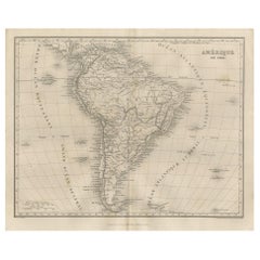
Antique Map of South America by Balbi '1847'
Located in Langweer, NL
Antique map titled 'Amérique du sud'. Original antique map of South America. This map originates from 'Abrégé de Géographie (..)' by Adrie...
Category
Antique Mid-19th Century Maps
Materials
Paper
$190 Sale Price
20% Off
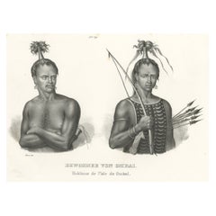
Antique Print of Warriors from Ombai Island, Alor, Archipel, Indonesia, ca.1845
Located in Langweer, NL
Antique print titled 'Bewohner von Ombai, Habitans de l'isle de Ombai'.
This print depicts natives from Ombai, Indonesia. Originates from 'Naturgeschichte und Abbildungen des Men...
Category
Antique Mid-19th Century Maps
Materials
Paper
$323 Sale Price
20% Off
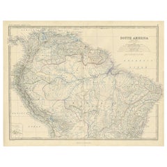
Antique Map of South America ‘North’ by A.K. Johnston, 1865
Located in Langweer, NL
Antique map titled 'South America, Northern Sheet'. Depicting Guiana, Ecuador, Brazil, Bolivia the Amazones and more. This map originates from the ‘Royal Atlas of Modern Geography’ b...
Category
Antique Mid-19th Century Maps
Materials
Paper
$261 Sale Price
20% Off
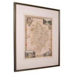
Antique Lithography Map, Warwickshire, English, Framed, Cartography, Victorian
Located in Hele, Devon, GB
This is an antique lithography map of Warwickshire. An English, framed atlas engraving of cartographic interest, dating to the mid 19th century and later.
Superb lithography of War...
Category
British Victorian Antique Mid-19th Century Maps
Materials
Glass, Wood, Paper
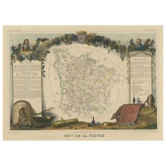
Hand Colored Antique Map of the Department of Nièvre, France
Located in Langweer, NL
Antique map titled 'Dept. de la Nièvre'. Map of the French department of Nievre, France. Part of the prestiegous Burgundy or Bourgogne wine region this area is known for its producti...
Category
Antique Mid-19th Century Maps
Materials
Paper
$323 Sale Price
20% Off
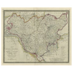
Large Original Antique Map of the Dutchy of Holstein, Germany, ca.1840
Located in Langweer, NL
Antique map titled 'A Map of the Dutchy of Holstein, with the Territories of the Imperial Towns Hamburg & Lubek, Also The Bishoprick of Eutin, Laid down from Fischer's Map (..)'. Sca...
Category
Antique Mid-19th Century Maps
Materials
Paper
$799 Sale Price
20% Off
Hand Colored Antique Map of the Department of Orne, France
Located in Langweer, NL
Antique map titled 'Dépt. de l'Orne'. Map of the French department of Orne, France. This area, part of Normandy, includes the village of Camembert, where the famous Camembert cheese ...
Category
Antique Mid-19th Century Maps
Materials
Paper
$323 Sale Price
20% Off
Antique Map of New South Wales in Australia, ca. 1850
Located in Langweer, NL
Antique map of Victoria, or Port Phillip (12.7 x 10.0") in Australia. Superb map of Victoria roughly centered on Melbourne. Vignettes of Aborigines, a ...
Category
European Antique Mid-19th Century Maps
Materials
Paper
$690 Sale Price
40% Off
Antique Map of Europe by Balbi '1847'
Located in Langweer, NL
Antique map titled 'Europe'. Original antique map of Europe. This map originates from 'Abrégé de Géographie (..)' by Adrien Balbi. Published 1847.
Category
Antique Mid-19th Century Maps
Materials
Paper
$142 Sale Price
20% Off
Old Rare Fish Print of the Witch Flounder or Torbay Sole, 1842
Located in Langweer, NL
Antique print, titled: 'Poissons Plate 13 - La Pole (Pleuronectes nigromanus).' - This rare plate shows the Witch flounder or Torbay sole (Glyptocephalus cynoglossus). From: 'Voyage ...
Category
Antique Mid-19th Century Maps
Materials
Paper
$780 Sale Price
20% Off
Antique Map of Oceania by Levasseur, circa 1860
Located in Langweer, NL
Antique map titled 'Carte générale de l'Océanie'. Large map of Oceania including New Zealand, Australia, Polynesia, Micronesia and the East Indies. This map originates from 'Atlas Un...
Category
Antique Mid-19th Century Maps
Materials
Paper
$237 Sale Price
20% Off
Anitque Print of a Fire Station in Yokohama, Japan, 1856
Located in Langweer, NL
Description: Antique print titled ‘Fire Companys House & Engine Yokuhama‘.
View of a fire station in Yokohama, Japan. This print originates from 'Narrat...
Category
Antique Mid-19th Century Maps
Materials
Paper
$228 Sale Price
20% Off
Decorative Antique Map of Germany, 1846
Located in Langweer, NL
Antique map titled 'Germany'. Old map of Germany.
This map originates from 'A New Universal Atlas Containing Maps of the various Empires, Kingdoms, ...
Category
Antique Mid-19th Century Maps
Materials
Paper
$218 Sale Price
20% Off
Antique Map of Northern Italy by J. Tallis, circa 1851
Located in Langweer, NL
A highly decorative mid-19th century map of Northern Italy which was drawn and engraved by John Rapkin (vignettes by A. H. Wray & J. B. Allen) and published in John Tallis & co.'s Th...
Category
Antique Mid-19th Century Maps
Materials
Paper
$171 Sale Price
47% Off
Northern Germany incl Hanover, Oldenburg, Lippe, Bremen, Hamburg & Lubeck, 1854
Located in Langweer, NL
Antique map titled 'Map of the Kingdom of Hanover, with the Grand Duchy of Oldenburg, the principalities of Lippe Detmold and Schauenburg Lippe (..)'.
Map of Northern Germany inclu...
Category
Antique Mid-19th Century Maps
Materials
Paper
$865 Sale Price
25% Off
Hand Colored Antique Map of the Department of Haute Marne, France
Located in Langweer, NL
Antique map titled 'Dépt. de la Hte Marne'. Map of the French department of Haute Marne, France. This department is part of the Champagne region, where the world-famous sparkling win...
Category
Antique Mid-19th Century Maps
Materials
Paper
$323 Sale Price
20% Off
Old Colourful Map of Sweden and Norway, 1846
Located in Langweer, NL
Antique map titled 'Sweden & Norway'. Old map of Sweden and Norway.
This map originates from 'A New Universal Atlas Containing Maps of the various Em...
Category
Antique Mid-19th Century Maps
Materials
Paper
$209 Sale Price
20% Off
Antique Map of Hungary, Transylvania and Dalmatia by W. G. Blackie, 1859
Located in Langweer, NL
Antique map titled 'Hungary, Transylvania, Dalmatia'. Original antique map of Hungary, Transylvania (Romania), Dalmatia (Croatia) and the Military Frontiers (Croatia, Slavonia & Bana...
Category
Antique Mid-19th Century Maps
Materials
Paper
$237 Sale Price
20% Off
Colourful Antique Map of Switzerland, 1846
Located in Langweer, NL
Antique map titled 'Switzerland'. Old map of Switzerland.
This map originates from 'A New Universal Atlas Containing Maps of the various Empires...
Category
Antique Mid-19th Century Maps
Materials
Paper
$209 Sale Price
20% Off
Hand-Colored Steel Engraving of Batavia 'Jakarta', Indonesia, Ca.1840
Located in Langweer, NL
Antique print titled 'Batavia'.
Steel engraving of Batavia (Jakarta), Indonesia. Originates from 'Meyers Universum'.
Artists and Engravers: Jos...
Category
Antique Mid-19th Century Maps
Materials
Paper
$142 Sale Price
20% Off
Antique Map of the Eastern United States with Only the Northern Part of Florida
Located in Langweer, NL
Antique map titled 'Verein-Staaten von Nord-America mit Ausnahme Florida's und der Westlichen Territorien'. This map extends as far west as Louisiana and only includes the northern p...
Category
Antique Mid-19th Century Maps
Materials
Paper
$780 Sale Price
20% Off
Old Map of Holstein with the Imperial Towns Hamburg & Lubeck, Germany, 1854
Located in Langweer, NL
Antique map titled 'Map of the Duchy of Holstein with the territories of the Imperial Towns Hamburg & Lubeck (..)
Based on a map by Fischer.' Map of the Duchy of Holstein. From Jam...
Category
Antique Mid-19th Century Maps
Materials
Paper
$923 Sale Price
20% Off
Hand Colored Antique Map of the Department of Oise, France
Located in Langweer, NL
Antique map titled 'Dept. de l'Oise'. Old map of the French department of Oise, France. The map proper is surrounded by elaborate decorative engravings designed to illustrate both th...
Category
Antique Mid-19th Century Maps
Materials
Paper
$323 Sale Price
20% Off
Hand Colored Antique Map of the Department of Doubs, France
Located in Langweer, NL
Antique map titled 'Dépt. du Doubs'. Map of the French department of Doubs, France. The whole is surrounded by elaborate decorative engravings designed to illustrate both the natural...
Category
Antique Mid-19th Century Maps
Materials
Paper
$202 Sale Price
50% Off
Large Antique Map of the west coast of Celebes, Sulawesi, Indonesia
Located in Langweer, NL
Original antique map titled 'Kaart der Westkust van Celebes van Makasser tot Laijkan'. This large map shows the west coast of Celebes, Sulawesi, Indonesia. It covers the region of Makassar to Cikoang. Inset map of the coast of Selat (Strait) Makassar, also showing the Dutch Fort Rotterdam, to day Fort Ujung Pandang. With historical traces dating back to the Kingdom of Gowa from the 16th century to colonization by the Dutch, this Fort has silently witnessed many episodes in Makassar’s history, playing a most essential role in its development. Originally called Benteng or Fort Jumpandang or Ujung Pandang, the huge complex was first built in 1545 in the era of Imanrigau Daeng Bonto Karaeng Lakiung or Karaeng Tunipalangga Ulaweng, the tenth King of Gowa. Initially, the fort was made from a mixture of Stone and burnt clay, and took the shape of a typical square Portuguese architectural...
Category
Antique Mid-19th Century Maps
Materials
Paper
$409 Sale Price
53% Off
Hand Colored Antique Map of the department of Indre and Loire, France
Located in Langweer, NL
Antique map titled 'Dépt. d'Indre et Loire'. Map of the Department de L’Indre et Loire, France. This region is known for its fine wines, agriculture, distilled spirits, and cheese. T...
Category
Antique Mid-19th Century Maps
Materials
Paper
$323 Sale Price
20% Off
Hand Colored Antique Map of the department of Cantal, France
Located in Langweer, NL
Antique map titled 'Dépt. du Cantal'. Map of the French department of Cantal, France. This area of France is known for its production of Cantal, a firm cheese, named after the region...
Category
Antique Mid-19th Century Maps
Materials
Paper
$323 Sale Price
20% Off
Hand Colored Antique Map of the Department of Ardèche, France
Located in Langweer, NL
Antique map titled 'Dépt. de l'Ardèche'. Map of the Department of Ardèche, France. This region is known for its fine wines, agriculture, distilled spirits, and cheese. The capital ci...
Category
Antique Mid-19th Century Maps
Materials
Paper
$323 Sale Price
20% Off
Hand Colored Antique Map of the Department of Correze, France
Located in Langweer, NL
Antique map titled 'Dépt. de la Corrèze'. Map of the French department of Correze, France. This area of France is known for its production of Straw Wine, a sweet red or white wine. T...
Category
Antique Mid-19th Century Maps
Materials
Paper
$323 Sale Price
20% Off
Hand Colored Antique Map of the Department of Calais, France
Located in Langweer, NL
Antique map titled 'Dépt. du Pas de Calais'. Map of the French department of Calais, France. This area is known for producing Maroilles, a soft cheese made from cow’s milk and with a...
Category
Antique Mid-19th Century Maps
Materials
Paper
$323 Sale Price
20% Off
Old Map of the French department of l'Aisne, France
Located in Langweer, NL
Antique map titled 'Dépt. de l'Aisne'. Map of the French department of l'Aisne, France. The whole is surrounded by elaborate decorative engravings designed to illustrate both the nat...
Category
Antique Mid-19th Century Maps
Materials
Paper
$323 Sale Price
20% Off
Hand Colored Antique Map of the Department of Ariège, France
Located in Langweer, NL
Antique map titled 'Dépt. de l'Ariège'. Map of the French department of Ariege, France. This area of France is known for its production of semi-soft and mild cheeses, such as Bethmal...
Category
Antique Mid-19th Century Maps
Materials
Paper
$323 Sale Price
20% Off
Hand Colored Antique Map of the Department of Creuse, France
Located in Langweer, NL
Antique map titled 'Dépt. de la Creuse'. Map of the French department of Creuse, France. This region is well known for its apple cider made from Limousin apples and its international...
Category
Antique Mid-19th Century Maps
Materials
Paper
$323 Sale Price
20% Off
Hand Colored Antique Map of the department of Drôme, France
Located in Langweer, NL
Antique map titled 'Dépt. de la Drôme'. Map of the French department of Drôme, France. This area is known for its production of Picodon, a spicy goats-milk ch...
Category
Antique Mid-19th Century Maps
Materials
Paper
$323 Sale Price
20% Off
Hand Colored Antique Map of the Department of Nord, France
Located in Langweer, NL
Antique map titled 'Dept. du Nord'. Map of the French department of Nord, France. This area is known for its production of Maroilles, a cow's milk cheese. This cheese is produced in ...
Category
Antique Mid-19th Century Maps
Materials
Paper
$323 Sale Price
20% Off
Rare Old Lithograph of the Assault of a Fort in Borneo, Indonesia, ca.1850
Located in Langweer, NL
Incredible action view of a rare German lithograph showing a massive assault on Fort Claurang in Borneo.
Published by Hartwich, A. Hölzer and TH. Lemke in Berlin around 1850.
...
Category
Antique Mid-19th Century Maps
Materials
Paper
$904 Sale Price
20% Off
Western Africa Antique Map by W. G. Blackie, 1859
Located in Langweer, NL
The antique map titled 'Western Africa' presents an original depiction of the region. Originating from 'The Imperial Atlas of Modern Geography,' this map was published by W. G. Black...
Category
Antique Mid-19th Century Maps
Materials
Paper
$237 Sale Price
20% Off
Decorative Hand-Colored French Map of the English Channel, 1827
Located in Langweer, NL
Antique map titled 'Carte et Coupe du Canal de la Manche'. Original antique map of the English Channel. Relief shown by hachures; depths by isolines. Profile...
Category
Antique Mid-19th Century Maps
Materials
Paper
$513 Sale Price
20% Off
Set of 2 Antique Maps of Scotland by W. G. Blackie, 1859
Located in Langweer, NL
Antique map titled 'Scotland'. Original antique map of Scotland. This map originates from ‘The Imperial Atlas of Modern Geography’. Published by W. G. Blackie, 1859.
Category
Antique Mid-19th Century Maps
Materials
Paper
$309 Sale Price / set
35% Off
Map of West Germany Incl Regions Wurtemberg, Bavaria, Hanover, Etc, c.1850
Located in Langweer, NL
Antique map titled '(Deutschland) Germany, Western States'.
Map of West Germany depicting many regions including Wurtemberg, Bavaria, Hanover and others. This map originates from...
Category
Antique Mid-19th Century Maps
Materials
Paper
$266 Sale Price
20% Off
Antique Map of the Crimean Peninsula and Sevastopol by W. G. Blackie, 1859
Located in Langweer, NL
Antique map titled 'The Crimea'. Original antique map of the Crimean Peninsula, Black Sea and Sevastopol. This map originates from ‘The Imperial Atlas of Modern Geography’. Published...
Category
Antique Mid-19th Century Maps
Materials
Paper
$166 Sale Price
20% Off
Antique Map of the Chinese Empire by W. G. Blackie, 1859
Located in Langweer, NL
Antique map titled 'The Chinese Empire'. Original antique map of the Chinese Empire. This map originates from ‘The Imperial Atlas of Modern Geography’. Published by W. G. Blackie, 1859.
Category
Antique Mid-19th Century Maps
Materials
Paper
$237 Sale Price
20% Off
Antique Map of Corrèze ‘France’ by V. Levasseur, 1854
Located in Langweer, NL
Antique map titled 'Dépt. da la Corrèze'. Map of the French department of Correze, France. This area of France is known for its production of Straw Wine, a sweet red or white wine. T...
Category
Antique Mid-19th Century Maps
Materials
Paper
$171 Sale Price
20% Off
Antique Map of France by Lapie, 1842
Located in Langweer, NL
Antique map titled 'Carte de France'. Map of France. This map originates from 'Atlas universel de géographie ancienne et moderne (..)' by Pierre M. Lapie and Alexandre E. Lapie. Pier...
Category
Antique Mid-19th Century Maps
Materials
Paper
$523 Sale Price
20% Off
Antique Map of Australasia by Lowry, 1852
Located in Langweer, NL
Antique map titled 'Australasia'. Original map of Australasia. This map originates from 'Lowry's Table Atlas constructed and engraved from the most recent Authorities' by J.W. Lowry....
Category
Antique Mid-19th Century Maps
Materials
Paper
$95 Sale Price
20% Off
Antique Map of Africa by Levasseur 'c.1840'
Located in Langweer, NL
Antique map titled 'Afrique'. Original antique map of Africa. Decorative map of the continent surrounded by allegorical vignettes. Engraved by Raimond Bonheur, father of the famous F...
Category
Antique Mid-19th Century Maps
Materials
Paper
$475 Sale Price
20% Off
Old Map Depicting the Entire Earth's Surface Divided into Six Parts France 1850
Located in Milan, IT
Map depicting the entire earth's surface divided into six parts which depicts the position of peoples on Earth based on the assumption that it is impossible for each people to have t...
Category
French Antique Mid-19th Century Maps
Materials
Glass, Wood, Paper
Antique Map of Russia in Asia by Wyld, '1845'
Located in Langweer, NL
Antique map titled 'Russia in Asia'. Original antique map of Russia in Asia. This map originates from 'An Atlas of the World, Comprehending Separate Maps of its Various Countries, co...
Category
Antique Mid-19th Century Maps
Materials
Paper
$154 Sale Price
35% Off
Vintage Geographic Splendor: 1859 Spain and Portugal
Located in Langweer, NL
The "Vintage Geographic Splendor: 1859 Spain and Portugal" map is an original antique piece from 'The Imperial Atlas of Modern Geography', published ...
Category
Antique Mid-19th Century Maps
Materials
Paper
$237 Sale Price
20% Off
Antique Map showing Isotherm Lines throughout the World by Johnston '1850'
Located in Langweer, NL
Antique map titled 'Humboldt's System of Isothermal Lines'. Original antique map showing isotherm lines throughout the world. This map originates from 'The Physical Atlas of Natural ...
Category
Antique Mid-19th Century Maps
Materials
Paper
$190 Sale Price
20% Off
Antique Map of the Burmese Empire by Wyld, '1845'
Located in Langweer, NL
Antique map titled 'Map of Burman Empire, Siam, Cochin China and Ton-King'. Original antique map of the Burmese Empire. This map originates from 'An Atlas of the World, Comprehending...
Category
Antique Mid-19th Century Maps
Materials
Paper
$237 Sale Price
20% Off
Antique Map of Austria by Lowry, 1852
Located in Langweer, NL
Antique map titled 'Austria'. Original map of Austria. This map originates from 'Lowry's Table Atlas constructed and engraved from the most recent Autho...
Category
Antique Mid-19th Century Maps
Materials
Paper
$95 Sale Price
20% Off
Antique Map of the Islands in the Pacific Ocean by Wyld, '1845'
Located in Langweer, NL
Antique map titled 'Islands in the Pacific Ocean'. Original antique map of the islands in the Pacific Ocean. This map originates from 'An Atlas of the World, Comprehending Separate M...
Category
Antique Mid-19th Century Maps
Materials
Paper
$190 Sale Price
20% Off
Antique Map of New South Wales and Victoria by W. G. Blackie, 1859
Located in Langweer, NL
Antique map titled 'New South Wales and Victoria'. Original antique map of New South Wales and Victoria. This map originates from ‘The Imperial Atlas of Modern Geography’. Published ...
Category
Antique Mid-19th Century Maps
Materials
Paper
$237 Sale Price
20% Off
Original French Antique Map of the Russian Empire, 1837
Located in Langweer, NL
Antique map titled 'Tableau Historique et Géographique de L'Empire de Russie'.
Original antique map of the Russian Empire will detailed written information about the chronology, ...
Category
Antique Mid-19th Century Maps
Materials
Paper
$276 Sale Price
20% Off
Antique Map of the Netherlands and Belgium by Hérisson, 1829
Located in Langweer, NL
Title: 'Carte Routière du Royaume des Pays-Bas comprenant la Hollande et la Belgique'
**Publisher**: Eustache Hérisson
**Publication Year**: 1829
This original antique map is a detailed depiction of the Netherlands and Belgium, dating back to 1829. As a 'Carte Routière', it focuses on the road networks of the region, providing valuable historical insights into the transportation and geographical understanding of the early 19th century. The map's delineation of the Kingdom of the Netherlands, including both Holland and Belgium, is particularly noteworthy as it represents the political geography of the period shortly before Belgium's independence in 1830.
The map is sectionalised and laid on linen, a common practice in the 19th century for preserving and reinforcing maps, making them more durable and portable. This method of mounting also suggests that the map was intended for practical use, possibly by travelers or for educational purposes.
**Artist and Publisher**: Eustache Hérisson, the publisher of this map, was a known figure in the cartographic and publishing world of the early 19th century. His work is characterized by attention to detail and accuracy, making this map not only a beautiful piece of art but also a reliable historical document.
This map is a valuable historical artifact, offering insights into the geographical and political landscape of the Netherlands...
Category
Antique Mid-19th Century Maps
Materials
Paper
$713 Sale Price
20% Off
Antique Map of the West Indies and Central America by W. G. Blackie, 1859
Located in Langweer, NL
Antique map titled 'The West India Island & Central America'. Original antique map of the West Indies and Central America, with inset map of Jamaica. Th...
Category
Antique Mid-19th Century Maps
Materials
Paper
$237 Sale Price
20% Off
1859 Vintage Map of Holland and Belgium: Blackie's Imperial Geographic Insight
Located in Langweer, NL
The "Antique Map of Holland and Belgium" from 'The Imperial Atlas of Modern Geography', published by W. G. Blackie in 1859, is a significant hi...
Category
Antique Mid-19th Century Maps
Materials
Paper
$237 Sale Price
20% Off
Decorative Antique Print of Fully Uniformed Generals of the Belgium Army, 1833
Located in Langweer, NL
One nicely hand coloured print of an original serie of 23 plates, showing generals discussing matters. published in 1833. Rare.
From a serie of beautiful lithographed plates with Belgian military costumes after Madou and printed by Dero-Becker. Comes from a Belgian military costume album, dedicated to the Belgian King, and financed by subscribers, some 90 Belgian nobility and officers of the Belgian Army...
Category
Antique Mid-19th Century Maps
Materials
Paper
$323 Sale Price
20% Off
Original Lithograph with a Scene of a Village and Harbour in New Guinea, c.1836
Located in Langweer, NL
Antique print titled 'Ansicht des Dorfes Kuauï'. Im Dory Hafen.
Old print with a scene of a village and harbour in New Guinea. This print originates from 'Entdeckungs, Reise der Franzosischen Corvette Astrolabe Unternomen auf Befehl Konig Karls...
Category
Antique Mid-19th Century Maps
Materials
Paper
$342 Sale Price
20% Off
Recently Viewed
View AllMore Ways To Browse
Bavarian Porcelain Vases
Beer Tankard
Bjorn L
Black Cabinet With Flowers And Birds
Black Tansu Chest
Blue Morpho
Blue Opaline Crystal Vases
Bow Front Buffet
Boy And Girl Statues
Brass Donkey
Brass Hound
Bread Oven
Bronze Atlas Sculpture
Bronze Door Stop
Bronze Shakespeare Sculpture
Buddha Bell
Bull Terrier
Butlers Chest
