Items Similar to Hand Colored Antique Map of the department of Indre and Loire, France
Want more images or videos?
Request additional images or videos from the seller
1 of 6
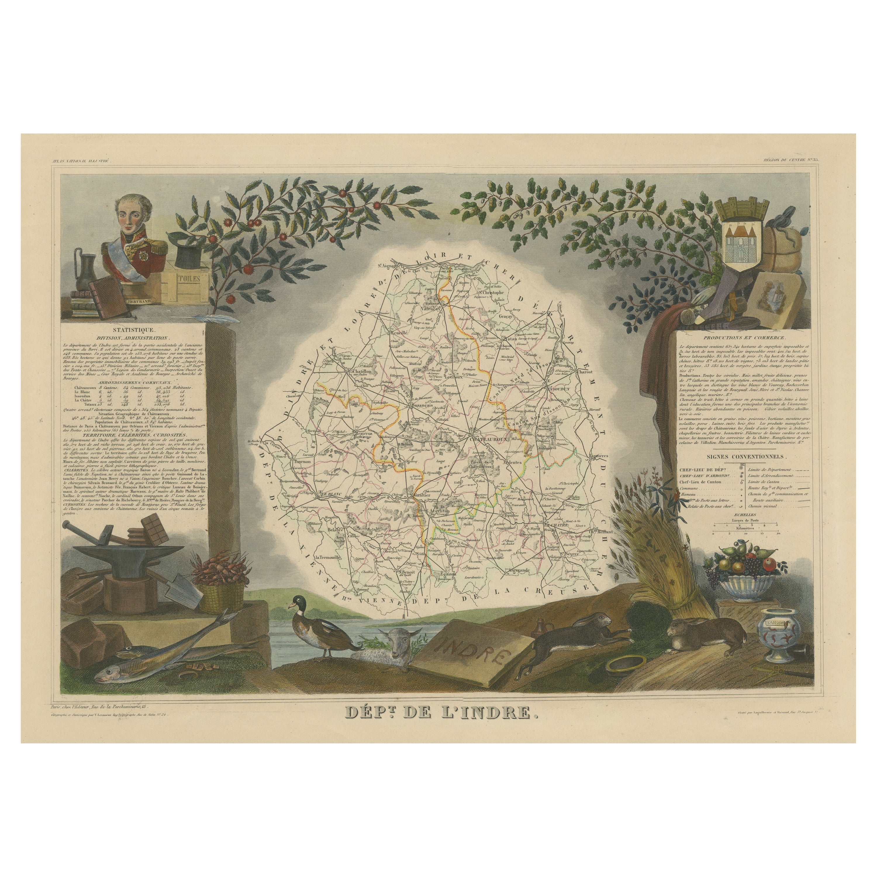
Hand Colored Antique Map of the department of Indre and Loire, France
About the Item
Antique map titled 'Dépt. d'Indre et Loire'. Map of the Department de L’Indre et Loire, France. This region is known for its fine wines, agriculture, distilled spirits, and cheese. The capital city is Tours. The whole is surrounded by elaborate decorative engravings designed to illustrate both the natural beauty and trade richness of the land. There is a short textual history of the regions depicted on both the left and right sides of the map.
This map originates from 'Atlas National de la France Illustree' published by V. Levasseur, circa 1852.
Victor Levasseur (1800–1870) was a French cartographer widely known for his distinctive decorative style. He produced numerous maps more admired for the artistic content of the scenes and data surrounding the map than for the detail of the map. Victor Levasseur's "Atlas National Illustré" and "Atlas Universel Illustré" are among the last great decorative atlases published.
- Creator:Victor Levasseur (Artist)
- Dimensions:Height: 20.28 in (51.5 cm)Width: 14.34 in (36.4 cm)Depth: 0.02 in (0.5 mm)
- Materials and Techniques:
- Period:
- Date of Manufacture:c.1852
- Condition:Wear consistent with age and use. General age-related toning. Shows some wear and soiling, blank verso. Few small tears/splits in margins. Please study images carefully.
- Seller Location:Langweer, NL
- Reference Number:
About the Seller
5.0
Platinum Seller
These expertly vetted sellers are 1stDibs' most experienced sellers and are rated highest by our customers.
Established in 2009
1stDibs seller since 2017
1,916 sales on 1stDibs
Typical response time: <1 hour
- ShippingRetrieving quote...Ships From: Langweer, Netherlands
- Return PolicyA return for this item may be initiated within 14 days of delivery.
More From This SellerView All
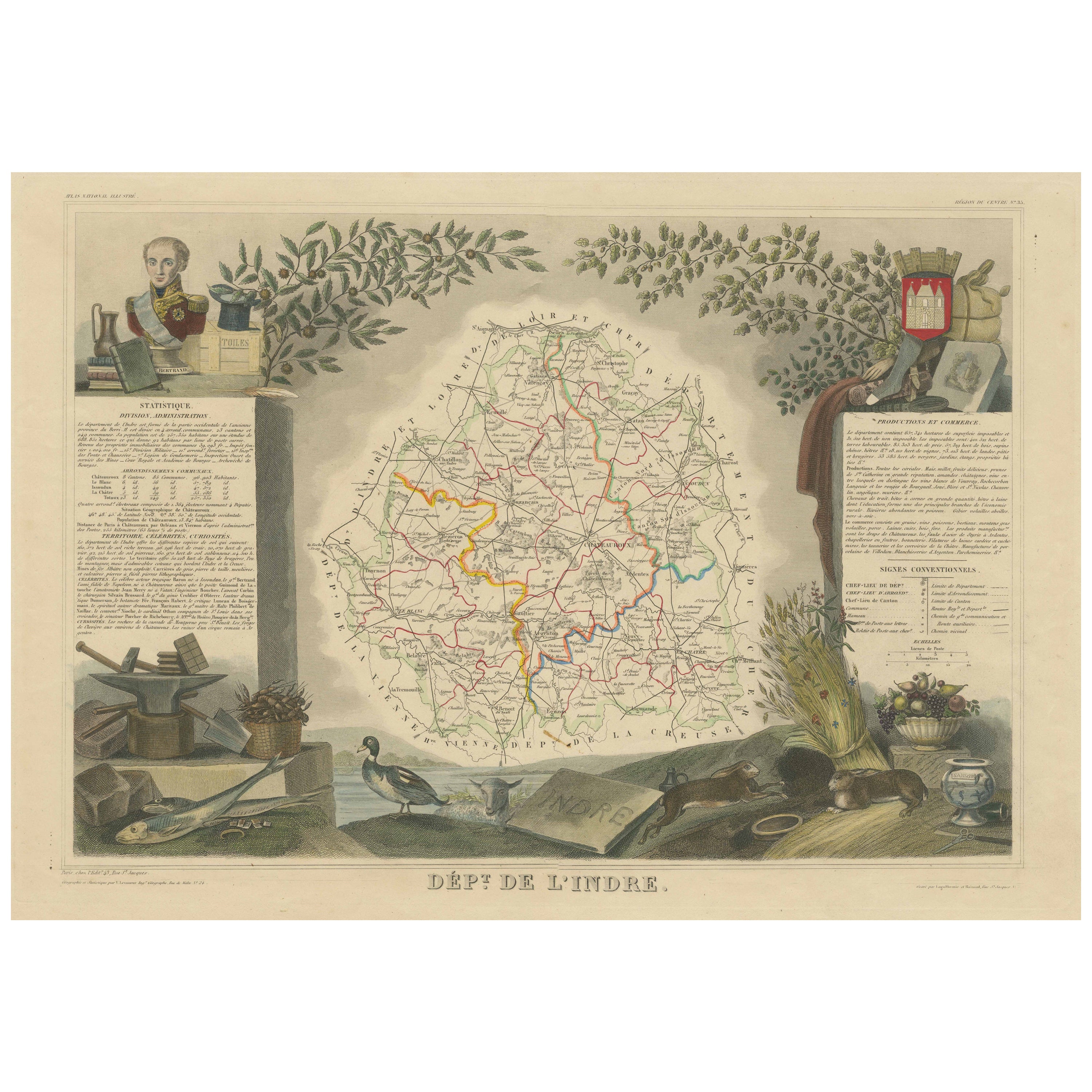
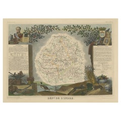
- Hand Colored Antique Map of the Department of Indre, FranceBy Victor LevasseurLocated in Langweer, NLAntique map titled 'Dept. de l'Indre'. Map of the French department of Indre, France. Part of the Loire Valley wine region, this area is known for its production of Chinon wines, typically red, and production of Pouligny-Saint-Pierre, goats'-milk cheese. It is also the birthplace of the great philosopher Rene Descartes...Category
Antique Mid-19th Century Maps
MaterialsPaper
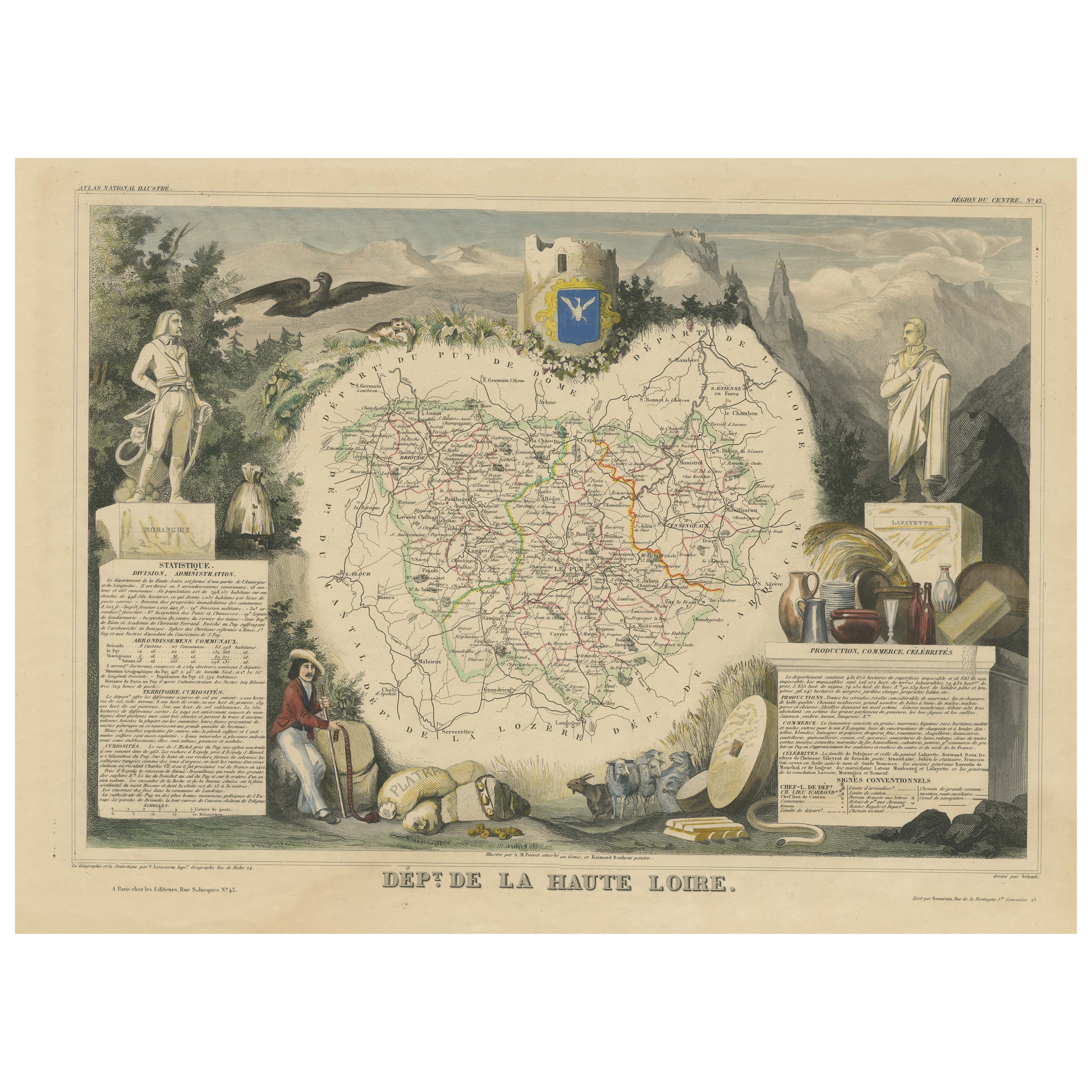
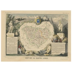
- Hand Colored Antique Map of the Department of Haute Loire, FranceBy Victor LevasseurLocated in Langweer, NLAntique map titled 'Dept. de la Haute Loire'. Map of the French department of Haute Loire, France. This area of France is part of the Loire Valley wine growing...Category
Antique Mid-19th Century Maps
MaterialsPaper
- Old Map of the French Department of Indre, FranceBy Victor LevasseurLocated in Langweer, NLAntique map titled 'Dept. de l'Indre'. Map of the French department of Indre, France. Part of the Loire Valley wine region, this area is known for its production of Chinon wines, typically red, and production of Pouligny-Saint-Pierre, goats'-milk cheese. It is also the birthplace of the great philosopher Rene Descartes...Category
Antique Mid-19th Century Maps
MaterialsPaper
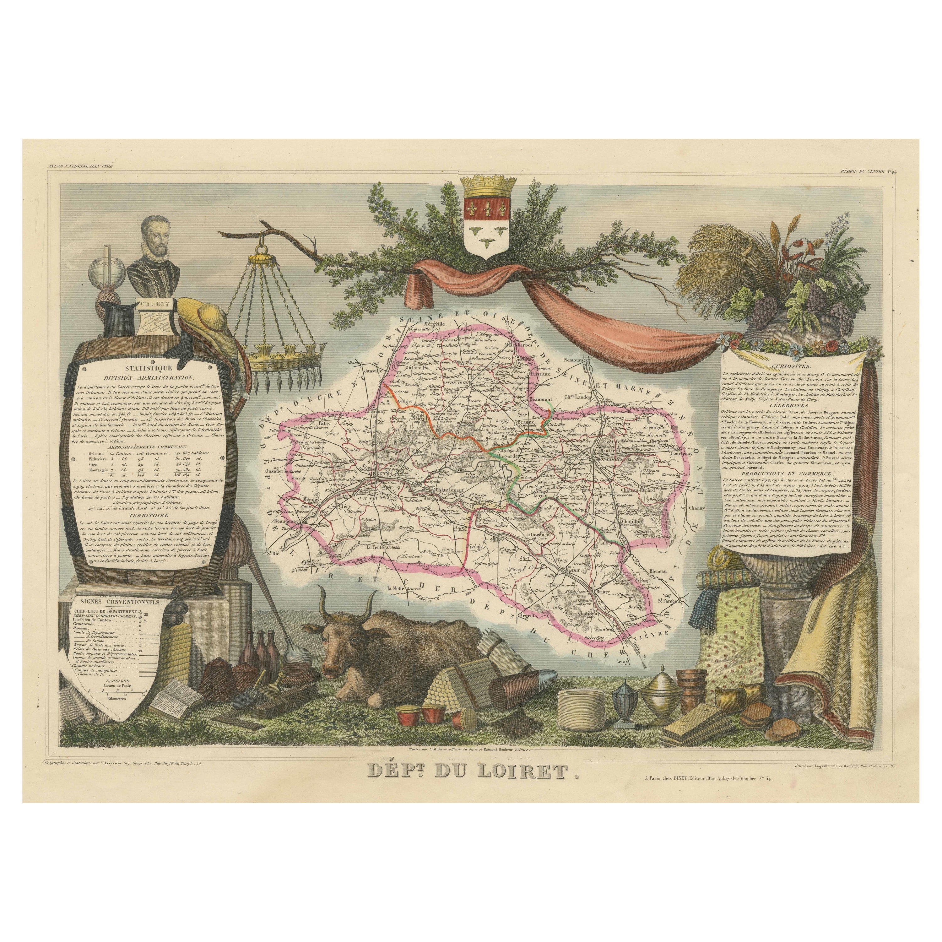
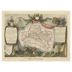
- Hand Colored Antique Map of the department of Loiret, FranceBy Victor LevasseurLocated in Langweer, NLAntique map titled 'Dépt. du Loiret'. Map of the French department of Loiret, France. Surrounding the city of Orleans, Loiret is considered the heart of France and is a registered Unesco World Heritage Site. This area of France is also part of the Loire Valley wine region, and is especially known for its production of Pinot Noirs...Category
Antique Mid-19th Century Maps
MaterialsPaper
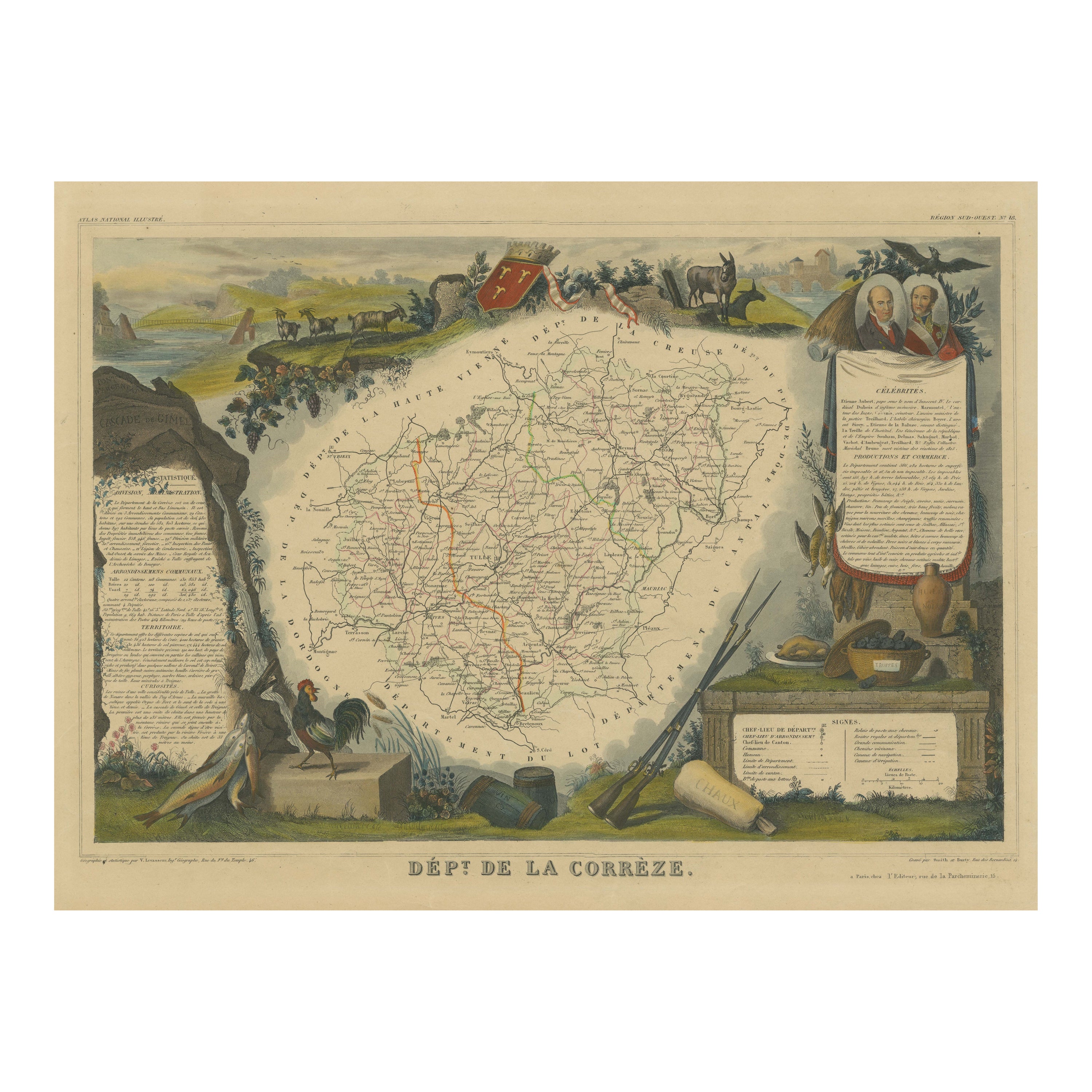
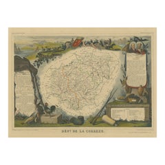
- Hand Colored Antique Map of the Department of Correze, FranceBy Victor LevasseurLocated in Langweer, NLAntique map titled 'Dépt. de la Corrèze'. Map of the French department of Correze, France. This area of France is known for its production of Straw Wine, a sweet red or white wine. T...Category
Antique Mid-19th Century Maps
MaterialsPaper
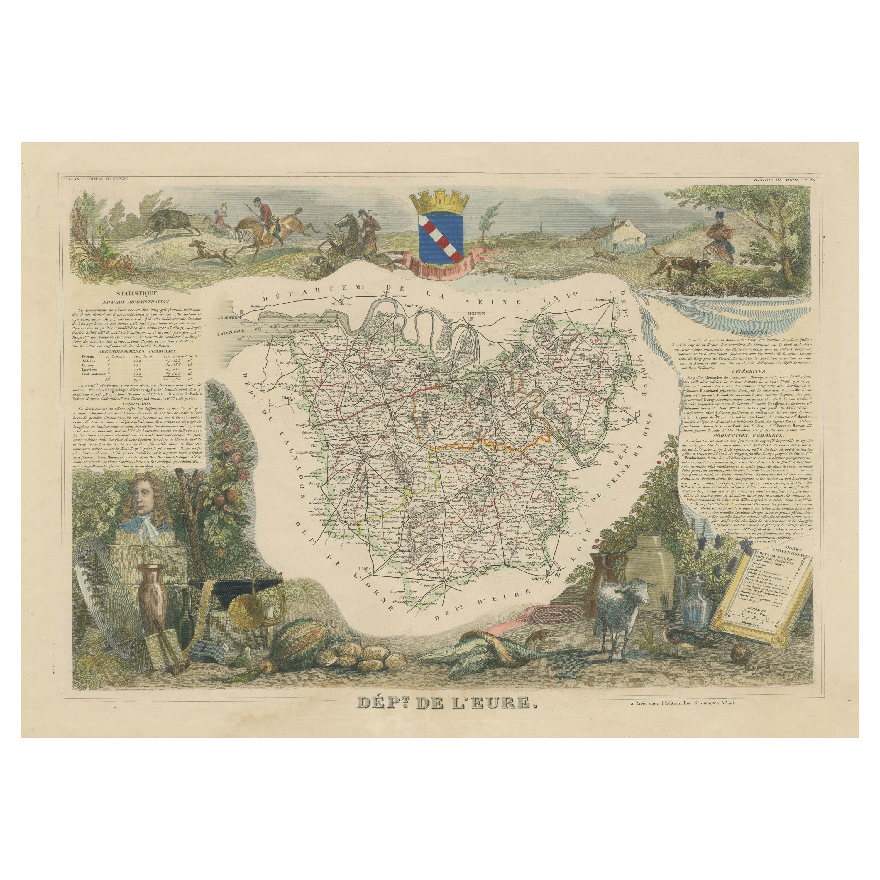
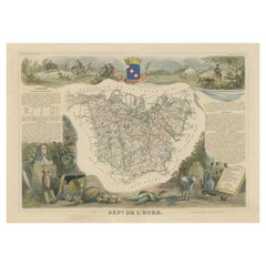
- Hand Colored Antique Map of the Department of Eure, FranceBy Victor LevasseurLocated in Langweer, NLAntique map titled 'Dépt. de l'Eure'. Map of the French department of Eure, France. This region of France is home to Giverny, where impressionist Claude Monet’s home and garden can...Category
Antique Mid-19th Century Maps
MaterialsPaper
You May Also Like
- The Normandy Region of France: A 17th C. Hand-colored Map by Sanson and JaillotBy Nicolas SansonLocated in Alamo, CAThis large hand-colored map entitled "Le Duché et Gouvernement de Normandie divisée en Haute et Basse Normandie en divers Pays; et par evêchez, avec le Gouvernement General du Havre ...Category
Antique 1690s French Maps
MaterialsPaper
- The Kingdom of Naples and Southern Italy: A Hand-Colored 18th Century Homann MapBy Johann Baptist HomannLocated in Alamo, CA"Novissima & exactissimus Totius Regni Neapolis Tabula Presentis Belli Satui Accommo Data" is a hand colored map of southern Italy and the ancient Kingdom of Naples created by Johann...Category
Antique Early 18th Century German Maps
MaterialsPaper
- Hand Colored 18th Century Homann Map of Austria Including Vienna and the DanubeBy Johann Baptist HomannLocated in Alamo, CA"Archiducatus Austriae inferioris" is a hand colored map of Austria created by Johann Baptist Homann (1663-1724) and published in Nuremberg, Germany in 1728 shortly after his death. ...Category
Antique Early 18th Century German Maps
MaterialsPaper
- Hand-Colored 18th Century Homann Map of the Black Sea, Turkey and Asia MinorBy Johann Baptist HomannLocated in Alamo, CAAn attractive original early 18th century hand-colored map of the Black Sea and Turkey entitled "Carte de L'Asie Minevre ou de la Natolie et du Pont Evxin Tiree des Voyages et des Ob...Category
Antique Early 18th Century German Maps
MaterialsPaper
- Hand-Colored 18th Century Homann Map of Denmark and Islands in the Baltic SeaBy Johann Baptist HomannLocated in Alamo, CAAn 18th century copper plate hand-colored map entitled "Insulae Danicae in Mari Balthico Sitae utpote Zeelandia, Fionia, Langelandia, Lalandia, Falstria, Fembria Mona" created by Joh...Category
Antique Early 18th Century German Maps
MaterialsPaper
- Hand-Colored 18th Century Homann Map of the Danube, Italy, Greece, CroatiaBy Johann Baptist HomannLocated in Alamo, CA"Fluviorum in Europa principis Danubii" is a hand colored map of the region about the Danube river created by Johann Baptist Homann (1663-1724) in his 'Atlas Novus Terrarum', publish...Category
Antique Early 18th Century German Maps
MaterialsPaper


Recently Viewed
View AllMore Ways To Browse
Hand Colored Antique
Hand Colored French
Fine Wine
Map Of France Wine
Wine Map France
French Wine Map
Wine And Cheese
Antique French Cheese
Antique Wine Maps
Wine Region Map
California Antique Map
Antique Maps Of Long Island
Antique Map Of Long Island
Antique Map New York City
Antique Map Long Island
Map Of Turkey
Turkey Map
Old Asia Map