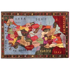
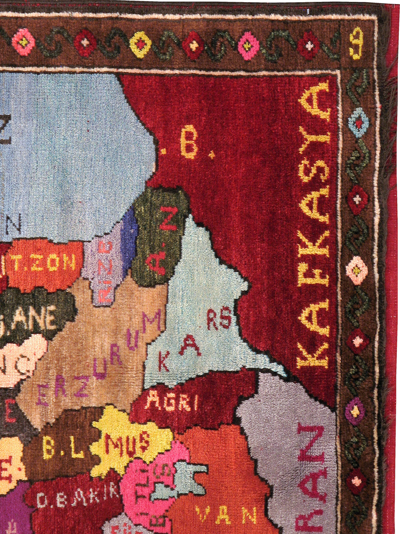
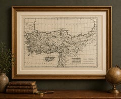
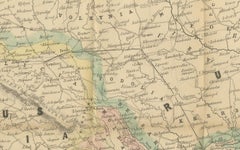
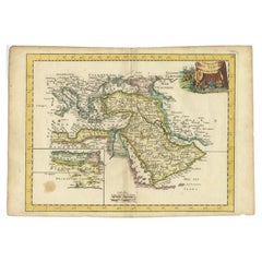
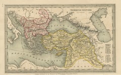
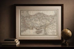
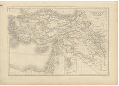
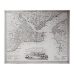
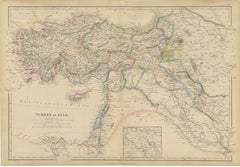
Vintage Turkish Map Rug
$3,200
Vintage Turkish Map Rug
Located in New York, NY
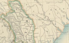
A vintage Turkish Pictorial carpet from the second quarter of the 20th century depicting a map of Turkey.
Category
Mid-20th Century Turkish Turkish Rugs
Materials
Wool
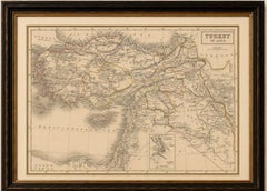
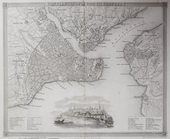
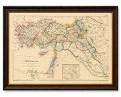
$3,200
Vintage Turkish Map Rug
Located in New York, NY
A vintage Turkish Pictorial carpet from the second quarter of the 20th century depicting a map of Turkey.
Wool

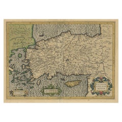
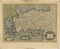
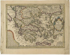
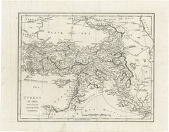
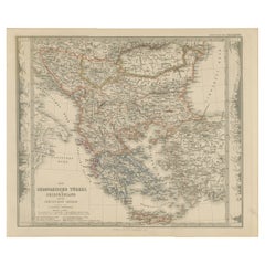
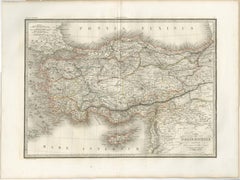
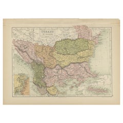
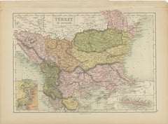
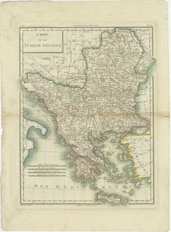
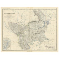
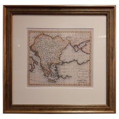
Small Antique Map of the European Turkey, Greece & Ionian Islands – c.1860
Located in Langweer, NL
Antique Map of the European Turkey, Greece & Ionian Islands – Stieler, c.1860 Original antique map titled *Die Europaeische Türkei, Griechenland und die Ionischen Inseln* (European ...
Paper
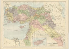
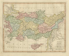
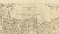
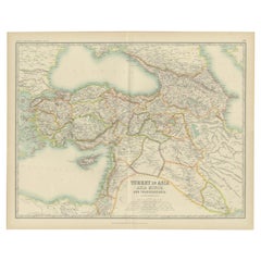
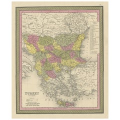
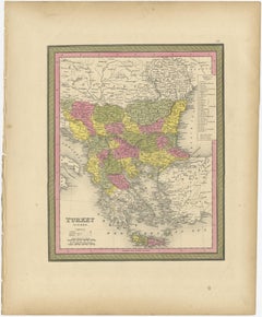
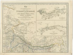
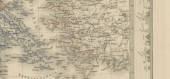
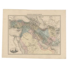
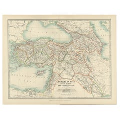
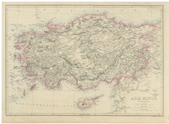
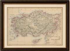
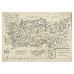
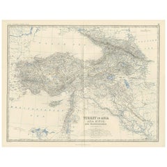
Asia Minor and the Ottoman Levant — Fine Bonne Map of Turkey, c.1780
Located in Langweer, NL
Asia Minor and the Ottoman Levant — Fine Bonne Map of Turkey, c.1780 This finely engraved antique map of Asia Minor (modern-day Turkey and surrounding regions) was created by the ce...
Paper
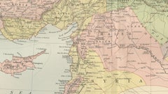
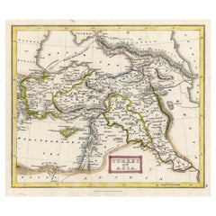
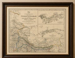
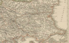
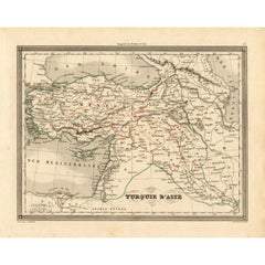
Antique Map Turkey in Asia, Ottoman Empire Anatolia Syria Iraq Black, 1884
Located in Langweer, NL
Antique Map Turkey in Asia, Ottoman Empire Anatolia Syria Iraq Black 1884 This detailed and beautifully engraved antique map titled Turkey in Asia was published in the New and Revis...
Paper
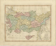
Ancient Asia Minor Map — Classical Anatolia & Pontus, Wilkinson London 1815
Located in Langweer, NL
Ancient Asia Minor Map — Classical Anatolia & Pontus, Wilkinson London 1815 This finely engraved and original hand-colored antique map titled Asia Minor Antiqua depicts the ancient ...
Paper
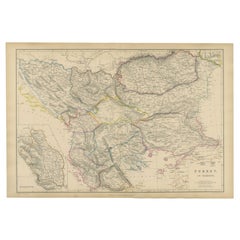
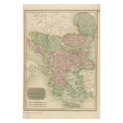
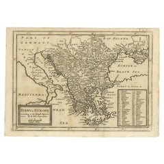
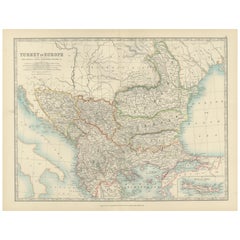
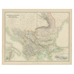
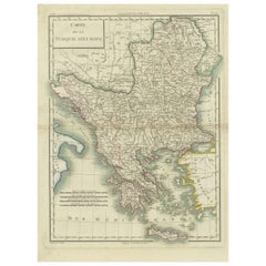
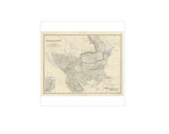
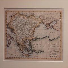
Turkey in Europe & Balkans Map, Antique Hand-Colored Map, 1860
Located in Langweer, NL
Turkey in Europe & Balkans Map, Antique Hand-Colored Map, 1860 This finely detailed antique map illustrates Turkey in Europe together with the broader Balkan Peninsula, presenting a...
Paper
$1,041Sale Price|20% Off
Antique Map of Asia Minor & the Levant – Anatolia, Syria & Cyprus, c.1818
Located in Langweer, NL
Antique Map of Asia Minor & the Levant – Anatolia, Syria & Cyprus, c.1818 Elegant antique map depicting Asia Minor and the Eastern Mediterranean, covering Anatolia (modern T...
Paper

$113Sale Price|20% Off
Antique Map of Turkey and Greece, 1852
Located in Langweer, NL
Antique map titled 'Europisch Turkije en Griekenland'. Map of Turkey in Europe and Greece.
Paper

Antique Map of Turkey in Europe, c.1780
Located in Langweer, NL
Large map of Turkey in Europe. Source unknown, to be determined.
Paper
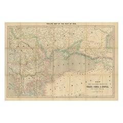
Philips Map of the Seat of War 1854 – Black Sea, Turkey & Russia Antique Map
Located in Langweer, NL
Philips Map of the Seat of War 1854 – Black Sea, Turkey & Russia Antique Map This folding map, titled “Philips’ Map of the Seat of War”, was published in Liverpool by George Philip ...
Paper

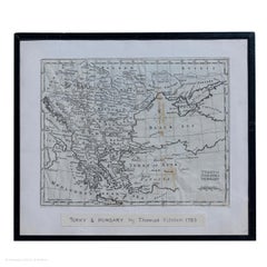
Map Turkey in Europe & Hungary Thomas Kitchin, 1783
Located in BUNGAY, SUFFOLK
Thomas Kitchen (1718 - 1784) : Map of Turkey in Europe & Hungary 1783 Visible sheet within the cream mount 25.5cm., 10" height 20cm., 8" In an ebonised frame length 33cm. 13", he...
Paper

Antique Map of Asia by with an Inset Map of Turkey in Asia, 1868
Located in Langweer, NL
Old map of Asia with an inset map of Turkey in Asia.
Paper

$236Sale Price|20% Off
Antique Map of Turkey in Asia by Johnston '1909'
Located in Langweer, NL
Antique map titled 'Turkey Asia ( Asia Minor )'. Original antique map of Turkey in Asia.
Paper


$189Sale Price|20% Off
Antique Map of Turkey in Asia by Wyld '1845'
Located in Langweer, NL
Antique map titled 'Map of Turkey in Asia'. Original antique map of Turkey in Asia.
Paper

$189Sale Price|20% Off
Antique Map of Turkey in Europe by Wyld, '1845'
Located in Langweer, NL
Antique map titled 'Turkey in Europe'. Original antique map of Turkey in Europe.
Paper
$792Sale Price|20% Off
Original Antique Map of Turkey, Asia Minor and Cyprus
By Gerard Mercator
Located in Langweer, NL
Antique map titled 'Natoliae sive Asia Minor'. Original old map of Turkey, Asia Minor and Cyprus.
Paper
$359Sale Price|20% Off
Original Antique Map of Greece and part of Turkey
Located in Langweer, NL
Small map of Greece and part of Turkey. This map originates from 'Le nouveau et curieux Atlas Geographique et historique' by Jacques Chiquet.
Paper
$217Sale Price|20% Off
Old Colourful Decorative Map of Turkey in Europe, 1846
Located in Langweer, NL
Antique map titled 'Turkey in Europe'. Old map of Turkey in Europe.
Paper
Antique Map of Turkey in Asia 'Asia Minor', 1841
Located in Langweer, NL
Antique map titled 'Turkey in Asia'. Original antique map of Asia Minor (Turkey).
Paper
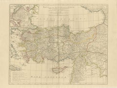
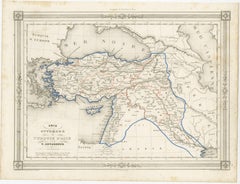
Ottoman Empire Map — Turkey in Asia, Syria & Mesopotamia, c.1830
Located in Langweer, NL
Title: Ottoman Empire Map — Turkey in Asia, Syria & Mesopotamia, c.1830 A finely engraved map capturing the heart of the Ottoman Empire at a pivotal moment before the modern bor...
Paper
$338Sale Price|35% Off
Orginal Antique Handcolored Map of the Turkish Empire, 1748
Located in Langweer, NL
Antique map titled 'L'Empire des Turcs'. Old map of the Turkish Empire with an inset of the North African regions.
Paper
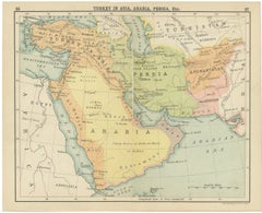
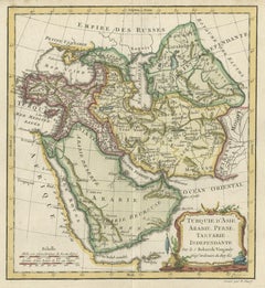
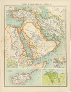
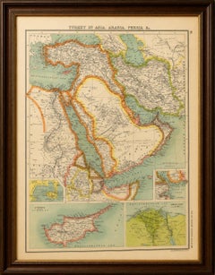
Turkey, Persia & Arabia Antique Map by James Wyld, Bosphorus, 1839
Located in Langweer, NL
Turkey, Persia & Arabia Antique Map by James Wyld, Bosphorus 1839 This finely engraved antique map by the celebrated British cartographer James Wyld presents a sweeping geographical...
Paper

Antique Map of Turkey in Asia, Arabia, Persia, ca.1890
Located in Langweer, NL
Antique Map of Turkey in Asia, Arabia, Persia, ca.1890 A finely engraved and beautifully hand-colored map titled “Turkey in Asia, Arabia, Persia, Etc.”, attributed to the esteemed S...
Paper

Antique Ottoman Empire Miniature Map, Turkey Balkans Arabia, Starling, 1833
Located in Langweer, NL
Antique Ottoman Empire Map, Turkey Balkans Arabia, Starling, 1833 A finely engraved and historically rich miniature map of the Ottoman Empire, drawn by Thomas Starling and published...
Paper
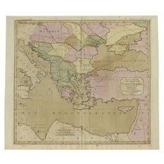
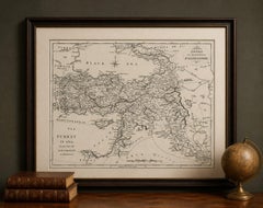
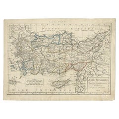
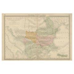
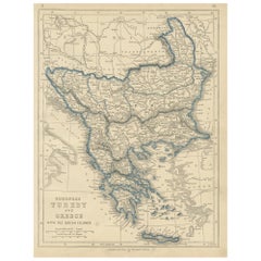
European Turkey and Greece Map – Balkans and Ionian Islands 1857
Located in Langweer, NL
European Turkey and Greece Map – Balkans and Ionian Islands 1857 This detailed antique print shows “Die Europäische Türkei, Griechenland und die Ionischen Inseln” meaning “European ...
Paper

$321Sale Price|20% Off
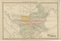
Antique Map of European Turkey and Greece, Copperplate Engraving, 1857
Located in Langweer, NL
European Turkey and Greece Map – Balkans and Ionian Islands 1857 This detailed antique print shows “Die Europäische Türkei, Griechenland und die Ionischen Inseln” meaning “European ...
Paper
Map of Turkish Dominions in Europe, Ottoman Balkan Territories 1813
Located in Langweer, NL
Map of Turkish Dominions in Europe, Ottoman Balkan Territories 1814 This antique map titled "Turkish Dominions in Europe" provides a detailed depiction of the Balkan Peninsula and a...
Paper
$157Sale Price|30% Off
Antique Map of Turkey in Asia, with Frame Style Border
Located in Langweer, NL
Antique map titled 'Asie Ottomane ou Turquie d'Asie'. Attractive map of Turkey in Asia.
Paper
$123Sale Price|72% Off
Antique Map of the Turkish Empire and Persia, circa 1890
By J. Migeon
Located in Langweer, NL
Antique map Turkish Emprie titled 'Turquie d'Asie et Perse'.
Paper


$653Sale Price|20% Off
Antique Map of Greece, Turkey and surroundings with original coloring
Located in Langweer, NL
Antique map of Greece with Crete and Cyprus, Turkey and the Black Sea.
Paper


Antique Map of Turkey and Greece by Petri, c.1873
Located in Langweer, NL
Antique map titled 'Europisch Turkije en Griekenland'. Old map depicting Turkey in Europe and Greece.
Paper

$321Sale Price|20% Off
Detailed Original Antique Map of Turkey in Europe, circa 1740
Located in Langweer, NL
Antique map Turkish Empire tilted 'Turky in Europe'. Beautiful, small antique map depicting modern-day Greece and surroundings.
Paper
Antique Map Asia Minor Turkey Levant, Lapie 1838 – Hand Colored Engraving
Located in Langweer, NL
Antique Map Asia Minor, Turkey & Levant – Lapie, Tardieu, 1838 This finely engraved and delicately hand-colored map of Asia Minor was published in Paris in 1838 as part of the renow...
Paper


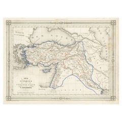
Antique Map by Pierre M. Lapie, Turkey, Persia, Afghanistan, 1842
By Pierre M. Lapie
Located in Langweer, NL
Map of Turkey, Persia and Afghanistan. This map originates from 'Atlas universel de géographie ancienne et moderne (..)' by Pierre M.
Paper
Antique Map of Turkey in Asia (Asia Minor and Transcaucasia), 1903
Located in Langweer, NL
Antique Map of Turkey in Asia (Asia Minor and Transcaucasia), 1903, with Intricate Provincial Borders This antique map, titled "Turkey in Asia (Asia Minor) and Transcaucasia," was e...
Paper
Antique Map of Turkey in Europe, 1903, with Delicate Pastel Coloration
Located in Langweer, NL
Title: Antique Map of Turkey in Europe, 1903, with Delicate Pastel Coloration Description: This antique map, titled "Turkey in Europe," was engraved and published in 1903 by the dis...
Paper
$165Sale Price|20% Off
Antique Map of Turkey in Europe by A & C. Black, 1870
Located in Langweer, NL
Antique map titled 'Turkey in Europe'. Original antique map of Turkey in Europe with inset maps of the Bosporus and Crete or Candia.
Paper
Antique Map of Asia Minor Turkey by Edward Weller, Weekly Dispatch, 1863
Located in Langweer, NL
Antique Map of Asia Minor Turkey by Edward Weller, Weekly Dispatch, 1863 Detailed antique map of Asia Minor, present-day Turkey, engraved by Edward Weller, F.R.G.S., and published i...
Paper


$165Sale Price|20% Off
Antique Map of Turkey in Asia by A & C. Black, 1870
Located in Langweer, NL
Antique map titled 'Turkey in Asia'. Original antique map of Turkey in Asia with inset Ruins of Babylon.
Paper

$397Sale Price|20% Off
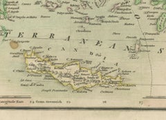
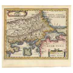
Original Old Map of Northeastern Greece & Northwestern Turkey, Published in 1661
Located in Langweer, NL
It covers the ancient region of Thrace, present-day European Turkey and part of Greece. The map is graced with two attractive strapwork cartouches.
Paper
Antique Map of Turkey in Europe with Bulgaria by Johnston, 1909
Located in Langweer, NL
Antique map titled 'Turkey in Europe with Bulgaria'. Original antique map of Turkey in Europe with Bulgaria.
Paper
Antique Map of Turkey in Asia, Ottoman Empire Middle East, c. 1850
Located in Langweer, NL
Antique Map of Turkey in Asia, Ottoman Empire Middle East, c. 1850 Large and finely engraved antique map titled “Turkey in Asia,” depicting the vast Asian territories of the Ottoman...
Paper
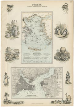
Antique Map of Turkey and Constantinople with Views & Figures, Fullarton c.1865
Located in Langweer, NL
Antique Map of Turkey and Constantinople with Views and Figures, Fullarton c.1865 A richly detailed and highly decorative lithographic map titled “Turkey; Central Mediterranean Regi...
Paper
Genuine Antique Map of European Turkey by Pierre Antoine Tardieu, 1802
Located in Langweer, NL
This is an original antique map titled "Carte de la Turquie d'Europe," which depicts the European territories of the Ottoman Empire.
Paper
$511Sale Price|20% Off
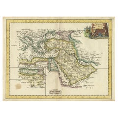
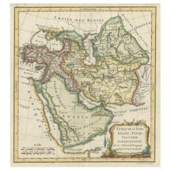
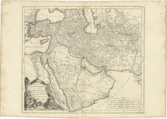
Old Map Depicting Turkey, Persia, Arab and Black Sea Etc, 1778
Located in Langweer, NL
Old map of Turkey in Asia. The map shows all of Turkey and the Black Sea, and extends east to include the Caspian Sea and the region of today's Afghanistan, Pakistan, and Turkmenistan.
Paper
Original Antique Map or City Plan of Istanbul, Turkey. Circa 1835
Located in St Annes, Lancashire
Nice map of Istanbul Drawn and engraved by J.Dower Published by Orr & Smith. C.1835 Unframed. Free shipping
Paper
Antique Map of Turkey in Europe by A.K. Johnston, 1865
Located in Langweer, NL
Antique map titled 'Turkey in Europe'. With an inset map of Crete, the Bosporus and Constantinople.
Paper
Antique Map of Asia Minor, Present-day Turkey and Cyprus, 1803
Located in Langweer, NL
Antique map titled 'Asiae Minoris Tabula Geographica'. Uncommon antique map of Asia minor, comprising most of what is present-day Turkey.
Paper
Antique Map of Turkey in Asia 'Asia Minor' by Vuillemin, 1846
Located in Langweer, NL
Antique map titled 'Turqui D'Asie'. Map of Turkey in Asia / Asia Minor.
Paper

Antique Map of Turkey in Asia by A.K. Johnston, 1865
Located in Langweer, NL
Antique map titled 'Turkey in Asia (Asia Minor) and Transcaucasia'.
Paper
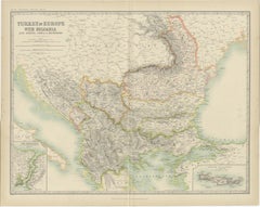
Turkey in Europe Map – Balkans, Rumelia, Serbia, Bulgaria, Rand McNally, ca.1888
Located in Langweer, NL
Turkey in Europe Map – Balkans, Rumelia, Serbia, Bulgaria, Rand McNally This detailed political and geographic map titled “Turkey in Europe” presents the Balkan Peninsula at a pivot...
Paper

Detailed Original Antique Map of the Turkish Empire with Arabia, 1778
Located in Langweer, NL
Title: Etats Due Grand-Seigneur En Asie, Empire De Perse, Pays Des Usbecs, Arabie et Egypte . . . 1753 Detailed map of the Turkish Empire, extending to the Black Sea, Georgia, the...
Paper
Original Antique Map of Turkey in Asia, Ottoman Empire & Middle East c.1860
Located in Langweer, NL
Original Antique Map of Turkey in Asia, Ottoman Empire & Middle East c.1860 This impressive original antique map depicts the vast territories historically known as "Turkey in Asia,"...
Paper
Turkey in Asia, Arabia & Persia Map with Cyprus and Egypt Insets c.1902
Located in Langweer, NL
Turkey in Asia, Arabia & Persia Map with Cyprus and Egypt Insets c.1902 A beautifully detailed antique map titled “Turkey in Asia, Arabia, Persia &c.”, published around 1900 as part...
Paper

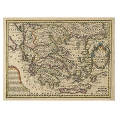
1852 Antique Map of European Turkey and Greece by J.W. Lowry
Located in Langweer, NL
Antique map titled 'European Turkey and Greece with the Ionian Islands'.
Paper
Antique Map of Turkey in Europe by J. Russell, Framed, Circa 1795
Located in Langweer, NL
Antique map titled 'Turkey in Europe and Hungary'. Original map of Turkey in Europe.
Paper


$710Sale Price|20% Off
Rare 1618 Antique Miniature Map of the Turkish Empire by P. Bertius
Located in Langweer, NL
Antique miniature map titled 'Turcicum Imperium'. Rare miniature map of the Turkish Empire.
Paper
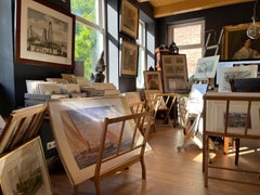
Antique and vintage collectibles and curiosities can bring whimsy and wonder to any interior.
Decorating with old scientific instruments, historical memorabilia and vintage musical instruments, as well as other authentic collectibles and curiosities that can be found on 1stDibs, presents an opportunity to create a unique, natural history museum-like atmosphere in your home that can provoke conversation as often as it pays tribute to how far we’ve come in understanding our world.
And bringing collectibles and curiosities into your space is actually on trend — Wunderkammern, or curiosity cabinets, were all the rage in Europe during the 1500s and continued to have adherents there and in the U.S. in the following centuries. Today, however, they’re experiencing a real surge in popularity and influencing how many interior designers are furnishing and decorating homes — combining contemporary with antique, scientific with tribal, earthly with extraterrestrial, Les Lalanne tables with Flemish tapestries.
The original Wunderkammern were entire rooms filled with objects demonstrating their owners’ worldly knowledge: A proper one included artificiala or preciosa (objets d’art); naturalia (such as skeletons, shells, minerals); exotica (taxidermy or dried plants); and scientifica (scientific instruments), frequently alongside religious relics and ancient artifacts.
Pay tribute to a history of rich and diverse musical traditions that have taken shape all over the world by decorating your home with a collection of antique and vintage musical instruments — with a little help from strong hanging wire or some wall hooks, vintage brass instruments such as a gong, French horn or trumpet can help elevate a home office or complement the efforts you’ve made to ensure a welcoming vibe in your home’s entryway. Bells or antique wind instruments can add provocative metallic contrasts to dark woods as tabletop decorative objects.
Create an intriguing focal point with Georgian scientific instruments, such as stick barometers with mahogany cases or lacquered brass telescopes. These items stem from an era named for the monarchies of the four King Georges, who ruled England in succession starting in 1714 (plus King William’s reign, which lasted until 1837). Just as there was beautiful jewelry produced during the period that today is coveted by collectors, there is much to be found in the collectibles and curiosities realm too.
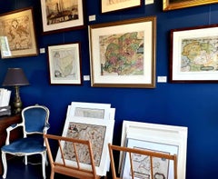
Wanderlust, nostalgia and a shared love of good design are contributing factors to certain trends in decorating — just as vintage trunks and luggage have reappeared as furniture or home accents in a bedroom or foyer, decorating with globes, maps or nautical objects is similarly rooted in the allure of travel and a penchant for the stylish finishing touch that collectibles bring to our homes.
Find a wide range of antique and vintage collectibles and curiosities on 1stDibs.
It's hard to resist the allure of a beautiful pool. So, go ahead and daydream about whiling away your summer in paradise.
It’s never too early for good design. These interiors combine elevated furnishings and a youthful spirit, resulting in spaces that are at once elegant and whimsical.
Produced in 1843, the well-preserved volume is evidence of the author's exacting specifications.
New or old, the coverlets add old-time charm to any space.
Get into the games! These items celebrate the events, athletes, host countries and sporting spirit.
French trendsetter and serial collector Daniel Rozensztroch tells us about his obsession with objects related to seafaring men.
The sought-after designer worked with the team at Hoffman Creative to produce a monograph that beautifully showcases some of Studio Shamshiri's most inspiring projects.
Italian writer and collector Umberto Pasti opens the doors to his remarkable cave of wonders in North Africa.