Items Similar to Hand-Colored Steel Engraving of Batavia 'Jakarta', Indonesia, Ca.1840


Want more images or videos?
Request additional images or videos from the seller
1 of 5
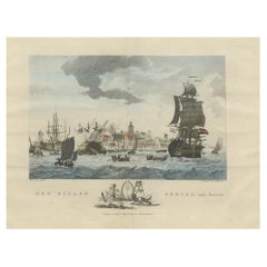
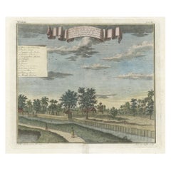
Hand-Colored Steel Engraving of Batavia 'Jakarta', Indonesia, Ca.1840
About the Item
Antique print titled 'Batavia'.
Steel engraving of Batavia (Jakarta), Indonesia. Originates from 'Meyers Universum'.
Artists and Engravers: Joseph Meyer (May 9, 1796 - June 27, 1856) was a German industrialist and publisher, most noted for his encyclopedia, Meyers Konversations-Lexikon. Meyer operated very successfully as a publisher, employing a system of serial subscription to publications, which was new at that time. To this end he founded a company, Bibliographisches Institut, in Gotha in 1826. It published several editions of the Bible, works of classical literature ("Miniatur-Bibliothek der deutschen Classiker", "Groschen-Bibliothek"), atlases, the world in pictures on steel engravings ("Meyers Universum", 1833–61, 17 volumes in 12 languages with 80,000 subscribers all over Europe), and an encyclopaedia.
Condition:
Good, age-related toning. Minor wear, blank verso. Please study image carefully.
- Dimensions:Height: 5.91 in (15 cm)Width: 8.47 in (21.5 cm)Depth: 0 in (0.02 mm)
- Materials and Techniques:
- Period:
- Date of Manufacture:circa 1840
- Condition:Wear consistent with age and use. Condition: Good, age-related toning. Minor wear, blank verso. Please study image carefully.
- Seller Location:Langweer, NL
- Reference Number:
About the Seller
5.0
Platinum Seller
These expertly vetted sellers are 1stDibs' most experienced sellers and are rated highest by our customers.
Established in 2009
1stDibs seller since 2017
1,922 sales on 1stDibs
Typical response time: <1 hour
- ShippingRetrieving quote...Ships From: Langweer, Netherlands
- Return PolicyA return for this item may be initiated within 14 days of delivery.
More From This SellerView All
- Beautiful View of Pulau 'Island' Onrust, Batavia 'Jakarta, Indonesia', ca.1805Located in Langweer, NLAntique print titled 'Het Eiland Onrust'. Beautiful view of the sea near Onrust Island, also known as Pulau Onrust or Pulau Kapal (ship island), Indonesia. Published by E. Maaskamp, ...Category
Antique Early 1800s Maps
MaterialsPaper
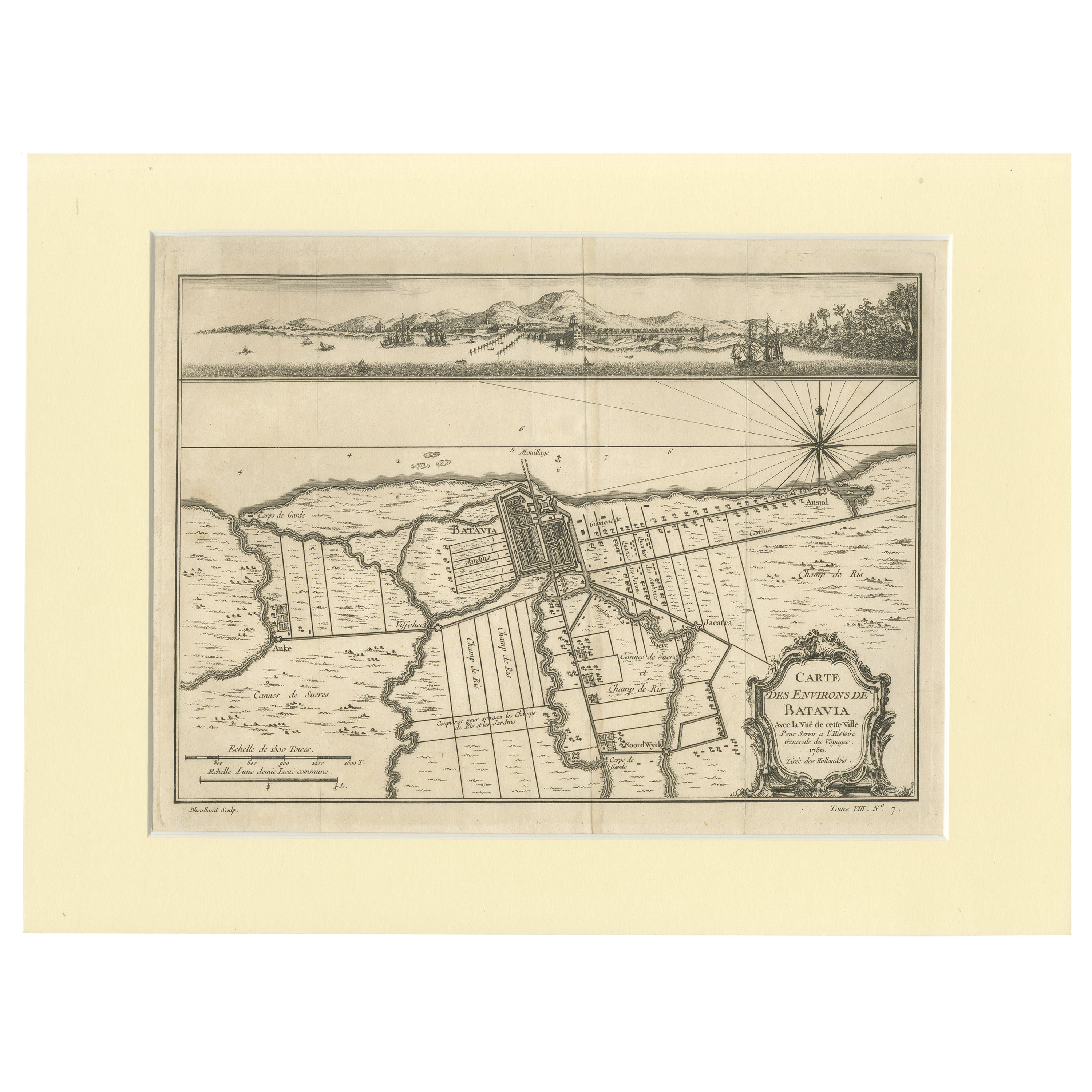
- Old Engraving of Batavia 'Jakarta, Indonesia' with Map and Harbour View, 1750Located in Langweer, NLAntique map titled 'Carte des environs de Batavia '. French map of the Batavia area (Jakarta) in Indonesia. With cartouche, scale and compass rose. Published circa 1750. The map i...Category
Antique 1750s Maps
MaterialsPaper
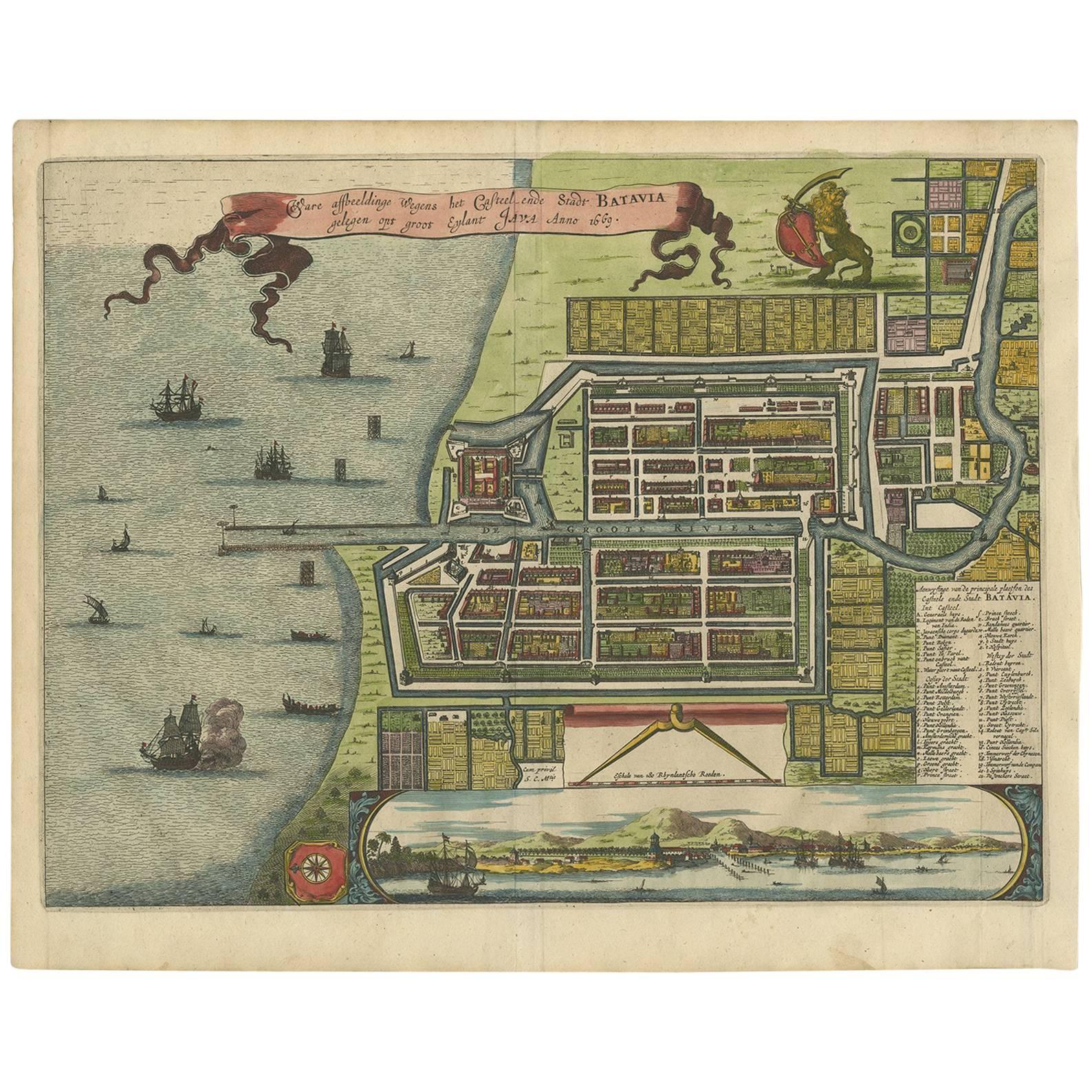
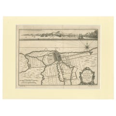
- Antique Map of Batavia, Dutch East Indies, Nowadays Jakarta, Indonesia, ca.1669Located in Langweer, NLAntique map titled 'Ware afbeeldinge wegens het Casteel ende Stadt Batavia gelegen opt groot Eylant Java Anno 1679. Plan de la Ville et du Chateau de Batavia en l'Isle de Iava. 1679....Category
Antique 1660s Maps
MaterialsPaper
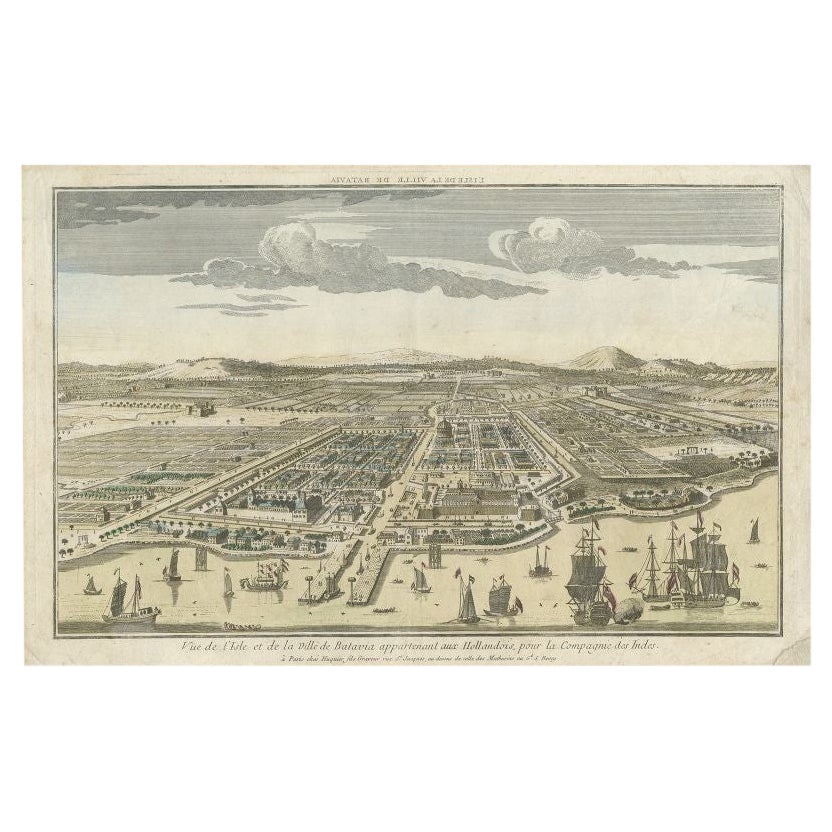
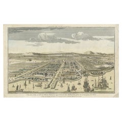
- Antique Print of Batavia or nowadays Jakarta, Indonesia, c.1755Located in Langweer, NLAntique print titled 'Vue de l'Isle et de la ville de Batavia appartenant aux Hollandois'. Beautiful view of the island and the city of Batavia belonging to the Dutch, for the India ...Category
Antique 18th Century Prints
MaterialsPaper
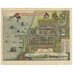
- Antique Map of Batavia 'Jakarta, Indonesia' by Montanus, 1679Located in Langweer, NLFine early plan of Batavia (Jakarta), published by Arnoldus Montanus. This map has a vignette at the bottom showing Jakarta from the sea with the volcanoes Mount Gede, Mount Pangrnago and Mount Salak in the background. The plan is based on the earlier, much larger map of Batavia published by Clement de Jonghe...Category
Antique Late 17th Century Unknown Maps
MaterialsPaper
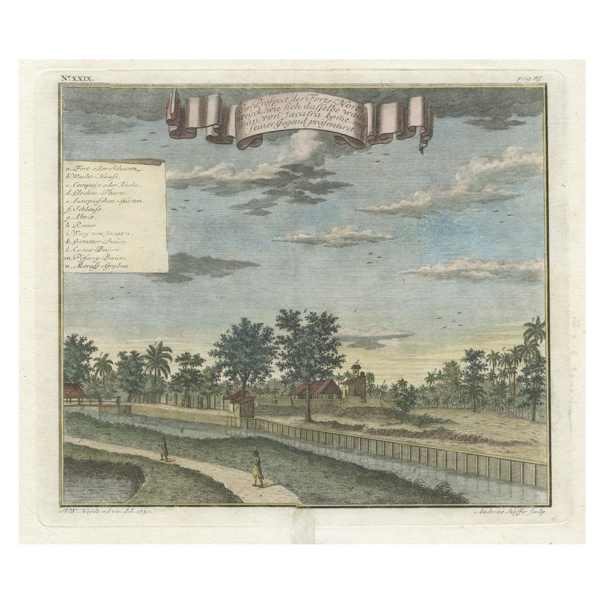
- Old Antique Print of Fort Noordwijk, Batavia 'Jakarta, Indonesia', 1739Located in Langweer, NLAntique print titled 'Ein Prospect des Forts Nortweijck, wie sich dasselbe wan man von Jacatra komt, mit seiner Gegend präsentiret'. Old print of Fort Noordwijk, Batavia (Jakarta)....Category
Antique 1730s Prints
MaterialsPaper

You May Also Like
- 18th century Set Hand Colored Nautical EngravingsBy M. OgierLocated in Savannah, GASigned M. Ogier (Fecit:by), this set of four hand colored engravings is part of a larger edition of plates. These plates are numbered PL 16, 347, 365 and 386. The subject is probably...Category
Antique 18th Century Unknown Elizabethan Prints
MaterialsGlass, Wood, Paper
- Antique Albertus Seba Pair 18th Century Hand-Colored Engravings ButterflyBy Albertus Seba 1Located in Washington, DCRare pair of original hand-colored prints from Sir Albertus Seba's cabinet of natural curiosities. Prints come from published volumes in Amste...Category
Antique Mid-18th Century Dutch Prints
MaterialsPaper
- Set of Twelve Colored Engravings of the Defeat of the Spanish Armada by J. PineLocated in Essex, MABy John Pine considered the foremost heraldic and decorative engraver of his generation. Depicting the defeat of the Spanish by the English Fleet in 1588. These are after a set of tapestries that hung in the House of Commons...Category
Antique 1740s English Prints
MaterialsPaper
- England, Scotland & Ireland: A Hand Colored Map of Great Britain by TirionBy Isaak TirionLocated in Alamo, CAThis is a hand-colored double page copperplate map of Great Britain entitled "Nieuwe Kaart van de Eilanden van Groot Brittannien Behelzende de Kon...Category
Antique Mid-18th Century Dutch Maps
MaterialsPaper
- 17th Century Hand-Colored Map of West Africa by Mercator/HondiusLocated in Alamo, CAA 17th century hand-colored map entitled "Guineae Nova Descriptio" by Gerard Mercator and Jodocus Hondius, published in their 'Atlas Minor' in Amsterdam in 1635. It is focused on the...Category
Antique Mid-17th Century Dutch Maps
MaterialsPaper
- Captain Cook's Exploration of Tahiti 18th C. Hand-Colored Map by BellinBy Jacques-Nicolas BellinLocated in Alamo, CAThis beautiful 18th century hand-colored copper plate engraved map is entitled "Carte de l'Isle de Taiti, par le Lieutenant J. Cook" was created by Jacques Nicolas Bellin and publish...Category
Antique Mid-18th Century French Maps
MaterialsPaper


Recently Viewed
View AllMore Ways To Browse
Antique Classical Engraving
Meyer May
Wall Sculptures Plaque
Main Door
Metal Display Cabinet
American Antique Cabinet
Mid Century Carved Wood Door
Antique Built In Cabinet
Antique Built In Cabinets
Brass Cabinet Nightstand
Small Cupboard With Doors
Midcentury China Cabinet
Ebonized Kitchen Cabinet
Display Case 1900
Silver Midcentury Ring
Chinese Antique Cabinet With
Antique Jacket
Military Metal