Mid-19th Century Maps
to
579
824
32
856
56
4
2
2,928
2,257
475
3
290
34
10
126
10
37
9
2
5
4
3
3
832
51
24
4
4
210
104
56
55
46
856
856
856
104
4
2
1
1
Period: Mid-19th Century
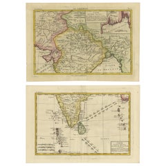
18th Century Cartographic Depiction of Upper India and Ceylon, 1835
Located in Langweer, NL
An exquisite set of two maps, 'Carte de la Partie Superieure De L'Inde en de Cadu Gange,' masterfully crafted by the renowned 18th-century French cartographer, Charles Marie Rigobert...
Category
Antique Mid-19th Century Maps
Materials
Paper
$418 Sale Price
20% Off
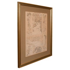
Antique Lithography Map, Coastal England, Framed Cartography Interest, Victorian
Located in Hele, Devon, GB
This is an antique lithography map of Coastal England. A Scottish, framed town engraving of cartographic interest, dating to the early Victorian period and later.
Superb lithograph...
Category
British Early Victorian Antique Mid-19th Century Maps
Materials
Glass, Wood
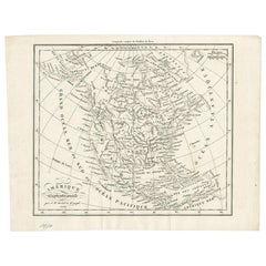
Antique Map of North America by Dufour 'circa 1834'
Located in Langweer, NL
Antique map titled 'Amérique Septentrionale'. Uncommon map of North America. Published by or after A.H. Dufour, circa 1834. Source unknown, to be determined.
Category
Antique Mid-19th Century Maps
Materials
Paper
$190 Sale Price
20% Off
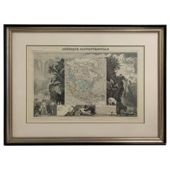
1847 Amerique Septentrionale Framed Map
Located in Stamford, CT
1847 Amerique Septentrionale Framed Map Illustrated by Raimond Bonheur. As found framed condition.
Category
American American Classical Antique Mid-19th Century Maps
Materials
Glass, Wood, Paper
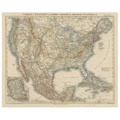
Antique Map of the United States with inset map of the region of Mexico City
Located in Langweer, NL
Antique map titled 'Verein-Staaten von Nord-America, Mexico, Yucatan u.a.'. Very detailed map of the United States of America showing the Caribbean. With an inset map of the surround...
Category
Antique Mid-19th Century Maps
Materials
Paper
$818 Sale Price
20% Off
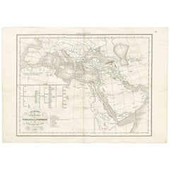
Géographie des Hébreux – Tableau de la Dispersion des Enfants de Noé, 1837
Located in Langweer, NL
Géographie des Hébreux – Tableau de la Dispersion des Enfants de Noé, 1837
This antique map, titled Géographie des Hébreux ou Tableau de la Dispersion des ...
Category
French Antique Mid-19th Century Maps
Materials
Paper
$228 Sale Price
20% Off
Hand Colored Antique Map of the Department of Vaucluse, France
Located in Langweer, NL
Antique map titled 'Dépt de Vaucluse'. Map of the French department of Vaucluse, France. Vaucluse is the center of wine production in the southern Rhone. Some of the smartest wines in France can be found here. There is also a very strong movement towards the adoption of organic and biodynamic viticulture and natural wine making...
Category
Antique Mid-19th Century Maps
Materials
Paper
$323 Sale Price
20% Off
Antique Map of Haute-Saone, France by V. Levasseur, 1854
Located in Langweer, NL
Antique map titled 'Dépt. de la Hte. Saône'. Map of the French department of Haute-Saone, France. Part of France's important Burgundy or Bourgogne Wine Region. This area is home to t...
Category
Antique Mid-19th Century Maps
Materials
Paper
$171 Sale Price
20% Off
Ornate Hand-Colored Map of Germany by John Tallis with Vignettes, ca. 1850
Located in Langweer, NL
Title: Hand-Colored Map of Germany by J. Tallis, ca. 1850
This beautifully hand-colored map of Germany, published by John Tallis & Co. around 1850, provides a comprehensive depictio...
Category
Antique Mid-19th Century Maps
Materials
Paper
Large Chart of the Gambier Islands, Tuamotu Archipelago, French Polynesia
Located in Langweer, NL
Antique map titled 'Carte du Groupe des Iles Manga-Reva (Archipel Pomotou)'. Large chart of the Tuamotu Archipelago, French Îles Tuamotu, also called Paumotu, island group of French ...
Category
Antique Mid-19th Century Maps
Materials
Paper
$2,284 Sale Price
20% Off
Antique Map of the French Colony of Algeria by V. Levasseur, 1854
Located in Langweer, NL
Antique map titled 'Algérie, Colonie Francaise'. Shows the region divided into the administrative provinces of Oban, Alger, and Constantine. The map proper is surrounded by elaborate...
Category
Antique Mid-19th Century Maps
Materials
Paper
$190 Sale Price
20% Off
1859 Denmark and Schleswig-Holstein Map: A Historical View from Blackie's Atlas
Located in Langweer, NL
The "Antique Map of Denmark with Schleswig & Holstein" from 'The Imperial Atlas of Modern Geography', published by W. G. Blackie in 1859, is a valuable historical document that provi...
Category
Antique Mid-19th Century Maps
Materials
Paper
$145 Sale Price
30% Off
Large Original Antique Map of Morocco. Edward Weller, 1861
Located in St Annes, Lancashire
Great map of Morocco
Lithograph engraving by Edward Weller
Original colour
Published, 1861
Unframed
Good condition.
Category
English Victorian Antique Mid-19th Century Maps
Materials
Paper
Antique Map of France by Lapie, 1842
Located in Langweer, NL
Antique map titled 'Carte des Gaules'. Map of France. This map originates from 'Atlas universel de géographie ancienne et moderne (..)' by Pierre M. Lapie and Alexandre E. Lapie. Pie...
Category
Antique Mid-19th Century Maps
Materials
Paper
$475 Sale Price
20% Off
Original Old Map Northeast India, incl Part of Himalayas and China, 1853
Located in Langweer, NL
Antique map titled 'India X'.
Old map of the the northeast region of India, including part of Himalayas and China. Great detail of landforms, rivers and water bodies, cities, towns...
Category
Antique Mid-19th Century Maps
Materials
Paper
$180 Sale Price
20% Off
Antique Map of the United States by Balbi '1847'
Located in Langweer, NL
Antique map titled 'Etats-Unis'. Original antique map of the United States. This map originates from 'Abrégé de Géographie (..)' by Ad...
Category
Antique Mid-19th Century Maps
Materials
Paper
$190 Sale Price
20% Off
Original Antique Map of England with Hand Coloring
Located in Langweer, NL
Antique map titled 'Engand'. Original old map of England. Engraved by W. Milton. Published by John Mc. Gowan, circa 1829.
Category
Antique Mid-19th Century Maps
Materials
Paper
$209 Sale Price
20% Off
Antique Map of North America Including the West Indies
Located in Langweer, NL
Original antique map titled 'Nord-America'. Old map of North America and the West Indies. Also showing British Overseas Territories and Hudson Bay.
This map originates from Stiel...
Category
Antique Mid-19th Century Maps
Materials
Paper
$552 Sale Price
20% Off
Nicely Hand-Colored Print of a Belgium Army Regiment Riding Horses, 1833
Located in Langweer, NL
One nicely hand coloured print of an original serie of 23 plates, showing officers and soldiers on horses in beautiful army costumes holding spears. published in 1833. Rare.
From a serie of beautiful lithographed plates with Belgian military costumes after Madou and printed by Dero-Becker. Comes from a Belgian military costume album, dedicated to the Belgian King, and financed by subscribers, some 90 Belgian nobility and officers of the Belgian Army...
Category
Antique Mid-19th Century Maps
Materials
Paper
$276 Sale Price
20% Off
Antique Map of the Kingdoms of Spain and Portugal by Wyld '1845'
Located in Langweer, NL
Antique map titled 'Kingdoms of Spain and Portugal'. Original antique map of the Kingdoms of Spain and Portugal. This map originates from 'An Atlas of the World, Comprehending Separa...
Category
Antique Mid-19th Century Maps
Materials
Paper
$190 Sale Price
20% Off
19th Century Illustrated Map of Ceylon (Sri Lanka) with Notable Landmarks
Located in Langweer, NL
John Tallis & Company is known for producing maps and atlases that were highly regarded for their accurate cartographic detail and their distinctive style. They often included ornate...
Category
Antique Mid-19th Century Maps
Materials
Paper
$276 Sale Price
20% Off
Large Original Antique Map of The South of Italy. John Dower, 1861
Located in St Annes, Lancashire
Great map of the South of Italy
Lithograph engraving by John Dower
Original colour
Published, 1861
Unframed
Good condition
Free shipping
Category
English Victorian Antique Mid-19th Century Maps
Materials
Paper
Hand Colored Antique Map of the department of Loir-et-Cher, France
Located in Langweer, NL
Antique map titled 'Dépt. de Loir et Cher'. Map of the French department Loir-et-Cher, France. This area is mainly known for its production of Selles-sur-Cher, a fine goats-milk chee...
Category
Antique Mid-19th Century Maps
Materials
Paper
$323 Sale Price
20% Off
Hand Colored Antique Map of the department of Hautes Alpes, France
Located in Langweer, NL
Antique map titled 'Dépt. des Hautes Alpes'. Map of the French department of Hautes Alpes, France. This area of France is known for its production of Cote...
Category
Antique Mid-19th Century Maps
Materials
Paper
$323 Sale Price
20% Off
Antique Map of Aube ‘France’ by V. Levasseur, 1854
Located in Langweer, NL
Antique map titled 'Dépt. de l'Aube'. Map of the French department of Aube, France. This area of France is known for its production of Chaource, a soft and salted cheese. Aube is par...
Category
Antique Mid-19th Century Maps
Materials
Paper
$171 Sale Price
20% Off
Detailed Map of New South Wales, Australia from 1833 by SDUK
Located in Langweer, NL
Detailed Map of New South Wales, Australia from 1833 by SDUK
This historical map of New South Wales, Australia, published in 1833 by the Society for the Diffusion of Useful Knowledg...
Category
Antique Mid-19th Century Maps
Materials
Paper
$533 Sale Price
20% Off
1859 Antique Arctic Vista: Greenland, Iceland and Faroe Islands, Blackie's Atlas
Located in Langweer, NL
The "1859 Antique Arctic Vista: Greenland, Iceland, and Faroe Islands" is an original antique map from 'The Imperial Atlas of Modern Geography', publishe...
Category
Antique Mid-19th Century Maps
Materials
Paper
$166 Sale Price
20% Off
Antique Map of South America with inset of the Quito Highlands, Hand-Colored
Located in Langweer, NL
Antique map titled 'Zuid-Amerika'. Original antique map of South America including Brazil, Peru, Colombia, Ecuador, Venezuela, Guyana, Bolivia, Paraguay, Uruguay, Chile, Argentina. Inset map of the mountains of Quito. Published by Otto Petri...
Category
Antique Mid-19th Century Maps
Materials
Paper
$171 Sale Price
20% Off
Antique Map of Bourbon/Reunion 'France' by V. Levasseur, 1854
Located in Langweer, NL
Antique map titled 'Ile de la Réunion'. Map of the French department of Ile. Bourbon or Reunion. Bourbon, or Reunion, is a volcanic island off the coast of Africa. It is one of Franc...
Category
Antique Mid-19th Century Maps
Materials
Paper
$190 Sale Price
20% Off
Antique Map of Afghanistan and Surroundings, '1845'
Located in Langweer, NL
Antique map titled 'Map of Persia and Caubul'. Original antique map of Afghanistan and surroundings.
This map originates from 'An Atlas of the World, Comprehending Separate Maps of...
Category
Antique Mid-19th Century Maps
Materials
Paper
$190 Sale Price
20% Off
Hand Colored Antique Map of the Department of Aude, France
Located in Langweer, NL
Antique map titled 'Dépt. de l'Aude'. Map of the French department of Aude, France. This area of France is famous for its wide variety of vineyards and wine production. In the east a...
Category
Antique Mid-19th Century Maps
Materials
Paper
$323 Sale Price
20% Off
Antique 1844 J Calvin Smith JH Colton Midwest United States Survey Map 27"
By J.H. Colton
Located in Dayton, OH
Antique framed black and white map of seven Midwestern American states. Guide Through Ohio, Michigan, Indiana, Illinois, Missouri, Wisco...
Category
Antique Mid-19th Century Maps
Materials
Paper
$940 Sale Price
20% Off
Hand Colored Antique Map of the Department of Gard, France
Located in Langweer, NL
Antique map titled 'Départ. Du Gard'. Map of the French department of Gard, France. This area of France is known mainly for its red wine and production of Bleu des Causses, a soft an...
Category
Antique Mid-19th Century Maps
Materials
Paper
$323 Sale Price
20% Off
Antique Map of South America by Wyld, '1845'
Located in Langweer, NL
Antique map titled 'South America'. Original antique map of South America. This map originates from 'An Atlas of the World, Comprehending ...
Category
Antique Mid-19th Century Maps
Materials
Paper
$285 Sale Price
20% Off
Antique Map of Gard ‘France’ by V. Levasseur, 1854
Located in Langweer, NL
Antique map titled 'Dépt. du Gard'. Map of the French department of Gard, France. This area of France is known mainly for its red wine and production of Bleu des Causses, a soft and ...
Category
Antique Mid-19th Century Maps
Materials
Paper
$171 Sale Price
20% Off
Antique Map of European Turkey and Greece by Lowry '1852'
Located in Langweer, NL
Antique map titled 'European Turkey and Greece with the Ionian Islands'. Original map of European Turkey and Greece. This map originates from 'Lowry's table Atlas constructed and eng...
Category
Antique Mid-19th Century Maps
Materials
Paper
$95 Sale Price
20% Off
Antique Map of England with Vignette of Stonehenge
Located in Langweer, NL
Antique map titled 'England'. Original antique map of England, with decorative vignette of stonehenge. Engraved by R. Scott. Published by Fulla...
Category
Antique Mid-19th Century Maps
Materials
Paper
$171 Sale Price
20% Off
Antique Map of Australasia, New Zealand, Polynesia & the Pacific Ocean, 1840
Located in Langweer, NL
Antique map titled 'The Pacific Ocean'.
This map depicts Australasia, New Zealand, Polynesia and islands in the Pacific Ocean including the Sandwich Islands.
Artists and Engravers: Published by the Society for the Diffusion of Useful Knowledge, 1840. Engraved by J. & C. Walker.
Condition:
Good, general age-related toning. Few tiny tears...
Category
Antique Mid-19th Century Maps
Materials
Abalone, Paper
$209 Sale Price
20% Off
Hand Colored Antique Map of the department of Aube, France
Located in Langweer, NL
Antique map titled 'Dépt. de l'Aube'. Map of the French department of Aube, France. This area of France is known for its production of Chaource, a soft and salted cheese. Aube is par...
Category
Antique Mid-19th Century Maps
Materials
Paper
$323 Sale Price
20% Off
Antique Map of Finistère ‘France’ by V. Levasseur, 1854
Located in Langweer, NL
Antique map titled 'Dépt. du Finistère'. Map of the French department of Finistère, Brittany, France. This area of France is known for its cider production and excellent boar hunting...
Category
Antique Mid-19th Century Maps
Materials
Paper
$171 Sale Price
20% Off
Antique County Map, Oxfordshire, English, Framed Cartography Interest, Victorian
Located in Hele, Devon, GB
This is an antique lithography map of Oxfordshire. An English, framed atlas engraving of cartographic interest, dating to the mid 19th century and later.
Superb lithography of Oxfo...
Category
British Mid-Century Modern Antique Mid-19th Century Maps
Materials
Wood
Antique Map of Sweden and Norway by Lowry, '1852'
Located in Langweer, NL
Antique map titled 'Sweden and Norway'. Two individual sheets of Sweden and Norway. This map originates from 'Lowry's Table Atlas constructed and engraved from the most recent Author...
Category
Antique Mid-19th Century Maps
Materials
Paper
$190 Sale Price / set
20% Off
Rare Fish Print of the Norway Redfish 'Sebastes Viviparus' and the Sculpin, 1842
Located in Langweer, NL
Antique print, titled: 'Poissons Plate 9 - La Sebaste du Nord (Sebastes septentrionalis) - Le Cotte Scorpion (Cottus scorpius).' - This rare plate shows the Norway redfish (Sebastes ...
Category
Antique Mid-19th Century Maps
Materials
Paper
$723 Sale Price
20% Off
Antique Map of Germany by Balbi '1847'
Located in Langweer, NL
Antique map titled 'Allemagne'. Original antique map of Germany. This map originates from 'Abrégé de Géographie (..)' by Adrien Balbi. Published...
Category
Antique Mid-19th Century Maps
Materials
Paper
$142 Sale Price
20% Off
Antique Map of Germany with the Empire of Austria by Wyld '1845'
Located in Langweer, NL
Antique map titled 'The Confederated States of Germany with the Empire of Austria, and The Kingdoms of Prussia and Poland'. Original antique map of ...
Category
Antique Mid-19th Century Maps
Materials
Paper
$285 Sale Price
20% Off
Original Antique English County Map, Kent. J & C Walker, 1851
Located in St Annes, Lancashire
Great map of Kent
Original colour
By J & C Walker
Published by Longman, Rees, Orme, Brown & Co. 1851
Unframed.
Category
English Other Antique Mid-19th Century Maps
Materials
Paper
Antique Map of Vienne 'France' by V. Levasseur, 1854
Located in Langweer, NL
Antique map titled 'Dépt. de la Vienne'. Decorative antique map of the French Department of Vienne, with its capital of Poitiers and small engraved vignette of the battle of Poitiers...
Category
Antique Mid-19th Century Maps
Materials
Paper
$171 Sale Price
20% Off
Guadeloupe and Dependencies: Mid-19th Century Map from France Pittoresque Series
Located in Langweer, NL
This map titled "Guadeloupe et Dépendances" is part of the France Pittoresque series and provides a detailed view of the island of Guadeloupe and its surrounding dependencies.
Features:
- The map shows the two main landmasses of Guadeloupe: Basse-Terre and Grande-Terre, separated by a narrow channel.
- Several smaller islands, including Marie-Galante, Les Saintes, and La Désirade, are also depicted.
- The main cities, towns, and geographical features are labeled, with emphasis on the island's mountain ranges and rivers, particularly on Basse-Terre.
- An inset at the bottom right provides a detailed plan of Pointe-à-Pitre, a major city and port on the island. The grid layout of the streets is clearly shown, reflecting urban planning of the time.
Artistic and Cartographic Details:
- The map uses clear linework to differentiate between the different islands and the sea, with significant natural features such as mountains and rivers carefully depicted.
- The map was drawn by Monin and engraved by Jacqueline and Barrière, whose names appear in the lower right corner.
- The scale in the lower left corner is measured in leagues, showing distances both by land and sea.
Historical Context:
- This map likely dates to the mid-19th century, a period when Guadeloupe was a key French colony in the Caribbean. Guadeloupe was known for its sugar and coffee plantations, which played a significant role in France's colonial economy.
- Maps like this were often used for administrative, military, and educational purposes to give a comprehensive view of France's overseas territories.
The map of Guadeloupe et Dépendances from the France Pittoresque series likely dates to the mid-19th century, around 1840 to 1860. This period corresponds to the height of French colonial influence in Guadeloupe, and the map's style, detailed urban planning, and cartographic techniques are consistent with maps produced in that era.
The specific publication date could be further narrowed down if the map was part of a known edition of the France Pittoresque atlas, but based on the cartographic style and historical context, 1840–1860 is a reasonable estimate.
Here are some relevant keywords people might use when searching for a map of Guadeloupe and its surrounding areas:
1. Guadeloupe map
2. Basse-Terre and Grande-Terre map
3. French Caribbean islands map...
Category
Antique Mid-19th Century Maps
Materials
Paper
$114 Sale Price
20% Off
Decorative Dutch Antique Map of North and South America, 1841
Located in Langweer, NL
Description: Antique map titled 'Amerika'. Small map of North and South America.
This map originates from the Dutch publication 'De Aarde, beschouwd in haren Natuurlijken Toestan...
Category
Antique Mid-19th Century Maps
Materials
Paper
$333 Sale Price
20% Off
Antique Map of Germany by Lapie, 1842
Located in Langweer, NL
Antique map titled 'Carte de la Germanie Ancienne'. Map of Germany. This map originates from 'Atlas universel de géographie ancienne et moderne (..)' by...
Category
Antique Mid-19th Century Maps
Materials
Paper
$475 Sale Price
20% Off
Antique View of Syracuse, Sicily, Italy, 1837
Located in Langweer, NL
Antique print titled 'Syracus'. View of Syracuse, Sicily, Italy. Originates from 'Meyers Universum'.
Artists and Engravers: Joseph Meyer (May 9, 1796 - June 27, 1856) was a Germa...
Category
Antique Mid-19th Century Maps
Materials
Paper
Antique Map Showing the Religions Around the World by Johnston '1854'
Located in Langweer, NL
Antique map titled 'Moral & Statistical Chart showing the Geographical Distribution of Man According to Religious Belief'. Rare large-size thematic map on the distribution of religio...
Category
Antique Mid-19th Century Maps
Materials
Paper
$928 Sale Price
35% Off
Set of 4 Antique Maps of part of the United States of America
Located in Langweer, NL
Set of four individual antique maps of part of the United States. Published as part of a set of six individual maps.
These maps originate from Stielers Handatlas, published circa 1...
Category
Antique Mid-19th Century Maps
Materials
Paper
$711 Sale Price / set
35% Off
Antique Map of Spain and Portugal, with Frame Style Border
Located in Langweer, NL
Antique map titled 'Espagne et Portugal'. Attractive map of Spain and Portugal. The map covers all of Spain and Portugal from France to the Mediterranean Sea and includes the Baleari...
Category
Antique Mid-19th Century Maps
Materials
Paper
$114 Sale Price
20% Off
Antique Map of Eure ‘France’ by V. Levasseur, 1854
Located in Langweer, NL
Antique map titled 'Dépt. de l'Eure'. Map of the French department of Eure, France. This region of France is home to Giverny, where impressionist Claude Monet’s home and garden can b...
Category
Antique Mid-19th Century Maps
Materials
Paper
$171 Sale Price
20% Off
Antique Map of the United States by Lowry, '1852'
Located in Langweer, NL
Antique map titled 'United States'. Four individual sheets of the United States. This map originates from 'Lowry's Table Atlas constructed and engraved from the most recent Authoriti...
Category
Antique Mid-19th Century Maps
Materials
Paper
$285 Sale Price / set
20% Off
Antique Map of Japan by W. G. Blackie, 1859
Located in Langweer, NL
Antique map titled 'Japan'. Original antique map of Japan. This map originates from ‘The Imperial Atlas of Modern Geography’. Published by W. G. B...
Category
Antique Mid-19th Century Maps
Materials
Paper
$178 Sale Price
25% Off
Antique Map of Southern Syria by Fullarton & Co, circa 1860
Located in Langweer, NL
Antique map titled 'Syria south part'. Published by Fullarton & Co, Glasgow, circa 1860.
- Title: Syria South Part
- Publisher: Fullarton & Co, Glasgow
- Date of Publication: Circa ...
Category
English Antique Mid-19th Century Maps
Materials
Paper
Antique Map of France by Balbi '1847'
Located in Langweer, NL
Antique map titled 'France'. Original antique map of France. This map originates from 'Abrégé de Géographie (..)' by Adrien Balbi. Published 1847.
Category
Antique Mid-19th Century Maps
Materials
Paper
$118 Sale Price
20% Off
Antique West Yorkshire Map, English, Framed Lithography, Cartography, Victorian
Located in Hele, Devon, GB
This is an antique lithography map of West Yorkshire. An English, framed atlas engraving of cartographic interest, dating to the mid 19th century and later.
Superb lithography of t...
Category
British Victorian Antique Mid-19th Century Maps
Materials
Paper
Recently Viewed
View AllMore Ways To Browse
Bavarian Porcelain Vases
Beer Tankard
Bjorn L
Black Cabinet With Flowers And Birds
Black Tansu Chest
Blue Morpho
Blue Opaline Crystal Vases
Bow Front Buffet
Boy And Girl Statues
Brass Donkey
Brass Hound
Bread Oven
Bronze Atlas Sculpture
Bronze Door Stop
Bronze Shakespeare Sculpture
Buddha Bell
Bull Terrier
Butlers Chest
