Other Maps
to
1
32
5
37
76
35
18
13
6
5
4
4
4
3
1
1
11
22
4
2
2
35
6
4
1
1
32
21
16
5
5
37
37
37
2
1
1
1
1
Style: Other
Original Antique Map of Ancient Greece, Achaia, Corinth, 1786
Located in St Annes, Lancashire
Great map of Ancient Greece. Showing the region of Thessaly, including Mount Olympus
Drawn by J.D. Barbie Du Bocage
Copper plate engraving by P.F Tardieu
Original hand color...
Category
1780s French Antique Other Maps
Materials
Paper
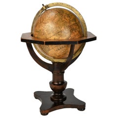
German Globe by C. Abel-Klinger, Nuremberg, circa 1860
Located in Milano, IT
Terrestrial globe
Artistic company C. Abel - Klinger
Nuremberg, circa 1860
H cm 31 x 22 cm (12.20 x 8.66 in); sphere 14 cm (5.51 in) in diameter
lb 2.30 (kg 1.04)
State of conservation: good. On the sphere there are slight visible signs of accidental bumping at the poles, as well as on New Guinea and England (vertical and more visible); some ink stains, especially at the South Pole and on the meridian that crosses North America.
The globe is composed of twelve whole gores of printed paper, juxtaposed and glued on a sphere made with a chalky base mixture.
The circle of the meridian, made of brass...
Category
1860s German Antique Other Maps
Materials
Wood, Paper
Original Antique Map of Ancient Greece- Boeotia, Thebes, 1787
Located in St Annes, Lancashire
Great map of Ancient Greece. Showing the region of Boeotia, including Thebes
Drawn by J.D. Barbie Du Bocage
Copper plate engraving by P.F T...
Category
1780s French Antique Other Maps
Materials
Paper
Original Antique Map of Spain and Portugal, circa 1790
Located in St Annes, Lancashire
Super map of Spain and Portugal
Copper plate engraving by A. Bell
Published, circa 1790.
Unframed.
Category
1790s English Antique Other Maps
Materials
Paper
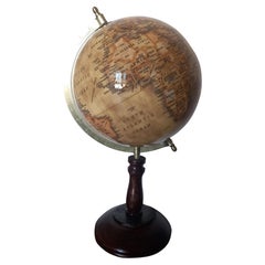
World Globe With Wooden Foot, and Brass 20th Century
Located in Mombuey, Zamora
Beautiful and elegant ball of the world to decorate any studio, living room or bedroom, it is small, with the base about 26 cm high and 10 wide.
Category
20th Century Italian Other Maps
Materials
Brass
$669 Sale Price
20% Off
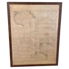
Large U.S. Coast and Geodetic Survey Chart A of the Atlantic Coast, 1877
Located in Nantucket, MA
Large U.S. Coast and Geodetic Survey Chart A of the Atlantic Coast, 1877, re-issued in February 1881, a printed paper laid down on linen navigational chart of the U.S. Atlantic coast...
Category
1880s American Antique Other Maps
Materials
Linen
Tony Sarg Map of Nantucket Town, 1937
By Tony Sarg
Located in Nantucket, MA
Tony Sarg Map of Residential Main Street, Nantucket, 1937, a black and white printed map of our historic downtown area, with images of each building, street names and whimsical figur...
Category
1930s American Vintage Other Maps
Materials
Paper
America "Amérique Septentrionale": A 19th Century French Map by Delamarche
By Maison Delamarche 1
Located in Alamo, CA
This framed mid 19th century map of North America entitled "Amérique Septentrionale" by Felix Delamarche was published in Paris in 1854 by Quay de l'Horloge du Palais, avec les Carte...
Category
Mid-19th Century American Antique Other Maps
Materials
Paper
Nantucket High-Ways, By-Ways and Not-Ways Decorative Map by Tony Sarg, ca 1930
By Tony Sarg
Located in Nantucket, MA
Vintage Nantucket High-Ways, By-Ways and Not-Ways Decorative Map by Tony Sarg, (Nantucket: 1880 - 1942) circa 1930, a decorative tourist map of Nantucket Island with details of roadw...
Category
1930s American Vintage Other Maps
Materials
Paper
20thC Leather Cased Collection Of Bartholomew Maps Of Great Britain c.1920
Located in Royal Tunbridge Wells, Kent
Antique 20th Century leather-cased collection of Bartholomew British road maps by Edward Stanford Ltd of London. One volume features a map of the entire British Isles, divided into n...
Category
20th Century British Other Maps
Materials
Leather, Paper
19th Century Chart of New England Coast, 1847
By U.S. Government
Located in Nantucket, MA
19th Century Chart of New England Coast: the U.S. Coast Survey Sketch A - Section 1, a triangulation chart showing the progress of the survey and details along the New England coas...
Category
1840s American Antique Other Maps
Materials
Paper
Utrecht city plan
Located in UTRECHT, UT
“Platte grond der Stad Utrecht vertonende alle Gragten, Straaten, Stegen, Gangen, Markten, en plaatsen der openbare Gebouwen”, engraving published by Johannes van Schoonhoven in Amst...
Category
1770s Dutch Antique Other Maps
Materials
Paper
$3,897
Curaçao map - C. van Baarsel en zoon
Located in UTRECHT, UT
“Kaart van het eiland Curaçao.”, “Algemeene kaart der Caraïbische eilanden”, “Plan van het fort Amsterdam op Curaçao” from the atlas “Atlas der overzeesche bezittingen van Zijne Maje...
Category
1810s Dutch Antique Other Maps
Materials
Paper
Original Antique English County Map, Huntingdonshire, J & C Walker, 1851
Located in St Annes, Lancashire
Great map of Huntingdonshire
Original colour
By J & C Walker
Published by Longman, Rees, Orme, Brown & Co. 1851
Unframed.
Category
1850s English Antique Other Maps
Materials
Paper
Antique County Map, Cambridgeshire, English, Framed Cartography, Robert Morden
Located in Hele, Devon, GB
This is an antique county map of Cambridgeshire. An English, framed atlas engraving of cartographic interest By Robert Morden, dating to the late 17th century and later.
Superb lit...
Category
Early 18th Century British Antique Other Maps
Materials
Glass, Wood, Paper
Original Antique English County Map, Warwickshire, J & C Walker, 1851
Located in St Annes, Lancashire
Great map of Warwickshire
Original colour
By J & C Walker
Published by Longman, Rees, Orme, Brown & Co. 1851
Unframed.
Category
1850s English Antique Other Maps
Materials
Paper
Large Antique Lithography Map, Northamptonshire, Framed Cartography, John Speed
Located in Hele, Devon, GB
This is a large antique lithography map of Northamptonshire. An English, framed atlas engraving of cartographic interest by John Speed, dating to the early 17th century and later.
Superb lithography reproduction of Northamtonshire - place names are written in 17th century English
Displays a desirable aged patina and in very good order
Fascinating Jacobean period cartography, set within a quality, later frame
Reproduced here from its appearance in the 'Theatre of Great Britain' of 1627 published by George Humble
Marked for John Speed as cartographer and George Humbell (sic) as seller
Exceptional detail, as expected from a John Speed map...
Category
Mid-17th Century British Antique Other Maps
Materials
Glass, Wood, Paper
Original Antique English County Map, Kent. J & C Walker, 1851
Located in St Annes, Lancashire
Great map of Kent
Original colour
By J & C Walker
Published by Longman, Rees, Orme, Brown & Co. 1851
Unframed.
Category
1850s English Antique Other Maps
Materials
Paper
Original Antique English County Map, Leicestershire, J & C Walker, 1851
Located in St Annes, Lancashire
Great map of Leicestershire
Original colour
By J & C Walker
Published by Longman, Rees, Orme, Brown & Co. 1851
Unframed.
Category
1850s English Antique Other Maps
Materials
Paper
Original Antique English County Map, Staffordshire, J & C Walker, 1851
Located in St Annes, Lancashire
Great map of Staffordshire
Original colour
By J & C Walker
Published by Longman, Rees, Orme, Brown & Co. 1851
Unframed.
Category
1850s English Antique Other Maps
Materials
Paper
Original Antique English County Map, Nottinghamshire, J & C Walker, 1851
Located in St Annes, Lancashire
Great map of Nottinghamshire
Original colour
By J & C Walker
Published by Longman, Rees, Orme, Brown & Co. 1851
Unframed.
Category
1850s English Antique Other Maps
Materials
Paper
Original Antique English County Map, Hertfordshire. J & C Walker, 1851
Located in St Annes, Lancashire
Great map of Hertfordshire
Original colour
By J & C Walker
Published by Longman, Rees, Orme, Brown & Co. 1851
Unframed.
Category
1850s English Antique Other Maps
Materials
Paper
Original Antique English County Map - Monmouthshire. J & C Walker. 1851
Located in St Annes, Lancashire
Great map of Monmouthshire
Original colour
By J & C Walker
Published by Longman, Rees, Orme, Brown & Co. 1851
Unframed.
Category
1850s English Antique Other Maps
Materials
Paper
Original Antique English County Map, Herefordshire, J & C Walker, 1851
Located in St Annes, Lancashire
Great map of Herefordshire
Original colour
By J & C Walker
Published by Longman, Rees, Orme, Brown & Co. 1851
Unframed.
Category
1850s English Antique Other Maps
Materials
Paper
Antique County Map, Hampshire, English, Framed Cartography, Robert Morden, 1700
Located in Hele, Devon, GB
This is an antique county map of Hampshire. An English, framed atlas engraving of cartographic interest By Robert Morden, dating to the late 17th century and later.
Superb lithogra...
Category
Late 17th Century British Antique Other Maps
Materials
Glass, Wood, Paper
Antique Coaching Road Map Cranborne to Dorchester, Framed Cartography, Victorian
Located in Hele, Devon, GB
This is an antique coaching road map of Cranborne to Dorchester. An English, framed lithograph engraving of regional interest with second map to reverse, dating to the mid 18th cent...
Category
Mid-18th Century British Antique Other Maps
Materials
Glass, Wood, Paper
Original Antique English County Map, Cambridgeshire, J & C Walker, 1851
Located in St Annes, Lancashire
Great map of Cambridgeshire
Original colour
By J & C Walker
Published by Longman, Rees, Orme, Brown & Co. 1851
Unframed.
Category
1850s English Antique Other Maps
Materials
Paper
Original Antique English County Map, Buckinghamshire, J & C Walker, 1851
Located in St Annes, Lancashire
Great map of Buckinghamshire
Original colour
By J & C Walker
Published by Longman, Rees, Orme, Brown & Co. 1851
Unframed.
Category
1850s English Antique Other Maps
Materials
Paper
Original Antique English County Map, Durham, J & C Walker, 1851
Located in St Annes, Lancashire
Great map of Durham
Original colour
By J & C Walker
Published by Longman, Rees, Orme, Brown & Co. 1851
Unframed.
Category
1850s English Antique Other Maps
Materials
Paper
Original Antique English County Map, Derbyshire, J & C Walker, 1851
Located in St Annes, Lancashire
Great map of Derbyshire
Original colour
By J & C Walker
Published by Longman, Rees, Orme, Brown & Co. 1851
Unframed.
Category
1850s English Antique Other Maps
Materials
Paper
Original Antique English County Map - Middlesex. J & C Walker. 1851
Located in St Annes, Lancashire
Great map of Middlesex
Original colour
By J & C Walker
Published by Longman, Rees, Orme, Brown & Co. 1851
Unframed.
Category
1850s English Antique Other Maps
Materials
Paper
Original Antique English County Map, Rutland, J & C Walker, 1851
Located in St Annes, Lancashire
Great map of Rutland
Original colour
By J & C Walker
Published by Longman, Rees, Orme, Brown & Co. 1851
Unframed.
Category
1850s English Antique Other Maps
Materials
Paper
Antique Map of Principality of Monaco
Located in Alessandria, Piemonte
ST/619 - "Old Geographical Atlas of Italy - Topographic map of ex-Principality of Monaco" -
ediz Vallardi - Milano -
A somewhat special edition ---
Category
Late 19th Century Italian Antique Other Maps
Materials
Paper
Old Horizontal Map of England
By Tasso
Located in Alessandria, Piemonte
ST/520 - Old rare Italian map of England, dated 1826-1827 - by Girolamo Tasso, editor in Venise, for the atlas of M.r Le-Sage.
Category
Early 19th Century Italian Antique Other Maps
Materials
Paper
Amsterdam city plan - Joost van Sassen
Located in UTRECHT, UT
“Afbeeldinge der Stad Amsterdam, gelyk deselve in den jaren 1536 door Cornelis Antonisz na ’t leven is geschildert, en Ao 1544 in druk uytgegeven.”, engraved by Joost van Sassen and ...
Category
1720s Dutch Antique Other Maps
Materials
Paper
Geographical Antique Map of Principality of Monaco
Located in Alessandria, Piemonte
ST/609 - Interesting antique color map of Monaco Principality in French language : "Carte qui contient le Principauté de Piémont, le Monferrat et la comté de...
Category
Late 18th Century Italian Antique Other Maps
Materials
Paper
Map "Estuary- Mouth of the Thames"
Located in Alessandria, Piemonte
ST/426 - Antique French Map of the estuary of the Thames, map dated 1769 -
"Mape of the entrance of the Thames. Designed by filing of Navy cards fo...
Category
Mid-18th Century French Antique Other Maps
Materials
Paper
Other maps for sale on 1stDibs.
Find a broad range of unique Other maps for sale on 1stDibs. Many of these items were first offered in the Mid-20th Century, but contemporary artisans have continued to produce works inspired by this style. If you’re looking to add vintage maps created in this style to your space, the works available on 1stDibs include more furniture and collectibles, wall decorations and other home furnishings, frequently crafted with paper, wood and other materials. If you’re shopping for used Other maps made in a specific country, there are Europe, United Kingdom, and England pieces for sale on 1stDibs. While there are many designers and brands associated with original maps, popular names associated with this style include Antonio Vallardi Editore, Bruno Santini, Gray and Co, and Maison Delamarche. It’s true that these talented designers have at times inspired knockoffs, but our experienced specialists have partnered with only top vetted sellers to offer authentic pieces that come with a buyer protection guarantee. Prices for maps differ depending upon multiple factors, including designer, materials, construction methods, condition and provenance. On 1stDibs, the price for these items starts at $30 and tops out at $3,814 while the average work can sell for $50.
Recently Viewed
View AllMore Ways To Browse
Bavarian Porcelain Vases
Beer Tankard
Bjorn L
Black Cabinet With Flowers And Birds
Black Tansu Chest
Blue Morpho
Blue Opaline Crystal Vases
Bow Front Buffet
Boy And Girl Statues
Brass Donkey
Brass Hound
Bread Oven
Bronze Atlas Sculpture
Bronze Door Stop
Bronze Shakespeare Sculpture
Buddha Bell
Bull Terrier
Butlers Chest


