Bruno Santini Maps
1
to
1
1
1
1
1
1
1
1
1
1
106
63
29
26
Creator: Bruno Santini
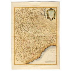
Geographical Antique Map of Principality of Monaco
By Bruno Santini
Located in Alessandria, Piemonte
ST/609 - Interesting antique color map of Monaco Principality in French language : "Carte qui contient le Principauté de Piémont, le Monferrat et la comté de...
Category
Late 18th Century Italian Other Antique Bruno Santini Maps
Materials
Paper
Related Items
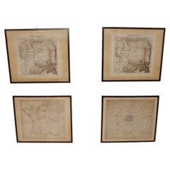
Set of 4 Antique Geographical Maps French-German War 1870-71
Located in Casale Monferrato, IT
Elegant late 19th century set of four antique geographical maps relating to the positioning of the armies in the Franco-German War 1870-71.
A...
Category
1890s Italian Antique Bruno Santini Maps
Materials
Paper
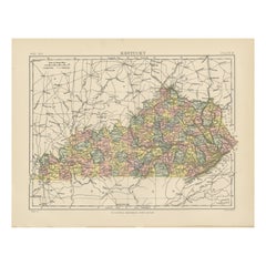
Antique Map of Kentucky
Located in Langweer, NL
Antique map titled 'Kentucky'. Original antique map of Kentucky, United States. This print originates from 'Encyclopaedia Britannica', Ninth E...
Category
Late 19th Century Antique Bruno Santini Maps
Materials
Paper
Antique Map of Oregon
Located in Langweer, NL
Antique map titled 'Oregon'. Original antique map of Oregon, United States. This print originates from 'Encyclopaedia Britannica', Ninth Edition. Publish...
Category
Late 19th Century Antique Bruno Santini Maps
Materials
Paper
Original Antique Map of Africa
Located in Langweer, NL
Antique map titled 'Afrika'. Original antique map of Africa, drawn by Van Beusekom. Published by 'Seyffardt's Boekhandel' in Amsterdam, circa 1870.
Category
Late 19th Century Antique Bruno Santini Maps
Materials
Paper
Antique Map of New Hampshire
Located in Langweer, NL
Antique map titled 'New Hampshire'. Original antique map of New Hampshire, United States. This print originates from 'Encyclopaedia Britan...
Category
Late 19th Century Antique Bruno Santini Maps
Materials
Paper
Original Antique Map of South America, circa 1830
Located in St Annes, Lancashire
Great map of South America
Copper plate engraving
Published by Butterworth, Livesey & Co., circa 1830
Unframed.
Category
Early 1800s English Other Antique Bruno Santini Maps
Materials
Paper
Antique Map of Arkansas
Located in Langweer, NL
Antique map titled 'Arkansas'. Original antique map of Arkansas, United States. This print originates from 'Encyclopaedia Britannica', Ninth Edition. P...
Category
Late 19th Century Antique Bruno Santini Maps
Materials
Paper
School Chart or Pull Down Map of Geography of the Netherlands, 1950s
Located in Hemiksem, VAN
A beautiful old school map of the Netherlands, painted on linen. The map shows the 3 different reliefs (low, middle, high) of the Netherlands. The beau...
Category
1950s Belgian Mid-Century Modern Vintage Bruno Santini Maps
Materials
Linen, Paint
Antique Map of Algeria, 1880
Located in Langweer, NL
Antique map titled 'Algérie. Old map of Algeria. This map originates from 'Géographie Universelle Atlas-Migeon' by J. Migeon.
Artists and Engravers: Published by J. Migeon. Review...
Category
19th Century Antique Bruno Santini Maps
Materials
Paper
Antique Map of Iowa
Located in Langweer, NL
Antique map titled 'Iowa'. Original antique map of Iowa, United States. This print originates from 'Encyclopaedia Britannica', Ninth Edition. Published 188...
Category
Late 19th Century Antique Bruno Santini Maps
Materials
Paper
1859 Vintage Maps of England and Wales: Blackie's Imperial Geographic Detail
Located in Langweer, NL
The "Antique Map of England & Wales" from 'The Imperial Atlas of Modern Geography', published by W. G. Blackie in 1859, is an original antique map that provides a detailed depiction ...
Category
Mid-19th Century Antique Bruno Santini Maps
Materials
Paper
H 14.57 in W 21.26 in D 0.02 in
Original 1859 Map of Asia from W.G. Blackie's Imperial Atlas of Modern Geography
Located in Langweer, NL
Antique map titled 'Asia'. Original antique map of Asia. This map originates from ‘The Imperial Atlas of Modern Geography’. Published by W. G. Blackie, 1859.
The "Classic Cartograph...
Category
Mid-19th Century Antique Bruno Santini Maps
Materials
Paper
H 14.57 in W 21.26 in D 0.02 in
Bruno Santini maps for sale on 1stDibs.
Bruno Santini maps are available for sale on 1stDibs. These distinctive items are frequently made of paper and are designed with extraordinary care. There are many options to choose from in our collection of Bruno Santini maps, although beige editions of this piece are particularly popular. Prices for Bruno Santini maps can differ depending upon size, time period and other attributes — on 1stDibs, these items begin at $975 and can go as high as $975, while a piece like these, on average, fetch $975.


