Victorian Maps
to
1
68
8
76
76
35
18
13
6
5
4
4
4
3
1
1
73
3
2
1
2
56
35
13
3
2
69
65
19
6
6
76
76
76
1
1
1
1
1
Style: Victorian
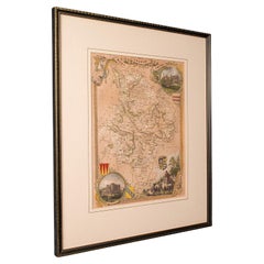
Antique Lithography Map, Huntingdonshire, English, Framed Cartography, Victorian
Located in Hele, Devon, GB
This is an antique lithography map of Huntingdonshire. An English, framed atlas engraving of cartographic interest, dating to the mid 19th century and later.
Superb lithography of ...
Category
Mid-19th Century British Antique Victorian Maps
Materials
Glass, Wood, Paper
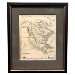
1846 "North America" Map, Engraved by I. Dower
Located in Colorado Springs, CO
Presented is an original 1846 map of “North America.” The map was drawn and engraved by I. Dower and published in London by Orr & Company. The map depicts North America, to include G...
Category
1840s English Antique Victorian Maps
Materials
Paper
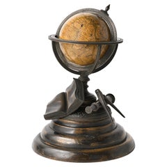
Miniature Terrestrial Globe Newton & Son London, Post 1833, Ante 1858
Located in Milano, IT
Miniature Terrestrial Globe
Newton & Son
London, post 1833, ante 1858
Paper, papier-mâché, bronze and wood
It measures: sphere diameter 2.95 in (7.6 cm); diameter of the wooden base 6.02 in (15.3 cm); height 8.36 in (21.24 cm).
Weight: 2,067 lb.
State of conservation: the globe still bears its original paint, but has various small gaps, abrasions and stains on the surface.
The globe is hinged with two pins at the meridian circle, which is in turn inserted perpendicular to the horizon circle; this is supported by four semi-arches connected at the bottom by a small goblet-shaped foot, resting on a wooden bell-shaped base.
Apart from the wooden base, the entire support structure is made of bronze; on the foot there are the scale reproductions of a compass, a telescope and an open book.
The sphere is made of papier-mâché and is covered with twelve printed paper gores.
In the North Pacific Ocean the globe bears a cartouche with the inscription (about 30% of the writing is illegible, but the missing parts can be easily integrated based on the rest):
NEWTON’S
New & Improved
TERRESTRIAL
Globe
Published by Newton & Son
66 Chancery Lane
LONDON
On the globe, much of central Africa is empty and the great lakes Tanganyika and Victoria are not marked (Europeans would begin to explore the area after 1858). Canada is called "British Territory" and Alaska "Russian Territory" (it would become part of the United States in 1867). Australia already bears its modern name (until 1829 it had been called New Holland) and its coasts are completely designed; Tasmania is listed as an island (Matthew Flinders circumnavigated it in 1798). The routes of Cook's various voyages are plotted; both the route followed by Biscoe in 1831 and the "Land of Enderby" which he discovered on the coast of Antarctica, south of Africa, are marked.
Bibliography
P. Van der Krogt, Old Globes...
Category
1840s English Antique Victorian Maps
Materials
Bronze
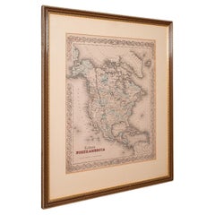
Antique North America Map, USA, Canada, Mexico, Cartography, Colton, Victorian
Located in Hele, Devon, GB
This is an antique North America map. A USA, framed lithography atlas engraving of the continent by JH Colton, dating to the Victorian period and later, circa 1860.
Fascinating, large framed map...
Category
Mid-19th Century American Antique Victorian Maps
Materials
Paper
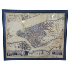
Vintage Oversized New York City Lower Manhattan 1840s Map Print
Located in Dayton, OH
Vintage late 20th century reproduction print of New York City featuring lower Manhattan in 1840.
Category
Late 20th Century Victorian Maps
Materials
Paper
$800 Sale Price
20% Off
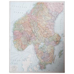
Large Original Vintage Map of Sweden and Norway circa 1920
Located in St Annes, Lancashire
Great map of Sweden and Norway
Original color. Good condition
Published by Alexander Gross
Unframed.
Category
1920s English Vintage Victorian Maps
Materials
Paper
Antique Lithography Map, Shropshire, English, Framed, Cartography, Victorian
Located in Hele, Devon, GB
This is an antique lithography map of Shropshire. An English, framed atlas engraving of cartographic interest, dating to the mid 19th century and later.
Superb lithography of Shrop...
Category
Mid-19th Century British Antique Victorian Maps
Materials
Wood
Antique Lithography Map, Western Russia, English, Framed, Cartography, Victorian
Located in Hele, Devon, GB
This is an antique lithography map of Western Russia. An English, framed atlas engraving of cartographic interest by John Rapkin, dating to the early Victorian period and later, circ...
Category
Mid-19th Century British Antique Victorian Maps
Materials
Wood
1868 "Lloyd's Topographical Railway Map of North America..." Hanging Wall Map
Located in Colorado Springs, CO
Presented is “Lloyd's Topographical Railway Map of North-America, or the United States Continent in 1900.” This map was published by J. T. Lloyd, in New York, in 1868. A large, hangi...
Category
1860s American Antique Victorian Maps
Materials
Linen, Paper
Fine French Antique 1856 Hand Watercolour Map of Dept Des Hautes Pyrenees
Located in West Sussex, Pulborough
We are delighted to offer for sale this stunning 1856 hand watercolour map of the Austrian Alps titled Dept Des Hautes Pyrenees taken from the Atlas Nat...
Category
1850s French Antique Victorian Maps
Materials
Paper
Pair of Miniature Globes Lane’s on Tripod Bases, London post 1833, ante 1858
By Lane's
Located in Milano, IT
Pair of miniature globes
Lane’s, London, post 1833, ante 1858
Papier-mâché, wood and paper
They measure:
Height 9.44 in (24 cm);
Sphere diameter 2.75 in (7 cm);
Diameter of t...
Category
1840s English Antique Victorian Maps
Materials
Paper, Wood
1866 Ensign & Bridgman's Rail Road Map of the United States
Located in Colorado Springs, CO
Presented is an 1866 issue of “Ensign & Bridgeman’s Rail Road Map of the United States, showing Depots & Stations.” First published in 1856, this is the third edition, following anot...
Category
1860s American Antique Victorian Maps
Materials
Paper
Early San Francisco View by Henry Firks Printed by W.H. Jones in 1849
Located in San Francisco, CA
A tinted lithographic view of San Francisco, made during the gold rush, showing a panoramic view of the bay's waterfront from the south along Montgomery Street to Telegraph Hill. The...
Category
Mid-19th Century American Antique Victorian Maps
Materials
Paper
Large Original Vintage Map of Iceland, circa 1920
Located in St Annes, Lancashire
Great map of Iceland
Original color. Good condition
Published by Alexander Gross
Unframed.
Category
1920s English Vintage Victorian Maps
Materials
Paper
Antique Lithography Map, Coastal England, Framed Cartography Interest, Victorian
Located in Hele, Devon, GB
This is an antique lithography map of Coastal England. A Scottish, framed town engraving of cartographic interest, dating to the early Victorian period and later.
Superb lithograph...
Category
Mid-19th Century British Antique Victorian Maps
Materials
Glass, Wood
Antique County Map, Sussex, English, Framed Lithography, Cartography, Victorian
Located in Hele, Devon, GB
This is an antique lithography map of Sussex. An English, framed atlas engraving of cartographic interest, dating to the mid 19th century and later.
Superb lithography of Sussex an...
Category
Mid-19th Century British Antique Victorian Maps
Materials
Paper
Large Original Antique Map of Italy. John Dower, 1861
Located in St Annes, Lancashire
Great map of Italy
Lithograph engraving by John Dower
Original colour
Published, 1861
Unframed
Good condition / repair to top right corner seen in last image
Category
1860s English Antique Victorian Maps
Materials
Paper
Large Original Antique City Plan of Lucknow, India. Edward Weller, 1861
Located in St Annes, Lancashire
Great city plan of Lucknow
Lithograph engraving by Edward Weller
Original colour
Published, 1861
Unframed
Good condition / slight corner loss bottom right shown in last image
...
Category
1860s English Antique Victorian Maps
Materials
Paper
Large Original Antique Map of Lombardy and Venice, Italy. John Dower, 1861
Located in St Annes, Lancashire
Great map of Lombardy and Venice
Lithograph engraving by John Dower
Original colour
Published, 1861
Unframed
Good condition / crease to bottom left corner
Free shipping
Category
1860s English Antique Victorian Maps
Materials
Paper
Large Original Antique Map of Morocco. Edward Weller, 1861
Located in St Annes, Lancashire
Great map of Morocco
Lithograph engraving by Edward Weller
Original colour
Published, 1861
Unframed
Good condition.
Category
1860s English Antique Victorian Maps
Materials
Paper
Antique Lithography Map, South America, English, Framed, Cartography, Victorian
Located in Hele, Devon, GB
This is an antique lithography map of South America. An English, framed atlas engraving of cartographic interest by John Rapkin , dating to the early Victorian period and later, circ...
Category
Mid-19th Century British Antique Victorian Maps
Materials
Wood
Antique County Map, Surrey, English, Framed Lithograph, Cartography, Victorian
Located in Hele, Devon, GB
This is an antique lithography map of Surrey. An English, framed atlas engraving of cartographic interest, dating to the mid 19th century and later.
Superb lithography of Surrey an...
Category
Mid-19th Century British Antique Victorian Maps
Materials
Paper
Original Antique Map of the American State of Washington, 1889
Located in St Annes, Lancashire
Great map of Washington
Drawn and Engraved by W. & A.K. Johnston
Published By A & C Black, Edinburgh.
Original colour
Unframed.
Category
1880s Scottish Antique Victorian Maps
Materials
Paper
Large Original Antique Map of The South of Italy. John Dower, 1861
Located in St Annes, Lancashire
Great map of the South of Italy
Lithograph engraving by John Dower
Original colour
Published, 1861
Unframed
Good condition
Free shipping
Category
1860s English Antique Victorian Maps
Materials
Paper
Antique County Map, Dorset, English, Framed Engraving, Cartography, Lithography
Located in Hele, Devon, GB
This is an antique lithography map of Dorset. An English, framed atlas engraving of cartographic interest, dating to the mid 19th century and later.
Superb lithography of Dorsetshi...
Category
Mid-19th Century British Antique Victorian Maps
Materials
Glass, Wood, Paper
Antique West Yorkshire Map, English, Framed Lithography, Cartography, Victorian
Located in Hele, Devon, GB
This is an antique lithography map of West Yorkshire. An English, framed atlas engraving of cartographic interest, dating to the mid 19th century and later.
Superb lithography of t...
Category
Mid-19th Century British Antique Victorian Maps
Materials
Paper
Original Antique Map of the American State of Pennsylvania, 1889
Located in St Annes, Lancashire
Great map of Pennsylvania
Drawn and Engraved by W. & A.K. Johnston
Published By A & C Black, Edinburgh.
Original colour
Unframed.
Repair to a minor tear on bottom edge.
Category
1880s Scottish Antique Victorian Maps
Materials
Paper
Antique Environs of Bath & Bristol Map, English, Framed Cartography, Victorian
Located in Hele, Devon, GB
This is an antique region map of Bath and Bristol. An English, framed atlas engraving of cartographic interest, dating to the mid 19th century and later.
Superb lithography of Bath...
Category
Mid-19th Century British Antique Victorian Maps
Materials
Glass, Wood, Paper
Antique East Yorkshire Map, English, Framed Lithograph, Cartography, Victorian
Located in Hele, Devon, GB
This is an antique lithography map of East Yorkshire. An English, framed atlas engraving of cartographic interest, dating to the mid 19th century and later.
Superb lithography of t...
Category
Mid-19th Century British Antique Victorian Maps
Materials
Paper
Original Antique Map of New Brunswick and Nova Scotia, 1889
Located in St Annes, Lancashire
Great map of New Brunswick and Nova Scotia
Drawn and Engraved by W. & A.K. Johnston
Published By A & C Black, Edinburgh.
Original colour
Unfr...
Category
1880s Scottish Antique Victorian Maps
Materials
Paper
Original Antique Map of the American State of Oregon, 1889
Located in St Annes, Lancashire
Great map of Oregon
Drawn and Engraved by W. & A.K. Johnston
Published By A & C Black, Edinburgh.
Original colour
Unframed.
Category
1880s Scottish Antique Victorian Maps
Materials
Paper
Small Antique County Map, Northamptonshire, English, Framed, Cartography, C.1850
Located in Hele, Devon, GB
This is a small antique county map of Northamptonshire. An English, framed atlas engraving of cartographic interest, dating to the mid 19th century and later.
Superb lithography of...
Category
Mid-19th Century British Antique Victorian Maps
Materials
Paper
Antique Nottinghamshire Map, English, Framed, Cartographic Interest, Victorian
Located in Hele, Devon, GB
This is an antique lithography map of Nottinghamshire. An English, framed atlas engraving of cartographic interest, dating to the mid 19th century and later.
Superb lithography of ...
Category
Mid-19th Century British Antique Victorian Maps
Materials
Wood
Original Antique Map of the American State of Nevada, 1889
Located in St Annes, Lancashire
Great map of Nevada
Drawn and Engraved by W. & A.K. Johnston
Published By A & C Black, Edinburgh.
Original colour
Unframed.
Category
1880s Scottish Antique Victorian Maps
Materials
Paper
Antique County Map, Hertfordshire, English, Framed Engraving, Cartography, Litho
Located in Hele, Devon, GB
This is an antique county map of Hertfordshire. An English, framed atlas engraving of cartographic interest, dating to the mid 19th century and later.
Superb lithography of Hertfor...
Category
Mid-19th Century British Antique Victorian Maps
Materials
Glass, Wood, Paper
Antique Lithography Map, Gloucestershire, English, Framed Engraving, Cartography
Located in Hele, Devon, GB
This is an antique lithography map of Gloucestershire. An English, framed atlas engraving of cartographic interest, dating to the mid 19th century ...
Category
Mid-19th Century British Antique Victorian Maps
Materials
Wood
Antique County Map, Kent, English, Framed, Lithography, Cartography, Victorian
Located in Hele, Devon, GB
This is an antique lithography map of Kent. An English, framed atlas engraving of cartographic interest, dating to the mid 19th century and later.
Superb lithography of Kent and it...
Category
Mid-19th Century British Antique Victorian Maps
Materials
Paper
Antique Lithography Map, West Africa, English, Framed, Cartography, Victorian
Located in Hele, Devon, GB
This is an antique lithography map of Western Africa. An English, framed atlas engraving of cartographic interest by John Rapkin, dating to the early Victorian period and later, circ...
Category
Mid-19th Century British Antique Victorian Maps
Materials
Wood
Antique Lithography Map, Northumberland, English, Framed, Engraving, Cartography
Located in Hele, Devon, GB
This is an antique lithography map of Northumberland. An English, framed atlas engraving of cartographic interest, dating to the mid 19th century a...
Category
Mid-19th Century British Antique Victorian Maps
Materials
Wood
Antique Lithography Map, Monmouthshire, Framed, Welsh Cartography, Victorian
Located in Hele, Devon, GB
This is an antique lithography map of Monmouthshire. An English, framed atlas engraving of cartographic interest, dating to the mid 19th century and later.
Superb lithography of Mo...
Category
Mid-19th Century British Antique Victorian Maps
Materials
Glass, Wood, Paper
Antique County Map, Essex, English, Framed, Cartographic Interest, Victorian
Located in Hele, Devon, GB
This is an antique lithography map of Essex. An English, framed atlas engraving of cartographic interest, dating to the mid 19th century and later.
Superb lithography of Essex and ...
Category
Mid-19th Century British Antique Victorian Maps
Materials
Wood
Original Large Antique Map of Paris, France by John Dower, 1861
Located in St Annes, Lancashire
Fabulous monochrome map of Paris.
Vignettes of St Germain En Laye, Saint Cloud, Versailles and Fontainbleau.
Unframed.
Drawn by J.Dower.
Lithography by Weller. 4 sheets joined to...
Category
1860s English Antique Victorian Maps
Materials
Paper
Antique Lithography Map, Cambridgeshire, English, Framed Cartography, Victorian
Located in Hele, Devon, GB
This is an antique lithography map of Cambridgeshire. An English, framed atlas engraving of cartographic interest, dating to the mid 19th century and later.
Superb lithography of C...
Category
Mid-19th Century British Antique Victorian Maps
Materials
Glass, Wood, Paper
Floor Model Terrestrial Globe Made in Germany by Dietrich Reimer Kiepert as is
By Dietrich Reimers 1, Heinrich Kiepert
Located in New York, NY
Impressive floor model globe Made in Germany Heinrich Kiepert, Dietrich Reimer c late 19th C / Early 20 C. The large ( 22" Dia. ) globe fits into the reeded oak column base, on a s...
Category
Late 19th Century German Antique Victorian Maps
Materials
Metal
Antique North Yorkshire Map, English, Framed Lithography, Cartography, Victorian
Located in Hele, Devon, GB
This is an antique lithography map of North Yorkshire. An English, framed atlas engraving of cartographic interest, dating to the mid 19th century and later.
Superb lithography of ...
Category
Mid-19th Century British Antique Victorian Maps
Materials
Paper
Antique Lithography Map, Derbyshire, English, Framed Cartography, Victorian
Located in Hele, Devon, GB
This is an antique lithography map of Derbyshire. An English, framed atlas engraving of cartographic interest, dating to the mid 19th century and later.
Superb lithography of Derby...
Category
Mid-19th Century British Antique Victorian Maps
Materials
Glass, Wood, Paper
Antique Berkshire Map, English County, Framed Engraving, Cartography, Lithograph
Located in Hele, Devon, GB
This is an antique county map of Berkshire. An English, framed atlas engraving of cartographic interest, dating to the mid 19th century and later.
Superb lithography of Berkshire a...
Category
Mid-19th Century British Antique Victorian Maps
Materials
Glass, Wood, Paper
Antique Lithography Map, Warwickshire, English, Framed, Cartography, Victorian
Located in Hele, Devon, GB
This is an antique lithography map of Warwickshire. An English, framed atlas engraving of cartographic interest, dating to the mid 19th century and later.
Superb lithography of War...
Category
Mid-19th Century British Antique Victorian Maps
Materials
Glass, Wood, Paper
Antique County Map, Norfolk, English, Framed Lithography, Cartography, Victorian
Located in Hele, Devon, GB
This is an antique lithography map of Norfolk. An English, framed atlas engraving of cartographic interest, dating to the mid 19th century and later.
Superb lithography of Norfolk a...
Category
Mid-19th Century British Antique Victorian Maps
Materials
Glass, Wood
Antique Leicestershire Map, English, Framed Cartographic Interest, Victorian
Located in Hele, Devon, GB
This is an antique lithography map of Leicestershire. An English, framed atlas engraving of cartographic interest, dating to the mid 19th century and later.
Superb lithography of Le...
Category
Mid-19th Century British Antique Victorian Maps
Materials
Wood
Antique Lithography Map, Cumberland, English, Framed, Cartography, Victorian
Located in Hele, Devon, GB
This is an antique lithography map of Cumberland. An English, framed atlas engraving of cartographic interest, dating to the mid 19th century and la...
Category
Mid-19th Century British Antique Victorian Maps
Materials
Wood
Antique Lithography Map, Westmoreland, English, Framed, Cartography, Victorian
Located in Hele, Devon, GB
This is an antique lithography map of Westmoreland. An English, framed atlas engraving of cartographic interest, dating to the mid 19th century and later.
Superb lithography of the ...
Category
Mid-19th Century British Antique Victorian Maps
Materials
Wood
Antique Lithography Map, Buckinghamshire, English, Framed Cartography, Victorian
Located in Hele, Devon, GB
This is an antique lithography map of Buckinghamshire. An English, framed atlas engraving of cartographic interest, dating to the mid 19th century and later.
Superb lithography of B...
Category
Mid-19th Century British Antique Victorian Maps
Materials
Wood, Paper
Antique County Map, Rutlandshire, English, Framed, Cartography, Victorian, 1860
Located in Hele, Devon, GB
This is an antique lithography map of Rutlandshire. An English, framed atlas engraving of cartographic interest, dating to the mid 19th century and later.
Superb lithography of Rutl...
Category
Mid-19th Century British Antique Victorian Maps
Materials
Wood
Antique Lithography Map, Environs of Southampton, English, Framed, Victorian
Located in Hele, Devon, GB
This is an antique lithography map 'The Environs of Southampton'. An English, framed town engraving of cartographic interest by John James Dower, dating to the Victorian period and ...
Category
Late 19th Century British Antique Victorian Maps
Materials
Wood
Antique Lithography Map, Bedfordshire, English, Framed Engraving, Cartography
Located in Hele, Devon, GB
This is an antique lithography map of Bedfordshire. An English, framed atlas engraving of cartographic interest, dating to the mid 19th century and...
Category
Mid-19th Century British Antique Victorian Maps
Materials
Wood
Antique Lithography Map, Hertfordshire, English, Framed Engraving, Cartography
Located in Hele, Devon, GB
This is an antique lithography map of Hertfordshire. An English, framed atlas engraving of cartographic interest, dating to the mid 19th century an...
Category
Mid-19th Century British Antique Victorian Maps
Materials
Wood
Antique Lithography Map, Isle of Thanet, Kent, English, Cartography, Victorian
Located in Hele, Devon, GB
This is an antique lithography map of The Isle of Thanet in Kent. An English, framed atlas engraving of cartographic interest, dating to the mid 19th century and later.
Superb litho...
Category
Mid-19th Century British Antique Victorian Maps
Materials
Wood
Antique Lithography Map, Black Sea, English, Framed, Cartography, Victorian
Located in Hele, Devon, GB
This is an antique lithography map of the Black Sea region. An English, framed atlas engraving of cartographic interest by John Rapkin, dating to the early Victorian period and later...
Category
Mid-19th Century British Antique Victorian Maps
Materials
Wood
Large Original Antique Map of Afghanistan. Edward Weller, 1861
Located in St Annes, Lancashire
Great map of Afghanistan
Lithograph engraving by Edward Weller
Original colour
Published, 1861
Unframed
Good condition
Category
1860s English Antique Victorian Maps
Materials
Paper
Victorian maps for sale on 1stDibs.
Find a broad range of unique Victorian maps for sale on 1stDibs. Many of these items were first offered in the Late 20th Century, but contemporary artisans have continued to produce works inspired by this style. If you’re looking to add vintage maps created in this style to your space, the works available on 1stDibs include more furniture and collectibles, wall decorations and other home furnishings, frequently crafted with paper, wood and other materials. If you’re shopping for used Victorian maps made in a specific country, there are Europe, United Kingdom, and England pieces for sale on 1stDibs. While there are many designers and brands associated with original maps, popular names associated with this style include John Cary, Lane's, Newton and Son, and Restoration Hardware. It’s true that these talented designers have at times inspired knockoffs, but our experienced specialists have partnered with only top vetted sellers to offer authentic pieces that come with a buyer protection guarantee. Prices for maps differ depending upon multiple factors, including designer, materials, construction methods, condition and provenance. On 1stDibs, the price for these items starts at $30 and tops out at $12,842 while the average work can sell for $771.
Recently Viewed
View AllMore Ways To Browse
Bavarian Porcelain Vases
Beer Tankard
Bjorn L
Black Cabinet With Flowers And Birds
Black Tansu Chest
Blue Morpho
Blue Opaline Crystal Vases
Bow Front Buffet
Boy And Girl Statues
Brass Donkey
Brass Hound
Bread Oven
Bronze Atlas Sculpture
Bronze Door Stop
Bronze Shakespeare Sculpture
Buddha Bell
Bull Terrier
Butlers Chest
