Victorian Maps
to
1
68
8
76
76
35
18
13
6
5
4
4
4
3
1
1
73
3
2
1
2
56
35
13
3
2
69
65
19
6
6
76
76
76
1
1
1
1
1
Style: Victorian
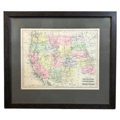
1890 "Map of Oregon, Kansas, California, and the Territories" by S. A. Mitchell
Located in Colorado Springs, CO
Presented is an 1890 map "Map of Oregon, Kansas, California, and the Territories" by S. A. Mitchell Jr. The map was issued in the atlas “Mitchell's New Intermediate Geography” publis...
Category
1890s American Antique Victorian Maps
Materials
Paper
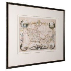
Antique County Map, Berkshire, English Framed Lithograph, Cartography, Victorian
Located in Hele, Devon, GB
This is an antique lithography map of Berkshire. An English, framed atlas engraving of cartographic interest, dating to the mid 19th century and later.
Superb lithography of Berksh...
Category
Mid-19th Century British Antique Victorian Maps
Materials
Paper
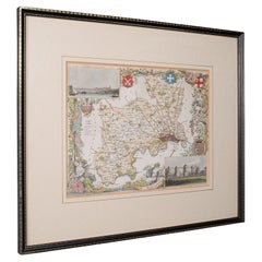
Antique County Map, Middlesex, English, Framed, Litho, Cartography, Victorian
Located in Hele, Devon, GB
This is an antique lithography map of Middlesex. An English, framed atlas engraving of cartographic interest, dating to the mid 19th century and later.
Superb lithography of Middle...
Category
Mid-19th Century British Antique Victorian Maps
Materials
Paper
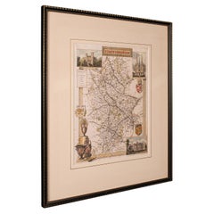
Antique County Map, Staffordshire, English, Framed Litho, Cartography, Victorian
Located in Hele, Devon, GB
This is an antique lithography map of Staffordshire. An English, framed atlas engraving of cartographic interest, dating to the mid 19th century and later.
Superb lithography of St...
Category
Mid-19th Century British Antique Victorian Maps
Materials
Glass, Wood, Paper
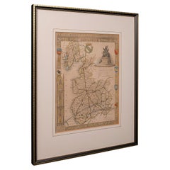
Antique County Map, Lancashire, English, Framed Lithography, Cartography, C.1860
Located in Hele, Devon, GB
This is an antique lithography map of Lancashire. An English, framed atlas engraving of cartographic interest, dating to the mid 19th century and later.
Superb lithography of Lanca...
Category
Mid-19th Century British Antique Victorian Maps
Materials
Glass, Wood, Paper
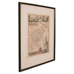
Antique Lithography Map, Northamptonshire, English, Framed Cartography, C.1860
Located in Hele, Devon, GB
This is an antique lithography map of Northamptonshire. An English, framed atlas engraving of cartographic interest, dating to the mid 19th century...
Category
Mid-19th Century British Antique Victorian Maps
Materials
Wood
Map Devonshire Richard Creighton J&C Walker Sculp Samuel Lewis
Located in BUNGAY, SUFFOLK
Devonshire drawn by Richard Creighton with reference to the Unions
Artist Richard Creighton
Engraved by J&C Walker Sculp
Published in Samuel Lewis Topographical Dictionary 1831, a...
Category
19th Century English Antique Victorian Maps
Materials
Paper
19th C. Terrestrial Globe on Stand for H.B. Nims After Copley
Located in Bridgeport, CT
Manufactured for H.B. Nims & Co., Troy New York, last quarter 19th c. After the original engravings by Charles Copley done in 1852.
Printed paper on wood with brass/ bronze meridian ring and a flat circular printed center horizon ring on wood labeled with the months of the year with notes. Mounted on a fine leafy iron baluster...
Category
Late 19th Century American Antique Victorian Maps
Materials
Bronze, Iron
Map Bedfordshire WilliamSchmollinger Dunstable Priory Woburn Abbey Moules Gothic
Located in BUNGAY, SUFFOLK
ARTIST William Schmollinger (1811-1869)
London : George Virtue, 1832. A highly attractive map in gothick style, with an ornamental architectural border, inset views of Dunstable Priory and Woburn Abbey...
Category
19th Century English Antique Victorian Maps
Materials
Paper
Map Hanging Wall County of Devon C&J Greenwood 1827 Exeter Cathedral Lundy Isle
Located in BUNGAY, SUFFOLK
C & J GREENWOOD MAP OF THE COUNTY OF DEVON, FROM AN ORIGINAL SURVEY, PUBLISHED 1827, WITH ENGRAVING OF EXETER CATHEDRAL AND MAP OF LUNDY INSET, 6ft 2 ...
Category
1820s English Antique Victorian Maps
Materials
Paper
Map Sussex
Located in BUNGAY, SUFFOLK
Map of Sussex with explanation
Maker unknown.
Category
19th Century English Antique Victorian Maps
Materials
Paper
$816
Map Bedfordshire WilliamSchmollinger Dunstable Priory Woburn Abbey Moules Gothic
Located in BUNGAY, SUFFOLK
Artist William Schmollinger (1811-1869)
London : George Virtue, 1832. A highly attractive map in gothick style, with an ornamental architectural border, inset views of Dunstable Priory and Woburn Abbey...
Category
19th Century English Antique Victorian Maps
Materials
Paper
Map Nottinghamshire Worksop Manor Newstead Abbey Nottingham Castle Shields H37cm
Located in BUNGAY, SUFFOLK
Map of Nottinghamshire with engravings of Worksop Manor Nottingham Castle Newstead Abbey
BIBLIOGRAPHY published in Barclay's Universal English Dicti...
Category
19th Century English Antique Victorian Maps
Materials
Paper
Fine Antique 1856 Hand Watercolour Map of Dept Des Hautes Alpes by Levasseur's
Located in West Sussex, Pulborough
We are delighted to offer for sale this stunning 1856 hand watercolour map of the Austrian Alps titled Dept Des Hautes Alpes taken from the Atlas National...
Category
1850s French Antique Victorian Maps
Materials
Paper
Beautiful Colour French Antique 1856 Hand Watercolour Map of Dept Des La Corse
Located in West Sussex, Pulborough
We are delighted to offer for sale this stunning 1856 hand watercolour map of the Austrian Alps titled Dept Des La Course taken from the Atlas National ...
Category
1850s French Antique Victorian Maps
Materials
Paper
Map Huntingdonshire R Scott Archibald Fullarton & Co Glasgow
Located in BUNGAY, SUFFOLK
Folding Map of Huntingdonshire by R Scott with distances from London and reference to the hundreds.
Published by Archibald Fullarton & Co Glasgow. Measure: 40...
Category
19th Century English Antique Victorian Maps
Materials
Paper
Victorian maps for sale on 1stDibs.
Find a broad range of unique Victorian maps for sale on 1stDibs. Many of these items were first offered in the Late 20th Century, but contemporary artisans have continued to produce works inspired by this style. If you’re looking to add vintage maps created in this style to your space, the works available on 1stDibs include more furniture and collectibles, wall decorations and other home furnishings, frequently crafted with paper, wood and other materials. If you’re shopping for used Victorian maps made in a specific country, there are Europe, United Kingdom, and England pieces for sale on 1stDibs. While there are many designers and brands associated with original maps, popular names associated with this style include John Cary, Lane's, Newton and Son, and Restoration Hardware. It’s true that these talented designers have at times inspired knockoffs, but our experienced specialists have partnered with only top vetted sellers to offer authentic pieces that come with a buyer protection guarantee. Prices for maps differ depending upon multiple factors, including designer, materials, construction methods, condition and provenance. On 1stDibs, the price for these items starts at $30 and tops out at $12,842 while the average work can sell for $771.
Recently Viewed
View AllMore Ways To Browse
Bavarian Porcelain Vases
Beer Tankard
Bjorn L
Black Cabinet With Flowers And Birds
Black Tansu Chest
Blue Morpho
Blue Opaline Crystal Vases
Bow Front Buffet
Boy And Girl Statues
Brass Donkey
Brass Hound
Bread Oven
Bronze Atlas Sculpture
Bronze Door Stop
Bronze Shakespeare Sculpture
Buddha Bell
Bull Terrier
Butlers Chest
