Benelux Maps
to
4,202
5,080
5,466
195
5,079
1
1
2,799
1,969
311
1
179
8
68
3
3
3
1
2
5,070
9
7
2
2
345
114
80
74
37
5,080
5,080
5,080
104
59
20
14
13
Item Ships From: Benelux
Large Antique County Map of Leicestershire, England, 1805
Located in Langweer, NL
Explore Leicestershire's Past: Antique Map by John Cary
Step into the history of Leicestershire, England, with this original old county map engraved by the renowned cartographer Joh...
Category
Early 19th Century Antique Benelux Maps
Materials
Paper
$218 Sale Price
20% Off
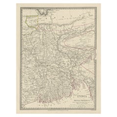
Steel Engraved Map of Part of the Bengal Presidency 'India & Bangladesh', 1831
Located in Langweer, NL
Antique map titled 'India Bengal Presidency'. Old steel engraved map of part of the Bengal Presidency. The Bengal Presidency (1757–1912), later reorganized as the Bengal Province (19...
Category
1830s Antique Benelux Maps
Materials
Paper
$352 Sale Price
20% Off
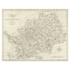
Large Antique County Map of Hertfordshire, England
Located in Langweer, NL
Antique map titled 'A Map of Hartfordshire from the best Authorities'. Original old county map of Hertfordshire, England. Engraved by John Cary. Originates from 'New British Atlas' b...
Category
Early 19th Century Antique Benelux Maps
Materials
Paper
$266 Sale Price
20% Off
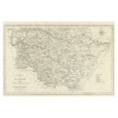
Large Antique County Map of the West Riding of Yorkshire 'South Part', England
Located in Langweer, NL
Antique map titled 'A Map of the South Part of the West Riding of Yorkshire from the best Authorities'. Original old county map of the south part of the West Riding of Yorkshire, Eng...
Category
Early 19th Century Antique Benelux Maps
Materials
Paper
$266 Sale Price
20% Off
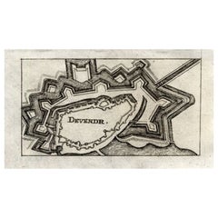
Antique Map of Deventer in the Netherlands, 1691
Located in Langweer, NL
Plate 'Devendr.' (Plan of the fortified city of Deventer, The Netherlands.) This attractive original old antique print / plate originates from: 'Aus...
Category
17th Century Antique Benelux Maps
Materials
Paper
$123 Sale Price
20% Off
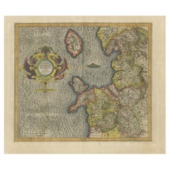
Antique Map of England by Mercator/Hondius, circa 1600
Located in Langweer, NL
Antique map titled 'Westmorlandia, Lancastria, Caernvan, Denbigh, Flint, Merionidh, Dalopia cum issulis Mania et Anglesey'. Original antique map of England...
Category
16th Century Antique Benelux Maps
Materials
Paper
$904 Sale Price
20% Off
Antique Map of the City of Jerusalem by N. Visscher, 1702
Located in Langweer, NL
Antique map titled 'Die Heylige en Wytvermaerde stadt Jerusalem Eerst Genaemt Salem, Genesis 14 vers 18'. This map originates from 'Biblia. Ouden ende Nieuwen Testaments (..)'. Publi...
Category
Early 18th Century Antique Benelux Maps
Materials
Paper
$3,283 Sale Price
20% Off
Antique Map of the City of London by Balbi '1847'
Located in Langweer, NL
Antique map titled 'London'. Original antique map of the city of London. This map originates from 'Abrégé de Géographie (..)' by Adrien Balbi. Published 1847.
Category
Mid-19th Century Antique Benelux Maps
Materials
Paper
$190 Sale Price
20% Off
Antique Map of Africa by Claude Buy de Mornas '1761'
Located in Langweer, NL
Antique map titled 'Afrique'. Original antique map of Africa flanked with descriptions containing geographical information about the area. This map originates from 'Atlas Methodique ...
Category
Mid-18th Century Antique Benelux Maps
Materials
Paper
$475 Sale Price
20% Off
Antique Map of Southern Sweden by Covens & Mortier, 'circa 1720'
Located in Langweer, NL
Antique map titled 'Regni Gothiae (..)'. Detailed map of South Sweden. Embellished with beautiful title cartouche with scale and coats of arms. Published in Amsterdam by Covens & Mor...
Category
Early 18th Century Antique Benelux Maps
Materials
Paper
$904 Sale Price
20% Off
Antique Map of the City of Dordrecht by Braun & Hogenberg, c.1581
Located in Langweer, NL
Antique map titled 'Dordrecht'. Map of the city of Dordrecht, the Netherlands. Bird's-eye plan view of the city, with many ships and two coats of arms in upper corners. This map orig...
Category
16th Century Antique Benelux Maps
Materials
Paper
$399 Sale Price
20% Off
Antique Print of Büdingenin Germany by Braun & Hogenberg, 1617
Located in Langweer, NL
Antique map titled 'Bingen'. Bird's eye-view of Büdingen, Germany. The view shows a city surrounded by vineyards and well fortified with walls and moats. On the right is the castle w...
Category
17th Century Antique Benelux Maps
Materials
Paper
$276 Sale Price
20% Off
Antique Map of Eastern Persia, 1852
Located in Langweer, NL
Antique map titled 'Eastern Persia'. Original map of Eastern Persia. This map originates from 'Lowry's Table Atlas constructed and engraved from the most recent Authorities' by J.W. ...
Category
Mid-19th Century Antique Benelux Maps
Materials
Paper
$95 Sale Price
20% Off
Large Antique County Map of Northumberland, England
Located in Langweer, NL
Antique map titled 'A Map of Northumberland from the best Authorities'. Original old county map of Northumberland, England. Engraved by John Cary. Originates from 'New British Atlas'...
Category
Early 19th Century Antique Benelux Maps
Materials
Paper
$228 Sale Price
20% Off
Set of 2 Antique Maps of the United States by W. G. Blackie, 1859
Located in Langweer, NL
Antique map titled 'The United States of North America, Atlantic States and Valley of the Mississippi'. Original antique map of the United States of North America, Atlantic States an...
Category
Mid-19th Century Antique Benelux Maps
Materials
Paper
$380 Sale Price / set
20% Off
Antique Map of Flanders 'Belgium' by F. de Wit, circa 1680
Located in Langweer, NL
Antique map titled 'Comitatus Flandriae Tabula, in Lucem Edita'. Large map of Flanders, Belgium. Published by F. de Wit, circa 1680.
Category
Late 17th Century Antique Benelux Maps
Materials
Paper
$571 Sale Price
20% Off
Antique Map of Western States, Michigan, Wisconsin, Iowa by A & C. Black, 1870
Located in Langweer, NL
Antique map titled 'Western States, Michigan, Wisconsin, Minnesota, Iowa with portions of Illinois & Indiana'. Original antique map of Western States, Michigan, Wisconsin, Minnesota,...
Category
Late 19th Century Antique Benelux Maps
Materials
Paper
$166 Sale Price
20% Off
Large Antique County Map of Huntingdonshire, England
Located in Langweer, NL
Antique map titled 'A Map of Huntingdonshire from the best Authorities'. Original old county map of Huntingdonshire, England. Engraved by John Cary. Originates from 'New British Atla...
Category
Early 19th Century Antique Benelux Maps
Materials
Paper
$218 Sale Price
20% Off
Antique Print of Moscow During the Fire of Moscow in Napoleon Wars, Russia, 1845
Located in Langweer, NL
Antique print titled 'Moscau am 20 September'. Original antique print of Moscow, during the Fire of Moscow, 1812. This print originates from 'Der Feldzug von 1812' by Friedrich Stege...
Category
19th Century Antique Benelux Maps
Materials
Paper
$133 Sale Price
20% Off
Original Antique Ptolemaic Map of the Region of Thailand and Malaysia
Located in Langweer, NL
Antique map titled 'Tabula Asiae XI'. Based on the interpretations of Solinus and Munster, this Ptolemaic map covers the region roughly of Thailand and Malaysia. An oddly shaped (Mal...
Category
16th Century Antique Benelux Maps
Materials
Paper
$542 Sale Price
20% Off
Antique Print of a Ruin of the Kew Gardens in London, England, c.1785
Located in Langweer, NL
Antique print titled 'Ruin de Kew vuë par le Nord'.
Copper engraving of a ruin of the Kew gardens. This print originates from 'Jardins Anglo-Chinois à la Mode' by Georg Louis le Rouge. Artists and Engravers: The work of Le Rouge is considered the most important engraved work concerning the history of European gardens during the 18th century.
Kew Gardens is a botanic garden in southwest London that houses the "largest and most diverse botanical and mycological collections in the world". Founded in 1840, from the exotic garden at Kew Park, its living collections includes some of the 27,000 taxa curated by Royal Botanic Gardens, Kew, while the herbarium, one of the largest in the world, has over 8.5 million preserved plant...
Category
18th Century Antique Benelux Maps
Materials
Paper
$361 Sale Price
20% Off
Large Antique County Map of Durham, England
Located in Langweer, NL
Antique map titled 'A Map of Durham from the best Authorities'. Original old county map of Durham, England. Engraved by John Cary. Originates from 'New ...
Category
Early 19th Century Antique Benelux Maps
Materials
Paper
$247 Sale Price
20% Off
Antique Map of the French Colonies in Senegal and Madagascar by V. Levasseur
By Victor Levasseur
Located in Langweer, NL
The antique map titled 'Colonies Françaises (en Afrique)' presents a decorative depiction of the French colonies located in Senegal and Madagascar within Africa. Surrounding the map ...
Category
Mid-19th Century Antique Benelux Maps
Materials
Paper
$190 Sale Price
20% Off
Antique Print of Cairo and Joseph's Well in Egypt, 1698
Located in Langweer, NL
Untitled antique print with a view of the city of Cairo in Egypt and Joseph's Well in Cairo. This print originates from 'Reizen van Cornelis de Bruyn, door de vermaardste deelen van ...
Category
17th Century Antique Benelux Maps
Materials
Paper
$161 Sale Price
20% Off
Antique Print of the Porcelain Pagoda in Nanjing, China, 1736
Located in Langweer, NL
Antique print titled 'La Tour de Porcelaine, Arc de Triomphe'. Old print depicting the Porcelain Pagoda in the Chinese city of Nanjing. It no longer ...
Category
18th Century Antique Benelux Maps
Materials
Paper
Antique Print of Various Apples by Knoop, 1758
Located in Langweer, NL
Antique print depicting apple variaties including the Soete Erveling, Winter Striepeling, Blanke Pepping, Soete Son-Appel, Witte Soete Jopen, Princesse Noble, Soete Robbert, Grauwe R...
Category
18th Century Antique Benelux Maps
Materials
Paper
$285 Sale Price
25% Off
Antique Map of China and Korea incl Formosa and Hainan, by Janssonius, ca.1650
Located in Langweer, NL
Antique map titled 'Imperii Sinarum Nova Descriptio'. Beautiful map of China and Korea, much detail troughout the map. Including the Islands of Formosa (Taiwan) and Hainan. The Great...
Category
17th Century Antique Benelux Maps
Materials
Paper
$2,807 Sale Price
20% Off
Antique Map of the Holy Land by Keur, 1748
Located in Langweer, NL
Antique Map Holy Land titled 'De Gelegentheyd van t'Paradys ende t'Landt Canaan, Mitsgaders d'eerst bewoonde Landen der Patriarchen'. Includes five decorative vignettes, including No...
Category
18th Century Antique Benelux Maps
Materials
Paper
$331 Sale Price
20% Off
Antique Map of the Night Skies of the Northern and Southern Hemispheres, 1880
Located in Langweer, NL
Antique world map titled 'Planisphère en Céleste'.
This map depicts the night skies of both the northern and southern hemispheres. This map originates from 'Géographie Universell...
Category
1880s Antique Benelux Maps
Materials
Paper
$276 Sale Price
20% Off
Original Copper Engraving with View of the Palace and Chinese Emperor, ca.1700
Located in Langweer, NL
Title: "The Station used by the great Mandaryns Staetsie der groote Mandarijns / The Station used by the great Mandaryns Staetsie der groote Mandarijns. 1665.
The richly illustrat...
Category
Early 1700s Antique Benelux Maps
Materials
Paper
$228 Sale Price
20% Off
Detailed Map of New Zealand Showing the Route of Capt. Cook's First Voyage, 1803
Located in Langweer, NL
Antique map New Zealand titled 'De Rivier de Theems en Mercurius Baai in Nieuw Zeeland'. Detailed map of New Zealand showing the route of Capta...
Category
19th Century Antique Benelux Maps
Materials
Paper
$618 Sale Price
20% Off
Antique Map of St. Louis and Chicago
Located in Langweer, NL
Antique map titled 'The City of St. Louis Missouri - The City of Chicago Illinois'. Dual map on single page showing St. Louis and Chicago. Finely produ...
Category
Mid-19th Century Antique Benelux Maps
Materials
Paper
$142 Sale Price
20% Off
Antique Map of Northern Italy by F. de Wit, 1690
Located in Langweer, NL
A very decorative map centered on Genua, and including the towns of Milan, Torino, Parma, Cremona, etc. Decorative title cartouche upper right, five putti holding the arms of the reg...
Category
Late 17th Century Antique Benelux Maps
Materials
Paper
$523 Sale Price
20% Off
Antique Map of North and East Asia, 1751
Located in Langweer, NL
Map 2: 'Carte des parties nord et est de L'Asie'. (Map of the Northern parts and East Asia.) Five maps on one sheet, showing California, Alaska and Siberia, Korea and Japan. South to...
Category
18th Century Antique Benelux Maps
Materials
Paper
Antique Map of Groningen with Contemporary Hand Coloring
Located in Langweer, NL
Antique map titled 'Tabulae dominii Groeningae quae et complecititur maximam partem Dreniae Emendata a F. de Wit'. Original antique map of the province of Groningen, the Netherlands....
Category
Late 17th Century Antique Benelux Maps
Materials
Paper
$628 Sale Price
20% Off
Antique Map of England and Wales, with References to the Counties
Located in Langweer, NL
Antique map titled 'England and Wales'. Original antique map of England and Wales, with references to the counties. Source unknown, to be determined. Published circa 1820.
Category
Early 19th Century Antique Benelux Maps
Materials
Paper
$133 Sale Price
20% Off
Large Antique County Map of Lincolnshire, England
Located in Langweer, NL
Antique map titled 'A Map of Lincolnshire from the best Authorities'. Original old county map of Lincolnshire, England. Engraved by John Cary. Originates from 'New British Atlas' by ...
Category
Early 19th Century Antique Benelux Maps
Materials
Paper
$276 Sale Price
20% Off
Pl. 4 Antique Print of Various Elements of the Kew Gardens by Le Rouge, c.1785
Located in Langweer, NL
Antique print titled 'Vue du Lac, de l'Orangerie et du Temple d'Eole à Kew (..)'. Copper engraving showing the lake, orangery, temple and pagoda of the Kew gardens. This print origin...
Category
18th Century Antique Benelux Maps
Materials
Paper
$133 Sale Price
20% Off
Map of Australia, New Zealand, Part of China, Japan and Southeast Asia, 1857
Located in Langweer, NL
German Antique map titled 'Australien'. Map of Australia, New Zealand, part of China, Japan and Southeast Asia. In the upper right is a bit of the California coast by San Francisco. ...
Category
19th Century Antique Benelux Maps
Materials
Paper
$666 Sale Price
20% Off
Antique Map of Harlingen, Harbour City in the Netherlands, 1691
Located in Langweer, NL
Plate 'Harlingen.' (Plan of the city of Harlingen, The Netherlands.) This attractive original old antique print / plate originates from: 'Ausführliche und grundrichtige Beschreibung ...
Category
17th Century Antique Benelux Maps
Materials
Paper
$133 Sale Price
20% Off
Large Antique County Map of Cambridgeshire, England
Located in Langweer, NL
Antique map titled 'A Map of Cambridgeshire from the best Authorities'. Original old county map of Cambridgeshire, England. Engraved by John Cary. Originates from 'New British Atlas'...
Category
Early 19th Century Antique Benelux Maps
Materials
Paper
$218 Sale Price
20% Off
Large Antique Map of the British Isles, with inset of the Orkneys and Shetlands
Located in Langweer, NL
Antique map titled 'A Map of Great Britain and Ireland (..)'. Large antique map of the British Isles, with part of the French and Dutch coasts, and an inset of the Orkneys and Shetla...
Category
Late 18th Century Antique Benelux Maps
Materials
Paper
$609 Sale Price
20% Off
German Antique Map of Australia and New Zealand, 1857
Located in Langweer, NL
Antique map Australia titled 'Festland von Australien und benachbarte Inseln'. Detailed map of Australia and New Zealand, including excellent det...
Category
19th Century Antique Benelux Maps
Materials
Paper
$237 Sale Price
20% Off
Large Antique County Map of the West Riding of Yorkshire 'North Part', England
Located in Langweer, NL
Antique map titled 'A Map of the North Part of the West Riding of Yorkshire from the best Authorities'. Original old county map of the north part of the West Riding of Yorkshire, Eng...
Category
Early 19th Century Antique Benelux Maps
Materials
Paper
$266 Sale Price
20% Off
Large Antique County Map of Worcestershire, England
Located in Langweer, NL
Antique map titled 'A Map of Worcestershire from the best Authorities'. Original old county map of Worcestershire, England. Engraved by John Cary. Originates from 'New British Atlas'...
Category
Early 19th Century Antique Benelux Maps
Materials
Paper
$218 Sale Price
20% Off
Large Antique County Map of Westmorland, England
Located in Langweer, NL
Antique map titled 'A Map of Westmoreland from the best Authorities'. Original old county map of Westmorland, England. Engraved by John Cary. Originates from 'New British Atlas' by J...
Category
Early 19th Century Antique Benelux Maps
Materials
Paper
$266 Sale Price
20% Off
Original Antique Engraving of Otago by Cook, 1803
By James Cook
Located in Langweer, NL
Antique print titled 'Otago Bevelhebber van het Eiland Amsterdam'. Antique print depicting Otago, commander of the Island Amsterdam. Originates from 'Reizen Rondom de Waereld door James Cook...
Category
19th Century Antique Benelux Maps
Materials
Paper
$228 Sale Price
20% Off
Original Antique Hand-Colored Optica Print of the Hague, C.1760
Located in Langweer, NL
Antique print titled 'Vue de la Haye en Hollande - Prospect von Gravenhag in Holland'. Beautiful view of The Hague, the Netherlands. This is an optical print, also called 'vue optiqu...
Category
18th Century Antique Benelux Maps
Materials
Paper
$342 Sale Price
20% Off
Antique Print of Villefranche in the Nice and Savoy Region of France, c.1865
Located in Langweer, NL
Antique print titled 'Villefranche près de Nice'. Original antique print of Villefranche near Nice, France. This print originates from 'Nice Et Savoie, Sites Pittoreques, Monuments, ...
Category
19th Century Antique Benelux Maps
Materials
Paper
$437 Sale Price
20% Off
Rare Original Antique View in Old Colours of Villefranche in France, c.1860
Located in Langweer, NL
Antique print titled 'Villefranche'. View of Villefranche near Nice, France. Source unknown, to be determined.
Artists and Engravers: Published by Lemercier, Paris.
Condition: ...
Category
19th Century Antique Benelux Maps
Materials
Paper
$304 Sale Price
20% Off
Beautiful Antique Map of the French Coast, from St. Valeri to Dieppe, 1720
Located in Langweer, NL
Antique map France titled 'Les Embouchures de la Somme et de Bresle Riv. ou est St. Valeri, Eu et Dieppe'.
Beautiful map of the French coast, fr...
Category
1720s Antique Benelux Maps
Materials
Paper
$850 Sale Price
35% Off
Rare Map of South America of Chili, La Plata, Paraguay, Brazil, Peru, c.1775
Located in Langweer, NL
Antique map titled 'South America agreeable to the most approved maps and charts'.
Rare map of South America depicting Chili, La Plata, Paraguay, Brazil, ...
Category
1770s Antique Benelux Maps
Materials
Paper
$513 Sale Price
20% Off
Antique Map of The Harbour of Acapulco in Mexico, 1749
Located in Langweer, NL
Description: Antique map titled 'Plan van de Haven van Acapulco (..) - Plan du Port d'Acapulco (..)'. Original antique map of the Port of Acapulco on the coast of Mexico in the South...
Category
1740s Antique Benelux Maps
Materials
Paper
$342 Sale Price
20% Off
Antique Map of Australia, New Zealand and Oceania by F. von Stülpnagel, 1850
Located in Langweer, NL
Antique map titled 'Australien und Polynesien in Mercators Projection'. A map of Australia, New Zealand and Oceania. This includes Fiji, Tahiti and several other island groups in the...
Category
Mid-19th Century Antique Benelux Maps
Materials
Paper
$183 Sale Price
30% Off
Het Huis Rechteren, Christ, 1846
Located in Langweer, NL
Het huis Rechteren.' (Rechteren Castle.) This Castle is situated in the province of Overijssel in Dalfsen. The castle was built in the 14th century by Herman van Voorst. Other well k...
Category
19th Century Antique Benelux Maps
Materials
Paper
$74 Sale Price
20% Off
Antique Map of Independent Tartary by W. G. Blackie, 1859
Located in Langweer, NL
Antique map titled 'Turkestan or Independent Tartary'. Original antique map of Turkestan or Independent Tartary. This map originates from ‘The Imperial Atlas of Modern Geography’. Pu...
Category
Mid-19th Century Antique Benelux Maps
Materials
Paper
$237 Sale Price
20% Off
Antique French Map of Hungary with Decorative Title Cartouche, c.1730
Located in Langweer, NL
Antique map titled 'La Hongrie suivant les Nouvelles Observations (..)'. Antique map of Hungary with decorative title cartouche. Artists and Engravers: ...
Category
18th Century Antique Benelux Maps
Materials
Paper
$361 Sale Price
20% Off
Original Engraved Portrait of Louis II, King of Hungary, Croatia & Bohemia, 1615
Located in Langweer, NL
Antique portrait titled 'Lodovicus D.G. (..)'.
Portrait of Louis II, King of Hungary, Croatia and Bohemia. This print originates from 'Tooneel der keysere...
Category
1610s Antique Benelux Maps
Materials
Paper
$276 Sale Price
20% Off
Antique Map of the East Indies by Janssonius, c.1644
By Johannes Janssonius
Located in Langweer, NL
Antique map titled 'India quae Orientalis dicitur, et Insulae adiacentes'. Old map of the East Indies and Southeast Asia showing the area between India in the West and parts of Japan...
Category
17th Century Antique Benelux Maps
Materials
Paper
$2,522 Sale Price
20% Off
Original Antique Sea Chart of the Coastline from England to Gibraltar, ca.1700
Located in Langweer, NL
Antique map titled 'A Chart of the Sea-Coast from England to the Streights.'
Original antique map showing the European coastline from the South of England (and North of France) to ...
Category
Early 1700s Antique Benelux Maps
Materials
Paper
$904 Sale Price
20% Off
Recently Viewed
View AllMore Ways To Browse
Greek Key Dresser
Green Glass Bud Vase Vintage
Gucci Tray
Half Moon Shelves
Handblown Glass Decanter
Heart Shaped Glass Dish
Hepplewhite Drop Leaf Table
Herend Cup
Hermes Dish
Horse Head Barware
Horse Mantel Clock
Large Limoges Platter
Michelangelo David Statue
Michelin Guide
Persian Khatam
Royal Worcester Aesthetic
Russell Woodard Aluminum
Russian Silver Niello

