Benelux Maps
to
4,163
5,156
5,544
200
5,155
1
1
2,834
2,008
313
1
181
8
67
3
3
3
1
2
5,146
10
8
2
2
492
186
110
89
60
5,156
5,156
5,156
104
58
20
14
13
Item Ships From: Benelux
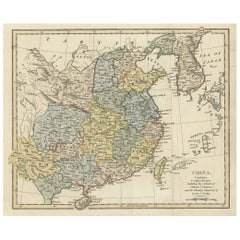
Original Old China Map, From Korea and the Sea of Japan to Teypin Island, 1803
Located in Langweer, NL
Antique map titled 'China, Contains 15 Subject Provinces Including the 2 Islands of Hainan, Formosa and the Tributary Kingdoms of Corea, Tonkin'.
Old map depicting China, extendi...
Category
Early 1800s Antique Benelux Maps
Materials
Paper
$526 Sale Price
20% Off
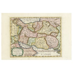
Map of the Persian Empire by Nicolas Sanson, Hand-colored, circa 1683
Located in Langweer, NL
Map of the Persian Empire by Nicolas Sanson, hand-colored, circa 1683
This finely detailed and delicately hand-colored map titled *L'Empire du Sophy des Perses* presents a late 17th...
Category
1680s Antique Benelux Maps
Materials
Paper
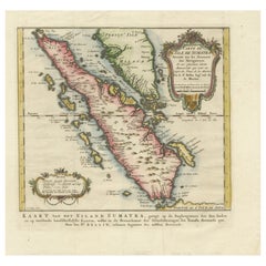
Rare 1770 Bellin Map of Sumatra with Stunning Decorative Cartouches
Located in Langweer, NL
Title: 1750 Bellin Map of Sumatra with Decorative Cartouches
This exquisite 18th-century map of Sumatra, drawn by Jacques-Nicolas Bellin around 1750, is a testament to the artistr...
Category
1770s Antique Benelux Maps
Materials
Paper
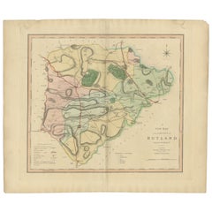
Antique Hand-Colored County Map of Rutland, England, 1804
Located in Langweer, NL
Antique county map of Rutland first published c.1800. Villages, towns, and cities illustrated include Oakham, Uppingham, and Normanton.
Charles ...
Category
Early 1800s Antique Benelux Maps
Materials
Paper
$310 Sale Price
20% Off
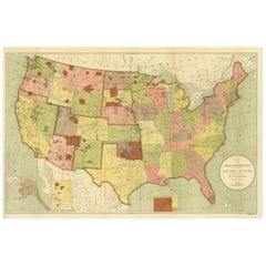
Antique Map Showing the Locations of Native American Tribes in 1899
Located in Langweer, NL
Antique map titled 'Map showing the Indian Reservations within the Limits of the United States'. Large folding map of the United States showing the Indian Reservations. The present m...
Category
Late 19th Century Antique Benelux Maps
Materials
Paper
$621 Sale Price
20% Off
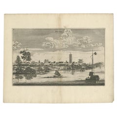
Antique Print of the City of Jiangxi, formerly romanized as Kiangsi, China, 1668
By Johannes Nieuhof
Located in Langweer, NL
Antique print China titled 'Kiangsi'. Old print depicting a view on the Chinese city of Kiangsi with its ramparts. Behind the city wall a pagoda can be seen. This print originates fr...
Category
17th Century Antique Benelux Maps
Materials
Paper
$382 Sale Price
20% Off
Antique Map of the of the Course of the Albis River 'or Elbe River'
By Johannes Janssonius
Located in Langweer, NL
Antique map titled 'Albis Fluvius Germaniae celebris A Fontiubus Ad Ostia, Cum Fluminibus ab utroque latere in illum fluenibus descriptus'. Detailed map of the course of the Albis Ri...
Category
Mid-17th Century Antique Benelux Maps
Materials
Paper
$573 Sale Price
20% Off
Map of the British Isles with Historical Kings, 1719
Located in Langweer, NL
This antique map, titled "Les Royaumes d'Angleterre d'Escosse et d'Irlande," offers a detailed view of the British Isles, including England, Wales, Scotland, and Ireland. Additionall...
Category
Early 18th Century Antique Benelux Maps
Materials
Paper
$420 Sale Price
20% Off
Antique Map of Cities in the Region of Hubei in China, 1758
Located in Langweer, NL
Antique map titled 'Plans de Quelques villes de la province de Hou-Quang.' Three plans of cities in a region named Hou-Quang (currently Hubei). While these maps by Van Schley after B...
Category
18th Century Antique Benelux Maps
Materials
Paper
$306 Sale Price
20% Off
Antique Print of Cairo in Egypt, 1698
Located in Langweer, NL
Untitled antique print with two views of Cairo, Egypt. 78: Palace of Sultan Gori. 79. Tower and aqueduct. This print originates from 'Reizen van Cornelis de Bruyn, door de vermaardst...
Category
17th Century Dutch Antique Benelux Maps
Materials
Paper
$277 Sale Price
20% Off
Antique Map of Greece, Turkey and surroundings with original coloring
Located in Langweer, NL
Antique map titled 'Nieuwe Kaart van Europisch Turkyen na de alderlaatste ontdekking in t licht gebracht'. Antique map of Greece with Crete and Cyprus, Turkey and the Black Sea. Publ...
Category
Mid-18th Century Antique Benelux Maps
Materials
Paper
$660 Sale Price
20% Off
Civil War Era Map of Kentucky and Tennessee with Scenic Insets, Published 1864
Located in Langweer, NL
Rare 1864 Civil War Era Map of Kentucky and Tennessee with Scenic Insets
Description: This stunning antique map, titled "Johnson's Kentucky and Tennessee," was published in 1864 by ...
Category
1860s Antique Benelux Maps
Materials
Paper
Algarve: A Tapestry of Sea and Sunlight in an Antique Map, 1903
Located in Langweer, NL
The image is a historical map of the Algarve, the southernmost region of Portugal. The map is titled "FARO. ALGARVE," indicating that it is centered around the city of Faro, which is...
Category
Early 1900s Antique Benelux Maps
Materials
Paper
$373 Sale Price
20% Off
Antique Map of the Ancient Greek Colonization
Located in Langweer, NL
Antique map titled 'Map I containing the Western Division of the Grecian Colonies & Conquests'. Original antique map of the ancient Greek colonization. Frontispiece map of 'The Histo...
Category
Late 18th Century Antique Benelux Maps
Materials
Paper
$172 Sale Price
20% Off
Historic 1864 Civil War Map of Georgia and Alabama with Coastal Focus
Located in Langweer, NL
Title: Historic 1864 Civil War Map of Georgia and Alabama with Coastal Focus
Description: This intricately detailed antique map, titled "Johnson's Georgia and Alabama," was publishe...
Category
1860s Antique Benelux Maps
Materials
Paper
Antique Map of Alentejo: Land of Tradition and Tranquility, 1903
Located in Langweer, NL
The image is a historical original antique map of the Alentejo region in Portugal. This map includes the topographical layout of the region, with its complex network of roads and wat...
Category
Early 1900s Antique Benelux Maps
Materials
Paper
$373 Sale Price
20% Off
Rare Hand-Colored Map of Lorraine and Barrois, France by Frederik De Wit c. 1688
Located in Langweer, NL
Title: Rare Hand-Colored Map of Lorraine and Barrois by Frederik De Wit c. 1688
Description: This remarkable 17th-century map, titled "Generalis Lotharingiae Ducatus," offers a deta...
Category
1680s Antique Benelux Maps
Materials
Paper
Antique Railway Folding Map of Central Europe by Müller, 1870
Located in Langweer, NL
Antique map titled 'Karte der Eisenbahnen Mittel-Europa's (..)'. Railway folding map of Central Europe. Published by Carl Flemming, 1870.
Category
Late 19th Century Antique Benelux Maps
Materials
Paper
$717 Sale Price
20% Off
Voorgevel der Afdeeling Nederlandsche Kolonien - Emrik & Binger, 1885
Located in Langweer, NL
Antique Print 'Voorgevel der Afdeeling: Nederlandsche Kolonien.' (Front of the section: 'Dutch Colonies'.) This plate shows the building of the section 'Dutch Colonies' on the World ...
Category
19th Century Antique Benelux Maps
Materials
Paper
$56 Sale Price
20% Off
Antique Old Map of Africa with Insets of Mauritius, Reunion and Natal, 1882
Located in Langweer, NL
The uploaded image is a historical map of Africa from the 1882 atlas by Blackie & Son. The map includes the entire African continent, with various countries, regions, and topographic...
Category
1880s Antique Benelux Maps
Materials
Paper
Antique Map of North America by Johnston, 1882
By Alexander Keith Johnston
Located in Langweer, NL
Antique map titled 'North America'.
Old map of North America. This map originates from 'The Royal Atlas of Modern Geography, Exhibiting, in a Series of Entirely Original and Authen...
Category
19th Century Antique Benelux Maps
Materials
Paper
Antique Map of the Eastern Hemisphere by Lapie, France, circa 1830
Located in Langweer, NL
Antique Map of the Eastern Hemisphere by Lapie, France, circa 1830
This finely engraved and hand-colored antique map, titled Hémisphère de l'ancien continent (Eastern Hemisphere), w...
Category
1830s Antique Benelux Maps
Materials
Paper
Beautiful Decorative Hand-Colored Antique Map of West Canada, 1851
Located in Langweer, NL
Description: Antique map of Canada titled 'West Canada'.
With decorative vignettes titled Kingston and Falls of Niagara. Originates from 'The Illustrated Atlas, And Modern History Of The World Geographical, Political, Commercial & Statistical, Edited By R. Montgomery Martin'. Published; John Tallis London, New York, Edinburgh & Dublin. 1851.
Drawn and Engraved by J. Rapkin.
Artists and Engravers: John Tallis (1817-1876) was a British map...
Category
1850s Antique Benelux Maps
Materials
Paper
$908 Sale Price
20% Off
1902 Cartographic View of Salamanca: The Golden Province of Spain
Located in Langweer, NL
This map showcases the province of Salamanca in the year 1902. Salamanca is located in the autonomous community of Castile and León in western Spain. It is bordered by the provinces ...
Category
Early 1900s Antique Benelux Maps
Materials
Paper
$264 Sale Price
35% Off
Detailed Original Antique Map of India, Southeast Asia and the Far East, 1719
Located in Langweer, NL
Antique map titled 'Carte des Indes, de la Chine & des Iles de Sumatra, Java & c'.
Detailed map of India, Southeast Asia and the Far East, extending from Gujerat to the supposed "T...
Category
1710s Antique Benelux Maps
Materials
Paper
$1,673 Sale Price
20% Off
Antique Map of of Bengal and the mouth of the Ganges River
Located in Langweer, NL
Antique map titled 'Carte du Bengale, avec la partie Septentrionale (..)'. Original antique map of Bengal and the mouth of the Ganges river. This map ori...
Category
Late 18th Century Antique Benelux Maps
Materials
Paper
Loudun and Mirebeau: A Cartographic Masterpiece of 17th Century France by Blaeu
Located in Langweer, NL
Cartography, 17th century. Willem (1571-1638) and Joan Blaeu (1596-1673), Theatrum Orbis Terrarum sive Atlas Novus..., 1635. Figure: Loudonois. Laudunum (Loudun); Mirebalais (Mirebea...
Category
1650s Antique Benelux Maps
Materials
Paper
$420 Sale Price
20% Off
Antique Map of the Region of Martigues, France
Located in Langweer, NL
Title: "Etang de Martigues et Environs: Antique Map of the Martigues Region, France"
Description: This antique map, titled "Etang de Martigue et Environs," offers a detailed view of...
Category
Mid-18th Century Antique Benelux Maps
Materials
Paper
$325 Sale Price
20% Off
1684 Mallet Map of Amazon River & Kingdom of Amazons – Hand Colored, Miniature
Located in Langweer, NL
This map, titled 'Royaume des Amazones', was created by Alain Manesson Mallet and published in 1684 in a German edition of Beschreibung des Gantzen Welt-Kreisses, a renowned work der...
Category
1680s French Antique Benelux Maps
Materials
Paper
16th-Century Panoramic View of Worms: A Woodcut from Sebastian Münster's
Located in Langweer, NL
This is a woodcut city view of Worms, published in Sebastian Münster's Cosmographia around 1578. The image depicts a bird's-eye view of the city of Worms, located in Rheinland-Pfalz,...
Category
16th Century German Antique Benelux Maps
Materials
Paper
$210 Sale Price
20% Off
Map of Polynesia Highlighting Cultural Landscapes and Maritime Activities, 1851
Located in Langweer, NL
John Tallis & Company was a London-based map publisher that flourished during the 19th century. Their maps, characterized by elaborate borders and decorative vignettes, are some of t...
Category
1850s Antique Benelux Maps
Materials
Paper
$277 Sale Price
20% Off
1882 Antique Map of the Indian Archipelago Showing Southeast Asia in Detail
Located in Langweer, NL
This 1882 map of the Indian Archipelago, published by Blackie and Son as part of the 'Comprehensive Atlas and Geography of the World,' provides a detailed depiction of the maritime r...
Category
1880s Antique Benelux Maps
Materials
Paper
Antique Map of Oceania by Hérisson, 1816
Located in Langweer, NL
Antique map titled "Océanie ou cinquième partie du monde". This is an original antique map of Oceania, the 5th continent, by Herisson taken from atlas "Nouv. Abrége de Géographie". A...
Category
19th Century Antique Benelux Maps
Materials
Paper
$122 Sale Price
20% Off
Antique Map of the Region of Franche-Comté by Janssonius, circa 1650
Located in Langweer, NL
Antique map titled 'Burgundiae Comitatus Franche Comté'. Old map of the historical and former region of Franche-Comté, France. As a region, it encompasse...
Category
Mid-17th Century Antique Benelux Maps
Materials
Paper
$573 Sale Price
20% Off
Old Map of the Empire of the Assyriens & the Tigres and Euphrates Rivers, 1683
Located in Langweer, NL
Antique map titled 'Empire des Assyriens' and 'Assyrie Chaldee et Mesopotamie selon les Anciens'.
Two maps on one sheet, the upper sheet showing the Empire of the Assyriens and the second showing the region of the Tigres and Euphrates Rivers. This map originates from Alain Manesson Mallet's 'Description de l 'Univers'.
Artists and engravers: Alain Manesson Mallet (1630–1706) was a French cartographer and engineer. He started his career as a soldier in the army of Louis XIV, became a Sergeant-Major in the artillery and an Inspector of Fortifications. He also served under the King of Portugal, before returning to France, and his appointment to the court of Louis XIV. His military engineering and mathematical background led to his position teaching mathematics at court. His major publications were Description de L'Univers (1683) in 5 volumes, and Les Travaux de Mars ou l'Art de la Guerre (1684) in 3 volumes.
His Description de L'Universe contains a wide variety of information, including star maps...
Category
1680s Antique Benelux Maps
Materials
Paper
$267 Sale Price
20% Off
Antique Map of the Netherlands and Belgium by Homann, circa 1710
By Johann Baptist Homann
Located in Langweer, NL
Antique map titled 'Tabula Generalis Totius Belgii Provinciae XVII. Infer. Germaniae (..)'. Map of the Benelux countries by Johann Baptist Homann. Shows the area between the Seine es...
Category
Early 18th Century German Antique Benelux Maps
Materials
Paper
$765 Sale Price
20% Off
The History of the Royal Canadian Mounted Police, Published in 1966
Located in Langweer, NL
This rare pictorial map by Peter R. Furse celebrates the history of the Royal Canadian Mounted Police. It was produced with the cooperation of the RCMP, as acknowledged in an elegant...
Category
1960s Vintage Benelux Maps
Materials
Paper
$860 Sale Price
20% Off
Beautiful Rare Antique Map of the Holy Land, 1648
Located in Langweer, NL
Antique map Holy Land titled 'Perigrinatie ofte Veertich-Iarige Reyse, der kinderen Israels uyt Egipten, door de Roode-Zee; mitsgaders de Woestyne tot int Beloofde Landt Canaan, : met groote vlyt uyt verscheryden auctoren by een gestelt, uyt de H. Schrift gecorigeert, ende int licht gegeven'.
Beautiful and rare antique map of the Holy Land...
Category
1640s Antique Benelux Maps
Materials
Paper
$803 Sale Price
20% Off
Highly Detailed Antique Map of Brabant, Province of the Netherlands, ca.1700
Located in Langweer, NL
Antique print, titled: 'Brabantiae Batavae Pars Occidentalis : sive Antuerpiensis Tetrarchiae Pars Septentrionalis comprehendens Baroniam Bredanam, Marchionatum Bergensem ad Zoman al...
Category
Early 1700s Antique Benelux Maps
Materials
Paper
$1,099 Sale Price
20% Off
Antique Map of the Bay and Rocks of Petatlan by Anson, 1749
Located in Langweer, NL
Antique map titled 'Baye et Rochers de Petaplan (..) - De Baay en de Rotsen van Petaplan (..)'. Original antique map of the bay and rocks of Petatlan, Mexico. This map originates fro...
Category
18th Century Antique Benelux Maps
Materials
Paper
$153 Sale Price
20% Off
Antique Print of a Statue of a Boy by Knight, 1835
Located in Langweer, NL
Antique print titled 'Boy extracting a Thorn'. Old print of a statue of a boy, extracting a thorn. Made after a statue by Piranesi. This print originates from 'One Hundred and Fifty ...
Category
19th Century Antique Benelux Maps
Materials
Paper
$65 Sale Price
20% Off
Antique Costume Print of a Young Farmer from the Region of Obermais, South Tyrol
Located in Langweer, NL
Antique costume print titled 'Junger Bauer aus Obermais bei Meran, Südtirol'. Old print showing a young farmer from the region of Obermais, near Meran, South Tyrol...
Category
19th Century Antique Benelux Maps
Materials
Paper
Antique Map of the West African Coast and the Cape Verde Islands, c.1680
Located in Langweer, NL
Antique map Africa titled 'Isles du Cap Verd Coste et Pays des Negres'. Antique map of the coast of Africa and the Cape Verde islands.
Artists and...
Category
17th Century Antique Benelux Maps
Materials
Paper
$344 Sale Price
20% Off
Venetian Trade Routes in the Levant – Antique Map by Pieter van der Aa, ca.1720
Located in Langweer, NL
Venetian Trade Routes in the Levant – Antique Map by Pieter van der Aa, Early 18th Century
This finely engraved map, published by Pieter van der Aa in Leiden, provides a detailed d...
Category
1720s Antique Benelux Maps
Materials
Paper
Antique Map of Persia and Afghanistan by Johnston, 1882
Located in Langweer, NL
Antique map titled 'Persia and Afghanistan'.
Old map of Persia and Afghanistan. This map originates from 'The Royal Atlas of Modern Geography, Exhibiting, in a Series of Entirely O...
Category
19th Century Antique Benelux Maps
Materials
Paper
George Philip's Large Relief Map of the World 150x110cm
By George Philip & Son
Located in Linkebeek, BE
George Philip's Large Relief Map of the World 150x110cm
PHILIP, George Relief Map of the World. George Philip and Son Limited, c. 1950. Large 3D relief map of the world. Shaded relie...
Category
20th Century British Benelux Maps
Materials
Plastic, Wood
Original 1859 Map of Asia from W.G. Blackie's Imperial Atlas of Modern Geography
Located in Langweer, NL
Antique map titled 'Asia'. Original antique map of Asia. This map originates from ‘The Imperial Atlas of Modern Geography’. Published by W. G. Blackie, 1859.
The "Classic Cartograph...
Category
Mid-19th Century Antique Benelux Maps
Materials
Paper
$239 Sale Price
20% Off
Battle of Wimpfen, 1622: Engraving by Matthäus Merian (ca. 1645)
Located in Langweer, NL
Title: Battle of Wimpfen, 1622: Engraving by Matthäus Merian (ca. 1645)
Description: This antique copper engraving, created by the renowned Swiss-German engraver Matthäus Merian aro...
Category
1640s Antique Benelux Maps
Materials
Paper
$325 Sale Price
20% Off
Scarce Antique Map of the Island of Java, Indonesia
Located in Langweer, NL
Title: "Kaart van 't Eyland Groot Java: Antique Map of Java, Indonesia"
Description: This antique map, titled "Kaart van 't Eyland Groot Java," offers a rare and valuable depiction ...
Category
Late 18th Century Antique Benelux Maps
Materials
Paper
$621 Sale Price
20% Off
Antique Map of the Distribution of Vegetation throughout the World '1851'
Located in Langweer, NL
Antique map titled 'Umrisse der Pflanzengeographie'. Original antique map showing the distribution of vegetation throughout the world. Five drawings above the map show the vegetation...
Category
Mid-19th Century Antique Benelux Maps
Materials
Paper
$717 Sale Price
20% Off
Important and Scarce Antique Map of Asia from Jesuit Sources, C.1713
Located in Langweer, NL
Antique map titled 'L'Asie selon les nouvelles observations de Messrs de l'Academie des Sciences etc'. The main focus of this important and scarce map of Asia is the delineation of the northeast part of the continent from Jesuit sources. The northeast coast is severely truncated with the discoveries of Nicolas Witsen shown, and the partial coastlines of Jesso and Compagnies Land are depicted to the north of Japan. Inset in the North Pacific is a map of that same region based on the information from Father Martino Martini. It shows Jesso connected to the mainland with a narrow strait between it and a huge Compagnies Land. An inset below, taken from Father Ferdinand Verbiest, illustrates the road between Peking and Kirin and Nincrita. Father Verbiest's world map of 1674, which he compiled for the Chinese, subsequently led to the Jesuits obtaining a commission to make a comprehensive topographical...
Category
18th Century Antique Benelux Maps
Materials
Paper
$3,347 Sale Price
20% Off
Antique Print of the Melville House in Fife, Scotland, 1725
Located in Langweer, NL
Antique print titled 'The Elevation of Melvin House in the Shire of Fyfe (..)'.
Old engraving of Melville House in Fife, Scotland. This print originates from 'Vitruvius Britannic...
Category
18th Century Antique Benelux Maps
Materials
Paper
$526 Sale Price
20% Off
18th Century Portugal Original Antique Engraving by Bowles
Located in Langweer, NL
Antique map titled 'Bowles's New Pocket Map of Portugal, Laid Down According to the Sr. Nolin'. Large and detailed map of Portugal. With nice vignette,...
Category
18th Century Antique Benelux Maps
Materials
Paper
$425 Sale Price
20% Off
Antique Map of Chile, La Plata and Part of Bolivia by A & C. Black, 1870
Located in Langweer, NL
Antique map titled 'Chili, La Plata & Bolivia'. Original antique map of Chile, La Plata and Part of Bolivia. This map originates from ‘Black's General Atlas o...
Category
Late 19th Century Antique Benelux Maps
Materials
Paper
$145 Sale Price
30% Off
Detailed 18th-Century Map of Paris and Its Surrounding Regions by Johann Homann
Located in Langweer, NL
This map, titled “Agri Parisiensis Tabula particularis,” was created and published by the German cartographer Johann Baptist Homann (1664–1724), or his workshop, in Nuremberg. Homann...
Category
1720s Antique Benelux Maps
Materials
Paper
Early Original Antique Map of South East Asia with Large Parts Still Unknown
Located in Langweer, NL
Antique map titled 'Insulae Indiae Orientalis'. Original antique map of Southeast Asia. Shows towns, villages, landmarks, mountains, and rivers. Relief shown pictorially. This map or...
Category
Late 17th Century Antique Benelux Maps
Materials
Paper
$440 Sale Price
20% Off
Antique Map of China and Korea incl Formosa and Hainan, by Janssonius, ca.1650
Located in Langweer, NL
Antique map titled 'Imperii Sinarum Nova Descriptio'. Beautiful map of China and Korea, much detail troughout the map. Including the Islands of Formosa (Taiwan) and Hainan. The Great...
Category
17th Century Antique Benelux Maps
Materials
Paper
$2,821 Sale Price
20% Off
Ornate 1850s Map of the United States: Featuring Iconic Landmarks and Portrets
Located in Langweer, NL
Ornate 1850s Map of the United States: Featuring Iconic Landmarks and Historical Portraits
This decorative 19th-century map of the United States, created by J. Rapkin and publishe...
Category
1850s Antique Benelux Maps
Materials
Paper
Colourful Old Detailed Map of Northern Carolina, United States of America
Located in Langweer, NL
Vintage map titled 'The Geographical Publishing Company's Premier Map of North Carolina'. Beautiful map of North Carolina. This map originates from Comme...
Category
Early 20th Century Benelux Maps
Materials
Paper
$277 Sale Price
20% Off
Rare Hand-Colored Antique Map of Asia, 1788
Located in Langweer, NL
Antique map titled 'Kaartje van Asia'.
Original antique map of Asia. This map originates from 'Nieuwe Natuur- Geschied- en Handelkundige Zak- en Reisatlas' by N.T. Gravius, 1788....
Category
1780s Antique Benelux Maps
Materials
Paper
$593 Sale Price
20% Off
Recently Viewed
View AllMore Ways To Browse
Greek Key Dresser
Green Glass Bud Vase Vintage
Gucci Tray
Half Moon Shelves
Handblown Glass Decanter
Heart Shaped Glass Dish
Hepplewhite Drop Leaf Table
Herend Cup
Hermes Dish
Horse Head Barware
Horse Mantel Clock
Large Limoges Platter
Michelangelo David Statue
Michelin Guide
Persian Khatam
Royal Worcester Aesthetic
Russell Woodard Aluminum
Russian Silver Niello
