Benelux Maps
to
4,199
5,135
5,520
198
5,134
1
1
2,839
1,984
311
1
179
8
68
3
3
3
1
2
5,125
10
8
2
2
431
175
89
79
48
5,135
5,135
5,135
104
58
20
14
13
Item Ships From: Benelux
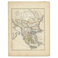
Antique Map of Turkey and Greece, 1852
Located in Langweer, NL
Antique map titled 'Europisch Turkije en Griekenland'. Map of Turkey in Europe and Greece. This map originates from 'School-Atlas van alle deelen der Aar...
Category
19th Century Antique Benelux Maps
Materials
Paper
$114 Sale Price
20% Off
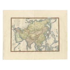
Antique Map of Asia by Brué '1820'
Located in Langweer, NL
Antique map titled 'Carte de l'Asie'. Original antique map of Asia. A blind stamp near the title reads 'Carte Encyprotipe'. This map originates fro...
Category
Early 19th Century Antique Benelux Maps
Materials
Paper
$619 Sale Price
20% Off
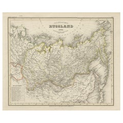
Antique Map of Russia in Asia from An Old German Atlas, 1845
By Meyer
Located in Langweer, NL
Antique map titled 'Asiatisches Russland'. This map depicts Russia in Asia and originates from 'Meyers Handatlas'.
Artists and Engravers: Engraved and published by 'Bibliographis...
Category
19th Century Antique Benelux Maps
Materials
Paper
$85 Sale Price
20% Off
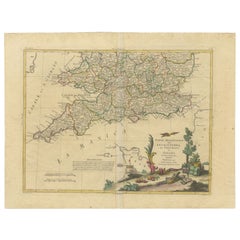
Antique Map of Southern England and Wales by Zatta, 1784
Located in Langweer, NL
"Antique map titled 'Parte Meridionale dell' Inghilterra e del Pricipato di Galles'. Engraved map of the southern part of England and Wales, with title cartouche. Shows political and...
Category
18th Century Antique Benelux Maps
Materials
Paper
$203 Sale Price
20% Off
Antique Map of the Rhineland and Alsace Region with Original Hand Coloring
Located in Langweer, NL
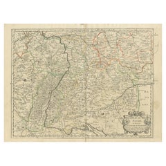
Antique map titled 'Palitinat du Rhein, Alsace, et partie de Souabe de Franconie (..)'. Double-page engraved map of the Rhineland and Alsace with original/contemporary hand coloring....
Category
Mid-17th Century Antique Benelux Maps
Materials
Paper
$295 Sale Price
20% Off
Antique Map extending from the Spice Islands to the west of Papua New Guinea
Located in Langweer, NL
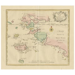
Antique map titled 'Kaart van de Papoasche Eilanden'. Beautiful original old map extending from the Spice Islands (Sallawatty, Patenta, Gammen, Land van Waigeeuw, Popo, Misool, and part of Seram) to the western end of Papua New Guinea. Many smaller islands are detailed, and depth soundings are shown near Seram and to the east of Misool. This map originates from 'Nieuwe en Beknopte Hand-Atlas, bestaande in eene Verzameling van eenige der algemeenste en nodigste Landkaarten' by I. Tirion. Published circa 1770.
Tirion was born in Utrecht in 1705. He moved to Amsterdam in 1725 and set up shop on Damrak as a book publisher. Tirion quick rose in prominence by publishing pamphlets, historical works, and, most importantly...
Category
Late 18th Century Antique Benelux Maps
Materials
Paper
$467 Sale Price
20% Off
Antique Map of Batavia 'Jakarta', Indonesia by Montanus, circa 1669
Located in Langweer, NL
Antique map Batavia titled 'Ware Affbeeldinge wegens het Casteel ende Stadt Batavia'. Antique print of the castle and city of Batavia on the Island of Java'. Rare edition with Englis...
Category
17th Century Antique Benelux Maps
Materials
Paper
$1,191 Sale Price
20% Off
Rare Engravings of Council of War in Bantam and Javanese Local Traders, 1614
Located in Langweer, NL
One leaf with an engraving on each site and text in old Dutch. One side shows the War Council of the locals in Bantam and the other side show some vegetables traders of Bantam.
B...
Category
Early 17th Century Antique Benelux Maps
Materials
Paper
$429 Sale Price
20% Off
Antique Print of Batavia Castle in Nowadays Jakarta, Indonesia, circa 1770
Located in Langweer, NL
Antique print titled 'Vue a Batavie du côte de la Courtine du Château - Prospect zu Batavia längst der Courtine des Castels'. Scarce view of Batavia Castle, present day Djakarta, Ind...
Category
18th Century Antique Benelux Maps
Materials
Paper
$524 Sale Price
20% Off
Antique Map of Australia by Lowry, 1852
Located in Langweer, NL
Antique map titled 'Australia'. Two individual sheets of Australia. This map originates from 'Lowry's table Atlas constructed and engraved from the most recent authorities' by J.W. L...
Category
Mid-19th Century Antique Benelux Maps
Materials
Paper
$190 Sale Price / set
20% Off
Antique Map of New South Wales by Johnston, '1909'
Located in Langweer, NL
Antique map titled 'South Australia, New South Wales, Victoria and Queensland'. Original antique map of New South Wales. With inset map of Cape York Pe...
Category
Early 20th Century Benelux Maps
Materials
Paper
$238 Sale Price
20% Off
Antique Map of China and Japan by Johnson, 1872
Located in Langweer, NL
Antique map titled 'Johnson's China and Japan'. Map of China and Japan, with an inset map of the vicinity of Canton and Hong Kong. This map originates from 'Johnson's New Illustrated...
Category
Late 19th Century Antique Benelux Maps
Materials
Paper
$286 Sale Price
20% Off
Antique Map of the United Kingdom and Ireland, c.1873
Located in Langweer, NL
Antique map titled 'Groot Brittanje en Ierland'. Old map depicting the United Kingdom and Ireland, with inset maps of London and factory districts of the UK. This map originates from...
Category
19th Century Antique Benelux Maps
Materials
Paper
$119 Sale Price
20% Off
Eason's War Map of Europe, circa 1914
Located in Langweer, NL
Antique map titled 'Eason's War Map of Europe'. Printed in Ireland. Source unknown, to be determined.
Artists and Engravers: Anonymous.
Condition: Good, ...
Category
20th Century Benelux Maps
Materials
Paper
$524 Sale Price
20% Off
Antique Map of Northern China and Far Eastern Russia Around the Amur River, 1754
Located in Langweer, NL
Antique map titled 'Carte De La Tartarie Orientale (..)'. A map for this far eastern portion of what is present day northern China and far eastern Russia...
Category
1750s Antique Benelux Maps
Materials
Paper
$476 Sale Price
20% Off
Antique Map of Asia by Delamarche, 1826
Located in Langweer, NL
Vaugondy's map plates and copyrights and later addes many plates from other sources as well. Charles Delamarche eventually passed control of the firm to his son Felix Delamarche (18t...
Category
19th Century Antique Benelux Maps
Materials
Paper
$228 Sale Price
20% Off
Antique Map of Suffren Island by Cook, 1803
Located in Langweer, NL
Antique map Australia titled 'Gezigt van het Eil. Suffren'. Antique map of Suffren Island. Originates from 'Reizen Rondom de Waereld door James C...
Category
19th Century Antique Benelux Maps
Materials
Paper
$171 Sale Price
20% Off
Antique Print of Batavia, Capital of the Dutch East Indies or Indonesia, '1726'
Located in Langweer, NL
Antique print Indonesia titled 'Batavia in 't Verschiet'. Large panoramic view on Batavia, present day Jakarta, Indonesia. Originates from 'Oud en Nieuw Oost-Indiën (..)' by François...
Category
18th Century Antique Benelux Maps
Materials
Paper
$1,191 Sale Price
20% Off
Antique Map of the Region of Fréjus, France
Located in Langweer, NL
Title: "Golf de Fréjus"
Description: This antique map, titled "Golf de Fréjus," is an original depiction of the region of Fréjus, France. It is part of the work "Le Petit Atlas Mari...
Category
Mid-18th Century Antique Benelux Maps
Materials
Paper
$283 Sale Price
30% Off
Large Antique Map of England and Wales
Located in Langweer, NL
Antique map titled 'An Accurate Map of England and Wales'. Original old map of England and Wales. Engraved by John Cary. Originates from 'New British Atlas' by John Stockdale, publis...
Category
Early 19th Century Antique Benelux Maps
Materials
Paper
$314 Sale Price
20% Off
Original Antique Engraving of Kannur 'or Cannanore', Kerala, India, 1726
Located in Langweer, NL
Antique print, titled: 'Cananor' - This is a print of a view of Kannur (or Cannanore), Kerala, India. From the monumental: "Oud en Nieuw Oost-Indiën ..." ...
Category
1720s Antique Benelux Maps
Materials
Paper
$524 Sale Price
20% Off
Antique Map of the Township of Franeker in Friesland, the Netherlands, 1865
Located in Langweer, NL
Friesland: Gemeente Franeker. These scarse detailed maps of Dutch Towns originate from the 'Gemeente-atlas' of Jacob Kuyper. This atlas of all towns in the Netherlands was published ...
Category
19th Century Antique Benelux Maps
Materials
Paper
$209 Sale Price
20% Off
American Election Map and 1960 Presidential Fact Sheet, Published 1960
Located in Langweer, NL
Title: “The 50 United States of America”
Subject: United States, Presidential Elections
Date: 1960 (dated)
Color: Printed Color
Size: 24.9 x 17.9 inches (63.2 x 45.5 cm)
This colorful map of the United States was drawn by Lorin Thompson and published by the General Foods Corporation. The map has an unusual coloring style with symbols of American history including past presidents, Native Americans, important buildings (White House, Statue of Liberty, Alamo), agriculture, industry, and more. Includes inset maps of Hawaii and Alaska with small American flags...
Category
1960s Vintage Benelux Maps
Materials
Paper
$572 Sale Price
20% Off
Antique Map of Mauritania, Massaesylia, Numidia, Tunisia, Cyrenaica & Marmarica
Located in Langweer, NL
Three maps on one sheet showing Mauritania, Massaesylia, Numidia, Tunisia, Cyrenaica and Marmarica (ancient Libya). This map originates from 'Schul-Atlas für die alte Erdbeschreibung...
Category
Early 19th Century Antique Benelux Maps
Materials
Paper
$343 Sale Price
20% Off
Antique Map of the Admiralty Islands, Bismarck Archipelago
Located in Langweer, NL
Antique map titled 'Trois Vues des Isles de l'Amirauté'. Several coastal views of the Admiralty Islands, Bismarck Archipelago, to the north of New Guinea in the South Pacific Ocean.
...
Category
Late 18th Century Antique Benelux Maps
Materials
Paper
$362 Sale Price
20% Off
Intriguing Antique Map of Europe, Asia and Africa by Scherer, c.1703
Located in Langweer, NL
Two maps on a single sheet showing Europe, Asia and Africa, each depicting nearly the same area. On close examination there are slight differences. Major cities are located. Printed ...
Category
18th Century Antique Benelux Maps
Materials
Paper
$286 Sale Price
20% Off
Antique Map of the Region Around the Nile and the City of Carthage
Located in Langweer, NL
Antique map titled 'Aegypti recentior descriptio - Carthaginis Celeberrimi sinus typus'. Two detailed regional maps by Ortelius. One map shows the region around the Nile, as far as A...
Category
16th Century Antique Benelux Maps
Materials
Paper
$552 Sale Price
20% Off
Antique Map of the Passage Between the Atlantic and Pacific Oceans, circa 1753
Located in Langweer, NL
Antique print, titled: 'Carte du Detroit de le Maire (…)' - This chart illustrates the important passage between the Atlantic and Pacific oceans. Jacob Le Maire and Willem Schouten d...
Category
18th Century Antique Benelux Maps
Materials
Paper
$219 Sale Price
20% Off
Antique Map of Korea and Southern China by Bonne '1771'
Located in Langweer, NL
Antique map titled 'Carte de la Tartarie Chinoise'. Original antique map of Korea and Southern China. Covers from the Lop Nor region eastward to K...
Category
Mid-18th Century Antique Benelux Maps
Materials
Paper
$548 Sale Price
20% Off
Old Map of the British Isles with the Faroes and Shetlands, Showing Cock Fights
Located in Langweer, NL
Antique map titled 'Les Isles Britaniques ou sont les Royaumes d'Angleterre (..)'. Original old map of the British Isles with inset maps of the Faroes and Shetlands. The title cartouche depicts dog...
Category
Early 18th Century Antique Benelux Maps
Materials
Paper
$438 Sale Price
20% Off
Antique Map of Switzerland by A & C. Black, 1870
Located in Langweer, NL
Antique map titled 'Switzerland'. Original antique map of Switzerland. This map originates from ‘Black's General Atlas of The World’. Published by A & C. Black, 1870.
Category
Late 19th Century Antique Benelux Maps
Materials
Paper
$166 Sale Price
20% Off
Antique Map of the Islands of Iwo Jima and Sulfur
Located in Langweer, NL
Untitled Antique Map of the islands of Iwo Jima and Sulfur, with a view of Sulphur with the hill. This map originates from 'A new, authentic, and complete collection of voyages round...
Category
Late 18th Century Antique Benelux Maps
Materials
Paper
$247 Sale Price
20% Off
Antique Map of the Region of Utingeradeel by Meijer & Schaafsma, 1906
Located in Langweer, NL
Antique map titled 'Gemeente Friesland. Gemeente Utingeradeel'. This map illustrates part of Friesland (The Netherlands) depicting Akkrum, Terkaple, Lekkerterp, Oldeboorn and more. Published by Tresling & Co, Amsterdam.
Artists and Engravers: Tresling and Co., Dutch Lithographers...
Category
20th Century Benelux Maps
Materials
Paper
$82 Sale Price
20% Off
Antique Map of Berkshire, South East England
By Joan (Johannes) Blaeu
Located in Langweer, NL
Antique map titled 'Bercheria vernacule Barkshire'. Original old map of Berkshire, a historic county in South East England. Published circa 1665 by J. Blaeu. Willem Jansz. Blaeu and ...
Category
Mid-17th Century Antique Benelux Maps
Materials
Paper
$1,144 Sale Price
20% Off
Old Map of the French department of Tarn, France
By Victor Levasseur
Located in Langweer, NL
Antique map titled 'Dépt. du Tarn'. Map of the French department of Tarn, France. This area produces a variety of traditional wines, including Cahors, Mauzac, Loin de l’Oeil and Onde...
Category
Mid-19th Century Antique Benelux Maps
Materials
Paper
$324 Sale Price
20% Off
Antique Map of the Township of Emmen, Drenthe in The Netherlands, 1865
Located in Langweer, NL
Drenthe: Gemeente Emmen, Roswinkel, Werdinge, Zuidbarge. These scarse detailed maps of Dutch Towns originate from the 'Gemeente-atlas' of Jacob Kuyper. This atlas of all towns in the...
Category
19th Century Antique Benelux Maps
Materials
Paper
$162 Sale Price
20% Off
Antique Map of Hondarribia Near the Bidasoa River, France & Spain
Located in Langweer, NL
Antique map titled 'Plan de Fontarabie et de la redoute d'Andaye'. Original old map of Hondarribia near the Bidasoa river, a river in the Basque Country of northern Spain and souther...
Category
Mid-18th Century Antique Benelux Maps
Materials
Paper
$324 Sale Price
20% Off
Bay of Arguin, West Coast of Africa from Cape Blanco to Tanit, Africa, 1747
Located in Langweer, NL
Antique map titled 'Carte De La Coste Occidentale D'Afrique (..)
Kaart van de Westkust van Afrika (..)'. Original antique map of the western coast of Africa. Shows the area aroun...
Category
1740s Antique Benelux Maps
Materials
Paper
$276 Sale Price
20% Off
Antique Print of Zeus at Olympia by Knight, 1835
Located in Langweer, NL
Antique print titled 'The Jupiter of Phidias'. Old print of a statue of Zeus at Olympia by Phidias, as imagined by engraver John Jackson. This print ori...
Category
19th Century Antique Benelux Maps
Materials
Paper
$69 Sale Price
20% Off
Antique Map of the course of the Don & Voga rivers
Located in Langweer, NL
Antique map titled 'Chart of the Course of The Don & the Volga through the Region of The Kosaks'. SW Russia & Ukraine: interesting map showing the course of th...
Category
Late 18th Century Antique Benelux Maps
Materials
Paper
$138 Sale Price
20% Off
Large Antique County Map of Middlesex, England
Located in Langweer, NL
Antique map titled 'A Map of Middlesex from the best Authorities'. Original old county map of Middlesex, England. Engraved by John Cary. Originates from 'New British Atlas' by John S...
Category
Early 19th Century Antique Benelux Maps
Materials
Paper
$266 Sale Price
20% Off
Antique Map Dedicated to British Merchants Trading to North America, ca.1746
Located in Langweer, NL
Description: Antique map titled 'A New Chart of the Coast of New England, Nova Scotia, New France or Canada, with the islands of Newfoundland, Capte Breton, St John's (..)'. Map stre...
Category
1740s Antique Benelux Maps
Materials
Paper
$810 Sale Price
20% Off
Original Antique Map of the Township of Winschoten in The Netherlands, 1862
Located in Langweer, NL
Groningen: Gemeente Winschoten-St. Vitus Holt. These scarse detailed maps of Dutch Towns originate from the 'Gemeente atlas van de Provincie Groningen in 62 kaarten.' by C. Fehse. Th...
Category
19th Century Antique Benelux Maps
Materials
Paper
$152 Sale Price
20% Off
Antique Map of North Africa by Lowry '1852'
Located in Langweer, NL
Antique map titled 'North Africa Marocco Algiers & Tunis'. Two individual sheets of North Africa. This map originates from 'Lowry's Table Atlas constructed and engraved from the most...
Category
Mid-19th Century Antique Benelux Maps
Materials
Paper
$143 Sale Price / set
20% Off
Antique Map of Virginia, Delaware, Maryland & West Virginia by Johnson, 1872
Located in Langweer, NL
Antique map titled 'Johnson's Viriginia (..). Original map of Virginia, Delaware, Maryland and West Virginia. This map originates from 'Johnson's New I...
Category
Late 19th Century Antique Benelux Maps
Materials
Paper
$238 Sale Price
20% Off
Detailed Antique Map of Santa Domingo, Puerto Rico, Eastern Bahamas, ca. 1780
Located in Langweer, NL
Description: Antique map titled 'L'Isle De St. Domingue, et celle De Porto-Rico.'
Detailed map of Santa Domingo, Puerto Rico, etc. Includes substanti...
Category
1780s Antique Benelux Maps
Materials
Paper
$667 Sale Price
20% Off
Antique Map of Wuxi and Huzhou in China, 1746
Located in Langweer, NL
Antique map titled 'Vusihyen. Hu Chew Fu'. Plans of Wuxi and Huzhou, China. Originates from Prévost's 'Histoire générale des voyages'.
Artists and Engravers: Antoine François Prévo...
Category
18th Century Antique Benelux Maps
Materials
Paper
$143 Sale Price
20% Off
Antique Map of North and West Africa by J.B. Elwe, 1792
Located in Langweer, NL
Beautiful richly engraved map of North and West Africa, based upon the earlier maps of De L'Isle. Richly annotated throughout and with excellent regional detail. Too much detail to d...
Category
Late 19th Century Antique Benelux Maps
Materials
Paper
$948 Sale Price
20% Off
Original French Antique Print of Villa Boulevard De Boulogne, Chabat, C.1900
Located in Langweer, NL
Antique print titled 'Villa Boulevard de Boulogne (Seine) Mr. L. Magne, Architecte'. This print depicts the design of a villa in France. Originates from 'La Brique et La Terre Cuite'...
Category
20th Century Benelux Maps
Materials
Paper
Antique Map of the Turkish Empire by Tirion 'c.1760'
Located in Langweer, NL
Antique map titled 'Nieuwe Kaart van het Turksche Ryk gelegen in Europa, Asia en Africa'. Original antique map of the Turkish Empire. The map is centered on the Mediterranean Sea but...
Category
Mid-18th Century Antique Benelux Maps
Materials
Paper
$1,334 Sale Price
20% Off
Original Antique Map of the Township of Borger in The Netherlands, 1865
Located in Langweer, NL
Drenthe - Gemeente Borger, Drouwen, Buinene, Westdorp. These scarse detailed maps of Dutch Towns originate from the 'Gemeente-atlas' of Jacob Kuyper. This atlas of all towns in the N...
Category
19th Century Antique Benelux Maps
Materials
Paper
$171 Sale Price
20% Off
Antique Map of Belgium and Luxembourg by Homann Heirs, 1747
Located in Langweer, NL
Antique map titled 'Belgium Catholicum seu Decem provinciae Germaniae Inferioris cum confiniis Germaniae sup. et Francia (..).' Detailed map of Belgium ...
Category
18th Century Antique Benelux Maps
Materials
Paper
$452 Sale Price
20% Off
Antique Map of the Westerkwartier Region, a Region in Groningen, 1791
Located in Langweer, NL
Antique map titled 'Das Wester Quartier'. Original antique map of Westerkwartier, a region in the province of Groningen, the Netherlands. This map orginates from 'Schauplatz der fünf...
Category
18th Century Antique Benelux Maps
Materials
Paper
Antique Miniature Map of Java by Bertius '1618'
Located in Langweer, NL
Antique miniature map titled 'Iava Maior'. Rare miniature map of Java, Indonesia. This map originates from 'Tabularum Geographicarum Contractarum Libri s...
Category
Early 17th Century Antique Benelux Maps
Materials
Paper
$619 Sale Price
20% Off
Antique Map of the Region of Valois by Hondius, circa 1630
Located in Langweer, NL
Antique map titled 'Le Pais de Valois'. Old map of the historic region of Valois, France. It corresponds to the southeastern quarter of the modern département of Oise, with an adjace...
Category
Mid-17th Century Antique Benelux Maps
Materials
Paper
$476 Sale Price
20% Off
Villa Salamandre – French Architectural Print from La Brique, Baumier, c.1900
Located in Langweer, NL
Villa Salamandre – French Architectural Lithograph from La Brique, Baumier, c.1900
This elegant antique architectural lithograph features the striking "Villa Salamandre" located in ...
Category
20th Century French Benelux Maps
Materials
Paper
Old Print of Standia, a Greek Island 'Heraklion, Crete, Greece, Balkans', 1688
Located in Langweer, NL
Antique print Greece titled 'Het Eilant Standia'. Old print of the island Standia, near Crete, Greece. This print originates from 'Nauwkeurige Bes...
Category
17th Century Antique Benelux Maps
Materials
Paper
$276 Sale Price
20% Off
Original Antique Map of Southern India and Ceylon 'Present-Day Sri Lanka'
By Jakob van der Schley
Located in Langweer, NL
Antique map titled 'Suite de la Carte de l'Indoustan (..) - Vervolg van de Kaart van Hindoestan (..)'. Original antique map of Southern India and Ceylon (present-day Sri Lanka). This...
Category
Mid-18th Century Antique Benelux Maps
Materials
Paper
$800 Sale Price
20% Off
Antique Map of the region of Lennep, Blankenburg and Dortmund, Germany
Located in Langweer, NL
Antique map titled 'Berge Ducatus Marck Comitatus'. Original antique map of the region of Lennep, Blankenburg and Dortmund, Germany. Published by Hondius, circa 1644.
Category
Mid-17th Century Antique Benelux Maps
Materials
Paper
$650 Sale Price
30% Off
Antique Map of Russia in Europe on Two Sheets from an Old German Atlas, Ca.1825
Located in Langweer, NL
Description: Antique map titled 'Europäisches Russland'.
Two individuel sheets, joined together they depict Russia in Europe. These maps originate from 'Stielers Handatlas'. Publis...
Category
1820s Antique Benelux Maps
Materials
Paper
$429 Sale Price
20% Off
Recently Viewed
View AllMore Ways To Browse
Greek Key Dresser
Green Glass Bud Vase Vintage
Gucci Tray
Half Moon Shelves
Handblown Glass Decanter
Heart Shaped Glass Dish
Hepplewhite Drop Leaf Table
Herend Cup
Hermes Dish
Horse Head Barware
Horse Mantel Clock
Large Limoges Platter
Michelangelo David Statue
Michelin Guide
Persian Khatam
Royal Worcester Aesthetic
Russell Woodard Aluminum
Russian Silver Niello
