Items Similar to Antique Map of the region of Lennep, Blankenburg and Dortmund, Germany

Want more images or videos?
Request additional images or videos from the seller
1 of 6
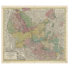
Antique Map of the region of Lennep, Blankenburg and Dortmund, Germany
About the Item
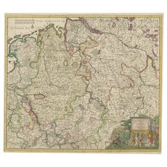
Antique map titled 'Berge Ducatus Marck Comitatus'. Original antique map of the region of Lennep, Blankenburg and Dortmund, Germany. Published by Hondius, circa 1644.
- Dimensions:Height: 18.04 in (45.8 cm)Width: 23.04 in (58.5 cm)Depth: 0.02 in (0.5 mm)
- Materials and Techniques:
- Period:Mid-17th Century
- Date of Manufacture:c.1644
- Condition:General age-related toning. Narrow margins. Shows some wear and soiling. Latin text on verso. Please study image carefully.
- Seller Location:Langweer, NL
- Reference Number:
About the Seller
5.0
Platinum Seller
These expertly vetted sellers are 1stDibs' most experienced sellers and are rated highest by our customers.
Established in 2009
1stDibs seller since 2017
1,919 sales on 1stDibs
Typical response time: <1 hour
- ShippingRetrieving quote...Ships From: Langweer, Netherlands
- Return PolicyA return for this item may be initiated within 14 days of delivery.
More From This SellerView All
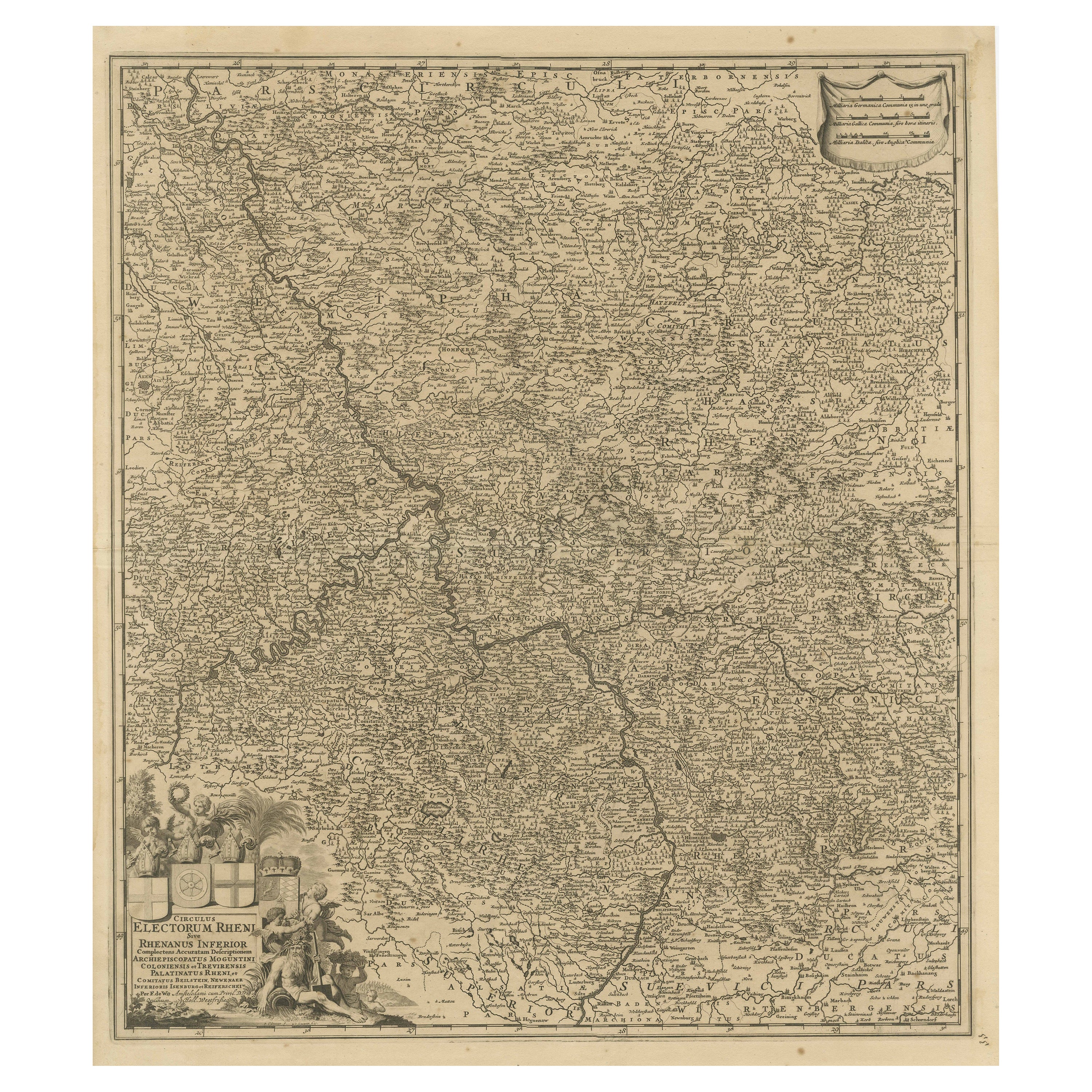
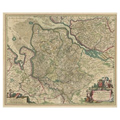
- Antique Map of the Niederrhein region, GermanyLocated in Langweer, NLAntique map titled 'Circulus Electorum Rheni sive Rhenanus Inferior (..)'. Original antique map of the Niederrhein region, Germany. By F. de Wit, circa 1690. Frederick de Wit (1629-...Category
Antique Late 17th Century Maps
MaterialsPaper
- Antique Map of the Region of Oldenburg, GermanyBy Willem BlaeuLocated in Langweer, NLAntique map titled 'Oldenburg Comitatus'. Detailed old map of Oldenburg, Germany. The map also shows Bremen and the Jade Bight. Published by W. Blaeu, circa 1640. Willem Jansz. Blaeu...Category
Antique Mid-17th Century Maps
MaterialsPaper
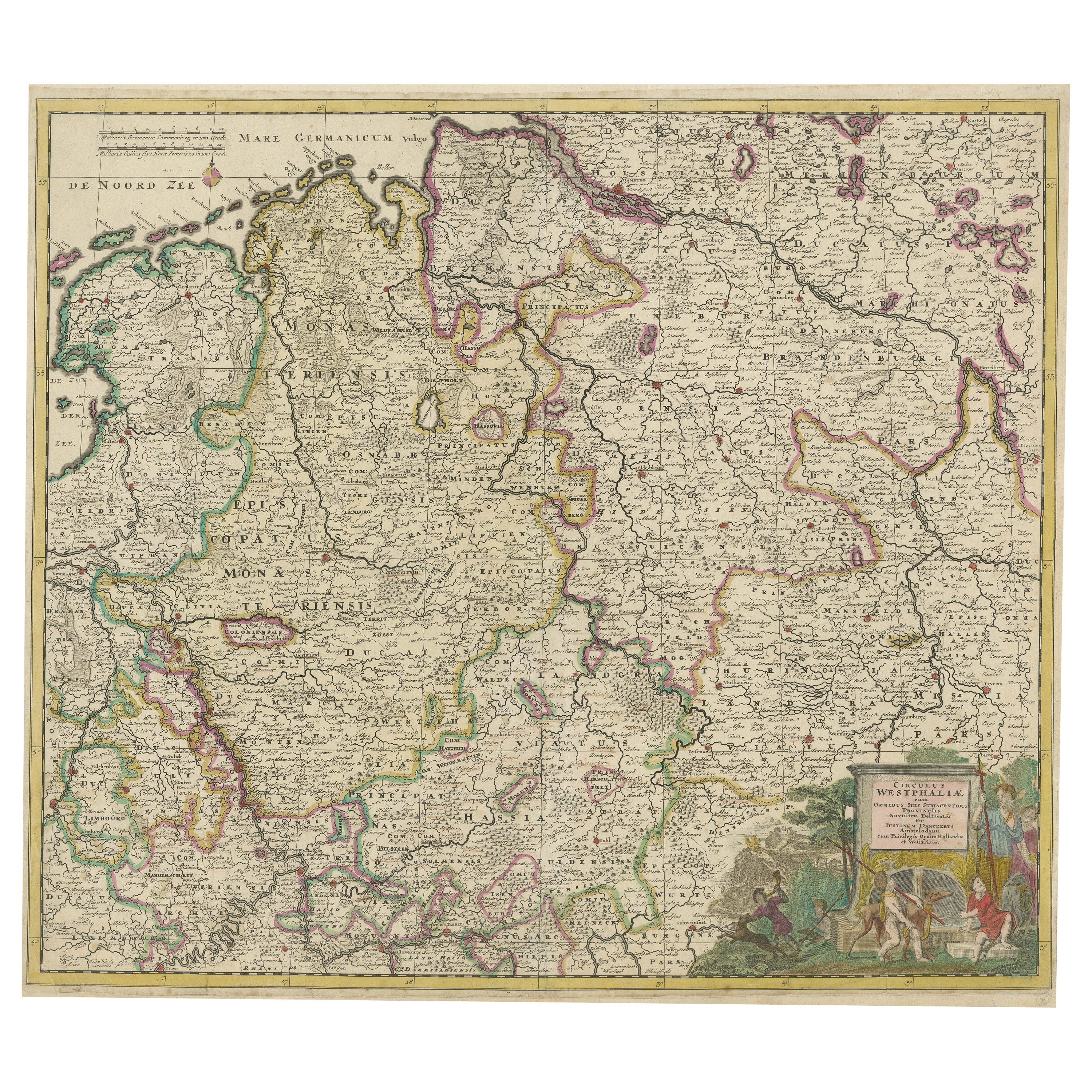
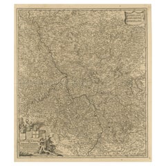
- Antique Map of the Westphalia region of GermanyLocated in Langweer, NLAntique map titled 'Circulus Westphaliae (..)'. Original old map of the Westphalia region, Germany. Published by Justus Danckerts, circa 1696. Justus Danckerts I (11 November 1635 ...Category
Antique Late 17th Century Maps
MaterialsPaper
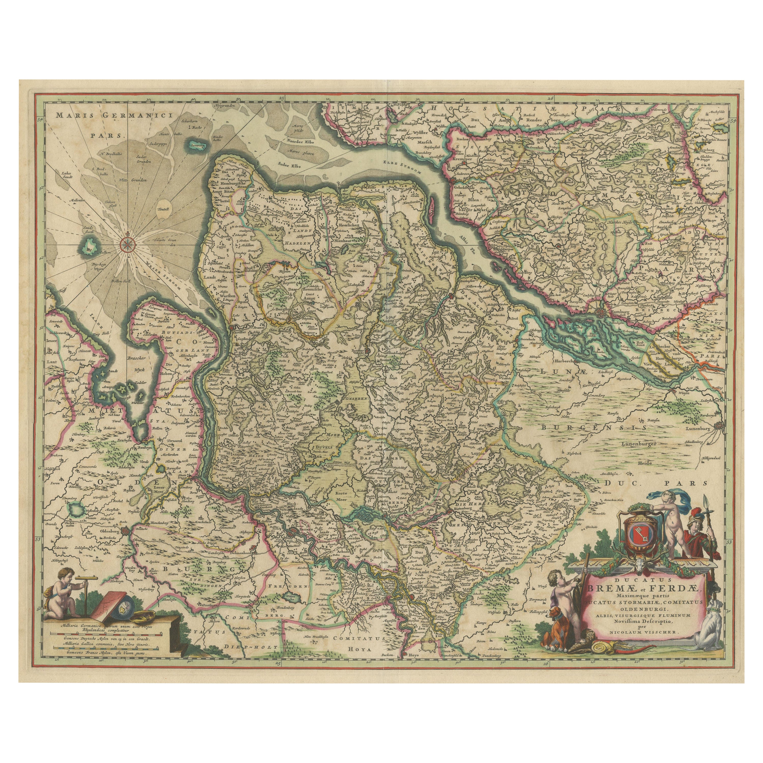
- Antique Map of the region of Bremen and Verden, GermanyLocated in Langweer, NLAntique map titled 'Ducatus Bremae et Ferdae (..)'. Original antique map of the region of Bremen and Verden, Germany. Published by N. Visscher, circa 1690. The Visscher family were...Category
Antique Late 17th Century Maps
MaterialsPaper
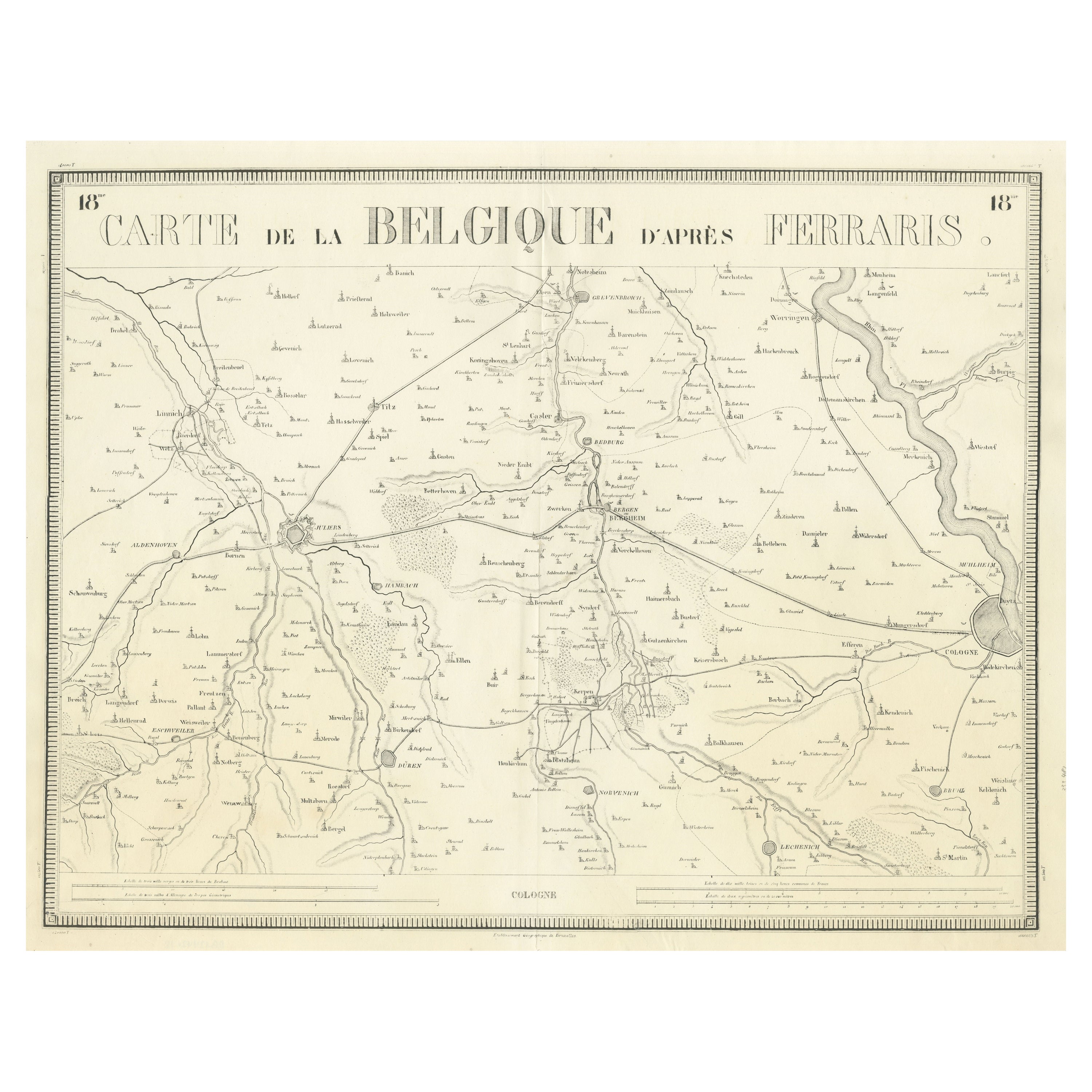
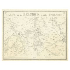
- Antique Map of the Region near Cologne, GermanyLocated in Langweer, NLAntique map titled 'Carte de la Belgique d'après Ferraris'. Original antique map of the region near Cologne, Germany. Cologne is the largest city of the German western state of North...Category
Antique Mid-19th Century Maps
MaterialsPaper
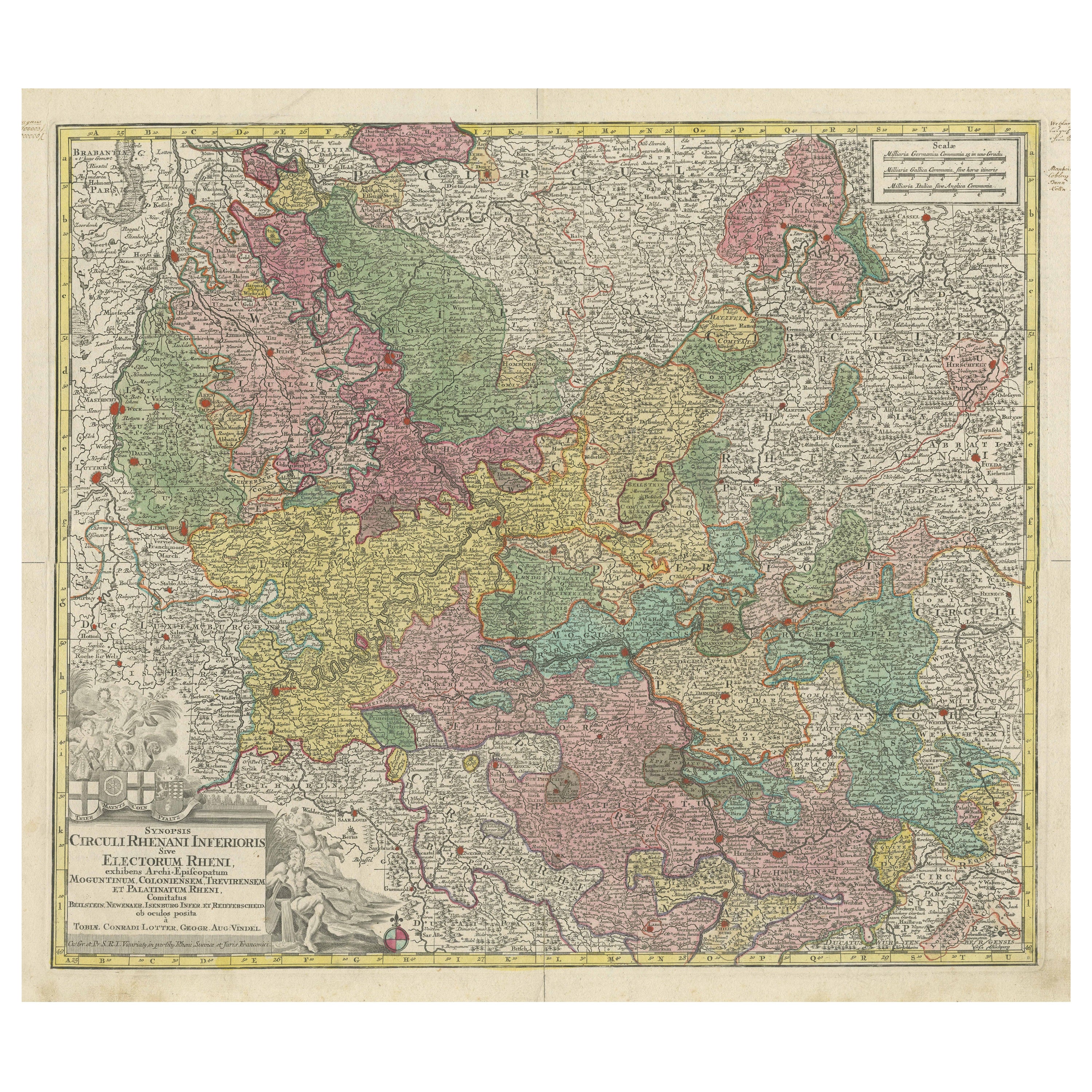
- Antique Map of the region of Trier, Mainz and Cologne, GermanyLocated in Langweer, NLAntique map titled 'Synopsis Circuli Rhenani Inferioris sive Electorum Rheni (..)'. Original antique map of the region of Trier, Mainz and Cologne, Germany. Published by T.C. Lotter,...Category
Antique Late 18th Century Maps
MaterialsPaper

You May Also Like
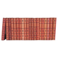
- Set of 20 Books by J. Van Lennep and J. J. CremerLocated in Baton Rouge, LAA collection of twenty volumes of works by Dutch novelists J. Van Lennep and J. J. Cremer. This set of books is bound in pressed fabric with gold lettering. There are minor signs of...Category
20th Century Dutch Other Books
MaterialsLeather, Paper
- 17th Century Hand-Colored Map of a Region in West Germany by JanssoniusBy Johannes JanssoniusLocated in Alamo, CAThis attractive highly detailed 17th century original hand-colored map is entitled "Archiepiscopatus Maghdeburgensis et Anhaltinus Ducatus cum terris adjacentibus". It was published ...Category
Antique Mid-17th Century Dutch Maps
MaterialsPaper
- 1594 Maurice Bouguereau Map of the Region Limoges, France, Ric0015Located in Norton, MA1594 Maurice Bouguereau map of the region Limoges, France, entitled "Totivs Lemovici et Confinium Pro Uinciarum Quantum ad Dioecefin Lemo Uicenfen Fpectant," Hand Colored Ric0015 Jean IV Le Clerc...Category
Antique 16th Century Dutch Maps
MaterialsPaper
- The Normandy Region of France: A 17th C. Hand-colored Map by Sanson and JaillotBy Nicolas SansonLocated in Alamo, CAThis large hand-colored map entitled "Le Duché et Gouvernement de Normandie divisée en Haute et Basse Normandie en divers Pays; et par evêchez, avec le Gouvernement General du Havre ...Category
Antique 1690s French Maps
MaterialsPaper
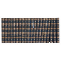
- Set of 20 Dutch Novels by J. Van LennepLocated in Baton Rouge, LAA collection of twenty volumes of novels by Dutch author J. Van Lennep. Leather bound with gold lettering, this set includes multiple works from the novelist. The pages have signs o...Category
20th Century Dutch Other Books
MaterialsLeather, Fabric
- 1861 Topographical Map of the District of Columbia, by Boschke, Antique MapLocated in Colorado Springs, COPresented is an original map of Albert Boschke's extremely sought-after "Topographical Map of the District of Columbia Surveyed in the Years 1856 ...Category
Antique 1860s American Historical Memorabilia
MaterialsPaper


Recently Viewed
View AllMore Ways To Browse
18th Engineer
Antique Map Of Cuba
Antique Maps Of Cuba
Cuba Antique Map
Nebraska Map
Santa Cruz Island
Map Of Kentucky
Yorkshire Ridings Map
Idaho Map
Rail Road Collectables
Antique Map Delaware
Antique Maps San Diego
Australasia Antique Map
Hawaii Map Vintage
Hawaii Vintage Map
Map Of Ural
Trinidad Map
Antique Montana Map