Continental Europe Maps
to
4,196
5,166
5,518
200
5,165
1
2
2
2
1
2,843
2,003
319
1
180
12
1
68
3
3
3
2
3
1
5,147
17
11
10
8
472
195
92
81
56
5,166
5,166
5,166
104
58
20
14
13
Item Ships From: Continental Europe
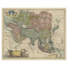
Antique Map of Asia and the East Indies and Korea as a Peninsula, ca.1660
Located in Langweer, NL
Antique map titled 'Asiae nova delineatio'. Decorative map of Asia and the East Indies. The map shows Korea as a peninsula. In China the Great Wall is depicted, as well as a long str...
Category
17th Century Antique Continental Europe Maps
Materials
Paper
$2,378 Sale Price
20% Off
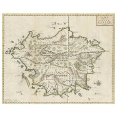
Old Antique Map of Borneo 'Kalimantan Indonesia, Sabah Malaysia & Brunei'
Located in Langweer, NL
Antique map titled 'Kaart van het Eyland Borneo'. Original antique map of the island of Borneo. Published 1724-1726 by Joannes van Braam and Gerard Onder de ...
Category
Early 18th Century Antique Continental Europe Maps
Materials
Paper
$1,522 Sale Price
20% Off
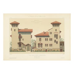
Old Architectural Design Print of Villa Boulevard de Boulogne, Chabat, c.1900
Located in Langweer, NL
Antique print titled 'Villa Boulevard de Boulogne (Seine) Mr. L. Magne, Architecte'. This print depicts the design of a villa in France. Originates from 'La Brique et La Terre Cuite'...
Category
20th Century Continental Europe Maps
Materials
Paper
$118 Sale Price
20% Off
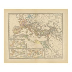
Imperium Romanum: A Detailed Map of the Roman Empire in its Zenith, 1880
Located in Langweer, NL
This original antique map, titled "IMPERIVM ROMANVM", is a detailed depiction of the Roman Empire at the height of its power. The main map encompasses the vast expanse of the Roman territories, stretching from the British Isles in the northwest to the deserts of Arabia and the northern fringes of Africa in the southeast.
**Key Features of the Map:**
1. **Territorial Colors**: The map uses different colors to distinguish the various provinces of the Roman Empire. These color-coded areas are to represent the administrative divisions within the Empire.
2. **Topography**: It shows a considerable amount of topographical detail, with mountain ranges, rivers, and bodies of water such as the Mediterranean Sea, prominently displayed.
3. **Cities and Settlements**: Cities are marked, with symbols indicative of their size or importance. Major cities such as Rome, Constantinople, Alexandria, and Carthage are highlighted.
4. **Road Networks**: There appear to be lines connecting various cities and towns, which could represent the famous Roman road network that facilitated trade and military movements.
5. **Latin Text...
Category
1880s Antique Continental Europe Maps
Materials
Paper
$352 Sale Price
20% Off
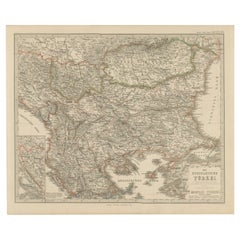
European Turkey Map – Detailed Balkan Ottoman Provinces 1858
Located in Langweer, NL
European Turkey and Greece Map – Balkans and Ionian Islands 1857
This detailed antique print shows “Die Europäische Türkei, Griechenland und die Ionische...
Category
Mid-19th Century German Antique Continental Europe Maps
Materials
Paper
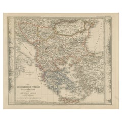
European Turkey and Greece Map – Balkans and Ionian Islands 1857
Located in Langweer, NL
European Turkey and Greece Map – Balkans and Ionian Islands 1857
This detailed antique print shows “Die Europäische Türkei, Griechenland und die Ionische...
Category
Mid-19th Century German Antique Continental Europe Maps
Materials
Paper
Greece Map – Kingdom of Greece and Ionian Islands 1847
Located in Langweer, NL
Greece Map – Kingdom of Greece and Ionian Islands 1847
This elegant antique print shows the Kingdom of Greece titled “Königreich Griechenland und die Ionischen Inseln” meaning “King...
Category
Mid-19th Century German Antique Continental Europe Maps
Materials
Paper
Antique Map of Jamaica and Hispaniola (Saint-Domingue and Santo Domingo), 1802
Located in Langweer, NL
This is an original antique map titled "Carte des Isles de la Jamaïque et de St. Domingue," depicting the islands of Jamaica and Saint-Domingue (modern-day Haiti and the Dominican Re...
Category
Early 1800s Antique Continental Europe Maps
Materials
Paper
$532 Sale Price
20% Off
Old Map of Radnorshire 1844 – Presteigne Rhayader Knighton Llandrindod Wells
Located in Langweer, NL
Old Map of Radnorshire by Samuel Lewis 1844 – Presteigne Rhayader Knighton Llandrindod Wells
Description: This original 1844 map of Radnorshire was engraved for Samuel Lewis’ Topographical Dictionary of Wales. It features key locations such as Presteigne, Rhayader, Knighton, Llandrindod Wells, and New Radnor. Hand-colored borders outline the county’s administrative divisions, and the map includes topographical shading, roads, rivers, and a decorative compass rose. A union reference key is clearly listed in the lower left.
Condition:
The map is in good condition with light toning and wide margins. The engraved lines remain crisp and the hand coloring is clear and unfaded. No tears or stains are present, with only minor age-related marks on the edges.
Framing suggestions:
Pair with an acid-free mat in cream or soft beige to match the aged tone of the paper. A dark wood or antique gold frame will enhance the historical feel. UV-protective glass is recommended. This piece is ideal for framing in a study, office, or heritage-themed space.
Keywords:
Radnorshire map 1844 Samuel Lewis antique...
Category
1840s Antique Continental Europe Maps
Materials
Paper
$228 Sale Price
20% Off
Europe Map – Political Divisions and Borders, Published in 1858
Located in Langweer, NL
Europe Map – Political Divisions and Borders 1858
This fine antique print shows Europe with its political divisions titled “Europa zur Übersicht der politischen Verhältnisse” meanin...
Category
Mid-19th Century German Antique Continental Europe Maps
Materials
Paper
Europe Map – Rivers, Watersheds and Elevation, Published in 1857
Located in Langweer, NL
Europe Map – Rivers, Watersheds and Elevation 1857
This beautiful antique print shows Europe with its river systems and watershed regions, titled “Europa zur Übersicht der Flussgebi...
Category
Mid-19th Century German Antique Continental Europe Maps
Materials
Paper
Antique Print of Alexandria in Egypt, 1698
Located in Langweer, NL
Antique print with two views of Alexandria, Egypt. This print originates from 'Reizen van Cornelis de Bruyn, door de vermaardste deelen van Klein Asia, de eylanden Scio, Rhodus, Cypr...
Category
17th Century Dutch Antique Continental Europe Maps
Materials
Paper
$228 Sale Price
20% Off
Arctic Polar Map – North Pole and Russian Empire Regions 1857
Located in Langweer, NL
Arctic Polar Map – North Pole and Russian Empire Regions 1857
This remarkable antique print shows the Arctic titled “Polar-Karte enthaltend die Länder und Meere am Nord-Pol” meaning...
Category
Mid-19th Century German Antique Continental Europe Maps
Materials
Paper
World Map – Mercator Projection with Global Sea Routes, Published in 1857
Located in Langweer, NL
World Map – Mercator Projection with Global Sea Routes 1857
This attractive antique print shows a world map titled “Planiglob in Mercators Projection zur Übersicht der Erdfläche und...
Category
Mid-19th Century German Antique Continental Europe Maps
Materials
Paper
Old Prints of Costumes of Hungary, Tyrol, Sweden, Romania, Holland, Etc., Ca1875
Located in Langweer, NL
Antique costume print including many different costumes including costumes of Hungary, Tyrol, Sweden and others.
This print originates from 'Blätter für Kostümkunde. Historische ...
Category
1870s Antique Continental Europe Maps
Materials
Paper
$209 Sale Price
20% Off
Antique Map of Senegal, West Africa
Located in Langweer, NL
Original antique map titled 'Carta del Senegal'. Antique map of Senegal, West Africa. This map originates from 'Compendio della storia generale dei viaggi (..)'. Published by De la Harpe...
Category
Mid-18th Century Antique Continental Europe Maps
Materials
Paper
$342 Sale Price
20% Off
Old Map of the Great Lakes and Upper Mississippi Valley, Northern America, c1780
Located in Langweer, NL
Antique map titled 'Partie Occidentale du Canada'.
A fine example of Rigobert Bonne and Guilleme Raynal's 1780 map of the Great Lakes and upper Mississippi Valley.
A map of c...
Category
1780s Antique Continental Europe Maps
Materials
Paper
$784 Sale Price
20% Off
Roman Italy and Provinces: A Cartographic Snapshot, 1880
Located in Langweer, NL
The map titled "ITALIA, Gallia Cisalpina, Sicilia, Sardinia, Corsica" focuses on Italy and its surrounding regions during Roman times. It offers a detailed depiction of the Italian peninsula, the Po Valley (Gallia Cisalpina), and the islands of Sicily, Sardinia, and Corsica.
Produced as part of the "Spruner-Menke Atlas Antiquus" by Karl Spruner von Merz and edited by Theodorus Menke, this map reflects the 19th-century European scholarship on ancient geography and history.
The period represented is likely during the Roman Republic or early Roman Empire, suggested by the level of detail in regions like Latium and Campania, which were central to Roman culture and power. This era was marked by Roman expansion and consolidation of the Italian peninsula, as well as the Punic Wars, which led to Roman dominance over the Mediterranean.
What makes this map interesting is its:
1. **Rich Detail**: The map delineates the intricate network of Roman roads, cities, and colonies, showing the infrastructure that facilitated Roman administration and control.
2. **Strategic Locations**: It identifies strategic locations like harbors and passes, crucial for trade and military campaigns.
3. **Geographic Accuracy**: It reflects the geographical knowledge of the time, with an accurate representation of the topography that shaped the development of these regions.
4. **Cultural and Historical Sites**: Insets of important sites like Syracuse offer a closer look at places of historical significance.
5. **Educational Purpose**: The map was designed to aid in the study of Roman history, providing a visual tool for understanding the ancient world...
Category
1880s Antique Continental Europe Maps
Materials
Paper
$352 Sale Price
20% Off
Solar System Map – Planetary Orbits and Data Chart, Published in 1857
Located in Langweer, NL
Solar System Map – Planetary Orbits and Data Chart 1857
This antique print shows a detailed diagram of the solar system titled “Planeten-System der Sonne” meaning “Planetary System ...
Category
Mid-19th Century German Antique Continental Europe Maps
Materials
Paper
Visible Side of the Moon Map – Detailed Lunar Crater Chart, Published in 1858
Located in Langweer, NL
Visible Side of the Moon Map – Detailed Lunar Crater Chart 1858
This fascinating antique print shows the visible side of the moon with incredible precision and detail. It depicts th...
Category
Mid-19th Century German Antique Continental Europe Maps
Materials
Paper
Antique Dutch Map of the Twelve Tribes of Israel – After Ezekiel, circa 1730
Located in Langweer, NL
Antique Dutch Map of the Twelve Tribes of Israel – After Ezekiel, circa 1730
This uncommon early 18th-century Dutch map is titled "Ontwerp en Erfdeeling van’t Land Kanaan, volgens h...
Category
Early 18th Century Dutch Antique Continental Europe Maps
Materials
Paper
1851 Tallis Map of China with Tibet, Formosa, and Burma – Engraved by J. Rapkin
Located in Langweer, NL
Title: 1851 Tallis Map of China with Tibet, Formosa, and Burma – Engraved by J. Rapkin
Description: This is a finely engraved and delicately hand-colored map of China, published a...
Category
1850s Antique Continental Europe Maps
Materials
Paper
$323 Sale Price
20% Off
Antique Folding Map of England and Wales
Located in Langweer, NL
Antique map titled 'England and Wales'. Original folding map of England and Wales. Publishes by A. & C. Black, circa 1890.
Category
Late 19th Century Antique Continental Europe Maps
Materials
Paper
$399 Sale Price
20% Off
Original Antique Map of Southern India and Ceylon 'Present-Day Sri Lanka'
By Jakob van der Schley
Located in Langweer, NL
Antique map titled 'Suite de la Carte de l'Indoustan (..) - Vervolg van de Kaart van Hindoestan (..)'. Original antique map of Southern India and Ceylon (present-day Sri Lanka). This...
Category
Mid-18th Century Antique Continental Europe Maps
Materials
Paper
$799 Sale Price
20% Off
Map of Liverpool and Birkenhead by Bartholomew, circa 1880, with Key Buildings
Located in Langweer, NL
Map of Liverpool and Birkenhead by J. Bartholomew, circa 1880, with key buildings
Detailed city plan titled 'Liverpool and Birkenhead with the surrounding districts', drawn by J. Ba...
Category
1880s Antique Continental Europe Maps
Materials
Paper
$228 Sale Price
20% Off
Antique Print with Coastal Views of Islands Near The American Coast by Cook
Located in Langweer, NL
Antique print America titled 'Gezigten der Landen van de West-Kust van Amerika, ten westen van Cook's Voyage'. Coastal views of various islands of the American coast, near Cook's riv...
Category
19th Century Antique Continental Europe Maps
Materials
Paper
$361 Sale Price
20% Off
Antique Map of Ambon Island in the Moluccas, Indonesia, c.1760
Located in Langweer, NL
Antique map Ambon titled 'Carte Particuliere de l 'Isle Amboine'. Old map showing Ambon, in the Moluccas Islands, better known as the Spice Islands. Ambon was the headquarters of the...
Category
18th Century Antique Continental Europe Maps
Materials
Paper
$228 Sale Price
20% Off
Detailed Antique Map of Hungary and Transylvania by Tirion, 1753
Located in Langweer, NL
Title: Nieuwe Kaart van’t Koninkryk Hongaryen en Zevenbergen by Isaak Tirion, 1753 – Antique Map of Hungary and Transylvania
Description: This is an antique 1753 map titled *Nieuwe Kaart van’t Koninkryk Hongaryen en Zevenbergen*, created by the notable Dutch cartographer and publisher Isaak Tirion. The map showcases the Kingdom of Hungary and the region of Transylvania (referred to as "Zevenbergen") as they appeared in the mid-18th century. Tirion’s maps are well-known for their clarity, precision, and attention to geographic detail, making them highly sought after by collectors of antique maps.
This map provides a detailed view of Hungary and Transylvania, including borders, towns, cities, rivers, and mountain ranges. It was created using the latest discoveries and updates of the time and reflects the political landscape of the region, which was part of the Habsburg Empire during a period of territorial changes and consolidations. The map’s borders are highlighted with color to distinguish different regions, and significant cities such as Buda, Pest, and Debrecen are clearly labeled.
Isaak Tirion was one of the most prominent Dutch publishers of the 18th century, particularly known for his *Nieuwe en Beknopte Hand-Atlas* (New and Concise Hand Atlas) series, which included a wide range of maps of Europe and beyond. His works were appreciated for their cartographic accuracy and artistic quality.
This map is a valuable piece for collectors interested in 18th-century European maps, particularly those that highlight Central Europe, Hungary, Transylvania, and the Habsburg Empire. It is a fine example of the craftsmanship of Isaak Tirion and offers insight into the historical geography of the region.
Condition: Excellent for its age, with finely preserved hand-coloring and wide margins. Slight edge wear typical of maps from this period.
Effective keywords that may help attract collectors or enthusiasts interested in historical maps of Hungary, Transylvania, and Central Europe:
- Antique map of Hungary
- Historical map of Transylvania
- 18th-century map of Central Europe
- Habsburg Empire map
- Isaak Tirion map
- Nieuwe Kaart van’t Koninkryk Hongaryen en Zevenbergen
- Kingdom of Hungary map...
Category
1750s Antique Continental Europe Maps
Materials
Paper
$574 Sale Price
30% Off
Antique Map of the Province of Gelderland, the Netherlands, c.1690
Located in Langweer, NL
Antique map titled 'Ducatus Geldriae novissima descriptio'. Map of Gelderland, The Netherlands. Shows many cities (like Arnhem, Nijmegen, Eindhoven, Zutphen, Zwolle, etc), roads, riv...
Category
17th Century Antique Continental Europe Maps
Materials
Paper
$474 Sale Price
20% Off
Antique Map of Spain by Covens & Mortier, c.1740
Located in Langweer, NL
Antique map Spain titled 'L?Espagne dressée sur la Description qui en a eté faite par Rodrigo Mendez Sylva (..)'. Beautiful map of Spain with decorat...
Category
18th Century Antique Continental Europe Maps
Materials
Paper
$499 Sale Price
20% Off
Map of Samoa or Schiffer-Inseln (Navigator Islands) - 19th Century German Map
Located in Langweer, NL
Map of Samoa or Schiffer-Inseln (Navigator Islands) - 19th Century German Map
This detailed 19th-century map of the Samoa Islands, also known as the Navigator Islands (Schiffer-In...
Category
1890s Antique Continental Europe Maps
Materials
Paper
$76 Sale Price
20% Off
Antique Map of the City of Verdun by Merian, c.1650
Located in Langweer, NL
Antique map titled 'Verdun'. Orginal antique map of Verdun, a small city in the Meuse department in Grand Est in northeastern France. This map originates from 'Topographia Germaniae'...
Category
17th Century Antique Continental Europe Maps
Materials
Paper
$56 Sale Price
20% Off
Antique Map of Martinique, Showing Roads, Houses, Sugar Plantations, etc. c.1750
Located in Langweer, NL
Antique map titled 'Carte de l'Isle de la Martinique'.
Detailed map of Martinique. Shows hilly terrain, forests, roads, houses, and even the sugar plantations. The island was to ...
Category
18th Century Antique Continental Europe Maps
Materials
Paper
$1,427 Sale Price
20% Off
Antique Map of the Region of Cologne and Liege by Scherer, 1699
Located in Langweer, NL
Antique map titled 'Archpiescopatus Coloniensis (..) Episcopatus Leodiensis (..).' Detailed uncommon map of the Archbishopric of Cologne and the Bishopric of Liege/Luik. Source unkno...
Category
17th Century Antique Continental Europe Maps
Materials
Paper
$214 Sale Price
20% Off
Nice Decorative Black and White Small Antique Map of Europe, 'circa 1834'
Located in Langweer, NL
Antique French map titled 'Europe par A.H. Dufour'. Uncommon map of Europe.
Published by or after A.H. Dufour, circa 1834. Source unknown, to be d...
Category
Mid-19th Century Antique Continental Europe Maps
Materials
Paper
$190 Sale Price
20% Off
Antique Map of Southern Asia with India, the Maldives, Ceylon and Arabia, c.1700
Located in Langweer, NL
Stunning Old Map of Asia.
Description: Two-sheet map of Asia, joined. The left part of this antique map is titled 'Partie occidentale d'une partie d'Asie ou sont les Isles de Zoco...
Category
Early 18th Century Antique Continental Europe Maps
Materials
Paper
$3,330 Sale Price
20% Off
Antique Map of Greece, Albania, Macedonia and Parts of Turkey and Cyprus, c.1745
Located in Langweer, NL
Antique map titled 'Accurata Totius Archipelagi Et Graeciae Universae Tabula'.
Detailed map of Greece. Includes Albania, Macedonia and parts of Turkey and Cyprus. With compass rose...
Category
18th Century Antique Continental Europe Maps
Materials
Paper
$808 Sale Price
20% Off
Pl. XX Villa Mon Caprice, Chabat, c.1900
Located in Langweer, NL
Antique print titled 'Villa mon Caprice Villers-Sur-Mer. Mr. E. Macé, Architecte'. This print depicts the design of a building in France. Originates from 'La Brique et La Terre Cuite...
Category
20th Century Continental Europe Maps
Materials
Paper
$121 Sale Price
20% Off
Antique Decorative Coloured Map Marocco, Algeria and Tunis, 1882
Located in Langweer, NL
The maps is from the 1882 atlas by Blackie & Son and offers a detailed view of the North African regions as understood in the late 19th century.
**Map of Morocco, Algeria, and Tun...
Category
1880s Antique Continental Europe Maps
Materials
Paper
$237 Sale Price
20% Off
Antique Plan of Emden in Germany by Guicciardini, 1612
Located in Langweer, NL
Antique map Emden titled 'Civitas Embda, eo modo situata cum essit controversia inter ipsam et suum Comitem anno'. Small plan of the city of Emden, Germany, Also depicted is part of ...
Category
17th Century Antique Continental Europe Maps
Materials
Paper
$361 Sale Price
20% Off
Antique Map of the World on Mercator's Projection, 1788
Located in Langweer, NL
Antique map titled 'Kaart van de Geheele Wereld (..)'. Uncommon small world map on Mercator's projection. Nice detail of the islands throughout the wor...
Category
Late 18th Century Antique Continental Europe Maps
Materials
Paper
$713 Sale Price
20% Off
Antique Map of the City of Berlin in Germany, '1847'
Located in Langweer, NL
Antique map titled 'Berlin'. Original antique map of the city of Berlin, Germany. This map originates from 'Abrégé de Géographie (..)' by Adrien Balbi. Published 1847.
Category
Mid-19th Century Antique Continental Europe Maps
Materials
Paper
$142 Sale Price
20% Off
Antique Map of Algeria and the French Colonies, 1875
Located in Langweer, NL
Antique map titled 'Algérie et Colonies Francaises'. Large map of Algeria and the French Colonies. This map originates from 'Atlas de Géographie Moderne Physique et Politique' by A. ...
Category
Late 19th Century French Antique Continental Europe Maps
Materials
Paper
$309 Sale Price
35% Off
Original Antique Map of Hungary and Transylvania 'Modern Day Romania', C.1710
Located in Langweer, NL
Antique map titled 'Hungary and Transilvania'.
Original antique map of Hungary and Transylvania (modern day Romania), centered on Budapest.
Artists and Engravers: Herman Moll ...
Category
1710s Antique Continental Europe Maps
Materials
Paper
$275 Sale Price
20% Off
Antique Map of Prussia and Mecklenburg by W. G. Blackie, 1859
Located in Langweer, NL
Antique map titled 'Prussia and Mecklenburg'. Original antique map of Prussia and Mecklenburg with inset map of East Prussia. This map originates from ‘Th...
Category
Mid-19th Century Antique Continental Europe Maps
Materials
Paper
$237 Sale Price
20% Off
Antique Map of the State of Ohio by Titus '1871'
Located in Langweer, NL
Antique map titled 'Railroad & Township Map of the State of Ohio'. Original antique map of the State of Ohio. This map originates from 'Atlas of Preble County Ohio' by C.O. Titus. Pu...
Category
Late 19th Century Antique Continental Europe Maps
Materials
Paper
$1,070 Sale Price
25% Off
Antique Print of the Fortress at the Nile 'Damietta, Egypt' by C. Niebuhr, 1774
Located in Langweer, NL
Antique print titled 'Castelle an dem Ausflus des Nîls nicht weit von Damiât'. Translated: 'Fort at the estuary of the Nile near Damietta, Egypt'. This print originates from 'Reisebe...
Category
Late 18th Century Antique Continental Europe Maps
Materials
Paper
$133 Sale Price
20% Off
Antique Map of the Province of Friesland, The Netherlands, c.1760
Located in Langweer, NL
Antique map titled 'Frisiae Dominium vernacule Friesland, verdeeld in de Hoofd-deelen van Oostergoo, Westergoo en Sevenwolden, Als ook der XI Steden Zynde noch onderscheiden in XXX G...
Category
18th Century Antique Continental Europe Maps
Materials
Paper
$516 Sale Price
20% Off
Turkey in Asia – Antique Ottoman Empire Map by John Tallis, ca. 1851
Located in Langweer, NL
Turkey in Asia – Antique Ottoman Empire Map by John Tallis, ca. 1851
This decorative 19th-century map titled "Turkey in Asia" was published by John Tallis & Company around 1851. Eng...
Category
Mid-19th Century English Antique Continental Europe Maps
Materials
Paper
Granada 1902: A Cartographic Exploration of Andalusia's Mountainous Province
Located in Langweer, NL
This original antique map depicts the province of Granada, part of the autonomous community of Andalusia in southern Spain, as of 1902. The map features several important details:
I...
Category
Early 1900s Antique Continental Europe Maps
Materials
Paper
$371 Sale Price
20% Off
Antique Map of the Duchy of Lüneburg, Lower Saxony, Germany
Located in Langweer, NL
Antique map titled 'Ducatus Luneburgensis (..)'. Map of the Duchy of Lüneburg in Lower Saxony, Germany. Published by J. Janssonius, circa 1664.
Jan Janssonius (also known as Johann ...
Category
Mid-17th Century Antique Continental Europe Maps
Materials
Paper
$513 Sale Price
20% Off
Antique Print of the City of Kinnungam in China, 1668
By Johannes Nieuhof
Located in Langweer, NL
Antique print China titled 'Kinnungam'. Old print depicting a view of the Chinese city of Kinnungam with its ramparts. This print originates from t...
Category
17th Century Antique Continental Europe Maps
Materials
Paper
$371 Sale Price
20% Off
Antique Map of Westfalia, Germany by Mercator/Hondius, circa '1620'
Located in Langweer, NL
Antique map titled 'Westfalia cum dioecelsi Bremensi'. Original antique map of Germany. Published by Mercator/Hondius, circa '1620'
17th Century antique detailled map of Westphali...
Category
16th Century Antique Continental Europe Maps
Materials
Paper
$903 Sale Price
20% Off
Ancient Crossroads: Albania to Assyria in Antiquity, Published in 1880
Located in Langweer, NL
The map titled "ALBANIA, IBERIA, COLCHIS, ARMENIA, MESOPOTAMIA, BABYLONIA, ASSYRIA" portrays the ancient regions that would encompass parts of modern-day Eastern Turkey, Armenia, Aze...
Category
1880s Antique Continental Europe Maps
Materials
Paper
$352 Sale Price
20% Off
Original Antique Map of the United Kingdom and Ireland, Published in 1875
Located in Langweer, NL
Antique map titled 'Iles Britanniques ou Royaume-Uni de la Grande Bretagne (..)'. Large map of the United Kingdom and Ireland. This map originates from...
Category
Late 19th Century French Antique Continental Europe Maps
Materials
Paper
$291 Sale Price
30% Off
Géographie des Hébreux – Tableau de la Dispersion des Enfants de Noé, 1837
Located in Langweer, NL
Géographie des Hébreux – Tableau de la Dispersion des Enfants de Noé, 1837
This antique map, titled Géographie des Hébreux ou Tableau de la Dispersion des ...
Category
Mid-19th Century French Antique Continental Europe Maps
Materials
Paper
$228 Sale Price
20% Off
Hand-Colored Map of West India Islands: St. Christopher's, St. Lucia and Nevis
Located in Langweer, NL
This map, titled "West India Islands," was published by John Thomson & Co. in 1821 as part of *Thomson's New General Atlas.* The map offers detailed depictions of three key islands i...
Category
1820s Antique Continental Europe Maps
Materials
Paper
$551 Sale Price
20% Off
1601 Miniature Map of Southeast Asia & Nova Guinea by Ortelius, Vrients Edition
Located in Langweer, NL
This miniature map of the East Indies and Nova Guinea was created by Abraham Ortelius and published in 1601 as part of the "Epitome" by Giovanni Battista Vrients. It is a finely hand...
Category
Early 1600s Antique Continental Europe Maps
Materials
Paper
Old Map of Ancient Assyria Divided into Syria, Mesopotamia, Babylonia & Assyria
Located in Langweer, NL
This map, "Assyria vetus diuisa in Syriam, Messopotamiam, Babyloniam, et Assyriam", by Pierre Mortier, is a late 17th-century depiction of the historical Middle East.
Title: Ancie...
Category
Early 1700s Antique Continental Europe Maps
Materials
Paper
Historical Map of Northern Europe and Russia - Engraved for I. Harrison, 1788
Located in Langweer, NL
Historical Map of Northern Europe and Russia - Engraved for I. Harrison, 1788
This impressive historical map titled A New Map of Europe Containing Denmark, Norway, Sweden and Russ...
Category
1780s Antique Continental Europe Maps
Materials
Paper
$799 Sale Price
20% Off
Recently Viewed
View AllMore Ways To Browse
Vintage Industrial Bins
Vintage Liquor Labels
Vintage Utensil Holders
Vintage Wicker Wine Bottles
Vintage Wrought Iron Fire Screen
Viso Porcelain
Wall Mount Water Fountains
Wedding Cabinets and Armoires
Wedgwood Green Jasperware
Wedgwood Portrait
West German Pot
White Ceramic Garden Stool
White Ironstone China
White Lacquer Bar Cart
Woman With Water Jug
Wooden Chest 1800
Wooden Tea Cart
Worcester Jug
