Netherlands Maps
to
4,199
5,130
5,520
197
5,129
1
2,838
1,984
307
1
179
6
68
3
3
3
2
5,124
9
7
2
1
427
174
89
78
47
5,130
5,130
5,130
104
58
20
14
13
Item Ships From: Netherlands
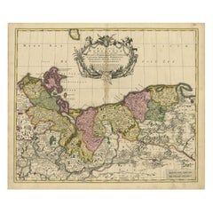
Map of the Duchy of Pomerania – Antique Engraving by P. Schenk Jr., c. 1750
Located in Langweer, NL
Map of the Duchy of Pomerania – Antique Engraving by P. Schenk Jr., c. 1750
Antique map titled 'Ducatus Pomeraniae Tabula Generalis'. This historical map presents the Duchy of Pomer...
Category
Mid-18th Century Dutch Antique Netherlands Maps
Materials
Paper
$477 Sale Price
20% Off
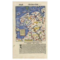
Friesland, Groningen, Drenthe, Overijssel – Antique Map by Seb. Münster, 1574
Located in Langweer, NL
Friesland, Groningen, Drenthe, Overijssel – Antique Map by Sebastian Münster, 1574
This rare and finely colored woodcut map of Northern Netherlands depicts the provinces of Friesl...
Category
16th Century Antique Netherlands Maps
Materials
Paper
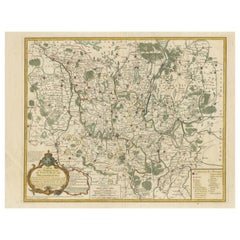
Map of the Margraviate and Electorate of Brandenburg by de Beaurain - ca.1750
Located in Langweer, NL
Historical Map of the Margraviate and Electorate of Brandenburg by Chevalier de Beaurain - Circa 1750
This impressive historical map, titled "Carte du Marquisat et Electorat de Br...
Category
1750s Antique Netherlands Maps
Materials
Paper
$515 Sale Price
20% Off
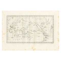
Antique Map of the World by Ferrario '1831'
Located in Langweer, NL
Original antique map of the world. This print originates from 'Costume Antico e Moderno: Palestine, China, India, Oceania' by Ferrario. Publis...
Category
Mid-19th Century Antique Netherlands Maps
Materials
Paper
$191 Sale Price
20% Off
Old Original Hand-Colored Engraving of Various Apples, 1758
Located in Langweer, NL
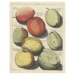
Antique print depicting apple variaties including the Pigeon of Passe Pomme, Rode Herfst- of Winter Calville, Witte Ribbert of Ribling, Winter Parmain Pepping, Paasch Appel, Wyker Pe...
Category
18th Century Antique Netherlands Maps
Materials
Paper
$305 Sale Price
20% Off
Antique Map of France with Decorative Title Cartouche
Located in Langweer, NL
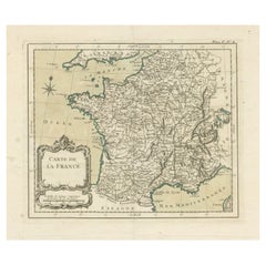
Antique map titled 'Carte de la France'. Original old map of France. This map originates from 'Le Petit Atlas Maritime Recueil De Cartes et Plans Des Quatre Parties Du Monde (..) by ...
Category
Mid-18th Century Antique Netherlands Maps
Materials
Paper
$229 Sale Price
20% Off
Antique Map of a Bay on the Coast of Chile, South America, c.1749
Located in Langweer, NL
Antique map titled 'Plan van een Baai en Haven aan de Kust van Chili (..) - Plan d'une Baye de la Côte du Chili (..)'. Original antique map of a bay on the coast of Chile discovered ...
Category
18th Century Antique Netherlands Maps
Materials
Paper
$305 Sale Price
20% Off
Antique Map of the Province of Zeeland, The Netherlands by Coronelli, 1692
Located in Langweer, NL
Antique map titled 'Contado di Zelanda'. Beautiful map of the Dutch province of Zeeland. With the islands of Walcheren, Schouwen-Duiveland, Noord-Beveland, Zuid-Beveland, Tholen and ...
Category
17th Century Antique Netherlands Maps
Materials
Paper
$639 Sale Price
20% Off
Brazil Coastline Map – Broenner Carte du Bresil, 1772 Captaincies
Located in Langweer, NL
Carte du Bresil Map, Broenner Krefeld 1772 – Brazil Coastline Captaincies
This is an engraved map titled Carte du Bresil Prem. Partie, published in Krefeld (Germany) by J.J. Broenne...
Category
Late 18th Century French Antique Netherlands Maps
Materials
Paper
Antique Map of the Hainaut Region by Visscher, c.1690
By Nicolaes Visscher II
Located in Langweer, NL
Antique map titled 'Comitatus Hannoniae et Archiepiscopatus Cameracensis Tabula'. Large map of the Hainaut region, France.
Artists and Engravers: Nicolaes Visscher II (1649, Amst...
Category
17th Century Antique Netherlands Maps
Materials
Paper
$310 Sale Price
20% Off
Central America Map – Johnson, Hand-Colored with Insets, c.1864
Located in Langweer, NL
Johnson’s Central America Map, USA c.1864 – Hand-Colored with Insets
This is a finely engraved and hand-colored map titled Johnson’s Central America, published by Johnson and Ward i...
Category
Mid-19th Century American Antique Netherlands Maps
Materials
Paper
Washington Oregon Idaho Map – Johnson, Hand-Colored, c.1864
Located in Langweer, NL
Johnson’s Washington Oregon Idaho Map, USA c.1864 – Hand-Colored
This is a finely engraved and hand-colored map titled Johnson’s Washington, Oregon, and Idaho, published by Johnson ...
Category
Mid-19th Century American Antique Netherlands Maps
Materials
Paper
Old Map of the Margraviate of Brandenburg by Giacomo Cantelli da Vignola, 1687
Located in Langweer, NL
Historical Map of the Margraviate of Brandenburg by Giacomo Cantelli da Vignola - 1687
This magnificent map, titled Marchesato, et Elettorato di Brandeburgo con una gran Porzione ...
Category
1680s Antique Netherlands Maps
Materials
Paper
$515 Sale Price
20% Off
Map of the Electorate of Bavaria, Incl Lake Constance, by Jesuit Scherer, c.1700
Located in Langweer, NL
Antique map titled 'Electorat Bavariae.' Map of the Electorate of Bavaria by the Jesuit Heinrich Scherer. The lower map shows the Lake Constance. Source unknown, to be determined.
...
Category
Early 1700s Antique Netherlands Maps
Materials
Paper
$592 Sale Price
20% Off
Print of the Bridge of Painshill & Windsor Park, Belfast, Northern Ireland, 1785
Located in Langweer, NL
Antique print titled 'Pont de Painshill á M. Hamilton (..)'.
Copper engraving of the bridge of Painshill and Windsor Park. This print originates from 'Jardins Anglo-Chinois à la ...
Category
18th Century Antique Netherlands Maps
Materials
Paper
$372 Sale Price
20% Off
Empire's Crossroads: An 1882 Map of Turkey in Asia by Blackie & Son
Located in Langweer, NL
This map, titled "Turkey in Asia," is another detailed illustration from the 1882 atlas by Blackie & Son. It showcases the vastness of the Asian territories of the Ottoman Empire, sp...
Category
1880s Antique Netherlands Maps
Materials
Paper
$236 Sale Price
40% Off
Hand Colored Antique Map of the Department of Cher, France
By Victor Levasseur
Located in Langweer, NL
Antique map titled 'Dépt. du Cher'. Map of the French department of Cher, France. This area of France is known for its production of Selles Sur Cher, a goats-milk cheese. The whole i...
Category
Mid-19th Century Antique Netherlands Maps
Materials
Paper
$324 Sale Price
20% Off
Antique Map of the United States with Vignette of Washington
Located in Langweer, NL
Antique map titled 'États-Unis'. A very attractive and detailed late 19th century map of the United States, with a fine decorative vignette of Washington. The extensive railway netwo...
Category
Late 19th Century Antique Netherlands Maps
Materials
Paper
$458 Sale Price
20% Off
Antique Map of Spain and Portugal, 1882
Located in Langweer, NL
"Antique map titled 'Spain & Portugal'.
Old map of Spain and Portugal. This map originates from 'The Royal Atlas of Modern Geography, Exhibiting, in a S...
Category
19th Century Antique Netherlands Maps
Materials
Paper
$219 Sale Price
20% Off
Antique Hand-Colored Map of Western Russia and Ukraine, c.1680
Located in Langweer, NL
Description: Antique map titled 'Novissima et Accuratissima Totius Russiae vulgo Muscoviae Tabula'.
Antique map of Western Russia and Ukraine, published by Justus Danckerts. The ma...
Category
1680s Antique Netherlands Maps
Materials
Paper
$716 Sale Price
20% Off
Pl. 6 Antique Print of Château De Neuilly by Le Rouge, c.1785
Located in Langweer, NL
Antique print titled 'Grande Facade de Neuilly'. Copper engraving showing part of Château de Neuilly. This print originates from 'Jardins Anglo-Chinois à la Mode' by Georg Louis le R...
Category
18th Century Antique Netherlands Maps
Materials
Paper
Antique Map of the Main Comoro Islands by Van Schley, 1749
By Jakob van der Schley
Located in Langweer, NL
Antique map titled ‘Carte des Isles de Comore (..) - Kaart van de Eilanden Komoro (..)’. Original antique map of the main Comoro Islands or Comoros including Comore, Mohéli, Anjouan ...
Category
18th Century Antique Netherlands Maps
Materials
Paper
$105 Sale Price
20% Off
Old Hand-colored Antique Print of Garden Architecture by Van Laar, 1802
Located in Langweer, NL
Untitled print of garden architecture. It shows garden buildings. This print originates from 'Magazijn van tuin-sieraden'. The book is compiled by Gijsbert van Laar, providing a surv...
Category
19th Century Antique Netherlands Maps
Materials
Paper
Antique Map of Stavoren by Priorato, 1673
Located in Langweer, NL
Antique map titled 'Staveren'. Original antique map of the city of Stavoren, Friesland, the Netherlands. This map orginates from 'Teatro del Belgio (..)', published in Frankfurt am Main in 1673 by Gualdo Priorato. Artists and Engravers: Author: Galeazzo Gualdo Priorato (1606-1678) entered military service at a very young age and served in Flanders under the Prince of Orange. After his retirement, he authored several historical accounts including the Teatro del Belgio, which described the Catholic/Protestant wars in Belgium and Netherlands during the seventeenth century. His superb plans do not show the internal layout of the cities, except for showing the locations of the major churches. Instead the emphasis is on the fortification, as well as on the surrounding site, rivers and canals...
Category
17th Century Antique Netherlands Maps
Materials
Paper
Antique Map of Russia and Siberia by Migeon, 1880
Located in Langweer, NL
Antique map titled 'Sibérie ou Russie d'Asie'. Migeon's map covers the Russian empire in Asia from european Russia and the Ural Mountains to the Bering Strait and from the Arctic Cir...
Category
19th Century Antique Netherlands Maps
Materials
Paper
$84 Sale Price
20% Off
World Map in Two Hemispheres: Eastern & Western - 1802 Tardieu Atlas
Located in Langweer, NL
Antique Map with Title: "Mappemonde en Deux Hémisphères"
Publication Details:
- **Atlas Title:** Nouvel Atlas Universel de Géographie Ancienne et Moderne
- **Purpose:** For the Nouvelle Edition de la Géographie de Guthrie
- **Mapmakers:** P. F. Tardieu, with contributions from various geographical works
- **Publisher:** Chez Hyacinthe Langlois, Libraire, quai des Augustins, n° 45
- **Year:** An X - 1802 (French Revolutionary Calendar)
**Geographical Scope:**
This antique map illustrates a double-hemisphere world map, showing both the Eastern (Old World) and Western (New World) hemispheres. It provides a global perspective, capturing the entire known world as understood in the early 19th century.
**Map Features:**
- **Hemispheres Displayed:**
- **Western Hemisphere:** The Americas, labeled as "Hémisphère Occidental ou Nouveau Monde...
Category
Early 1800s Antique Netherlands Maps
Materials
Paper
$439 Sale Price
20% Off
Pl. XXV Villa Marguerite a Houlgate, Chabat, c.1900
Located in Langweer, NL
Antique print titled 'Villa Marguerite a Houlgate, Mr. E.M. Auburtin, Architecte'. This print depicts the design of a villa in France. Originates from 'La Brique et La Terre Cuite' b...
Category
20th Century Netherlands Maps
Materials
Paper
$114 Sale Price
20% Off
Bay of Saint Helena: French Naval Chart by N.B. Ingénieur de la Marine, ca.1770
Located in Langweer, NL
Bay of Saint Helena: French Naval Chart by N.B. Ingénieur de la Marine, 18th Century
This meticulously detailed copper engraving, titled 'Carte de la Baye de Sainte Helene' (Map of the Bay of Saint Helena), was drawn by N.B., an engineer of the French Navy (*Ingénieur de la Marine*). The map was created based on the navigational observations of mariners and published in the 18th century, most likely in France. It offers a precise and practical representation of Saint Helena Bay, a crucial anchorage point in the South Atlantic Ocean.
Saint Helena Bay, located on the island of Saint Helena, was an important stopover for ships sailing between Europe and Asia, particularly for Dutch and British vessels during the Age of Exploration and the later colonial period. Its significance was further heightened when the island became the final exile location of Napoleon Bonaparte from 1815 to 1821.
The map shows the bay with impressive attention to detail, depicting the coastline with numerous soundings marked in French and English leagues (*Lieues Marines de France et d'Angleterre*), allowing navigators to gauge the water depth and avoid hazards. The bay’s natural topography, including hills and coastal elevations, is rendered in delicate engraving lines. A large central peak dominates the landscape, surrounded by rugged terrain, while a smaller inlet and river (*Riviere*) are also shown, highlighting the complex geography of the bay.
A decorative fleur-de-lis compass rose marks the left side of the chart, indicating orientation and providing a clear sense of direction for mariners. The map's clean and elegant design reflects the French cartographic tradition of combining functional navigation aids with aesthetic appeal.
The chart includes practical features such as scale indicators and coastal profiles that help sailors recognize the bay from a distance. The detailed soundings marked throughout the bay make this map an invaluable tool for understanding the navigational challenges of the area, particularly for large, heavily laden ships.
This rare chart belongs to a series of marine maps...
Category
1770s Antique Netherlands Maps
Materials
Paper
$133 Sale Price
20% Off
Antique Map of the British Isles with Outline Coloring
Located in Langweer, NL
Antique map titled 'Iles Britanniques'. Attractive map of the British Isles. Details England, Scotland and Ireland as well as parts of neighboring France. Upper right corner features...
Category
Mid-19th Century Antique Netherlands Maps
Materials
Paper
$105 Sale Price
20% Off
Antique Map of the Township of Zuidhorn in The Netherlands, 1862
Located in Langweer, NL
Groningen: Gemeente Noordhorn-Zuidhorn. These scarse detailed maps of Dutch Towns originate from the 'Gemeente atlas van de Provincie Groningen in 62 kaarten.' by C. Fehse. This atla...
Category
19th Century Antique Netherlands Maps
Materials
Paper
$181 Sale Price
20% Off
Antique Map of Egypt and Arabia Petraea by A & C. Black, 1870
Located in Langweer, NL
Antique map titled 'Egypt and Arabia Petraea'. Original antique map of Egypt and Arabia Petraea. This map originates from ‘Black's General Atlas of The World’. Published by A & C. Bl...
Category
Late 19th Century Antique Netherlands Maps
Materials
Paper
$145 Sale Price
30% Off
A 19th-Century Map of West Canada with Niagara Falls and Indigenous Scenes
Located in Langweer, NL
Decorative 19th-Century Map of West Canada with Niagara Falls and Indigenous Scenes
This detailed 19th-century map of West Canada, drawn and engraved by J. Rapkin and published by...
Category
1850s Antique Netherlands Maps
Materials
Paper
Western Roman Empire Map: British Isles & Gaul - 1802 Tardieu Atlas
Located in Langweer, NL
Antique Map Description and title: "Partie Occidentale de l'Empire Romain ou du Monde connu des Anciens d'Après d'Anville"
Publication Details:
- **Atlas Title:** Nouvel Atlas Univ...
Category
Early 1800s Antique Netherlands Maps
Materials
Paper
$420 Sale Price
20% Off
Hindostan or British India Map – Johnson, Hand-Colored USA c.1864
Located in Langweer, NL
Johnson’s Hindostan or British India Map, USA c.1864 – Hand-Colored
This is a finely engraved and hand-colored map titled Johnson’s Hindostan or British India, published by Johnson ...
Category
Mid-19th Century American Antique Netherlands Maps
Materials
Paper
Johnson’s China Map with Canton Inset, USA Published c.1864 – Hand-Colored
Located in Langweer, NL
Johnson’s China Map with Canton Inset, USA Published c.1864 – Hand-Colored
This is a finely engraved and hand-colored map titled Johnson’s China, publis...
Category
Mid-19th Century American Antique Netherlands Maps
Materials
Paper
Arctic Exploration: An Original Map of the North Circumpolar Regions, 1882
Located in Langweer, NL
This map, extracted from the 1882 atlas by Blackie & Son, presents the North Circumpolar Regions in a projection centered on the North Pole, offering a unique view of the Arctic territories. The map's radial lines emanate from the pole, focusing on the northernmost parts of continents and the intricate archipelagos that are scattered across the Arctic Ocean.
The territories of Canada, Greenland, Northern Europe, Russia, and the northern extremities of Asia are portrayed with careful detail, highlighting the geography known to Victorian explorers. Notably, the map's color palette is subdued, with the cold regions depicted in pale hues, while coastlines and political boundaries are traced in warmer tones, providing a stark contrast that emphasizes the frigid environment.
The map likely served purposes both educational and navigational, capturing the extent of polar exploration at the time. Names of seas, straits, and islands honor explorers and patrons of the age of Arctic exploration, and the map also hints at the incomplete knowledge of the era, with some areas less detailed than others, reflecting the limits of exploration and cartographic knowledge of the Arctic region at that time.
Moreover, the map includes longitudinal and latitudinal markers, which would have been crucial for navigation and expedition planning. The inclusion of such detail illustrates the growing interest in polar exploration during the late 19th century...
Category
1880s Antique Netherlands Maps
Materials
Paper
$267 Sale Price
20% Off
Antique Map of the Cities of the Province of Hu-Quang by Basire, 1738
Located in Langweer, NL
Antique print titled 'Cities of the Province of Hu-Quang'. Old map depicting four walled cities of the Chinese Qing dynasty province of Hu-Quang (modern day HUNAN and part of surroun...
Category
18th Century Antique Netherlands Maps
Materials
Paper
$194 Sale Price
20% Off
1732 Henri Chatelain Map of the Holy Land Divided Among the Tribes of Israel
Located in Langweer, NL
Title: 1732 Henri Chatelain Map of the Holy Land Divided Among the Tribes of Israel
This exquisite 18th-century map by Henri Chatelain, published in 1732, offers a detailed depict...
Category
1710s Antique Netherlands Maps
Materials
Paper
Detailed 1720s Map – Siege of Douay and Lines of Circumvallation, France
Located in Langweer, NL
Detailed 1720s Map – Siege of Douay and Lines of Circumvallation, France
This engraved map shows the detailed fortifications and surrounding region of Douay (Douai) in northern Fran...
Category
Early 18th Century French Antique Netherlands Maps
Materials
Paper
Detailed Map of Southeast Asia From the Tip of Cambodia to Java, 1739
Located in Langweer, NL
Antique map titled 'Nieuwe kaart van de Sundasche Eilanden als Borneo, Sumatra en Groot Iava & c'.
Detailed map of Southeast Asia, extending from the tip of Cambodia to Java. Thi...
Category
1730s Antique Netherlands Maps
Materials
Paper
$618 Sale Price
24% Off
Antique Engraving of Tinian, an Island of the Northern Mariana Islands, 1757
Located in Langweer, NL
Antique print titled 'Vue de la Rde de Tinian
Gezigt van de Rheede van Tinian (..)'. Views of the south-west side of the island of Tinian and a view of the anchorage of Tinian, w...
Category
1750s Antique Netherlands Maps
Materials
Paper
$343 Sale Price
20% Off
Antique Map of South Africa showing the Travels of Truter and Somerville
Located in Langweer, NL
Antique map titled 'Charte von Süd-Afrika'. Original antique map of South Africa showing the travels of Truter and Somerville. Published ci...
Category
Early 19th Century Antique Netherlands Maps
Materials
Paper
$401 Sale Price
20% Off
Batavia Market Scenes & Government House – Antique Prints VOC Period, c.1780
Located in Langweer, NL
Batavia Views – Government House and Market Scenes, circa 1780
This is an original late 18th-century engraving featuring two detailed views of Batavia (now Jakarta, Indonesia) under...
Category
Late 18th Century Dutch Antique Netherlands Maps
Materials
Paper
Original Antique Map of the Region Between the Gulf of Lybia and the Red Sea
Located in Langweer, NL
Original antique map titled 'Aegyptus et Cyrene'. Detailed ancient map of the region between the Gulf of Lybia and the Red Sea, with marvelous detail along the Mediterranean Coastline and the Nile, Egypt. This map originates from 'Philippi Cluveri Introductionis in universam geographiam (..)' by P. Clüver. Published 1729.
Philipp Clüver was an Early Modern German geographer and historian. Cluver's Geography was one of the most enduring works of the 17th & 18th Centuries, issued by several different publishers with many different sets of maps...
Category
Early 18th Century Antique Netherlands Maps
Materials
Paper
$401 Sale Price / item
20% Off
Antique Map of Catalonia by Blaeu, circa 1650
Located in Langweer, NL
Antique map titled 'Catalonia'. Antique map of Catalonia, extending from C. De Romani on the Northern Coast to Alfachs and Panicola in Valencia on the southern end of the coast and s...
Category
Mid-17th Century Antique Netherlands Maps
Materials
Paper
$859 Sale Price
20% Off
Antique Map of the World on Mercator Projection by Anson, 1749
Located in Langweer, NL
Antique map titled 'Nieuwe Wereld Kaart waar in de Reizen van den Hr. Anson rondsom de Wereld'. Original antique map of the world on Mercator'...
Category
18th Century Antique Netherlands Maps
Materials
Paper
$438 Sale Price
25% Off
1579 Ornate Map of Burgundy County by Ferdinand de Lannoy
Located in Langweer, NL
1579 Ornate Map of Burgundy County by Ferdinand de Lannoy
Description of the Map:
This is a beautifully detailed map of the Burgundy region, titled "Bvrgvndiae Comitatus Recentiss....
Category
16th Century Antique Netherlands Maps
Materials
Paper
$945 Sale Price
20% Off
Antique Map of Iberia or the Iberian Peninsula with Portugal and Spain, 1842
Located in Langweer, NL
Antique map titled 'Carte de l'Ibérie ou Espagne Ancienne'. Map of Iberia, or the Iberian Peninsula. This map originates from 'Atlas universel de géographie ancienne et moderne (..)'...
Category
19th Century Antique Netherlands Maps
Materials
Paper
$362 Sale Price
20% Off
Antique Map of Eastern Europe, Incl Montenegro & Serbia & a Budapest Map, 1890
Located in Langweer, NL
Antique map titled 'Osterreich-Ungarn in 4 Blattern, Blatt 4.'
Map of Eastern Europe, with Montenegro in the lower left corner, the southern ...
Category
1890s Antique Netherlands Maps
Materials
Paper
Antique Map of the Area around the Abbey in Soligny-la-Trappe 'c.1710'
Located in Langweer, NL
Antique map titled 'La nouvelle Thebaide ou la Carte tres particuliere et exacte de l'Abbaye de la Maison Dieu Nostre Dame de la Trappe (..)'. Rare, original map of the area around t...
Category
Early 18th Century Antique Netherlands Maps
Materials
Paper
$764 Sale Price
20% Off
Antique Map of Spain and Portugal by Levasseur, '1875'
Located in Langweer, NL
Antique map titled 'Carte générale de l'Espagne et du Portugal (..)'. Large map of Spain and Portugal. This map originates from 'Atlas de Géographie Moder...
Category
Late 19th Century Antique Netherlands Maps
Materials
Paper
$358 Sale Price
40% Off
Antique Decorative County Map of Huntingdonshire, England, 1804
Located in Langweer, NL
Antique county map of Huntingdonshire first published c.1800. Cities illustrated include Kimbolton, Chesterton, Folkesworth, and Great Stewkeley.
Charles Smith was a cartographer ...
Category
Early 1800s Antique Netherlands Maps
Materials
Paper
$310 Sale Price
20% Off
Old Map of Vaucluse, France: A Cartographic Celebration of Viticulture, 1852
Located in Langweer, NL
This original hand-colored map is from the "Atlas National Illustré," a work by Victor Levasseur, a French geographer and cartographer known for his richly illustrated maps.
The map...
Category
1850s Antique Netherlands Maps
Materials
Paper
$324 Sale Price
20% Off
Antique Print of Chinese Vessels Near Lantam, China, 1665
Located in Langweer, NL
Antique print titled 'Lantam'. Old print depicting Chinese ships on the coast of Lantam. Also depicted are Chinese village houses. This print originates f...
Category
17th Century Antique Netherlands Maps
Materials
Paper
Antique Print of the Town Hall of Batavia or Jakarta in Todays Indonesia, 1770
Located in Langweer, NL
Antique optical print titled 'Prospect des Rathhauses in Batavia (..)'. View of the town hall of Batavia, Indonesia. This is an optical print, also called 'vue optique' or 'vue d'opt...
Category
18th Century Antique Netherlands Maps
Materials
Paper
$544 Sale Price
20% Off
Antique Miniature Map of the Turkish Empire by Bertius '1618'
Located in Langweer, NL
Antique miniature map titled 'Turcicum Imperium'. Rare miniature map of the Turkish Empire. This map originates from 'Tabularum Geographicarum Contractarum Libri septem (..)' by P. B...
Category
Early 17th Century Antique Netherlands Maps
Materials
Paper
$716 Sale Price
20% Off
Antique Map of Peru, Ecuador and Bolivia by Lapie, 1842
Located in Langweer, NL
Antique map titled 'Carte du Perou et du Haut Perou'. Map of Peru, Ecuador and Bolivia. This map originates from 'Atlas universel de géographie ancienne et...
Category
19th Century Antique Netherlands Maps
Materials
Paper
$228 Sale Price
20% Off
Antique Map of the Siege of Syracuse, Sicilia, Italy, 'ca.1675'
Located in Langweer, NL
Antique map titled 'Syracus beseeged by the Athenians.' This original uncommon antique map shows the siege of Syracuse, Italy, by the Athenians. Key top left.
The siege of Syracus...
Category
1670s Antique Netherlands Maps
Materials
Paper
$706 Sale Price
20% Off
Antique Map of Denmark with Schleswig & Holstein by A & C. Black, 1870
Located in Langweer, NL
Antique map titled 'Denmark with Schleswig & Holstein'. Original antique map of Denmark with Schleswig & Holstein. This map originates from ‘Black's General Atlas of The World’. Publ...
Category
Late 19th Century Antique Netherlands Maps
Materials
Paper
$125 Sale Price
40% Off
Antique Map of Egypt and Palestina by H. Kiepert 'circa 1870'
By Heinrich Kiepert
Located in Langweer, NL
Antique map titled 'Aegyptus, Phoenice et Palestina'. With inset maps of Tyrus, Alexandria and Hierosolyma. This map originates from 'Atlas Antiquus. Zwölf Karten zur Alten Geschicht...
Category
Late 19th Century Antique Netherlands Maps
Materials
Paper
$152 Sale Price
20% Off
Recently Viewed
View AllMore Ways To Browse
Flemish Cabinets 17th Century
Fox Figurine
Fox Hunt Plate
French Art Deco Rosewood Buffet
French Bulldog Gold
French Louis Xvi Enfilade
French Provincial Antique Dresser
French Provincial Furniture Antique Dresser
French Zinc Bar
Frog Figurine
Georgian Mahogany Longcase Clock
German Folding Trolley
Glass And Brass Fireplace Screen
Glass Nude Woman Sculpture
Glass Parrots
Glass Poodle
Gothic Corbel
Granite Pagoda
