Netherlands Maps
to
4,202
5,075
5,466
195
5,074
1
2,798
1,969
307
1
179
6
68
3
3
3
2
5,069
8
6
2
1
341
113
80
73
36
5,075
5,075
5,075
104
59
20
14
13
Item Ships From: Netherlands
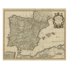
Beautiful Old Map of Spain and Portugal With Decorative Title Cartouche, ca.1740
Located in Langweer, NL
Antique map Spain titled 'L’Espagne dressée sur la Description qui en a eté faite par Rodrigo Mendez Sylva (..)'.
Beautiful map of Spain with dec...
Category
1740s Antique Netherlands Maps
Materials
Paper
$1,142 Sale Price
20% Off
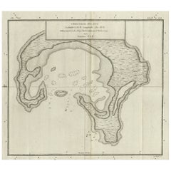
Antique Map of Christmas Island by Cook, C.1781
Located in Langweer, NL
Antique map Kiribati titled 'Christmas Island (..)'. Antique map of Christmas Island, also known as Kiritimati. Originates from an edition of Cook's Voyages.
Artists and Engravers: Engraved by Duff.
Condition: Good, some wear and age-related toning. Please study image carefully.
Date: c.1781
Overall size: 27.5 x 21.5 cm.
Image size: 20.5 x 18 cm.
We sell original antique maps to collectors, historians, educators and interior decorators all over the world. Our collection includes a wide range of authentic antique maps...
Category
18th Century Antique Netherlands Maps
Materials
Paper
$228 Sale Price
20% Off
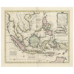
Rare Antique Map of the Dutch East Indies 'Indonesia', 1774
Located in Langweer, NL
Rare decorative engraved map of the Dutch East Indies, or nowadays Indonesia.
Title (in old Dutch): NIEUWE EN NAUKEURIGE KAART DER OOST-INDISCHE ...
Category
1770s Antique Netherlands Maps
Materials
Paper
$1,142 Sale Price
20% Off
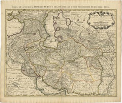
1742 Antique Map of the Persian Empire with Detailed Borders and Cartouche
Located in Langweer, NL
Title: 1742 Covens & Mortier Map of the Persian Empire by Guillaume De L'Isle
This remarkable 1742 map, "Carte de Perse," was originally designed by Guillaume De L'Isle, a preemin...
Category
1740s Dutch Antique Netherlands Maps
Materials
Paper
$1,541 Sale Price
20% Off
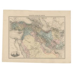
Antique Map of the Turkish Empire and Persia, circa 1890
By J. Migeon
Located in Langweer, NL
Antique map Turkish Emprie titled 'Turquie d'Asie et Perse'. Beautiful map depicting the Turkish Empire and Persia. With vignette depicting Damascus. This map originates from 'Nouvel...
Category
19th Century Antique Netherlands Maps
Materials
Paper
$361 Sale Price
20% Off
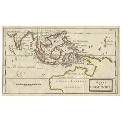
Map of The East Indies with the Route of Capt. William Dampier's Voyage, 1698
Located in Langweer, NL
Antique map titled 'Kaart van Oost Indie'.
Old map of the East Indies. It shows the routes of Captain William Dampier's voyage throughout the regio...
Category
1690s Antique Netherlands Maps
Materials
Paper
$694 Sale Price
20% Off
1856 Engraved Map of Switzerland with Cantonal Borders by Stülpnagel
Located in Langweer, NL
1856 Engraved Map of Switzerland with Cantonal Borders by Stülpnagel
This finely detailed antique map of Switzerland, titled "Die Schweiz," was published in 1856 by the renowned Ger...
Category
Mid-19th Century German Antique Netherlands Maps
Materials
Paper
1856 France and Switzerland Map with Mountain Profiles
Located in Langweer, NL
1856 Map of France and Switzerland with Paris Inset by Stülpnagel
This finely detailed antique map of France and Switzerland was published in 1856 by the esteemed German cartographe...
Category
Mid-19th Century German Antique Netherlands Maps
Materials
Paper
Antique Map of Britain & Ireland with North Sea Detail – 1856 Stülpnagel
Located in Langweer, NL
Antique Map of the British Isles & North Sea by Stülpnagel, 1856
This beautifully detailed 1856 map titled *"Die Britischen Inseln und die Nord-See"* was drawn by F. von Stülpnagel ...
Category
Mid-19th Century German Antique Netherlands Maps
Materials
Paper
Antique Map of Australia, New Zealand & Polynesia – Stülpnagel, 1857
Located in Langweer, NL
Antique Map of Australia, New Zealand & Polynesia – Stülpnagel, 1857
Description:
This finely engraved and delicately hand-colored map titled "Australien und Polynesien in Mercator'...
Category
Mid-19th Century German Antique Netherlands Maps
Materials
Paper
Antique Map of the Caribbean & Central America – West Indies, 1857
Located in Langweer, NL
Antique Map of the Caribbean & Central America – West Indies, 1857
This finely engraved and hand-colored map titled "West-Indien und Centro-America" was published in 1857 by Justus ...
Category
Mid-19th Century German Antique Netherlands Maps
Materials
Paper
1857 Engraved Map of Russia, Finland & Scandinavia – Historic Print
Located in Langweer, NL
Antique Map of European Russia Including Scandinavia – Stieler Atlas 1857
This antique map titled "Europäisches Russland nebst Schweden und Norwegen" (European Russia together with ...
Category
Mid-19th Century German Antique Netherlands Maps
Materials
Paper
Antique Map of West and Central Africa – Stieler Atlas, Justus Perthes 1857
Located in Langweer, NL
Antique Map of West and Central Africa – Stieler Atlas, Justus Perthes 1857
This finely engraved map titled "Mittel- und Nord-Africa. Westl. Theil." was published in 1857 by Justus ...
Category
Mid-19th Century German Antique Netherlands Maps
Materials
Paper
Colorfull Antique Map of Africa with Algeria Inset – Stieler Atlas 1858
Located in Langweer, NL
Antique Map of Africa with Algeria Inset – Stieler Atlas 1858
This antique map of Africa, engraved by F. von Stülpnagel and published by Justus Perthes in 1858, is a finely detailed...
Category
Mid-19th Century German Antique Netherlands Maps
Materials
Paper
World Map in Two Hemispheres: Eastern & Western - 1802 Tardieu Atlas
Located in Langweer, NL
Antique Map with Title: "Mappemonde en Deux Hémisphères"
Publication Details:
- **Atlas Title:** Nouvel Atlas Universel de Géographie Ancienne et Moderne
- **Purpose:** For the Nouvelle Edition de la Géographie de Guthrie
- **Mapmakers:** P. F. Tardieu, with contributions from various geographical works
- **Publisher:** Chez Hyacinthe Langlois, Libraire, quai des Augustins, n° 45
- **Year:** An X - 1802 (French Revolutionary Calendar)
**Geographical Scope:**
This antique map illustrates a double-hemisphere world map, showing both the Eastern (Old World) and Western (New World) hemispheres. It provides a global perspective, capturing the entire known world as understood in the early 19th century.
**Map Features:**
- **Hemispheres Displayed:**
- **Western Hemisphere:** The Americas, labeled as "Hémisphère Occidental ou Nouveau Monde...
Category
Early 1800s Antique Netherlands Maps
Materials
Paper
$437 Sale Price
20% Off
Antique Print of the New Garden Room of Hall Barn by Campbell, 1725
Located in Langweer, NL
Antique print titled 'Section of a New Garden Room at Hall Barn (..)'. Plan of the garden room for Hall Barn, near Beaconsfield, Buckinghamshire. This print originates from 'Vitruvius Britannicus...
Category
18th Century Antique Netherlands Maps
Materials
Paper
$170 Sale Price
20% Off
Antique Map of Denmark 1858 – Includes Iceland & Copenhagen Plan
Located in Langweer, NL
Antique Map of Denmark 1858 – Includes Iceland & Copenhagen Plan
This finely detailed antique map of Denmark was published in 1858 by Justus Perthes in Gotha, as part of the renowne...
Category
Mid-19th Century German Antique Netherlands Maps
Materials
Paper
Antique Map of Scandinavia 1857 – Sweden & Norway in Detail
Located in Langweer, NL
Sweden and Norway Map – Stieler Atlas Engraving, 1858
This fine antique map titled Schweden und Norwegen (Sweden and Norway) was published in 1858 by Justus Perthes of Gotha and dra...
Category
Mid-19th Century German Antique Netherlands Maps
Materials
Paper
Antique Map of the Empire of the Great Mogul
Located in Langweer, NL
Antique map titled 'Magni Mogolis Imperium'. This map depicts the Empire of the Great Mogul in northern India including the region from Iran to Burma. The Indus and Ganges Rivers are...
Category
Late 17th Century Antique Netherlands Maps
Materials
Paper
$913 Sale Price
20% Off
Pl. 50 Antique Print of Decorative Art in the Renaissance Period by Racinet, 1869
Located in Langweer, NL
Old print of decorative art in the Renaissance period. This print originates from 'L'Ornement polychrome'. A beautiful work containing about 2000 patterns of all the styles of Art ol...
Category
19th Century Antique Netherlands Maps
Materials
Paper
$69 Sale Price
20% Off
Teruel 1901: A Cartographic Depiction of Heritage and Natural Splendor in Spain
Located in Langweer, NL
Original antique map of Teruel in Spain, with highlighted gold. The province of Teruel, located in the region of Aragon in eastern Spain, is known for several unique features:
1. **Mudejar Architecture**: Teruel is famous for its well-preserved Mudejar architecture, which is a style that is a fusion of Christian and Islamic design. This includes notable examples like the Tower of El Salvador and the Teruel Cathedral, both of which are UNESCO World Heritage sites.
2. **Dinopolis**: It hosts Dinópolis, a paleontological park that is one of the largest of its kind in Europe, featuring dinosaur fossils and interactive...
Category
Early 1900s Antique Netherlands Maps
Materials
Paper
$285 Sale Price
20% Off
Antique Map of South America by De la Harpe '1780'
Located in Langweer, NL
Antique map titled 'Carte de l'Amerique Méridionale'. Original antique map of South America. Note the 'Laguna de Xarayes' is illustrated as the source of the Paraguay river. The laguna is now known as Pantanal, world's largest tropical wetland area. This map orginates from 'Abrégé de l'histoire générale des Voyages' by J.F. de la Harpe.
Category
Late 18th Century Antique Netherlands Maps
Materials
Paper
$475 Sale Price
20% Off
Rare Original Map of New Amsterdam (New York) – “Restitutio”, ca. 1674 –
Located in Dronten, NL
An exceptionally rare and original 17th-century engraving of New Amsterdam, now New York City, published by the renowned Amsterdam cartographer Carel (Carolus) Allard around 1674. Kn...
Category
17th Century Dutch Antique Netherlands Maps
Materials
Paper
1710 Edward Wells Detailed Ancient Greece Map with Ornate Cartouche
Located in Langweer, NL
"1710 Edward Wells Map of Ancient Greece: A New Map of Antient Greece, Tirana, Morea, Ilyricum, Sicily, and Macedonia"
Description of the Map:
This map, produced around 1710 and en...
Category
1710s Antique Netherlands Maps
Materials
Paper
$732 Sale Price
20% Off
Antique Map of the Pyrenees Orientales 'France' by V. Levasseur, 1854
By Victor Levasseur
Located in Langweer, NL
Antique map titled 'Dépt. des Pyréneés Orles'. Map of the French department of Pyrenees Orientales, France. This area is a well-known wine producing region. A wide variety of wines c...
Category
Mid-19th Century Antique Netherlands Maps
Materials
Paper
$190 Sale Price
20% Off
17th-Century Map of Sri Lanka (Ceylon) by Mercator & van den Keere, 1630
Located in Langweer, NL
This captivating 17th-century map titled "Zeilan ou Ceilon Isle" (Ceylon/Sri Lanka) was engraved by Petrus Kaerius (van den Keere) and published in Mercator's "Atlas Minor," edited b...
Category
1630s Antique Netherlands Maps
Materials
Paper
1862 Johnson's Map of the Vicinity of Richmond & Peninsular Campaign, Virginia
Located in Langweer, NL
Title: 1862 Johnson's Map of the Vicinity of Richmond & Peninsular Campaign, Virginia
Description: This 1862 map titled "Johnson's Map of the Vicinity of Richmond and Peninsular Cam...
Category
1860s Antique Netherlands Maps
Materials
Paper
$304 Sale Price
20% Off
Authentic 1644 Janssonius Map of the Champagne Region (Campania) in France
Located in Langweer, NL
"1644 Janssonius Map of Champagne, France"
This meticulously detailed original antique map, engraved in 1644, is a work by the esteemed cartographer Johannes Janssonius. It depicts the historic province of Champagne, situated in the northeastern part of France. The map is notable for its high level of detail, with meticulously drawn boundaries, city markers, and river courses. It features a beautifully rendered cartouche adorned with the provincial coat of arms, flanked by classical figures, indicative of the region's cultural significance. In the lower left corner, a pair of cherubs are engaged in surveying, symbolizing the scientific endeavor of cartography. The elaborate compass rose and the scale bar further complement the map's utility and artistic merit.
Champagne is renowned globally for its viticultural heritage, being the birthplace of the eponymous Champagne sparkling wine. The region's unique terroir, with its chalky soil and cool climate, is ideal for the production of the grapes used in champagne-making. The historical significance of Champagne extends beyond winemaking; it has been the site of pivotal battles and royal coronations, which shaped the course of French and European history. This map is not only a navigational tool but also a snapshot of a region rich in history and tradition, an artifact that embodies the geographical and cultural prestige of Champagne.
This description provides a detailed visual and contextual presentation of the map, suitable for a catalog entry, emphasizing both its artistic features and the historical and cultural importance of the Champagne region.
THE WINE AREAS:
The Champagne region, known primarily for its production of the sparkling wine that bears its name, encompasses several important cities and sites of historical and cultural significance:
1. **Reims**: Often considered the unofficial capital of the Champagne region, Reims is renowned for its grand cathedral, Notre-Dame de Reims, where French kings were historically crowned...
Category
1640s Antique Netherlands Maps
Materials
Paper
$609 Sale Price
20% Off
Map of the Holy Land Divided into 12 Tribes, the Travels of Jesus Christ, 1700
Located in Langweer, NL
Antique map titled 'Het Heylige Land verdeeld in de Twaalf Stammen Israels (..)'.
Decorative and detailed map of the Holy Land divided into 12 Tribes, sh...
Category
Early 1700s Antique Netherlands Maps
Materials
Paper
$466 Sale Price
20% Off
1882 Map of Argentina, La Plata, Chile, Paraguay, Uruguay, and Patagonia
Located in Langweer, NL
This 1882 map, published as part of the 'Comprehensive Atlas and Geography of the World' by Blackie and Son, provides an intricate depiction of Argentina, La Plata, Chile, Paraguay, ...
Category
1880s Antique Netherlands Maps
Materials
Paper
A 19th-Century Map of West Canada with Niagara Falls and Indigenous Scenes
Located in Langweer, NL
Decorative 19th-Century Map of West Canada with Niagara Falls and Indigenous Scenes
This detailed 19th-century map of West Canada, drawn and engraved by J. Rapkin and published by...
Category
1850s Antique Netherlands Maps
Materials
Paper
Rare Antique Bible Map of Southern Europe by A. Schut, 1743
Located in Langweer, NL
Antique map of the Mediterranean and a large part of Europe, illustrating the voyage of St. Paul to Rome. This map originates from ‘Biblia Sacra, dat is, de H. Schriftuer van het Oud...
Category
Mid-18th Century Antique Netherlands Maps
Materials
Paper
$519 Sale Price
32% Off
Antique Map of the Middle East with a Large Arabia, 1799
Located in Langweer, NL
Antique map titled 'Perse, Turquie Asiatique et Arabie (..)'. Map of the Middle East with a large Arabia, extending from the Black Sea to the In...
Category
Late 18th Century Antique Netherlands Maps
Materials
Paper
$1,418 Sale Price
20% Off
Antique Plan of the City of Bayonne, France
Located in Langweer, NL
Antique map titled 'Plan de Bayonne'. Original old plan of the city of Bayonne, France. This map originates from 'Le Petit Atlas Maritime (..)' by J.N. Bellin. Published 1764.
Be...
Category
Mid-18th Century Antique Netherlands Maps
Materials
Paper
$323 Sale Price
20% Off
Antique Map of Greece by Allard (c.1698)
Located in Langweer, NL
Antique map titled 'Hellas seu Graecia Universa' Detailed map of Greece, with Crete, the Aegean Islands, and part of Turkey. With two cartouches, compass rose and scale. Carolus Alla...
Category
Late 17th Century Antique Netherlands Maps
Materials
Paper
$932 Sale Price
20% Off
Rare Map of Rama or Ramma 'Ramallah?' in Palestine or the Holy Land, ca.1730
Located in Langweer, NL
Antique map titled 'Rama'.
This maps shows a view of Ramma (Ramallah?) in Palestine or the Holy Land. With Dutch legend. Source unknown, to be determined.
Artists and Engraver...
Category
1730s Antique Netherlands Maps
Materials
Paper
$266 Sale Price
20% Off
Old Print of a Countrywoman of Upper Carniola, Slovenia, Eastern Europe, 1804
Located in Langweer, NL
Old print of a countrywoman of Upper Carniola, Slovenia.
This print originates from 'The Costume of the Hereditary States of the House of Austria' by William Miller.
Artists and engravers: Engraved by William Ellis.
Category
Early 1800s Antique Netherlands Maps
Materials
Paper
$266 Sale Price
20% Off
1802 Map of Australasia and the South Pacific - European Exploration Routes
Located in Langweer, NL
1802 Johann Walch Map of Australasia and the South Pacific - European Exploration Routes
This 1802 map by Johann Walch provides a highly detailed view of Australasia and the South P...
Category
Early 1800s Antique Netherlands Maps
Materials
Paper
$1,713 Sale Price
20% Off
Pl. 89 Antique Print of Decorative Art in the 18th Century by Racinet, 1869
Located in Langweer, NL
Old print of decorative art in the 18th century. This print originates from 'L'Ornement polychrome'. A beautiful work containing about 2000 patterns of all the styles of Art old and ...
Category
19th Century Antique Netherlands Maps
Materials
Paper
Original Engraving of the West Indies, Gulf of Mexico, Antilles, Caribbean, 1780
Located in Langweer, NL
Rigobert Bonne and G. Raynal's 1780 map of the West Indies, Gulf of Mexico, Antilles, and the Caribbean stands as a remarkable cartographic piece, offering a detailed and expansive v...
Category
Late 18th Century Antique Netherlands Maps
Materials
Paper
$371 Sale Price
20% Off
1882 Detailed Map of South America showing Political and Geographical Features
Located in Langweer, NL
This 1882 map of South America, published by Blackie and Son as part of the 'Comprehensive Atlas and Geography of the World,' showcases the continent in remarkable detail. It provide...
Category
1880s Antique Netherlands Maps
Materials
Paper
Antique Map of Venezuela by Montanus, 1671
By Arnoldus Montanus
Located in Langweer, NL
Antique map titled 'Venezuela cum parte Australi Novae Andalusiae'. The map extends from Coquibocoa to the Orinoque River, centered on Bariquicemento and Cape de Curiacao. Large cart...
Category
Mid-17th Century English Antique Netherlands Maps
Materials
Paper
$571 Sale Price
20% Off
Old Map of Ancient Spain and Portugal – Hispania Antiqua Featuring Roman Cities
Located in Langweer, NL
Title: "Hispania Antiqua in Tres Praecipuas Partes Divisa: Tarraconensem, Lusitaniam, et Bæticam" by Robert de Vaugondy, 18th Century
Description:
This beautifully detailed map titl...
Category
Late 18th Century Antique Netherlands Maps
Materials
Paper
$628 Sale Price
20% Off
Old Map of the Spice Islands, Moluccas by Bellin, Published in 1771
Located in Langweer, NL
Title: 1771 Jacques-Nicolas Bellin Map of the Moluccas, the Spice Islands of Indonesia
Description: This finely engraved eighteenth-century map, titled Carte Particulière des Is...
Category
1770s Antique Netherlands Maps
Materials
Paper
$190 Sale Price
20% Off
Historical Large Map of Kyoto, Japan (1905) - Published by Kobayashi
Located in Langweer, NL
Old map of Kyoto, Japan. Published by Kobayashi, 1905.
This is an old map of Kyoto, Japan, published by Kobayashi in 1905. The map showcases a detailed layout of Kyoto during the ea...
Category
Early 20th Century Netherlands Maps
Materials
Paper
$1,665 Sale Price
20% Off
Colonial Cartography: The Banda Islands - the Epicenter of the Spice Trade, 1818
Located in Langweer, NL
Antique map titled 'Kaart der Bandasche Eilanden' with a view titled 'Gezigt van het Eiland Neira en de Goening Api'. Rare and attractive map of the Banda Islands with a large view of Banda Neira and Gunung Api. One of 12 maps from ‘Atlas van Overzeesche bezittingen’ (Atlas of Oversea Possessions) by J.S. van den Bosch. J.S. van den Bosch (1780 – 1844), Major General, Knight of the 3rd Class of the Military William Order.
It is a rare and visually appealing representation of the Banda Islands, a group of ten small volcanic islands in the Banda Sea, part of present-day Indonesia.
The map is one of twelve from the “Atlas van Overzeesche bezittingen” (Atlas of Overseas Possessions) by J.S. van den Bosch, who was a Major General and a Knight of the Military William Order. Johannes van den Bosch, who lived from 1780 to 1844, had a significant military and administrative career, including serving as Governor-General of the Dutch East Indies. His works and collections are reflective of the Dutch colonial interest and administration in the region.
The Banda Islands, depicted in this map, are particularly famous for being the sole source of nutmeg and mace before the mid-19th century. Nutmeg was highly valued in European cuisine, as a preservative, and as a medicine. The monopoly on these spices made the Banda Islands extremely important during the age of spice trade, which also led to intense colonial competition and conflict, notably between the Dutch and the British.
The map itself provides a detailed topographical representation of the Banda Islands, possibly with depth soundings and navigational hazards indicated, which would have been essential information for the ships of the Dutch East India Company and other seafarers. The large view of Banda Neira and Gunung Api (literally "Fire Mountain...
Category
Early 19th Century Antique Netherlands Maps
Materials
Paper
$799 Sale Price
20% Off
Biblical Journeys: Apostle Paul's Voyages and the Israelites' Exodus, 1856
Located in Langweer, NL
Two maps in matting board. From the Pictorial Bible Atlas, published in 1856.
Title for Map 1: Voyages and Travels of Apostle Paul – Illustrated Antique...
Category
1850s Antique Netherlands Maps
Materials
Paper
Large Antique Map of France by De Wit, c.1680
By Frederick de Wit
Located in Langweer, NL
Antique map titled 'Accuratissima Galliae Tabula vulgo Royaume de France'. Detailed map of France. Shows provinces, cities, rivers etc.
Artists and Engravers: Frederick de Wit (1...
Category
17th Century Antique Netherlands Maps
Materials
Paper
$618 Sale Price
20% Off
Antique Map of Alexander the Great's Empire & Campaigns, de Vaugondy, 1753
Located in Langweer, NL
Antique Map of Alexander the Great's Empire & Campaigns, de Vaugondy, 1753
This rare and elegantly engraved map, titled "Antiquor Imperiorum Tabula, in qua Prae Caeteris, Macedonicu...
Category
Mid-18th Century European Antique Netherlands Maps
Materials
Paper
Large Antique Map of Texas with Panhandle & Bay Inset Maps, Colton, 1873
Located in Langweer, NL
Large Antique Map of Texas with Panhandle & Bay Inset Maps, Colton, 1873
This richly detailed and visually striking antique map of Texas was pub...
Category
1870s Antique Netherlands Maps
Materials
Paper
Colorful 1915 Road Map of Oregon with Portland Inset & Index – Geographical Pub.
Located in Langweer, NL
Colorful 1915 Road Map of Oregon with Portland Inset & Index – Geographical Pub.
Description:
This vibrant and information-rich folding map of Oregon, titled "Premier Series Oregon"...
Category
1910s Vintage Netherlands Maps
Materials
Paper
Pl. 91 Antique Print of Decorative Art in the 18th Century by Racinet, 1869
Located in Langweer, NL
Old print of decorative art in the 18th century. This print originates from 'L'Ornement polychrome'. A beautiful work containing about 2000 patterns of all the styles of Art old and ...
Category
19th Century Antique Netherlands Maps
Materials
Paper
1667 Melchior Tavernier Map of the Patriarchate of Constantinople – Black Sea
Located in Langweer, NL
This 1667 map titled "Patriarchatus Constantinopolitani Geographica Descriptio" was crafted by renowned French cartographer Melchior Tavernier, who was a prominent map engraver during the 17th century. This rare and historically significant map focuses on the territories under the ecclesiastical jurisdiction of the Patriarchate of Constantinople, one of the most important centers of the Eastern Orthodox Church.
It covers regions around the Black Sea (Pontus Euxinus), parts of Greece, and adjacent areas in Asia Minor and the Balkans, which were historically vital during the Byzantine and Ottoman Empires. The map is filled with ancient place names, making it a valuable resource for both historical and cartographic enthusiasts.
Key Features:
- Antique ecclesiastical map illustrating the influence of the Orthodox Patriarchate of Constantinople in the 17th century.
- Features beautifully detailed ancient coastlines, rivers, and terrains, providing a comprehensive geographical view of the region.
- Rich with historic place names - like Byzantium, Nicomedia, Nicaea, Cyzicus, Bithynia, Pontus, Macedonia, and Thrace - that date back to the classical era, offering insights into the ancient geography of the eastern Mediterranean.
- A finely engraved strapwork cartouche in the lower right corner with Baroque-style decoration, featuring two putti (cherubic figures) – a hallmark of 17th-century map art.
- The map extends to include the Mediterranean Sea (Mare Mediterraneum) to the south and the Black Sea to the north, highlighting its ecclesiastical and geopolitical significance.
- Original hand coloring may still be present, enhancing the decorative appeal for collectors of antique maps.
This rare map offers a unique perspective on the religious influence and historical geography of the Eastern Mediterranean during the late 17th century. It would appeal to collectors interested in:
- **Byzantine history**
- **Ottoman Empire**
- **Eastern Orthodox Church**
- **Antique cartography...
Category
1660s French Antique Netherlands Maps
Materials
Paper
$649 Sale Price
30% Off
Original 17th-Century Antique Map of Nanjing Province, China – by Blaeu
Located in Langweer, NL
Title: 17th-Century Antique Map of Nanjing Province, China – "Nanking sive Kiangnan" by Blaeu, with Decorative Details
Description: This captivating 17th-century map of Nanjing Pr...
Category
1650s Antique Netherlands Maps
Materials
Paper
18th-Century Map of the Eastern Roman Empire by Henri Chatelain, c. 1719
Located in Langweer, NL
Title: 18th-Century Map of the Eastern Roman Empire by Henri Chatelain, c. 1719
Description: This intricately detailed map, titled *Nouvelle Carte pour Servir à l'Histoire de l'Empi...
Category
1710s Antique Netherlands Maps
Materials
Paper
Map of Cape Verde and the Mouth of the River Niger by Coronelli, 1691
Located in Langweer, NL
Map of Cape Verde and the Mouth of the River Niger by Coronelli, 1691
This finely engraved map, titled "Bocche del Fiume Negro et Isole di Capo Verde," was created in 1691 by Vincen...
Category
Late 17th Century Antique Netherlands Maps
Materials
Paper
Antique Map of Warwickshire by Speed, c.1614
Located in Langweer, NL
Antique map titled 'The Counti of Warwick (..)'. Map of Warwickshire, England. Includes inset town plans of Warwick and Coventry. This map originates from 'Theatre of Great Britaine'...
Category
17th Century Antique Netherlands Maps
Materials
Paper
$447 Sale Price
20% Off
Map of Ancient Gaul & Roman Provinces: Early 19th Century - 1802 Tardieu Atlas
Located in Langweer, NL
### Antique Map Description
**Title:** La Gaule et Ses Grandes Dignités Romaines au Temps des Empereurs
**Publication Details:**
- **Atlas Title:** Nouvel Atlas Universel de Géogra...
Category
Early 1800s Antique Netherlands Maps
Materials
Paper
Decorative Antique Print of Garden Architecture by Van Laar, 1802
Located in Langweer, NL
Untitled print of garden architecture. It shows garden buildings, benches and garden decor. This print originates from 'Magazijn van tuin-sieraden'...
Category
19th Century Antique Netherlands Maps
Materials
Paper
$133 Sale Price
20% Off
Newfoundland and St. Pierre & Miquelon: Early 19th Century French Map
Located in Langweer, NL
The map is titled "Île et Banc de Terre-Neuve avec les Îles St. Pierre et Miquelon", depicting Newfoundland and the French islands of St. Pierre and Miquelon. It is from the Petit Atlas National series.
Features:
- The map is divided into two sections:
1. The left side shows Newfoundland (Terre-Neuve) and its surrounding waters, including important locations such as the Île du Cap Breton and Grand Bank fishing areas.
2. The right side focuses on St. Pierre and Miquelon, a French overseas territory near Newfoundland.
- Hand-colored outlines mark the territories, with color distinctions for the different islands.
- Administrative divisions and key geographic features, such as capes, bays, and towns, are labeled on the map.
Here the text translated:
Here is the translation of the text from French to English:
**NOTICE.**
The islands of St. Pierre and Miquelon, the only remaining French possession in this part of America since the loss of Canada, are located a few miles from the southern coast of Newfoundland, which belongs to the English. Their relatively fertile soil is broken up by hills that give rise to small streams.
**Grande Miquelon**, the northernmost of the two islands, has a circumference of about 9 to 10 leagues. It offers a convenient port for fishing boats.
**Petite Miquelon**, to the south of Grande Miquelon, has a circumference of about 6 leagues. It is well-watered and well-wooded.
**Saint Pierre**, to the south-southwest of the two other islands, presents a somewhat similar appearance but is devoid of trees. Although it is the smallest of the three islands, it is the most important due to the size of its harbor, which can accommodate 30 to 40 ships of various sizes, and because of its favorable coastline for the preparation, preservation, and export of cod. On its eastern coast, at the bottom of a beautiful bay, lies the town of Saint Pierre, the only notable settlement on the three islands. It is the residence of a naval officer who, under the title of Commander, governs the colony.
The permanent population is about 2,000 souls, of which 800 reside in Saint Pierre. However, sailors come to the islands from the coasts of Brittany and Normandy during the cod fishing season on the Grand Banks of Newfoundland and the Gulf of St. Lawrence. In 1833, it was estimated that about 14,000 sailors were employed in this fishery, and the purchase of supplies required by the colony was valued at over one million francs.
---
This translation reflects the original notice describing the French islands of St. Pierre and Miquelon, with details about their geography, population, and economic activities related to the fishing industry.
Historical Context:
- This map is part of a collection meant to showcase France's overseas colonies and territories, including the small but significant St. Pierre and Miquelon, which has been under French control for centuries and was a critical fishing and trading hub.
- The Petit Atlas National series was typically published in the early 19th century, and this map likely dates from the same period, around 1815–1820.
People searching for maps or information about Newfoundland and the French islands of St. Pierre and Miquelon use the following keywords:
1. Newfoundland map...
Category
1820s Antique Netherlands Maps
Materials
Paper
$152 Sale Price
20% Off
Recently Viewed
View AllMore Ways To Browse
Flemish Cabinets 17th Century
Fox Figurine
Fox Hunt Plate
French Art Deco Rosewood Buffet
French Bulldog Gold
French Louis Xvi Enfilade
French Provincial Antique Dresser
French Provincial Furniture Antique Dresser
French Zinc Bar
Frog Figurine
Georgian Mahogany Longcase Clock
German Folding Trolley
Glass And Brass Fireplace Screen
Glass Nude Woman Sculpture
Glass Parrots
Glass Poodle
Gothic Corbel
Granite Pagoda
