Netherlands Maps
to
4,202
5,075
5,466
195
5,074
1
2,798
1,969
307
1
179
6
68
3
3
3
2
5,069
8
6
2
1
341
113
80
73
36
5,075
5,075
5,075
104
59
20
14
13
Item Ships From: Netherlands
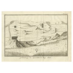
Topographic Map of Mount Sinai Summit – Antique Engraving by Pococke, 1776
Located in Langweer, NL
Topographic Map of Mount Sinai Summit – Antique Engraving by Pococke, 1776
This antique engraving offers a rare and detailed view of the summit plateau of Mount Sinai, titled "Grond...
Category
Late 18th Century Dutch Antique Netherlands Maps
Materials
Paper
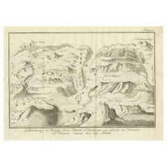
Mount Sinai & St. Catherine's – Antique Map of the Sinai Monasteries, 1776
Located in Langweer, NL
Mount Sinai & St. Catherine's – Antique Map of the Sinai Monasteries, 1776
Description:
This finely engraved antique map depicts the mountainous region of the Sinai Peninsula, focus...
Category
Late 18th Century Dutch Antique Netherlands Maps
Materials
Paper
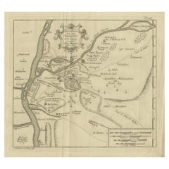
Cairo, Babylon & Heliopolis – Antique Map of Ancient Memphis Region, 1776
Located in Langweer, NL
Cairo, Babylon & Heliopolis – Antique Map of Ancient Memphis Region, 1776
This antique map is an 18th-century Dutch engraving showing the region around ancient Memphis, Egypt, inclu...
Category
Late 18th Century Dutch Antique Netherlands Maps
Materials
Paper
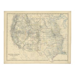
1874 Map of Western United States – Detailed Atlas by Keith Johnston
Located in Langweer, NL
1874 Map of Western United States by Keith Johnston – Detailed Atlas
This is an original antique map titled “United States of North America (Western States)” by Alexander Keith John...
Category
1870s Scottish Antique Netherlands Maps
Materials
Paper
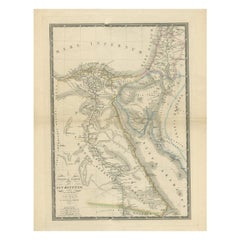
Antique Map of Ancient Egypt Also Depicting the Nile River and Red Sea, 1845
Located in Langweer, NL
Antique map Egypt titled 'General Karte von Alt Aegypten von A.H. Brué'. Large map of Egypt also depicting the Nile river and Red Sea. Source unknown...
Category
19th Century Antique Netherlands Maps
Materials
Paper
$237 Sale Price
20% Off
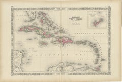
1864 Johnson's Map of the West Indies and Bermuda
Located in Langweer, NL
Title: 1864 Johnson's Map of the West Indies and Bermuda
Description: This is an 1864 map titled "Johnson's West Indies," published by Johnson and Ward. The map provides a detailed ...
Category
1860s Antique Netherlands Maps
Materials
Paper
$304 Sale Price
20% Off
Antique Map of the Antilles and Central America – 1872
Located in Langweer, NL
Title: Antique Map of the Antilles and Central America – 1872
Description:
This finely detailed antique map, titled Antilles et Amérique Centrale, was published in 1872 under t...
Category
1870s Antique Netherlands Maps
Materials
Paper
1690 Frederick de Wit Sea Chart of Hudson Bay, Baffin Bay and Greenland
Located in Langweer, NL
Title: c. 1690 Frederick de Wit Sea Chart of Hudson Bay, Baffin Bay, and Greenland - Engraved by Romeyn de Hooghe
This striking sea chart by Frederick de Wit, titled "Septemtrionali...
Category
1690s Antique Netherlands Maps
Materials
Paper
Promised Land of Canaan – Antique Map of Israel with Biblical Scenes, van Jagen
Located in Langweer, NL
Promised Land of Canaan – Antique Map of Israel with Biblical Scenes, van Jagen
This remarkable antique map titled Het beloofde landt Canaan doorwandelt...
Category
1740s Dutch Antique Netherlands Maps
Materials
Paper
Antique Map of the Frankfurt Region by Johannes Janssonius, Hand-Colored, C.1650
Located in Langweer, NL
Antique Map of the Frankfurt Region by Johannes Janssonius circa 1650 Hand-Colored
This rare and beautifully detailed antique map titled Territorium Francofurtense depicts the reg...
Category
1650s Antique Netherlands Maps
Materials
Paper
Ancient World Map of Europe, Asia & Northern Africa with Ancient Names, 1725
Located in Langweer, NL
Antique map titled 'Geografische Kaarte van de Oude Weereld (..).'
Original antique map of the ancient world depicting Europe, Asia, and northern Africa with ancient place names....
Category
1720s Antique Netherlands Maps
Materials
Paper
$1,116 Sale Price
24% Off
Antique Map of the Netherlands by Petri, 1852
Located in Langweer, NL
Antique map titled 'Het Koninkrijk der Nederlanden'. Map of the Netherlands, with coats of arms of all Dutch provinces. Also includes a small inset map of Luxembourg...
Category
19th Century Antique Netherlands Maps
Materials
Paper
$136 Sale Price
20% Off
Copper Engraving with a Panoramic View of Mexico City, 1754
Located in Langweer, NL
Antique print titled 'Nouveau Mexico'.
Copper engraving with a panoramic view of Mexico city. This print originates from 'Histoire générale des voyages, ou nouvelle collection de...
Category
1750s Antique Netherlands Maps
Materials
Paper
$523 Sale Price
20% Off
Map of Kingdoms of Castile, León, Galicia, Asturias, Biscay and Navarre in Spain
Located in Langweer, NL
Antique map titled 'Partie Septentrionale de la Couronne de Castille (..)'. Decorative and highly detailed map of Northwestern Spain, including Gallicia...
Category
Mid-18th Century Antique Netherlands Maps
Materials
Paper
$628 Sale Price
20% Off
Engraving of St. Gallen and its Monastery, from Civitates Orbis Terrarum (1575)
Located in Langweer, NL
Description of the Engraving: Braun & Hogenberg’s "S. Galli Opp. et Monasterium Heluetiorum" from Civitates Orbis Terrarum (1575)
This is an original, hand-colored copper engraving ...
Category
16th Century Antique Netherlands Maps
Materials
Paper
$656 Sale Price
20% Off
Antique Map of Denmark by F. de Wit, 1680
Located in Langweer, NL
Antique map titled 'Dania Regnum'. Large, attractive map of Denmark, Sleschwig-Holstein and southern Sweden. Good detail throughout. Embellished with a title cartouche with the Danis...
Category
Late 17th Century Antique Netherlands Maps
Materials
Paper
$918 Sale Price
20% Off
Antique Map of Kentucky
Located in Langweer, NL
Antique map titled 'Kentucky'. Original antique map of Kentucky, United States. This print originates from 'Encyclopaedia Britannica', Ninth E...
Category
Late 19th Century Antique Netherlands Maps
Materials
Paper
$276 Sale Price
20% Off
Antique Map of the Region of Georgia with Inset Maps of Florida and Texas
Located in Langweer, NL
Antique map of part of the United States showing Alabama, Georgia, North Carolina, South Carolina, Tennessee, Kentucky, Virginia and part of Florida. With inset maps of the southern ...
Category
Late 19th Century Antique Netherlands Maps
Materials
Paper
$523 Sale Price
50% Off
Antique Map of North America by Levasseur '1875'
Located in Langweer, NL
Antique map titled 'Carte générale de l'Amérique Septentrionale'. Large map of North America. This map originates from 'Atlas de Géographie Modern...
Category
Late 19th Century Antique Netherlands Maps
Materials
Paper
$475 Sale Price
20% Off
Asia Minor and Provinces: A Roman Empire Map from Spruner-Menke Atlas, 1880
Located in Langweer, NL
This authentic map of the 19th century, titled "PONTUS ET BITHYNIA, ASIA, LYCIA ET PAMPHYLIA, GALATIA, CAPPADOCIA, SYRIA, CRET, CYPRVS," details the regions of Asia Minor and surrounding territories during the Roman Empire.
The map is interesting for a number of reasons:
1. **Comprehensive Detail**: It covers a wide range of regions that played significant roles in ancient history, from the cultural crossroads of Asia Minor to the strategic island of Cyprus.
2. **Geographical Information**: It includes detailed topographical features such as mountain ranges, river systems, and coastlines, illustrating the complex geography that influenced ancient political and military strategies.
3. **Historical Context**: The map reflects the Roman administrative organization of these provinces, which were critical for trade, military campaigns, and cultural exchange within the empire.
4. **Inset Maps**: The presence of inset maps for Lycia, Ionia, and Asia Minor provides focused details on regions that had substantial historical significance due to their cultural heritage and geopolitical importance.
5. **Latin Labels**: The use of Latin in the map’s labels and descriptions adds to the historical authenticity and would have served as a scholarly reference for 19th-century academics.
6. **Ancient Civilizations**: This area was the cradle of numerous ancient civilizations and the map likely includes cities of ancient Greek...
Category
1880s Antique Netherlands Maps
Materials
Paper
$352 Sale Price
20% Off
Old World Map Featuring Captain Cook's Exploration Routes and Polar Views, 1787
Located in Langweer, NL
1786 World Map with Polar Projections - "Globo Terrestre" by Giovanni Maria Cassini
This 1786 map titled "Globo Terrestre" by Giovanni Maria Cassini offers a fascinating and detai...
Category
1860s Antique Netherlands Maps
Materials
Paper
$1,808 Sale Price
20% Off
Original Antique Miniature Map of Persia, Published, ca.1601
Located in Langweer, NL
Antique miniature map titled 'Persia'. Small map of Persia published in the Epitome, or pocket-edition of the "Theatrum Orbis Terrarum".
Artists and e...
Category
Early 1600s Antique Netherlands Maps
Materials
Paper
$513 Sale Price
20% Off
Map of French Colonies in the Americas: St. Martin, French Guiana and St. Pierre
Located in Langweer, NL
This is an intricately detailed map from 1852 titled *Colonies Françaises en Amérique*, depicting several key French colonies in the Americas.
The map focuses on regions such as Fr...
Category
1850s Antique Netherlands Maps
Materials
Paper
$180 Sale Price
20% Off
Colored wall map of the WORLD
By Chambon
Located in ZWIJNDRECHT, NL
“Mappe Monde, contenant les Parties Connues du Globe Terrestre”
CHAMBON, Gobert-Denis (France, 17.. - 1781)
Paris, Longchamps et Janvier, 1754
Size H. 115 x W. 145 cm.
Gobert-Denis Chambon made copper engraving after the work of Guillaume De L’Isle, published in 1754 by Jean Janvier and S.G. Longschamps.
A huge wall map of the world in two hemispheres printed on two sheets, depicting the Eastern and Western hemispheres supported by two male figures, decorated at the bottom right and left with two celestial hemispheres (boreal and southern) and at the bottom in the middle with an armillary sphere, in addition.
This map is most notable for its depiction of the Sea of Japan labeled "Mer de Corée" and of "Mer de L'Ouest" or Sea of the West - a great sea, easily the size of the Mediterranean, to flow from the then-known Strait of Juan de Fuca...
Category
Mid-18th Century French French Provincial Antique Netherlands Maps
Materials
Wood, Paper
$28,554 Sale Price
20% Off
Large Antique County Map of Suffolk, England
Located in Langweer, NL
Antique map titled 'A Map of Suffolk from the best Authorities'. Original old county map of Suffolk, England. Engraved by John Cary. Originates from 'New British Atlas' by John Stock...
Category
Early 19th Century Antique Netherlands Maps
Materials
Paper
$247 Sale Price
20% Off
1882 Map of Australia and New Zealand with Regional and Geographical Features
Located in Langweer, NL
This 1882 map of Australia and New Zealand, published by Blackie and Son as part of the 'Comprehensive Atlas and Geography of the World,' provides a detailed and insightful look at t...
Category
1880s Antique Netherlands Maps
Materials
Paper
Antique Map of Ohio, with Inset Maps of Cleveland, Columbus and Cincinnati
Located in Langweer, NL
Antique map titled 'Ohio'. Original antique map of Ohio, United States. With inset maps of Cleveland, Columbus and Cincinnati. This print originates from 'Encyclopaedia Britannica', ...
Category
Late 19th Century Antique Netherlands Maps
Materials
Paper
$276 Sale Price
20% Off
Antique Map of the Eastern Hemisphere by Valk & Chenk '1708'
Located in Langweer, NL
Antique map titled 'Hemispherium Orbis Antiqui, Cumzonis Circulis, Et Sity populorum Diverso'. Decorative example of Andreas Cellarius's map of the Eastern Hemisphere, illustrating with climatic zones ranging from Frigida Borealis to Torrida, with planetary details superimposed. The elaborate border includes fine scrollwork, numerous putti, and additional diagrams showing armillary spheres and climatic zones. Andreas Cellarius was born in 1596 in Neuhausen and educated in Heidelberg. He emigrated to Holland in the early 17th century and 1637 moved to Hoorn, where he became the rector of the Latin School. Cellarius' best known work is his Harmonia Macrocosmica, first issued in 1660 by Jan Jansson, as a supplement to Jansson's Atlas Novus. The work consists of a series of Celestial Charts...
Category
Early 18th Century Dutch Antique Netherlands Maps
Materials
Paper
$4,015 Sale Price
25% Off
Old Print of Anjer or Anyer, Coastal Town in Banten, West Java, Indonesia, 1844
Located in Langweer, NL
Antique print titled 'Anjer - Anjer'. View of Anyer (also known as Anjer or Angier), a coastal town in Banten, formerly West Java, Indonesia. This print originates from 'Gezigten uit...
Category
1840s Antique Netherlands Maps
Materials
Paper
$428 Sale Price
20% Off
Gipuzkoa 1902: A Cartographic Snapshot of the Basque Coastline and Highlands
Located in Langweer, NL
The map showcases the province of Gipuzkoa (also known as Guipúzcoa in Spanish), which is part of the autonomous community of the Basque Country in northern Spain, as of the year 190...
Category
Early 1900s Antique Netherlands Maps
Materials
Paper
$342 Sale Price
20% Off
Antique Map of France at the Beginning of the 17th Century by Zannoni, 1765
By G. A. Rizzi-zannoni
Located in Langweer, NL
Antique map France titled 'Carte pour servir à intelligence de l'Histoire de France (..)'. Beautiful old map of France. This map originates from 'At...
Category
18th Century Antique Netherlands Maps
Materials
Paper
$151 Sale Price
20% Off
Antique Map of Scandinavia: Norway, Sweden and Denmark
Located in Langweer, NL
Antique map titled 'Suède, Norwège & Danemark'. Attractive map of Scandinavia, with Sweden, Norway and Denmark. With an inset map of Iceland and th...
Category
Mid-19th Century Antique Netherlands Maps
Materials
Paper
$114 Sale Price
20% Off
Southwestern U.S. Immigration Map for Texas, Arkansas, and Louisiana, 1881
Located in Langweer, NL
Southwestern U.S. Immigration Map - Published by The Southwestern Immigration Company, Austin, Texas. Detailed Railroad Routes and Regional Statistics for Texas, Arkansas, and Louisi...
Category
1880s Antique Netherlands Maps
Materials
Paper
$981 Sale Price
25% Off
Renaissance Mapping of Sumatra: Featuring Singapore in Münster’s Woodcut, c.1590
Located in Langweer, NL
Description: Antique map titled 'Sumatra ein grosse Insel / so von den alten Geographen Taprobana genennt worden'. Beautiful map of Sumatra and the southern part of Malaysia, with Si...
Category
16th Century Antique Netherlands Maps
Materials
Paper
$1,380 Sale Price
20% Off
Large Antique County Map of Leicestershire, England, with Outline Coloring
Located in Langweer, NL
Antique map titled 'A Map of Leicestershire from the best Authorities'. Original old county map of Leicestershire, England. Engraved by John Cary. Originates from 'New British Atlas'...
Category
Early 19th Century Antique Netherlands Maps
Materials
Paper
$161 Sale Price
20% Off
1864 Johnson's Map of Virginia, Delaware, and Maryland with Fort Monroe Inset
Located in Langweer, NL
Title: 1864 Johnson's Map of Virginia, Delaware, and Maryland with Fort Monroe Inset
Description: This 1864 map titled "Johnson's Virginia, Delaware, and ...
Category
1860s Antique Netherlands Maps
Materials
Paper
$285 Sale Price
20% Off
Antique Decorative Coloured Map of North America, 1882
Located in Langweer, NL
This original antique map of North America is from the Blackie & Son Atlas published in 1882. Here are several points of interest about this map:
1. **Political Borders**: The map l...
Category
1880s Antique Netherlands Maps
Materials
Paper
$237 Sale Price
20% Off
Navigational Chart of Jamaica, Cape Gracias a Dios, and the Mosquito Coast, 1775
Located in Langweer, NL
The map titled "The Island of Jamaica and Cape Gracias a Dios with the Banks (Shows Moskito Kings Party)" illustrates a significant historical period marked by shifting colonial infl...
Category
1770s Antique Netherlands Maps
Materials
Paper
$999 Sale Price
30% Off
Map of New Zealand Showing Maori Culture and Early Colonial Settlements, 1851
Located in Langweer, NL
John Tallis & Company were renowned for their ornate and detailed maps in the mid-19th century. Their works often featured elaborate borders, decorative motifs, and insets of vignett...
Category
1850s Antique Netherlands Maps
Materials
Paper
$180 Sale Price
20% Off
Antique Map of the Yenisei River in Siberia, Russia, 1768
By Prevost
Located in Langweer, NL
Antique map titled 'Carte des Bras du Jenisei (..)'. Map of the Yenisei River and surroundings, Siberia. This print originates from volume 18 of 'Histoire generale des voyages (..)' ...
Category
18th Century Antique Netherlands Maps
Materials
Paper
$266 Sale Price
20% Off
Toledo 1902: A Historical Cartographic Study of this Spanish Province
Located in Langweer, NL
The print is a historical map of the province of Toledo from 1902. It's a detailed, colored map, highlighting topographical features, such as mountain ranges and rivers, as well as i...
Category
Early 1900s Antique Netherlands Maps
Materials
Paper
$314 Sale Price
20% Off
Antique Map of the Balkans with Coat of Arms
Located in Langweer, NL
Antique map titled 'Tavola Nuova di Schiavonia'. Ruscelli's map of the Balkans, with a coat of arms. The mountains are represented, river systems are shown in detail, and cities, towns and ports denoted throughout this 16th century map. A number of islands in the Adriatic Sea are also shown. This map originates from 'Espositione & introduttioni universali di Gir. Ruscelli sopra tutta la Geografia di Tolomeo (..)' published by Girolamo Ruscelli, 1561.
Girolamo Ruscelli (1500-1566) was a cartographer, humanist, and scholar from Tuscany. Ruscelli was a prominent writer and editor in his time, writing about a wide variety of topics including the works of Giovanni Boccaccio and Francesco Petrarch, Italian language, Italian poetry, medicine, alchemy, and militia. One of his most notable works was a translation of Ptolemy...
Category
16th Century Antique Netherlands Maps
Materials
Paper
$418 Sale Price
20% Off
Antique Map of Persia, Georgia and Kazakhstan by Bonne, c.1780
Located in Langweer, NL
Antique map titled 'Carte de la Perse, de la Georgie, et de la Tartarie Independante'. Map of Persia, Georgia and Kazakhstan.
This map shows current days Georgia, Iran, Irak, Kazak...
Category
18th Century Antique Netherlands Maps
Materials
Paper
Map of the Amazon River's Course and Surrounding Regions (1743-1744)
Located in Langweer, NL
This original antique map, titled "Carte du Cours du Maragnon ou de la Grande Riviere des Amazones," illustrates the course of the Amazon River (referred to here as the Maragnon) fro...
Category
1750s Antique Netherlands Maps
Materials
Paper
$371 Sale Price
29% Off
1821 Thomson Map of Guadeloupe, Marie-Galante and Antigua in the West Indies
Located in Langweer, NL
This map, published in 1821 by John Thomson, showcases Guadeloupe, Marie-Galante, and Antigua from the *West India Islands* collection. Part of Thomson's *New General Atlas*, it prov...
Category
1820s Antique Netherlands Maps
Materials
Paper
$552 Sale Price
20% Off
Antique Print with a Plan of Kunta Kinteh Island and views of Fort James, Gambia
Located in Langweer, NL
Antique print titled 'Plan of Iames Island in the Gambia - N.E. Prospect of Iames Fort - N.N.W. Prospect of Iames Fort'. Print with a plan of Kunta Kinteh I...
Category
Mid-18th Century Antique Netherlands Maps
Materials
Paper
$209 Sale Price
20% Off
Antique Map of Warwickshire in England by Speed, c.1614
Located in Langweer, NL
Antique map titled 'The Counti of Warwick the Shire Towne and Citie of Coventre described'. Map of Warwickshire, England. Includes inset town plans of Warwic...
Category
17th Century Antique Netherlands Maps
Materials
Paper
$723 Sale Price
20% Off
Antique Map of the Northern Hemisphere by Lowry, '1852'
Located in Langweer, NL
Antique map titled 'Perspective Projection of the World on the horizon of London'. Original map of the northern hemisphere. This map originates fro...
Category
Mid-19th Century Antique Netherlands Maps
Materials
Paper
$142 Sale Price
20% Off
Striking Antique View of Kozhikode, also known as Calicut, in Kerala, India
Located in Langweer, NL
Antique print titled 'Calechut'. Wonderful, miniature copper engraving depicting Arion riding on a very cheerful looking sea monster in the important tradi...
Category
Mid-17th Century Antique Netherlands Maps
Materials
Paper
$418 Sale Price
20% Off
Antique Map of the Gulf of Mexico and Caribbean Islands by Tardieu, 1802
Located in Langweer, NL
This is an original antique map titled "Carte du Golfe du Mexique et des Isles Antilles," depicting the Gulf of Mexico and the Caribbean islands. Created by Pierre Antoine Tardieu, t...
Category
Early 1800s Antique Netherlands Maps
Materials
Paper
$533 Sale Price
20% Off
Barbados Island at the Height of the Plantation Economy, Circa 1759
Located in Langweer, NL
Carte de l'Isle de la Barbade by Jacques-Nicolas Bellin (1703–1772), Circa 1759
This rare antique map of Barbados, titled Carte de l'Isle de la Barbad...
Category
1750s Antique Netherlands Maps
Materials
Paper
$418 Sale Price
20% Off
Gateway to the Steppes: Tallis's Masterpiece Map of Indepent Tartary, 1851
Located in Langweer, NL
The map is of "Independent Tartary," a historical region in Central Asia that covered parts of what are now Kazakhstan, Uzbekistan, Turkmenistan, and surrounding areas. The map was p...
Category
1850s Antique Netherlands Maps
Materials
Paper
$314 Sale Price
20% Off
Large Antique Map of Ceylon, Sri Lanka
Located in Langweer, NL
Antique map titled 'Nieuwe Kaart van het Eyland Ceylon opgestelt door Francois Valentyn'. Beautiful map of Sri Lanka. Originates from 'Oud en Nieuw Oost ...
Category
Mid-18th Century Antique Netherlands Maps
Materials
Paper
$751 Sale Price
20% Off
Set of Four Original Antique Maps of Asia by Bolton & Seale, circa 1770
Located in Langweer, NL
Set of four antique maps of Asia:
1) Asia plate 6, Part of China, Tibet and Tartary
2) Asia plate 2, Japan, Corea, the Monguls and part of China
3) As...
Category
Late 18th Century Antique Netherlands Maps
Materials
Paper
$7,471 Sale Price / set
20% Off
1874 Map of the United States with Territorial Boundaries
Located in Langweer, NL
Title: 1874 Map of the United States with Territorial Boundaries
Description: This is an 1874 map titled "Map of the United States," showcasing the country during a period of rapid ...
Category
1870s Antique Netherlands Maps
Materials
Paper
$247 Sale Price
20% Off
Original Hand-coloured Antique Map of Pomerania by Sanson '1684'
By Nicolas Sanson
Located in Langweer, NL
Antique map titled 'Le Duche de Pomeranie divise en ses Principales Parties (..)'. Large map of Pomerania. Pomerania is a historical region on the southern shore of the Baltic Sea in...
Category
Late 17th Century Antique Netherlands Maps
Materials
Paper
$904 Sale Price
20% Off
Turkey in Asia: Biblical Regions and the Holy Land from The Royal Atlas (1856)
Located in Langweer, NL
This antique map titled "Turkey in Asia (Biblical Regions) The Holy Land and its Borders" comes from "The Royal Illustrated Atlas", which was published in 1856 by A. Fullarton & Co. ...
Category
Mid-19th Century Antique Netherlands Maps
Materials
Paper
$628 Sale Price
20% Off
Oriental Realms: A Detailed Map of Persia, Afghanistan, and Beloochistan, 1882
Located in Langweer, NL
This historical map from the 1882 atlas published by Blackie & Son is a comprehensive depiction of Persia (modern-day Iran), Afghanistan, and Baluchistan (the region that includes pa...
Category
1880s Antique Netherlands Maps
Materials
Paper
$295 Sale Price
20% Off
Plan of Pondicherry Fortifications and Attacks, France, c.1750
Located in Langweer, NL
Plan of Pondicherry Fortifications and Attacks, France, c.1750
This finely engraved map depicts the fortified city of Pondicherry, titled "Plan de Pondichéry et de ses attaques." It...
Category
Mid-18th Century French Antique Netherlands Maps
Materials
Paper
Antique Hand-Coloured Map of North and South America, ca.1765
Located in Langweer, NL
Description: Antique map titled 'Nieuwe Kaart van Amerika.' Attractive map of North and South America, the western part of Africa and south west Europe. Source unknown, to be determi...
Category
1760s Antique Netherlands Maps
Materials
Paper
$1,189 Sale Price
20% Off
Recently Viewed
View AllMore Ways To Browse
Flemish Cabinets 17th Century
Fox Figurine
Fox Hunt Plate
French Art Deco Rosewood Buffet
French Bulldog Gold
French Louis Xvi Enfilade
French Provincial Antique Dresser
French Provincial Furniture Antique Dresser
French Zinc Bar
Frog Figurine
Georgian Mahogany Longcase Clock
German Folding Trolley
Glass And Brass Fireplace Screen
Glass Nude Woman Sculpture
Glass Parrots
Glass Poodle
Gothic Corbel
Granite Pagoda
