Netherlands Maps
to
4,202
5,075
5,466
195
5,074
1
2,798
1,969
307
1
179
6
68
3
3
3
2
5,069
8
6
2
1
341
113
80
73
36
5,075
5,075
5,075
104
59
20
14
13
Item Ships From: Netherlands
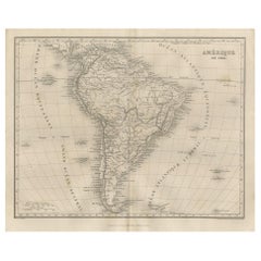
Antique Map of South America by Balbi '1847'
Located in Langweer, NL
Antique map titled 'Amérique du sud'. Original antique map of South America. This map originates from 'Abrégé de Géographie (..)' by Adrie...
Category
Mid-19th Century Antique Netherlands Maps
Materials
Paper
$190 Sale Price
20% Off
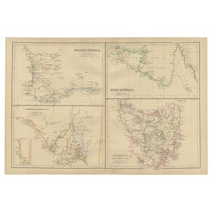
Antique Map of West, South, North Australia and Tasmania by W. G. Blackie, 1859
Located in Langweer, NL
Antique map titled 'Western Australia, South Australia, North Australia and Tasmania'. Original antique map of Western Australia, South Australia, North Australia and Tasmania. This ...
Category
Mid-19th Century Antique Netherlands Maps
Materials
Paper
$237 Sale Price
20% Off
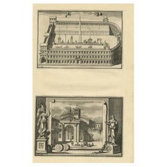
Circus Flaminius (..), Anonymous, 1704
Located in Langweer, NL
Antique print, titled: 'Circus Flaminius (?)' - This original old antique print shows a reconstruction of Circus Flaminius, a large, circular area in ancient Rome, located in the sou...
Category
18th Century Antique Netherlands Maps
Materials
Paper
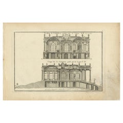
Pl. 1 Antique Print of Pavillon La Bouëxière by Le Rouge, c.1785
Located in Langweer, NL
Antique print titled 'Pavillon de Labossiere (..)'. Copper engraving of pavillon La Bouëxière. This print originates from 'Jardins Anglo-Chinois à la Mode' by Georg Louis le Rouge. A...
Category
18th Century Antique Netherlands Maps
Materials
Paper
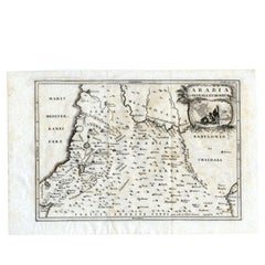
Antique Map of the Arabian Desert by Cellarius, 1731
Located in Langweer, NL
Antique map titled 'Arabia Petraea et Deserta.' Arabian desert with present day Israel, Jordania, Iraq. With decorative cartouche showing dromedaries. T...
Category
18th Century Antique Netherlands Maps
Materials
Paper
$166 Sale Price
20% Off
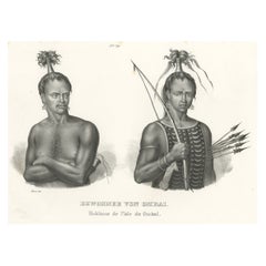
Antique Print of Warriors from Ombai Island, Alor, Archipel, Indonesia, ca.1845
Located in Langweer, NL
Antique print titled 'Bewohner von Ombai, Habitans de l'isle de Ombai'.
This print depicts natives from Ombai, Indonesia. Originates from 'Naturgeschichte und Abbildungen des Men...
Category
1840s Antique Netherlands Maps
Materials
Paper
$323 Sale Price
20% Off
Great Antique Bird's-Eye View Plan of Brielle by Blaeu in The Netherlands, 1649
Located in Langweer, NL
Antique print, titled: 'Briela.'
Bird's-eye view plan of Brielle in The Netherlands. With key to locations and coats of arms. Text in Dutch on verso. This plan originates from the famous city Atlas: 'Toneel der Steeden' published by Joan Blaeu...
Category
1640s Antique Netherlands Maps
Materials
Paper
$1,189 Sale Price
20% Off
Inside View of Magdalen Chapel in the Cowgate in Edinburgh. Scotland, 1790
Located in Langweer, NL
Antique print titled 'Inside View of Magdalen Chapel, near Winchester, from the West'. Inside view of the Magdalen Chapel taken from the Chancel from the West. Artists and Engravers:...
Category
18th Century Antique Netherlands Maps
Materials
Paper
The Holy Sepulchre '..', Basire, 1795
Located in Langweer, NL
Antique print titled 'The Holy Sepulchre at Northwold in the County of Norfolk'. Antique print depicting the Holy Sepulchre, Northwold. Artists and Engr...
Category
18th Century Antique Netherlands Maps
Materials
Paper
$142 Sale Price
20% Off
Antique Print of the Stowe House in Stowe, Buckinghamshire, England, c.1785
Located in Langweer, NL
Antique print titled 'Plan actuel du Chateau de Stowe'.
Copper engraving showing a plan and elements of the Stowe House.
Stowe House is a grade I l...
Category
18th Century Antique Netherlands Maps
Materials
Paper
$542 Sale Price
20% Off
Antique Map of the Black Sea and Surroundings by Sharpe, 1849
Located in Langweer, NL
Antique map titled 'Russia on the Euxine'. Old map of the Black Sea and the surrounding (Russia). This map originates from 'Sharpe's Corresponding Atlas (..)' by J. Sharpe. Artists and Engravers: Published by Chapman and Hall...
Category
19th Century Antique Netherlands Maps
Materials
Paper
$90 Sale Price
20% Off
Antique Map of the Moluques Islands, Part of Indonesia, circa 1750
Located in Langweer, NL
Map of the Moluques (also known as the Moluccas, Moluccan Islands or simply Maluku). Depicts the islands of Herij, Ternate, Tidor, Pottebackers, Timor, Machian and Bachian.
Category
Mid-18th Century Antique Netherlands Maps
Materials
Paper
$199 Sale Price
20% Off
Antique Map of the Province of Zeeland by Veelwaard, C.1840
Located in Langweer, NL
Antique map titled 'Kaart van Zeeland (..).' Uncommon map showing the province of Zeeland in the Netherlands. Source unkown, to be determined. Published circa 1840.
Artists and E...
Category
19th Century Antique Netherlands Maps
Materials
Paper
$118 Sale Price
20% Off
Pavillon Tuilerie – French Architecture Lithograph from La Brique, 1889 Expo
Located in Langweer, NL
Pavillon Tuilerie – French Architectural Lithograph from La Brique, Exposition 1889
This richly detailed architectural lithograph presents the front elevation of the Pavillon de la ...
Category
20th Century French Netherlands Maps
Materials
Paper
Antique Map of the Region of Bavaria and Austria by Tirion, c.1740
Located in Langweer, NL
Antique map titled 'Carte des environs de Batavia - Kaart van de Buitenstreken van Batavia'. Map of the Batavia area (Jakarta) in Indonesia. With cartouche, scale and compass rose. P...
Category
18th Century Antique Netherlands Maps
Materials
Paper
$212 Sale Price
20% Off
Antique Map of Gabon, Angola and the Congo Region in Africa c.1680
Located in Langweer, NL
Antique map titled 'Royaume de Congo'.
Map of Gabon, the Congo and Angola from Cape Lopez and Sao Tomé to approximately the border with present-day Namibia. The map is fully engrav...
Category
17th Century Antique Netherlands Maps
Materials
Paper
Antique Map of Picardy, Aroits and French Flanders by Bonne, c.1780
Located in Langweer, NL
Antique map titled 'Carte des Gouvernements de Flandre Francoise, d'Artois, de Picardie et du Boulenois.' An attractive example of Rigobert Bonne's 1771 decorative map of the French regions of Picardy, Artois, and French Flanders. Covers the region in full from the English Chanel to Normandy. A large decorative title cartouche appears in the upper right. Source unknown, to be determined. Artists and Engravers: Rigobert Bonne (1727-1795 ) was one of the most important cartographers of the late 18th century. In 1773 he succeeded Jacques Bellin as Royal Cartographer to France in the office of the Hydrographer at the Depôt de la Marine. Working in his official capacity Bonne compiled some of the most detailed and accurate maps of the period. Bonne's work represents an important step in the evolution of the cartographic ideology away from the decorative work of the 17th and early 18th century towards a more detail oriented and practical aesthetic. With regard to the rendering of terrain Bonne maps...
Category
18th Century Antique Netherlands Maps
Materials
Paper
$166 Sale Price
20% Off
Antique Map of the Coast of Africa and the Cape Verde Islands, ca.1680
Located in Langweer, NL
Antique map Africa titled 'Isles du Cap Verd Coste et Pays des Negres'.
Antique map of the coast of Africa and the Cape Verde islands.
Artis...
Category
1680s Antique Netherlands Maps
Materials
Paper
$333 Sale Price
20% Off
Antique Map of Haute-Garonne ‘France’ by V. Levasseur, 1854
Located in Langweer, NL
Antique map titled 'Dépt. de la Hte. Garonne'. Map of the French department of Haute-Garonne, France. This area of France produces the delicious but lesser known Buzet wines, and ten...
Category
Mid-19th Century Antique Netherlands Maps
Materials
Paper
$171 Sale Price
20% Off
Old Map of Indian Ocean & Sumatra, Java, Borneo, India, Arabia, Africa, c.1783
Located in Langweer, NL
Antique map titled 'Carte des Declinaisons et Inclinaisons de L'Aiguille Aimantée redigée d'après la table des observations Magnetiques faites par les Voyageurs depuis l'Année 1775'....
Category
1780s Antique Netherlands Maps
Materials
Paper
$1,332 Sale Price
20% Off
Antique Map of the City of Leeuwarden by Christyn, 1785
Located in Langweer, NL
Antique map titled 'La Ville de Lewarde'. Old map of the city of Leeuwarden, Friesland. Originates from 'Les Délices des Pays-Bas' by J.B. Christyn.
Artists and Engravers: Author:...
Category
18th Century Antique Netherlands Maps
Materials
Paper
$108 Sale Price
20% Off
Cary’s Map of the Low Countries – Antique 1813 British Map
Located in Langweer, NL
Antique map of the Netherlands titled 'A New Map of the United Provinces comprehending Holland, Zealand, Utrecht, Gelders, Over Yssel, Friesland and Groningen (..)'. Scarce re-editio...
Category
19th Century English Antique Netherlands Maps
Materials
Paper
Antique Map of the Banda Islands in Indonesia by Valentijn, 1726
Located in Langweer, NL
Antique map Indonesia titled 'Kaart der Zuyd-Wester Eylanden van Banda'. Map of the islands in the southwestern part of the Banda Sea including ...
Category
Mid-18th Century Dutch Antique Netherlands Maps
Materials
Paper
$475 Sale Price
20% Off
Antique Map of the Coast of Northwest Africa by Dien, 1820
Located in Langweer, NL
Antique map Africa titled 'Partie Occidentale de l'Ancien Continent, depuis Lisbonne jusquá la Riviere de Sierra Leona'. Detailed map of Coastal Nor...
Category
19th Century Antique Netherlands Maps
Materials
Paper
$117 Sale Price
20% Off
Antique Map of the Seven United Provinces of Holland by Seutter, 1727
Located in Langweer, NL
Antique map titled ‘Belgium Foederatum Auctius Et Emendatius‘. Important antique map of the Seven United Provinces of Holland with inset views of the East Indies, the province of Lim...
Category
18th Century Antique Netherlands Maps
Materials
Paper
$689 Sale Price
20% Off
Antique Map of South America ‘North’ by A.K. Johnston, 1865
Located in Langweer, NL
Antique map titled 'South America, Northern Sheet'. Depicting Guiana, Ecuador, Brazil, Bolivia the Amazones and more. This map originates from the ‘Royal Atlas of Modern Geography’ b...
Category
Mid-19th Century Antique Netherlands Maps
Materials
Paper
$261 Sale Price
20% Off
Antique Map of the Danube River by Homann, c.1720
By Homann Heirs
Located in Langweer, NL
Antique map titled 'Danubii Fluminis (..)'. Regional map of the Donau river, Shows the Danube river from Belgrade in Serbia, along the border between Roma...
Category
18th Century Antique Netherlands Maps
Materials
Paper
$880 Sale Price
20% Off
Antique Print of Decorative Art in the Renaissance Period by Racinet, 186
Located in Langweer, NL
Old print of decorative art in the Renaissance period. This print originates from 'L'Ornement polychrome'. A beautiful work containing about 2000 patterns of all the styles of Art ol...
Category
19th Century Antique Netherlands Maps
Materials
Paper
1889 Decorative Brickwork Patterns – Gallerie des Machines, Chabat c.1900
Located in Langweer, NL
1889 Decorative Brickwork Patterns – Gallerie des Machines, Chabat c.1900
This antique architectural print presents a series of decorative brick and tile floor patterns from the Gal...
Category
20th Century French Netherlands Maps
Materials
Paper
Antique Map of Germany of German in Roman Times, c.1660
Located in Langweer, NL
Antique map Germany titled 'Germaniae Veteris Typus'. Antique map probably by Blaeu or based on an earlier state by W. Blaeu.
Minor differences shown in the cartouches. Top left ha...
Category
17th Century Antique Netherlands Maps
Materials
Paper
$808 Sale Price
20% Off
Pl. XII Villa a Houlgate, Chabat, c.1900
Located in Langweer, NL
Antique print titled 'Villa a Houlgate Mr. E. Papinot Architecte'. This print depicts the design of a villa in France. Originates from 'La Brique et La Terre Cuite' by P. Chabat. Art...
Category
20th Century Netherlands Maps
Materials
Paper
$118 Sale Price
20% Off
Original Old Map of South East England Incl London, Oxford, Cambridge, Etc, 1633
Located in Langweer, NL
Antique map titled 'Warwicum, Northhamtonia, Huntingdonia, Cantabrigia, Suffolcia, Oxonium, Buckinghamia, Befordia, Harfordia, Essexia, Berceria, Middlesexia, Southhatonia, Surria, Catiu & Southsexia'.
Old map of south east England. Includes London, Salisbury, Oxford, Cambridge, Leicester and Norwich and the Isle of Wight. Originates from the 1633 German edition of the Mercator-Hondius Atlas Major, published by Henricus Hondius and Jan Jansson under the title: 'Atlas: das ist Abbildung der gantzen Welt, mit allen darin begriffenen Laendern und Provintzen: sonderlich von Teutschland, Franckreich, Niderland, Ost und West Indien: mit Beschreibung der selben.'
Artists and engravers: Gerard Mercator (1512 - 1594) originally a student of philosophy was one of the most renowned cosmographers and geographers of the 16th century, as well as an accomplished scientific instrument maker. He is most famous for introducing Mercators Projection, a system which allowed navigators to plot the same constant compass bearing on a flat map.
Category
1630s Antique Netherlands Maps
Materials
Paper
$1,094 Sale Price / item
20% Off
Encoloured Engraving of Cliff Kaloiero or Caloiero Island, Panaia, Greece, 1688
Located in Langweer, NL
Antique print Greece titled 'De Klip van Kaloiero'. Old print of the Island Kaloiero or Panaia, Greece. This print originates from 'Nauwkeurige Be...
Category
17th Century Antique Netherlands Maps
Materials
Paper
$275 Sale Price
20% Off
Antique Map of Northwest Europe by Kiepert, c.1870
Located in Langweer, NL
Antique map titled 'Germanisches Nordwest-Europa'. Old map of North-West Europe depicting the United Kingdom, Ireland, the Netherlands, Germany, Scandinavia and surroundings. This ma...
Category
19th Century Antique Netherlands Maps
Materials
Paper
$128 Sale Price
20% Off
Antique Map of the Netherlands in 1530 by Mees, 1852
Located in Langweer, NL
Antique map titled 'Noord-Nederland in 1530. De laatste tijden der Grafelijke Regering'. Map of the Netherlands in 1530. This map originates from 'Historische Atlas van Noord-Nederla...
Category
19th Century Antique Netherlands Maps
Materials
Paper
$121 Sale Price
20% Off
Antique Map of the Island Java, Indonesia, c.1650
Located in Langweer, NL
Antique map titled 'Insulae Iavae cum parte insularum Boreno Sumatrae (..)'.
Beautiful map of the island of Java and part of Borneo, Bali, Madura and Sumatra. With decorative carto...
Category
17th Century Antique Netherlands Maps
Materials
Paper
$3,093 Sale Price
20% Off
Old Print with a View of Saint Petersburg, Russia, 1887
Located in Langweer, NL
Description: Antique print titled 'Birds-Eye View of St. Petersburg'.
Old print with a view of Saint Petersburg, Russia. Originates from 'Voyages and Travels'.
Artists and En...
Category
1880s Antique Netherlands Maps
Materials
Paper
$247 Sale Price
20% Off
Antique Map of France by Janssonius, c.1650
Located in Langweer, NL
Antique map titled 'Gallia Vetus'. Beautiful map of France based on Caesar's De Bello Gallico. In the columns to the left and right important tribes and people are described.
Art...
Category
17th Century Antique Netherlands Maps
Materials
Paper
$499 Sale Price
20% Off
Antique Map of the County of Hainaut by Jaillot, 1692
Located in Langweer, NL
Antique map titled 'Le Comté de Haynaut divisé en Chateliensis, Balliages, Prevoste's (..)'. Large map of the county of Hainaut (France) with its most important cities, Mons (Bergen)...
Category
17th Century Antique Netherlands Maps
Materials
Paper
$212 Sale Price
20% Off
Antique Map of the Region of Lyon by Janssonius, 1657
By Johannes Janssonius
Located in Langweer, NL
Antique map of France titled 'La Principaute de Dombes'. Detailed map of the area above Lyon. This map originates from 'Atlas Novus, Sive Theatrum Orbis Orbis Terrarum: In quo Gallia...
Category
17th Century Antique Netherlands Maps
Materials
Paper
$393 Sale Price
20% Off
Antique Map of the Netherlands in 1560 by Mees, 1853
Located in Langweer, NL
Antique map titled 'Noord-Nederland in 1560. Kerkelijke verdeeling, na de oprigting der nieuwe bisdommen'. Map of the Netherlands in 1560. This map originates from 'Historische Atlas...
Category
19th Century Antique Netherlands Maps
Materials
Paper
$121 Sale Price
20% Off
Antique Map of Japan by J.N. Bellin, 1752
Located in Langweer, NL
Bellin's wonderfully detailed map of Japan from the atlas of Prevost d'Exiles' influential collection of travel narratives, Histoire Generale des Voyages. Considered the best general...
Category
Mid-18th Century Antique Netherlands Maps
Materials
Paper
$437 Sale Price
20% Off
Antique Map of South America by Scherer, c.1700
By Thomas Kitchin
Located in Langweer, NL
Antique map of part of South America. Two maps on a single sheet, each depicting nearly the same area. On close examination there are slight differences in the rivers, lakes and moun...
Category
18th Century Antique Netherlands Maps
Materials
Paper
$142 Sale Price
20% Off
Antique Map of the Alsace region and Nova Zembla by Scherer, c.1700
Located in Langweer, NL
Antique map titled 'Chorographia Alsatiae.' Map of the Alsace region and Nova Zembla, printed for Scherer's 'Atlas Novus' (1702-1710). Scherer's 'Atlas Novus' forms an important mile...
Category
18th Century Antique Netherlands Maps
Materials
Paper
$142 Sale Price
20% Off
Antique Map of the Buton Strait by Philippe, 1787
Located in Langweer, NL
Antique map titled 'Carte du Détroit de Bouton'. Map of the Buton Strait between Paula Buton and Celebes, Indonesia. This map originates from 'World atlas for the study of geography ...
Category
18th Century Antique Netherlands Maps
Materials
Paper
$114 Sale Price
20% Off
Antique Map of Southern Norway by Janssonius, c.1650
Located in Langweer, NL
"Antique map titled 'Nova et Accurata Tabula Episcopatuum Stavangriensis et Asloiensis'. Old map of the southern part of Norway, it covers the region around Bergen. Decorated with ma...
Category
17th Century Antique Netherlands Maps
Materials
Paper
$717 Sale Price
20% Off
Antique Map of Southeast Asia by Walker, c.1845
Located in Langweer, NL
"Untitled map of southeast Asia. This map depicts India, Indonesia, Australia and surrounding regions. Also depicts a large part of the Indian Ocean. Artists and Engravers: Engraved ...
Category
19th Century Antique Netherlands Maps
Materials
Paper
$69 Sale Price
20% Off
Herculaneum Monuments, 1762: Bayardi's Engraving Plate 61
Located in Langweer, NL
Antique print originating from 'Le Antichita di Ercolano Esposte'. A vast survey of the bronzes, statues, wall-paintings, and monuments of Herculaneum. This monumental work was the f...
Category
18th Century Antique Netherlands Maps
Materials
Paper
Antique Print of the Mansion House in London, England, by Woolfe, c.1770
Located in Langweer, NL
Antique print titled 'Section of the Mansion House'.
Old engraving of the Mansion House, London. This print originates from 'Vitruvius Britannicus...
Category
18th Century Antique Netherlands Maps
Materials
Paper
Antique Folding Map of Kyoto, Japan, 1920
Located in Langweer, NL
Antique folding map of Kyoto, Japan. On the verso of this map photos of buildings, other structures and informative text can be found.
Category
20th Century Netherlands Maps
Materials
Paper
Antique Map of the County Ferwerderadeel, Friesland, The Netherlands, 1868
Located in Langweer, NL
Antique map titled 'Provincie Friesland - Gemeente Ferwerderadeel'. Map of the township of Ferwerderadeel including Ferwerd, Blija and many other villages. This map originates from '...
Category
19th Century Antique Netherlands Maps
Materials
Paper
$152 Sale Price
20% Off
Antique Map of The Bay of D'Estaing located on the Russian island Sakhalin, 1798
Located in Langweer, NL
Antique map titled 'Plan of La Baie d'Estaing'.
This map shows the bay of D'Estaing located on the Russian island of Sakhalin. La Perouse was selected b...
Category
1790s Antique Netherlands Maps
Materials
Paper
$342 Sale Price
20% Off
Large Wall Map of Europe by George Philip & Son, circa 1920
Located in Langweer, NL
Antique map titled 'Philips' New Commercial Map of Europe'. Very large wall map of Europe including the North African coast and Turkey. Decorative bord...
Category
Early 20th Century Netherlands Maps
Materials
Linen, Paper
$2,082 Sale Price
30% Off
Antique Map of Kyoto located in The Kansai Region on the Island of Honshu, c1740
Located in Langweer, NL
Antique map titled 'Plan de la Ville de Meaco'.
Detailed plan of Kyoto, located in the Kansai region on the island of Honshu, Japan. This map most likely originates from an edition of 'Histoire et description generale du Japon' by P.F.X. de Charlevoix.
Artists and Engravers: Jacques-Nicolas Bellin (1703-1772) was among the most important mapmakers of the eighteenth century. In 1721, at age 18, he was appointed hydrographer (chief cartographer) to the French Navy. In August 1741, he became the first Ingénieur de la Marine of the Depot des cartes...
Category
18th Century Antique Netherlands Maps
Materials
Paper
$428 Sale Price
20% Off
Detailed Regional Antique Map of Northwestern France and Catholic Belgium, 1648
Located in Langweer, NL
Antique map titled 'Picardie et les Pays Bas Catholiques (..)'.
Detailed regional map of Northwestern France and Catholic Belgium, from an early edition of Sanson's Atlas.
Art...
Category
1640s Antique Netherlands Maps
Materials
Paper
$628 Sale Price
20% Off
Antique Map of Asia by Larousse, 1897
Located in Langweer, NL
Front: 'Carte Generale de l'Asie.' (General map of Asia). Rear: 'Asie.' (Asia, scenes of Asia, nature, plants and animals, people, costume).' This rare early lithographic print origi...
Category
19th Century Antique Netherlands Maps
Materials
Paper
$71 Sale Price
20% Off
Antique Map of the Seventeen Provinces of Netherlands, Belgium, Luxembourg, 1748
By Homann Heirs
Located in Langweer, NL
Antique map titled 'Belgii Universi seu Inferioris Germaniae quam XVII Provinciae (..)'.
Map of the Seventeen Provinces after Tobias Meier, published by Homann's Heirs in 1748. The...
Category
18th Century Antique Netherlands Maps
Materials
Paper
$437 Sale Price
20% Off
Antique Map of the World with California as an Island, 1788
Located in Langweer, NL
Description: Antique map titled 'De wareld in een ronde gedaante van de Noord Pool te zien - De Wareld verbeeld in de gedaante van een hard'. This interesting composition contains three world maps on the sheet. At left is a northern projection showing all the landmasses. At right is a cordiform projection (heart-shaped). At top is a map of the world as known to the ancients. Both the polar and cordiform projections show California as an island...
Category
1780s Antique Netherlands Maps
Materials
Paper
$618 Sale Price
20% Off
Original Copper Engraving of Koroni 'or Corone', Greece, 1688
Located in Langweer, NL
Antique print titled 'Das Aussehen der Stadt und Vestung Coron von der Seit des Auffgang'.
Copper engraving of Koroni (or Corone), Greece. This print originates from 'Ruhm-belorb...
Category
1680s Antique Netherlands Maps
Materials
Paper
$247 Sale Price
20% Off
Antique Map of the Hainaut Region 'France' by F. de Wit, circa 1680
Located in Langweer, NL
Antique map titled 'Comitatus Hannoniae et Episcopatus Cambresis Descriptio'. Large map of the Hainaut region, France. Published by F. de Wit, circa 1680.
Category
Late 17th Century Antique Netherlands Maps
Materials
Paper
$547 Sale Price
20% Off
Recently Viewed
View AllMore Ways To Browse
Flemish Cabinets 17th Century
Fox Figurine
Fox Hunt Plate
French Art Deco Rosewood Buffet
French Bulldog Gold
French Louis Xvi Enfilade
French Provincial Antique Dresser
French Provincial Furniture Antique Dresser
French Zinc Bar
Frog Figurine
Georgian Mahogany Longcase Clock
German Folding Trolley
Glass And Brass Fireplace Screen
Glass Nude Woman Sculpture
Glass Parrots
Glass Poodle
Gothic Corbel
Granite Pagoda
