Entertainment Prints and Multiples

to
33
203
170
86
44
29
Overall Width
to
Overall Height
to
198
40
21
2
1
1
1
1
28
26
25
20
17
186
156
159
31
1
4
19
48
34
11
20
4
3
70
371
154
7
596
39,944
21,029
14,365
13,004
11,551
9,254
8,127
6,020
4,353
3,853
3,719
3,674
3,656
3,500
3,330
3,311
2,787
2,736
2,676
184
175
120
115
21
25
307
359
114
Art Subject: Entertainment
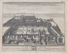
Trinity College, Cambridge engraving Pieter van der Aa after David Loggan iv
Located in London, GB
Pieter van der Aa (1659 - 1733), after David Loggan (1634 - 1692) Trinity College, Cambridge Engraving 12 x 16 cm An eighteenth-century view of Trinity College, Cambridge, engraved ...
Category

Early 18th Century Realist Prints and Multiples

Materials

Engraving

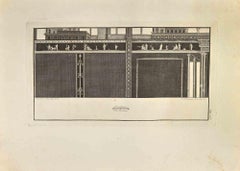
Ancient Roman Architectures - Etching Ferdinando Campana - 18th Century
Located in Roma, IT
Ancient Roman Fresco from "Antiquities of Herculaneum" is an etching on paper realized by Ferdinando Campana in the 18th Century. Signed on the ...
Category

Late 18th Century Old Masters Figurative Prints

Materials

Etching

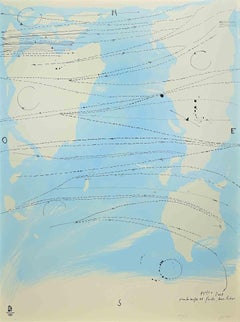
Little World Map Rome Peking - Olympic Games Beijing 2008
Located in Roma, IT
This artwork is a lithograph made by Piero Pizzi Cannella, from the portfolio The Unique Collection for the Olympic Fine Arts 2008 presented during the Olympic Games and produced in...
Category

Early 2000s Contemporary Figurative Prints

Materials

Lithograph

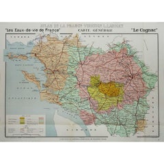
1947 original map "Les eaux-de-vie de France - Le Cognac" by Larmat
Located in PARIS, FR
The 1947 original map Atlas de la France vinicole - Les eaux-de-vie de France - Le Cognac, created by Louis Larmat and printed by Dorel in Paris, is a fascinating and detailed cartog...
Category

1940s Prints and Multiples

Materials

Lithograph, Paper

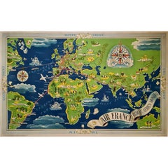
1937 Original planisphere by Lucien boucher - World map
Located in PARIS, FR
Original poster Airline Company - Map - Tourism West - Northern - Orient - Midi In 1937, Lucien Boucher, a renowned French illustrator, unveiled his masterpiece, the "Planisphère ...
Category

1930s Prints and Multiples

Materials

Linen, Lithograph, Paper

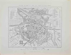
Plan of Metz and its Fortifications - Lithograph by R. Walker - 1872
Located in Roma, IT
Plan of Metz and its Fortifications is a map realized by R. Walker. Lithograph, printed in 1872 by Milliam Mackenzie, London. Good condition.
Category

1870s Modern Figurative Prints

Materials

Lithograph

Prussia (after the war of 1866) - Lithograph - 1872
Located in Roma, IT
Prussia (after the war of 1866) is a map realized by an artist during the 19th century. Lithograph, printed in 1872 by Milliam Mackenzie, London. Good condition.
Category

1870s Modern Figurative Prints

Materials

Lithograph

Battle of Vionville - Lithograph by R. Walker - 1872
Located in Roma, IT
Battle of Vionville is a map realized by R. Walker. Lithograph, printed in 1872 by Milliam Mackenzie, London. Good condition.
Category

1870s Modern Figurative Prints

Materials

Lithograph

Battle of Beaumont - Lithograph by R. Walker - 1872
Located in Roma, IT
Battle of Beaumont is a map realized by R. Walker. Lithograph, printed in 1872 by Milliam Mackenzie, London. Good condition.
Category

1870s Modern Figurative Prints

Materials

Lithograph

1947 original map "Le Cognac Bois ordinaires & Bois communs" by Larmat
Located in PARIS, FR
The 1947 original map Atlas de la France Vinicole - Les Eaux-de-vie de France - Le Cognac Bois Ordinaires & Bois Communs dits à Terroir, created by Louis Larmat and printed by Dorel ...
Category

1940s Prints and Multiples

Materials

Lithograph, Paper

Battle of Wissembourg - Lithograph by R. Walker - 1872
Located in Roma, IT
Battle of Wissembourg is a map realized by R. Walker. Lithograph, printed in 1872 by Milliam Mackenzie, London. Good condition.
Category

1870s Modern Figurative Prints

Materials

Lithograph

Battle of Saarbruck - Lithograph by R. Walker - 1872
Located in Roma, IT
Battle of Saarbruck is an map realized by R. Walker. Lithograph, printed in 1872 by Milliam Mackenzie, London. Good condition.
Category

1870s Modern Figurative Prints

Materials

Lithograph

South Germany - Lithograph - 1872
Located in Roma, IT
South Germany is a map realized by an artist during the 19th century. Lithograph, printed in 1872 by Milliam Mackenzie, London. Good condition.
Category

1870s Modern Figurative Prints

Materials

Lithograph

1947 original map "Les eaux-de-vie de France - Le Cognac fins bois" by Larmat
Located in PARIS, FR
The 1947 original map Atlas de la France Vinicole - Les Eaux-de-vie de France - Le Cognac Fins Bois, created by Louis Larmat and printed by Dorel in Paris, is an exquisite piece that...
Category

1940s Prints and Multiples

Materials

Lithograph, Paper

1848 Original map by Maillard - Plan de Paris et ses Fortifications
Located in PARIS, FR
In the realm of cartography, maps serve as both practical tools and artistic representations, encapsulating the essence of a place at a specific moment in time. The 1848 vintage map,...
Category

1840s Prints and Multiples

Materials

Paper, Linen, Lithograph

Pianta dei Giardini di S. Maria - Roma - Etching - 17th Century
Located in Roma, IT
Pianta dei Giardini di S.Maria - Roma is an original drawing in etching technique on ivory-colored paper, realized by Anonymous Artist of the 17th Century...
Category

17th Century Modern Landscape Prints

Materials

Etching

Peloponnesvs (Greece) - Etching by Johannes Janssonius - 1650s
Located in Roma, IT
Peloponnesvs is an antique map realized in 1650 by Johannes Janssonius (1588-1664). The Map is Hand-colored etching, with coeval watercoloring. Good conditions with slight foxing. ...
Category

1650s Modern Figurative Prints

Materials

Etching

1943 original map "Les vins des Côtes du Rhône - Groupe Meridional"
Located in PARIS, FR
The 1943 original map by L. Larmat from the "Atlas de la France Vinicole" series, titled "Les vins des Côtes du Rhône - Groupe Méridional", is a significant cartographic depiction of...
Category

1940s Prints and Multiples

Materials

Lithograph, Paper

Pietro Ruffo - Exhibition Poster - Offset Print after Pietro Ruffo- 2011
Located in Roma, IT
Pietro Ruffo - Exhibition Poster is an offset print realized for the exhibition by Pietro Ruffo at Galerie Di Meo in 2011. Good conditions.
Category

2010s Contemporary Figurative Prints

Materials

Paper, Offset

Map of the North of Scotland 17th century hand-coloured map by Gerardus Mercator
Located in London, GB
Gerardus Mercator (1512 - 1594) Map of the North of Scotland (1683) Engraving with later hand colouring 35 x 45 cm A fantastically characterful and detailed map engraving of the North of Scotland from 1683. The highly detailed and beautifully coloured map is inscribed to the reverse with a description of the parts of Scotland illustrated, called the 'Troisieme Table d'Escosse'. The map comes from the 1683 French edition of Gerardus Mercator's Atlas Major, which was first published in 1585. Gerardus Mercator was the Flemish father of mapmaking. He was a skilled geographer, cosmographer and cartographer and is most renowned for creating the 1569 world map based on a new projection which represented sailing courses of constant bearing (rhumb lines) as straight lines - an innovation that is still employed in today's nautical charts. Mercator was a highly influential pioneer in the history of cartography and is generally considered one of the founders of the Netherlandish school of cartography and geography. He is also widely considered the most notable figure of the school. In his own day, he was a notable maker of globes and scientific instruments. In addition, he had interests in theology, philosophy, history, mathematics and geomagnetism. He was also an accomplished engraver and calligrapher. Unlike other great scholars of the age, he travelled little and his knowledge of geography came from his library of over a thousand books and maps, from his visitors and from his vast correspondence (in six languages) with other scholars, statesmen, travellers, merchants and seamen. Mercator's early maps were in large formats suitable for wall mounting but in the second half of his life, he produced over 100 new regional maps in a smaller format suitable for binding into his Atlas of 1595. This was the first appearance of the word Atlas in reference to a book of maps...
Category

1680s Prints and Multiples

Materials

Engraving

Map of Cambridge, engraving Pieter van der Aa after David Loggan
Located in London, GB
Pieter van der Aa (1659 - 1733), after David Loggan (1634 - 1692) Map of Cambridge Engraving 12 x 16 cm An eighteenth-century view of Cambridge, engraved by Pieter van der Aa after ...
Category

Early 18th Century Realist Prints and Multiples

Materials

Engraving

Sidney Sussex, Cambridge engraving Pieter van der Aa after David Loggan
Located in London, GB
Pieter van der Aa (1659 - 1733), after David Loggan (1634 - 1692) Sidney Sussex College, Cambridge Engraving 12 x 16 cm An eighteenth-century view of Sidney Sussex, Cambridge, engra...
Category

Early 18th Century Realist Prints and Multiples

Materials

Engraving

Corpus Christi, Cambridge engraving Pieter van der Aa after David Loggan
Located in London, GB
Pieter van der Aa (1659 - 1733), after David Loggan (1634 - 1692) Corpus Christi College, Cambridge Engraving 12 x 16 cm An eighteenth-century view of Corpus Christi, Cambridge, eng...
Category

Early 18th Century Realist Prints and Multiples

Materials

Engraving

Dalmatia with the Adjacent Islands - Etching by Giovanni Cassini - 1792
Located in Roma, IT
Dalmatia with the Adjacent Islands - Plate 42 is an original old master artwork realized by Giovanni Cassini in 1792 Handcolored etching. Includes frame
Category

Late 18th Century Old Masters Figurative Prints

Materials

Etching

Library View, Cambridge engraving Pieter van der Aa after David Loggan
Located in London, GB
Pieter van der Aa (1659 - 1733), after David Loggan (1634 - 1692) The Auditoriums & Public Library, Cambridge Engraving 12 x 16 cm An eighteenth-century view of the auditoriums and ...
Category

Early 18th Century Realist Prints and Multiples

Materials

Engraving

Magdalene College, Cambridge engraving Pieter van der Aa after David Loggan
Located in London, GB
Pieter van der Aa (1659 - 1733), after David Loggan (1634 - 1692) Magdalene College, Cambridge Engraving 12 x 16 cm An eighteenth-century view of Magdalene College, Cambridge, engra...
Category

Early 18th Century Realist Prints and Multiples

Materials

Engraving

Map of Vallombrosa - Florence 1926
Located in Roma, IT
This Map of Vallombrosa is a vintage offset print realized by an anonymous author in 1926. The state of preservation of the artwork is aged with some small diffused stains and the a...
Category

1920s Modern Figurative Prints

Materials

Color

1949 original map of Belgian Congo - Belgian Ministry of Colonies
Located in PARIS, FR
This 1949 original poster titled Congo Belge, created by French illustrator Laboulais, offers a striking example of mid-20th-century colonial-era educational and promotional art. Pub...
Category

1940s Prints and Multiples

Materials

Paper, Lithograph, Linen

17th Century map of Cumberland, UK by Robert Morden
Located in Petworth, West Sussex
Robert Morden (British, circa 1650 – 1703) A map of Cumberland with hand colouring An engraving 14.1/4 x 16.5/8 in. (36.5 x 42.5 cm.)
Category

17th Century Academic Landscape Prints

Materials

Engraving

Oil Lamp - Etching by Marcantonio Iacomino - 18th Century
Located in Roma, IT
Oil Lamp is an Etching realized by Marcantonio Iacomino (1730-1806). The etching belongs to the print suite “Antiquities of Herculaneum Exposed” (original title: “Le Antichità di E...
Category

18th Century Old Masters Figurative Prints

Materials

Etching

Map of Germany - Original Etching - 1820
Located in Roma, IT
Map of Germany is an Original Etching realized by an unknown artist of 19th century in 1820. Very good condition on two sheets of white paper joined at...
Category

1820s Modern Figurative Prints

Materials

Etching

View of La Rochelle - Etching by G. Braun and F. Hogenberg - Late 16th Century
Located in Roma, IT
This View of La Rochelle (ancient name: Rochel) is an original etching realized by George Braun and Franz Hogenberg as part of the famous Series "Civitates Orbis Terrarum". The “Civ...
Category

16th Century Figurative Prints

Materials

Etching

Atrium Toscan - Origina Etchingi by G.B. Cipriani -Late 18th Century
Located in Roma, IT
Atrium Toscan is an original etching artwork realized by Giovanni Battista Cipriani in the late 18th Century. Good conditions with sme foxing. Signed on the Plate. The artwork r...
Category

Late 18th Century Modern Figurative Prints

Materials

Etching

View of 4 Ancient German Cities - Etching by G. Braun and F. Hogenberg
Located in Roma, IT
Maps is an original etching realized by G. Braun and F. Hogenberg as part of the so called "Civitates Orbis Terrarum". The “Civitates Orbis Terrarum” (Atlas of Cities of the World) ...
Category

16th Century Figurative Prints

Materials

Etching

Map of France - Etching - 1820
Located in Roma, IT
Map of France is an Original Etching realized by an unknown artist of 19th century in 1820. Very good condition on two sheets of white paper joined at t...
Category

1820s Modern Figurative Prints

Materials

Etching

Hemisphere Of The New Continent - Ancient Map by J.G. Heck - 1834.
Located in Roma, IT
Hemisphere Of The New Continent is an artwork realized around 1760 by Johann Georg Heck Original colored print. Good conditions except for yellowing of paper and tears along the m...
Category

1830s Modern Figurative Prints

Materials

Etching

Map of Russia - Etching by Marco Di Pietro - 19th Century
Located in Roma, IT
This map of Russia is an etching realized by the Italian engraver Marco Di Pietro in 19th century. The state of preservation of the artwork is excellent. The signature is engraved o...
Category

19th Century Old Masters Figurative Prints

Materials

Etching

Libra - Etching by Charles De la Haye - 18th Century
Located in Roma, IT
Libra is an original etching on paper realized by Charles De la Haye after Andrea Stech, in the 18th century. Signed in the plate on the lower. Good conditio...
Category

18th Century Modern Figurative Prints

Materials

Etching

Interior Plan - Original Etching by François Mazoit - 19th century
Located in Roma, IT
Interior Plan is an original etching realized by François Mazoit in the 19th century. Plate-signed on the lower right. Very good conditions.
Category

19th Century Modern Interior Prints

Materials

Etching

Valsavia Superiore e Inferiore - Etching by V. M. Coronelli - Late 17th century
By Vincenzo Maria Coronelli
Located in Roma, IT
Valsavia Superiore e Inferiore is a beautiful historical etching on ivory-colored paper, realized by Vincenzo Maria Coronelli (1650-1718) in the late 17th century. This interesting ...
Category

Late 17th Century Figurative Prints

Materials

Paper, Etching

Map of Lyon - Original Etching - 19th Century
Located in Roma, IT
Map of Lyon is an original etching realized by an anonymous engraver of the 19th Century. Printed in series of "France Pittoresque" at the top center. The state of preservation of ...
Category

19th Century Modern Figurative Prints

Materials

Etching

View of Leiden - Etching by G. Braun and F. Hogenberg - Late 1500
Located in Roma, IT
This map of Leida is an original etching realized by George Braun and Franz Hogenberg as part of the famous Series "Civitates Orbis Terrarum". The “Civitates Orbis Terrarum” (Atlas...
Category

16th Century Figurative Prints

Materials

Etching

Questo Silenzio (This Silence) - Etching by Renzo Biasion
Located in Roma, IT
Mariateresa Maschio, Renzo Biasion, Questo silenzio, Bologna, Editart. Original etching, hand signed and numbered. Very touching poem by Mariateresa Maschio , with an original etchi...
Category

1970s Contemporary Figurative Prints

Materials

Etching

Ancient Map of Senegal - Original Etching - 19th Century
Located in Roma, IT
Map of Senegal is an original etching realized by an anonymous engraver of the 19th Century. Printed in series of "France Pittoresque" at the top center. The state of preservation ...
Category

19th Century Figurative Prints

Materials

Etching

Map of Calcaria - From "Civitates Orbium Terrarum" by F. Hogenberg - 1575
Located in Roma, IT
"Machelen", from the collection "Civitates Orbis Terrarum", Cologne, T. Graminaeus, 1575. The “Civitates Orbis Terrarum” (Atlas of Cities of the World) was the second oldest print...
Category

16th Century Figurative Prints

Materials

Etching, Aquatint

Map of Vienne - Original Etching - 19th Century
Located in Roma, IT
Map of Vienne is an original etching realized by an anonymous engraver of the 19th Century. Belongs to the Series of "France Pittoresque" at the top center. The state of preservati...
Category

19th Century Figurative Prints

Materials

Etching

original lithograph
Located in Henderson, NV
Medium: original lithograph. This lithograph was printed in 1955 for the "Improvisations" portfolio, and published by the Artists Equity Association of New York in an edition of 2000...
Category

1950s Prints and Multiples

Materials

Lithograph

Carta delle Aspirazioni Nazionali - Vintage Offset - 20th century
Located in Roma, IT
Carta delle Aspirazioni Nazionali is an original offset, realized by an anonymous artist in the mid-20th Century. Fair conditions with riping and cutaways. The artwork is depicted ...
Category

Mid-20th Century Modern Figurative Prints

Materials

Offset

The Circus - Original Lithograph by Bruno Capacci - 1950s
Located in Roma, IT
The Circus is an original lithograph on ivory-colored paper, realized by Bruno Capacci in Mid 20th Century. The state of preservation of the artwork is excellent. Not signed. Not N...
Category

1950s Surrealist Figurative Prints

Materials

Lithograph

Map of Deux Sèvres - Original Etching - 19th Century
Located in Roma, IT
Map of Deux Sèvres is an original antique etching realized by an anonymous engraver of the 19th Century. Printed in series of "France Pittoresque" at the top center. The state of p...
Category

19th Century Modern Figurative Prints

Materials

Etching

Map of Switzerland - Etching - 19th Century
Located in Roma, IT
This map of Netherlands is an etching realized in 19th century. The state of preservation of the artwork is excellent. The signature "F.B." is engraved on the lower right. At the to...
Category

19th Century Figurative Prints

Materials

Etching

Da te Lontano - Screen Print on Acetate by E. Pouchard - 1973
Located in Roma, IT
Da te Lontano from Diecicomeleditadiduemani is a silk-screen print on acetates, realized in 1973 by the artist Ennio Pouchard (1928). Signed on plate on the lower right. Title...
Category

1970s Contemporary Figurative Prints

Materials

Screen

Ancient Map of Guyane - Original Etching - 19th Century
Located in Roma, IT
Map of Guyane is an original etching realized by an anonymous engraver of the 19th Century. Belongs to the Series of "France Pittoresque" at the top center. The state of preservati...
Category

19th Century Modern Figurative Prints

Materials

Etching

Pieter van der Aa: Map of Cambridge, after David Loggan
Located in London, GB
Pieter van der Aa (1659-1733), after David Loggan (1634–1692) Map of Cambridge 12 x 16 cm Engraving (1727) An eighteenth-century map of Cambridge eng...
Category

Early 18th Century Realist Prints and Multiples

Materials

Engraving

Map of China - Etching - 19th Century
Located in Roma, IT
This map of China is an etching realized in 19th century. The state of preservation of the artwork is excellent. At the top of the paper, the inscription...
Category

19th Century Figurative Prints

Materials

Etching

Leyden, Map from "Civitates Orbis Terrarum" - by F. Hogenberg - 1575
Located in Roma, IT
Braun G., Hogenberg F., Leyden, from the collection Civitates Orbis Terrarum, Cologne, T. Graminaeus, 1572-1617. The “Civitates Orbis Terrarum” (Atlas of Cities of the World) was th...
Category

16th Century Figurative Prints

Materials

Etching, Aquatint

Tarn et Garonne Map - Original Lithograph - 19th Century
Located in Roma, IT
Tarn et Garonne Map is an original lithograph realized by an Anonymous artist of the 19th Century. Printed in series of "France Pittoresque" at the top center. The state of preservation of the artwork is good. An interesting piece of art in this geographical map...
Category

19th Century Modern Figurative Prints

Materials

Paper, Lithograph

Berkshire 19th century map engraved by John Dower
Located in London, GB
To see more, scroll down to "More from this Seller" and below it click on "See all from this Seller." John Dower (1825 - 1901) Map of Berkshire from an actual survey made in the ye...
Category

1820s Prints and Multiples

Materials

Engraving

Li Governi di Borgogna - Ancient Map - 1777
Located in Roma, IT
Li Governi di Borgogna is an original black and white etching on paper, printed by Antonio Zatta in Venice, 1777. Original Title: Li Governi di Borgogna della Franca Contea e del Ly...
Category

1770s Modern Landscape Prints

Materials

Etching

Original poster Concentration Camps in the Soviet Union Never in France S.F.I.O.
Located in PARIS, FR
The original poster titled "Les camps de concentration en Union soviétique - jamais ça en France" ("Concentration Camps in the Soviet Union - Never in France") serves as a stark poli...
Category

1940s Prints and Multiples

Materials

Lithograph, Paper, Linen

Recently Viewed

View All