Entertainment Prints and Multiples

to
61
207
148
84
43
26
Overall Width
to
Overall Height
to
174
39
21
2
2
1
1
1
26
25
20
17
11
158
159
159
32
1
4
18
50
34
11
20
3
3
69
341
160
7
564
40,326
21,436
14,478
12,988
11,600
9,572
8,377
6,040
4,298
3,777
3,677
3,676
3,636
3,526
3,387
3,306
2,797
2,741
2,667
179
157
120
115
22
25
280
331
115
Art Subject: Entertainment
STEP LIGHTLY #3
Located in Aventura, FL
Lithograph on paper. Sheet size 19 x 12 inches. Hand signed, dated and numbered by the artist. Edition of 300. Certificate of Authenticity Included. Artwork in Excellent Conditi...
Category

Late 20th Century Contemporary Figurative Prints

Materials

Paper, Lithograph

Little World Map Rome Peking - Olympic Games Beijing 2008
Located in Roma, IT
This artwork is a lithograph realized by Piero Pizzi Cannella, from the portfolio The Unique Collection for the Olympic Fine Arts 2008 presented during the Olympic Games and produced...
Category

Early 2000s Contemporary Figurative Prints

Materials

Lithograph

Moscovie dite autrement... - Etching by Pierre Duval - 1676
Located in Roma, IT
Etching on copper with colored borders. Image dimension: 40x50.8 cm. Unusual map of European Russia extending from the Gulf of Finland south to just before the Black Sea and the Ca...
Category

1670s Modern Figurative Prints

Materials

Etching

Penisola dell'India... - Etching by Giacomo Cantelli da Vignola - 1683
Located in Roma, IT
Etching realized by Giacomo Cantelli da Vignola, and published by Giacomo dé Rossi in 1683. It is part of the Series "Mercurio Geografico or Geographical Guide to All Parts of the W...
Category

1680s Modern Figurative Prints

Materials

Etching

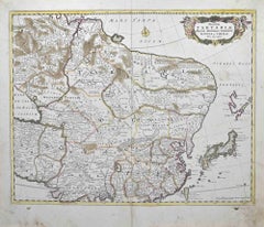
Asia Declineatio: A 17th Century Hand-colored Map of Asia by Justus Danckerts
Located in Alamo, CA
This is a scarce 17th century beautifully hand-colored copperplate engraved map of Asia entitled “Exactissima Asiae Delineatio in Praecipuas Regiones Caerterasque Partes divisa et de...
Category

Late 17th Century Old Masters Landscape Prints

Materials

Engraving

Emmanuel College, Cambridge engraving Pieter van der Aa after David Loggan ii
Located in London, GB
Pieter van der Aa (1659 - 1733), after David Loggan (1634 - 1692) Emmanuel College, Cambridge Engraving 12 x 16 cm An eighteenth-century view of Emmanuel College, Cambridge, engrave...
Category

Early 18th Century Realist Prints and Multiples

Materials

Engraving

1941 original map "Les vins de Bordeaux - Loupiac, ..." by Larmat
Located in PARIS, FR
In 1941, L. Larmat crafted an exquisite map titled Atlas de la France Vinicole: Les Vins de Bordeaux - Loupiac, Sainte-Croix-du-Mont, Ières Côtes de Bordeaux, Côtes de Bordeaux St. M...
Category

1940s Prints and Multiples

Materials

Lithograph, Paper

1941 original map "Les vins de Bordeaux - Médoc, Haut-Médoc" by Larmat
Located in PARIS, FR
The 1941 original map by L. Larmat, titled "Atlas de la France vinicole – Les vins de Bordeaux, Médoc, Haut-Médoc", is a part of Larmat's renowned cartographic series that documents ...
Category

1940s Prints and Multiples

Materials

Lithograph, Paper

Map of Poland - Etching - Early 20th Century
Located in Roma, IT
Map of Poland is an etching map realized in the early 20th century. Good conditions.
Category

Early 20th Century Modern Figurative Prints

Materials

Etching

Original Northwest Orient and Trans World Airlines vintage travel poster
Located in Spokane, WA
Original poster: NORTHWEST ORIENT AIRLINES, TRANS WORLD AIRLINES poster. Description There’s a New Way Around the World / Northwest Orient Airlines – Trans World Airlines. Circa 1...
Category

1950s American Modern Landscape Prints

Materials

Lithograph

L'Herault, France. Antique map of a French department, 1856
Located in Melbourne, Victoria
'Dept. de Saone et Loire', steel engraving with original outline hand-colouring., 1856, from Levasseur's Atlas National Illustre. This area is home to a wide variety of vineyards a...
Category

19th Century Naturalistic Landscape Prints

Materials

Engraving

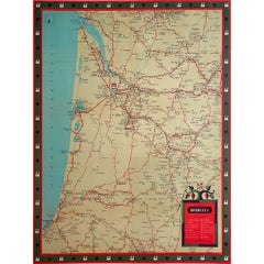
Original Vins du Sud-Ouest vintage French wine map poster
Located in Spokane, WA
Original Les Vignobles de France , Vins du Sud-Quest French vintage wine map poster. Horizontal. Size 36.5" x 27". Archival linen backed and re...
Category

Late 20th Century American Modern Landscape Prints

Materials

Lithograph

West Coast of Africa; Guinea & Sierra Leone: Bellin 18th Century Map
Located in Alamo, CA
This is a Jacques Bellin copper-plate map entitled "Partie de la Coste de Guinee Dupuis la Riviere de Sierra Leona Jusquau Cap das Palmas", depicting the coast of Guinea and Sierra L...
Category

1740s Old Masters Landscape Prints

Materials

Engraving

Queens' College, Cambridge, engraving by David Loggan
Located in London, GB
David Loggan (1634 - 1692) Queens' College, Cambridge Engraving 37 x 45 cm An eighteenth-century view of Queens', Cambridge, engraved by David Loggan, the noted engraver, draughtsm...
Category

18th Century Realist Prints and Multiples

Materials

Engraving

Map of North America - Etching - 19th Century
Located in Roma, IT
Map of America is an etching realized during the 19th century. Good condition.
Category

Early 19th Century Modern Figurative Prints

Materials

Etching

Map of the War between Hungary and Prussia - Etching - 19th Century
Located in Roma, IT
Map of the War between Hungary and Prussia is an etching realized during the 19th century. Good condition.
Category

Early 19th Century Modern Figurative Prints

Materials

Etching

Map of Battle of Waterloo - Etching by Pierre François Tardieu - 1837
Located in Roma, IT
Map of Battle of Waterloo is an Etching realized by Pierre François Tardieu in 1837. Good conditions. The artwork is realized in a well-balanced composition. the artwork and belong...
Category

1830s Modern Figurative Prints

Materials

Etching

St John's College, Oxford 1675 engraving by David Loggan
Located in London, GB
To see our other views of Oxford and Cambridge, scroll down to "More from this Seller" and below it click on "See all from this seller" - or send us a message if you cannot find the ...
Category

1670s Realist Landscape Prints

Materials

Engraving

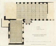
Ceiling plan of Crosby Hall, Bishopsgate Street
Located in Middletown, NY
Robert Wilkinson, 1816. Copperplate engraving on buff wove paper with hand coloring in watercolor, 10 7/8 x 13 /4 inches (275 x 336 mm), full margins. In good condition with some sc...
Category

Early 19th Century English School Landscape Prints

Materials

Handmade Paper, Engraving, Watercolor

Map of Moravia - Etching - 19th Century
Located in Roma, IT
The Map of Moravia is an etching map realized in the 19th century. Good conditions.
Category

19th Century Modern Figurative Prints

Materials

Etching

1944 original map "Les vins de Champagne – Montagne de Reims" by Louis Larmat
Located in PARIS, FR
The 1944 original map "Atlas de la France Vinicole – Les vins de Champagne – Montagne de Reims" by Louis Larmat is an exquisite piece of cartography that reflects both the history an...
Category

1940s Prints and Multiples

Materials

Lithograph, Paper

1950 original map by Garcia Fuentes Manuel - Sevilla Perspectiva General
Located in PARIS, FR
The 1950 original map by Garcia Fuentes Manuel, titled "Sevilla Perspectiva General," offers a comprehensive and detailed overview of Seville as it stood...
Category

1950s Prints and Multiples

Materials

Paper, Lithograph, Linen

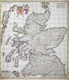
Map of Scotland - Etching by Johannes Blaeu - 1650s
Located in Roma, IT
Map of Scotland is an geographic map realized by Johannes Blaeu. Etching, printed in 1660 ca. Copper engraving, colored (coeval coloring), on paper, with center fold; Latin text. ...
Category

1650s Modern Figurative Prints

Materials

Etching

1943 original map "Les vins des Côtes du Rhône" by Larmat
Located in PARIS, FR
The 1943 original map by L. Larmat, titled "Les vins des Côtes du Rhône", is part of the comprehensive "Atlas de la France Vinicole" series, which meticulously charts France’s most r...
Category

1940s Prints and Multiples

Materials

Lithograph, Paper

Antique Architectural Engraving - Santo Spirito Palace
Located in Houston, TX
Antique Architectural engraving of the floor plan of the Santo Spirito Palace located in Florence, Italy by Italian, Giacomo Rossi, 16...
Category

18th Century and Earlier Interior Prints

Materials

Ink, Paper

Map of the War between Hungary and Prussia - Etching - 19th Century
Located in Roma, IT
Map of the War between Hungary and Prussia is an etching realized during the 19th century. Good condition.
Category

Early 19th Century Modern Figurative Prints

Materials

Etching

original lithograph
Located in Henderson, NV
Medium: original lithograph. This lithograph was printed in 1955 for the "Improvisations" portfolio, and published by the Artists Equity Association of New York in an edition of 2000...
Category

1950s Prints and Multiples

Materials

Lithograph

New Map of the Terraqueous Globe - WORLD MAP - CALIFORNIA AS AN ISLAND
By Edward Wells
Located in Santa Monica, CA
EDWARD WELLS (British 1667- 1727) A NEW MAP of the TERRAQUEOUS GLOBE - according to the latest Discoveries and most general Divisions of it into CONTINENTS and OCEANS, 1700-01 (Shirley 609) Engraved by Michael Burghers, Oxford. Hand-colored, Platemark 14 1/4 x 20 1/8 inches. Central cartouche flanked by figures representing the continents with dedication to William, Duke of Gloucester...
Category

Early 1700s Old Masters Landscape Prints

Materials

Engraving

Durham, English County Antique map, 1847
Located in Melbourne, Victoria
Steel-engraved map with original outline colouring by Isaac Slater. A detailed engraved map of the English county with title, scale, and key. Decorated with an uncoloured engraved vi...
Category

19th Century Naturalistic Landscape Prints

Materials

Engraving

Original 'Map of the United States as Californians See It' vintage map poster
Located in Spokane, WA
Original vintage poster: "Map of the United States as Californians See It". 1947, artist: Oren Arnold. Size: 16.5" x 20.5", R. H. MOEBUS COMPANY This poster is not linen-backed. This poster is in very good fine condition, ready to frame. A humorous satirical pictorial map from 1947 with the golden sun on the upper left, gives a detailed depiction of California, its relative size to the rest of the United States, showing Florida as "Death Valley", the rest of the United States as "Unexplored" 'Unimportant anyway, not in California". The image has your Mexican singer; bikini-clad bathers and others set in the image. Shows rivers, lakes, harbors, landmarks, parks, recreational activities, and local people. This map shows Los Angeles’ city...
Category

1940s American Modern Landscape Prints

Materials

Offset

Map of Calcaria - From "Civitates Orbium Terrarum" by F. Hogenberg - 1575
Located in Roma, IT
"Machelen", from the collection "Civitates Orbis Terrarum", Cologne, T. Graminaeus, 1575. The “Civitates Orbis Terrarum” (Atlas of Cities of the World) was the second oldest print...
Category

16th Century Figurative Prints

Materials

Etching, Aquatint

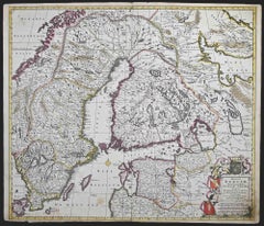
Sweden and Adjacent Portions of Scandinavia: A Hand-colored 18th C. Homann Map
Located in Alamo, CA
This hand-colored copper-plate map of Sweden and adjacent portions of Scandinavia entitled "Regni Sueciae in Omnes suas Subjacentes Provincias accurate divisi Tabula Generalis" was c...
Category

Early 18th Century Old Masters Landscape Prints

Materials

Engraving

Invader Invasion Planete Marseille (Marseille Map Folded)
Located in Englishtown, NJ
Very cool map with little white Invaders showing street art. Folded version of the Invader Marseille Map. Shows the location of the 96 street mosaics that Invader has placed in the F...
Category

21st Century and Contemporary Street Art Prints and Multiples

Materials

Color

Circa 1960 original advertising poster, Old Nick: Martinique, L'île du Rhum
Located in PARIS, FR
This original advertising poster, Old Nick: Martinique, L'île du Rhum, serves as a vibrant celebration of the rich heritage of rum production on the island of Martinique. The poster ...
Category

1960s Prints and Multiples

Materials

Paper, Lithograph

Shade of a Tree, Signed Modern Screenprint by Shoichi Ida
Located in Long Island City, NY
Shade of a Tree Shoichi Ida, Japanese (1941–2006) Date: 1970 Screenprint, signed, titled, numbered and dated in pencil Edition of 1/30 Image Size: 21.25 x 27.25 inches Size: 22 x 28 ...
Category

1970s Modern Animal Prints

Materials

Screen

Wiltshire, original vintage map by Donald McCullough
Located in London, GB
David McCullough Wiltshire Lithograph 57 x 43 cm The Countryman County Map of Wiltshire was part of the Countryman magazine’s series of illustrated county maps, designed to celebr...
Category

1940s Realist Figurative Prints

Materials

Lithograph

Antique French Copper Engraving - Horse Stables
Located in Houston, TX
Crisp antique copper engraving of a unique floor plan of French horse stables from Recueil d'Architecture, 1780. Original artwork on paper displayed on a...
Category

1780s Interior Prints

Materials

Ink, Paper

Map of Russia - Etching by Marco Di Pietro - 19th Century
Located in Roma, IT
This map of Russia is an etching realized by the Italian engraver Marco Di Pietro in 19th century. The state of preservation of the artwork is excellent. The signature is engraved o...
Category

19th Century Old Masters Figurative Prints

Materials

Etching

1937 original poster designed as a board game - automobile race across Belgium
Located in PARIS, FR
The 1937 original map poster titled "Une course d'automobiles à travers la Belgique" is a fascinating artifact that combines cartography, graphic design, and the cultural enthusiasm ...
Category

1930s Prints and Multiples

Materials

Lithograph, Linen, Paper

Toulouse-Lautrec, Composition, TLautrec (after)
Located in Fairfield, CT
Medium: Lithograph and stencil on vélin paper Year: 1946 Paper Size: 13 x 17 inches Inscription: Signed in the plate and unnumbered, as issued Notes: From the folio, TLautrec, 1946. ...
Category

1940s Post-Impressionist Figurative Prints

Materials

Lithograph

1899 "Plan des Tramways de Paris" by Wuhrer - Paris's public transportation
Located in PARIS, FR
The 1899 "Plan des Tramways de Paris" by Wuhrer is a fascinating snapshot of Paris's public transportation landscape at the dawn of the 20th century. This meticulously crafted map delineates the extensive network of tramway lines that crisscrossed the city, each route marked in detail to aid both residents and visitors in navigating the bustling metropolis. The Belle Époque, during which this map was produced, was a period of significant growth and modernization in Paris. The city's population was expanding rapidly, and with it came the need for a more efficient means of urban transport. Tramways emerged as a vital solution, connecting neighborhoods and making the city's many attractions more accessible. These electric trams were a symbol of technological progress, replacing the horse-drawn carriages of earlier years and setting the stage for the future of public transit...
Category

1890s Prints and Multiples

Materials

Lithograph, Paper

Jesus College, Cambridge engraving Pieter van der Aa after David Loggan
Located in London, GB
Pieter van der Aa (1659 - 1733), after David Loggan (1634 - 1692) Jesus College, Cambridge Engraving 12 x 16 cm An eighteenth-century view of Jesus College, Cambridge, engraved by P...
Category

Early 18th Century Realist Prints and Multiples

Materials

Engraving

1944 original map Les vins de Champagne – Vignobles du Bar-Séquanais
Located in PARIS, FR
The 1944 original map "Atlas de la France Vinicole – Les vins de Champagne – Vignobles du Bar-Séquanais et du Bar-sur-Aubois", created by Louis Larmat and printed by Dorel in Paris, ...
Category

1940s Prints and Multiples

Materials

Lithograph, Paper

1848 Original map by Maillard - Plan de Paris et ses Fortifications
Located in PARIS, FR
In the realm of cartography, maps serve as both practical tools and artistic representations, encapsulating the essence of a place at a specific moment in time. The 1848 vintage map,...
Category

1840s Prints and Multiples

Materials

Paper, Linen, Lithograph

Ethiopian Churches Floor Plans - Etching by Lino Bianchi Barriviera - 1948
Located in Roma, IT
Ethiopian Churches floor plans is a modern artwork realized by Lino Bianchi Barriviera in 1948. Black and white etching. Signed and dated on plate. Plate n.11 (as reported on the ...
Category

1940s Modern Figurative Prints

Materials

Etching

Var, France. Antique map of a French department, 1856
Located in Melbourne, Victoria
'Dept. du Var', steel engraving with original outline hand-colouring., 1856, from Levasseur's Atlas National Illustre. Var covers the heart of the French Riviera or Cote d'Azur., and includes the resort cities of Cannes, Nice and San Tropez...
Category

19th Century Naturalistic Landscape Prints

Materials

Engraving

Map of Paris Photography Fine Art Print Limited Edition
Located in Slovak Republic, SK
Old map of Paris/ 1937, limited edition of 15. Fine Art Print.
Category

1930s Other Art Style Still-life Prints

Materials

Color, Digital

Haut Rhin, France. Antique map of a French department, 1856
Located in Melbourne, Victoria
'Dept. du Bas Rhin', steel engraving with original outline hand-colouring., 1856, from Levasseur's Atlas National Illustre. This mountainous area is part of the Alsace wine region ...
Category

19th Century Naturalistic Landscape Prints

Materials

Engraving

View of Blois - Etching by G. Braun and F. Hogenberg -Late 16th Century
Located in Roma, IT
This view of Blois (ancient name: Bloys) is an original etching realized by George Braun and Franz Hogenberg as part of the famous "Civitates Orbis Terrarum". The “Civitates Orbis T...
Category

16th Century Figurative Prints

Materials

Etching

Illustrated Map of Madagascar by D. J. Allonsius 1953 Original Poster Africa
Located in PARIS, FR
Nice illustrated Map of Madagascar by D. J. Allonsius. This original poster was printed by Dufrénoy in Paris in 1953
Category

1950s Prints and Multiples

Materials

Linen, Paper, Lithograph

Antique Italian Engraving - Crescenzi Palace
Located in Houston, TX
Antique copper engraving of the floor plan to Crescenzi Palace in Rome, Italy by Italian Giovanni Giacomo de' Rossi, 1650. Original artwork on paper displayed on a white mat with a...
Category

15th Century and Earlier Interior Prints

Materials

Ink, Paper

Ancient Map-Poli Arctici (Map of the Poles)-Etching by Johannes Janssonius-1650s
Located in Roma, IT
Poli Arctici is an ancient map realized in 1650 by Johannes Janssonius (1588-1664). The Map is a Hand-colored etching, with coeval watercoloring. Good conditions with slight foxing...
Category

1650s Modern Figurative Prints

Materials

Etching

1937 Original planisphere by Lucien boucher - World map
Located in PARIS, FR
Original poster Airline Company - Map - Tourism West - Northern - Orient - Midi In 1937, Lucien Boucher, a renowned French illustrator, unveiled his masterpiece, the "Planisphère ...
Category

1930s Prints and Multiples

Materials

Linen, Lithograph, Paper

Circa 1825 original engraving of the map of Syria by Giraldon Bovinet
Located in PARIS, FR
The circa 1825 original engraving of "Syrie" by Giraldon Bovinet, based on the work of L. Vivien, is a historically significant map that reflects early 19th-century cartographic tech...
Category

1820s Prints and Multiples

Materials

Engraving, Paper

Union Pacific West vintage fun map railroad travel poster
Located in Spokane, WA
Original “The Union Pacific West fun map, archivally linen backed in very good condition. Ready to frame. This was initially folded, and the fold marks were ...
Category

1960s American Modern Landscape Prints

Materials

Offset

Plan and Facade of a Greek House - Lithograph - 1862
Located in Roma, IT
Plan and Facade of a Greek House is a lithograph on paper realized in 1862. The artwork belongs to the Suite Uses and customs of all the peoples of the universe: " History of the go...
Category

1860s Modern Figurative Prints

Materials

Lithograph

Westmoreland, English County Antique map, 1847
Located in Melbourne, Victoria
Steel-engraved map with original outline colouring by Isaac Slater. A detailed engraved map of the English county with title, scale, and key. Decorated with an uncoloured engraved v...
Category

19th Century Naturalistic Landscape Prints

Materials

Engraving

La Gironde, France. Antique map of a French department, 1856
Located in Melbourne, Victoria
'La Gironde', steel engraving with original outline hand-colouring., 1856, from Levasseur's 'Atlas National Illustre'. This coastal department is the seat of the Bordeaux wine regi...
Category

19th Century Naturalistic Landscape Prints

Materials

Engraving

Recently Viewed

View All