Entertainment Prints and Multiples

to
33
203
170
86
44
29
Overall Width
to
Overall Height
to
198
40
21
2
1
1
1
1
28
26
25
20
17
186
156
159
31
1
4
19
48
34
11
20
4
3
70
371
154
7
596
39,944
21,029
14,365
13,004
11,551
9,254
8,127
6,020
4,353
3,853
3,719
3,674
3,656
3,500
3,330
3,311
2,787
2,736
2,676
184
175
120
115
21
25
307
359
114
Art Subject: Entertainment
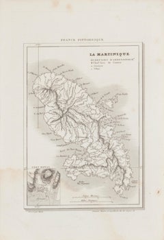
Map Of Martinique - Etching - 19th Century
Located in Roma, IT
Map Of Martinique is an etching realized by an anonymous engraver of the 19th Century. Printed within the series "France Pittoresque" at the top center. The state of preservation o...
Category

19th Century Modern Figurative Prints

Materials

Etching

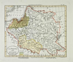
Map of Poland - Etching - Early 20th Century
Located in Roma, IT
Map of Poland is an etching map realized in the early 20th century. Good conditions.
Category

Early 20th Century Modern Figurative Prints

Materials

Etching

Invader Invasion Planete Marseille (Marseille Map Folded)
Located in Englishtown, NJ
Very cool map with little white Invaders showing street art. Folded version of the Invader Marseille Map. Shows the location of the 96 street mosaics that Invader has placed in the F...
Category

21st Century and Contemporary Street Art Prints and Multiples

Materials

Color

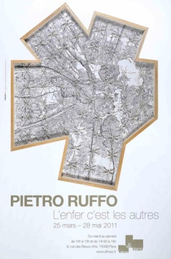
Pietro Ruffo - Exhibition Poster - Offset Print after Pietro Ruffo- 2011
Located in Roma, IT
Pietro Ruffo - Exhibition Poster is an offset print realized for the exhibition by Pietro Ruffo at Galerie Di Meo in 2011. Good conditions.
Category

2010s Contemporary Figurative Prints

Materials

Paper, Offset

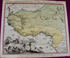
West Africa: 18th Century Hand-colored Homann Map Entitled "Guinea Propria"
Located in Alamo, CA
This is a scarce richly hand colored copper plate engraved map of Africa entitled "Guinea Propria, nec non Nigritiae vel Terrae Nigrorum Maxima Pars" by Johann Baptist Homann (1664-1...
Category

1740s Other Art Style Prints and Multiples

Materials

Engraving

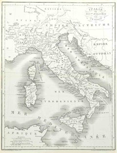
Map of Italy - Etching by Pierre François Tardieu - 1837
Located in Roma, IT
Map of Italy is an Etching realized in 1837. Good conditions. The artwork is realized in a well-balanced composition. the artwork and belongs to the suite suite "AtlasBatt" realize...
Category

1830s Modern Figurative Prints

Materials

Lithograph

1946 original map "Les vins des côteaux de la Loire - Vouvray " by Larmat
Located in PARIS, FR
The 1946 map titled Atlas de la France Vinicole - Les Vins des Côteaux de la Loire: Vouvray by Louis Larmat, printed by Dorel in Paris, presents an intimate exploration of one of the...
Category

1940s Prints and Multiples

Materials

Lithograph, Paper

New South Wales, Australia, antique mid 19th century engraved John Tallis map
Located in Melbourne, Victoria
'New South Wales' With decorative border surrounds and vignettes of 'Sydney Cove'. 'The Murray' and 'Xanthorrhea'. 'Drawn and engraved by J Rapkin'. Published by John Tallis. 375m...
Category

1840s Victorian Landscape Prints

Materials

Engraving

Zeidler Roberts 'Queen's Quay Terminal' 1979- Offset Lithograph
Located in Brooklyn, NY
Paper Size: 25.75 x 19.75 inches ( 65.405 x 50.165 cm ) Image Size: 24.25 x 18.25 inches ( 61.595 x 46.355 cm ) Framed: No Condition: A-: Near Mint, very light signs of handling ...
Category

1970s Prints and Multiples

Materials

Offset

Floor plan of St Albans Cathedral (1810), engraving by James Basire
Located in London, GB
James Basire & John Carter Floor plan of St Albans Cathedral Engraving 61 x 95 cm This engraving was originally published by the Society of Antiquaries of London, an organisation ...
Category

1810s Realist Landscape Prints

Materials

Engraving

Map of Moravia - Etching - 19th Century
Located in Roma, IT
The Map of Moravia is an etching map realized in the 19th century. Good conditions.
Category

19th Century Modern Figurative Prints

Materials

Etching

Old British Empire Map - Ancient Map by Karl Spruner - 1760 ca.
By Karl Spruner von Merz
Located in Roma, IT
Old British Empire Map is an artwork realized around 1760 by Karl Spruner. Original hand-colored print. Good conditions except for yellowing of pa...
Category

1760s Modern Figurative Prints

Materials

Etching

Map of Mar Del Nort - Etching by Johannes Janssonius - 1650s
Located in Roma, IT
Antique Map -Mar Del Nort is an antique map realized in 1650 by Johannes Janssonius (1588-1664). The Map is Hand-colored etching, with coeval watercolorang. Good conditions with sl...
Category

1650s Modern Figurative Prints

Materials

Etching

L'Herault, France. Antique map of a French department, 1856
Located in Melbourne, Victoria
'Dept. de Saone et Loire', steel engraving with original outline hand-colouring., 1856, from Levasseur's Atlas National Illustre. This area is home to a wide variety of vineyards a...
Category

19th Century Naturalistic Landscape Prints

Materials

Engraving

Durham, English County Antique map, 1847
Located in Melbourne, Victoria
Steel-engraved map with original outline colouring by Isaac Slater. A detailed engraved map of the English county with title, scale, and key. Decorated with an uncoloured engraved vi...
Category

19th Century Naturalistic Landscape Prints

Materials

Engraving

Mariam Biet Section - Etching by Lino Bianchi Barriviera - 1948
Located in Roma, IT
Mariam Biet Section is a modern artwork realized by Lino Bianchi Barriviera in 1948. Black and white etching. Signed on plate. Plate n.14 (as reported on the higher margin). The ...
Category

1940s Modern Figurative Prints

Materials

Etching

Haut Rhin, France. Antique map of a French department, 1856
Located in Melbourne, Victoria
'Dept. du Bas Rhin', steel engraving with original outline hand-colouring., 1856, from Levasseur's Atlas National Illustre. This mountainous area is part of the Alsace wine region ...
Category

19th Century Naturalistic Landscape Prints

Materials

Engraving

Circa 1950 poster Air Algérie regular line network
Located in PARIS, FR
The circa 1950 poster Air Algérie, réseau des lignes régulières by C. Rivière is a vibrant and captivating piece of mid-century commercial art that illustrates the network of regular...
Category

1950s Prints and Multiples

Materials

Lithograph, Paper, Linen

Map of the War -Vesfaglia and Lower Saxony - Etching - 19th Century
Located in Roma, IT
Map of the War -Vestaglia and Lower Saxony is an etching realized during the 19th century. Good condition.
Category

Early 19th Century Modern Figurative Prints

Materials

Etching

1941 original map "Les vins de Bordeaux - Loupiac, ..." by Larmat
Located in PARIS, FR
In 1941, L. Larmat crafted an exquisite map titled Atlas de la France Vinicole: Les Vins de Bordeaux - Loupiac, Sainte-Croix-du-Mont, Ières Côtes de Bordeaux, Côtes de Bordeaux St. M...
Category

1940s Prints and Multiples

Materials

Lithograph, Paper

Northamptonshire, English County Antique map, 1847
Located in Melbourne, Victoria
Steel-engraved map with original outline colouring by Isaac Slater. A detailed engraved map of the English county with title, scale, and key. Decorated with an uncoloured engraved view of 'Peterborough...
Category

19th Century Naturalistic Landscape Prints

Materials

Engraving

Burdigala, Map from "Civitates Orbis Terrarum" - by F.Hogenberg - 1575
Located in Roma, IT
"Burdigala", from the collection "Civitates Orbis Terrarum", Cologne, T. Graminaeus, 1575. The “Civitates Orbis Terrarum” (Atlas of Cities of the World) was the second oldest prin...
Category

16th Century Figurative Prints

Materials

Etching, Aquatint

Plan and Facade of a Greek House - Lithograph - 1862
Located in Roma, IT
Plan and Facade of a Greek House is a lithograph on paper realized in 1862. The artwork belongs to the Suite Uses and customs of all the peoples of the universe: " History of the go...
Category

1860s Modern Figurative Prints

Materials

Lithograph

Cumberland, English County Antique map, 1847
Located in Melbourne, Victoria
Steel-engraved map with original outline colouring by Isaac Slater. A detailed engraved map of the English county with title, scale, and key. Decorated with an uncoloured engraved vi...
Category

19th Century Naturalistic Landscape Prints

Materials

Engraving

1947 original map Gouvernement Généraux du Poitou, du Pays d'Aunis
Located in PARIS, FR
The 1947 original map Gouvernement Généraux du Poitou, du Pays d'Aunis et de Saintonge Angoumois, created by Louis Larmat and printed by Dorel in Paris, is a beautifully detailed cartographic representation of a historically significant region in western France. This map, part of Larmat’s extensive body of work, is known for its artistic craftsmanship and geographical precision, offering a comprehensive view of the historical administrative regions of Poitou, Aunis, Saintonge, and Angoumois, which played key roles in the political and cultural history of France. Louis Larmat is celebrated for his contributions to cartography, particularly for his ability to merge historical context, topographical detail, and aesthetic elegance in his maps. His works, especially those focusing on the vinicultural regions of France, are highly respected for their accuracy and artistry. This particular map, although focusing on a more political and historical aspect rather than the wine regions he is most famous for, continues his tradition of detailed regional documentation. Larmat’s cartographic works often transcended the realm of simple geographical depiction, becoming historical documents that encapsulate the cultural essence of the regions they portray. This map illustrates the general governments (administrative divisions) of the provinces of Poitou, Aunis, Saintonge, and Angoumois, regions that are steeped in history. These areas, situated along France’s western coastline, have been integral to the country’s political, economic, and cultural development over centuries. The region of Poitou, for example, is historically known as the birthplace of Eleanor of Aquitaine...
Category

1940s Prints and Multiples

Materials

Lithograph, Paper

Hertfordshire, English County Antique map, 1847
Located in Melbourne, Victoria
Steel-engraved map with original outline colouring by Isaac Slater. A detailed engraved map of the English county with title, scale, and key. Decorated with an uncoloured engraved v...
Category

19th Century Naturalistic Landscape Prints

Materials

Engraving

Emile Deyrolle 'La Laiterie De La Ferme'
Located in Brooklyn, NY
Paper Size: 29.5 x 35.5 inches ( 74.93 x 90.17 cm ) Image Size: 29.5 x 35.5 inches ( 74.93 x 90.17 cm ) Framed: No Condition: B-: Good Condition, Signs of Handling and Age Supplement...
Category

1960s Contemporary Prints and Multiples

Materials

Offset

Emile Deyrolle 'La Ferme A Cour Fermee'
Located in Brooklyn, NY
Paper Size: 35.5 x 29.5 inches ( 90.17 x 74.93 cm ) Image Size: 35.5 x 29.5 inches ( 90.17 x 74.93 cm ) Framed: No Condition: B-: Good Condition, Signs of Handling and Age Supplement...
Category

1960s Contemporary Prints and Multiples

Materials

Offset

Herefordshire, English County Antique map, 1847
Located in Melbourne, Victoria
Steel-engraved map with original outline colouring by Isaac Slater. A detailed engraved map of the English county with title, scale, and key. Decorated with an uncoloured engraved vi...
Category

19th Century Naturalistic Landscape Prints

Materials

Engraving

Loir and Cher, France. Antique map of a French department, 1856
Located in Melbourne, Victoria
'Dept. de Loir and Cher', steel engraving with original outline hand-colouring., 1856, from Levasseur's Atlas National Illustre. This area is mainly known for its production of Sel...
Category

19th Century Naturalistic Landscape Prints

Materials

Engraving

Antique Copper Engraving - Massimi Palace
Located in Houston, TX
Over 350 year old exquisite antique copper engraving of the architectural floor plans to Massimi Palace in Italy by Giovanni Giacomo de' Ross...
Category

15th Century and Earlier Interior Prints

Materials

Paper, Ink

Antique Italian Engraving - Crescenzi Palace
Located in Houston, TX
Antique copper engraving of the floor plan to Crescenzi Palace in Rome, Italy by Italian Giovanni Giacomo de' Rossi, 1650. Original artwork on paper displayed on a white mat with a...
Category

15th Century and Earlier Interior Prints

Materials

Paper, Ink

Indre and Loire, France. Antique map of a French department, 1856
Located in Melbourne, Victoria
'Dept. d'Indre et Loire', steel engraving with original outline hand-colouring., 1856, from Levasseur's 'Atlas National Illustre'. This area is known for its production of Chenin b...
Category

19th Century Naturalistic Landscape Prints

Materials

Engraving

Var, France. Antique map of a French department, 1856
Located in Melbourne, Victoria
'Dept. du Var', steel engraving with original outline hand-colouring., 1856, from Levasseur's Atlas National Illustre. Var covers the heart of the French Riviera or Cote d'Azur., and includes the resort cities of Cannes, Nice and San Tropez...
Category

19th Century Naturalistic Landscape Prints

Materials

Engraving

Ypra, Map from "Civitates Orbis Terrarum" - by F. Hogenberg - 1575
Located in Roma, IT
Braun G., Hogenberg F., Ypra (Ypres), from the collection Civitates Orbis Terrarum, Cologne, T. Graminaeus, 1572-1617. The “Civitates Orbis Terrarum” (Atlas of Cities of the World) ...
Category

16th Century Figurative Prints

Materials

Etching, Aquatint

1983 original poster for the 2nd Tour de France des "Grand-mères automobiles"
Located in PARIS, FR
In 1983, the 2nd Tour de France des "Grand-mères automobiles" (Tour de France of "Grandmother Cars") captured the imagination of car enthusiasts and history buffs alike. This unique ...
Category

1980s Prints and Multiples

Materials

Paper, Lithograph

Original poster to promote the 4th Tour de France of the Grand-mères automobiles
Located in PARIS, FR
The purpose of the poster was to promote the 4th Tour de France of the "Grand-mères automobiles" which was held from September 9 to 22, 1985. The "Grand-Mères-Automobiles" were born ...
Category

1950s Prints and Multiples

Materials

Lithograph, Paper

Campagne de Russie - Etching by Pierre François Tardieu - 1837
Located in Roma, IT
Campagne de Russie is an Etching realized by Pierre François Tardieu in 1837. Good conditions. The artwork is realized in a well-balanced composition. the artwork and belongs to th...
Category

1830s Modern Figurative Prints

Materials

Lithograph

1948 original map titled La Vallée de la Dordogne de Bordeaux à la Bourboule
Located in PARIS, FR
The 1948 original map titled La Vallée de la Dordogne de Bordeaux à la Bourboule was created by the French artist and cartographer Jean Moles. This map serves as both a geographical ...
Category

1940s Prints and Multiples

Materials

Lithograph, Paper

1941 original map "Les vins de Bordeaux - Graves, Graves supérieurs" by Larmat
Located in PARIS, FR
The 1941 original map by L. Larmat, titled "Atlas de la France vinicole – Les vins de Bordeaux: Graves, Graves Supérieurs, Cérons", is a significant contribution to the series that s...
Category

1940s Prints and Multiples

Materials

Lithograph, Paper

Map of the World - Original Etching - 1820
Located in Roma, IT
Map of the World is an Original Etching realized by an unknown artist of 19th century in 1820. Very good condition on two sheets of white paper joine...
Category

1820s Modern Figurative Prints

Materials

Etching

1950 original map by Garcia Fuentes Manuel - Sevilla Perspectiva General
Located in PARIS, FR
The 1950 original map by Garcia Fuentes Manuel, titled "Sevilla Perspectiva General," offers a comprehensive and detailed overview of Seville as it stood...
Category

1950s Prints and Multiples

Materials

Paper, Lithograph, Linen

Regnum Hungariae - Etching by Frederick de Wit - 1680ca
Located in Roma, IT
This double-page etching with contemporary coloring, entitled Regnum Hungariae, was realized by the cartographer Frederick de Wit for the famous Atlas published in Amsterdam in ca. 1...
Category

1680s Modern Figurative Prints

Materials

Etching

Regni Hungariae et Regionum - Etching by Frederick de Wit - 1680ca
Located in Roma, IT
This triple-page etching with contemporary coloring, entitled Regni Hungariae et Regionum, was realized by the cartographer Frederick de Wit for the famous Atlas published in Amsterd...
Category

1680s Modern Figurative Prints

Materials

Etching

Turcicum Imperium - Etching by Frederick de Wit - 1680ca
Located in Roma, IT
This double-page etching with contemporary coloring, entitled Turcicum Imperium, was realized by the cartographer Frederick de Wit for the famous Atlas published in Amsterdam in ca. ...
Category

1680s Modern Figurative Prints

Materials

Etching

Terra Sancta - Etching by Frederick de Wit - 1680ca
Located in Roma, IT
This double-page etching with contemporary coloring, entitled Terra Sancta, was realized by the cartographer Frederick de Wit for the famous Atlas published in Amsterdam in ca. 1680....
Category

1680s Modern Figurative Prints

Materials

Etching

Map of Ancient Greece of Macedonia and... - Lithograph by Auguste Wahlen - 1844
Located in Roma, IT
Map of Ancient Greece of Macedonia and Thrace is a lithograph made by Auguste Wahlen in 1844. Hand colored. Good condition. Bottom left is the original title "Carta della Grecia A...
Category

1840s Modern Figurative Prints

Materials

Lithograph

Pietro Ruffo - Exhibition Poster - Offset Print after Pietro Ruffo- 2011
Located in Roma, IT
Pietro Ruffo - Exhibition Poster is an offset print realized for the exhibition by Pietro Ruffo at Galerie Di Meo in 2011. Good conditions.
Category

2010s Contemporary Figurative Prints

Materials

Paper, Offset

Circa 1950 original map poster of Calvados, designed by André Lesot - Normandy
Located in PARIS, FR
This circa 1950 original map poster of Calvados, designed by André Lesot, is a beautifully detailed representation of this historic region in Normandy, France. Produced by Éditions G...
Category

1950s Prints and Multiples

Materials

Lithograph, Paper, Linen

Map of Oxfordshire by Joan Blaeu with college crests
Located in London, GB
To see our other original maps, scroll down to "More from this Seller" and below it click on "See all from this Seller" - or send us a message if you cannot find the poster you want....
Category

1660s Landscape Prints

Materials

Engraving

Norvegia Regnum - Etching by Frederick de Wit - 1680ca
Located in Roma, IT
This double-page etching with contemporary coloring, entitled Norvegia Regnum, was realized by the cartographer Frederick de Wit for the famous Atlas published in Amsterdam in ca. 16...
Category

1680s Modern Figurative Prints

Materials

Etching

Tabula Russia Vulgo Moscovia - Etching by Frederick de Wit - 1680ca
Located in Roma, IT
This double-page etching with contemporary coloring, entitled Tabula Russia vulgo Moscovia, was realized by the cartographer Frederick de Wit for the famous Atlas published in Amster...
Category

1680s Modern Figurative Prints

Materials

Etching

Accuratissima Totius Regni Hispaniae... - Etching by Frederick de Wit - 1680ca
Located in Roma, IT
This double-page etching with contemporary coloring, entitled Accuratissima Totius Regni Hispaniae Portugalliae, was realized by the cartographer Frederick de Wit for the famous Atla...
Category

1680s Modern Figurative Prints

Materials

Etching

Map of Scotland - Etching by Johannes Blaeu - 1650s
Located in Roma, IT
Map of Scotland is an geographic map realized by Johannes Blaeu. Etching, printed in 1660 ca. Copper engraving, colored (coeval coloring), on paper, with center fold; Latin text. ...
Category

1650s Modern Figurative Prints

Materials

Etching

Map of Battle of Waterloo - Etching by Pierre François Tardieu - 1837
Located in Roma, IT
Map of Battle of Waterloo is an Etching realized by Pierre François Tardieu in 1837. Good conditions. The artwork is realized in a well-balanced composition. the artwork and belong...
Category

1830s Modern Figurative Prints

Materials

Etching

1941 original map "Les vins de Bordeaux - Blayais, Côtes de Blaye" by Larmat
Located in PARIS, FR
In 1941, L. Larmat created an impressive map titled Atlas de la France Vinicole: Les Vins de Bordeaux - Blayais, Côtes de Blaye, Bourgeais, Côtes de Bourg, printed by Dorel in Paris....
Category

1940s Prints and Multiples

Materials

Lithograph, Paper

Totius fluminis Rheni Novissima Descriptio- Etching by Frederick de Wit - 1680ca
Located in Roma, IT
This double-page etching with contemporary coloring, entitled Totius fluminis Rheni novissima descriptio, was realized by the cartographer Frederick de Wit for the famous Atlas publi...
Category

1680s Modern Figurative Prints

Materials

Etching

Accuratissima Germaniae Tabula - Etching by Frederick de Wit - 1680ca
Located in Roma, IT
This double-page etching with contemporary coloring, entitled Accuratissima Germaniae Tabula [...], was realized by the cartographer Frederick de Wit for the famous Atlas published i...
Category

1680s Modern Figurative Prints

Materials

Etching

Novissima et Accuratissima XVII ... - Etching by Frederick de Wit - 1680ca
Located in Roma, IT
This double-page etching with contemporary coloring, entitled Novissima et accuratissima XVII Provinciarum Germaniae Inferior Tabula, was realized by the cartographer Frederick de Wi...
Category

1680s Modern Figurative Prints

Materials

Etching

Map of Ancient Greece - Original Etching by Antonio Zatta - 1785
Located in Roma, IT
This Map of ancient Greek is an etching realized by Antonio Zatta in Venice in 1785. The state of preservation of the artwork is good expect for the worn paper. Mounted on a cardbo...
Category

1770s Landscape Prints

Materials

Etching

Recently Viewed

View All