Entertainment Prints and Multiples

to
33
203
170
86
44
29
Overall Width
to
Overall Height
to
198
40
21
2
1
1
1
1
28
26
25
20
17
186
156
159
31
1
4
19
48
34
11
20
4
3
70
371
154
7
596
39,944
21,029
14,365
13,004
11,551
9,254
8,127
6,020
4,353
3,853
3,719
3,674
3,656
3,500
3,330
3,311
2,787
2,736
2,676
184
175
120
115
21
25
307
359
114
Art Subject: Entertainment
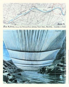
Over the River (From Underneath) Project for the Arkansas River, CO Signed Print
Located in San Rafael, CA
Christo (1935 - 2020) and Jeanne-Claude (1935 - 2009) Over the River (From Underneath) Project for the Arkansas River, Colorado Offset lithograph in colors on smooth paper Signed by ...
Category

21st Century and Contemporary Contemporary Landscape Prints

Materials

Archival Paper

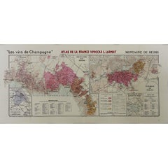
1944 original map "Les vins de Champagne – Montagne de Reims" by Louis Larmat
Located in PARIS, FR
The 1944 original map "Atlas de la France Vinicole – Les vins de Champagne – Montagne de Reims" by Louis Larmat is an exquisite piece of cartography that reflects both the history an...
Category

1940s Prints and Multiples

Materials

Lithograph, Paper

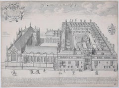
David Loggan Brasenose College Oxford Collegium Aenei Nasi Print 1675 engraving
Located in London, GB
To see our other views of Oxford and Cambridge, scroll down to "More from this Seller" and below it click on "See all from this Seller" - or send us a message if you cannot find the ...
Category

1670s Realist Prints and Multiples

Materials

Engraving

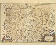
Ancient Map - Macedonia - Etching by Johannes Janssonius - 1650s
Located in Roma, IT
Macedonia is an ancient map realized in 1650 by Johannes Janssonius (1588-1664). The Map is Hand-colored etching, with coeval watercoloring. Good condit...
Category

1650s Modern Figurative Prints

Materials

Etching

Amstelredam - Etching by Johannes Janssonius - 1650s
Located in Roma, IT
Amstelredam is an ancient map realized in 1650 by Johannes Janssonius (1588-1664). Good conditions. from Atlantis majoris quinta pars, Orbem maritimum [Novus Atlas, volume V: carte...
Category

1650s Modern Figurative Prints

Materials

Etching

Oceani Borealis - Etching by Johannes Janssonius - 1660s
Located in Roma, IT
Oceani Borealis is an ancient map realized in 1650 by Johannes Janssonius (1588-1664). Good conditions. From Atlantis majoris quinta pars, Orbem maritimum [Novus Atlas, volume V: c...
Category

1660s Modern Figurative Prints

Materials

Etching

Mare Atlanticum - Etching by Johannes Janssonius - 1650s
Located in Roma, IT
Mare Atlanticum is an ancient map realized in 1650 by Johannes Janssonius (1588-1664). Good conditions. From Atlantis majoris quinta pars, Orbem maritimum [Novus Atlas, volume V: c...
Category

1650s Modern Figurative Prints

Materials

Etching

Polus Antarcticus - Etching by Johannes Janssonius - 1650s
Located in Roma, IT
Polus Antarcticus is a top rare ancient map realized in 1650 by Johannes Janssonius (1588-1664). Good conditions. From Atlantis majoris quinta pars, Orbem maritimum [Novus Atlas, v...
Category

1650s Modern Figurative Prints

Materials

Etching

Map of Ancient Rome - Original Etching by Alessandro Moschetti - 1848
Located in Roma, IT
Plan of Rome is a beautiful original black and white etching, a rare and antique illustrated map of the eternal city of Rome, published in 1848. Image Di...
Category

1840s Figurative Prints

Materials

Etching

Wadham College, Oxford 1675 engraving by David Loggan
Located in London, GB
To see our other views of Oxford and Cambridge, scroll down to "More from this Seller" and below it click on "See all from this seller" - or send us a message if you cannot find the view you want. David Loggan (1634 - 1692) Wadham College, Oxford (1675) Engraving 32 x 41 cm Loggan's view of Wadham from the 'Oxonia Illustrata'. Loggan was born to English and Scottish parents, and was baptised in Danzig in 1634. After studying engraving in Danzig with Willem Hondius (1598-1652 or 1658), he moved to London in the late 1650s, going on to produce the engraved title-page for the folio 1662 Book of Common Prayer. He married in 1663 and moved to Nuffield in Oxfordshire in 1665. Loggan was appointed Public Sculptor to the nearby University of Oxford in the late 1660s, having been commissioned to produce bird’s-eye views of all the Oxford colleges. He lived in Holywell Street as he did this. The 'Oxonia Illustrata' was published in 1675, with the help of Robert White (1645-1704). Following its completion, Loggan began work on his equivalent work for Cambridge; the 'Cantabrigia Illustrata' was finally published in 1690, when he was made engraver to Cambridge University. The 'Oxonia Illustrata' also includes an engraving of Winchester College (Winchester and New College share William of Wykeham as their founder) whilst the 'Cantabrigia Illustrata' includes one of Eton College (which shares its founder, Henry VIII, with King’s College). Bird’s-eye views from this era required a particular talent as an architectural perspectivist; it was not until 1783 that it became possible for artists to ascend via hot air balloons and view the scenes they were depicting from above. Loggan thus had to rely on his imagination in conceiving the views. Loggan’s views constitute the first accurate depictions of the two Universities, in many ways unchanged today. Whilst the Oxford engravings were produced in reasonable numbers and ran to a second edition by Henry Overton (on thicker paper and with a plate number in Roman numerals in the bottom right-hand corner), those of Cambridge were printed in much smaller numbers. The Dutchman...
Category

1670s Realist Landscape Prints

Materials

Engraving

Prague and Egra, Antique Map from "Civitates Orbis Terrarum" - 1572-1617
Located in Roma, IT
Braun G. & Hogenberg F., Praga, Egra, from the collection Civitates Orbis Terrarum, Cologne, T. Graminaeus, 1572-1617. Image dimensions: 39.5 x 47.5 cm. Dimensions: 41 x 52.5 cm. Wo...
Category

16th Century Landscape Prints

Materials

Etching

Magdalene College, Cambridge engraving by David Loggan
Located in London, GB
To see our other views of Oxford and Cambridge, scroll down to "More from this Seller" and below it click on "See all from this seller" - or send us a message if you cannot find the view you want. David Loggan (1634 - 1692) Magdalene College, Cambridge (1690) Engraving 38 x 43 cm Loggan's view of Magdalene from the 'Cantabrigia Illustrata'. Loggan was born to English and Scottish parents, and was baptised in Danzig in 1634. After studying engraving in Danzig with Willem Hondius (1598-1652 or 1658), he moved to London in the late 1650s, going on to produce the engraved title-page for the folio 1662 Book of Common Prayer. He married in 1663 and moved to Nuffield in Oxfordshire in 1665. Loggan was appointed Public Sculptor to the nearby University of Oxford in the late 1660s, having been commissioned to produce bird’s-eye views of all the Oxford colleges. He lived in Holywell Street as he did this. The 'Oxonia Illustrata' was published in 1675, with the help of Robert White (1645-1704). Following its completion, Loggan began work on his equivalent work for Cambridge; the 'Cantabrigia Illustrata' was finally published in 1690, when he was made engraver to Cambridge University. The 'Oxonia Illustrata' also includes an engraving of Winchester College (Winchester and New College share William of Wykeham as their founder) whilst the 'Cantabrigia Illustrata' includes one of Eton College (which shares its founder, Henry VIII, with King’s College). Bird’s-eye views from this era required a particular talent as an architectural perspectivist; it was not until 1783 that it became possible for artists to ascend via hot air balloons and view the scenes they were depicting from above. Loggan thus had to rely on his imagination in conceiving the views. Loggan’s views constitute the first accurate depictions of the two Universities, in many ways unchanged today. Whilst the Oxford engravings were produced in reasonable numbers and ran to a second edition by Henry Overton (on thicker paper and with a plate number in Roman numerals in the bottom right-hand corner), those of Cambridge were printed in much smaller numbers. The Dutchman Pieter van der Aa published some miniature versions of the engravings for James Beverell’s guidebook to the UK, 'Les Delices de la Grande Bretagne' (circa 1708). The contemporary artist Andrew Ingamells...
Category

1670s Realist Landscape Prints

Materials

Engraving

British Empire Exhibition 1924 Wembley map by Stanley Kennedy North
Located in London, GB
To see more, scroll down to "More from this Seller" and below it click on "See all from this Seller." Stanley Kennedy North (1887 - 1942) British Empire Exhibition Map (1924) Lithog...
Category

1920s Landscape Prints

Materials

Lithograph

David Loggan: Pembroke College, Cambridge engraving
Located in London, GB
David Loggan (1634-1692) Pembroke College, Cambridge Engraving, 1690 36 x 45cm To see our other views of Oxford and Cambridge, scroll down to "More f...
Category

17th Century Prints and Multiples

Materials

Engraving, Etching

Map of Oxfordshire coloured 18th century engraving by Thomas Kitchin
Located in London, GB
To see our other original maps, scroll down to "More from this Seller" and below it click on "See all from this Seller" - or send us a message if you cannot find the poster you want....
Category

1760s Landscape Prints

Materials

Engraving

David Loggan: Magdalen College, Oxford (1674 engraving)
Located in London, GB
David Loggan (1634-1692) Engraving of Magdalen College, Oxford Engraving, 1674 32 x 42cm To see our other views of Oxford and Cambridge, scroll down ...
Category

17th Century Prints and Multiples

Materials

Engraving, Etching

AMERICAE - Sive Novi Orbis, Nova Descriptio
Located in Santa Monica, CA
ABRAHAM ORTELIUS (1527 - 1598) AMERICAE SIVE NOVI ORBIS, NOVA DESCRIPTIO, 1587 (1603) (Van Den Broecke 11, Burden 64; Schwartz & Ehrenberg 69) Engraving. A very good, well printed...
Category

16th Century Old Masters Landscape Prints

Materials

Engraving

Antique Architectural Engraving - Asti Palace
Located in Houston, TX
Over 350 year old antique architectural engraving of the floor plan of the Asti Palace located in Italy by Italian Giacomo Rossi, 1650...
Category

18th Century and Earlier Interior Prints

Materials

Paper, Ink

Maris Mediterranei - Etching by Johannes Janssonius - 1650s
Located in Roma, IT
Maris Mediterranei is an ancient map realized in 1650 by Johannes Janssonius (1588-1664). The Map is Hand-colored etching, with coeval watercoloring. Good conditions with slight fo...
Category

1650s Modern Figurative Prints

Materials

Etching

Barbarga - Etching by Johannes Janssonius - 1650s
Located in Roma, IT
Barbarga is an ancient map realized in 1650 by Johannes Janssonius (1588-1664). Good conditions. From Atlantis majoris quinta pars, Orbem maritimum [Novus Atlas, volume V: carte ma...
Category

1650s Modern Figurative Prints

Materials

Etching

Freti Canalis - Etching by Johannes Janssonius - 1650s
Located in Roma, IT
Freti Canalis is an ancient map realized in 1650 by Johannes Janssonius (1588-1664). Good conditions. From Atlantis majoris quinta pars, Orbem maritimum [Novus Atlas, volume V: car...
Category

1650s Modern Figurative Prints

Materials

Etching

Achaiae Noua - Etching by Johannes Janssonius - 1650s
Located in Roma, IT
Achaiae Noua is an ancient map realized in 1650 by Johannes Janssonius (1588-1664). Good conditions. From Atlantis majoris quinta pars, Orbem maritimum [Novus Atlas, volume V: cart...
Category

1650s Modern Figurative Prints

Materials

Etching

Nova Zemla - Etching by Johannes Janssonius - 1650s
Located in Roma, IT
Nova Zemla is an ancient map realized in 1650 by Johannes Janssonius (1588-1664). Good conditions. From Atlantis majoris quinta pars, Orbem maritimum [Novus Atlas, volume V: carte ...
Category

1650s Modern Figurative Prints

Materials

Etching

1947 original map "Les eaux-de-vie de France - Le Cognac petite Champagne"
Located in PARIS, FR
The 1947 original map Atlas de la France Vinicole - Les eaux-de-vie de France - Le Cognac Petite Champagne et Borderies, created by Louis Larmat and printed by Dorel in Paris, is a d...
Category

1940s Prints and Multiples

Materials

Lithograph, Paper

Paris Roofs, Modern Screenprint by Marion McClanahan
Located in Long Island City, NY
Marion McClanahan, American (1921 - 1993) - Paris Roofs, Year: circa 1980, Medium: Screenprint, signed and numbered in pencil, Edition: 300, AP 50, Image Size: 23 x 31 inches, Si...
Category

1980s Modern Landscape Prints

Materials

Screen

View of Lyon - by George Braun and Franz Hogenberg - Late 16th Century
Located in Roma, IT
This View of Lyon is an original etching realized by George Braun and Franz Hogenberg as part of the Series "Civitates Orbis Terrarum". The “Civitates...
Category

16th Century Figurative Prints

Materials

Etching

Salzburg, Map from "Civitates Orbis Terrarum"-by F. Hogenberg - 1575
Located in Roma, IT
Aquatint black and white showing the antique map of "Saltzburg", Salzburg. One of the first views of the famous Austrian city of Wolfgang Amadeus Mozart. Good conditions, some disco...
Category

16th Century Figurative Prints

Materials

Etching, Aquatint

Utrecht, Antique Map from "Civitates Orbis Terrarum"
Located in Roma, IT
Braun G., Hogenberg F., Traiectum or Utrecht, from the collection Civitates Orbis Terrarum, Cologne, T. Graminaeus, 1572-1617. Very fine B/W aquatint showing a view of Utrecht, with...
Category

16th Century Landscape Prints

Materials

Etching

LONG STANDING #2
Located in Aventura, FL
Lithograph on paper. Sheet size 19 x 12 inches. Hand signed, dated and numbered by the artist. Edition of 300. Certificate of Authenticity Included. Artwork in Excellent Conditi...
Category

Late 20th Century Contemporary Figurative Prints

Materials

Paper, Lithograph

Nova Persiae, Armeniae, Natoliae et Ara.. - Etching by Frederick de Wit - 1680ca
Located in Roma, IT
This double-page etching with contemporary coloring, entitled Nova Persiae, Armeniae, Natoliae et Arabiae, was realized by the cartographer Frederick de Wit for the famous Atlas publ...
Category

1680s Modern Figurative Prints

Materials

Etching

Dépt. De L’Ariège, & Dépt. De la Vendée, from Atlas National de France Illustré
By Louis Francois Couche
Located in Middletown, NY
Two (2) historiated engraved maps, each 11 1/4 x 16 7/16 inches (285 x 418 mm) with handcoloring, on wove paper, the latter engraved by C. Smith after Couché fils, published by Combe...
Category

Mid-19th Century French School Landscape Prints

Materials

Watercolor, Handmade Paper, Engraving

Battle of Forbach - Lithograph by R. Walker - 1872
Located in Roma, IT
Battle of Forbach is a map realized by R. Walker. Lithograph, printed in 1872 by Milliam Mackenzie, London. Good condition.
Category

1870s Modern Figurative Prints

Materials

Lithograph

Map of Greece - Etching on Paper 19th Century
Located in Roma, IT
Image dimensions: 22.2 x 27.8 cm. Grecia is an interesting hand-colored etching on paper, realized by an anonymous artist in the first half of the XIX century. With the inscriptions in Italian, this original print describes the geography of Greece with the great charisma of the antique maps. In very good conditions, except for a usual yellowing of the paper at the edges and minor defects and signs of the time, and some light yellow strips...
Category

19th Century Modern Figurative Prints

Materials

Etching

Europa Regnorum Provinciarum: 18th Century Hand-colored Map of Europe by Lotter
By Tobias Conrad Lotter
Located in Alamo, CA
This is an 18th century hand-colored copperplate engraved map entitled "Europa Regnorum Provinciarum Regionum" created by the German cartographer Tobias Conrad Lotter. It was publish...
Category

Mid-18th Century Landscape Prints

Materials

Engraving

North America: A Framed Hand-colored 19th Century German Map by Adolph Stieler
By Adolf Stieler
Located in Alamo, CA
This framed early 19th century map of North America entitled "Nord-Amerika" is plate No. LIV (No. 46) from Adolph Stieler's Hand-Atlas, published in Gotha, Germany by Justus Perthes ...
Category

1830s Landscape Prints

Materials

Engraving

Original 1940 Washington & Oregon Pictorial Map vintage poster
Located in Spokane, WA
Map of historical landmarks, American Indian territories, rivers, mountains, dams, colleges, federal grazing districts, cities, agriculture, and other activities that were present in...
Category

1940s American Realist Landscape Prints

Materials

Offset

Prussia (after the war of 1866) - Lithograph - 1872
Located in Roma, IT
Prussia (after the war of 1866) is an artwork realized by an artist during the 19th century. Lithograph, printed in 1872 by Milliam Mackenzie, London. Good condition.
Category

1870s Modern Figurative Prints

Materials

Lithograph

Antique Architectural Engraving - Santo Spirito Palace
Located in Houston, TX
Antique Architectural engraving of the floor plan of the Santo Spirito Palace located in Florence, Italy by Italian, Giacomo Rossi, 16...
Category

18th Century and Earlier Interior Prints

Materials

Ink, Paper

Accuratissima Angliae Regni et Walliae... - Etching by Frederick de Wit - 1680ca
Located in Roma, IT
This double-page etching with contemporary coloring, entitled Accuratissima Angliae Regni et Walliae Principatus, was realized by the cartographer Frederick de Wit for the famous Atl...
Category

1680s Modern Figurative Prints

Materials

Etching

Circa 1935 original poster by Walter Eckhard - Philips Radio G.M. Oord Haarlem
Located in PARIS, FR
A dazzling fusion of cartography, commercial ambition, and visual storytelling, this circa 1935 original poster by Walter Eckhard serves as a remarkable artifact of early globalism —...
Category

1930s Prints and Multiples

Materials

Paper, Lithograph

Map of Lombardy - Original Etching - 19th Century
Located in Roma, IT
The Map of Lombardy is an original etching realized by an anonymous artist. Fair conditions, the folding line of the middle is repaired. The artwork represents the map of Lombardo....
Category

19th Century Modern Figurative Prints

Materials

Etching

Original Vins du Sud-Ouest vintage French wine map poster
Located in Spokane, WA
Original Les Vignobles de France , Vins du Sud-Quest French vintage wine map poster. Horizontal. Size 36.5" x 27". Archival linen backed and re...
Category

Late 20th Century American Modern Landscape Prints

Materials

Lithograph

Battle of Courcelles - Lithograph by R. Walker - 1872
Located in Roma, IT
Battle of Courcelles is a map realized by R. Walker. Lithograph, printed in 1872 by Milliam Mackenzie, London. Good condition.
Category

1870s Modern Figurative Prints

Materials

Lithograph

Battle of Sedan - Lithograph by Robert Walker - 1872
Located in Roma, IT
Battle of Sedan is an artwork realized by R. Walker. Lithograph, printed in 1872 by Milliam Mackenzie, London. Good condition.
Category

1870s Modern Figurative Prints

Materials

Lithograph

Picasso, Sans titre, Pablo Picasso, Toros Y Toreros (after)
Located in Southampton, NY
Héliogravure on vélin paper. Paper Size: 14.75 x 10.5 inches. Inscription: Unsigned and unnumbered, as issued. Notes: From the album, Pablo Picasso, Toros y toreros, 1961. Published ...
Category

1960s Cubist Figurative Prints

Materials

Lithograph

France in Departments - Lithograph - 1872
Located in Roma, IT
France in Departments is an artwork realized by an artist of the 19th century. Lithograph, printed in 1872 by Milliam Mackenzie, London. Good condition.
Category

1870s Modern Figurative Prints

Materials

Lithograph

Original San Francisco, California vintage fun map poster Henry Hinton
Located in Spokane, WA
Original San Francisco, California fun map vintage poster 1970. Archival linen backed in very fine condition, ready to frame. -Artist: Henry Hinton I don’t know how much more you could include in this detailed fun map of San Francisco...
Category

1970s American Impressionist Landscape Prints

Materials

Offset

Antique Italian Engraving - Cardinal Este Palace
Located in Houston, TX
Over 350 year old antique copper engraving of the floor plan to the Palace of Cardinal Este located in Tivoli, Italy by Italian Giovanni Giacomo de Rossi, 1650. Original artwork on ...
Category

15th Century and Earlier Interior Prints

Materials

Paper, Ink

Original 'Bundesbahn durch das Gastliches Deutschland' vintage poster
Located in Spokane, WA
Linen-backed original German / Germany culinary map in excellent condition. MIT DER DEUTSCHEN BUNDESBAHN DURCH DAS GASTLICHE DEUTSCHLAND. Mit der Deutschen Bundesbahn durch das Gastliche Deutschland (With Deutsche Bundesbahn through Hospitable Germany). A map of Germany showing all the food and wine features in various regions and cities. If you go to Germany and want to find the origins of foods, this will lead you to the correct city. From wine, bread, fish, cookies, spat, prezels, pork, bier, french...
Category

1950s American Modern Landscape Prints

Materials

Lithograph

Falda Giovanni Battista and De Rossi Giovanni Giacomo Plan of Villa Farnesina
Located in Roma, IT
A very interesting and important Engraving, framed between two glasses and two colors natural and gilded wood frame of the Plan of the palace of Caprarola that inspired the American ...
Category

Late 18th Century Landscape Prints

Materials

Paper

Ristauro del Tempio della Fortuna Prenestina - Etching by L. Rossini - 1826
Located in Roma, IT
Ristauro del Tempio della Fortuna Prenestina. From the collection “Le antichità de’ contorni di Roma (...)” a Virtuous proof concerning the restoration of the Fortuna Prenestina Temple, with artchitectural plan, sections and some notes. Signed on plate “Rossini dis. e inc.” lower-left corner, with date and place “Roma, 1826”. In Excellent condition with some light stains. Image Dim: cm 67.5 x 51 , Dim: cm 70 x 53 Luigi Rossini (1790 – 1857) Like Giovanni Battista Piranesi, Luigi Rossini was an architect and his etchings have the same tendency to emphasize the massive constructions of the Ancient Rome. He became famous thanks to his etchings representing Roman landscapes and antique monuments...
Category

1820s Modern Landscape Prints

Materials

Etching

Original Byrd Map of Antartic Expedition 1934 vintage poster map
Located in Spokane, WA
Original Authorized Map of the Second BYRD Antarctic Expedition vintage poster map. Printed in 1934 by G.F. Corp. Artist: George Annand. Authentic 1934 Print: This is the genuin...
Category

1930s American Realist Landscape Prints

Materials

Offset

Pyrenees Orientales, France. Antique map of a French department, 1856
Located in Melbourne, Victoria
'Dept. des Pyrenees Orientales', steel engraving with original outline hand-colouring., 1856, from Levasseur's 'Atlas National Illustre'. This area is well-known wine producing reg...
Category

19th Century Naturalistic Landscape Prints

Materials

Engraving

Map of Chatham, Cape Cod
Located in New York, NY
Original map of Chatham, Cape Cod, with recent hand-coloring, 1938. Light toning to edges; has original holes punched in left edge. From "Massachusetts Cit...
Category

1930s Prints and Multiples

Materials

Paper

Regni Poloniae et Ducatus Lithuaniae.. - Etching by Frederick de Wit - 1680ca
Located in Roma, IT
This double-page etching with contemporary coloring, entitled Regni Poloniae et Ducatus Lithuaniae, Voliniae, Podoliae, Ucraniae, Prussiae et Curlandiae, was realized by the cartogra...
Category

1680s Modern Figurative Prints

Materials

Etching

Novissima Prae Caeteris Aliis... - Etching by Frederick de Wit - 1680ca
Located in Roma, IT
This double-page etching with contemporary coloring, entitled Novissima Prae Caeteris Aliis Accuratissima Regnorum Angliae, Scotiae, Hiberniae, was realized by the cartographer Frede...
Category

1680s Modern Figurative Prints

Materials

Etching

Nova et Accurata Totius Europae Descriptio- Etching by Frederick de Wit - 1680ca
Located in Roma, IT
This double-page etching with contemporary coloring, entitled Nova et Accurata Totius Europae Descriptio, was realized by the cartographer Frederick de Wit for the famous Atlas publi...
Category

1680s Modern Figurative Prints

Materials

Etching

HOMANN, Johann Baptist (1663-1724) Nova Anglia. Septentrionali Americæ implantat
Located in Bristol, CT
Map Sz: 18 3/4"H x 22 5/8"W Frame Sz: 27 1/2"H x 31"W Nuremberg: Homann Heirs, [circa 1740]. Copper-engraved map, with full original colour. A highly fascinating and attractive ma...
Category

1740s Prints and Multiples

Materials

Paper

An original poster featuring an illustrated map of Tenerife - La Lucha
Located in PARIS, FR
A beautiful poster featuring an illustrated map of Tenerife or Tenerife, an island in Spain that forms part of the Canary Islands archipelago in the Atlantic Ocean. It is not only t...
Category

1950s Prints and Multiples

Materials

Lithograph, Paper

Novissima ac Prae Caeteris Alus Accurat.. - Etching by Frederick de Wit - 1680ca
Located in Roma, IT
This double-page etching with contemporary coloring, entitled Novissima ac Prae Caeteris Alus Accuratissima Regni et Insulae Hiberniae, was realized by the cartographer Frederick de ...
Category

1680s Modern Figurative Prints

Materials

Etching

Recently Viewed

View All