Map Prints and Multiples

to
129
127
132
66
33
20
Overall Width
to
Overall Height
to
151
22
16
2
2
1
1
28
26
11
10
8
116
128
116
18
1
3
17
34
32
7
10
1
28
267
111
450
40,710
21,583
14,546
13,094
11,674
9,636
8,478
6,139
4,338
3,816
3,718
3,717
3,670
3,551
3,366
3,353
2,800
2,766
2,694
151
123
100
70
25
28
204
261
72
Art Subject: Map
South Germany - Lithograph - 1872
Located in Roma, IT
South Germany is an artwork realized by an artist during the 19th century. Lithograph, printed in 1872 by Milliam Mackenzie, London. Good condition.
Category

1870s Modern Figurative Prints

Materials

Lithograph

Battle of Saarbruck - Lithograph - 1872
Located in Roma, IT
Battle of Saarbruck is an artwork realized by R. Walker. Lithograph, printed in 1872 by Milliam Mackenzie, London. Good condition.
Category

1870s Modern Figurative Prints

Materials

Lithograph

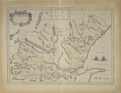
Northern Scotland: 17th Century Hand-colored Map by Mercator
Located in Alamo, CA
This is a framed hand-colored 17th century map of Northern Scotland by Gerard Mercator entitled "Scotiae pars Septentrionalis", published in Amsterdam in 1636. It is a highly detailed map of the northern part of Scotland, with the northwest Highlands and the cities Inverness and Aberdeen, as well as the Orkney Islands and the Hebrides. There is a decorative title cartouche in the upper left corner. The map is presented in an antiqued brown wood...
Category

Mid-17th Century Other Art Style Landscape Prints

Materials

Engraving

New Map of the Terraqueous Globe - WORLD MAP - CALIFORNIA AS AN ISLAND
By Edward Wells
Located in Santa Monica, CA
EDWARD WELLS (British 1667- 1727) A NEW MAP of the TERRAQUEOUS GLOBE - according to the latest Discoveries and most general Divisions of it into CONTINENTS and OCEANS, 1700-01 (Shirley 609) Engraved by Michael Burghers, Oxford. Hand-colored, Platemark 14 1/4 x 20 1/8 inches. Central cartouche flanked by figures representing the continents with dedication to William, Duke of Gloucester...
Category

Early 1700s Old Masters Landscape Prints

Materials

Engraving

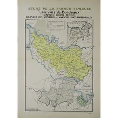
1943 original map " Les vins des Côtes du Rhône - Groupe Septentrional"
Located in PARIS, FR
The 1943 original map by L. Larmat from the "Atlas de la France Vinicole" series, titled "Les vins des Côtes du Rhône - Groupe Septentrional", is a beautiful and historically signifi...
Category

1940s Prints and Multiples

Materials

Lithograph, Paper

Map of the War between Hungary and Prussia - Etching - 19th Century
Located in Roma, IT
Map of the War between Hungary and Prussia is an etching realized during the 19th century. Good condition.
Category

Early 19th Century Modern Figurative Prints

Materials

Etching

17th Century Dutch Map of Italy, Sicily, Sardinia, Corsica and Dalmatian Coast
By Theodorus Danckerts
Located in Alamo, CA
This hand colored 17th century Dutch map entitled "Novissima et Accuratissima totius Italiae Corsicae et Sardiniae Descriptio" by Theodore Danckerts depicts the Italian Peninsula in ...
Category

1690s Prints and Multiples

Materials

Engraving

Durham, English County Antique map, 1847
Located in Melbourne, Victoria
Steel-engraved map with original outline colouring by Isaac Slater. A detailed engraved map of the English county with title, scale, and key. Decorated with an uncoloured engraved vi...
Category

19th Century Naturalistic Landscape Prints

Materials

Engraving

1943 original illustrated map of Cochinchine by Dylbert
Located in PARIS, FR
The 1943 original illustrated map of Cochinchine by Dylbert is a striking example of cartographic artistry from a period steeped in global conflict and colonial influence. Created du...
Category

1940s Prints and Multiples

Materials

Lithograph, Paper, Linen

1943 original map "Les vins des Côtes du Rhône" by Larmat
Located in PARIS, FR
The 1943 original map by L. Larmat, titled "Les vins des Côtes du Rhône", is part of the comprehensive "Atlas de la France Vinicole" series, which meticulously charts France’s most r...
Category

1940s Prints and Multiples

Materials

Lithograph, Paper

Var, France. Antique map of a French department, 1856
Located in Melbourne, Victoria
'Dept. du Var', steel engraving with original outline hand-colouring., 1856, from Levasseur's Atlas National Illustre. Var covers the heart of the French Riviera or Cote d'Azur., and includes the resort cities of Cannes, Nice and San Tropez...
Category

19th Century Naturalistic Landscape Prints

Materials

Engraving

Haut Rhin, France. Antique map of a French department, 1856
Located in Melbourne, Victoria
'Dept. du Bas Rhin', steel engraving with original outline hand-colouring., 1856, from Levasseur's Atlas National Illustre. This mountainous area is part of the Alsace wine region ...
Category

19th Century Naturalistic Landscape Prints

Materials

Engraving

Original 'Map of the United States as Californians See It' vintage map poster
Located in Spokane, WA
Original vintage poster: "Map of the United States as Californians See It". 1947, artist: Oren Arnold. Size: 16.5" x 20.5", R. H. MOEBUS COMPANY This poster is not linen-backed. This poster is in very good fine condition, ready to frame. A humorous satirical pictorial map from 1947 with the golden sun on the upper left, gives a detailed depiction of California, its relative size to the rest of the United States, showing Florida as "Death Valley", the rest of the United States as "Unexplored" 'Unimportant anyway, not in California". The image has your Mexican singer; bikini-clad bathers and others set in the image. Shows rivers, lakes, harbors, landmarks, parks, recreational activities, and local people. This map shows Los Angeles’ city...
Category

1940s American Modern Landscape Prints

Materials

Offset

1948 original map titled La Vallée de la Dordogne de Bordeaux à la Bourboule
Located in PARIS, FR
The 1948 original map titled La Vallée de la Dordogne de Bordeaux à la Bourboule was created by the French artist and cartographer Jean Moles. This map serves as both a geographical ...
Category

1940s Prints and Multiples

Materials

Lithograph, Paper

1958 map poster dedicated to La Provence France’s most cherished regions
Located in PARIS, FR
This vibrant 1958 map poster dedicated to La Provence offers a whimsical and informative journey through one of France’s most cherished regions. Combining charm and clarity, it serve...
Category

1950s Prints and Multiples

Materials

Linen, Paper, Lithograph

See Glasgow by Train original vintage 1960s poster by Elizabeth Scott
Located in London, GB
To see our other original vintage posters, scroll down to "More from this Seller" and below it click on "See all from this Seller" - or send us a message if you cannot find the poste...
Category

1960s Prints and Multiples

Materials

Lithograph

1947 original map "Le Cognac Bois ordinaires & Bois communs" by Larmat
Located in PARIS, FR
The 1947 original map Atlas de la France Vinicole - Les Eaux-de-vie de France - Le Cognac Bois Ordinaires & Bois Communs dits à Terroir, created by Louis Larmat and printed by Dorel ...
Category

1940s Prints and Multiples

Materials

Lithograph, Paper

Map of Scotland - Etching by Johannes Blaeu - 1650s
Located in Roma, IT
Map of Scotland is an geographic map realized by Johannes Blaeu. Etching, printed in 1660 ca. Copper engraving, colored (coeval coloring), on paper, with center fold; Latin text. ...
Category

1650s Modern Figurative Prints

Materials

Etching

Men of the Night - Lithograph by Pino Reggiani - 1970 ca.
Located in Roma, IT
Hand Signed. Edition of 110 pieces. Excellent condition.
Category

1970s Contemporary Figurative Prints

Materials

Lithograph

Prussia (after the war of 1866) - Lithograph - 1872
Located in Roma, IT
Prussia (after the war of 1866) is a map realized by an artist during the 19th century. Lithograph, printed in 1872 by Milliam Mackenzie, London. Good condition.
Category

1870s Modern Figurative Prints

Materials

Lithograph

Battle of Carignan - Lithograph by R. Walker - 1872
Located in Roma, IT
Battle of Carignan is a map realized by Robert Walker. Lithograph, printed in 1872 by Milliam Mackenzie, London. Good condition.
Category

1870s Modern Figurative Prints

Materials

Lithograph

Battle of Gravelotte - Lithograph by R. Walker - 1872
Located in Roma, IT
Battle of Gravelotte is a map realized by Robert Walker. Lithograph, printed in 1872 by Milliam Mackenzie, London. Good condition.
Category

1870s Modern Figurative Prints

Materials

Lithograph

Battle of Vionville - Lithograph by R. Walker - 1872
Located in Roma, IT
Battle of Vionville is a map realized by R. Walker. Lithograph, printed in 1872 by Milliam Mackenzie, London. Good condition.
Category

1870s Modern Figurative Prints

Materials

Lithograph

Battle of Beaumont - Lithograph by R. Walker - 1872
Located in Roma, IT
Battle of Beaumont is a map realized by R. Walker. Lithograph, printed in 1872 by Milliam Mackenzie, London. Good condition.
Category

1870s Modern Figurative Prints

Materials

Lithograph

Battle of Courcelles - Lithograph by R. Walker - 1872
Located in Roma, IT
Battle of Courcelles is a map realized by R. Walker. Lithograph, printed in 1872 by Milliam Mackenzie, London. Good condition.
Category

1870s Modern Figurative Prints

Materials

Lithograph

Battle of Forbach - Lithograph by R. Walker - 1872
Located in Roma, IT
Battle of Forbach is a map realized by R. Walker. Lithograph, printed in 1872 by Milliam Mackenzie, London. Good condition.
Category

1870s Modern Figurative Prints

Materials

Lithograph

Battle of Woerth - Lithograph by R. Walker - 1872
Located in Roma, IT
Battle of Woerth is a map realized by R. Walker. Lithograph, printed in 1872 by Milliam Mackenzie, London. Good condition.
Category

1870s Modern Figurative Prints

Materials

Lithograph

Battle of Wissembourg - Lithograph by R. Walker - 1872
Located in Roma, IT
Battle of Wissembourg is a map realized by R. Walker. Lithograph, printed in 1872 by Milliam Mackenzie, London. Good condition.
Category

1870s Modern Figurative Prints

Materials

Lithograph

Battle of Saarbruck - Lithograph by R. Walker - 1872
Located in Roma, IT
Battle of Saarbruck is an map realized by R. Walker. Lithograph, printed in 1872 by Milliam Mackenzie, London. Good condition.
Category

1870s Modern Figurative Prints

Materials

Lithograph

South Germany - Lithograph - 1872
Located in Roma, IT
South Germany is a map realized by an artist during the 19th century. Lithograph, printed in 1872 by Milliam Mackenzie, London. Good condition.
Category

1870s Modern Figurative Prints

Materials

Lithograph

France in Departments - Lithograph - 1872
Located in Roma, IT
France in Departments is a map realized by an artist of the 19th century. Lithograph, printed in 1872 by Milliam Mackenzie, London.
Category

1870s Modern Figurative Prints

Materials

Lithograph

Indre and Loire, France. Antique map of a French department, 1856
Located in Melbourne, Victoria
'Dept. d'Indre et Loire', steel engraving with original outline hand-colouring., 1856, from Levasseur's 'Atlas National Illustre'. This area is known for its production of Chenin b...
Category

19th Century Naturalistic Landscape Prints

Materials

Engraving

Berkshire, English County Antique map, 1847
Located in Melbourne, Victoria
Steel-engraved map with original outline colouring by Isaac Slater. A detailed engraved map of the English county with title, scale, and key. Decorated with an uncoloured engraved v...
Category

19th Century Naturalistic Landscape Prints

Materials

Engraving

Bas Rhin, France. Antique map of a French department, 1856
Located in Melbourne, Victoria
'Dept. du Bas Rhin', steel engraving with original outline hand-colouring., 1856, from Levasseur's Atlas National Illustre. Part of the Alsace wine region surrounding Strasbourg. T...
Category

19th Century Naturalistic Landscape Prints

Materials

Engraving

Herefordshire, English County Antique map, 1847
Located in Melbourne, Victoria
Steel-engraved map with original outline colouring by Isaac Slater. A detailed engraved map of the English county with title, scale, and key. Decorated with an uncoloured engraved vi...
Category

19th Century Naturalistic Landscape Prints

Materials

Engraving

1947 original map Gouvernement Généraux du Poitou, du Pays d'Aunis
Located in PARIS, FR
The 1947 original map Gouvernement Généraux du Poitou, du Pays d'Aunis et de Saintonge Angoumois, created by Louis Larmat and printed by Dorel in Paris, is a beautifully detailed car...
Category

1940s Prints and Multiples

Materials

Lithograph, Paper

Golf of Benngala - Etching by Johannes Janssonius - 1650s
Located in Roma, IT
Golfo De Benngala is an antique map realized in 1650 by Johannes Janssonius (1588-1664). The Map is Hand-colored etching, with coeval watercoloring. Good conditions with slight fox...
Category

1650s Modern Figurative Prints

Materials

Etching

Original San Francisco, California vintage fun map poster Henry Hinton
Located in Spokane, WA
Original San Francisco, California fun map vintage poster 1970. Archival linen backed in very fine condition, ready to frame. -Artist: Henry Hinton I don’t know how much more you could include in this detailed fun map of San Francisco...
Category

1970s American Impressionist Landscape Prints

Materials

Offset

Circa 1950 original illustrated map by André Lesot for "Carte de la Manche"
Located in PARIS, FR
The circa 1950 original illustrated map by André Lesot for "Carte de la Manche" is a significant piece that highlights both artistic design and geographic representation. Created dur...
Category

1950s Prints and Multiples

Materials

Lithograph, Linen, Paper

West Africa: 18th Century Hand-colored Homann Map Entitled "Guinea Propria"
Located in Alamo, CA
This is a scarce richly hand colored copper plate engraved map of Africa entitled "Guinea Propria, nec non Nigritiae vel Terrae Nigrorum Maxima Pars" by Johann Baptist Homann (1664-1...
Category

1740s Other Art Style Prints and Multiples

Materials

Engraving

Europa Regnorum Provinciarum: 18th Century Hand-colored Map of Europe by Lotter
By Tobias Conrad Lotter
Located in Alamo, CA
This is an 18th century hand-colored copperplate engraved map entitled "Europa Regnorum Provinciarum Regionum" created by the German cartographer Tobias Conrad Lotter. It was publish...
Category

Mid-18th Century Landscape Prints

Materials

Engraving

Australia Original Vintage Propaganda Poster post WW2 MacDonald Max Gill
Located in London, GB
To see our other original vintage travel and propaganda posters, scroll down to "More from this Seller" and below it click on "See all from this Seller" - or send us a message if you...
Category

1940s Modern Landscape Prints

Materials

Lithograph

West Coast of Africa; Guinea & Sierra Leone: Bellin 18th Century Map
Located in Alamo, CA
This is a Jacques Bellin copper-plate map entitled "Partie de la Coste de Guinee Dupuis la Riviere de Sierra Leona Jusquau Cap das Palmas", depicting the coast of Guinea and Sierra L...
Category

1740s Old Masters Landscape Prints

Materials

Engraving

View of Haarlem, The Netherlands - by G. Braun and F. Hogenberg - Late 1500
Located in Roma, IT
This vie of Haarlem in the Netherlands (ancient name: Harlemvm) is an original etching realized by George Braun and Franz Hogenberg as part of the Series "Civitates Orbis Terrarum". ...
Category

16th Century Figurative Prints

Materials

Etching

Constellation of Blessed Spirits - Woodcut - 1963
Located in Roma, IT
Constellation of Blessed Spirits -  "The Divine Comedy" - Song 20 -  Paradise is a woodcut print realized in 1963 for a series illustrating the Medieval poem of the "Divine Comedy" b...
Category

1960s Surrealist Figurative Prints

Materials

Woodcut

1848 Original map by Maillard - Plan de Paris et ses Fortifications
Located in PARIS, FR
In the realm of cartography, maps serve as both practical tools and artistic representations, encapsulating the essence of a place at a specific moment in time. The 1848 vintage map,...
Category

1840s Prints and Multiples

Materials

Paper, Linen, Lithograph

John Speede Map The Countye of Monmouth
Located in London, GB
To see our other views and maps of England - including London, Oxford and Cambridge, scroll down to "More from this Seller" and below it click on "See all from this Seller" - or send...
Category

17th Century Realist Landscape Prints

Materials

Engraving

1899 "Plan des Tramways de Paris" by Wuhrer - Paris's public transportation
Located in PARIS, FR
The 1899 "Plan des Tramways de Paris" by Wuhrer is a fascinating snapshot of Paris's public transportation landscape at the dawn of the 20th century. This meticulously crafted map delineates the extensive network of tramway lines that crisscrossed the city, each route marked in detail to aid both residents and visitors in navigating the bustling metropolis. The Belle Époque, during which this map was produced, was a period of significant growth and modernization in Paris. The city's population was expanding rapidly, and with it came the need for a more efficient means of urban transport. Tramways emerged as a vital solution, connecting neighborhoods and making the city's many attractions more accessible. These electric trams were a symbol of technological progress, replacing the horse-drawn carriages of earlier years and setting the stage for the future of public transit...
Category

1890s Prints and Multiples

Materials

Lithograph, Paper

Sweden and Adjacent Portions of Scandinavia: A Hand-colored 18th C. Homann Map
Located in Alamo, CA
This hand-colored copper-plate map of Sweden and adjacent portions of Scandinavia entitled "Regni Sueciae in Omnes suas Subjacentes Provincias accurate divisi Tabula Generalis" was c...
Category

Early 18th Century Old Masters Landscape Prints

Materials

Engraving

Three Questions #IX
Located in San Francisco, CA
This artwork titled "Three Questions #IX" 2003 is an original soft ground etching on Somerset paper by American artist Mary Esch, b.1965. It is Hand signed, dated, titled and numbere...
Category

21st Century and Contemporary Modern Figurative Prints

Materials

Etching

Shade of a Tree, Signed Modern Screenprint by Shoichi Ida
Located in Long Island City, NY
Shade of a Tree Shoichi Ida, Japanese (1941–2006) Date: 1970 Screenprint, signed, titled, numbered and dated in pencil Edition of 1/30 Image Size: 21.25 x 27.25 inches Size: 22 x 28 ...
Category

1970s Modern Animal Prints

Materials

Screen

Map of Vallombrosa - Florence 1926
Located in Roma, IT
This Map of Vallombrosa is a vintage offset print realized by an anonymous author in 1926. The state of preservation of the artwork is aged with some small diffused stains and the a...
Category

1920s Modern Figurative Prints

Materials

Color

Danube River, Italy, Greece and Croatia: A Hand-colored 18th C. Homann Map
Located in Alamo, CA
"Fluviorum in Europa principis Danubii" is a hand-colored map of the region about the Danube river created by Johann Baptist Homann (1663-1724) in his 'Atlas Novus Terrarum', publish...
Category

Early 18th Century Old Masters Landscape Prints

Materials

Engraving

Northern Scotland: 16th Century Hand-colored Map by Mercator
Located in Alamo, CA
This is a framed hand-colored 16th century map of Northern Scotland by Gerard Mercator entitled "Scotiae pars Septentrionalis", published in Amsterdam in 1636. It is a highly detailed map of the northern part of Scotland, with the northwest Highlands and the cities Inverness and Aberdeen, as well as the Orkney Islands and the Hebrides. There is a decorative title cartouche in the upper left corner. The map is presented in an antiqued brown wood...
Category

16th Century Other Art Style Landscape Prints

Materials

Engraving

1937 original poster designed as a board game - automobile race across Belgium
Located in PARIS, FR
The 1937 original map poster titled "Une course d'automobiles à travers la Belgique" is a fascinating artifact that combines cartography, graphic design, and the cultural enthusiasm ...
Category

1930s Prints and Multiples

Materials

Lithograph, Linen, Paper

Ancient Map-Poli Arctici (Map of the Poles)-Etching by Johannes Janssonius-1650s
Located in Roma, IT
Poli Arctici is an ancient map realized in 1650 by Johannes Janssonius (1588-1664). The Map is a Hand-colored etching, with coeval watercoloring. Good conditions with slight foxing...
Category

1650s Modern Figurative Prints

Materials

Etching

Original planisphere for Air France worldwide air network by Lucien Boucher
Located in PARIS, FR
Lucien Boucher 🇫🇷 (1889 - 1971) is a French painter, engraver, poster artist and designer. He studied ceramics at the School of Sevres before being sent to the front in 1914. Taken...
Category

1950s Prints and Multiples

Materials

Paper, Lithograph, Linen

Ancient Map of Denmark and Sweden - Original Etching - 19th Century
Located in Roma, IT
This Map of Denmark and Sweden is an etching realized by an anonymous artist. The state of preservation of the artwork is good with some small diffused stains. Sheet dimension: 27x...
Category

Late 19th Century Modern Figurative Prints

Materials

Etching

Map of Battle of Waterloo - Etching by Pierre François Tardieu - 1837
Located in Roma, IT
Map of Battle of Waterloo is an Etching realized by Pierre François Tardieu in 1837. Good conditions. The artwork is realized in a well-balanced composition. the artwork and belong...
Category

1830s Modern Figurative Prints

Materials

Etching

Griffin's 1955 Northern Ireland original map - Tourism - Geography
Located in PARIS, FR
Griffin's 1955 Northern Ireland map stands out as a captivating representation of the region's geography and features. Printed by James Upton Limited in Birm...
Category

1950s Prints and Multiples

Materials

Linen, Lithograph, Paper

Recently Viewed

View All