Map Prints and Multiples

to
16
127
131
65
32
19
Overall Width
to
Overall Height
to
151
23
16
2
2
1
28
26
11
10
8
115
128
113
18
1
3
17
34
31
6
10
1
27
265
109
448
39,763
20,943
14,175
12,942
11,441
9,199
8,120
5,975
4,350
3,850
3,715
3,660
3,615
3,494
3,321
3,310
2,794
2,725
2,674
147
123
98
69
24
25
204
260
69
Art Subject: Map
Dalmatia with the Adjacent Islands - Etching by Giovanni Cassini - 1792
Located in Roma, IT
Dalmatia with the Adjacent Islands - Plate 42 is an original old master artwork realized by Giovanni Cassini in 1792 Handcolored etching. Includes frame
Category

Late 18th Century Old Masters Figurative Prints

Materials

Etching

Original Vintage Air France Horoscope Poster by Lucien Boucher 1953 Small Format
Located in Boca Raton, FL
This stunning original vintage poster by Lucien Boucher (1889–1971) is among his most sought-after designs for Air France. Created in the 1950s, it showcases the airline’s extensive ...
Category

1950s Prints and Multiples

Materials

Lithograph

1949 original map of Belgian Congo - Belgian Ministry of Colonies
Located in PARIS, FR
This 1949 original poster titled Congo Belge, created by French illustrator Laboulais, offers a striking example of mid-20th-century colonial-era educational and promotional art. Pub...
Category

1940s Prints and Multiples

Materials

Paper, Lithograph, Linen

1938 original map titled "Carte du réseau aérien français" Air France
Located in PARIS, FR
The 1938 original map titled "Carte du réseau aérien français" by A. Collinet offers a captivating snapshot of Air France's global aviation network durin...
Category

1930s Prints and Multiples

Materials

Linen, Paper, Lithograph

Original poster Concentration Camps in the Soviet Union Never in France S.F.I.O.
Located in PARIS, FR
The original poster titled "Les camps de concentration en Union soviétique - jamais ça en France" ("Concentration Camps in the Soviet Union - Never in France") serves as a stark poli...
Category

1940s Prints and Multiples

Materials

Lithograph, Paper, Linen

Proposal for a Broome Street Expressway in the Form of a Cigarette and Smoke
Located in New York, NY
This work is offered by CLAMP in New York City.
Category

1970s Contemporary Prints and Multiples

Materials

Lithograph

Prussia (after the war of 1866) - Lithograph - 1872
Located in Roma, IT
Prussia (after the war of 1866) is a map realized by an artist during the 19th century. Lithograph, printed in 1872 by Milliam Mackenzie, London. Good condition.
Category

1870s Modern Figurative Prints

Materials

Lithograph

Battle of Beaumont - Lithograph by R. Walker - 1872
Located in Roma, IT
Battle of Beaumont is a map realized by R. Walker. Lithograph, printed in 1872 by Milliam Mackenzie, London. Good condition.
Category

1870s Modern Figurative Prints

Materials

Lithograph

Battle of Vionville - Lithograph by R. Walker - 1872
Located in Roma, IT
Battle of Vionville is a map realized by R. Walker. Lithograph, printed in 1872 by Milliam Mackenzie, London. Good condition.
Category

1870s Modern Figurative Prints

Materials

Lithograph

Battle of Wissembourg - Lithograph by R. Walker - 1872
Located in Roma, IT
Battle of Wissembourg is a map realized by R. Walker. Lithograph, printed in 1872 by Milliam Mackenzie, London. Good condition.
Category

1870s Modern Figurative Prints

Materials

Lithograph

Battle of Saarbruck - Lithograph by R. Walker - 1872
Located in Roma, IT
Battle of Saarbruck is an map realized by R. Walker. Lithograph, printed in 1872 by Milliam Mackenzie, London. Good condition.
Category

1870s Modern Figurative Prints

Materials

Lithograph

South Germany - Lithograph - 1872
Located in Roma, IT
South Germany is a map realized by an artist during the 19th century. Lithograph, printed in 1872 by Milliam Mackenzie, London. Good condition.
Category

1870s Modern Figurative Prints

Materials

Lithograph

1935 original map French exploration in North America
Located in PARIS, FR
In 1935, a remarkable map titled "Les Français au Cœur de l'Amérique" was produced, highlighting the rich history of French exploration and influence in North America. This map is a ...
Category

1930s Prints and Multiples

Materials

Lithograph, Paper

View of 4 Ancient German Cities - Etching by G. Braun and F. Hogenberg
Located in Roma, IT
Maps is an original etching realized by G. Braun and F. Hogenberg as part of the so called "Civitates Orbis Terrarum". The “Civitates Orbis Terrarum” (Atlas of Cities of the World) ...
Category

16th Century Figurative Prints

Materials

Etching

Map of Russia - Etching by Marco Di Pietro - 19th Century
Located in Roma, IT
This map of Russia is an etching realized by the Italian engraver Marco Di Pietro in 19th century. The state of preservation of the artwork is excellent. The signature is engraved o...
Category

19th Century Old Masters Figurative Prints

Materials

Etching

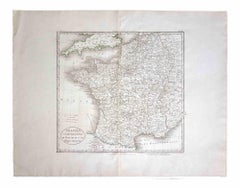
Map of France - Etching - 1820
Located in Roma, IT
Map of France is an Original Etching realized by an unknown artist of 19th century in 1820. Very good condition on two sheets of white paper joined at t...
Category

1820s Modern Figurative Prints

Materials

Etching

Valsavia Superiore e Inferiore - Etching by V. M. Coronelli - Late 17th century
By Vincenzo Maria Coronelli
Located in Roma, IT
Valsavia Superiore e Inferiore is a beautiful historical etching on ivory-colored paper, realized by Vincenzo Maria Coronelli (1650-1718) in the late 17th century. This interesting ...
Category

Late 17th Century Figurative Prints

Materials

Paper, Etching

Hemisphere Of The New Continent - Ancient Map by J.G. Heck - 1834.
Located in Roma, IT
Hemisphere Of The New Continent is an artwork realized around 1760 by Johann Georg Heck Original colored print. Good conditions except for yellowing of paper and tears along the m...
Category

1830s Modern Figurative Prints

Materials

Etching

View of Leiden - Etching by G. Braun and F. Hogenberg - Late 1500
Located in Roma, IT
This map of Leida is an original etching realized by George Braun and Franz Hogenberg as part of the famous Series "Civitates Orbis Terrarum". The “Civitates Orbis Terrarum” (Atlas...
Category

16th Century Figurative Prints

Materials

Etching

La Revue Blanche - Lithograph After P. Bonnard - 1951
Located in Roma, IT
Image dimensions: 28 x 21.5 cm. La Revue Blanche is a wonderful chromolithograph, signed in pencil on the lower right margin by Pierre Bonnard. Sign...
Category

1950s Post-Impressionist Figurative Prints

Materials

Lithograph

Map of Calcaria - From "Civitates Orbium Terrarum" by F. Hogenberg - 1575
Located in Roma, IT
"Machelen", from the collection "Civitates Orbis Terrarum", Cologne, T. Graminaeus, 1575. The “Civitates Orbis Terrarum” (Atlas of Cities of the World) was the second oldest print...
Category

16th Century Figurative Prints

Materials

Etching, Aquatint

Map of Rouen - Original Etching - 19th Century
Located in Roma, IT
Map of Rouen is an original etching realized by an Anonymous engraver of the 19th Century. Printed within the series of "France Pittoresque". The state of preservation of the artwo...
Category

19th Century Figurative Prints

Materials

Etching

Carta delle Aspirazioni Nazionali - Vintage Offset - 20th century
Located in Roma, IT
Carta delle Aspirazioni Nazionali is an original offset, realized by an anonymous artist in the mid-20th Century. Fair conditions with riping and cutaways. The artwork is depicted ...
Category

Mid-20th Century Modern Figurative Prints

Materials

Offset

Map of Greece - Original Etching by Antonio Zatta - 18th Century
Located in Roma, IT
This Map of Greece is an etching realized by Antonio Zatta, Cartographer, publisher and typographer. The state of preservation of the artwork is good except for the worn paper and t...
Category

1780s Figurative Prints

Materials

Etching

Ancient Map of Senegal - Original Etching - 19th Century
Located in Roma, IT
Map of Senegal is an original etching realized by an anonymous engraver of the 19th Century. Printed in series of "France Pittoresque" at the top center. The state of preservation ...
Category

19th Century Figurative Prints

Materials

Etching

Map of Deux Sèvres - Original Etching - 19th Century
Located in Roma, IT
Map of Deux Sèvres is an original antique etching realized by an anonymous engraver of the 19th Century. Printed in series of "France Pittoresque" at the top center. The state of p...
Category

19th Century Modern Figurative Prints

Materials

Etching

Map of Oxfordshire by Joan Blaeu with college crests
Located in London, GB
To see our other original maps, scroll down to "More from this Seller" and below it click on "See all from this Seller" - or send us a message if you cannot find the poster you want....
Category

1660s Landscape Prints

Materials

Engraving

Map of Switzerland - Etching - 19th Century
Located in Roma, IT
This map of Netherlands is an etching realized in 19th century. The state of preservation of the artwork is excellent. The signature "F.B." is engraved on the lower right. At the to...
Category

19th Century Figurative Prints

Materials

Etching

Ancient Map of Guyane - Original Etching - 19th Century
Located in Roma, IT
Map of Guyane is an original etching realized by an anonymous engraver of the 19th Century. Belongs to the Series of "France Pittoresque" at the top center. The state of preservati...
Category

19th Century Modern Figurative Prints

Materials

Etching

Leyden, Map from "Civitates Orbis Terrarum" - by F. Hogenberg - 1575
Located in Roma, IT
Braun G., Hogenberg F., Leyden, from the collection Civitates Orbis Terrarum, Cologne, T. Graminaeus, 1572-1617. The “Civitates Orbis Terrarum” (Atlas of Cities of the World) was th...
Category

16th Century Figurative Prints

Materials

Etching, Aquatint

Map of China - Etching - 19th Century
Located in Roma, IT
This map of China is an etching realized in 19th century. The state of preservation of the artwork is excellent. At the top of the paper, the inscription...
Category

19th Century Figurative Prints

Materials

Etching

Tarn et Garonne Map - Original Lithograph - 19th Century
Located in Roma, IT
Tarn et Garonne Map is an original lithograph realized by an Anonymous artist of the 19th Century. Printed in series of "France Pittoresque" at the top center. The state of preservation of the artwork is good. An interesting piece of art in this geographical map...
Category

19th Century Modern Figurative Prints

Materials

Paper, Lithograph

New Revised North America Map with Mythical Figures and Animals
Located in Houston, TX
Copperplate engraving hand colored map of Northern America. The figures of the mythical figure along the right side and the animals were added in later after the original printing. T...
Category

Early 1700s Naturalistic Landscape Prints

Materials

Engraving

Map of Paris - Original Etching - 19th Century
Located in Roma, IT
This Map of Paris is an original print in etching technique. The state of preservation of the artwork is very good. This artwork represents a detailed map of the city of Paris..
Category

19th Century Figurative Prints

Materials

Etching

Price - Map of Seine - Original Etching - 19th Century
Located in Roma, IT
Map of Seine is an original etching realized by an anonymous engraver of the 19th Century. Printed in series of "France Pittoresque" at the top center. The state of preservation of...
Category

19th Century Figurative Prints

Materials

Etching

Li Governi di Borgogna - Ancient Map - 1777
Located in Roma, IT
Li Governi di Borgogna is an original black and white etching on paper, printed by Antonio Zatta in Venice, 1777. Original Title: Li Governi di Borgogna della Franca Contea e del Ly...
Category

1770s Modern Landscape Prints

Materials

Etching

Colonie d'Alger - Original Etching - 19th century
Located in Roma, IT
Colonie d'Alger is an original etching realized by an Anonymous engraver of the 19th Century. Printed in series of "France Pittoresque" at the top center. The state of preservation...
Category

19th Century Old Masters Figurative Prints

Materials

Etching

View of Haarlem, The Netherlands - by G. Braun and F. Hogenberg - Late 1500
Located in Roma, IT
This vie of Haarlem in the Netherlands (ancient name: Harlemvm) is an original etching realized by George Braun and Franz Hogenberg as part of the Series "Civitates Orbis Terrarum". ...
Category

16th Century Figurative Prints

Materials

Etching

Ancient Map of Denmark and Sweden - Original Etching - 19th Century
Located in Roma, IT
This Map of Denmark and Sweden is an etching realized by an anonymous artist. The state of preservation of the artwork is good with some small diffused stains. Sheet dimension: 27x...
Category

Late 19th Century Modern Figurative Prints

Materials

Etching

Isle of Man original vintage poster by Gordon Davey
By Gordon Davey
Located in London, GB
To see our other original vintage posters, scroll down to "More from this Seller" and below it click on "See all from this Seller" - or send us a message if you cannot find the poste...
Category

1950s Prints and Multiples

Materials

Lithograph

A Map of the Colne Valley Cloth District, West Yorkshire by Max Gill
Located in London, GB
To see our other original maps, scroll down to "More from this Seller" and below it click on "See all from this Seller" - or send us a message if you cannot find the poster you want....
Category

1940s Prints and Multiples

Materials

Lithograph

17th Century map of Cumberland, UK by Robert Morden
Located in Petworth, West Sussex
Robert Morden (British, circa 1650 – 1703) A map of Cumberland with hand colouring An engraving 14.1/4 x 16.5/8 in. (36.5 x 42.5 cm.)
Category

17th Century Academic Landscape Prints

Materials

Engraving

Hemisphere Of The New Continent - Ancient Map by J.G. Heck - 1834.
Located in Roma, IT
Hemisphere Of The New Continent - West is an artwork realized in 1834 by Johann Georg Heck Original colored print. Good conditions except for yellowing of the paper and very littl...
Category

1830s Modern Figurative Prints

Materials

Etching

Map of Northumberland by Joannem Janssonium 17th century
Located in London, GB
To see our other original maps, scroll down to "More from this Seller" and below it click on "See all from this Seller" - or send us a message if you cannot find the poster you want....
Category

1640s Landscape Prints

Materials

Engraving

1851 Original map by Maillard - Plan de Paris et ses Fortifications
Located in PARIS, FR
In the world of cartography, maps transcend mere geography; they are historical records and works of art, encapsulating the essence of a place at a specific moment in time. The 1851 ...
Category

1850s Prints and Multiples

Materials

Paper, Lithograph, Linen

Australia Original Vintage Propaganda Poster post WW2 MacDonald Max Gill
Located in London, GB
To see our other original vintage travel and propaganda posters, scroll down to "More from this Seller" and below it click on "See all from this Seller" - or send us a message if you...
Category

1940s Modern Landscape Prints

Materials

Lithograph

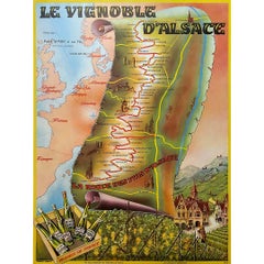
1963 original poster Le Vignoble d'Alsace, la Route des Vins d'Alsace
Located in PARIS, FR
P. Barbier's 1963 original poster promoting "Le Vignoble d'Alsace, la Route des Vins d'Alsace" (The Vineyards of Alsace, the Alsace Wine Route) stands as a picturesque invitation to explore the rich winemaking heritage and scenic beauty of this renowned French region. This poster, created to promote the Alsace Wine Route, not only serves as promotional material but also encapsulates the essence of tradition, culture, and the joy of wine exploration. The Alsace Wine Route, or "Route des Vins d'Alsace," winds through the picturesque vineyards and charming villages of the Alsace region in northeastern France. This route is known for its exceptional wines, centuries-old winemaking traditions, and stunning landscapes...
Category

1960s Prints and Multiples

Materials

Lithograph, Paper

Old advertising poster made by Willy Fisher in the 1950s - Le Vignoble d'Alsace
Located in PARIS, FR
Old advertising poster made by Willy Fisher in the 1950s, Le Vignoble d'Alsace - Vins d'Alsace. Alcohol - Tourism - Wine The grape varieties of Alsace wines
Category

1950s Prints and Multiples

Materials

Paper, Lithograph

Original poster made in the 1950's of the Greater Portland Maine
Located in PARIS, FR
Original cartographic poster made in the 1950's that shows us all the monuments and different places of historical importance in the city of Portland. Portland, also known as Portla...
Category

1950s Prints and Multiples

Materials

Paper, Linen, Lithograph

Cambridgeshire map 17th century engraving by Kip after Saxton
Located in London, GB
To see more, scroll down to "More from this Seller" and below it click on "See all from this Seller." William Kip (active 1598 - 1610) after Christopher Saxton (1540 - 1610). Map o...
Category

1630s Landscape Prints

Materials

Engraving

Map of the North of Scotland 17th century hand-coloured map by Gerardus Mercator
Located in London, GB
Gerardus Mercator (1512 - 1594) Map of the North of Scotland (1683) Engraving with later hand colouring 35 x 45 cm A fantastically characterful and detailed map engraving of the North of Scotland from 1683. The highly detailed and beautifully coloured map is inscribed to the reverse with a description of the parts of Scotland illustrated, called the 'Troisieme Table d'Escosse'. The map comes from the 1683 French edition of Gerardus Mercator's Atlas Major, which was first published in 1585. Gerardus Mercator was the Flemish father of mapmaking. He was a skilled geographer, cosmographer and cartographer and is most renowned for creating the 1569 world map based on a new projection which represented sailing courses of constant bearing (rhumb lines) as straight lines - an innovation that is still employed in today's nautical charts. Mercator was a highly influential pioneer in the history of cartography and is generally considered one of the founders of the Netherlandish school of cartography and geography. He is also widely considered the most notable figure of the school. In his own day, he was a notable maker of globes and scientific instruments. In addition, he had interests in theology, philosophy, history, mathematics and geomagnetism. He was also an accomplished engraver and calligrapher. Unlike other great scholars of the age, he travelled little and his knowledge of geography came from his library of over a thousand books and maps, from his visitors and from his vast correspondence (in six languages) with other scholars, statesmen, travellers, merchants and seamen. Mercator's early maps were in large formats suitable for wall mounting but in the second half of his life, he produced over 100 new regional maps in a smaller format suitable for binding into his Atlas of 1595. This was the first appearance of the word Atlas in reference to a book of maps...
Category

1680s Prints and Multiples

Materials

Engraving

Berkshire 19th century map engraved by John Dower
Located in London, GB
To see more, scroll down to "More from this Seller" and below it click on "See all from this Seller." John Dower (1825 - 1901) Map of Berkshire from an actual survey made in the ye...
Category

1820s Prints and Multiples

Materials

Engraving

The Holy Land National Savings original vintage poster by Mahoney
Located in London, GB
To see our other original vintage posters, scroll down to "More from this Seller" and below it click on "See all from this Seller" - or send us a message if you cannot find the poste...
Category

1950s Prints and Multiples

Materials

Lithograph

"No Room for Horses", 1978, Lithograph by Dennis Oppenheim
Located in Long Island City, NY
Artist: Dennis Oppenheim, American (1938 - 2011) Title: No Room for Horses Year: 1978 Medium: Lithograph, signed and numbered in pencil Edition: 100 Size: 39...
Category

1970s Land Landscape Prints

Materials

Lithograph

Westmoreland, English County Antique map, 1847
Located in Melbourne, Victoria
Steel-engraved map with original outline colouring by Isaac Slater. A detailed engraved map of the English county with title, scale, and key. Decorated with an uncoloured engraved v...
Category

19th Century Naturalistic Landscape Prints

Materials

Engraving

Berkshire, English County Antique map, 1847
Located in Melbourne, Victoria
Steel-engraved map with original outline colouring by Isaac Slater. A detailed engraved map of the English county with title, scale, and key. Decorated with an uncoloured engraved v...
Category

19th Century Naturalistic Landscape Prints

Materials

Engraving

Nottinghamshire, English County Antique map, 1847
Located in Melbourne, Victoria
Steel-engraved map with original outline colouring by Isaac Slater. A detailed engraved map of the English county with title, scale, and key. Decorated with an uncoloured engraved vi...
Category

19th Century Naturalistic Landscape Prints

Materials

Engraving

Monmouthshire, English County Antique map, 1847
Located in Melbourne, Victoria
Steel-engraved map with original outline colouring by Isaac Slater. A detailed engraved map of the English county with title, scale, and key. Decorated with an uncoloured engraved vi...
Category

19th Century Naturalistic Landscape Prints

Materials

Engraving

Derbyshire, English County Antique map, 1847
Located in Melbourne, Victoria
Steel-engraved map with original outline colouring by Isaac Slater. A detailed engraved map of the English county with title, scale, and key. Decorated with an uncoloured engraved vi...
Category

19th Century Naturalistic Landscape Prints

Materials

Engraving

Huntingdonshire, English County Antique map, 1847
Located in Melbourne, Victoria
Steel-engraved map with original outline colouring by Isaac Slater. A detailed engraved map of the English county with title, scale, and key. Decorated with an uncoloured engraved vi...
Category

19th Century Naturalistic Landscape Prints

Materials

Engraving

Recently Viewed

View All