Map Prints and Multiples

to
129
127
132
66
33
20
Overall Width
to
Overall Height
to
151
22
16
2
2
1
1
28
26
11
10
8
116
128
116
18
1
3
17
34
32
7
10
1
28
267
111
450
40,710
21,583
14,546
13,094
11,674
9,636
8,478
6,139
4,338
3,816
3,718
3,717
3,670
3,551
3,366
3,353
2,800
2,766
2,694
151
123
100
70
25
28
204
261
72
Art Subject: Map
1941 original map "Les vins de Bordeaux - Loupiac, ..." by Larmat
Located in PARIS, FR
In 1941, L. Larmat crafted an exquisite map titled Atlas de la France Vinicole: Les Vins de Bordeaux - Loupiac, Sainte-Croix-du-Mont, Ières Côtes de Bordeaux, Côtes de Bordeaux St. M...
Category

1940s Prints and Multiples

Materials

Lithograph, Paper

1941 original map "Les vins de Bordeaux - Médoc, Haut-Médoc" by Larmat
Located in PARIS, FR
The 1941 original map by L. Larmat, titled "Atlas de la France vinicole – Les vins de Bordeaux, Médoc, Haut-Médoc", is a part of Larmat's renowned cartographic series that documents ...
Category

1940s Prints and Multiples

Materials

Lithograph, Paper

Original poster Concentration Camps in the Soviet Union Never in France S.F.I.O.
Located in PARIS, FR
The original poster titled "Les camps de concentration en Union soviétique - jamais ça en France" ("Concentration Camps in the Soviet Union - Never in France") serves as a stark poli...
Category

1940s Prints and Multiples

Materials

Lithograph, Paper, Linen

St. Christophe (St. Kitts): Bellin 18th Century Hand Colored Map
Located in Alamo, CA
Jacques Bellin's copper-plate map of the Caribbean island of Saint Kitts entitled "Carte De De l'Isle St. Christophe Pour servir á l'Histoire Genle. des V...
Category

1740s Other Art Style Landscape Prints

Materials

Engraving

Map of Ancient Greece of Macedonia and... - Lithograph by Auguste Wahlen - 1844
Located in Roma, IT
Map of Ancient Greece of Macedonia and Thrace is a lithograph made by Auguste Wahlen in 1844. Hand colored. Good condition. Bottom left is the original title "Carta della Grecia A...
Category

1840s Modern Figurative Prints

Materials

Lithograph

Map of the World - Original Etching - 1820
Located in Roma, IT
Map of the World is an Original Etching realized by an unknown artist of 19th century in 1820. Very good condition on two sheets of white paper joine...
Category

1820s Modern Figurative Prints

Materials

Etching

Hemisphere Of The New Continent - Ancient Map by J.G. Heck - 1834.
Located in Roma, IT
Hemisphere Of The New Continent is an artwork realized around 1760 by Johann Georg Heck Original colored print. Good conditions except for yellowing of paper and tears along the m...
Category

1830s Modern Figurative Prints

Materials

Etching

Circa 1950 original illustrated map for "Carte France autour de Bordeaux"
Located in PARIS, FR
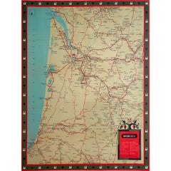
The circa 1950 original illustrated map for "Carte France autour de Bordeaux" is an excellent representation of mid-20th century cartography, focusing on the area surrounding Bordeau...
Category

1950s Prints and Multiples

Materials

Paper, Linen

A Hand Colored 18th Century Framed Map of South America by Thomas Jefferys
Located in Alamo, CA
This detailed hand colored map of South America by Thomas Jefferys was published in London in 1750. The map shows countries, early colonial possessions, towns, rivers, mountains, and...
Category

Mid-18th Century Other Art Style Landscape Prints

Materials

Engraving

Circa 1950 poster Air Algérie regular line network
Located in PARIS, FR
The circa 1950 poster Air Algérie, réseau des lignes régulières by C. Rivière is a vibrant and captivating piece of mid-century commercial art that illustrates the network of regular...
Category

1950s Prints and Multiples

Materials

Lithograph, Paper, Linen

Circa 1825 original engraving of the map of Syria by Giraldon Bovinet
Located in PARIS, FR
The circa 1825 original engraving of "Syrie" by Giraldon Bovinet, based on the work of L. Vivien, is a historically significant map that reflects early 19th-century cartographic tech...
Category

1820s Prints and Multiples

Materials

Engraving, Paper

1941 original map "Les vins de Bordeaux - Entre-deux-mers, Graves... " by Larmat
Located in PARIS, FR
In 1941, French cartographer L. Larmat created a remarkable map titled Atlas de la France Vinicole: Les Vins de Bordeaux - Entre-Deux-Mers, Graves de Vayres, Sainte-Foy Bordeaux, whi...
Category

1940s Prints and Multiples

Materials

Lithograph, Paper

1941 original map "Les vins de Bordeaux - Saint-Émilion, Pomerol..." by Larmat
Located in PARIS, FR
The 1941 original map by L. Larmat, titled "Atlas de la France vinicole – Les vins de Bordeaux: Saint-Émilion, Pomerol, Néac, Côtes de Fronsac, Côtes Canon-Fronsac", offers a detaile...
Category

1940s Prints and Multiples

Materials

Lithograph, Paper

Map of Campaign of 1814 - Etching by Pierre François Tardieu - 1837
Located in Roma, IT
Map of Campaign of 1814 is an Etching realized by Pierre François Tardieu in 1837. Good conditions. The artwork is realized in a well-balanced composition. the artwork and belongs ...
Category

1830s Modern Figurative Prints

Materials

Lithograph

1943 original map "Les vins des Côtes du Rhône - Chateauneuf du Pape " by Larmat
Located in PARIS, FR
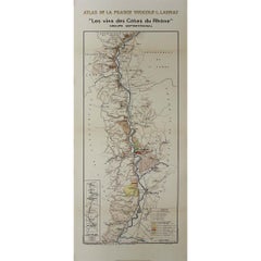
The 1943 original map by L. Larmat, titled "Les vins des Côtes du Rhône - Châteauneuf-du-Pape - Tavel", is an exquisite part of the "Atlas de la France Vinicole" series. Printed by D...
Category

1940s Prints and Multiples

Materials

Lithograph, Paper

1939 original map for Air France titled "Nova et Vetera" by Lucien Boucher
Located in PARIS, FR
In 1939, Lucien Boucher, a renowned French artist and illustrator, created a captivating map for Air France titled "Nova et Vetera", which translates to "New and Old" in Latin. This original lithographic poster is a remarkable fusion of vintage cartographic art and modern aviation, crafted as a promotional piece for the airline. It beautifully symbolizes the connection between the historic routes of exploration and the new ones made possible by air travel. Boucher was celebrated for his unique ability to combine the romanticism of classic maps with the sleek, modern spirit of 20th-century flight. Among his series of illustrated maps for Air France, "Nova et Vetera" stands out with its nostalgic allure and references to history. The map exudes the charm of the age of exploration, echoing the style of 16th- and 17th-century cartographers. Rendered in rich, earthy tones, it depicts brown continents framed by pale blue oceans, evoking the feel of antique navigational...
Category

1930s Prints and Multiples

Materials

Lithograph, Paper, Linen

Map of Cambridgeshire, 18th century engraving by Sutton Nicholls
Located in London, GB
To see more, scroll down to "More from this Seller" and below it click on "See all from this Seller." Sutton Nichols (1668 - 1729) Map of Cambridgeshire Engraving 43 x 36 cm Signe...
Category

18th Century Landscape Prints

Materials

Engraving

Map of Spain and Portugal - Etching by Pierre François Tardieu - 1837
Located in Roma, IT
Map of Spain and Portugal is an Etching realized by Pierre François Tardieu in 1837. Good conditions. The artwork is realized in a well-balanced composition. the artwork and belong...
Category

1830s Modern Figurative Prints

Materials

Lithograph

Little World Map Rome Peking - Olympic Games Beijing 2008
Located in Roma, IT
This artwork is a lithograph realized by Piero Pizzi Cannella, from the portfolio The Unique Collection for the Olympic Fine Arts 2008 presented during the Olympic Games and produced...
Category

Early 2000s Contemporary Figurative Prints

Materials

Lithograph

1946 original map "Les vins des côteaux de la Loire - Bourgueil" by Larmat
Located in PARIS, FR
The 1946 original map Atlas de la France Vinicole - Les Vins des Côteaux de la Loire: Bourgueil, St Nicolas-de-Bourgueil, Chinon, Montlouis, Jasnières, created by Louis Larmat and pr...
Category

1940s Prints and Multiples

Materials

Lithograph, Paper

1946 original map "Les vins des côteaux de la Loire - Vouvray " by Larmat
Located in PARIS, FR
The 1946 map titled Atlas de la France Vinicole - Les Vins des Côteaux de la Loire: Vouvray by Louis Larmat, printed by Dorel in Paris, presents an intimate exploration of one of the...
Category

1940s Prints and Multiples

Materials

Lithograph, Paper

1947 original map "Les eaux-de-vie de France - Le Cognac fins bois" by Larmat
Located in PARIS, FR
The 1947 original map Atlas de la France Vinicole - Les Eaux-de-vie de France - Le Cognac Fins Bois, created by Louis Larmat and printed by Dorel in Paris, is an exquisite piece that...
Category

1940s Prints and Multiples

Materials

Lithograph, Paper

Map of the North of Scotland 17th century hand-coloured map by Gerardus Mercator
Located in London, GB
Gerardus Mercator (1512 - 1594) Map of the North of Scotland (1683) Engraving with later hand colouring 35 x 45 cm A fantastically characterful and detailed map engraving of the North of Scotland from 1683. The highly detailed and beautifully coloured map is inscribed to the reverse with a description of the parts of Scotland illustrated, called the 'Troisieme Table d'Escosse'. The map comes from the 1683 French edition of Gerardus Mercator's Atlas Major, which was first published in 1585. Gerardus Mercator was the Flemish father of mapmaking. He was a skilled geographer, cosmographer and cartographer and is most renowned for creating the 1569 world map based on a new projection which represented sailing courses of constant bearing (rhumb lines) as straight lines - an innovation that is still employed in today's nautical charts. Mercator was a highly influential pioneer in the history of cartography and is generally considered one of the founders of the Netherlandish school of cartography and geography. He is also widely considered the most notable figure of the school. In his own day, he was a notable maker of globes and scientific instruments. In addition, he had interests in theology, philosophy, history, mathematics and geomagnetism. He was also an accomplished engraver and calligrapher. Unlike other great scholars of the age, he travelled little and his knowledge of geography came from his library of over a thousand books and maps, from his visitors and from his vast correspondence (in six languages) with other scholars, statesmen, travellers, merchants and seamen. Mercator's early maps were in large formats suitable for wall mounting but in the second half of his life, he produced over 100 new regional maps in a smaller format suitable for binding into his Atlas of 1595. This was the first appearance of the word Atlas in reference to a book of maps...
Category

1680s Prints and Multiples

Materials

Engraving

Siege of Toulon - Etching by Pierre François Tardieu - 1837
Located in Roma, IT
Siege of Toulon is an Etching realized by Pierre François Tardieu in 1837. Good conditions. The artwork is realized in a well-balanced composition. the artwork and belongs to the s...
Category

1830s Modern Figurative Prints

Materials

Lithograph

1941 original map "Les vins de Bordeaux - Blayais, Côtes de Blaye" by Larmat
Located in PARIS, FR
In 1941, L. Larmat created an impressive map titled Atlas de la France Vinicole: Les Vins de Bordeaux - Blayais, Côtes de Blaye, Bourgeais, Côtes de Bourg, printed by Dorel in Paris....
Category

1940s Prints and Multiples

Materials

Lithograph, Paper

1943 original map "Les vins des Côtes du Rhône - Groupe Meridional"
Located in PARIS, FR
The 1943 original map by L. Larmat from the "Atlas de la France Vinicole" series, titled "Les vins des Côtes du Rhône - Groupe Méridional", is a significant cartographic depiction of...
Category

1940s Prints and Multiples

Materials

Lithograph, Paper

Ancient Map - Macedonia - Etching by Johannes Janssonius - 1650s
Located in Roma, IT
Macedonia is an ancient map realized in 1650 by Johannes Janssonius (1588-1664). The Map is Hand-colored etching, with coeval watercoloring. Good condit...
Category

1650s Modern Figurative Prints

Materials

Etching

Ancient Map - Zeilan - Etching by Johannes Janssonius - 1650s
Located in Roma, IT
Ancient Map - Zeilan is an ancient map realized in 1650 by Johannes Janssonius (1588-1664). The Map is Hand-colored etching, with coeval watercoloring. ...
Category

1650s Modern Figurative Prints

Materials

Etching

1950 original map by Garcia Fuentes Manuel - Sevilla Perspectiva General
Located in PARIS, FR
The 1950 original map by Garcia Fuentes Manuel, titled "Sevilla Perspectiva General," offers a comprehensive and detailed overview of Seville as it stood...
Category

1950s Prints and Multiples

Materials

Paper, Lithograph, Linen

View of 4 Ancient German Cities - Etching by G. Braun and F. Hogenberg
Located in Roma, IT
Maps is an original etching realized by G. Braun and F. Hogenberg as part of the so called "Civitates Orbis Terrarum". The “Civitates Orbis Terrarum” (Atlas of Cities of the World) ...
Category

16th Century Figurative Prints

Materials

Etching

La Revue Blanche - Lithograph After P. Bonnard - 1951
Located in Roma, IT
Image dimensions: 28 x 21.5 cm. La Revue Blanche is a wonderful chromolithograph, signed in pencil on the lower right margin by Pierre Bonnard. Sign...
Category

1950s Post-Impressionist Figurative Prints

Materials

Lithograph

Orbis Terrarum - Etching by Johannes Janssonius - 1650s
Located in Roma, IT
Antique Map - Orbis Terrarum is an antique map realized in 1650 by Johannes Janssonius (1588-1664). The Map is Hand-colored etching, with coeval watercoloring. Good conditions with...
Category

1650s Modern Figurative Prints

Materials

Etching

Amstelredam - Etching by Johannes Janssonius - 1650s
Located in Roma, IT
Amstelredam is an ancient map realized in 1650 by Johannes Janssonius (1588-1664). Good conditions. from Atlantis majoris quinta pars, Orbem maritimum [Novus Atlas, volume V: carte...
Category

1650s Modern Figurative Prints

Materials

Etching

"Rhode Island Map, 1933"
Located in Bristol, CT
Classic c1933 colour (12 fold) red framed map of Rhode Island designed by H.W. Hetherington from Narragansett Bay to Buzzard's Bay Map Sz: 17 3/8"...
Category

1930s Prints and Multiples

Materials

Lithograph

Map of Ancient Greece - Original Etching by Antonio Zatta - 1785
Located in Roma, IT
This Map of ancient Greek is an etching realized by Antonio Zatta in Venice in 1785. The state of preservation of the artwork is good expect for the worn paper. Mounted on a cardbo...
Category

1770s Landscape Prints

Materials

Etching

Little World Map Rome Peking - Olympic Games Beijing 2008
Located in Roma, IT
This artwork is a lithograph made by Piero Pizzi Cannella, from the portfolio The Unique Collection for the Olympic Fine Arts 2008 presented during the Olympic Games and produced in...
Category

Early 2000s Contemporary Figurative Prints

Materials

Lithograph

Old British Empire Map - Ancient Map by Karl Spruner - 1760 ca.
By Karl Spruner von Merz
Located in Roma, IT
Old British Empire Map is an artwork realized around 1760 by Karl Spruner. Original hand-colored print. Good conditions except for yellowing of pa...
Category

1760s Modern Figurative Prints

Materials

Etching

1938 original map titled "Carte du réseau aérien français" Air France
Located in PARIS, FR
The 1938 original map titled "Carte du réseau aérien français" by A. Collinet offers a captivating snapshot of Air France's global aviation network durin...
Category

1930s Prints and Multiples

Materials

Linen, Paper, Lithograph

Map of Paris - Original Etching - 19th Century
Located in Roma, IT
This Map of Paris is an original print in etching technique. The state of preservation of the artwork is very good. This artwork represents a detailed map of the city of Paris..
Category

19th Century Figurative Prints

Materials

Etching

Section of Word Map-A Puzzle
Located in New York, NY
This lithograph by Oyvind Fahlstrom, produced in an edition of 100, is offered by CLAMP in New York City.
Category

1970s Contemporary Prints and Multiples

Materials

Lithograph

Map of Mar Del Nort - Etching by Johannes Janssonius - 1650s
Located in Roma, IT
Antique Map -Mar Del Nort is an antique map realized in 1650 by Johannes Janssonius (1588-1664). The Map is Hand-colored etching, with coeval watercolorang. Good conditions with sl...
Category

1650s Modern Figurative Prints

Materials

Etching

Oceani Borealis - Etching by Johannes Janssonius - 1660s
Located in Roma, IT
Oceani Borealis is an ancient map realized in 1650 by Johannes Janssonius (1588-1664). Good conditions. From Atlantis majoris quinta pars, Orbem maritimum [Novus Atlas, volume V: c...
Category

1660s Modern Figurative Prints

Materials

Etching

Mare Atlanticum - Etching by Johannes Janssonius - 1650s
Located in Roma, IT
Mare Atlanticum is an ancient map realized in 1650 by Johannes Janssonius (1588-1664). Good conditions. From Atlantis majoris quinta pars, Orbem maritimum [Novus Atlas, volume V: c...
Category

1650s Modern Figurative Prints

Materials

Etching

Dalmatia with the Adjacent Islands - Etching by Giovanni Cassini - 1792
Located in Roma, IT
Dalmatia with the Adjacent Islands - Plate 42 is an original old master artwork realized by Giovanni Cassini in 1792 Handcolored etching. Includes frame
Category

Late 18th Century Old Masters Figurative Prints

Materials

Etching

Map of Russia - Etching by Marco Di Pietro - 19th Century
Located in Roma, IT
This map of Russia is an etching realized by the Italian engraver Marco Di Pietro in 19th century. The state of preservation of the artwork is excellent. The signature is engraved o...
Category

19th Century Old Masters Figurative Prints

Materials

Etching

1939 original map Lucien Boucher Crédit Lyonnais Afrique Du Nord Union Française
Located in PARIS, FR
The 1939 original map by Lucien Boucher, commissioned by Crédit Lyonnais, is a remarkable piece of cartographic art that highlights the regions of North Africa within the French Unio...
Category

1930s Prints and Multiples

Materials

Paper, Lithograph

Pietro Ruffo - Exhibition Poster - Offset Print after Pietro Ruffo- 2011
Located in Roma, IT
Pietro Ruffo - Exhibition Poster is an offset print realized for the exhibition by Pietro Ruffo at Galerie Di Meo in 2011. Good conditions.
Category

2010s Contemporary Figurative Prints

Materials

Paper, Offset

Map of Calcaria - From "Civitates Orbium Terrarum" by F. Hogenberg - 1575
Located in Roma, IT
"Machelen", from the collection "Civitates Orbis Terrarum", Cologne, T. Graminaeus, 1575. The “Civitates Orbis Terrarum” (Atlas of Cities of the World) was the second oldest print...
Category

16th Century Figurative Prints

Materials

Etching, Aquatint

Original poster to promote the 4th Tour de France of the Grand-mères automobiles
Located in PARIS, FR
The purpose of the poster was to promote the 4th Tour de France of the "Grand-mères automobiles" which was held from September 9 to 22, 1985. The "Grand-Mères-Automobiles" were born ...
Category

1950s Prints and Multiples

Materials

Lithograph, Paper

Cambridgeshire map 17th century engraving by Kip after Saxton
Located in London, GB
To see more, scroll down to "More from this Seller" and below it click on "See all from this Seller." William Kip (active 1598 - 1610) after Christopher Saxton (1540 - 1610). Map o...
Category

1630s Landscape Prints

Materials

Engraving

1935 original map French exploration in North America
Located in PARIS, FR
In 1935, a remarkable map titled "Les Français au Cœur de l'Amérique" was produced, highlighting the rich history of French exploration and influence in North America. This map is a ...
Category

1930s Prints and Multiples

Materials

Lithograph, Paper

Valsavia Superiore e Inferiore - Etching by V. M. Coronelli - Late 17th century
By Vincenzo Maria Coronelli
Located in Roma, IT
Valsavia Superiore e Inferiore is a beautiful historical etching on ivory-colored paper, realized by Vincenzo Maria Coronelli (1650-1718) in the late 17th century. This interesting ...
Category

Late 17th Century Figurative Prints

Materials

Paper, Etching

Illustrated map of Italy by Umberto Zimelli dating from 1933
Located in PARIS, FR
Very nice illustrated map of Italy dating from 1933. Italy - Tourism
Category

1930s Prints and Multiples

Materials

Paper, Lithograph, Linen

The Holy Land National Savings original vintage poster by Mahoney
Located in London, GB
To see our other original vintage posters, scroll down to "More from this Seller" and below it click on "See all from this Seller" - or send us a message if you cannot find the poste...
Category

1950s Prints and Multiples

Materials

Lithograph

Isle of Man original vintage poster by Gordon Davey
By Gordon Davey
Located in London, GB
To see our other original vintage posters, scroll down to "More from this Seller" and below it click on "See all from this Seller" - or send us a message if you cannot find the poste...
Category

1950s Prints and Multiples

Materials

Lithograph

Leyden, Map from "Civitates Orbis Terrarum" - by F. Hogenberg - 1575
Located in Roma, IT
Braun G., Hogenberg F., Leyden, from the collection Civitates Orbis Terrarum, Cologne, T. Graminaeus, 1572-1617. The “Civitates Orbis Terrarum” (Atlas of Cities of the World) was th...
Category

16th Century Figurative Prints

Materials

Etching, Aquatint

Wiltshire, original vintage map by Donald McCullough
Located in London, GB
David McCullough Wiltshire Lithograph 57 x 43 cm The Countryman County Map of Wiltshire was part of the Countryman magazine’s series of illustrated county maps, designed to celebr...
Category

1940s Realist Figurative Prints

Materials

Lithograph

Carta delle Aspirazioni Nazionali - Vintage Offset - 20th century
Located in Roma, IT
Carta delle Aspirazioni Nazionali is an original offset, realized by an anonymous artist in the mid-20th Century. Fair conditions with riping and cutaways. The artwork is depicted ...
Category

Mid-20th Century Modern Figurative Prints

Materials

Offset

Old advertising poster made by Willy Fisher in the 1950s - Le Vignoble d'Alsace
Located in PARIS, FR
Old advertising poster made by Willy Fisher in the 1950s, Le Vignoble d'Alsace - Vins d'Alsace. Alcohol - Tourism - Wine The grape varieties of Alsace wines
Category

1950s Prints and Multiples

Materials

Paper, Lithograph

Price - Map of Seine - Original Etching - 19th Century
Located in Roma, IT
Map of Seine is an original etching realized by an anonymous engraver of the 19th Century. Printed in series of "France Pittoresque" at the top center. The state of preservation of...
Category

19th Century Figurative Prints

Materials

Etching

Recently Viewed

View All