Bartele Gallery
to
203
9,168
5,968
4,453
3,637
2,275
1,396
1,251
1,217
1,118
993
682
525
500
409
394
373
358
334
308
256
249
171
165
163
162
146
143
141
140
137
129
117
116
111
110
87
74
65
62
59
59
56
55
48
41
35
33
19
19
17
8
5
4
2
2
1
Period: 1850s
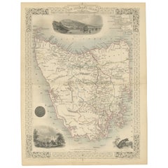
Map of Tasmania with Illustrations of Local Fauna and Colonial Landmarks, 1851
Located in Langweer, NL
John Tallis & Company was renowned for their detailed and ornate maps during the 19th century. Their maps are distinguished by the intricate borders and vignettes that are as informa...
Category
Antique 1850s Maps
Materials
Paper
$277 Sale Price
20% Off
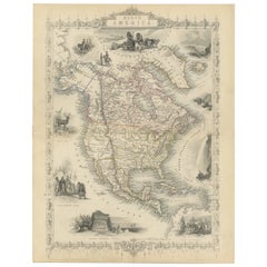
Victorian Visions of the New World: A Detailed Tallis Map of North America, 1851
Located in Langweer, NL
The map presented here is an intricate example from the series of maps produced by John Tallis & Company. Tallis maps are known for their detailed and elaborate style, often includin...
Category
Antique 1850s Maps
Materials
Paper
$345 Sale Price
20% Off
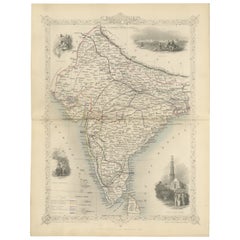
Mid-19th Century Decorative Map of India with Cultural and Natural Vignettes
Located in Langweer, NL
The Tallis maps, including the one of India, are known for their detailed and ornamental style. They were produced during the mid-19th century, a time when cartographic publishing became as much an art form as a means of geographic representation.
John Tallis & Company, founded by John Tallis, was known for creating maps with elaborate borders and vignettes surrounding the map itself. These maps often included illustrations that depicted scenes representative of the region's culture, significant local wildlife, architectural landmarks, and portraits of indigenous peoples...
Category
Antique 1850s Maps
Materials
Paper
$297 Sale Price
20% Off
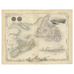
A Decorative Map of Nova Scotia and Newfoundland by John Tallis, 1851
Located in Langweer, NL
The map is part of the series created by John Tallis & Company, known for their mid-19th-century maps. This particular map illustrates the regions of Nova Scotia and Newfoundland and...
Category
Antique 1850s English Maps
Materials
Paper
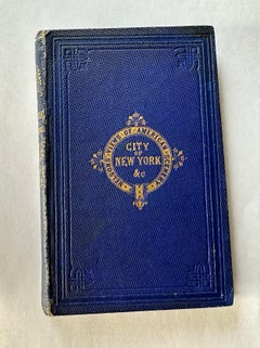
Nelson's Guide to the City of New York and its Neighbourhood, 1858
Located in Langweer, NL
"Nelson's Guide to the City of New York and its Neighbourhood," published in 1858 by T. Nelson in London and New York, serves as an invaluable resource for exploring the historical a...
Category
Antique 1850s Books
Materials
Paper
$421 Sale Price
20% Off
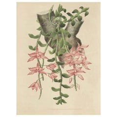
Orchid Elegance: Huge Exquisite Chromolithograph of the Dutch Colonial Era, 1854
Located in Langweer, NL
A very large chromolithograph of the orchid species Dendrobium macranthum, as indicated by the text at the bottom of the print. It is from a collection called, "Illustrations d'orchi...
Category
Antique 1850s Prints
Materials
Paper
$1,341 Sale Price
20% Off
Large Masterpiece of Botanical Illustration from the Dutch East Indies, 1854
Located in Langweer, NL
A large chromolithograph botanical illustration, featuring the orchid species Phaius blumei Lindl. The print comes from the 19th-century work "Illustrations d'orchidees des Indes Ori...
Category
Antique 1850s Prints
Materials
Paper
$1,341 Sale Price
20% Off
Large Orchid Illustrations of the Dutch East Indies: A Botanical Heritage, 1854
Located in Langweer, NL
A large and rare original chromolithographic plate from a significant 19th-century botanical work on orchids from the Dutch East Indies (now Indonesia).
It is taken from the book t...
Category
Antique 1850s Prints
Materials
Paper
$1,341 Sale Price
20% Off
Antique Flower Lithograph of Purple and Yellow Wilcannia Lilies, 1856
Located in Langweer, NL
Antique print titled 'Calostemma Purpureum - Calostemma Luteum'.
Lithograph of purple and yellow wilcannia lilies. This print originates from 'Fl...
Category
Antique 1850s Prints
Materials
Paper
$134 Sale Price
20% Off
Engraving of a Wood Depot on the St Lawrence River near the City of Quebec, 1850
Located in Langweer, NL
A color engraving from the 19th century, with the scene described as "Wood depot on the St Lawrence River near the city of Quebec, years 1850."
The artists involved in the creation...
Category
Antique 1850s Prints
Materials
Paper
$162 Sale Price
20% Off
Detailed German Map of Australia Including Statistics of 1841, Published in 1854
Located in Langweer, NL
Title: "Detailed Map of Austral Land - 1854"
This historic map, titled "Australland," was published in Glogau in 1854 by cartographer Carl Flemming. It's an intricately detailed dep...
Category
Antique 1850s Maps
Materials
Paper
$191 Sale Price
20% Off
Charting the West: Surveyor General Roe’s Western Australian Expedition , 1852
Located in Langweer, NL
This map is a historical document, focused on Western Australia. It illustrates the route of an expedition under Surveyor General Roe from Perth to Russell Range during 1848 and 1849...
Category
Antique 1850s Prints
Materials
Paper
$277 Sale Price
20% Off
Renaissance Architectural Orders by Vignola's Frontispiece, 1767
Located in Langweer, NL
This image is an intricate frontispiece from a book by Jacques Barozzi de Vignole, known as Vignola, an influential 16th-century Italian architect who was one of the great architect ...
Category
Antique 1850s Prints
Materials
Paper
$162 Sale Price
20% Off
Decorative Engraved Panthéon Paris in the 1800s by Bry & Benoist
Located in Langweer, NL
The image is an engraving of the Panthéon in Paris, created by Auguste Bry (1805–1880) and Philippe Benoist (1813–).
The Panthéon originally served as a church dedicated to St. Gen...
Category
Antique 1850s Prints
Materials
Paper
$258 Sale Price
20% Off
Renaissance Nobility: Württemberg and Mainz Engraved and Handcolored, circa 1850
Located in Langweer, NL
Title: "Renaissance Nobility: Württemberg and Mainz"
This composite image juxtaposes two hand-colored prints from the Renaissance era, offering a glimpse into the fashion and famili...
Category
Antique 1850s Prints
Materials
Paper
$162 Sale Price / set
20% Off
Lion-tailed Macaque - A Portrait of Wild Majesty Engraved, circa 1850
Located in Langweer, NL
Title: "Lion-tailed Macaque - A Portrait of Wild Majesty"
Description: This 19th-century coloured engraving, a creation of the German School, portrays the distinctive Lion-tailed Ma...
Category
Antique 1850s Prints
Materials
Paper
$153 Sale Price
20% Off
The Varied Panther of Nature's Palette in a Hand-Colored Engraving, crica 1850
Located in Langweer, NL
Title: "The Varied Panther of Nature's Palette"
Description: This 19th-century coloured engraving, crafted with the meticulous hand of German illustrator Johann Eberhard Ihle and en...
Category
Antique 1850s Prints
Materials
Paper
$182 Sale Price
20% Off
Old Map of Vaucluse, France: A Cartographic Celebration of Viticulture, 1852
Located in Langweer, NL
This original hand-colored map is from the "Atlas National Illustré," a work by Victor Levasseur, a French geographer and cartographer known for his richly illustrated maps.
The map...
Category
Antique 1850s Maps
Materials
Paper
$325 Sale Price
20% Off
1852 Map of Haut-Rhin: An Illustrated Gateway to Alsace's Viticultural Splendors
Located in Langweer, NL
This original hand-colored map is from the "Atlas National Illustré," a work by Victor Levasseur, a French geographer and cartographer known for his richly illustrated maps.
The map...
Category
Antique 1850s Maps
Materials
Paper
$325 Sale Price
20% Off
Levasseur's 1852 Cartographic Portrait of Gironde: Celebrating the Bordeaux Wine
Located in Langweer, NL
This original hand-colored map is from the "Atlas National Illustré," a work by Victor Levasseur, a French geographer and cartographer known for his richly illustrated maps.
The map is a steel engraving, which was a common and precise method for creating maps at the time. The inclusion of the publisher's name, A. Combette from Paris, and the addresses of the various contributors to the map's creation, like the engravers Laguillermie and Rainaud, adds to the historical context of the piece.
The margins of the map are adorned with detailed illustrations that serve as a visual encyclopedic reference to the region's geography, economy, and notable figures. The use of color along the boundaries makes the map not only a tool for navigation but also an educational resource, providing insights into the department's landscape, economy, and cultural significance.
The text included in the map's design provides statistical information, a map legend, and discussions about the land, local curiosities, notable personalities, products, and commerce, which would have been invaluable for education and reference at the time.
The 'Atlas National Illustré' is celebrated for its combination of cartographic detail and artistic embellishment, making it a valuable cultural artifact. It represents the height of decorative map-making in the 19th century, alongside the works of John Tallis and Archibald Fullarton.
This uploaded image is a detailed and colored map of the Département de la Gironde from Victor Levasseur's "Atlas National Illustré." Similar to the other maps from this series, it features a central map with the title 'Dépt. de la Gironde' at the bottom.
Surrounding the map are decorative vignettes and elements that bring to life the cultural and economic aspects of the Gironde department. On the left, there is likely statistical information about the department and its subdivisions, reflecting the population and administrative details. This is framed by images that may represent the local industries and natural resources, such as wine, which is a central feature of the Bordeaux region located within Gironde.
The right side of the map contains a textual history and descriptions of the region, coupled with portraits of notable figures, possibly historic personages or contributors to the region's cultural and economic development. The illustrations often include agricultural products, symbols of commerce, and scenes of daily life, as well as architectural landmarks.
The presence of wine bottles, barrels, and vineyards in the illustrations would be indicative of the Gironde's prominence in wine production, particularly Bordeaux wines, which are esteemed worldwide. These engravings serve to emphasize the richness of the land and the sophistication of its products.
Maps from this era, especially those by Levasseur, are notable for their combination of art and education, providing a snapshot not only of the geography but also of the societal and economic conditions of the time. The detailed engravings also suggest that this map was as much a decorative piece as it was a functional one, intended for display and reference by those interested in the illustrated region.
The Gironde department in France is renowned for its significant contribution to the wine industry, particularly through the Bordeaux wine region. A bit more about the important places within Gironde and the types of wine the area is known for:
1. **Bordeaux**: The capital city of the department and the heart of the wine region. It's not only an urban center but also a hub for the wine trade.
2. **Médoc**: North of Bordeaux, known for prestigious châteaux and wines like Margaux, Saint-Julien, Pauillac, and Saint-Estèphe.
3. **Saint-Émilion**: East of Bordeaux, recognized for its full-bodied red wines and the picturesque medieval town.
4. **Pomerol**: Also near Saint-Émilion, smaller than its neighbor but equally renowned, particularly for Château Pétrus...
Category
Antique 1850s Maps
Materials
Paper
$325 Sale Price
20% Off
Map of Rhône: Culture and Commerce in Lyon's Silk and Wine Legacy, 1852
Located in Langweer, NL
This original hand-colored map is from the "Atlas National Illustré," a work by Victor Levasseur, a French geographer and cartographer known for his richly illustrated maps.
The map...
Category
Antique 1850s Maps
Materials
Paper
$325 Sale Price
20% Off
Antique Print of Dutch Prince Willem of Orange at the Battle of Waterloo, c.1855
Located in Langweer, NL
Antique print titled 'Slag bij Waterloo (De Kroonprins gekwetst)'.
Old print of Willem Frederik George, Prince of Orange, wounded during the Battle of Waterloo...
Category
Antique 1850s Prints
Materials
Paper
$220 Sale Price
20% Off
Original Old Map Northeast India, incl Part of Himalayas and China, 1853
Located in Langweer, NL
Antique map titled 'India X'.
Old map of the the northeast region of India, including part of Himalayas and China. Great detail of landforms, rivers and water bodies, cities, towns...
Category
Antique 1850s Maps
Materials
Paper
$182 Sale Price
20% Off
Maritime Wonders: Beached Leviathans of the 19th Century in Siberia, circa 1850
Located in Langweer, NL
The text in the image is in Italian:
"Balena spinta sulle coste della Siberia."
The phrase mean "Whale stranded on the coasts of Siberia."
The image is a lithograph created by B...
Category
Antique 1850s Prints
Materials
Paper
$86 Sale Price
20% Off
Antique Print of a View of Uraga, Yedo, Japan, 1856
Located in Langweer, NL
Description: Antique print titled ‘View of Uraga, Yedo Bay'. View of Uraga, Japan.
This print originates from 'Narrative of the expedition of an American squadron to the China se...
Category
Antique 1850s Prints
Materials
Paper
$230 Sale Price
20% Off
Horse Races on Ice in Rotterdam, The Netherlands on the River Maas, 1855
Located in Langweer, NL
Antique print titled 'Gezicht op de Harddraverij met Paard en Narreslede, langs de Willemskade'.
Old print depicting an ice skating scene in the Netherlands. This print originate...
Category
Antique 1850s Prints
Materials
Paper
$210 Sale Price
20% Off
Original Antique Print of a Street Scene in Naha, Okinawa in Japan, 1856
Located in Langweer, NL
Antique print titled ‘Street in Napha Lew-Chew'.
Antique print of a street scene in Naha, the capital city of the Okinawa Prefecture, Japan. Okinawa used to be called Great Lew C...
Category
Antique 1850s Prints
Materials
Paper
$230 Sale Price
20% Off
Map of West Germany Incl Regions Wurtemberg, Bavaria, Hanover, Etc, c.1850
Located in Langweer, NL
Antique map titled '(Deutschland) Germany, Western States'.
Map of West Germany depicting many regions including Wurtemberg, Bavaria, Hanover and others. This map originates from...
Category
Antique 1850s Maps
Materials
Paper
$268 Sale Price
20% Off
Rare Old Lithograph of the Assault of a Fort in Borneo, Indonesia, ca.1850
Located in Langweer, NL
Incredible action view of a rare German lithograph showing a massive assault on Fort Claurang in Borneo.
Published by Hartwich, A. Hölzer and TH. Lemke in Berlin around 1850.
...
Category
Antique 1850s Arms, Armor and Weapons
Materials
Paper
$910 Sale Price
20% Off
Old Bird Print of the Tahiti Sandpiper or Tahitian Sandpiper, 1854
Located in Langweer, NL
Antique print titled 'Tringa Leucoptera'.
Old bird print of the Tahiti sandpiper or Tahitian sandpiper (Prosobonia leucoptera). This print originates from 'Bijdragen tot de Dierk...
Category
Antique 1850s Prints
Materials
Paper
Antique Print of Tokyo Bay 'or Edo Bay', Located in Southern Kantō, Japan, 1856
Located in Langweer, NL
Antique print titled 'To-Ri-Ga-Sa-Ki, Yedo Bay'. View of Tokyo Bay (or Edo Bay), a bay located in the southern Kanto region of Japan, and spans the coasts of Tokyo, Kanagawa Prefectu...
Category
Antique 1850s Maps
Materials
Paper
$325 Sale Price
20% Off
Antique Lithograph of a Japanese Junk, a Type of Sailing Ship, 1856
Located in Langweer, NL
Antique print titled ‘Japanese Junk'.
Lithograph of a Japanese junk, a type of sailing ship. This print originates from 'Narrative of the expedition of an A...
Category
Antique 1850s Maps
Materials
Paper
$364 Sale Price
20% Off
Original Old Handcolored Print Featuring Various Sea Shells, ca. 1852
Located in Langweer, NL
Untitled antique print featuring various sea shells.
This print originates from 'A History of the Earth and Animated Nature' by O. Goldsmith. Goldsmith's Animated Nature went thr...
Category
Antique 1850s Prints
Materials
Paper
$172 Sale Price
20% Off
Religious Old Print of Moses Making Water & The Crossing of the Red Sea, ca.1850
Located in Langweer, NL
Large antique print with two religious engravings. The upper image depicts the crossing of the Red Sea. The lower image depicts Moses makes the water spring out from the rock. This print originates from a work illustrating the complete series of Vatican frescos painted...
Category
Antique 1850s Maps
Materials
Paper
$452 Sale Price
30% Off
Early French Nautical Chart of the Northern Coast of of Java, Indonesia, C.1850
Located in Langweer, NL
Antique map titled Carte de la côte Nord de Java.
Early French nautical chart of the northern coast of the island of Java, Indonesia. It includes Ci...
Category
Antique 1850s Maps
Materials
Paper
$1,102 Sale Price
20% Off
Nicely Framed View of Muiden Castle, the Netherlands, 1858
Located in Langweer, NL
Antique print titled 'Muiden'. View of Muiden Castle, the Netherlands. This print originates from 'Het koningrijk der Nederlanden voorgesteld in eene reeks van 136 naar de natuur get...
Category
Antique 1850s Prints
Materials
Paper
$469 Sale Price
20% Off
Neatly Framed Decorative Hand-Colored View of Zierikzee, the Netherlands, 1858
Located in Langweer, NL
Antique print titled 'Zierikzee'.
View of the city of Zierikzee, the Netherlands. This print originates from 'Het koningrijk der Nederlanden voorgesteld in eene reeks van 136 naa...
Category
Antique 1850s Maps
Materials
Paper
$469 Sale Price
20% Off
Beautiful Lithograph of The Vulcano Gunung Lamongan, Java, Indonesia, c.1853
Located in Langweer, NL
Antique print titled 'G. Lamongan'. Beautiful lithograph of Gunung Lamongan. Gunung Lamongan or Mount Lamongan (1,651m - 5, 417 ft) is a small stratovolcano located between the massi...
Category
Antique 1850s Prints
Materials
Paper
$402 Sale Price
20% Off
British Politican Henry Charles Sturt of Crichel House, Dorset, England, c.1850
Located in Langweer, NL
Antique mezzotint of Henry Charles Sturt, with handwritten titles. Henry Charles Sturt of Crichel House, Dorset, was a British landowner and politici...
Category
Antique 1850s Prints
Materials
Paper
$795 Sale Price
20% Off
Antique Print of Beetles, Published in 1854
Located in Langweer, NL
Antique print titled Procére Scabreux, Procére d'Olivier'.
Print of beetles. This print originates from 'Musée d'Histoire Naturelle' by M. Achille Comte...
Category
Antique 1850s Prints
Materials
Paper
$210 Sale Price
20% Off
Antique Print of Various Insects, Published in 1854
Located in Langweer, NL
Antique print titled 'Insectes'.
Print of various insects. This print originates from 'Musée d'Histoire Naturelle' by M. Achille Comte.
Artists a...
Category
Antique 1850s Prints
Materials
Paper
$230 Sale Price
20% Off
Old Original Antique Hand-Colored Print of a Magyar Pig Keeper in Germany, 1850
Located in Langweer, NL
Antique costume print titled 'Gardeur de Porcs Magyar'.
The Mangalica (also Mangalitsa or Mangalitza) is a Hungarian breed of domestic pig. It was developed in the mid 19th centu...
Category
Antique 1850s Prints
Materials
Paper
$277 Sale Price
20% Off
Original Antique Map of the Channel Islands, Incl. Decorative Vignettes, 1851
Located in Langweer, NL
Antique map titled ‘Channel Islands’.
Includes decorative vignettes titled St. Peters Port, Castle Cornet, Druidical altar near Lancresse, Mont Orgueil Castle and Jersey. Originates from 'The Illustrated Atlas, And Modern History Of The World Geographical, Political, Commercial & Statistical, Edited By R. Montgomery Martin'. Published; John Tallis London, New York, Edinburgh & Dublin. 1851. Drawn and Engraved by J. Rapkin.
Artists and engravers: John Tallis (1817-1876) was a British map...
Category
Antique 1850s Maps
Materials
Paper
$431 Sale Price
20% Off
Map of Russia with Vignettes of the Neoskoi Prospect, St. Petersburg, ca.1851
Located in Langweer, NL
Antique map titled 'Russia in Europe'.
Map of European Russia. Showing vignettes of the Neoskoi Prospect, St. Petersburg, Polish Captives on their way to Siberia, a Russian Bear...
Category
Antique 1850s Maps
Materials
Paper
$277 Sale Price
20% Off
Original Antique Print of Chinese Punishment with Bamboo, 1859
Located in Langweer, NL
Antique print titled 'Puishment of the Bamboo'. Print of Chinese punishment with bamboo. This print originates from 'The Chinese Empire: historical and descriptive. Illustrating the ...
Category
Antique 1850s English Prints
Materials
Paper
$158 Sale Price
40% Off
Original Antique Print of Chinese Street Punishments, 1859
Located in Langweer, NL
Antique print titled 'No.1 Street Punishments'.
Print of Chinese street punishments. Shows a prisoner, his arms bound and flags attached to his ear...
Category
Antique 1850s English Prints
Materials
Paper
$197 Sale Price
25% Off
Nicely Hand-Colored View of the City of Amersfoort, The Netherlands, 1858
Located in Langweer, NL
Antique print titled 'Amersfoort van den Appelenweg gezien'.
View of the city of Amersfoort, the Netherlands. This print originates from 'Het koningrijk der Nederlanden voorgeste...
Category
Antique 1850s Prints
Materials
Paper
$148 Sale Price
20% Off
Antique Engravings on One Sheet Depicting Ruins in Mexico, 1857
Located in Langweer, NL
Two images on one sheet depicting ruins in Mexico.
This print originates from 'Die Kunstwerke vom Alterthum bis auf die Gegenwart, oder, Wegweiser durch das ganze Gebiet der bild...
Category
Antique 1850s Prints
Materials
Paper
$210 Sale Price
20% Off
Antique Print of a Ruin of a Temple of the Inca's in Mexico, 1857
Located in Langweer, NL
Untitled print of a ruin in Mexico. This print originates from 'Die Kunstwerke vom Alterthum bis auf die Gegenwart, oder, Wegweiser durch das ganze Gebiet der bildenden Kunst : entha...
Category
Antique 1850s Architectural Models
Materials
Paper
$172 Sale Price
20% Off
Original Antique Handcolored Print Depicting a Woman from Puebla, Mexico, 1850
Located in Langweer, NL
Antique costume print titled 'Femme de Puebla'.
Old print depicting a woman from Puebla, Mexico. This print originates from 'Costumes Moderne (Musée de Costumes).
Artists and...
Category
Antique 1850s Prints
Materials
Paper
$230 Sale Price
20% Off
Antique Map of Part of the Chinese Coast, Explored by the French, Ca.1852
Located in Langweer, NL
Antique map titled 'Plan du Golfe D'Anville (Côte de Tartarie)'.
Old map of part of the Chinese coast, explored with the French corvette 'Caprieuse'. The Capricieuse was a late 2...
Category
Antique 1850s Maps
Materials
Paper
$662 Sale Price
34% Off
Ice Skating Activities Near Katendrecht and Rotterdam, The Netherlands, 1855
Located in Langweer, NL
Antique print titled 'De Stad van Katendrecht gezien'.
Old print depicting an ice skating scene in the Netherlands. This print originates from 'Het ijs vermaak op de Maas te Rott...
Category
Antique 1850s Prints
Materials
Paper
$210 Sale Price
20% Off
Ice Skating Fun on the River Maas, Rotterdam, The Netherlands, 1855
Located in Langweer, NL
Antique print titled 'De Maas voor de fabriek te Fyenoord'.
Old print depicting an ice skating scene in the Netherlands. This print originates from 'Het...
Category
Antique 1850s Prints
Materials
Paper
$210 Sale Price
20% Off
Print of Ice Skating Scene on the River Maas in Rotterdam, the Netherlands, 1855
Located in Langweer, NL
Antique print titled 'De Schaatsenrijdersbaan op de Maas'.
Old print depicting an ice skating scene in the Netherlands. This print originates from 'Het ijs vermaak op de Maas te ...
Category
Antique 1850s Prints
Materials
Paper
$210 Sale Price
20% Off
Print of An Ice Skating Scene on the River Maas, Rotterdam, Netherlands, 1855
Located in Langweer, NL
Antique print titled 'Gezicht van het Bolwerk op de Maas'.
Old print depicting an ice skating scene in the Netherlands. This print originates from 'Het ijs vermaak op de Maas te ...
Category
Antique 1850s Prints
Materials
Paper
$210 Sale Price
20% Off
Old Lithograph of Bullfighting with The Bull Tossing The Picador & Horse, 1852
Located in Langweer, NL
Antique print titled 'The Bull tossing the Picador and Horse'.
Old lithograph showing a bullfighting scene.
Artists and Engravers: Made after an ...
Category
Antique 1850s Prints
Materials
Paper
$249 Sale Price
20% Off
Old Print of 'Beugelen', One of the Oldest Ball Sports in The Netherlands, 1857
Located in Langweer, NL
Antique print titled 'Plate IV 'De Beugelbaan - Le Jeu de Passe.'
This plate shows a 19th century scene in Noord-Brabant, The Netherlands. Men are playing the Dutch game 'beugelen'. This original antique print was published in 1857 by Frans Buffa & Zonen Amsterdam as part of the publication 'Nederlandsche Kleederdrachten naar de natuur' (Dutch folk costume, illustrated using real-life models) by Valentyn Bing.
'Beugelen' is a popular sport in which a heavy sphere is moved with a wooden shovel...
Category
Antique 1850s Prints
Materials
Paper
$431 Sale Price
20% Off
Old Print of a Bourgeoise in Folk Costume from Jászsági, Lower Hungary, 1850
Located in Langweer, NL
Antique costume print titled 'Bourgeois de J'Azberény'.
Old print depicting a Bourgeoise in folk costume from Jászsági, lower Hungary. This print originates from 'Costumes Modern...
Category
Antique 1850s Prints
Materials
Paper
$230 Sale Price
20% Off
Print Depicting a Bourgeoise in Folk Costume from Jászsági, Lower Hungary, 1850
Located in Langweer, NL
Antique costume print titled 'Bourgeois, Maite Tanneur de J'Azberény'.
Old print depicting a Bourgeoise in folk costume from Jászsági, lower Hungary. ...
Category
Antique 1850s Prints
Materials
Paper
$268 Sale Price
20% Off
Original Antique Map of Austria from an Old Dutch School Atlas, 1852
Located in Langweer, NL
Antique map titled 'Het Keizerrijk Oostenrijk'.
Map of the Austrian Empire. This map originates from 'School-Atlas van alle deelen der Aarde' by Otto Petri...
Category
Antique 1850s Maps
Materials
Paper
$182 Sale Price
20% Off
