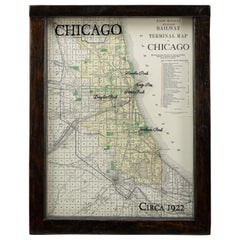
1922 Map of Chicago, Rand McNally Standard Railway Map
View Similar Items


Want more images or videos?
Request additional images or videos from the seller
1 of 5
1922 Map of Chicago, Rand McNally Standard Railway Map
$1,250List Price
About the Item
- Dimensions:Height: 29.5 in (74.93 cm)Width: 23.25 in (59.06 cm)Depth: 2 in (5.08 cm)
- Materials and Techniques:
- Place of Origin:
- Period:
- Date of Manufacture:1922
- Condition:Wear consistent with age and use. Overall very good condition considering age. Paper quality is very good, with only a slight fold line in the centre with minimal wear. Framed in a custom wood frame with painted glass.
- Seller Location:Colorado Springs, CO
- Reference Number:Seller: M2201stDibs: LU909714011072
About the Seller
4.9
Platinum Seller
Premium sellers with a 4.7+ rating and 24-hour response times
Established in 2010
1stDibs seller since 2011
463 sales on 1stDibs
Authenticity Guarantee
In the unlikely event there’s an issue with an item’s authenticity, contact us within 1 year for a full refund. DetailsMoney-Back Guarantee
If your item is not as described, is damaged in transit, or does not arrive, contact us within 7 days for a full refund. Details24-Hour Cancellation
You have a 24-hour grace period in which to reconsider your purchase, with no questions asked.Vetted Professional Sellers
Our world-class sellers must adhere to strict standards for service and quality, maintaining the integrity of our listings.Price-Match Guarantee
If you find that a seller listed the same item for a lower price elsewhere, we’ll match it.Trusted Global Delivery
Our best-in-class carrier network provides specialized shipping options worldwide, including custom delivery.More From This Seller
View AllAntique Map of Paris, "Carte Routiere des Environs de Paris" 1841
Located in Colorado Springs, CO
This beautiful hand-colored road map of Paris was published in 1841. The map shows Paris and the surrounding area in a folding pocket map. Organized and detailed for travelers, this ...
Category
Antique 1840s French Maps
Materials
Paper

1868 "Lloyd's Topographical Railway Map of North America..." Hanging Wall Map
Located in Colorado Springs, CO
Presented is “Lloyd's Topographical Railway Map of North-America, or the United States Continent in 1900.” This map was published by J. T. Lloyd, in New York, in 1868. A large, hangi...
Category
Antique 1860s American Late Victorian Maps
Materials
Linen, Paper

“The Restaurant of the House of Representatives” Engraving by Harper's Weekly
Located in Colorado Springs, CO
This original wood engraving is titled “The Restaurant of the House of Representatives, Washington, DC.” It was published as a double-page image, in the August 12, 1893 issue of the famous 19th century newspaper Harper’s Weekly. The print was illustrated by Charles Stanley Reinhardt.
The House Restaurant, a unique part of life in the Capitol, has been in the same location since the 1857 Capitol Expansion. Congressional members’ busy work schedule made the availability of food on site a necessity. But the restaurant also served as an informal meeting spot for members to continue conversations and deal making.
This 1893 print illustrates the convivial atmosphere. Details including elegantly dressed tables...
Category
Antique 1890s American Prints
Materials
Paper

1876 "Gettysburg, The Repulse of Longstreet's Assault." Engraving
Located in Colorado Springs, CO
Presented here is an 1876 engraving of John B. Bachelder and James Walker’s Gettysburg. The Repulse of Longstreet’s Assault. The engraved scene depicts the decisive battle on the final day of the Battle of Gettysburg. Researched by the photographer and topographer John B. Bachelder and painted by James Walker, the original painting was created in 1870. This detailed engraving was done by H. B. Hall Jr. and published by James Drummond Ball.
Otherwise called Pickett’s Charge, the battle occurred on July 3, 1863. Pickett’s corp commander, Lieutenant General James Longstreet was placed in charge of the attack despite his hesitations. Longstreet’s central role led to the title of the work, Repulse of Longstreet’s Assault. In an attempt to gain control of an important supply route, nine Confederate brigades charged across three-quarters of a mile of open ground against cannon fire to take Cemetery Ridge from the defending Union Army. Despite their overwhelming numbers, the Confederate forces were repelled with considerable casualties marking not only a decisive victory for the Union, but also the beginning of the slow defeat of Lee’s Army. The furthest the charging forces advanced before being repulsed would forever be known as the “High Water Mark of the Confederacy.” The Confederate army never recovered from the losses at Gettysburg and it effectively ended Lee’s campaign into Pennsylvania.
The engraving gives the perspective from the Union rear, one that encompasses most of the battlefield, from Big Round Top on the left to the northern reaches of Cemetery Ridge on the right. The Confederate lines at Seminary Ridge are in the far distance, partially obscured by bursting shells. The image centers on the main Confederate assault, in the vicinity of what today are known as "The Copse" and "The Bloody Angle." The composition has elemen...
Category
Antique 1870s American Prints
Materials
Paper

“A Football Match, Scotland v. England” Antique Engraving, Proof Edition of 100
By Overend and Smythe
Located in Colorado Springs, CO
This is the 1889 William H. Overend (1851-1898) and Lionel Smythe (1839-1918) first edition, photogravure of the Calcutta Cup – a Rugby match between Scotland and England, that has been played over 100 times, the first match...
Category
Antique 19th Century English Prints
Materials
Paper

N.E. View of the United States Capitol, Washington, DC Antique Proof Print 1858
Located in Colorado Springs, CO
This engraved print shows a view of the United States Capitol Building, in Washington, D.C. The print depicts the neoclassical building from the northeast orientation, with a bustling street scene in front. The steel engraving is a proof printing, drawn and engraved by Henry Sartain and published in 1858.
Plans began in May 1854 to build a new cast-iron dome for the United States Capitol. The then-architect of the Capitol Thomas Walter and his team were sold on the aesthetics of a new dome, as well as the utility of a fire-proof one. A year later, on March 3, 1855, President Franklin Pierce...
Category
Antique 1850s American Prints
Materials
Paper

You May Also Like
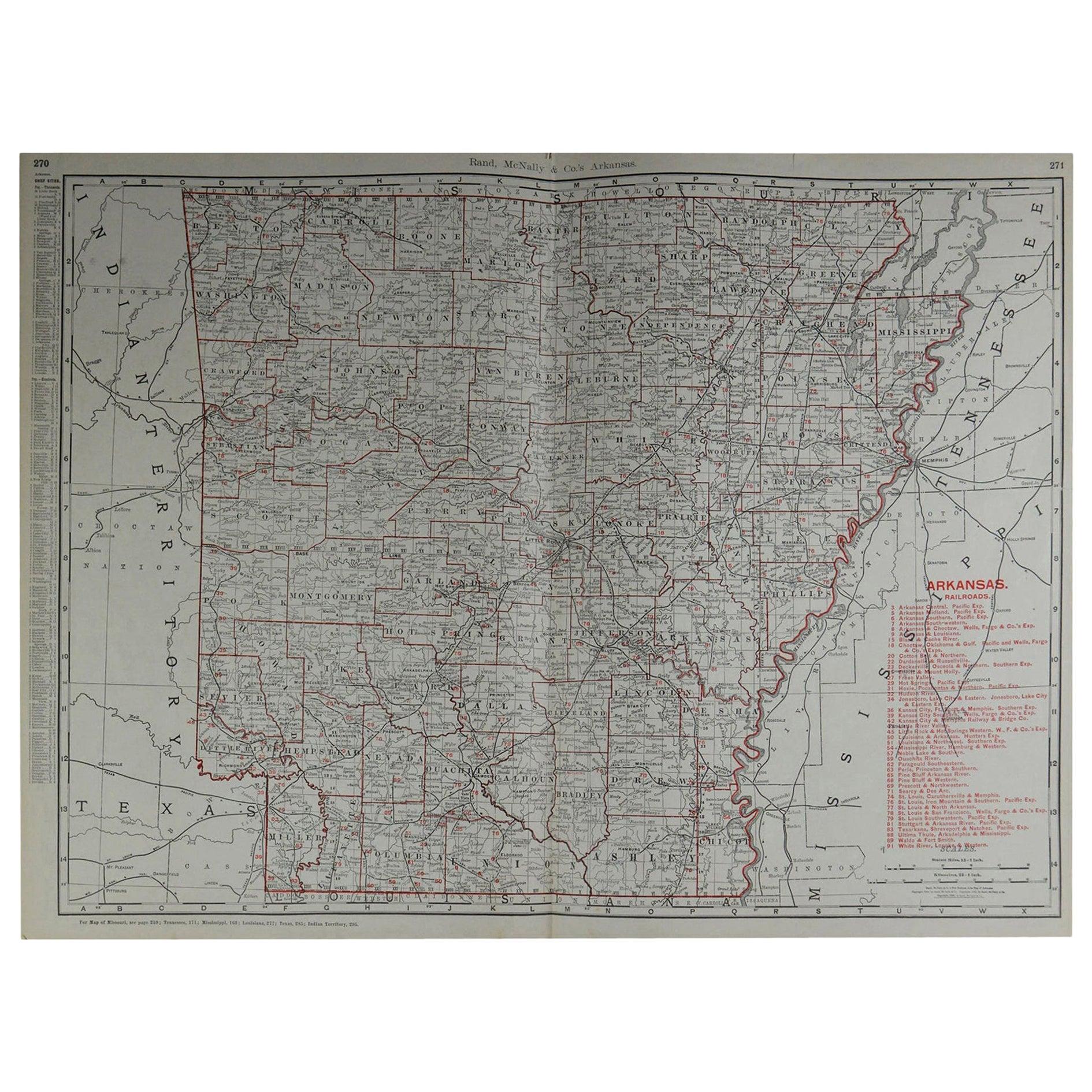
Antique Railroad Map of the United States by Rand, McNally & Co, 1900
Located in Langweer, NL
Antique map titled 'Rand, McNally & Co's New Official Railroad map of the United States with portions of The Dominion of Canada, The Republic of Mexico and the West Indies'. Large railroad map of the United States, sectionalised and laid on linen. Map shows state boundaries for the United States, Mexico, the West Indies, and lower portion of Canada; major cities and towns, military posts, Native American reservations, and railroads; Oklahoma and "Indian Territory." Inset: "Map of Alaska...
Category
20th Century Maps
Materials
Linen, Paper

$2,229 Sale Price
25% Off
Free Shipping
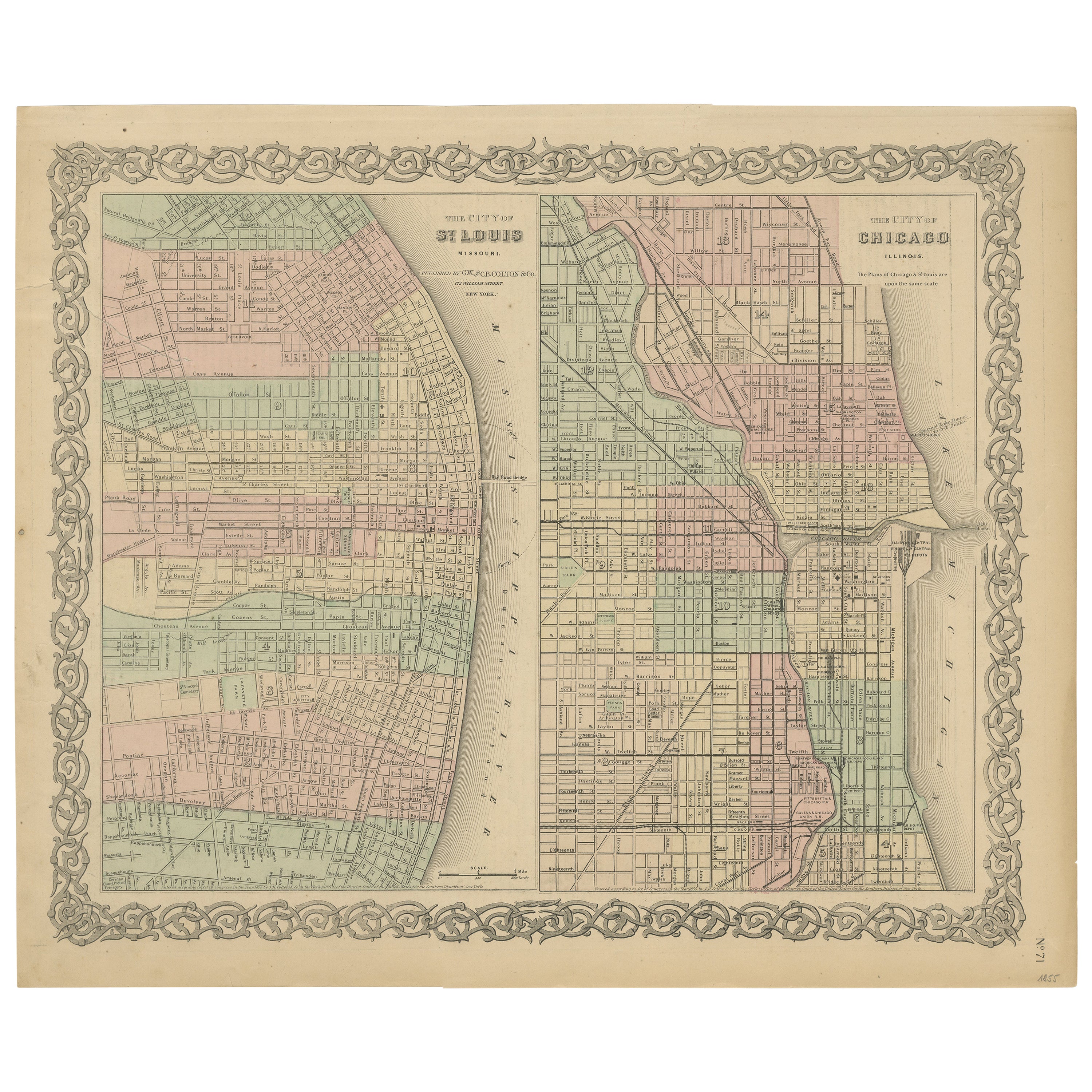
Antique Map of St. Louis and Chicago
Located in Langweer, NL
Antique map titled 'The City of St. Louis Missouri - The City of Chicago Illinois'. Dual map on single page showing St. Louis and Chicago. Finely produ...
Category
Antique Mid-19th Century Maps
Materials
Paper

$142 Sale Price
20% Off
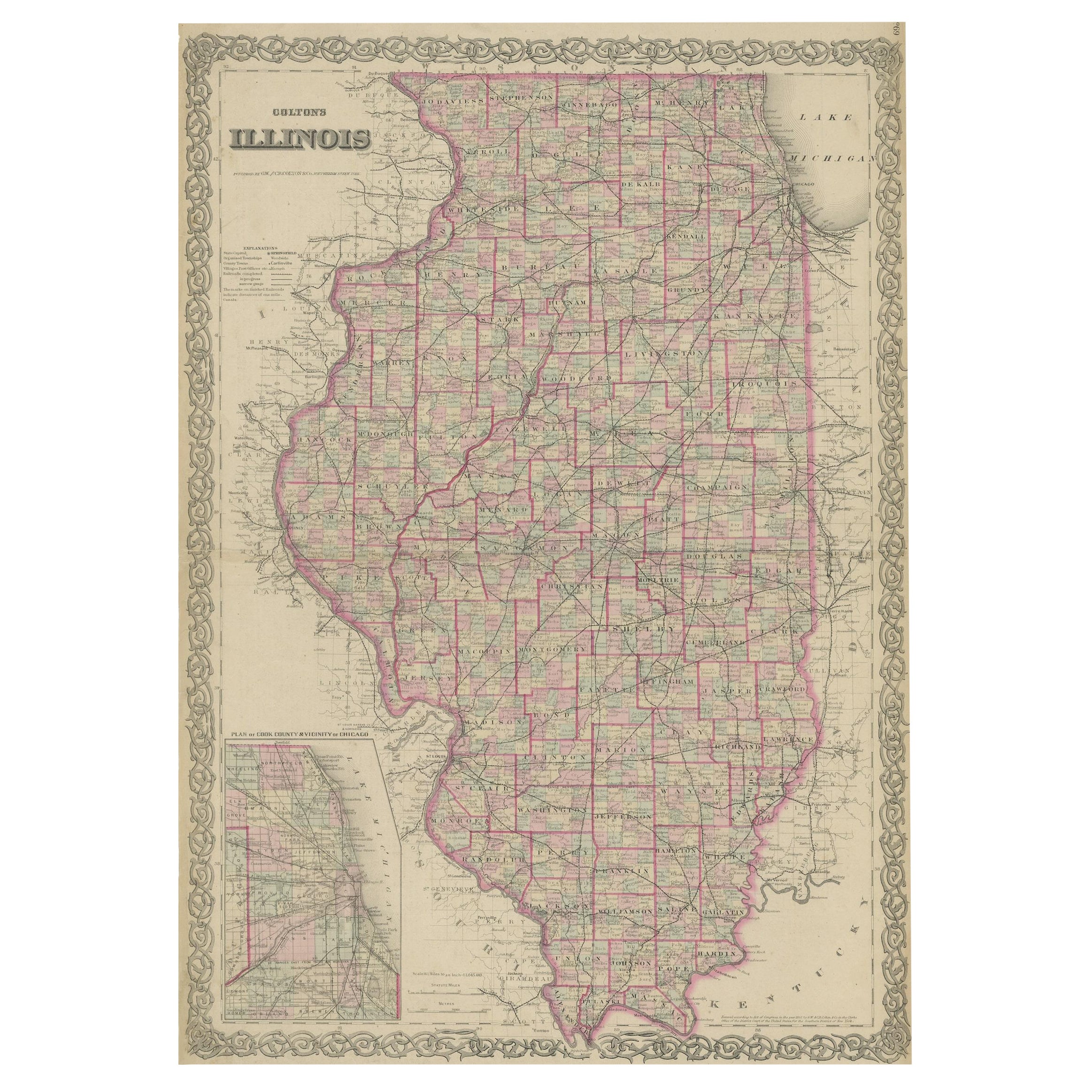
Colton's Map of Illinois, with an Inset of Chicago
Located in Langweer, NL
Antique map titled 'Colton's Illinois'. Antique map of Illinois, a state in the Midwestern United States. With an inset map of of Cook County &...
Category
Antique Mid-19th Century Maps
Materials
Paper
$228 Sale Price
20% Off
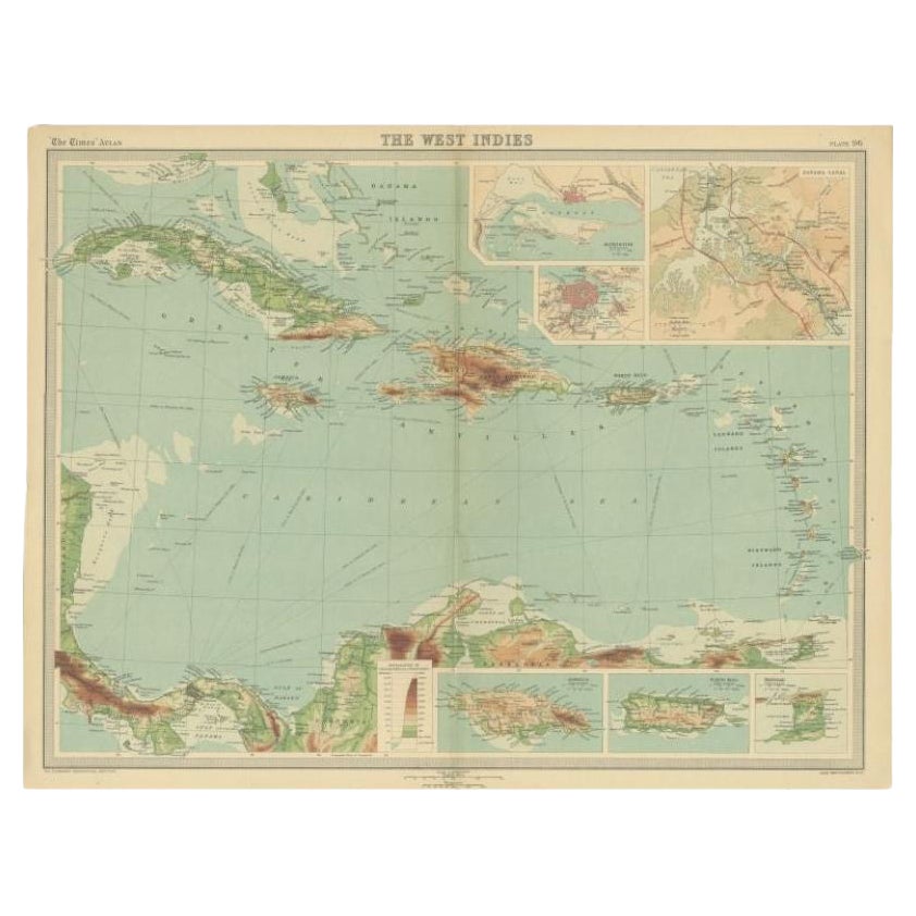
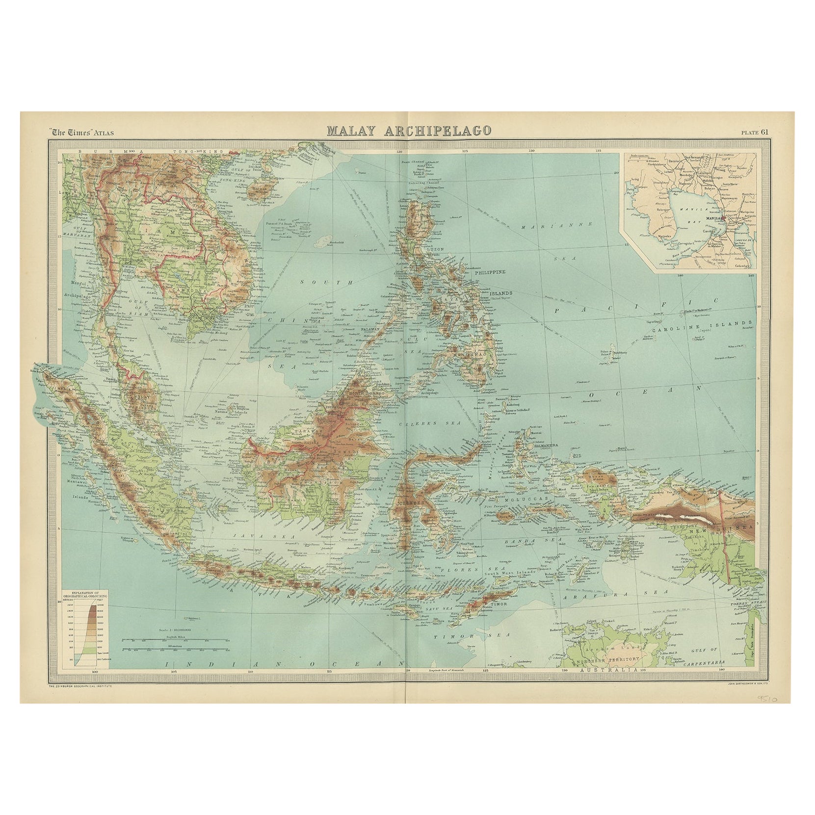
Antique Map of the West Indies in Full Color, 1922
Located in Langweer, NL
Antique map titled 'The West Indies.' A map of the West Indies, the Carribean region. This includes the Greater Antilles (Jamaica, Haiti, Puerto Rico and Cuba) and the Lesser Antille...
Category
20th Century Maps
Materials
Paper
$133 Sale Price
20% Off
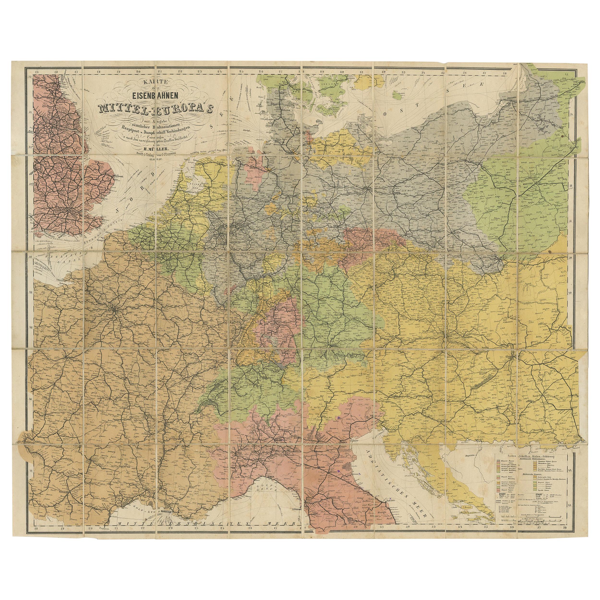
Antique Railway Folding Map of Central Europe by Müller, 1870
Located in Langweer, NL
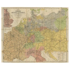
Antique map titled 'Karte der Eisenbahnen Mittel-Europa's (..)'. Railway folding map of Central Europe. Published by Carl Flemming, 1870.
Category
Antique Late 19th Century Maps
Materials
Paper
$713 Sale Price
20% Off
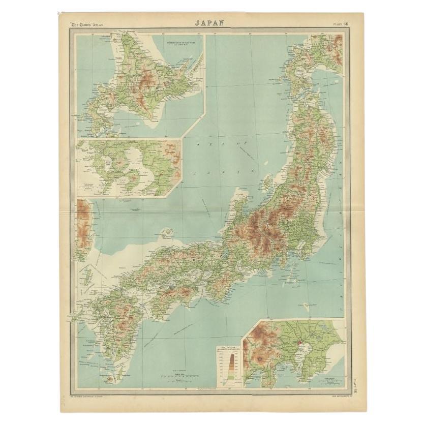
Antique Map of the Region of Tokyo and Nagasaki in Japan, 1922
Located in Langweer, NL
Antique map of Japan titled 'Japan - Environs of Tokio & Nagasaki'. Old map of Japan, includes inset maps of Tokyo, Nagasaki and surroundings. This map or...
Category
20th Century Maps
Materials
Paper

$171 Sale Price
20% Off
Recently Viewed
View AllMore Ways To Browse
Antique Railroad Collectibles
Antique Railroad Maps
Hand Painted Antique Map
Map Railroad
Antique Chicago Maps
Antique Railroad Switch
Antique English Maps
Map Of India
British Empire Furniture
American West Antiques
Furniture Russian 18th Century
Antique Law Office Furniture
Map Stand
Antique Maps Of Italy
Antique Doctors
Antique Map India
Antique Topographic Maps
Antique Railroad