Maps
to
815
1,042
42
1,085
10
1
2,927
2,257
475
3
290
34
10
126
10
37
9
2
5
4
3
3
1,084
10
9
2
2
159
74
62
56
14
1,085
1,085
1,085
59
12
10
6
5
Maps For Sale
Period: Early 1900s
Period: 17th Century
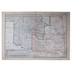
Original Antique Map of the American State of Oklahoma, 1903
Located in St Annes, Lancashire
Antique map of Oklahoma
Published By A & C Black. 1903
Original colour
Good condition
Unframed.
Free shipping
Category
Early 1900s English Antique Maps
Materials
Paper
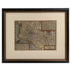
1608 Hispaniae Novae Sive Magnae Vera Descriptio Framed Mexico Map
Located in Stamford, CT
1608 Hispaniae Novae Sive Magnae Vera Descriptio Framed Mexico Map. As found custom black wooden frame/ matting.
This map is based on the work of Abraham Ortelius as is an example o...
Category
Early 1600s Mexican Spanish Colonial Antique Maps
Materials
Glass, Wood, Paper
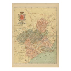
1902 Murcia: A Cartographic Snapshot of Spain's Southeastern Province
Located in Langweer, NL
The map represents the province of Murcia, Spain, as it was in 1902. Here's an overview of its characteristics:
- **Geography**: It displays the varied terrain of Murcia, from the c...
Category
Early 1900s Antique Maps
Materials
Paper
$321 Sale Price
20% Off
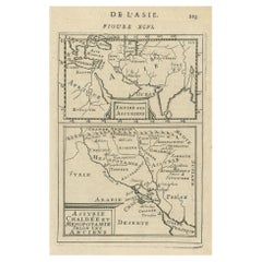
Old Map of the Empire of the Assyriens & the Tigres and Euphrates Rivers, 1683
Located in Langweer, NL
Antique map titled 'Empire des Assyriens' and 'Assyrie Chaldee et Mesopotamie selon les Anciens'.
Two maps on one sheet, the upper sheet showing the Empire of the Assyriens and the second showing the region of the Tigres and Euphrates Rivers. This map originates from Alain Manesson Mallet's 'Description de l 'Univers'.
Artists and engravers: Alain Manesson Mallet (1630–1706) was a French cartographer and engineer. He started his career as a soldier in the army of Louis XIV, became a Sergeant-Major in the artillery and an Inspector of Fortifications. He also served under the King of Portugal, before returning to France, and his appointment to the court of Louis XIV. His military engineering and mathematical background led to his position teaching mathematics at court. His major publications were Description de L'Univers (1683) in 5 volumes, and Les Travaux de Mars ou l'Art de la Guerre (1684) in 3 volumes.
His Description de L'Universe contains a wide variety of information, including star maps...
Category
1680s Antique Maps
Materials
Paper
$264 Sale Price
20% Off
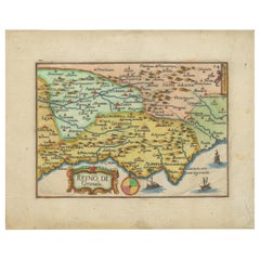
Antique Map of Granada Spain – Hand-Coloured Tassin Engraving 1651
Located in Langweer, NL
Antique Map of Granada Spain – Hand-Coloured Tassin Engraving 1651
This beautiful hand-coloured engraved map depicts the historic Kingdom of Granada in southern Spain, created by th...
Category
Mid-17th Century French Antique Maps
Materials
Paper
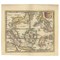
1692 Jacq. Peeters Map: East Indies, Indonesia, Japan, Philippines and Singapore
Located in Langweer, NL
1692 Jacques Peeters Map: East Indies, Indonesia & Japan with Unique Inset
This hand-colored map from 1692, created by Jacques Peeters, captures the islands of Indonesia, the Philippines, and features a unique inset of Japan.
It closely resembles Nicolas de Fer's map and is primarily based on Sanson's influential maps. The map meticulously details cities, smaller settlements, rivers, mountain chains, and forests, offering a comprehensive view of the region's geography.
The inset map of Japan stands out due to its distinctive shape and influences, reflecting different cartographic sources. Notable features include the marked equator and detailed latitude and longitude indications on the borders.
The map measures 6.5 inches in width by 5.5 inches in height and is in excellent condition, with a dark impression, slight toning, and a minor centerfold crease.
Keywords:
- East Indies map
- Indonesia historical map
- Philippines map...
Category
1690s Antique Maps
Materials
Paper
$622 Sale Price
20% Off
1698 Mercator Ptolemaic Map of Asia East of the Ganges
Located in Langweer, NL
**Catalogue Description:**
**Title:** Tab. XI. Asiae, comprehendens Indiam extra Gangem.
**Description:**
This is an exquisite Ptolemaic map depicting Asia east of the Ganges, ti...
Category
1680s Antique Maps
Materials
Paper
$888 Sale Price
20% Off
Original Antique Print of Mount Cinthus on the isle of Delos, Greece, 1688
Located in Langweer, NL
Antique print Greece titled 'Bergh Cinthus'. Old print of Mount Cinthus (birth place of Apollo), Delos, Greece. This print originates from 'Nauwkeurige Beschrijving der eilanden in de in de Archipel der Middellantsche Zee' by O. Dapper.
Mount Cynthus (Kýnthos) is located on the isle of Delos, part of the Greek Cyclades.
In Greek mythology, Leto gave birth to Apollo and Artemis...
Category
17th Century Antique Maps
Materials
Paper
Original Antique Map of the American State of Louisiana, 1903
Located in St Annes, Lancashire
Antique map of Louisiana
Published By A & C Black. 1903
Original colour
Good condition
Unframed.
Free shipping
Category
Early 1900s English Antique Maps
Materials
Paper
Antique Map of the Berchtesgaden Region by Scherer, 1699
Located in Langweer, NL
Antique map titled 'Principat et praepositura Berchtesgadensis (..).' Detailed uncommon map of the Berchtesgaden region in southern Bavaria, Germany. Source unknown, to be determined...
Category
17th Century Antique Maps
Materials
Paper
$212 Sale Price
20% Off
Original Antique Map of the American State of Massachusetts, 1903
Located in St Annes, Lancashire
Antique map of Vermont and New Hampshire
Published By A & C Black. 1903
Original colour
Good condition
Unframed.
Free shipping
Category
Early 1900s English Antique Maps
Materials
Paper
Northern Schleswig and Haderslev Map by Johannes Mejer and Johannes Blaeu, 1662
Located in Langweer, NL
The map shows the Duchy of Schleswig, which spans the area between the North Sea coast, Kolding, and Flensburg. The maps were originally published by Johannes Mejer in the regional a...
Category
1660s Antique Maps
Materials
Paper
$529 Sale Price
20% Off
Cartographic Elegance: The Art and Science of 17th-Century Asian Maps, ca.1681
Located in Langweer, NL
This original antique map is an artifact from a pivotal era in cartography, reflecting not only the geographical knowledge of its time but also the intertwining of art and science in...
Category
1680s Antique Maps
Materials
Paper
$368 Sale Price
20% Off
Antique Map of the Region of Poitou by Janssonius, 1657
Located in Langweer, NL
Antique map 'Pictauiae Ducatus Descriptio vulgo le Pais de Poictov'. Decorative map of the region of Poitou with Rochelle, Nantes, etc., France. This map originates from 'Atlas Novus...
Category
Mid-17th Century Antique Maps
Materials
Paper
$519 Sale Price
20% Off
Antique Map of the Region of Pays de Caux by Janssonius, 1657
Located in Langweer, NL
Antique map 'Le Pais de Caux'. Decorative map of the region of Pays de Caux, France. This map originates from 'Atlas Novus, Sive Theatrum Orbis Orbis Terrarum: In quo Galliae, Helvet...
Category
Mid-17th Century Antique Maps
Materials
Paper
$519 Sale Price
20% Off
Rare Hand-Colored Map of Franche-Comté and Burgundy by Frederik De Wit c. 1688
Located in Langweer, NL
Title: Rare Hand-Colored Map of Franche-Comté and Burgundy by Frederik De Wit c. 1688
Description: This stunning 17th-century map, titled "Comitatus Burgundiae vulgo La Franche Comt...
Category
1680s Antique Maps
Materials
Paper
Original Antique Map of the American State of Washington, 1903
Located in St Annes, Lancashire
Antique map of Washington
Published By A & C Black. 1903
Original colour
Good condition
Unframed.
Free shipping
Category
Early 1900s English Antique Maps
Materials
Paper
Original Antique Map of the Dutch Provinces of Overijssel and Drenthe, 1635
Located in Langweer, NL
Antique map titled 'Transiselania Dominium vernacule Over-Yssel.' - Map of the Dutch Provinces of Overijssel and Drenthe. Dedicated to Mr. Bartold Wich...
Category
1630s Antique Maps
Materials
Paper
$453 Sale Price
20% Off
Antique Map of Southern Germany by F. de Wit, circa 1680
Located in Langweer, NL
This antique map depicts a portion of southern Germany that included the historic regions of Bavaria, the Palatinate, Prussia-Brandenburg, the Rhineland and Saxony. Regensberg, Freis...
Category
Late 17th Century Antique Maps
Materials
Paper
$656 Sale Price
20% Off
Antique Plan of Duinkerke or Dunkirk in France by Guicciardini, 1612
Located in Langweer, NL
Antique map Duinkerke titled 'Duijnkerken'. Small plan of the city of Duinkerke/Dunkerque, France.
Artists and Engravers: Lodovico Guicciardini (1521-1589): an Italian merchant fr...
Category
17th Century Antique Maps
Materials
Paper
$217 Sale Price
20% Off
Alicante in a 1901 Antique Map: Maritime Gateway of Spain's Costa Blanca
Located in Langweer, NL
An original antique map of the province of Alicante, dated 1901. It is part of the atlas series by D. Benito Chias y Carbo, featuring cartographic elements.
Here are some characteri...
Category
Early 1900s Antique Maps
Materials
Paper
$415 Sale Price
20% Off
1640 Willem Blaeu Map Entitled "Contado di molise et principato vltra, " Ric.a003
By Willem Blaeu
Located in Norton, MA
1640 Willem Blaeu map entitled
"Contado di molise et principato vltra,"
Colored
Ric. a003
Measures: 38 x 49.6 cm and wide margins
DBLAEU.
Cou...
Category
17th Century Dutch Antique Maps
Materials
Paper
Greece 1660 Jan Jansson Watercolour Map Peloponesus Sive Morea I Laurenbergio
Located in West Sussex, Pulborough
We are delighted to offer for sale this Jan Jansson Date: 1660 (published) Amsterdam map of Greece.
This is an authentic antique map of Peloponnese or...
Category
1660s Danish Dutch Colonial Antique Maps
Materials
Copper
Large Original Antique City Plan of Philadelphia, USA, circa 1900
Located in St Annes, Lancashire
Fabulous colorful map of Philadelphia
Original color
By Rand, McNally & Co.
Published, circa 1900.
Unframed
Free shipping.
Category
Early 1900s American Antique Maps
Materials
Paper
Copper-Engraved Map Showing the Algerian Coast of North Africa, Published 1683
Located in Langweer, NL
Antique map titled 'Partie de Barbarie, ou est le Royaume d'Alger (..)'.
Copper-engraved map showing the Algerian coast of North Africa. Published 1683.
Artists and Engravers:...
Category
1680s Antique Maps
Materials
Paper
$321 Sale Price
20% Off
Johannes Janssonius' 17th-Century Map of the Duchy of Bremen in Germany
Located in Langweer, NL
The map titled "Ducatus olim Episcopatus Bremensis et ostiorum Albis et Visurgis Fluviorum novissima Descriptio" by Johannes Janssonius provides a rich historical and geographical il...
Category
1650s Antique Maps
Materials
Paper
$726 Sale Price
20% Off
Blaeu Map of Ottoman Balkans – Walachia Bulgaria Romania, circa 1665
Located in Langweer, NL
Blaeu Map of Ottoman Balkans – Walachia Bulgaria Romania, circa 1665
This is an original hand-coloured antique map titled “Walachia, Servia, Bulgaria, Romania,” published by Joan Bl...
Category
17th Century Dutch Antique Maps
Materials
Paper
17th Century Blaeu Map – Ottoman Balkans: Walachia, Bulgaria, Romania, ca. 1650
Located in Langweer, NL
Blaeu Map of Walachia, Servia, Bulgaria, Romania, circa 1640
This is an original antique map titled “Walachia, Servia, Bulgaria, Romania,” published by Joan Blaeu in Amsterdam betwe...
Category
17th Century Dutch Antique Maps
Materials
Paper
Thraciae Veteris Typus – 1618 Ortelius Map of Ancient Thrace with Hand Color
Located in Langweer, NL
Thraciae Veteris Typus – 1618 Ortelius Map of Ancient Thrace with Hand Color
This striking early 17th-century map, Thraciae Veteris Typus, was published in 1618 by Abraham Orteliu...
Category
Early 1600s Antique Maps
Materials
Paper
Japanese Isles Map by Mallet, 1683 – Decorative Miniature Map
Located in Langweer, NL
1683 Map of Japan Isles by Mallet – Decorative Miniature Map
This is an original antique map titled “Isles du Japon,” created by Alain Manesson Mallet and published in Paris in 1683...
Category
1680s French Antique Maps
Materials
Paper
Early Woodcut Map of Franconia and Surrounding Regions, 1628
Located in Langweer, NL
Title: Early Woodcut Map of Franconia and Surrounding Regions, 1628
Franconia (Franckenlande) is a region in Germany. Historically, Franconia was a significant part of the Holy Roma...
Category
1620s Antique Maps
Materials
Paper
Very Rare Antique Print of the Kings Celebrations in Pegu, Myanmar, 1682
Located in Langweer, NL
Plate: 'Konings feesten tot Pegu.' (Kings celebrations in Pegu.)
On this plate: 1. The King. 2. And the Queen, sprinkling water on each other. 3. Their children. 4. Officers. 5. ...
Category
1680s Antique Maps
Materials
Paper
$434 Sale Price
20% Off
Antique Map of the Island of Psara by Dapper, 1688
Located in Langweer, NL
Antique map titled 'Sara.' Map of Psara ( Psyra or Ipsera) Island (North East Aegean Islands), Greece. This map originates from 'Nauwkeurige Beschrijving der eilanden in de Archipel ...
Category
17th Century Antique Maps
Materials
Paper
$141 Sale Price
20% Off
Original Antique Map of the American State of South Carolina, 1903
Located in St Annes, Lancashire
Antique map of South Carolina
Published By A & C Black. 1903
Original colour
Good condition
Unframed.
Free shipping
Category
Early 1900s English Antique Maps
Materials
Paper
Scarce Antique Map of the Middle East, Surrounded by Latin Text, 1624
Located in Langweer, NL
Antique map titled 'Lumen Historium per Orientem (..).'
Scarce map of the Middle East, surrounded by Latin text. The two insets show Israel and an oval world map. This map (from the last edition of Ortelius Theatri Orbis Terrarum Parergon, 1624) was engraved by Franciscus Hareio. Later, this map was copied by Hornius for his World Atlas (1653).
Artists and Engravers: Franciscus Haraeus (Latinised form of Franciscus Verhaer; also known as Frans Verhaer), (Utrecht 1555? - Leuven, 11 January 1631), was a Dutch theologian, historian, and cartographer. He is best known for his history (from a Catholic point of view) of the Dutch Revolt...
Category
1620s Antique Maps
Materials
Paper
$897 Sale Price
20% Off
17th-Century Original Antique Map of Hunan and Hubei Provinces, China – by Blaeu
Located in Langweer, NL
Title: 17th-Century Antique Map of Hunan and Hubei Provinces, China – "Hvqvang" by Blaeu, Richly Detailed and Illustrated
Description: This beautiful 17th-century map of the regions that now comprise Hunan and Hubei Provinces, historically referred to as "Hvqvang," was created by Johannes Blaeu and published in 1655 as part of the *Novus Atlas Sinensis*. This map, drawn with input from Jesuit missionary Martino Martini, provides a meticulous representation of central China’s geography, capturing its rivers, towns, and mountainous terrain.
The Yangtze River (Changjiang) is prominently featured, emphasizing the region’s importance as a vital waterway for trade and transportation. Wuhan, now a modern metropolis, and Changsha, the capital of Hunan Province, were historically significant cities that appear on the map. The area is also notable for its fertile lands and contributions to China’s agricultural prosperity, particularly in rice and tea production.
The decorative cartouche in the lower-right corner features two figures in traditional Chinese attire standing amid bamboo, symbolizing the cultural and natural richness of the region. Blaeu’s map combines precision and artistry, with vibrant hand-coloring distinguishing boundaries and geographical features. The copperplate engraving ensures fine detail, making this map a remarkable historical artifact.
Condition: Near excellent. Clean impression with vivid hand-coloring. Wide margins with minor age-toning appropriate for its age.
Framing Tips: Use a neutral double mat and a gilt or dark wood frame to enhance the presentation. UV-protective glass is recommended to preserve the vivid hand-coloring and intricate engraving details.
Hunan and Hubei, historically referred to as "Hvqvang," are known for their strategic location along the Yangtze River and their cultural and economic significance in Chinese history. The region’s fertile lands have supported extensive rice cultivation, earning it the title of one of China’s "breadbaskets." Hubei, with Wuhan at its center, has long been a hub of transportation and trade, owing to the convergence of the Yangtze and Han Rivers. Hunan, with Changsha as its capital, is known for its rich cultural heritage and contributions to Chinese literature and art.
Important places in the region include Wuhan, an ancient trade center, and Changsha, known for its historical sites and cultural prominence. The Yangtze River, a key feature on the map, highlights the region’s historical importance as a major waterway for commerce and agriculture. Other notable features include Dongting Lake, a vital ecological and cultural landmark, and the surrounding mountainous areas that have shaped the region’s history and development.
Keywords: antique map of Hunan, Hubei map, Hvqvang map, Yangtze River map, 17th-century Chinese map...
Category
1650s Antique Maps
Materials
Paper
Original Antique Map showing Southern India, Northern Sri Lanka & Malabar, 1652
Located in Langweer, NL
Antique map titled 'Presqu'Isle de l'Inde deca le Gange (..)'.
Old map showing the southern part of India, including the northern part of Sri Lanka. With inset map of Southern India (Malabar). This map covers the subcontinent from the Bay of Bengal and the Gulf of Cambay to Ceylon. The Mogul Empire can be found in the north. Further south...
Category
1650s Antique Maps
Materials
Paper
$623 Sale Price
20% Off
Antique Map of Romania and Bulgaria Centered on the Danube River
Located in Langweer, NL
Antique map titled 'Vetus descriptio Daciarum nec non Moesiarum'. Impressive map of the area of Romania and Bulgaria centered on the Danube River. The map is based on Ortelius' map o...
Category
Mid-17th Century Antique Maps
Materials
Paper
$652 Sale Price
20% Off
Orense in Depth: A 1902 Topographical Map of Galicia's Mountainous Province
Located in Langweer, NL
The map is a detailed cartographic representation of the province of Orense (Ourense in Galician), located in the northwest of Spain, as it was in 1902. Here's a brief description an...
Category
Early 1900s Antique Maps
Materials
Paper
$292 Sale Price
20% Off
Guadalajara 1902: A Cartographic Image of Castilla-La Mancha's Northern Province
Located in Langweer, NL
The map illustrates the province of Guadalajara, part of the autonomous community of Castilla-La Mancha in Spain, as of 1902. The map includes various geographic and infrastructural ...
Category
Early 1900s Antique Maps
Materials
Paper
$274 Sale Price
20% Off
Original Antique Map of Turkey, Asia Minor and Cyprus
Located in Langweer, NL
Antique map titled 'Natoliae sive Asia Minor'. Original old map of Turkey, Asia Minor and Cyprus. Includes a decorative cartouches, sailing ship, sea mon...
Category
Early 17th Century Antique Maps
Materials
Paper
$793 Sale Price
20% Off
Cartographic Depiction of Flensburg and Surrounding Territories, Anno 1648
Located in Langweer, NL
Title: Landtcarte Vonn dem Ambte Flensborg, ohne Nordgoeßherde. Anno 1648.
Description:
This exquisitely detailed and old coloured map of Flensburg was crafted by the noted cartogr...
Category
1640s German Antique Maps
Materials
Paper
$1,171 Sale Price
20% Off
A Handsome & Detailed Map of the Duchy of Mecklenburg & Pomerania, Germany, 1680
Located in Langweer, NL
Antique map titled 'Ducatus Meklenburgicus in quo sunt Ducatus Vandaliae et Meklenburgi Ducatus et Comitatus Swerinensis.'
A handsome and detailed map of the Duchy of Mecklenburg...
Category
1680s Antique Maps
Materials
Paper
$699 Sale Price
20% Off
1767 D’Anville Map of the Holy Land: Ancient Divisions and Biblical Geography
Located in Langweer, NL
Ancient Map of Palestine or the Holy Land by D'Anville (1767)
This detailed map, created by the renowned French cartographer Jean Baptiste Bourguignon d'Anville in 1767, depicts the...
Category
1670s Antique Maps
Materials
Paper
Original Antique Map of the American State of Virginia, 1903
Located in St Annes, Lancashire
Antique map of Virginia
Published By A & C Black. 1903
Original colour
Good condition
Unframed.
Free shipping
Category
Early 1900s English Antique Maps
Materials
Paper
Old Map of the Margraviate of Brandenburg by Giacomo Cantelli da Vignola, 1687
Located in Langweer, NL
Historical Map of the Margraviate of Brandenburg by Giacomo Cantelli da Vignola - 1687
This magnificent map, titled Marchesato, et Elettorato di Brandeburgo con una gran Porzione ...
Category
1680s Antique Maps
Materials
Paper
$510 Sale Price
20% Off
Original Antique Map of the American State of Minnesota, 1903
Located in St Annes, Lancashire
Antique map of Minnesota
Published By A & C Black. 1903
Original colour
Good condition
Unframed.
Free shipping
Category
Early 1900s English Antique Maps
Materials
Paper
Old Map by Blaeu of the City of Franeker, Friesland, The Netherlands, 1649
Located in Langweer, NL
Antique map titled 'Franekera'.
Old map of the city of Franeker, Friesland. Also shows two cartouches, coats of arms and legend. This map originates from a Latin edition of the t...
Category
1640s Antique Maps
Materials
Paper
$1,086 Sale Price
20% Off
Antique Print of the City of Kancheu in China, 1668
Located in Langweer, NL
Antique print China titled 'Kancheu'. Old print depicting a view on the Chinese city of Kancheu with its ramparts. This print originates from the L...
Category
17th Century Antique Maps
Materials
Paper
$274 Sale Price
20% Off
Original Antique Map of the American State of Alaska, 1903
Located in St Annes, Lancashire
Antique map of Alaska
Published By A & C Black. 1903
Original colour
Good condition
Unframed.
Free shipping
Category
Early 1900s English Antique Maps
Materials
Paper
Original Antique Map of the American State of Pennsylvania( Western Part ), 1903
Located in St Annes, Lancashire
Antique map of Pennsylvania ( Western part )
Published By A & C Black. 1903
Original colour
Good condition
Unframed.
Free shipping
Category
Early 1900s English Antique Maps
Materials
Paper
Circa 1659 Johannes Blaeu Map: Ducatus Silesiae Ligniciensis, Legnica Region
Located in Langweer, NL
Circa 1659 Johannes Blaeu Map: Ducatus Silesiae Ligniciensis, Legnica Region
This hand-colored map from circa 1659 by Johannes Blaeu, titled "Ducatus Silesiae Ligniciensis," depicts the region centered around Legnica (Lignitz) in southwestern Poland.
It extends to include the cities of Lublin, Jawor, and Lwówek Śląski.
The map features decorative elements such as a title cartouche adorned with a putto, garlands of fruit, and birds, and a distance scale cartouche that includes a hunter with his dogs.
This map is dedicated to Georgius Rodulfus, the Duke of Silesia, by Ionas Scultetus, reflecting the map's historical context and noble patronage.
It includes Spanish text on the verso, indicating publication between 1659 and 1672. Measuring 20.9 inches wide by 16.3 inches high, the map is in excellent condition with a sharp impression, full contemporary color, and a large watermark of the god Atlas. Minor details include a bit of printer's ink residue at the right and slight marginal soiling.
Keywords:
- Johannes Blaeu map
- Silesia historical map
- Legnica (Lignitz) map
- 17th-century Poland map...
Category
1650s Antique Maps
Materials
Paper
$1,039 Sale Price
20% Off
Rare Small Antique Map of the Persian Empire, 1692
Located in Langweer, NL
Antique map titled 'Perse'. Small engraved map of the Persian Empire, decorated with a simple cartouche and armorial shield. This map originates from 'L'Atlas en Abrege, ou Nouvelle ...
Category
17th Century Antique Maps
Materials
Paper
Original Antique Map of the American State of South Dakota, 1903
Located in St Annes, Lancashire
Antique map of South Dakota
Published By A & C Black. 1903
Original colour
Good condition
Unframed.
Free shipping
Category
Early 1900s English Antique Maps
Materials
Paper
Original Antique Map of the American State of Mississippi, 1903
Located in St Annes, Lancashire
Antique map of Mississippi
Published By A & C Black. 1903
Original colour
Good condition
Unframed.
Free shipping
Category
Early 1900s English Antique Maps
Materials
Paper
Original Antique Map of the Road from Bristol to Weymouth
Located in Langweer, NL
Antique map titled 'The Road from Bristol to Weymouth (..)'. Original antique map of the road from Bristol to Weymouth. Plate 60 from Ogilby's 'Britannia', the first road atlas of En...
Category
Late 17th Century Antique Maps
Materials
Paper
$207 Sale Price
20% Off
Large Original Antique City Plan of Montreal, Canada, circa 1900
Located in St Annes, Lancashire
Fabulous colorful map of Montreal
Original color
By Rand, McNally & Co.
Published, circa 1900
Unframed
Minor edge tears
Free shipping.
Category
Early 1900s American Antique Maps
Materials
Paper
Stunning Decorative Antique Map of East Frisia with an Inset of Emden, c.1610
Located in Langweer, NL
Description: Antique map titled 'Typus Frisie Orientalis a Dullarto (..)'. One of the most decorative maps of East Frisia and its important shipping center of Emden and the Watten Is...
Category
1610s Antique Maps
Materials
Paper
$3,071 Sale Price
20% Off
Minho: A Legacy of Lush Landscapes and Living Traditions in Portugal, 1903
Located in Langweer, NL
Ths authentic print is a historical map of the Minho region in the northwestern part of Portugal. The map includes detailed geographical features, such as rivers, mountain ranges, an...
Category
Early 1900s Antique Maps
Materials
Paper
$321 Sale Price
20% Off
Antique Map of the Province of Overijssel by Coronelli, c.1692
Located in Langweer, NL
Antique map titled 'Tran-siselana' Splendid detailed and decorative map of the province of Overijssel in the Netherlands by Vincenzo Coronelli. An elaborate title cartouche garlanded...
Category
17th Century Antique Maps
Materials
Paper
$509 Sale Price
20% Off
Recently Viewed
View AllMore Ways To Browse
Antique Wellington Chests
Antonio Cassi Ramelli
Archimede Seguso Birds
Art Deco Coasters
Art Deco Footballer
Art Deco Music Cabinet
Art Deco Waterfall Bedroom Furniture
Art Deco Waterfall Bedroom
Art Deco Whisky
Art Foulard
Art Nouveau Sunflower
Arts And Crafts Silver Coffee Pot
Asian Pink Bowl
Avesn Vase
Baccarat Carafe
Bakelite Bird
Bakelite Cocktail Picks
Bamboo Ikebana Vase
