Items Similar to Antique Map of Alaska '1904'


Want more images or videos?
Request additional images or videos from the seller
1 of 5
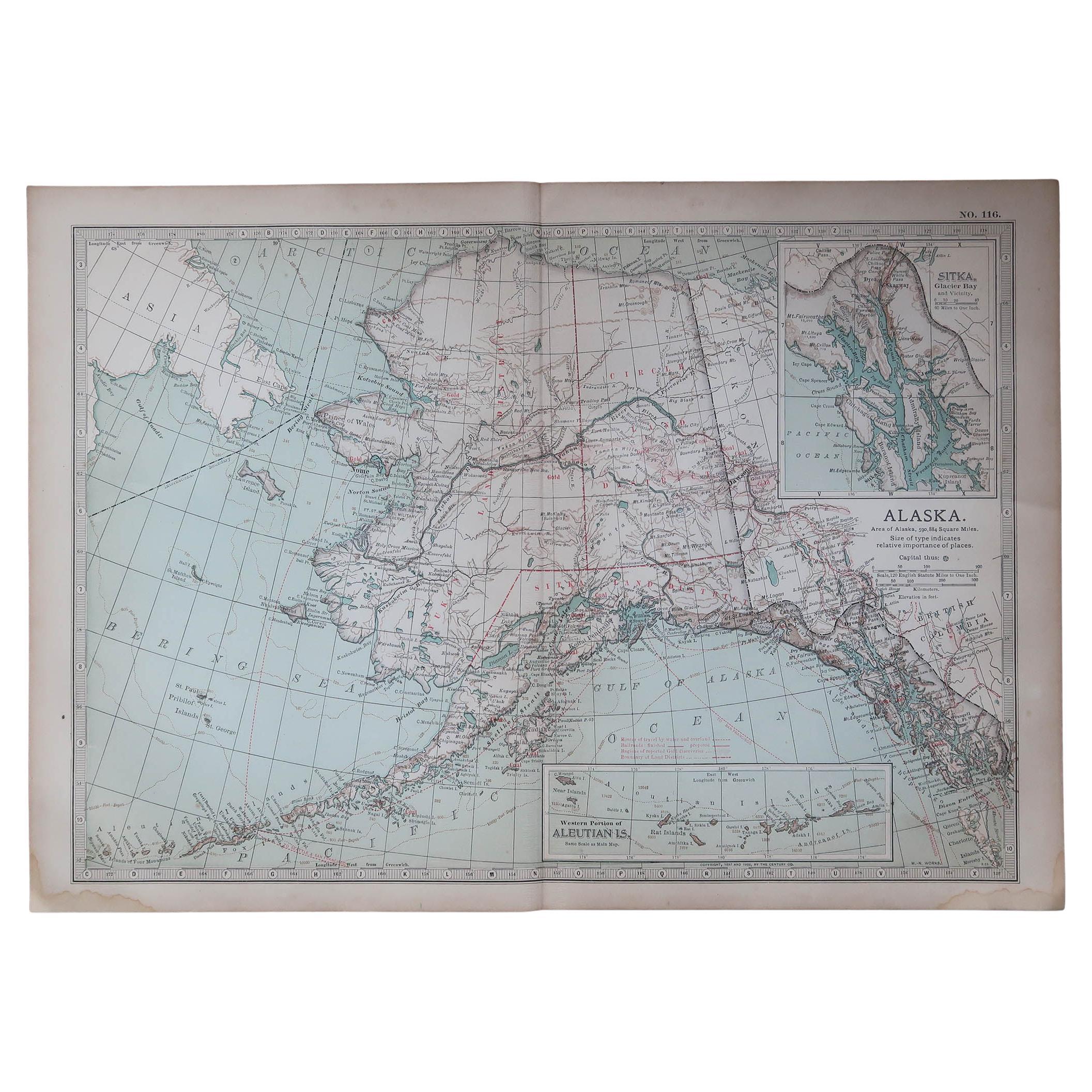
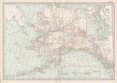
Antique Map of Alaska '1904'
$574.92
$718.6420% Off
£426.04
£532.5520% Off
€480
€60020% Off
CA$784.87
CA$981.0920% Off
A$873.13
A$1,091.4220% Off
CHF 457.71
CHF 572.1320% Off
MX$10,669.48
MX$13,336.8520% Off
NOK 5,828.34
NOK 7,285.4220% Off
SEK 5,486.57
SEK 6,858.2220% Off
DKK 3,654.68
DKK 4,568.3520% Off
Shipping
Retrieving quote...The 1stDibs Promise:
Authenticity Guarantee,
Money-Back Guarantee,
24-Hour Cancellation
About the Item
An antique map titled 'Map of Alaska Compiled Under the Direction of R.U. Goode, Geographer,' which relies on data from both the U.S. Geological Survey and the U.S. Coast and Geodetic Survey; a significant historical document. Here are some aspects of this map that stand out:
**Geographical Detail**: The map incorporates data from the U.S. Geological Survey and the U.S. Coast and Geodetic Survey, it offers a highly detailed view of Alaska's topography and watershed. This level of detail includes mountain ranges, river systems, elevations, and other physical features such as lakes, forests, and glaciers.
**Inset of the Aleutian Islands**: The inclusion of an inset depicting the Aleutian Islands suggests the map's comprehensive nature, ensuring these significant, geographically dispersed parts of Alaska are accurately represented. The Aleutian Islands are a chain of islands extending from southwestern Alaska, and their depiction would be essential for a complete cartographic representation of the state.
**Cartographic Accuracy**: The map's compilation under the direction of R.U. Goode, a geographer, indicates that it would have been created with a focus on scientific accuracy and precision, utilizing the most advanced cartographic information and techniques available at the time.
**Historical Importance**: The map could provide insights into Alaska at a particular point in its history around 1904, showing the state before significant modern development, during a time of important exploration and surveying activity.
**Research and Navigation Use**: With its detailed topographic information, the map would have served important functions for research, navigation, and planning. It would have been of particular use to those involved in geological, hydrological, and ecological studies, as well as to navigators and explorers of the region.
**Educational Value**: As a detailed map with scientific backing, it would have been an invaluable educational tool, likely used in academic settings or by government agencies to inform about the geography of Alaska.
**Collectibility**: For collectors of antique maps, this piece would be of particular interest due to its detail, the reputation of the U.S. Geological Survey and the U.S. Coast and Geodetic Survey for accuracy, and the involvement of a recognized geographer like R.U. Goode. It would also appeal to those with a specific interest in Alaskan history, cartography, and natural sciences.
In summary, this map of Alaska stands as a testament to the scientific cartographic endeavors of its time and would be a prized piece for its rich detail and historical value.
- Dimensions:Height: 33.47 in (85 cm)Width: 47.25 in (120 cm)Depth: 0.02 in (0.5 mm)
- Materials and Techniques:
- Period:
- Date of Manufacture:1904
- Condition:Issued folding. Few tiny splits at fold intersections. Blank verso, please study images carefully.
- Seller Location:Langweer, NL
- Reference Number:Seller: BG-122731stDibs: LU3054317793062
About the Seller
5.0
Recognized Seller
These prestigious sellers are industry leaders and represent the highest echelon for item quality and design.
Platinum Seller
Premium sellers with a 4.7+ rating and 24-hour response times
Established in 2009
1stDibs seller since 2017
2,502 sales on 1stDibs
Typical response time: <1 hour
- ShippingRetrieving quote...Shipping from: Langweer, Netherlands
- Return Policy
Authenticity Guarantee
In the unlikely event there’s an issue with an item’s authenticity, contact us within 1 year for a full refund. DetailsMoney-Back Guarantee
If your item is not as described, is damaged in transit, or does not arrive, contact us within 7 days for a full refund. Details24-Hour Cancellation
You have a 24-hour grace period in which to reconsider your purchase, with no questions asked.Vetted Professional Sellers
Our world-class sellers must adhere to strict standards for service and quality, maintaining the integrity of our listings.Price-Match Guarantee
If you find that a seller listed the same item for a lower price elsewhere, we’ll match it.Trusted Global Delivery
Our best-in-class carrier network provides specialized shipping options worldwide, including custom delivery.More From This Seller
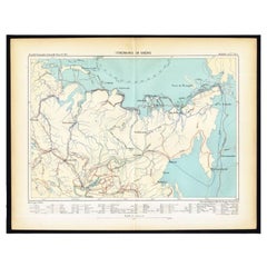
View AllAntique Map of Siberia by Levasseur '1875'
Located in Langweer, NL
Antique map titled 'Carte de la Russie d'Asie Sibérie'. Large map of Siberia. This map originates from 'Atlas de Géographie Moderne Physique et Politique' by A. Levasseur. Published ...
Category
Antique Late 19th Century Maps
Materials
Paper

$383 Sale Price
20% Off
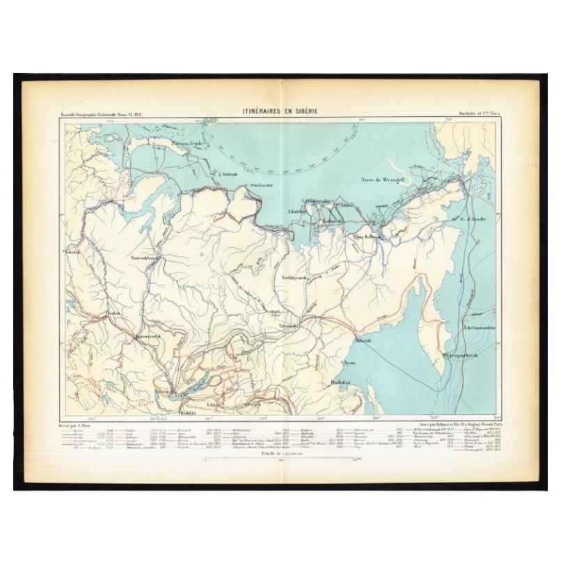
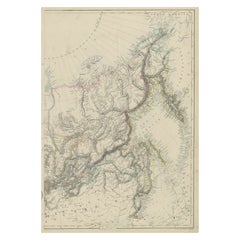
Antique Map of Siberia by Reclus, 1881
Located in Langweer, NL
Antique map titled 'Itineraires en Siberie.' This map shows the itineraries of famous explorers in Siberia between 1648 and 1879. This original old antique print / plate originates f...
Category
Antique 19th Century Maps
Materials
Paper
Antique Map of the United States 'North West' by Johnston, '1909'
Located in Langweer, NL
Antique map titled 'United States of North America'. Original antique map of the United States of North America ( North West ). This map originates from the ‘Royal Atlas of Modern Ge...
Category
Early 20th Century Maps
Materials
Paper

$239 Sale Price
20% Off
Old Map of Russia Originating from the 'Weekly Dispatch Atlas', ca.1865
Located in Langweer, NL
Antique map titled 'Russia in Asia, E Sheet'.
Old map of Russia originating from the 'Weekly Dispatch Atlas'.
Artists and Engravers: Engraved by J.W. Lowry.
Category
Antique 1860s Maps
Materials
Paper
$172 Sale Price
20% Off
19th-Century Decorative Map of British America with Arctic and Pacific Vignettes
Located in Langweer, NL
19th-Century Decorative Map of British America with Arctic and Pacific Vignettes
This 19th-century map of British America, drawn and engraved by J. Rapkin and published by J & F T...
Category
Antique 1850s Maps
Materials
Paper

Antique Map of the Arctic Regions by Lowry '1852'
Located in Langweer, NL
Antique map titled 'Arctic Regions'. Original map of the Arctic Regions. This map originates from 'Lowry's Table Atlas constructed and engraved from the most recent Authorities' by J...
Category
Antique Mid-19th Century Maps
Materials
Paper

$95 Sale Price
20% Off
You May Also Like
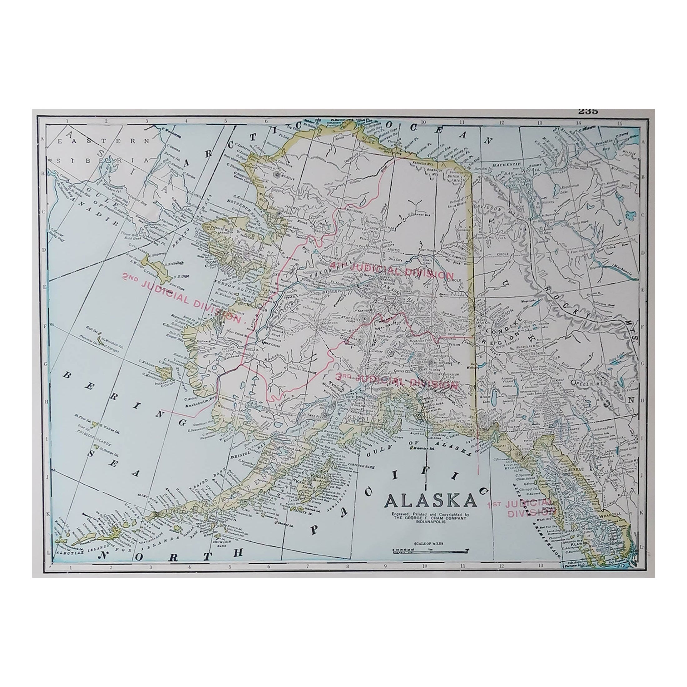
Original Antique Map of the American State of Alaska, 1903
Located in St Annes, Lancashire
Antique map of Alaska
Published By A & C Black. 1903
Original colour
Good condition
Unframed.
Free shipping
Category
Antique Early 1900s English Maps
Materials
Paper

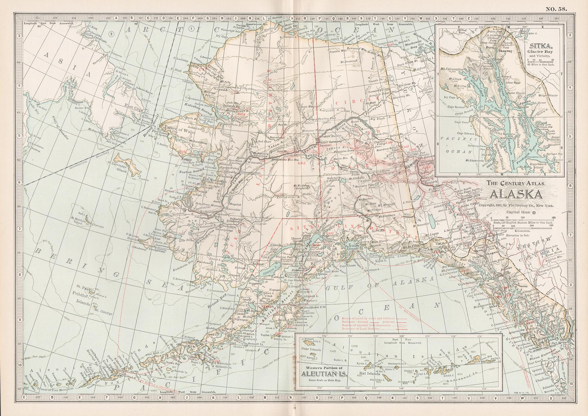
Large Original Antique Map of Alaska, USA, C.1900
Located in St Annes, Lancashire
Fabulous map of Alaska
Original color
Engraved and printed by the George F. Cram Company, Indianapolis.
Published, C.1900
Unframed
Free shipping.
Category
Antique 1890s American Maps
Materials
Paper

Alaska, United States of America, Century Atlas state antique vintage map
Located in Melbourne, Victoria
'The Century Atlas. Alaska.' Inset maps of 'Sitka, Glacier Bay' and Aleutian Is.'.
Original antique map, 1903.
Central fold as issued. Map name and number printed on the reverse cor...
Category
Early 20th Century Victorian More Prints
Materials
Lithograph

Alaska, North America. Century Atlas antique vintage map
Located in Melbourne, Victoria
'The Century Atlas. Alaska, North America.'
Original antique map, 1903.
Inset maps of 'Sitka, Glacier Bay' and Aleutian Is.'.
Central fold as issued. Map name and number printed on...
Category
Early 20th Century Victorian More Prints
Materials
Lithograph
Original Antique Map of the American State of Washington, 1903
Located in St Annes, Lancashire
Antique map of Washington
Published By A & C Black. 1903
Original colour
Good condition
Unframed.
Free shipping
Category
Antique Early 1900s English Maps
Materials
Paper

Original Antique Map of the American State of Washington, 1889
Located in St Annes, Lancashire
Great map of Washington
Drawn and Engraved by W. & A.K. Johnston
Published By A & C Black, Edinburgh.
Original colour
Unframed.
Category
Antique 1880s Scottish Victorian Maps
Materials
Paper

More Ways To Browse
Antique Topographic Maps
Southwestern Antiques
Antique Navigator
Antique Level Tool
Antique Navigational Tools
Antique Geological Maps
Antique Maps Of Italy
Antique Map India
Antique Topographic Maps
Antique Railroad
Antique Maps Of Africa
Railroad Furniture
Antiques Compasses
Antique House Plans
Antique Navigation
Colonial Furniture Company
Mississippi Furniture
Antique Scottish Wood Furniture