Items Similar to Antique Map of the Baltic Sea by Johnston, '1909'

Want more images or videos?
Request additional images or videos from the seller
1 of 5
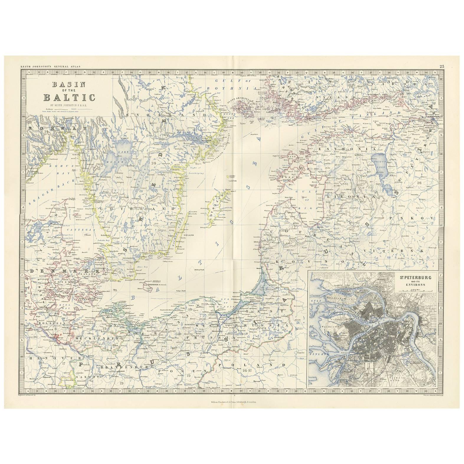
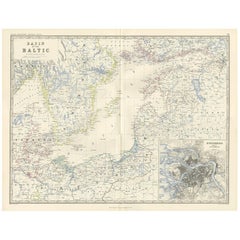
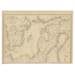
Antique Map of the Baltic Sea by Johnston, '1909'
$239.63
$299.5420% Off
£178.35
£222.9420% Off
€200
€25020% Off
CA$328.23
CA$410.2920% Off
A$365.07
A$456.3320% Off
CHF 190.63
CHF 238.2820% Off
MX$4,442.45
MX$5,553.0720% Off
NOK 2,434.58
NOK 3,043.2220% Off
SEK 2,283.21
SEK 2,854.0120% Off
DKK 1,522.53
DKK 1,903.1620% Off
Shipping
Retrieving quote...The 1stDibs Promise:
Authenticity Guarantee,
Money-Back Guarantee,
24-Hour Cancellation
About the Item
Antique map titled 'Basin of the Baltic'. Original antique map of Baltic Sea. With inset maps of Kiel, Stettin, Danzig and St Petersburg. This map originates from the ‘Royal Atlas of Modern Geography’. Published by W. & A.K. Johnston, 1909.
- Dimensions:Height: 19.49 in (49.5 cm)Width: 24.41 in (62 cm)Depth: 0.02 in (0.5 mm)
- Materials and Techniques:
- Period:
- Date of Manufacture:1909
- Condition:Minor fading. General age-related toning, some foxing. Please study image carefully.
- Seller Location:Langweer, NL
- Reference Number:Seller: BG-12940-251stDibs: LU3054324701862
About the Seller
5.0
Recognized Seller
These prestigious sellers are industry leaders and represent the highest echelon for item quality and design.
Platinum Seller
Premium sellers with a 4.7+ rating and 24-hour response times
Established in 2009
1stDibs seller since 2017
2,508 sales on 1stDibs
Typical response time: <1 hour
- ShippingRetrieving quote...Shipping from: Langweer, Netherlands
- Return Policy
Authenticity Guarantee
In the unlikely event there’s an issue with an item’s authenticity, contact us within 1 year for a full refund. DetailsMoney-Back Guarantee
If your item is not as described, is damaged in transit, or does not arrive, contact us within 7 days for a full refund. Details24-Hour Cancellation
You have a 24-hour grace period in which to reconsider your purchase, with no questions asked.Vetted Professional Sellers
Our world-class sellers must adhere to strict standards for service and quality, maintaining the integrity of our listings.Price-Match Guarantee
If you find that a seller listed the same item for a lower price elsewhere, we’ll match it.Trusted Global Delivery
Our best-in-class carrier network provides specialized shipping options worldwide, including custom delivery.More From This Seller
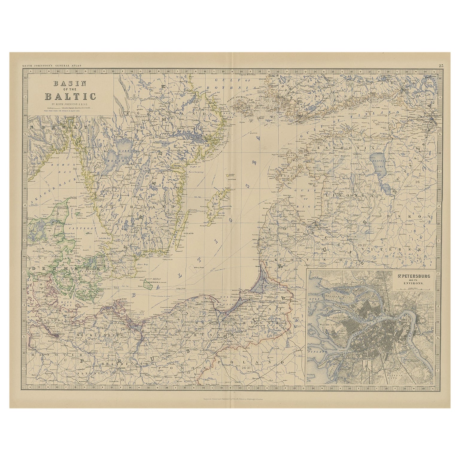
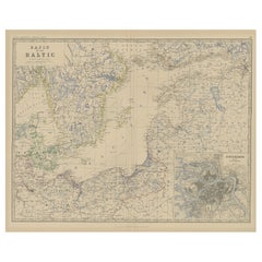
View AllAntique Map of the Surroundings of the Baltic Sea by A.K. Johnston, 1865
Located in Langweer, NL
Antique map titled 'Basin of the Baltic'. Depicting, Denmark, Sweden, Finland, Estonia, Poland, Prussia and more. With an inset map of St. Peterburg and environments. This map origin...
Category
Antique Mid-19th Century Maps
Materials
Paper
$287 Sale Price
20% Off
Old Map of the the Baltic Sea Region, Inset of St. Petersburg, 1882
Located in Langweer, NL
Description: antique map titled 'Basin of the Baltic'. Old map of the regiona round the Baltic Sea. Includes an inset map of St. Petersburg. This map originates from 'The Royal Atlas...
Category
Antique 1880s Prints
Materials
Paper
$335 Sale Price
20% Off
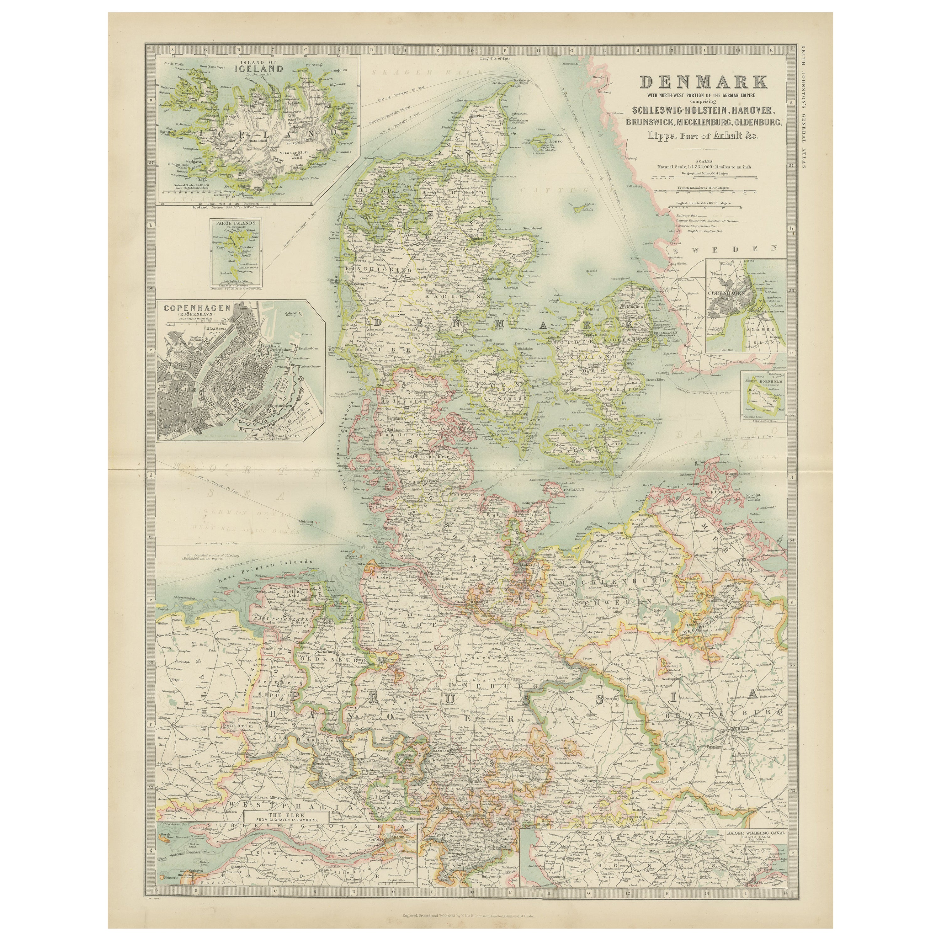
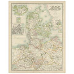
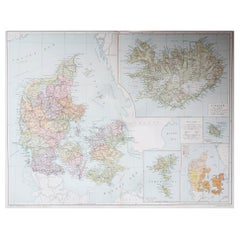
Antique Map of Denmark by Johnston '1909'
Located in Langweer, NL
Antique map titled 'Denmark'. Original antique map of Denmark. With inset maps of Iceland, Faroe Island, and Copenhagen. This map originates from the ‘Royal Atlas of Modern Geography...
Category
Early 20th Century Maps
Materials
Paper
$239 Sale Price
20% Off
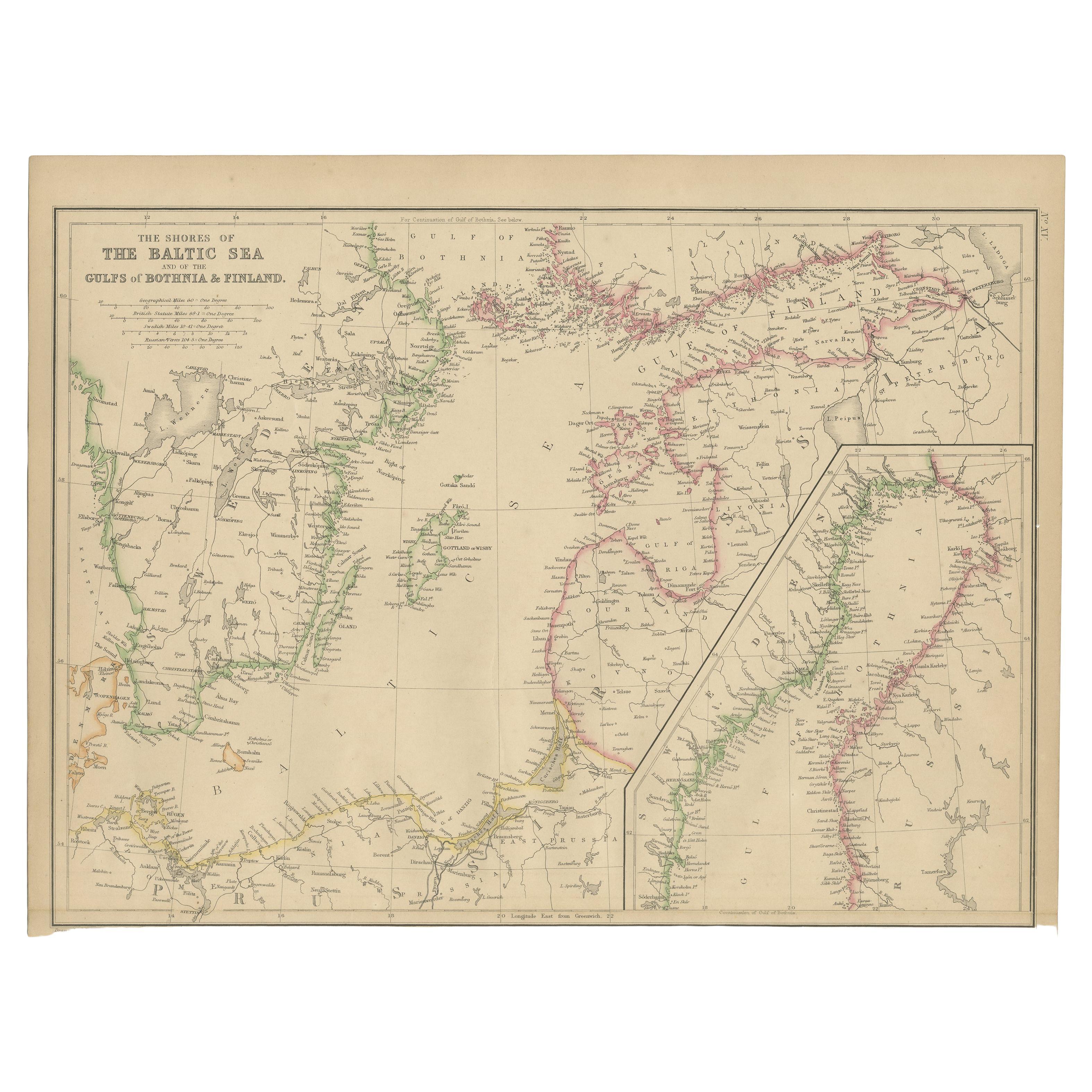
Antique Map of the Shores of The Baltic Sea by W. G. Blackie, 1859
Located in Langweer, NL
Antique map titled 'The shores of The Baltic sea and of the Gulfs of Bothnia & Finland'. Original antique map of the Shores of the Baltic Sea. This map originates from ‘The Imperial ...
Category
Antique Mid-19th Century Maps
Materials
Paper
$167 Sale Price
20% Off
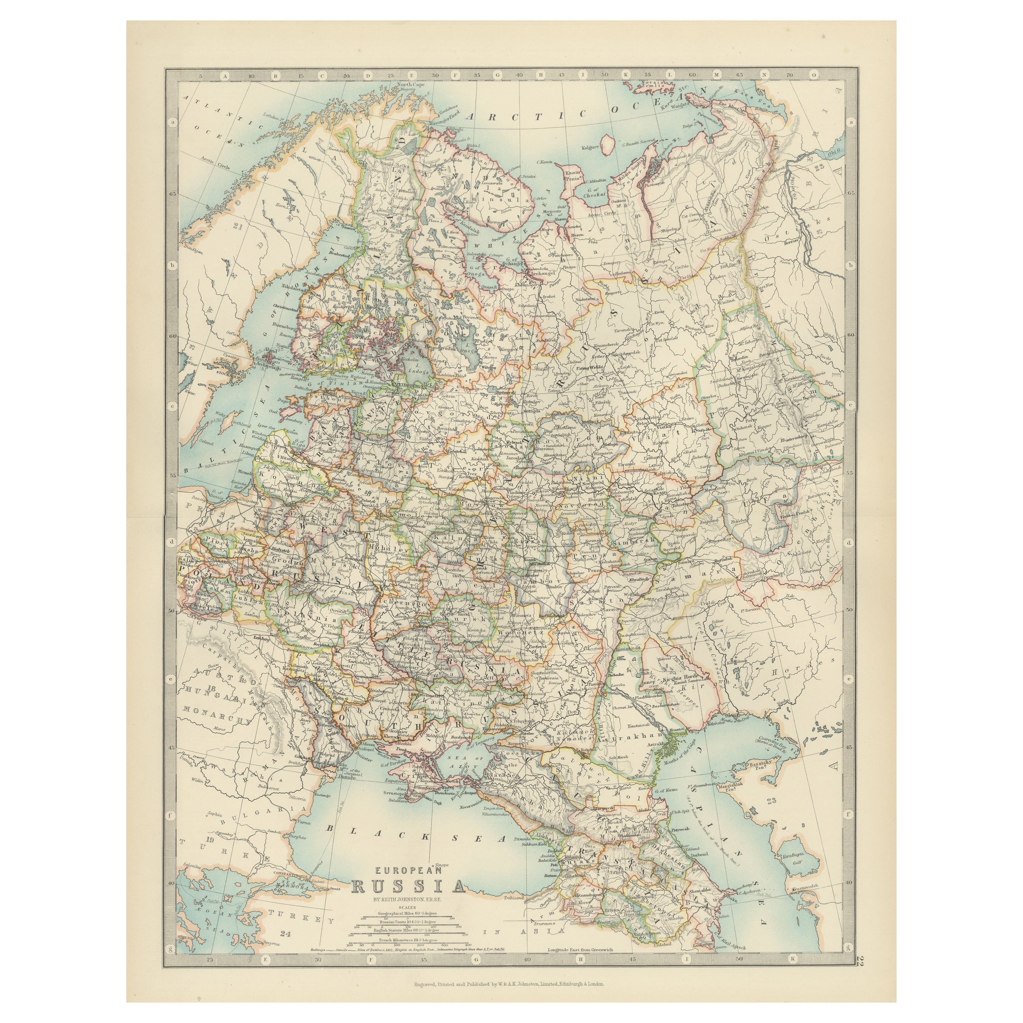
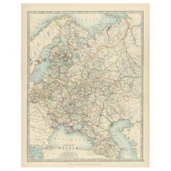
Antique Map of European Russia, 1903, with Colorful Provincial Boundaries
Located in Langweer, NL
Title: Antique Map of European Russia, 1903, with Colorful Provincial Boundaries
Description:
This antique map, titled "European Russia," was engraved and published in 1903 by W. & ...
Category
Early 20th Century Maps
Materials
Paper
Denmark & Schleswig-Holstein Map with Copenhagen & Iceland Insets – 1865 Atlas
Located in Langweer, NL
Denmark & Schleswig-Holstein Map with Copenhagen & Iceland Insets – 1865 Atlas
This detailed antique map titled Denmark and the Duchies Schleswig, Holstein & Lauenburg; Hanover, Bru...
Category
Antique Mid-19th Century Maps
Materials
Paper

$263 Sale Price
20% Off
You May Also Like
Original Antique Map of the American State of Michigan ( Northern Part ), 1903
Located in St Annes, Lancashire
Antique map of Michigan ( Northern part )
Published By A & C Black. 1903
Original colour
Good condition
Unframed.
Free shipping
Category
Antique Early 1900s English Maps
Materials
Paper

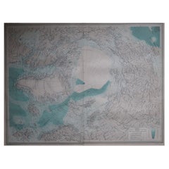
Large Original Vintage Map of The North Pole, circa 1920
Located in St Annes, Lancashire
Great maps of The North Pole.
Unframed.
Original color.
By John Bartholomew and Co. Edinburgh Geographical Institute.
Published, circa 1920.
Free shipp...
Category
Vintage 1920s British Maps
Materials
Paper
Antique Lithography Map, Black Sea, English, Framed, Cartography, Victorian
Located in Hele, Devon, GB
This is an antique lithography map of the Black Sea region. An English, framed atlas engraving of cartographic interest by John Rapkin, dating to the early Victorian period and later...
Category
Antique Mid-19th Century British Early Victorian Maps
Materials
Wood

Large Original Vintage Map of Sweden and Norway circa 1920
Located in St Annes, Lancashire
Great map of Sweden and Norway
Original color. Good condition
Published by Alexander Gross
Unframed.
Category
Vintage 1920s English Victorian Maps
Materials
Paper

Large Original Vintage Map of Iceland, circa 1920
Located in St Annes, Lancashire
Great map of Iceland
Original color. Good condition
Published by Alexander Gross
Unframed.
Category
Vintage 1920s English Victorian Maps
Materials
Paper
Large Original Antique Map of Poland by Sidney Hall, 1847
Located in St Annes, Lancashire
Great map of Poland
Drawn and engraved by Sidney Hall
Steel engraving
Original colour outline
Published by A & C Black. 1847
Unframed
...
Category
Antique 1840s Scottish Maps
Materials
Paper

More Ways To Browse
Kiel Furniture
Antique Kiel Furniture
Antique Marine Maps
Antique Indian Maps
Antique Maps Of Wales
Antique Map Denmark
Antique World Globe Map
Hemispheres Map
Map New Holland
Treasure Map
Caribbean Antiques
19th Century Map Of Africa
Antique Malaysia
Antique Map Of Ireland
Ships Log
Map Of Egypt
Nautical Maps
Antique Maps Of Long Island