Items Similar to Antique Map of Eastern Tartary and the Gobi Desert by Van Schley, 1758


Want more images or videos?
Request additional images or videos from the seller
1 of 5
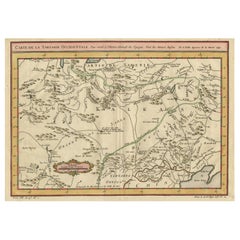
Antique Map of Eastern Tartary and the Gobi Desert by Van Schley, 1758
$326.25
$407.8220% Off
£246.06
£307.5720% Off
€280
€35020% Off
CA$451.07
CA$563.8420% Off
A$505.28
A$631.6020% Off
CHF 265.39
CHF 331.7420% Off
MX$6,144.03
MX$7,680.0420% Off
NOK 3,360.71
NOK 4,200.8920% Off
SEK 3,190.22
SEK 3,987.7820% Off
DKK 2,131.54
DKK 2,664.4320% Off
About the Item
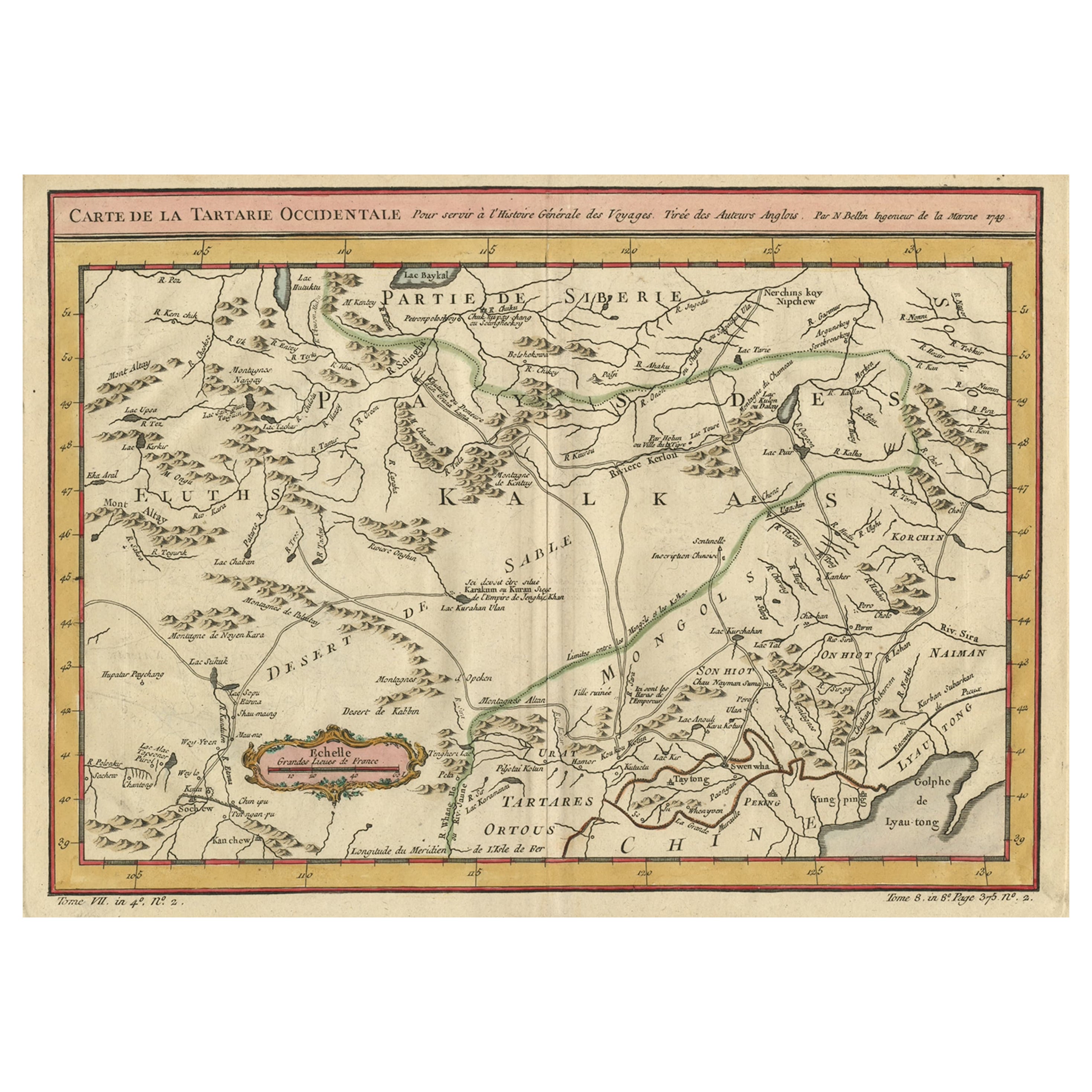
Antique map titled 'Carte de la Tartarie occidentale.' Original antique map of Eastern Tartary and the Gobi desert showing the silk road and the Great Wall of China. While these maps by Van Schley after Bellin were initially made for 'Histoire Generale des Voyages' (Paris 1746-1759), this is from the 1758 Dutch edition of that work published by Arkstee & Merkus.
Artists and Engravers: Made by 'Jakob van Schley' after 'Jacques Nicolas Bellin'. Jakob van der Schley (1715-1779) was a Dutch draughtsman and engraver, who studied under Bernard Picart. Jacques-Nicolas Bellin (1703-1772) was a French hydrographer, geographer and member of The Philosophes. His career, spanning over 50 years, caused an enormous outpt in maps, particular of maritime interest.
Condition: Very good, given age. Original folds, as issued. Later hand colouring. General age-related toning and/or occasional minor defects from handling. Please study image carefully.
Date: 1758
Overall size: 35 x 24.5 cm.
Image size: 31.8 x 23.8 cm.
- Creator:Jakob van der Schley (Artist)
- Dimensions:Height: 9.65 in (24.5 cm)Width: 13.78 in (35 cm)Depth: 0 in (0.01 mm)
- Materials and Techniques:
- Period:
- Date of Manufacture:1758
- Condition:
- Seller Location:Langweer, NL
- Reference Number:Seller: PCT-508121stDibs: LU3054326222282
About the Seller
5.0
Recognized Seller
These prestigious sellers are industry leaders and represent the highest echelon for item quality and design.
Platinum Seller
Premium sellers with a 4.7+ rating and 24-hour response times
Established in 2009
1stDibs seller since 2017
2,517 sales on 1stDibs
Typical response time: <1 hour
- ShippingRetrieving quote...Shipping from: Langweer, Netherlands
- Return Policy
Authenticity Guarantee
In the unlikely event there’s an issue with an item’s authenticity, contact us within 1 year for a full refund. DetailsMoney-Back Guarantee
If your item is not as described, is damaged in transit, or does not arrive, contact us within 7 days for a full refund. Details24-Hour Cancellation
You have a 24-hour grace period in which to reconsider your purchase, with no questions asked.Vetted Professional Sellers
Our world-class sellers must adhere to strict standards for service and quality, maintaining the integrity of our listings.Price-Match Guarantee
If you find that a seller listed the same item for a lower price elsewhere, we’ll match it.Trusted Global Delivery
Our best-in-class carrier network provides specialized shipping options worldwide, including custom delivery.More From This Seller
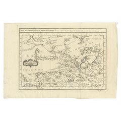
View AllAntique Map of Western Tartary and the Gobi Desert of the Russian Empire, c.1750
Located in Langweer, NL
Antique map titled 'A Map of Western Tartary Drawn from the Survey of the Jesuits and Mr. Kyrillow's Map of the Russian Empire'. Map of the Gobi Desert and the eastern portion of the...
Category
Antique 18th Century Maps
Materials
Paper

$326 Sale Price
20% Off
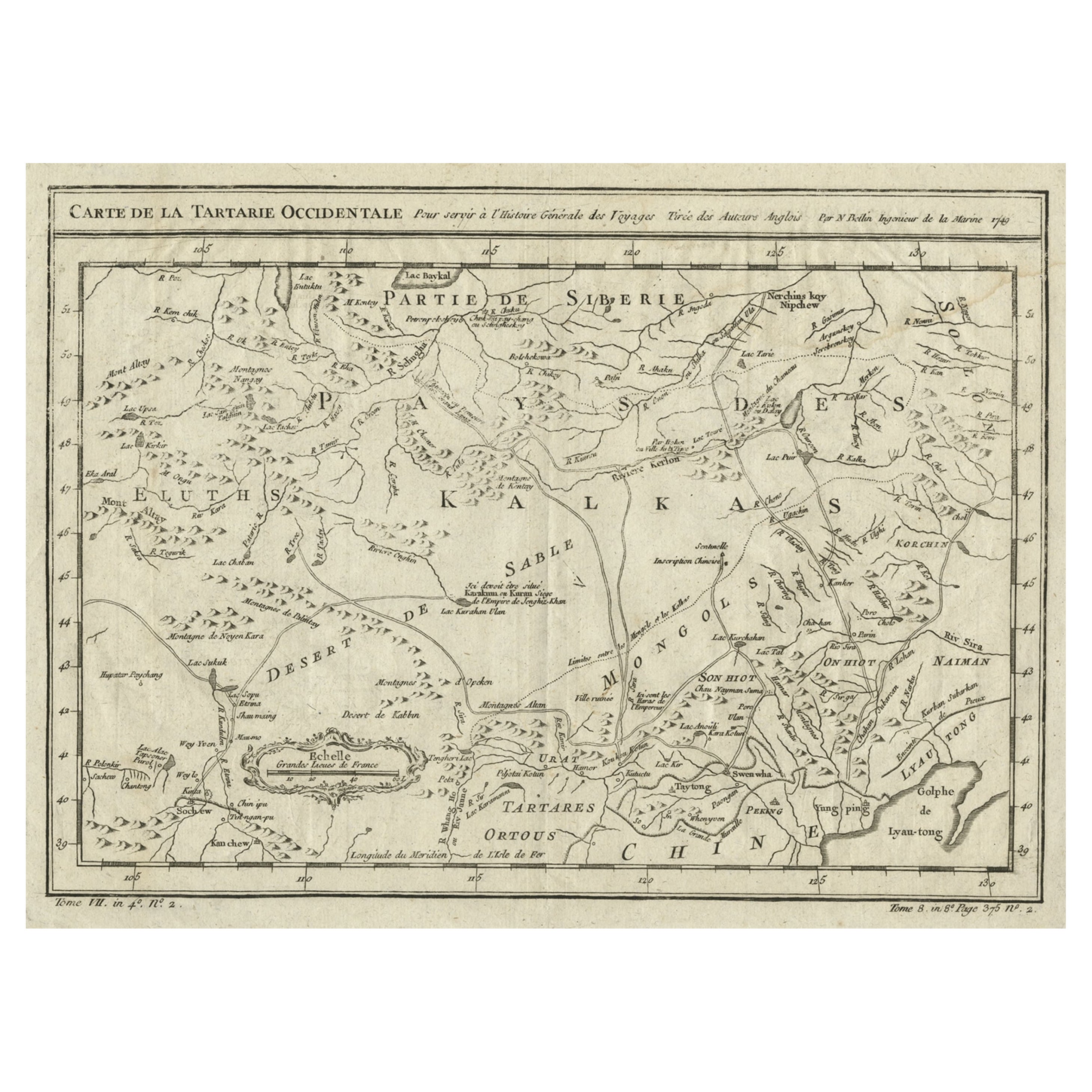
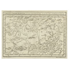
Antique Map of Tartary and Northeast Asia by Bellin, circa 1750
By Jacques-Nicolas Bellin
Located in Langweer, NL
Antique map titled 'Carte de la Tartarie Occidentale'. Map of Tartary and northeast Asia, from Lake Baykal, Partie du Siberia in the north, Pays des Kalkas at the center, as well as ...
Category
Antique Mid-18th Century European Maps
Materials
Paper

$130 Sale Price
20% Off
Old Hand-Colored Map of Western Tartary with Focus on Present-Day Mongolia, 1749
Located in Langweer, NL
Antique map titled 'Carte de la Tartarie Occidentale pour Servir a l'Histoire Générale des Voyages. Tirée des Auteurs Anglois.'
This map covers western Tartary and focuses on the...
Category
Antique 1740s Maps
Materials
Paper
$410 Sale Price
20% Off
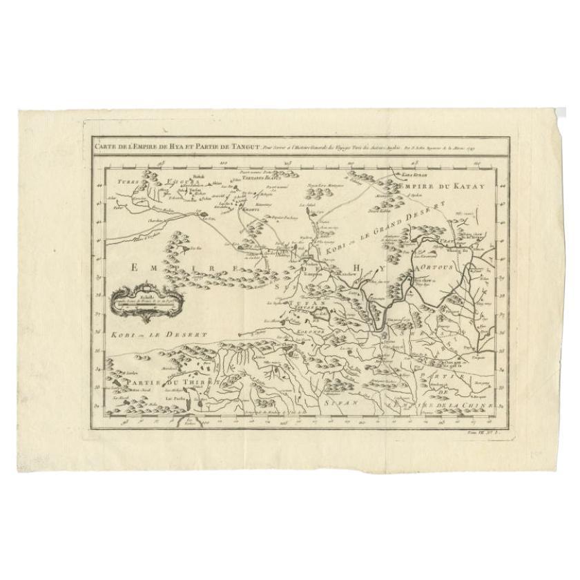
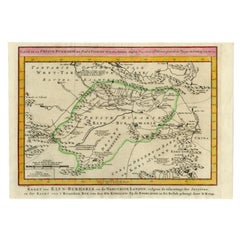
Antique Map of Tibet, The Gobi Desert and China by Bellin, circa 1764
Located in Langweer, NL
Antique map titled 'Carte de l'Empire de Hya et Partie de Tangut'. Old map of Tibet, Gobi desert and China depicting the Great Wall of China and caravan routes. Originates from Prevo...
Category
Antique 18th Century Maps
Materials
Paper
$223 Sale Price
20% Off
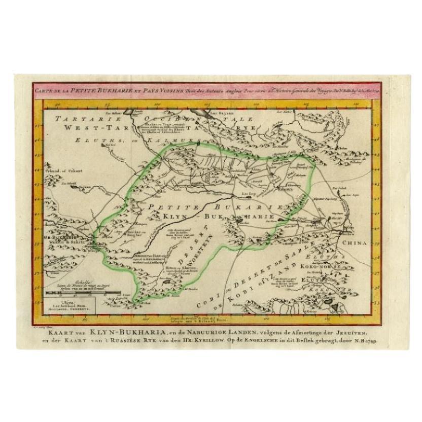
Antique Map of the Bukhari Region by Van Schley, 1758
Located in Langweer, NL
Antique map titled 'Carte de la petite Bukharie et pays voisins.' Original antique map of the Bukhari (Sinkiang in north-western China) and neighboring countries. While these maps by...
Category
Antique 18th Century Maps
Materials
Paper
$137 Sale Price
20% Off
Interesting Antique Map of Tartary and Northeast Asia, 1749
Located in Langweer, NL
Condition: Good, given age. Original folds, as issued. Some small water stains above image and top-right. Please study scan carefully.
Category
Antique 1740s Maps
Materials
Paper
$270 Sale Price
20% Off
You May Also Like
"Nova Barbariae Descriptio", a 17th Century Hand-Colored Map of North Africa
By Johannes Janssonius
Located in Alamo, CA
This original attractive 17th century hand-colored map of North Africa entitled "Nova Barbariae Descriptio" by Johannes Janssonius was published in Paris in 1635. It includes the Med...
Category
Antique Mid-17th Century Dutch Maps
Materials
Paper

Super Rare Antique French Map of Chine and the Chinese Empire, 1780
Located in Amsterdam, Noord Holland
Super Rare Antique French Map of Chine and the Chinese Empire, 1780
Very nice map of Asia. 1780 Made by Bonne.
Additional information:
Type: Map
...
Category
Antique 18th Century European Maps
Materials
Paper

$584 Sale Price
31% Off
California, Alaska and Mexico: 18th Century Hand-Colored Map by de Vaugondy
By Didier Robert de Vaugondy
Located in Alamo, CA
This is an 18th century hand-colored map of the western portions of North America entitled "Carte de la Californie et des Pays Nord-Ouest separés de l'Asie par le détroit d'Anian, ex...
Category
Antique 1770s French Maps
Materials
Paper

Antique French Map of Asia Including China Indoneseia India, 1783
Located in Amsterdam, Noord Holland
Very nice map of Asia. 1783 Dedie au Roy.
Additional information:
Country of Manufacturing: Europe
Period: 18th century Qing (1661 - 1912)
Condition: Overall Condition B (Good Used)...
Category
Antique 18th Century European Maps
Materials
Paper

$648 Sale Price
20% Off
1718 Ides & Witsen Map "Route D'amsterdam a Moscow Et De La Ispahan Et Gamron
Located in Norton, MA
1718 Ides & Witsen map, entitled
"Route D'Amsterdam A Moscow Et De La Ispahan Et Gamron,"
Ric.b005
Subject: Eastern Europe and Central Asia
Period: 1718 (published)
Publicati...
Category
Antique Early 18th Century Dutch Maps
Materials
Paper

Map Holy Land La Terre Sainte Engraved van Loon Published N de Fer 1703 French
Located in BUNGAY, SUFFOLK
La Terre Sainte, The Holy Land, Tiree Des Memoires De M.De.La Rue. Par N. de Fer. Geographe de Sa Majeste Catoliq et de Monseigneur le Dauphin. Avec Privil du Roi 1703
Detailed map of the Holy Land from Nicholas de Fer's L'Atlas Curieux ou le Monde. East is oriented at the top.
MAKER Nicolas de Fer 1646-1720
The French cartographer and engraver, Nicolas de Fer, was a master at creating maps that were works of art. The maps that he published were printed during the Baroque period when the decorative arts were characterized by ornate detail. De Fer’s detailed maps and atlases were valued more for their decorative content than their geographical accuracy.
Nicolas de Fer was born in 1646. His father, Antoine de Fer, owned a mapmaking firm. At the age of twelve, Nicolas was apprenticed to a Parisian engraver named Louis Spirinx. The family business was starting to decline when his father died in 1673. Nicolas de Fer’s mother, Genevieve, took over the business after the death of her husband. In 1687 the business was passed on to Nicolas and the profits increased after he took over the firm. Nicolas de Fer was a prolific cartographer who produced atlases and hundreds of single maps. He eventually became the official geographer to King Louis XIV of France and King Philip V...
Category
Antique Early 1700s French Louis XIV Maps
Materials
Paper

More Ways To Browse
Silk Map
Medieval Capital
Civil War Map
Map Of Singapore
Migeon Migeon
Scottish Coat Of Arms
Antique Maps Of Canada
Antique Railroad Maps
Relief Map
Antique Map Of Venice
Antique Map Of Georgia
Antique Nautical Charts
Hand Painted Antique Map
Antique Maps New Zealand
Antique Maps Persia
Map Railroad
Mariner Furniture
Vintage Glass Map