Items Similar to Antique Map of the Pacific Ocean by Renneville, 1725


Want more images or videos?
Request additional images or videos from the seller
1 of 6
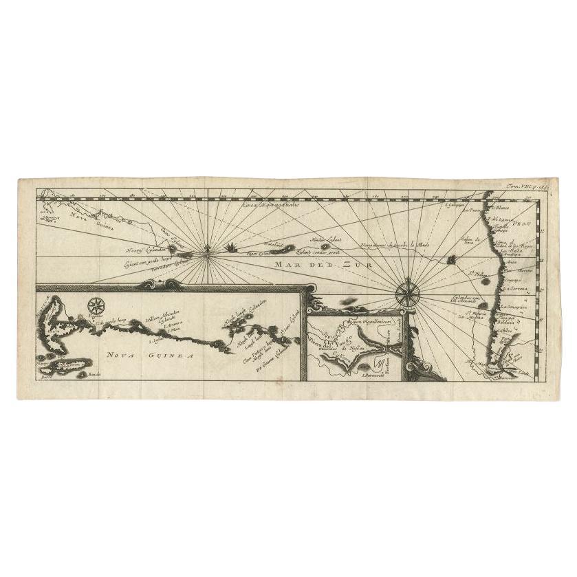
Antique Map of the Pacific Ocean by Renneville, 1725
$424.55
$530.6920% Off
£317.79
£397.2320% Off
€360
€45020% Off
CA$584.30
CA$730.3820% Off
A$651.27
A$814.0820% Off
CHF 341.70
CHF 427.1220% Off
MX$7,953.03
MX$9,941.2820% Off
NOK 4,326.63
NOK 5,408.2920% Off
SEK 4,089.32
SEK 5,111.6520% Off
DKK 2,740.57
DKK 3,425.7220% Off
About the Item
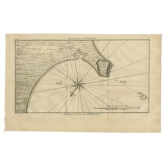
Rare map of the Southern Pacific, illustrating Le Maire's tracks, extending from the La Maire Straits to Nova Guinea, with a large inset of the northern Coastline of New Guinea and a smaller inset of Le Maire's Strait and Tierre del Fuego. From De Renneville's rare Recueil des Voyages, published in Paris in 1725.
Artists and Engravers: Author: Constantin de Renneville (ca. 1650-1723).
Condition: Good, given age. Original folds, as issued. General age-related toning and/or occasional minor defects from handling. Please study scan carefully.
Date: 1725
Coloring: Hand coloring
Overall size: 43.4 x 15.8 cm
Image size: 42.4 x 15.2 cm
We sell original antique maps to collectors, historians, educators and interior decorators all over the world. Our collection includes a wide range of authentic antique maps from the 16th to the 20th centuries. Buying and collecting antique maps is a tradition that goes back hundreds of years. Antique maps have proved a richly rewarding investment over the past decade, thanks to a growing appreciation of their unique historical appeal. Today the decorative qualities of antique maps are widely recognized by interior designers who appreciate their beauty and design flexibility. Depending on the individual map, presentation, and context, a rare or antique map can be modern, traditional, abstract, figurative, serious or whimsical. We offer a wide range of authentic antique maps for any budget.
- Dimensions:Height: 6.23 in (15.8 cm)Width: 17.09 in (43.4 cm)Depth: 0 in (0.01 mm)
- Materials and Techniques:
- Period:
- Date of Manufacture:1725
- Condition:Condition: Good, given age. Original folds, as issued. General age-related toning and/or occasional minor defects from handling. Please study scan carefully.
- Seller Location:Langweer, NL
- Reference Number:Seller: BL-000011stDibs: LU3054329642182
About the Seller
5.0
Recognized Seller
These prestigious sellers are industry leaders and represent the highest echelon for item quality and design.
Platinum Seller
Premium sellers with a 4.7+ rating and 24-hour response times
Established in 2009
1stDibs seller since 2017
2,513 sales on 1stDibs
Typical response time: <1 hour
- ShippingRetrieving quote...Shipping from: Langweer, Netherlands
- Return Policy
Authenticity Guarantee
In the unlikely event there’s an issue with an item’s authenticity, contact us within 1 year for a full refund. DetailsMoney-Back Guarantee
If your item is not as described, is damaged in transit, or does not arrive, contact us within 7 days for a full refund. Details24-Hour Cancellation
You have a 24-hour grace period in which to reconsider your purchase, with no questions asked.Vetted Professional Sellers
Our world-class sellers must adhere to strict standards for service and quality, maintaining the integrity of our listings.Price-Match Guarantee
If you find that a seller listed the same item for a lower price elsewhere, we’ll match it.Trusted Global Delivery
Our best-in-class carrier network provides specialized shipping options worldwide, including custom delivery.More From This Seller
View AllAntique Map of the Pacific Ocean by Renneville, 1702
Located in Langweer, NL
Antique map, untitled. A map of the Pacific Ocean, with the coast of Peru in the right edge and the outline of New Guinea in the left edge. In betwe...
Category
Antique 18th Century Maps
Materials
Paper
Antique Map of the Pacific Ocean by Anson, 1765
Located in Langweer, NL
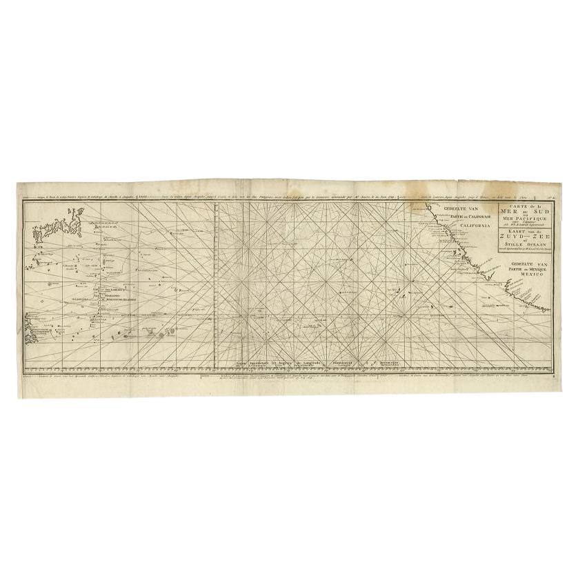
Antique map titled 'Carte de la Mer du Sud ou Mer Pacifique - Kaart van de Zuyd-Zee of stille oceaan (..)'. Nautical chart of the Pacific Ocean depicting the trade routes used by Spanish Galleons from Acapulco in Mexico to Manila in the Philippines. In particular this chart depicts the voyages of the Spanish Nostra Seigniora de Cabadonga and the British Navy Commodore George Anson. Anson succeed in capturing the Spanish treasure...
Category
Antique 18th Century Maps
Materials
Paper

$929 Sale Price
20% Off
Antique Map of Mar del Sur, Chile, Peru, New Guinea and Tierra del Fuego, 1621
Located in Langweer, NL
Uncommon and rare map of Mar del Sur and the coast of Peru. With inset maps of part of New Guinea and Tierra del Fuego. This map originates from 'Miroir Oost &...
Category
Antique 17th Century Maps
Materials
Paper

$707 Sale Price
20% Off
Antique Map of the Coast of Juan Fernandez by Van Schley, 1757
Located in Langweer, NL
Antique map titled 'Cote du Nord Est de l'Isle de Juan Fernandez (..).' Map of the Chilean South Pacific archipelago of the Juan Fernandez Islands. This island was made famous by Dan...
Category
Antique 18th Century Maps
Materials
Paper

$134 Sale Price
20% Off
Antique Map of the Bay and Rocks of Petatlan by Anson, 1749
Located in Langweer, NL
Antique map titled 'Baye et Rochers de Petaplan (..) - De Baay en de Rotsen van Petaplan (..)'. Original antique map of the bay and rocks of Petatlan, Mexico. This map originates fro...
Category
Antique 18th Century Maps
Materials
Paper
$150 Sale Price
20% Off
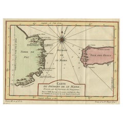
Antique Map of the Passage Between the Atlantic and Pacific Oceans, circa 1753
Located in Langweer, NL
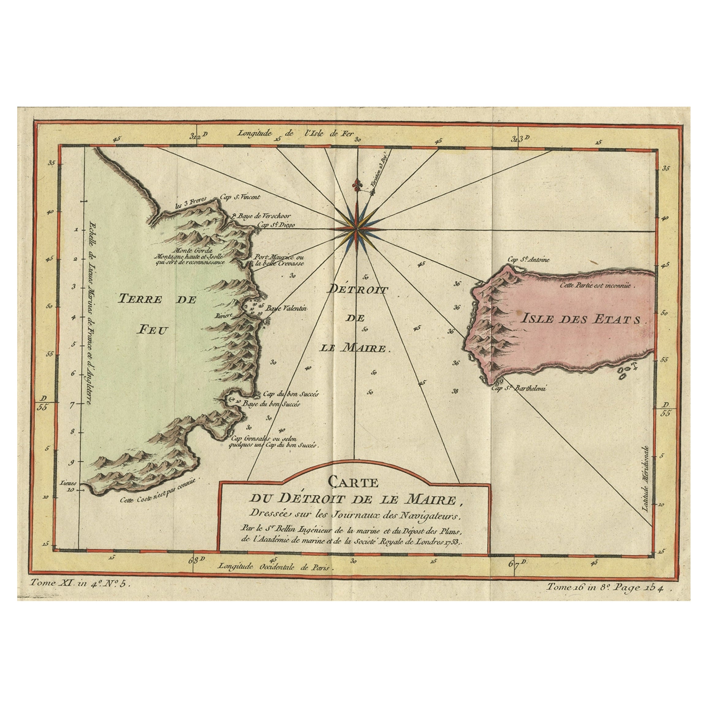
Antique print, titled: 'Carte du Detroit de le Maire (…)' - This chart illustrates the important passage between the Atlantic and Pacific oceans. Jacob Le Maire and Willem Schouten d...
Category
Antique 18th Century Maps
Materials
Paper
$216 Sale Price
20% Off
You May Also Like
Original Antique Map of South America. C.1780
Located in St Annes, Lancashire
Great map of South America
Copper-plate engraving
Published C.1780
Two small worm holes to left side of map
Unframed.
Category
Antique Early 1800s English Georgian Maps
Materials
Paper

California, Alaska and Mexico: 18th Century Hand-Colored Map by de Vaugondy
By Didier Robert de Vaugondy
Located in Alamo, CA
This is an 18th century hand-colored map of the western portions of North America entitled "Carte de la Californie et des Pays Nord-Ouest separés de l'Asie par le détroit d'Anian, ex...
Category
Antique 1770s French Maps
Materials
Paper

West Coast of Africa, Guinea & Sierra Leone: An 18th Century Map by Bellin
By Jacques-Nicolas Bellin
Located in Alamo, CA
Jacques Bellin's copper-plate map entitled "Partie de la Coste de Guinee Dupuis la Riviere de Sierra Leona Jusquau Cap das Palmas", depicting the coast of Guinea and Sierra Leone in ...
Category
Antique Mid-18th Century French Maps
Materials
Paper

Antique Map - Mare Pacificum - Etching by Johannes Janssonius - 1650s
By Johannes Janssonius
Located in Roma, IT
Mare Pacificum is an antique map realized in 1650 by Johannes Janssonius (1588-1664).
The Map is Hand-colored etching, with coeval watercolorang.
Good conditions with slight foxing...
Category
1650s Modern Figurative Prints
Materials
Etching

North & South America: A 17th Century Hand-colored Map by Jansson & Goos
By Johannes Janssonius
Located in Alamo, CA
A 17th century hand-colored map of North & South America entitled "Americae Descriptio" by the cartographer Johannes Jansson, published in Jansson's Atlas Minor in Amsterdam in 1628....
Category
Antique 1620s Dutch Maps
Materials
Paper

Large Original Antique Map of The Pacific Ocean, Fullarton, C.1870
Located in St Annes, Lancashire
Great map of The Pacific Ocean
From the celebrated Royal Illustrated Atlas
Lithograph by Swanston. Original color.
Published by Fullarton,...
Category
Antique 1870s Scottish Maps
Materials
Paper

More Ways To Browse
Tunisia Antique Map
Antique Map New Orleans
Antique Maps Of Maryland
Gambia Antique Map
Antique Manitoba
Antique Map Of Brooklyn
Antique Map Of Michigan
Cham Antiques
Map Of Native American Tribes
Antique Furniture Halifax Furniture
Antique Furniture Trinidad
Antique Kiel Furniture
Cornwall Map
Marie Galante
Patagonia Map
Shepherd And Hedger
Vignola Furniture
Washington Dc Map