Items Similar to Antique Plan of Paramaribo 'Suriname' Published 1920

Want more images or videos?
Request additional images or videos from the seller
1 of 5
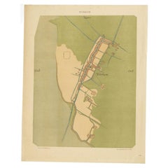
Antique Plan of Paramaribo 'Suriname' Published 1920
$816.67
$1,020.8420% Off
£601.48
£751.8520% Off
€680
€85020% Off
CA$1,111.02
CA$1,388.7720% Off
A$1,234.58
A$1,543.2320% Off
CHF 646.94
CHF 808.6720% Off
MX$15,139.98
MX$18,924.9720% Off
NOK 8,251.28
NOK 10,314.1120% Off
SEK 7,762.51
SEK 9,703.1320% Off
DKK 5,176.74
DKK 6,470.9220% Off
Shipping
Retrieving quote...The 1stDibs Promise:
Authenticity Guarantee,
Money-Back Guarantee,
24-Hour Cancellation
About the Item
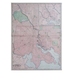
Large lithographed plan of Paramaribo, capital city of Suriname, showing the situation, circa 1916-1917. With small inset plan. Published in 1920.
- Dimensions:Height: 24.41 in (62 cm)Width: 29.14 in (74 cm)Depth: 0.02 in (0.5 mm)
- Materials and Techniques:
- Period:
- Date of Manufacture:1920
- Condition:General age-related toning. Minor wear, blank verso. Please study images carefully.
- Seller Location:Langweer, NL
- Reference Number:Seller: BG-116741stDibs: LU3054321190762
About the Seller
5.0
Recognized Seller
These prestigious sellers are industry leaders and represent the highest echelon for item quality and design.
Platinum Seller
Premium sellers with a 4.7+ rating and 24-hour response times
Established in 2009
1stDibs seller since 2017
2,494 sales on 1stDibs
Typical response time: 1 hour
- ShippingRetrieving quote...Shipping from: Langweer, Netherlands
- Return Policy
Authenticity Guarantee
In the unlikely event there’s an issue with an item’s authenticity, contact us within 1 year for a full refund. DetailsMoney-Back Guarantee
If your item is not as described, is damaged in transit, or does not arrive, contact us within 7 days for a full refund. Details24-Hour Cancellation
You have a 24-hour grace period in which to reconsider your purchase, with no questions asked.Vetted Professional Sellers
Our world-class sellers must adhere to strict standards for service and quality, maintaining the integrity of our listings.Price-Match Guarantee
If you find that a seller listed the same item for a lower price elsewhere, we’ll match it.Trusted Global Delivery
Our best-in-class carrier network provides specialized shipping options worldwide, including custom delivery.More From This Seller
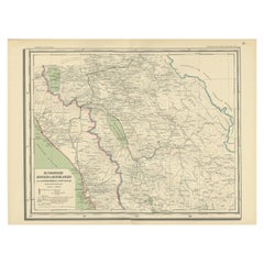
View AllAntique Map of the Region of Banjarmasin, Indonesia 1900
Located in Langweer, NL
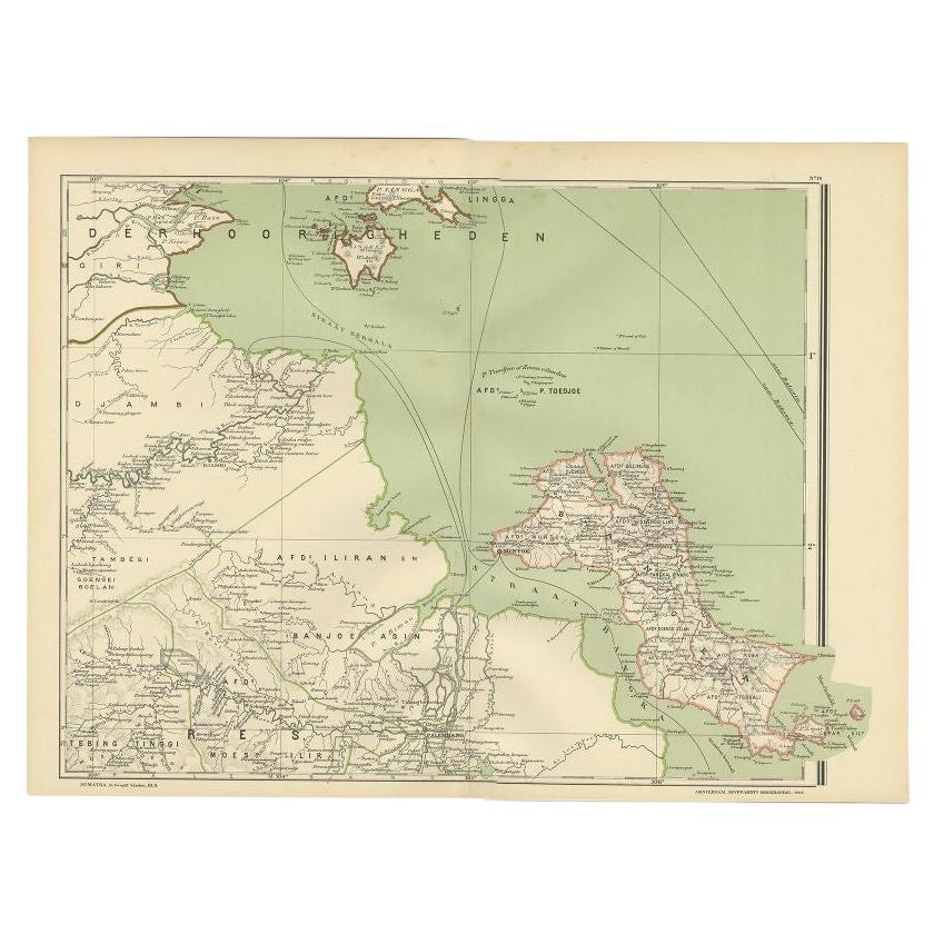
Antique Map of the Region of Banyuasin, Sumatra. Also depicting Bangka/Banka island. This map originates from 'Atlas van Nederlandsch Oost- en West-Indië' by I. Dornseiffen.
Artist...
Category
20th Century Maps
Materials
Paper

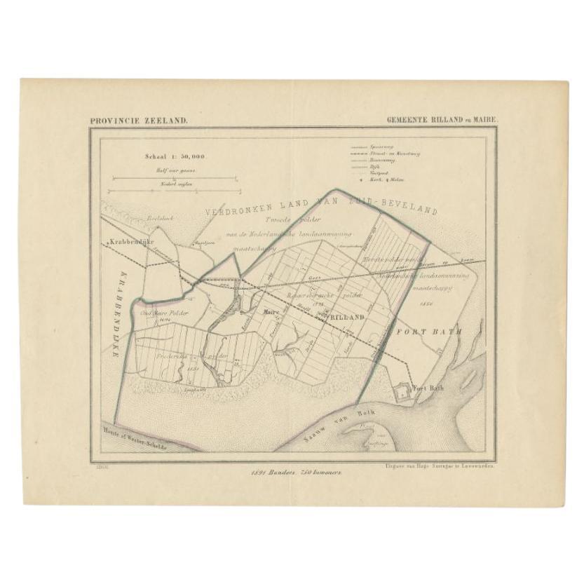
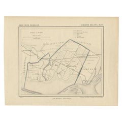
Antique Map of the Region of Rilland and Maire, Zeeland, the Netherlands, 1866
Located in Langweer, NL
Antique map titled 'Provincie Zeeland - Gemeente Rilland en Maire'. Original antique map of the region of Rilland en Maire, the Netherlands. This map originates from the 'Gemeente-At...
Category
Antique 19th Century Maps
Materials
Paper
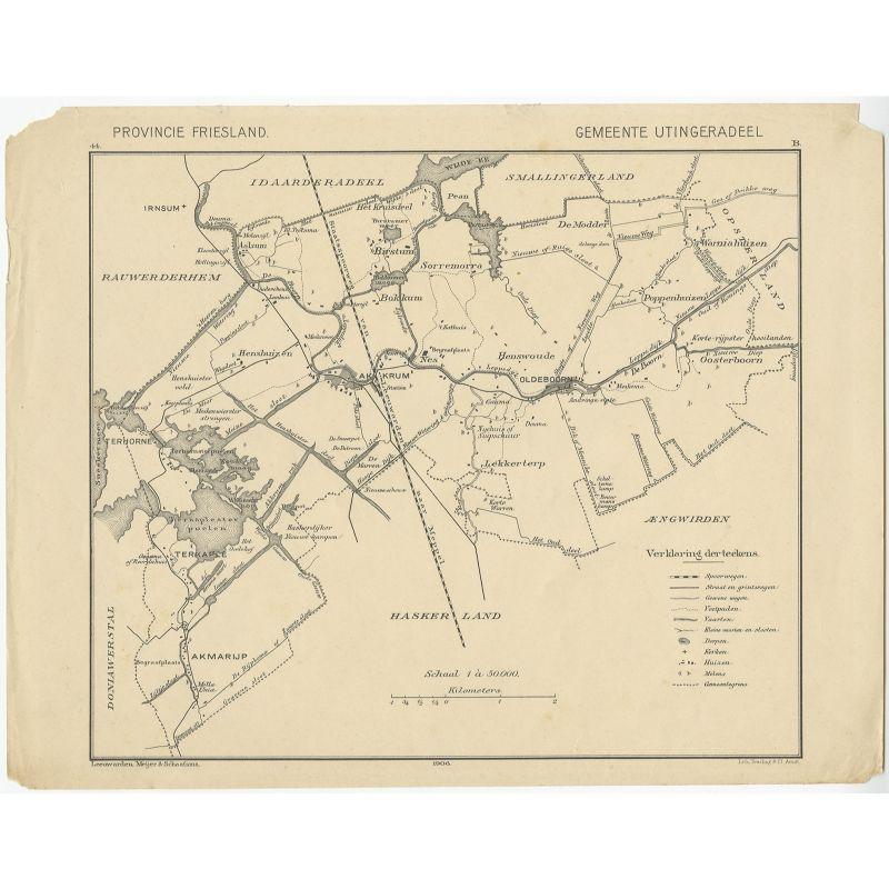
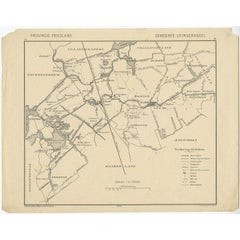
Antique Map of the Region of Utingeradeel by Meijer & Schaafsma, 1906
Located in Langweer, NL
Antique map titled 'Gemeente Friesland. Gemeente Utingeradeel'. This map illustrates part of Friesland (The Netherlands) depicting Akkrum, Terkaple, Lekkerterp, Oldeboorn and more. Published by Tresling & Co, Amsterdam.
Artists and Engravers: Tresling and Co., Dutch Lithographers...
Category
20th Century Maps
Materials
Paper
$83 Sale Price
20% Off
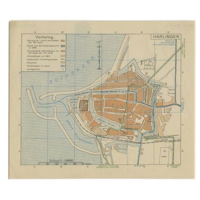
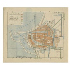
Vintage Map of the Frisian City of Harlingen, 1930
Located in Langweer, NL
Vintage map titled 'Harlingen'. Original map of the city of Harlingen, Friesland, the Netherlands. Published circa 1930.
Condition: Good, passe-partout/matting included. General a...
Category
20th Century Maps
Materials
Paper
Antique Map of Padang, Sumatra, Indonesia, 1900
Located in Langweer, NL
Antique map titled 'De Padangsche Beneden-en Bovenlanden van de Koninginnedbaai tot Fort de Kock'. Old map of Padang, Sumatra. This map originates from 'Atlas van Nederlandsch Oost- ...
Category
20th Century Maps
Materials
Paper
Old Map of The Frisian City of Workum in Holland, 1916
Located in Langweer, NL
Antique map Workum titled 'Workum'. Antique map depicting the Frisian city of Workum, the Netherlands.
Artists and Engravers: Lithograph by J. Smulders & Co, Den Haag.
Condi...
Category
20th Century Maps
Materials
Paper
$81 Sale Price
20% Off
You May Also Like
Large Original Antique City Plan of Montreal, Canada, circa 1900
By Rand McNally & Co.
Located in St Annes, Lancashire
Fabulous colorful map of Montreal
Original color
By Rand, McNally & Co.
Published, circa 1900
Unframed
Minor edge tears
Free shipping.
Category
Antique Early 1900s American Maps
Materials
Paper

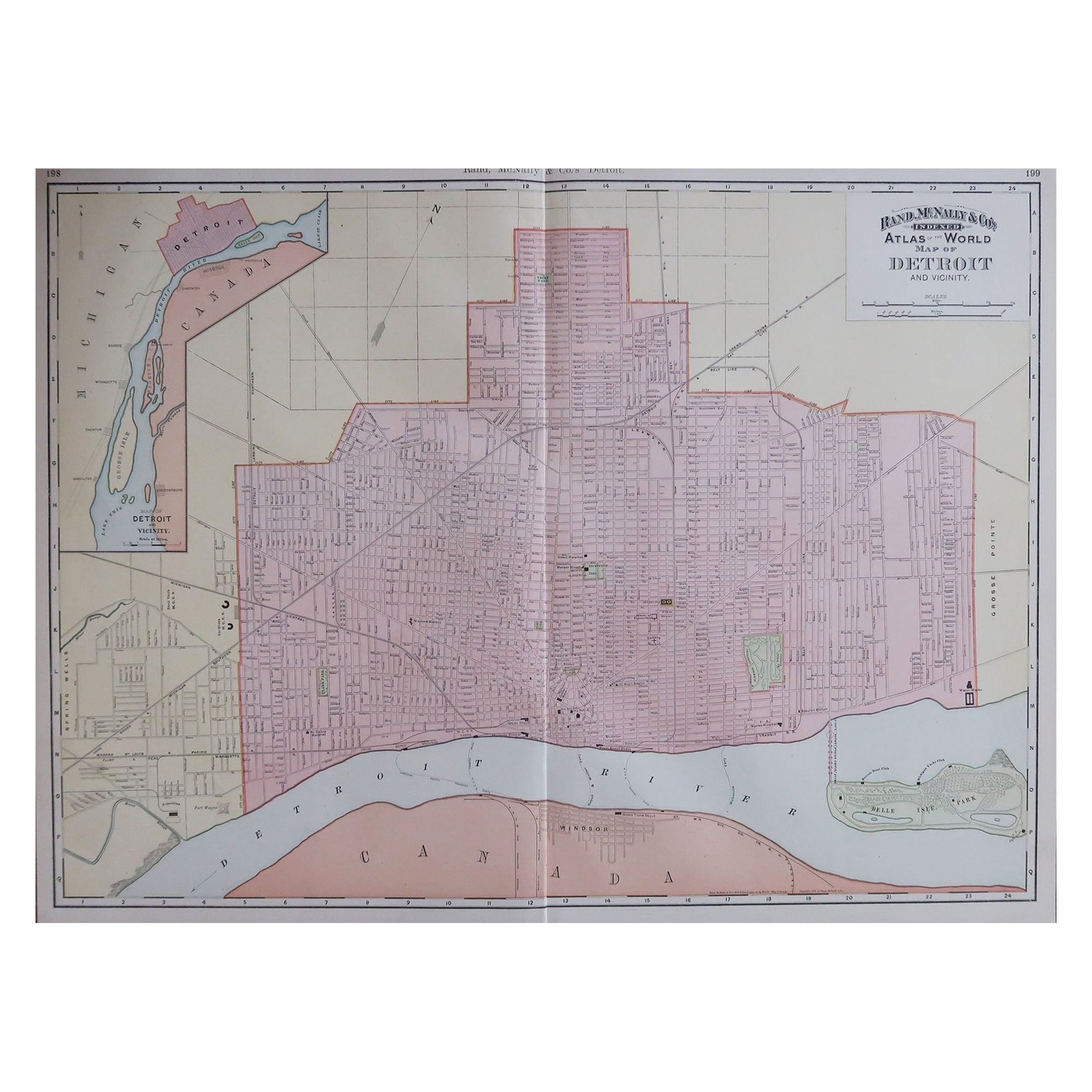
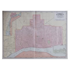
Large Original Antique City Plan of Detroit, USA, 1894
By Rand McNally & Co.
Located in St Annes, Lancashire
Fabulous colorful map of Detroit
Original color
By Rand, McNally & Co.
Published, 1894
Unframed
Free shipping.
Category
Antique 1890s American Maps
Materials
Paper
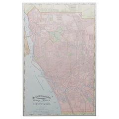
Original Antique City Plan of Buffalo, New York, USA, circa 1900
By Rand McNally & Co.
Located in St Annes, Lancashire
Fabulous colorful map of Buffalo
Original color
By Rand, McNally & Co.
Published, circa 1900
Unframed
Minor edge tears
Free shipping.
Category
Antique 1890s American Maps
Materials
Paper
Large Original Antique City Plan of Baltimore, USA, 1894
By Rand McNally & Co.
Located in St Annes, Lancashire
Fabulous colorful map of Baltimore
Original color
By Rand, McNally & Co.
Published, 1894
Unframed
Free shipping.
Category
Antique 1890s American Maps
Materials
Paper
Original Antique Map of the American State of Illinois ( Southern Part ), 1903
Located in St Annes, Lancashire
Antique map of Illinois ( Southern part )
Published By A & C Black. 1903
Original colour
Good condition
Unframed.
Free shipping
Category
Antique Early 1900s English Maps
Materials
Paper

Antique Map of American Cities, Vignette of New York City, circa 1920
Located in St Annes, Lancashire
Great maps of American Cities
Unframed
Original color
By John Bartholomew and Co. Edinburgh Geographical Institute
Published, circa 1920
Category
Vintage 1920s British Maps
Materials
Paper

More Ways To Browse
Antique Compass Map
Blaeu Maps
Antique Collectables Australia
Military Map
Antique Maps Scotland
Mississippi Antique
Denmark Map
Antique Maps Of North America
Wine Map
Map Greece
Roman Map
Antique Maps Of Russia
Antique Roman Map
Maps Of Mediterranean
Mercator Map
Antique Railroad Furniture
Atlas Globe
Antique Mississippi Furniture