Items Similar to Antique Map of the Region of Rilland and Maire, Zeeland, the Netherlands, 1866

Want more images or videos?
Request additional images or videos from the seller
1 of 5
Antique Map of the Region of Rilland and Maire, Zeeland, the Netherlands, 1866
About the Item
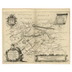
Antique map titled 'Provincie Zeeland - Gemeente Rilland en Maire'. Original antique map of the region of Rilland en Maire, the Netherlands. This map originates from the 'Gemeente-Atlas' by J. Kuyper.
Artists and Engravers: Published by H. Suringar.
Condition: Fair/good, general age-related toning. Vertical folding line. Shows some wear and creasing, blank verso. Please study image carefully.
Date: 1866
Overall size: 24.5 x 19.5 cm.
Image size: 18 x 15 cm.
We sell original antique maps to collectors, historians, educators and interior decorators all over the world. Our collection includes a wide range of authentic antique maps from the 16th to the 20th centuries. Buying and collecting antique maps is a tradition that goes back hundreds of years. Antique maps have proved a richly rewarding investment over the past decade, thanks to a growing appreciation of their unique historical appeal. Today the decorative qualities of antique maps are widely recognized by interior designers who appreciate their beauty and design flexibility. Depending on the individual map, presentation, and context, a rare or antique map can be modern, traditional, abstract, figurative, serious or whimsical. We offer a wide range of authentic antique maps for any budget.
- Dimensions:Height: 7.68 in (19.5 cm)Width: 9.65 in (24.5 cm)Depth: 0 in (0.01 mm)
- Materials and Techniques:
- Period:
- Date of Manufacture:1866
- Condition:Condition: Fair/good, general age-related toning. Vertical folding line. Shows some wear and creasing, blank verso. Please study image carefully.
- Seller Location:Langweer, NL
- Reference Number:
About the Seller
5.0
Platinum Seller
These expertly vetted sellers are 1stDibs' most experienced sellers and are rated highest by our customers.
Established in 2009
1stDibs seller since 2017
1,929 sales on 1stDibs
Typical response time: <1 hour
- ShippingRetrieving quote...Ships From: Langweer, Netherlands
- Return PolicyA return for this item may be initiated within 14 days of delivery.
More From This SellerView All
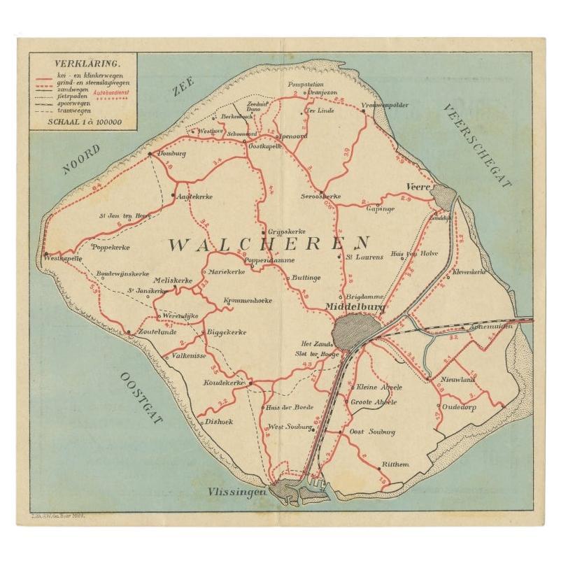
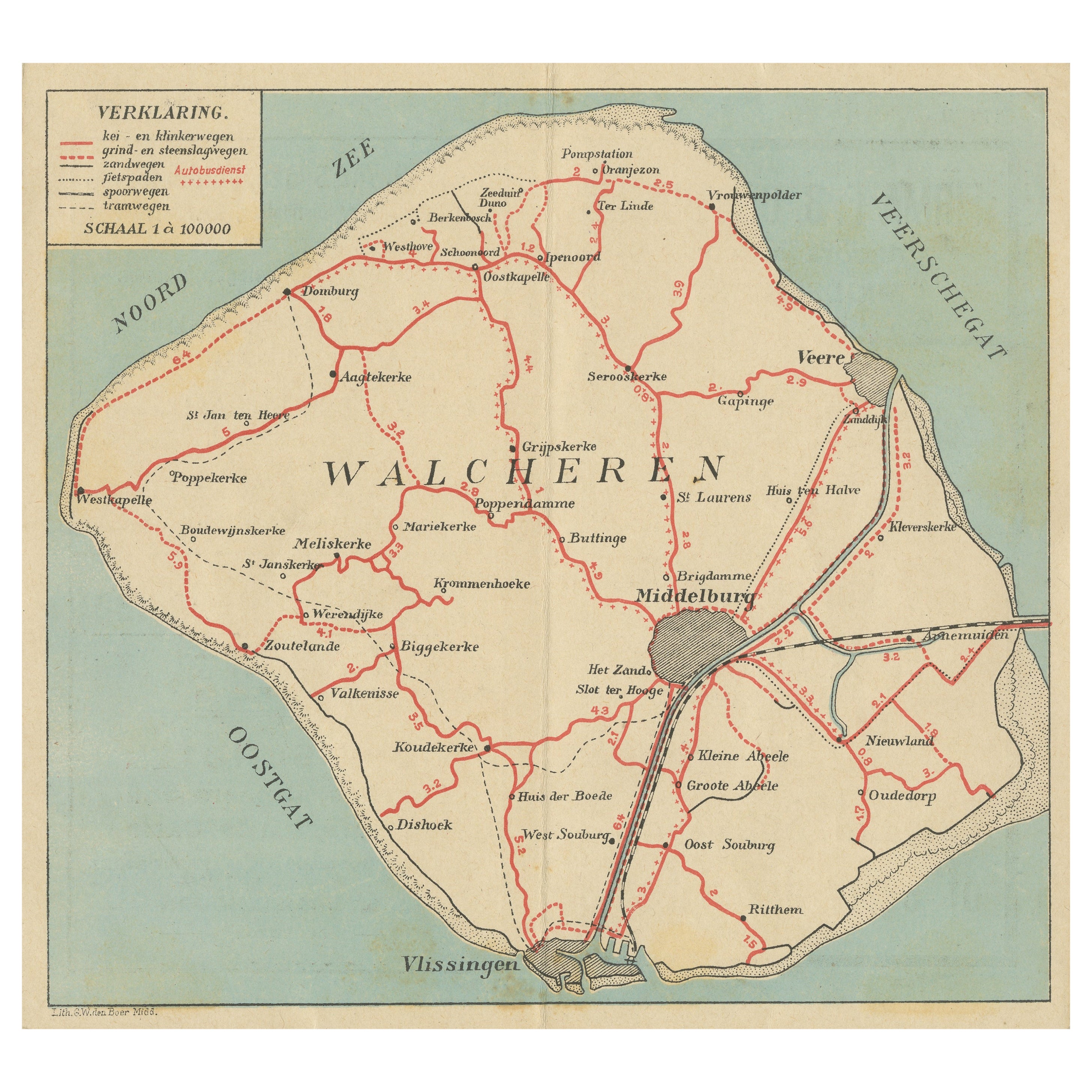
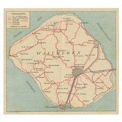
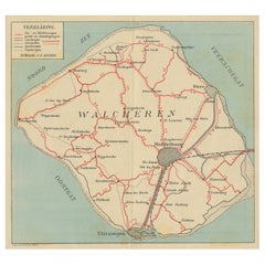
- Antique Map of Walcheren in Zeeland, the Netherlands, c.1910Located in Langweer, NLAntique map of Walcheren, part of the province of Zeeland, the Netherlands. Shows the cities of Veere, Middelburg, Vlissingen and others. Source unknown, to be determined. Published ...Category
20th Century Maps
MaterialsPaper
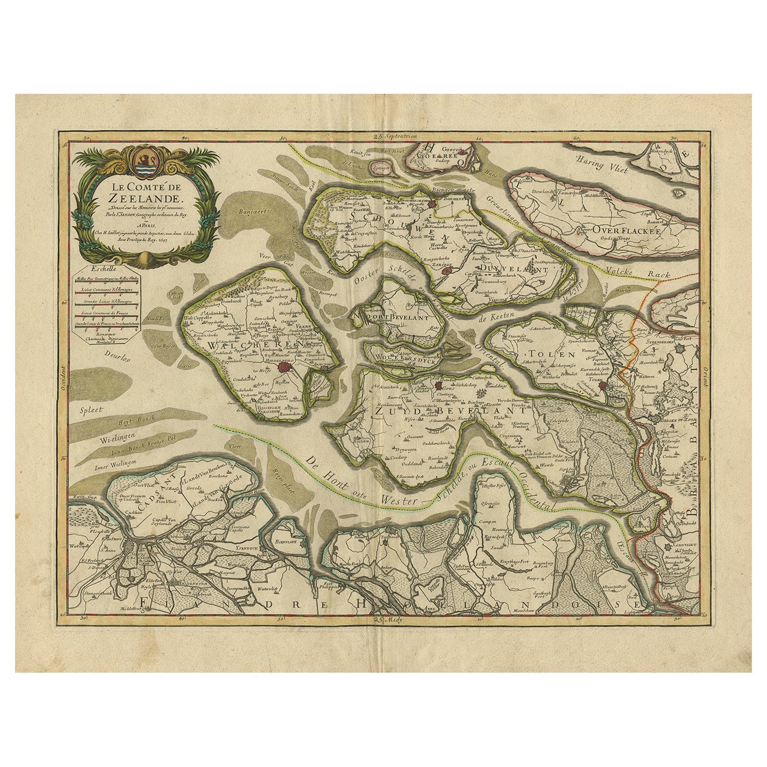
- Antique Map of Zeeland, The Netherlands, by Jaillot, 1693Located in Langweer, NLAntique map titled 'Le Comte de Zeelande (..).' Detailed map of the province of Zeeland, The Netherlands. Details shown include fortified towns, roads, sandbanks and marshlands. Base...Category
Antique 17th Century Maps
MaterialsPaper
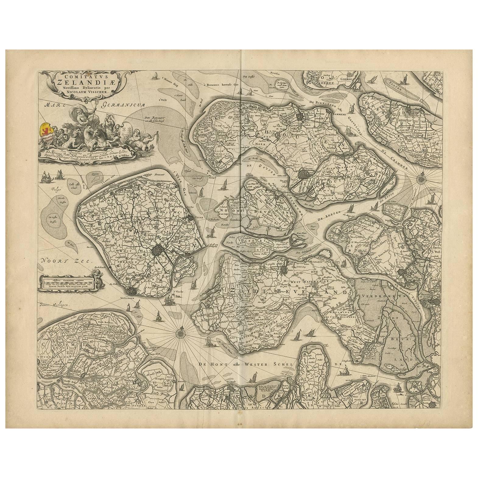
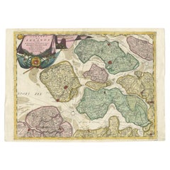
- Antique Map of Zeeland 'The Netherlands' by N. Visscher, circa 1690Located in Langweer, NLAntique map titled 'Comitatus Zelandiae (..)'. Detailed chart of the province Zeeland, The Netherlands, with details shown pictorially. Published by N. Visscher.Category
Antique Late 17th Century Maps
MaterialsPaper
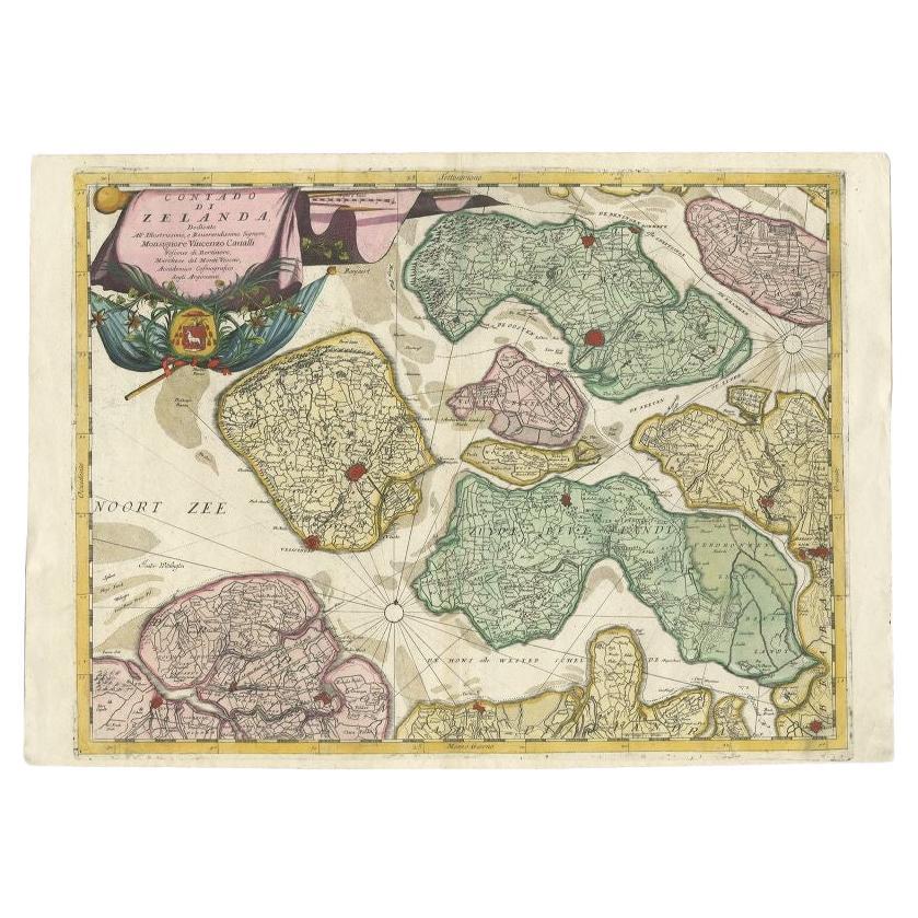
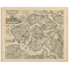
- Antique Map of the Province of Zeeland, The Netherlands by Coronelli, 1692Located in Langweer, NLAntique map titled 'Contado di Zelanda'. Beautiful map of the Dutch province of Zeeland. With the islands of Walcheren, Schouwen-Duiveland, Noord-Beveland, Zuid-Beveland, Tholen and ...Category
Antique 17th Century Maps
MaterialsPaper
- Antique Map of Walcheren in the Province of Zeeland, the Netherlands, ca.1910Located in Langweer, NLAntique map of Walcheren, part of the province of Zeeland, the Netherlands. Shows the cities of Veere, Middelburg, Vlissingen and others. Source unknown, to be determined. Publis...Category
Vintage 1910s Maps
MaterialsPaper
- Antique Map of the Region of Dantumadeel, Friesland, The Netherlands, 1664Located in Langweer, NLAntique map titled 'De Grietenije van Dantuma deel (..)'. Map of the Grietenij of Dantumadeel, Friesland, The Netherlands. Multiple cartouches, key and coat of arms. Originates from ...Category
Antique 17th Century Maps
MaterialsPaper

You May Also Like
- 1866 Ensign & Bridgman's Rail Road Map of the United StatesLocated in Colorado Springs, COPresented is an 1866 issue of “Ensign & Bridgeman’s Rail Road Map of the United States, showing Depots & Stations.” First published in 1856, this is the third edition, following anot...Category
Antique 1860s American Late Victorian Maps
MaterialsPaper
- Original Antique Map of The Netherlands, Engraved by Barlow, Dated 1807Located in St Annes, LancashireGreat map of Netherlands Copper-plate engraving by Barlow Published by Brightly & Kinnersly, Bungay, Suffolk. Dated 1807 Unframed.Category
Antique Early 1800s English Maps
MaterialsPaper
- Original Antique Map of The Netherlands, Sherwood, Neely & Jones, Dated 1809Located in St Annes, LancashireGreat map of The Netherlands Copper-plate engraving by Cooper Published by Sherwood, Neely & Jones. Dated 1809 Unframed.Category
Antique Early 1800s English Maps
MaterialsPaper
- 1752 Vaugoundy Map of Flanders : Belgium, France, and the Netherlands, Ric.a002Located in Norton, MALarge Vaugoundy Map of Flanders: Belgium, France, and the Netherlands Colored -1752 Ric.a002 Description: This is a 1752 Didier Robert de Vaugondy map of Flanders. The map de...Category
Antique 17th Century Unknown Maps
MaterialsPaper
- 1594 Maurice Bouguereau Map of the Region Limoges, France, Ric0015Located in Norton, MA1594 Maurice Bouguereau map of the region Limoges, France, entitled "Totivs Lemovici et Confinium Pro Uinciarum Quantum ad Dioecefin Lemo Uicenfen Fpectant," Hand Colored Ric0015 Jean IV Le Clerc...Category
Antique 16th Century Dutch Maps
MaterialsPaper
- The Normandy Region of France: A 17th C. Hand-colored Map by Sanson and JaillotBy Nicolas SansonLocated in Alamo, CAThis large hand-colored map entitled "Le Duché et Gouvernement de Normandie divisée en Haute et Basse Normandie en divers Pays; et par evêchez, avec le Gouvernement General du Havre ...Category
Antique 1690s French Maps
MaterialsPaper


Recently Viewed
View AllMore Ways To Browse
Large Antique Compass
Antique Map Of New England
Antique Maps New England
Antique Map New England
Antique New England Maps
Antique Maps Greece
Antique Map Greece
Nautical Chart Nautical Chart
Antique Greek Map
Antique Greece Map
Antique Map Of Greece
Antique World Chart
Map Of Portugal
Turkish Map
Hemispheres Map
Antique Travel Map
Portugal Map
Used Nautical Charts