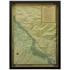
"Little Big Horn, 1876" Raised Relief Map, 1989
View Similar Items

Want more images or videos?
Request additional images or videos from the seller
1 of 5
"Little Big Horn, 1876" Raised Relief Map, 1989
$1,750List Price
About the Item
- Dimensions:Height: 31.5 in (80.01 cm)Width: 23.5 in (59.69 cm)Depth: 2.5 in (6.35 cm)
- Materials and Techniques:
- Place of Origin:
- Period:1980-1989
- Date of Manufacture:1989
- Condition:Wear consistent with age and use.
- Seller Location:Colorado Springs, CO
- Reference Number:Seller: M2711stDibs: LU909714009162
About the Seller
4.9
Platinum Seller
Premium sellers with a 4.7+ rating and 24-hour response times
Established in 2010
1stDibs seller since 2011
462 sales on 1stDibs
Authenticity Guarantee
In the unlikely event there’s an issue with an item’s authenticity, contact us within 1 year for a full refund. DetailsMoney-Back Guarantee
If your item is not as described, is damaged in transit, or does not arrive, contact us within 7 days for a full refund. Details24-Hour Cancellation
You have a 24-hour grace period in which to reconsider your purchase, with no questions asked.Vetted Professional Sellers
Our world-class sellers must adhere to strict standards for service and quality, maintaining the integrity of our listings.Price-Match Guarantee
If you find that a seller listed the same item for a lower price elsewhere, we’ll match it.Trusted Global Delivery
Our best-in-class carrier network provides specialized shipping options worldwide, including custom delivery.More From This Seller
View All1876 "Gettysburg, The Repulse of Longstreet's Assault." Engraving
Located in Colorado Springs, CO
Presented here is an 1876 engraving of John B. Bachelder and James Walker’s Gettysburg. The Repulse of Longstreet’s Assault. The engraved scene depicts the decisive battle on the final day of the Battle of Gettysburg. Researched by the photographer and topographer John B. Bachelder and painted by James Walker, the original painting was created in 1870. This detailed engraving was done by H. B. Hall Jr. and published by James Drummond Ball.
Otherwise called Pickett’s Charge, the battle occurred on July 3, 1863. Pickett’s corp commander, Lieutenant General James Longstreet was placed in charge of the attack despite his hesitations. Longstreet’s central role led to the title of the work, Repulse of Longstreet’s Assault. In an attempt to gain control of an important supply route, nine Confederate brigades charged across three-quarters of a mile of open ground against cannon fire to take Cemetery Ridge from the defending Union Army. Despite their overwhelming numbers, the Confederate forces were repelled with considerable casualties marking not only a decisive victory for the Union, but also the beginning of the slow defeat of Lee’s Army. The furthest the charging forces advanced before being repulsed would forever be known as the “High Water Mark of the Confederacy.” The Confederate army never recovered from the losses at Gettysburg and it effectively ended Lee’s campaign into Pennsylvania.
The engraving gives the perspective from the Union rear, one that encompasses most of the battlefield, from Big Round Top on the left to the northern reaches of Cemetery Ridge on the right. The Confederate lines at Seminary Ridge are in the far distance, partially obscured by bursting shells. The image centers on the main Confederate assault, in the vicinity of what today are known as "The Copse" and "The Bloody Angle." The composition has elemen...
Category
Antique 1870s American Prints
Materials
Paper

The Boys of '76 by Charles Carleton Coffin, 1876
Located in Colorado Springs, CO
Coffin, Charles Carleton. The Boys of ‘76. New York: Harper & Brothers, 1876. First Edition. Illustrated. Octavo. Rebound in ¼ burgundy leather and cloth boards with raised bands, gi...
Category
Antique 1870s American American Colonial Books
Materials
Leather, Fabric, Paper

1854 Map of Massachusetts, Connecticut and Rhode Island, Antique Wall Map
Located in Colorado Springs, CO
This striking wall map was published in 1854 by Ensign, Bridgman & Fanning and has both full original hand-coloring and original hardware. This impression is both informative and highly decorative.
The states are divided into counties, outlined in red, green, and black, and subdivided into towns. Roads, canals, and railroad lines are prominently depicted, although they are not all labeled. The mapmakers also marked lighthouses, banks, churches, and prominent buildings, with a key at right. The map is an informative and comprehensive overview of the infrastructural development of New England prior to the Civil War. Physical geographies depicted include elevation, conveyed with hachure marks, rivers and lakes. The impression features an inset map of Boston...
Category
Antique 19th Century American Maps
Materials
Paper

Life of Andrew Jackson by James Parton 3-Volume Leather Set, 1876
Located in Colorado Springs, CO
Parton, James. Life of Andrew Jackson. Boston: James R. Osgood and Company, 1876. Three volume set, later printing. Rebound in ¼ calf and matching blue cloth boards with gilt titles, stamps, and raised bands to spine. With matching archival blue cloth slip case with ribbon and inlaid portrait of Jackson on the cover.
Presented is an 1876 printing of James Parton’s three volume biography of President Andrew Jackson. First published in 1859-60 by Mason Brothers of New York, this is a later printing by Boston-based James R. Osgood and Company. James Parton's biography of the life of Andrew Jackson is one of the most important and best accounts on the early American president. In fact, Bunn and Williams call this work "the first serious biography of the [Jackson]" (Bunn).
Parton’s biography appeared in print amid the escalating political crisis of 1860, providing readers and pundits with a historical lens through which to view current events. Born in England and raised primarily in the United States, James Parton (1822-1891) was among the leading biographers of the mid-nineteenth century. His Life of Horace Greeley (1855) and Life and Times of Aaron Burr (1857) garnered widespread acclaim, and he would later publish books on Benjamin Butler...
Category
Antique 1870s North American Books
Materials
Leather

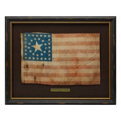
38-Star Antique American Flag with Unique Canton, circa 1876-1890
Located in Colorado Springs, CO
This is a striking 38-star American flag. The flag dates to 1876-1890, when Colorado (represented by the large star in the center of the flag’s canton) joined the Union as the 38th s...
Category
Antique Late 19th Century American Political and Patriotic Memorabilia
Materials
Muslin
1868 "Lloyd's Topographical Railway Map of North America..." Hanging Wall Map
Located in Colorado Springs, CO
Presented is “Lloyd's Topographical Railway Map of North-America, or the United States Continent in 1900.” This map was published by J. T. Lloyd, in New York, in 1868. A large, hangi...
Category
Antique 1860s American Late Victorian Maps
Materials
Linen, Paper

You May Also Like
World Relief Map
Located in Antwerp, BE
Large world relief map.
Measures: Width 232 cm.
Height 158 cm.
Category
Mid-20th Century German Mid-Century Modern Maps
Materials
Acrylic

$2,121
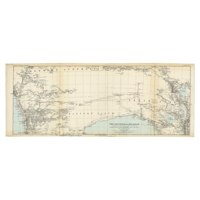
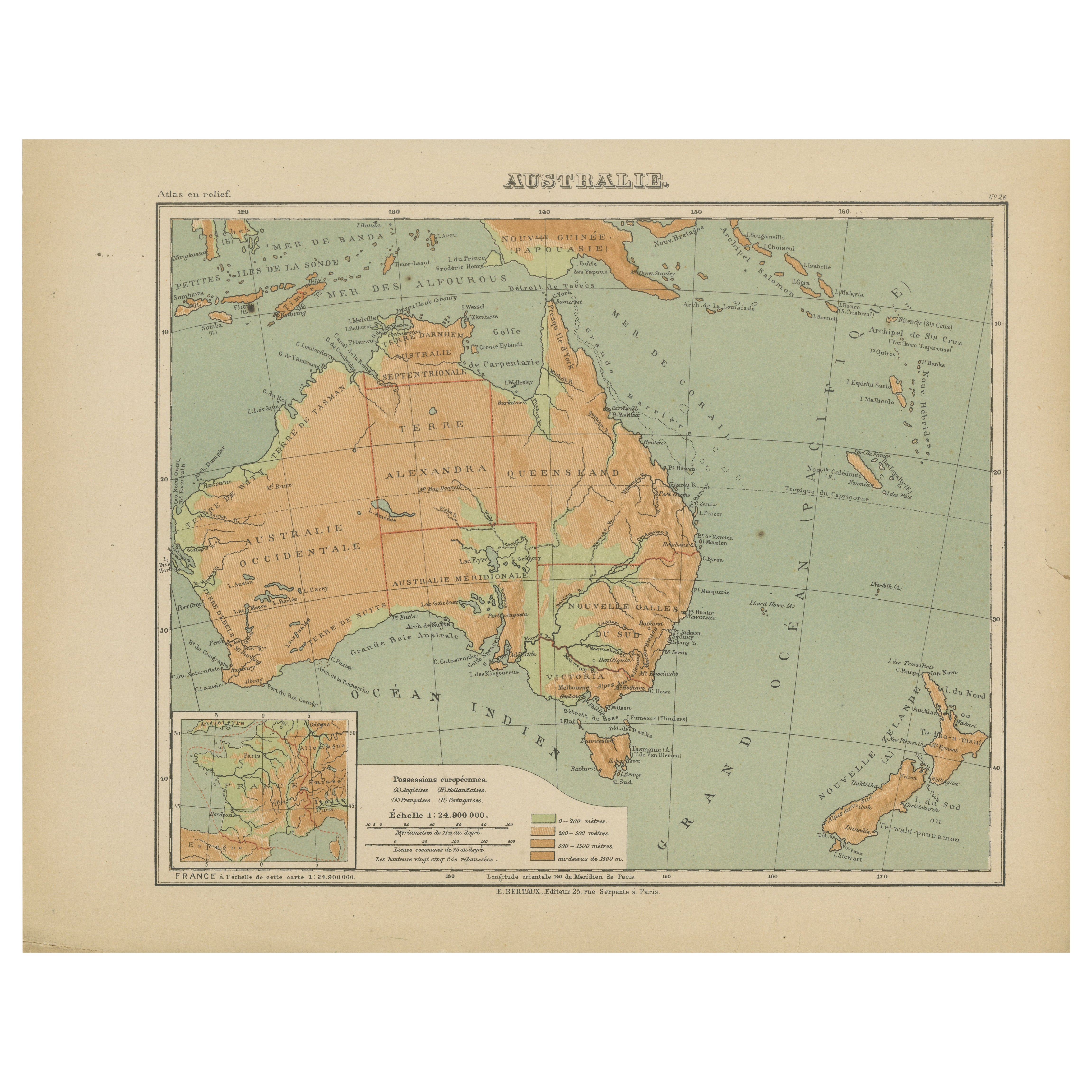
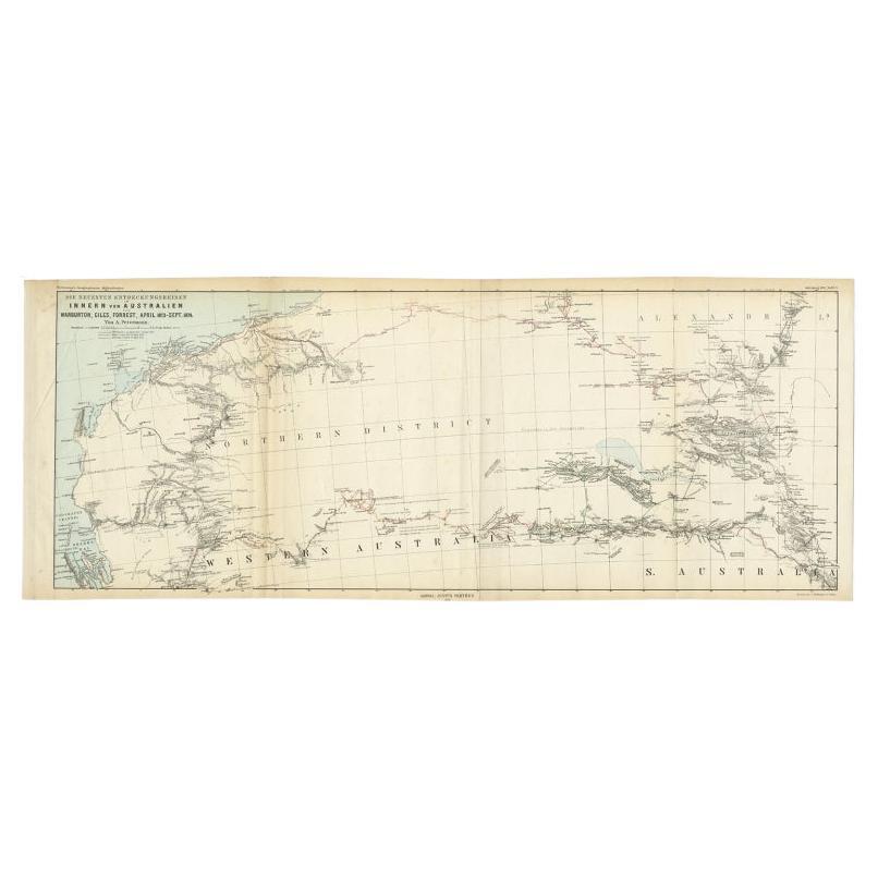
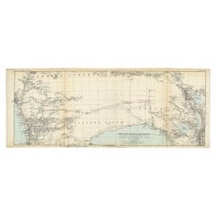
Antique Exploration Map of Australia from Beltana to Perth, 1876
Located in Langweer, NL
Antique map titled 'Thomas Elders' Expedition durch Inner-Australien von Beltana im Osten bis Perth im Western ausgefuhrt durch E. Giles (..)'. Old map of Australia from Bunbury to A...
Category
Antique 19th Century Maps
Materials
Paper
$235 Sale Price
20% Off
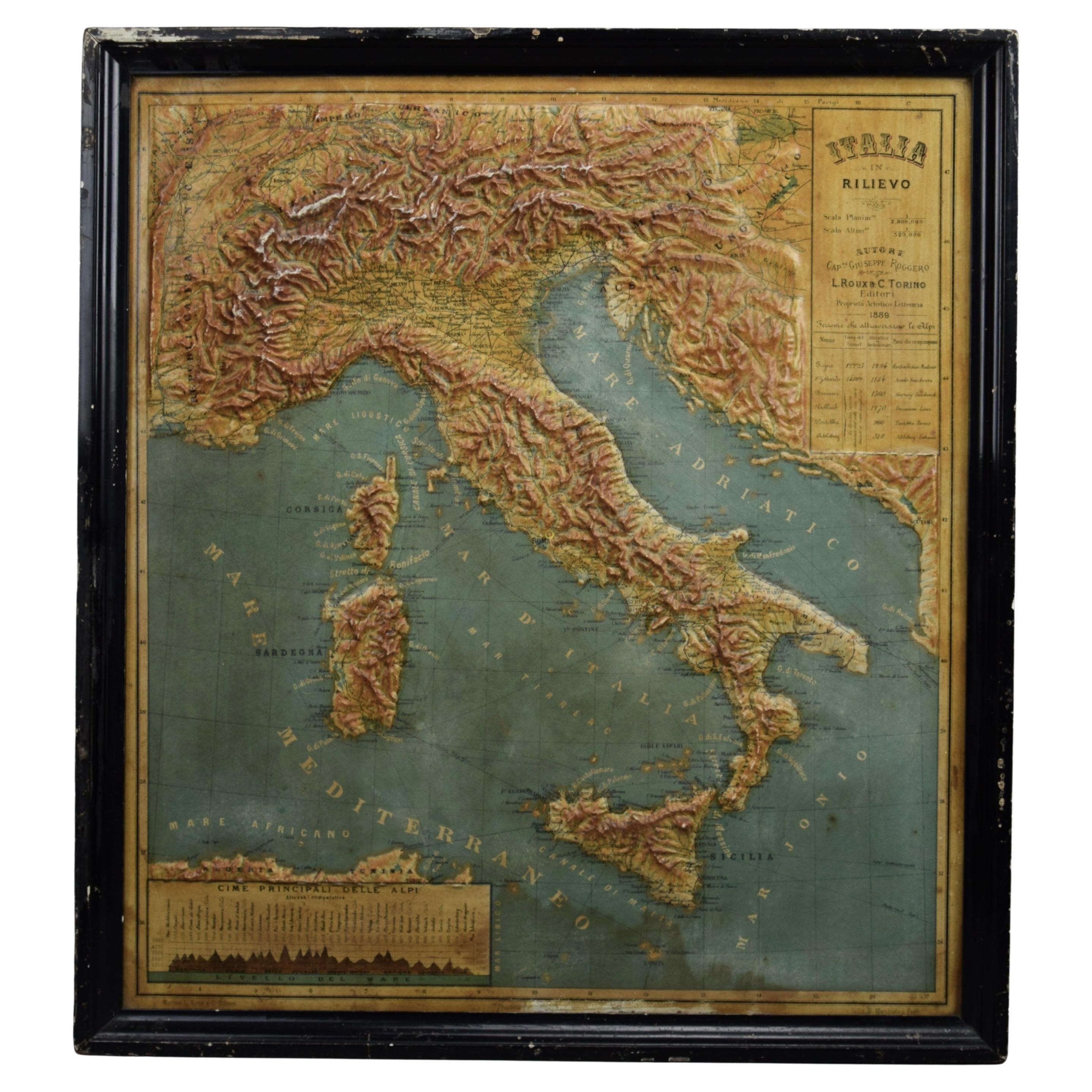
1889 Map of Italy in 3D Relief
Located in Weesp, NL
Introducing a true gem for collectors and history enthusiasts alike: this rare 1889 *"Italia in Rilievo"* map by L. Roux & Co. from Torino, a masterpiece of craftsmanship and cartogr...
Category
Antique 1880s European Maps
Materials
Paper

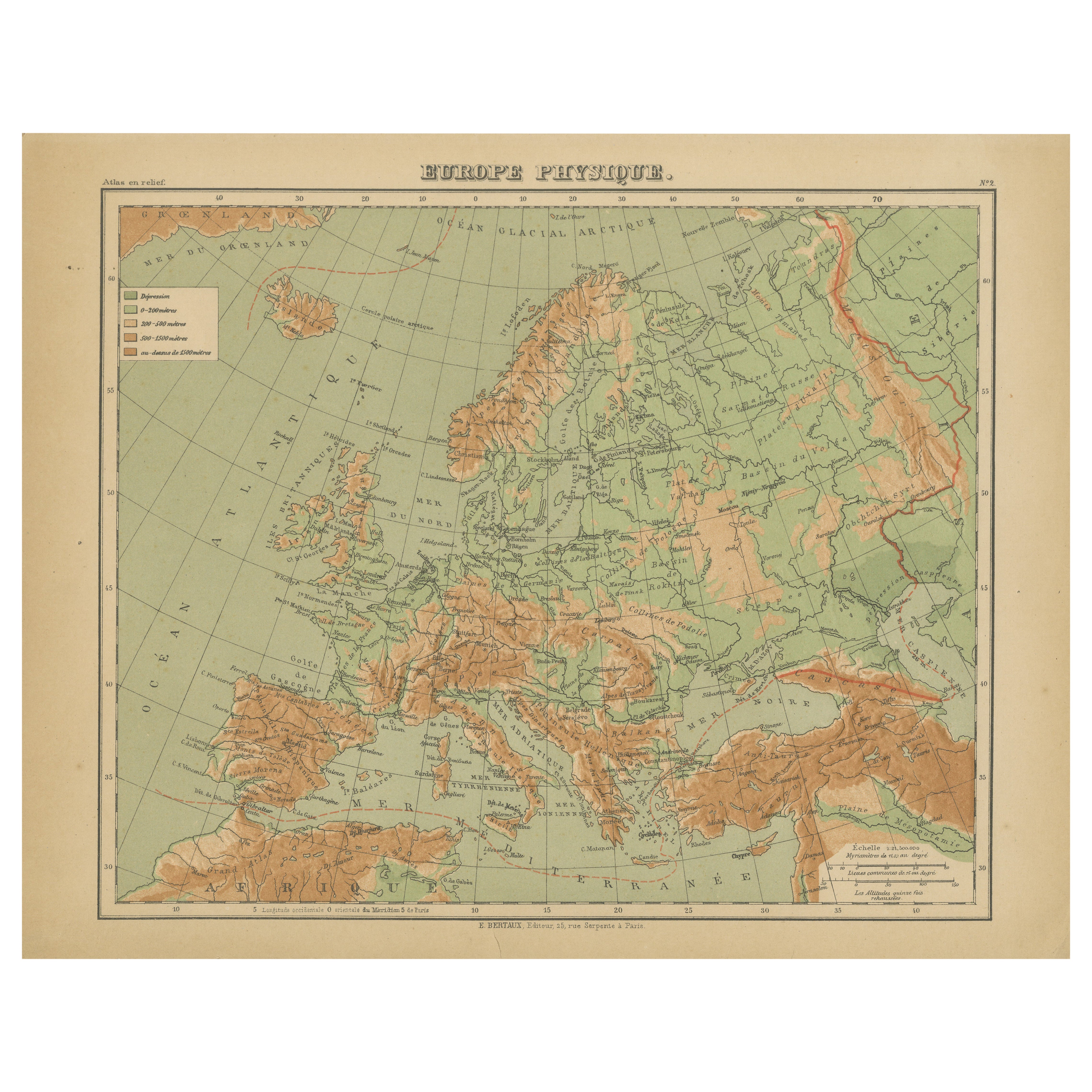
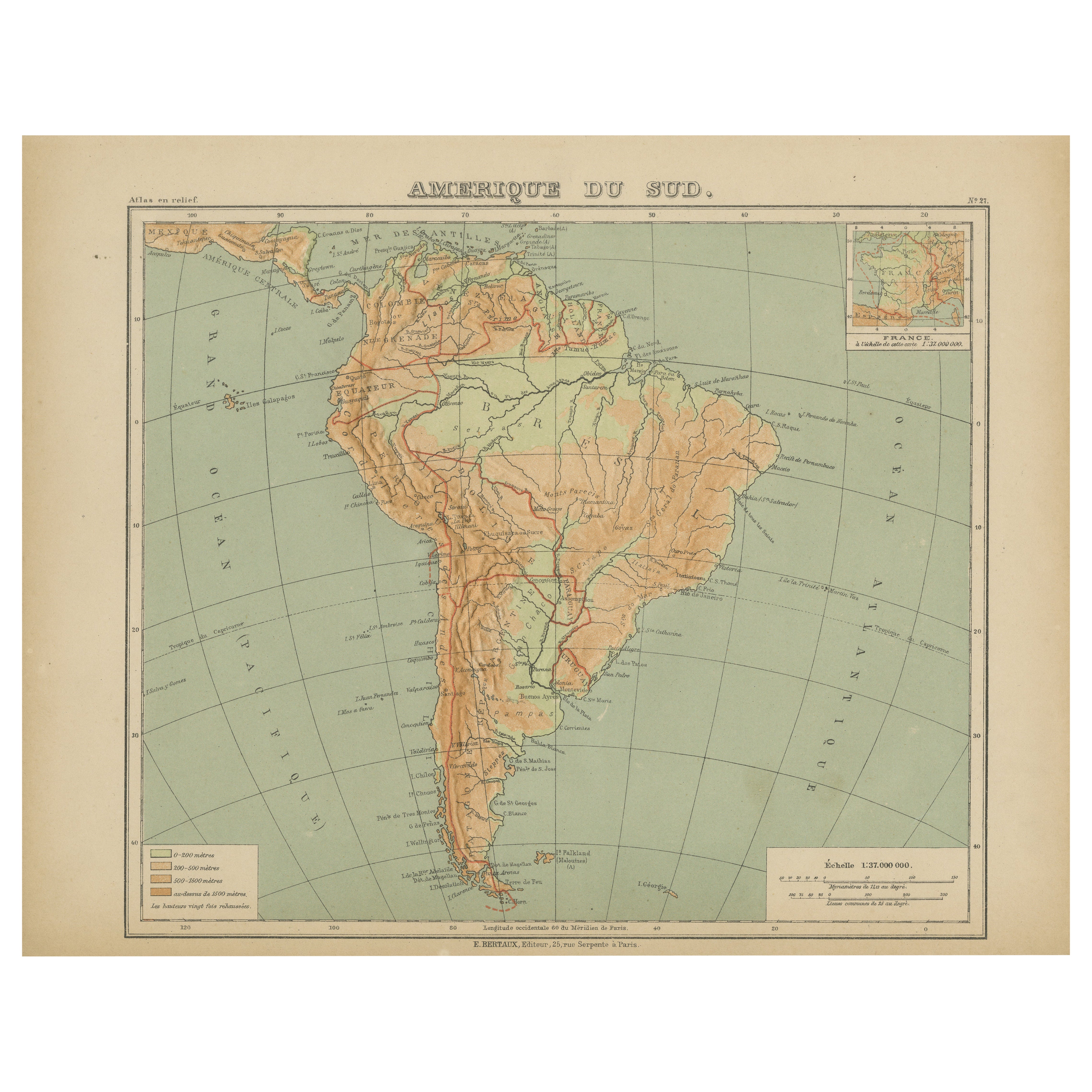
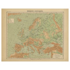
Relief Atlas Map of Europe by Hachette – Antique French Map c.1883
Located in Langweer, NL
Antique Map of Europe – Physical Relief Map by Hachette, circa 1883
Description:
This antique map titled “Europe Physique” was published by Hachette in Paris around 1883 and origina...
Category
Antique Late 19th Century French Maps
Materials
Paper
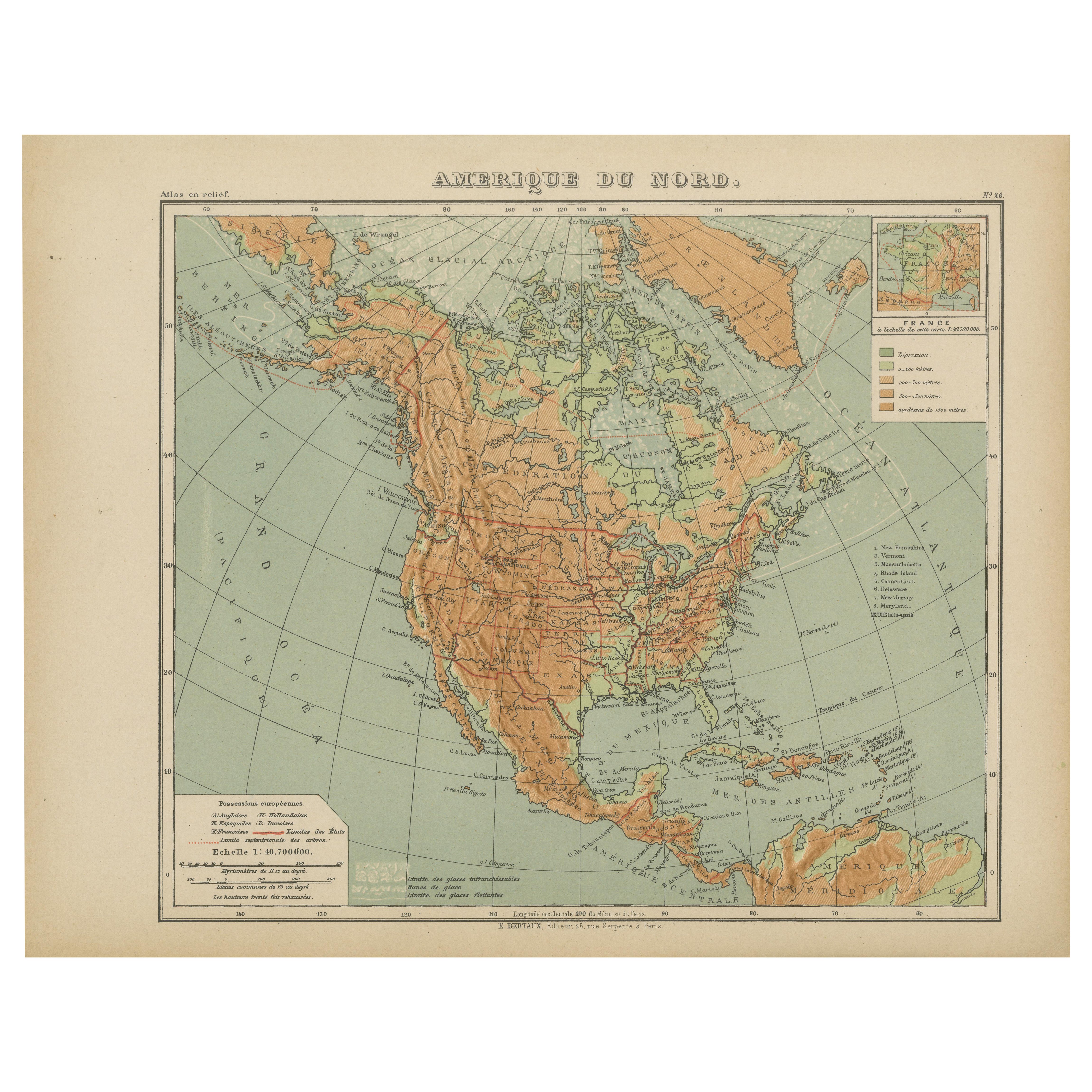
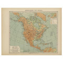
Antique Map of North America – Physical Relief Map by Hachette c.1883
Located in Langweer, NL
Antique Map of North America – Physical Relief Map by Hachette c.1883
Description:
This antique map titled “Amérique du Nord” was published around 1883 by E. Hachette in Paris as pa...
Category
Antique Late 19th Century French Maps
Materials
Paper
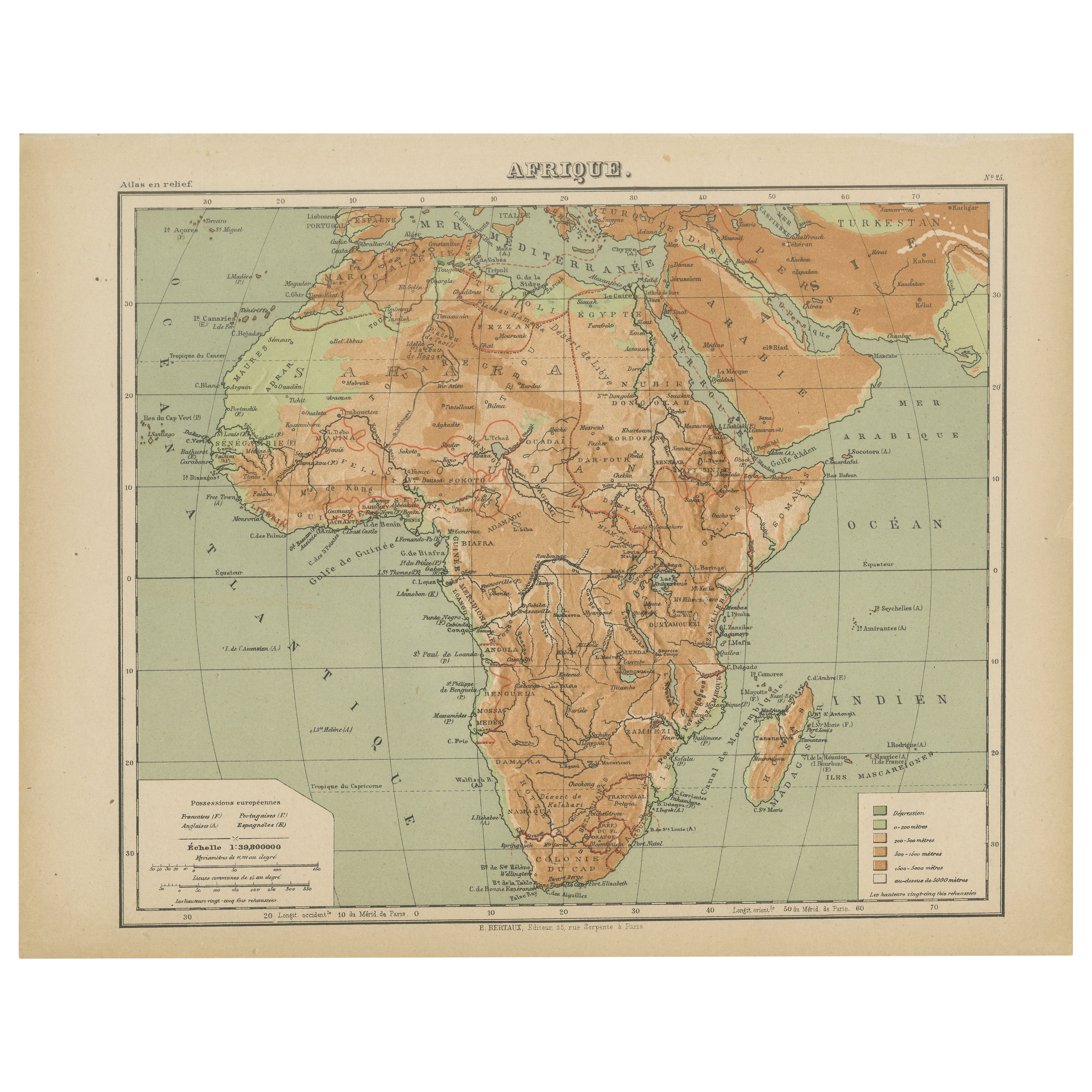
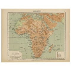
Relief Atlas Map of Africa by Hachette – Antique c.1883 French Map
Located in Langweer, NL
Antique Map of Africa – Relief Atlas Map by Hachette, circa 1880
Description:
This is an attractive antique map titled “Afrique,” published by Hachette...
Category
Antique Late 19th Century Maps
Materials
Paper
Recently Viewed
View AllMore Ways To Browse
Relief Map
Lakota Sioux
Raised Relief Map
Antique English Maps
Map Of India
British Empire Furniture
American West Antiques
Furniture Russian 18th Century
Antique Law Office Furniture
Map Stand
Antique Maps Of Italy
Antique Doctors
Antique Map India
Antique Topographic Maps
Antique Railroad
Antique Maps Of Africa
Railroad Furniture
Antiques Compasses