Paper Maps
to
4,227
5,427
175
5,604
3
55
29
14
9
9
5
1
1
1
1
1
1
2,922
2,245
437
3
280
23
5
126
8
35
7
2
3
3
2
5,607
128
60
35
32
728
303
220
165
142
5,607
5,607
5,607
104
59
28
21
15
Material: Paper
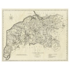
Large Antique County Map of Cumberland, England
Located in Langweer, NL
Antique map titled 'A Map of Cumberland from the best Authorities'. Original old county map of Cumberland, England. Engraved by John Cary. Originates...
Category
Early 19th Century Antique Paper Maps
Materials
Paper
$152 Sale Price
20% Off
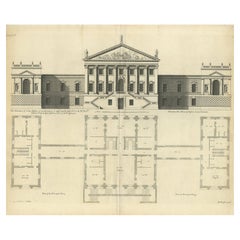
Antique Architectural Print of a New Design for Robert Walpole, England, 1725
Located in Langweer, NL
Antique print titled 'This New Design of my Invention, is most humbly inscrib'd to the Rt. Honble Robert Walpole (..)'.
Old print depicting a new de...
Category
18th Century Antique Paper Maps
Materials
Paper
$418 Sale Price
20% Off
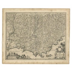
Original Antique Map of the Southern Coast of France by Janssonius, 1657
Located in Langweer, NL
Antique map of France titled 'Comté et Gouvernement de Provence'. Decorative map of the southern coast of France. This map originates from 'Atlas Novus,...
Category
17th Century Antique Paper Maps
Materials
Paper
$684 Sale Price
20% Off
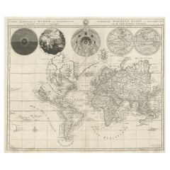
Antique World Map with Astronomical Spheres by Pierre Mortier, Amsterdam, c.1700
Located in Langweer, NL
Antique World Map with Astronomical Spheres by Pierre Mortier, Amsterdam, circa 1700
This fascinating antique world map titled "Carte générale du monde, ou description du monde terr...
Category
17th Century French Antique Paper Maps
Materials
Paper
$873 Sale Price
25% Off
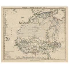
Antique Map of West and Central Africa – Stieler Atlas, Justus Perthes 1857
Located in Langweer, NL
Antique Map of West and Central Africa – Stieler Atlas, Justus Perthes 1857
This finely engraved map titled "Mittel- und Nord-Africa. Westl. Theil." was published in 1857 by Justus ...
Category
Mid-19th Century German Antique Paper Maps
Materials
Paper
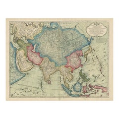
1723 Antique Map of Asia – Carte d’Asie by Guillaume Delisle, Paris
Located in Langweer, NL
Title: Carte d'Asie – Rare Hand-Colored Map of Asia by Guillaume Delisle, Paris 1723
Description:
This rare and highly decorative antique map titled 'Carte d'Asie', engraved and han...
Category
Early 18th Century French Antique Paper Maps
Materials
Paper
Observatory & Spakaia Church, Beryozovo, Demyanskoye, Tyumen Oblast in Russia
Located in Langweer, NL
Antique print titled 'Vue de l'Observatoire et de l 'Eglise de Spaskaia (..)'. Copper engraving of the Observatory and the Church of Spakaia at Beryozovo on the North side. Below, a ...
Category
18th Century Antique Paper Maps
Materials
Paper
$275 Sale Price
20% Off
Antique Map of the Old World Projection, Entitled Orbis Terrarum Ad Mentem, 1825
Located in Langweer, NL
Antique map titled 'Orbis Terrarum ad Mentem (..)'. Old map of the world originating from 'Atlas der Oude Wereld'.
Artists and Engravers: Published by C. Ph. Funke and W. van Boe...
Category
19th Century Antique Paper Maps
Materials
Paper
$209 Sale Price
20% Off
Antique Map of a Hemisphere by Scherer, c.1703
Located in Langweer, NL
Antique map depiciting a horizon/hemisphere. Printed for Scherer's 'Atlas Novus' (1702-1710).
Artists and Engravers: Heinrich Scherer (1628-1704) was a Professor of Hebrew, Mathematics and Ethics at the University of Dillingen until about 1680. Thereafter he obtained important positions as Official Tutor to the Royal Princes...
Category
18th Century Antique Paper Maps
Materials
Paper
$180 Sale Price
20% Off
Antique Map Depiciting a Horizon or Hemisphere c.1703
Located in Langweer, NL
Antique map depiciting a horizon/hemisphere. Printed for Scherer's 'Atlas Novus' (1702-1710).
Artists and Engravers: Heinrich Scherer (1628-1704) was a Professor of Hebrew, Mathematics and Ethics at the University of Dillingen until about 1680. Thereafter he obtained important positions as Official Tutor to the Royal Princes...
Category
18th Century Antique Paper Maps
Materials
Paper
$180 Sale Price
20% Off
Antique Map of Denmark 1858 – Includes Iceland & Copenhagen Plan
Located in Langweer, NL
Antique Map of Denmark 1858 – Includes Iceland & Copenhagen Plan
This finely detailed antique map of Denmark was published in 1858 by Justus Perthes in Gotha, as part of the renowne...
Category
Mid-19th Century German Antique Paper Maps
Materials
Paper
Antique Map of Scandinavia 1857 – Sweden & Norway in Detail
Located in Langweer, NL
Sweden and Norway Map – Stieler Atlas Engraving, 1858
This fine antique map titled Schweden und Norwegen (Sweden and Norway) was published in 1858 by Justus Perthes of Gotha and dra...
Category
Mid-19th Century German Antique Paper Maps
Materials
Paper
Comore Island Original Antique Engraving by Van Schley, 1749
Located in Langweer, NL
Antique map titled 'Carte des Isles de Comore Johanna ou Anouan Mohilla ou Moaly et Mayote (..) - Kaart van de Eilanden Komoro, Anjuan, Moelia, en Mayotta (..)'. Copper engraving of ...
Category
18th Century Antique Paper Maps
Materials
Paper
Antique Print of a Porphyry Vase by Sandberg, c.1864
Located in Langweer, NL
Antique print titled 'Porphyr Vas'. View of the giant Porphyry vase of Rosendal Palace, a Swedish palace pavilion located on Djurgården, an island in central Stockholm. This print or...
Category
19th Century Antique Paper Maps
Materials
Paper
$64 Sale Price
20% Off
Western & Eastern Hemisphere Maps – World Double Hemisphere Engravings 1857
Located in Langweer, NL
Western & Eastern Hemisphere Maps – World Double Hemisphere Engravings 1857
These beautiful antique prints show two complementary hemispheric maps titled “Westliche Halbkugel” (West...
Category
Mid-19th Century German Antique Paper Maps
Materials
Paper
Antique Map of the Region of Bourbon by Janssonius, 1657
Located in Langweer, NL
Antique map of France titled 'Borbonium Ducatus - Bourbonnois'. Decorative map of the Bourbon region. This map originates from 'Atlas Novus, Sive Theatrum Orbis Orbis Terrarum: In qu...
Category
17th Century Antique Paper Maps
Materials
Paper
$392 Sale Price
20% Off
"Atlas to Accompany Monograph XXXII on the Geology of Yellowstone National Park"
By United States Geological Survey
Located in Colorado Springs, CO
This is an original 1904 "Atlas to Accompany Monograph XXXII on the Geology of the Yellowstone National Park" by Arnold Hague. Published by the Department of the Interior, the Atlas ...
Category
Early 1900s American Antique Paper Maps
Materials
Leather, Fabric, Paper
Handcolored Print of an Estate by Smallegange, Zeeland, The Netherlands, 1696
Located in Langweer, NL
Antique print titled 'Rynsburch'. Copper engraving of the estate of Rijnsburg, the Netherlands. This print originates from 'Nieuwe Cronyk van Zeeland' by Mattheus Smallegange.
Ar...
Category
17th Century Antique Paper Maps
Materials
Paper
Antique Print of the 'Korenbeurs' in Amsterdam, c.1760
Located in Langweer, NL
Antique print titled 'Gezicht van de Nieuwe Koren-Beurs tot Amsterdam - Vue de la Nouvelle Bourse (..)'.
Optical print of the 'Korenbeurs' in Amsterdam, the Netherlands. The Korenbeurs (""grain bourse"") was a 17th-century commodity market in Amsterdam where grain was traded. The building stood on the banks of the Amstel, on the western side (Nieuwezijde) of the Damrak. It was directly south of the Oude Brug bridge, on a spot now occupied by the former stock and commodity exchange Beurs van Berlage...
Category
18th Century Antique Paper Maps
Materials
Paper
$342 Sale Price
20% Off
Antique Print of the Rokin Canal in Amsterdam, The Netherlands, c.1765
Located in Langweer, NL
Antique print titled 'Gezigt langs het Rokin op de Nieuwe-Zyds-Kapel en Beurs'. Original antique print of the 'Rokin' canal in Amsterdam, the Netherlands. Published circa 1765.
Ar...
Category
18th Century Antique Paper Maps
Materials
Paper
$228 Sale Price
20% Off
Decorative Antique Map of Sweden and Part of Finland, 1806
Located in Langweer, NL
Antique map titled 'La Suede.'
Decorative map of Sweden and part of Finland by Robert de Vaugondy, revised and published by Delamarche. Source unknown, to be determined.
Artists and Engravers: Made by 'Charles Francois Delamarche' after an anonymous artist. Charles Francois Delamarche (1740-1817) founded the important and prolific Paris based Maison Delamarche map publishing firm in the late 18th century. A lawyer by trade Delamarche entered the map business with the acquisition from Jean-Baptiste Fortin of Robert de Vaugondy's map plates...
Category
Early 1800s French Antique Paper Maps
Materials
Paper
Large Antique Map of the Region of Berry, Nivernois & Bourbonnais, France, 1753
Located in Langweer, NL
Antique map titled 'Gouvernements généraux du Berry, du Nivernois et du Bourbonois'.
Large, original antique map of the region of Berry, Nivernois and Bourbonnais, France. Featur...
Category
1750s Antique Paper Maps
Materials
Paper
$532 Sale Price
20% Off
Original Old Map of St Kitts, Antigua, Bermuda, Barbados, and Jamaica, ca.1745
Located in Langweer, NL
Antique map titled 'Dominia Anglorum in praecipuis Insulis Americae ut sunt Insula S. Christophori, Antegoa, Iamaica, Barbados nec non Insulae Bermudes vel Sommers dictae. Die Englis...
Category
1740s Antique Paper Maps
Materials
Paper
$1,378 Sale Price
20% Off
Antique Map of France at the End of the Ministry of Cardinal Richelieu, 1765
Located in Langweer, NL
Antique map France titled 'Etat du Domaine à la fin du Ministère du Cardinal de Richelieu (..)'. Beautiful old map of France. This map originates fr...
Category
18th Century Antique Paper Maps
Materials
Paper
$140 Sale Price
20% Off
Antique Map of France with Beautiful Title Cartouche and Border, c.1740
Located in Langweer, NL
Antique map titled 'La France suivant les nouvelles Observations de Messrs de l'Academie Royale des Sciences etc.'. Rare map of France with beautiful title cartouche and decorative b...
Category
18th Century Antique Paper Maps
Materials
Paper
$427 Sale Price
20% Off
Detailed 1729 Battle Map – Allied Army Camp at Denain France, 1712 Siege
Located in Langweer, NL
Map of Allied Camp at Denain, France, 1712 Attack – Published 1729
This engraved map depicts the army camp of the Allied forces at Denain, attacked by the French on July 24, 1712 du...
Category
Early 18th Century Dutch Antique Paper Maps
Materials
Paper
1847 Ornamental Map of the United States & Mexico by H. Phelps
Located in Colorado Springs, CO
Offered is an original 1847 ornamental map of the U.S. entitled "Ornamental Map of the United States & Mexico" by Humphrey Phelps. The map was issued as an act of Congress by Phelps on Fulton Street, New York. The broadside is elaborately hand-colored.
This is a very detailed and graphic propaganda map of the United States expressing U.S. dominance of the North American continent. The hand-colored map proclaims the Manifest Destiny, with the recent acquisition of Upper California and Texas at the conclusion of the Mexican-American War. The newly acquired land is boldly colored, standing in stark contrast to the rest of the U.S. The map details a potential route for a railroad running from New York City, to Buffalo, to Chicago, then west along the Oregon Trail to Oregon City. This route anticipates the construction of the transcontinental railroad by nearly 20 years.
The map includes elaborately detailed renderings of George Washington, Hernan Cortez, and Montezuma at top to represent European expansion to the Americas. At bottom are four inset designs with text showing the following: a chronological history of the U.S. beginning from settlement to the U.S. victory in the Mexican-American war; an illustration of General Zachary Taylor with details on the Oregon Territory; an illustration of the Aztec Temple of the Sun in Tenochtitlan and a chronology of the Conquest of the Aztec Empire under Cortez; a portrait of General Antonio Lopez de Santa Anna...
Category
1840s American Antique Paper Maps
Materials
Paper
Original Antique Map of The United States of America by Dower, circa 1835
Located in St Annes, Lancashire
Nice map of the USA
Drawn and engraved by J.Dower
Published by Orr & Smith. C.1835
Unframed.
Free shipping
Category
1830s English Antique Paper Maps
Materials
Paper
Antique Map of the Kingdom of Denmark by Wyld '1845'
Located in Langweer, NL
Antique map titled 'Kingdom of Denmark'. Original antique map of the Kingdom of Denmark. This map originates from 'An Atlas of the World, Comprehending Separate Maps of its Various C...
Category
Mid-19th Century Antique Paper Maps
Materials
Paper
$154 Sale Price
35% Off
Rare Hand-colored Map of the British Isles by Gerard Valk, Published circa 1700
Located in Langweer, NL
Map of the British Isles by Gerard Valk circa 1700 – Hand-Colored Engraving
This elegant copperplate engraving titled *Les Isles Britanniques, qui contiennent les Royaumes d'Anglete...
Category
Early 1700s Dutch Antique Paper Maps
Materials
Paper
Antique World Map on Mercator's Projection, Ocean Currents and Trade Routes 1903
Located in Langweer, NL
Title: Antique World Map on Mercator's Projection, 1903, Showing Ocean Currents and Trade Routes
Description:
This antique map, titled "Chart of the World on Mercator's Projection,"...
Category
Early 20th Century Paper Maps
Materials
Paper
Antique Map of Australia by Levasseur, '1875'
Located in Langweer, NL
Antique map titled 'Carte générale de l'Australie'. Large map of Australia. This map originates from 'Atlas de Géographie Moderne Physique et Politiq...
Category
Late 19th Century Antique Paper Maps
Materials
Paper
$415 Sale Price
30% Off
Original Antique Map of Trier and Luxembourg by Joan Blaeu, Amsterdam circa 1640
Located in Langweer, NL
Map of Trier and Luxembourg by Joan Blaeu, Amsterdam circa 1640
This beautifully engraved and hand-colored map titled Trevirensis Archiepiscopatus, et Lutzenburgi Ducatus depicts th...
Category
Mid-17th Century Dutch Antique Paper Maps
Materials
Paper
Vintage North Polar Chart Featuring Arctic Exploration Routes, 1903
Located in Langweer, NL
Title: Vintage North Polar Chart Featuring Arctic Exploration Routes, 1903
This vintage map titled "North Polar Chart" offers a fascinating glimpse into early 20th-century Arctic ex...
Category
Early 20th Century Paper Maps
Materials
Paper
Antique Map of the Region of Aiguillon by Janssonius, 1657
Located in Langweer, NL
Antique map 'Le Duche d'Aiguillon'. Decorative map of the Aiguillon region, France. Located at the confluence of the Lot and Garonne rivers. The map is based on the cartography of Pi...
Category
Mid-17th Century Antique Paper Maps
Materials
Paper
$522 Sale Price
20% Off
Rare Original Double Hemisphere World Map with Allegorical Figures, 1785
Located in Langweer, NL
Antique map titled 'Nieuwe en Naukeurige Kaart der Gantsche bekende Werreld.'
A double hemisphere world map. Four allegorical figures in the c...
Category
1780s Antique Paper Maps
Materials
Paper
$2,804 Sale Price
20% Off
Vintage Swedish Topographic School Map of European Alps, Made in Sweden 1922
Located in Los Angeles, CA
Vintage Swedish Topographic School map of European Alps, Made in Sweden 1922
This vintage Swedish school map is so unique and a great example of why t...
Category
1920s Swedish Vintage Paper Maps
Materials
Linen, Wood, Paper
Topographic Map of Mount Sinai Summit – Antique Engraving by Pococke, 1776
Located in Langweer, NL
Topographic Map of Mount Sinai Summit – Antique Engraving by Pococke, 1776
This antique engraving offers a rare and detailed view of the summit plateau of Mount Sinai, titled "Grond...
Category
Late 18th Century Dutch Antique Paper Maps
Materials
Paper
Cairo, Babylon & Heliopolis – Antique Map of Ancient Memphis Region, 1776
Located in Langweer, NL
Cairo, Babylon & Heliopolis – Antique Map of Ancient Memphis Region, 1776
This antique map is an 18th-century Dutch engraving showing the region around ancient Memphis, Egypt, inclu...
Category
Late 18th Century Dutch Antique Paper Maps
Materials
Paper
Antique Map of California as an Island "The 5 Californias" by Robert de Vaugondy
Located in San Diego, CA
A very nice and rare antique map entitled "Carte de la Californie Suivant" (The 5 Californias), by Didier Robert de Vaugondy of Paris, circa 1772. The map itself measures 15.5" x 13...
Category
Mid-19th Century American Antique Paper Maps
Materials
Paper
Matthaus Seutter, Framed 1730 Color Engraving Map of "Belgium Fonderatum"
Located in Bridgeport, CT
Label on verso. From Grosser Atlas. The name Belgium comes from the ancient designation "Gallis Belgica". Figural decoration upper left. M. Seutter was a famed German mapmaker in the...
Category
18th Century European Renaissance Antique Paper Maps
Materials
Brass
1685 Alain Manesson Mallet Map of Hokkaido (Lesso) in Northern Japan
Located in Langweer, NL
Title: 1685 Alain Manesson Mallet Map of Hokkaido, Iesso, and Company’s Land
Description: This engraved seventeenth-century map, titled Terre de Iesso, was published in 1685 as pa...
Category
1680s Antique Paper Maps
Materials
Paper
Original Antique Engraving of Inhabitants of Tonga Tabu, C.1836
Located in Langweer, NL
Antique print titled 'Tonga-Tabu'. Old print depicting various inhabitants of Tonga Tabu. This print originates from 'Entdeckungs, Reise der Franzosischen Corvette Astrolabe Unternomen auf Befehl Konig Karls...
Category
19th Century Antique Paper Maps
Materials
Paper
Cartographic Heritage: The 1901 Map of the Vizcaya Province in Spain
Located in Langweer, NL
This is a historical map of the province of Vizcaya (Biscay) in Spain, dated 1901. The title on the map is "VIZCAYA. 1901." It shows the topographical details of the region with cont...
Category
Early 1900s Antique Paper Maps
Materials
Paper
$304 Sale Price
20% Off
Original Antique Map or City Plan of Istanbul, Turkey. Circa 1835
Located in St Annes, Lancashire
Nice map of Istanbul
Drawn and engraved by J.Dower
Published by Orr & Smith. C.1835
Unframed.
Free shipping
Category
1830s English Antique Paper Maps
Materials
Paper
Hand-Colored Map of Westphalia – Copper Engraving by Ottens, Amsterdam c.1720
Located in Langweer, NL
Hand-Colored Map of Westphalia – Copper Engraving by Ottens, Amsterdam c.1720
This striking early 18th-century map titled *Nova Ducatus Westphaliae Tabula accurate descripta et in S...
Category
Early 17th Century European Antique Paper Maps
Materials
Paper
Switzerland Map 1778 – Striking Hand-Colored Copperplate of the Thirteen Cantons
Located in Langweer, NL
Switzerland Map 1778 – Faden’s Hand-Colored Copperplate of the Thirteen Cantons
This striking copperplate engraving, published by William Faden in London in 1778, offers a detailed ...
Category
Late 18th Century European Antique Paper Maps
Materials
Paper
Antique Map of France, 1903, with Inset of Paris and Corsica
Located in Langweer, NL
Title: Antique Map of France, 1903, with Inset of Paris and Corsica
Description:
This antique map, titled "France," was engraved and published in 1903 by the renowned W. & A.K. John...
Category
Early 20th Century Paper Maps
Materials
Paper
1658 Large Map of the Holy Land by Jansson – Twelve Tribes of Israel in 6 Sheets
Located in Langweer, NL
Holy Land Divided Among the Twelve Tribes – Six-Part Map by Jan Jansson and Georgius Hornius, circa 1658
This rare and impressive six-sheet engraved map of the Holy Land was publish...
Category
Mid-17th Century Dutch Antique Paper Maps
Materials
Paper
Antique 1830 Map of Munster, Ireland with Limerick, Cork, Kerry and Tipperary
Located in Langweer, NL
Title: Antique 1830 Map of Munster, Ireland with Limerick, Cork, Kerry, and Tipperary
Description: This 1830 German-language map, titled Britisches Reich – C. Kon: Ireland, focu...
Category
1830s Antique Paper Maps
Materials
Paper
1687 Engraved View of Rhodes by O. Dapper – Hand-Colored Island of Rhodus
Located in Langweer, NL
1687 Engraved View of Rhodes by O. Dapper – Hand-Colored Island of Rhodus
This original antique print is a beautifully detailed copper engraving titled "Het Eylant Rhodus" (The Isla...
Category
1680s Antique Paper Maps
Materials
Paper
Bordeaux City View – Braun & Hogenberg Original Woodcut, ca. 1575
Located in Langweer, NL
Bordeaux City View – Braun & Hogenberg Original Woodcut, ca. 1575
Description:
This detailed and highly decorative bird’s-eye view of Bordeaux, titled Bovrdeavx, originates from the...
Category
16th Century German Antique Paper Maps
Materials
Paper
17th Century Framed Map of Ancient France Titled "Typus Galliae Veteris"
Located in Dallas, TX
Decorate an office or a library with this elegant historic map. Crafted in the Netherlands circa 1630, this beautifully framed antique map with pr...
Category
17th Century Dutch Baroque Antique Paper Maps
Materials
Glass, Giltwood, Paper
Old Map of Gloucestershire by Samuel Lewis 1844 – Gloucester, Cheltenham, Bristo
Located in Langweer, NL
Title: Old Map of Gloucestershire by Samuel Lewis 1844 – Gloucester Cheltenham Bristol Cirencester Tewkesbury
Description:
This antique 1844 map of Gloucestershire was engraved for Samuel Lewis’ Topographical Dictionary of England. It includes major towns such as Gloucester, Cheltenham, Bristol, Cirencester, and Tewkesbury. Roads, rivers, and topographical details are finely engraved, with hand-colored borders marking the county boundaries. The map also shows neighboring counties including Herefordshire, Somerset, Wiltshire, and Oxfordshire. A decorative compass rose completes the elegant composition.
Condition:
The map is in good condition with slight age toning and wide clean margins. The engraved lines remain sharp and the original hand coloring is well preserved. Folding line as issued. No tears or stains are visible.
Framing suggestions:
Use an acid-free mat in ivory or light beige to complement the map’s aged tone. A dark wood, black, or antique gold frame will enhance the historic style. UV-protective glass is recommended for long-term preservation. Ideal for display in a home library, study, or office with a classic interior.
Keywords:
Gloucestershire map 1844 Samuel Lewis antique...
Category
1840s Antique Paper Maps
Materials
Paper
$180 Sale Price
20% Off
Antique Map of the of the Course of the Albis River 'or Elbe River'
Located in Langweer, NL
Antique map titled 'Albis Fluvius Germaniae celebris A Fontiubus Ad Ostia, Cum Fluminibus ab utroque latere in illum fluenibus descriptus'. Detailed map of the course of the Albis Ri...
Category
Mid-17th Century Antique Paper Maps
Materials
Paper
$570 Sale Price
20% Off
1866 Ensign & Bridgman's Rail Road Map of the United States
Located in Colorado Springs, CO
Presented is an 1866 issue of “Ensign & Bridgeman’s Rail Road Map of the United States, showing Depots & Stations.” First published in 1856, this is the third edition, following anot...
Category
1860s American Late Victorian Antique Paper Maps
Materials
Paper
Pl. 8 Antique Plan of the House of Mr. Morel by Le Rouge, c.1785
Located in Langweer, NL
Antique print titled 'Plan de la Maison de Ville et de Campagne de Mr. Morel'. Copper engraving showing a plan of the house of Mr. Morel. This print originates from 'Jardins Anglo-Ch...
Category
18th Century Antique Paper Maps
Materials
Paper
Johnson’s New Brunswick Nova Scotia Newfoundland Map, USA c.1864
Located in Langweer, NL
Johnson’s New Brunswick Nova Scotia Newfoundland Map, USA c.1864
This is a finely engraved and hand-colored map titled Johnson’s New Brunswick, Nova Scotia, Newfoundland, and Prince...
Category
Mid-19th Century American Antique Paper Maps
Materials
Paper
1863 "Lloyd's New Map of the United States, the Canadas, and New Brunswick"
Located in Colorado Springs, CO
Presented is “Lloyd's New Map of the United States, the Canadas and New Brunswick, From the latest Surveys, Showing Every Railroad & Station Finished to June 1863, and the Atlantic and Gulf Coasts.” A large, Civil War-era hanging map of the United States and adjacent territories, this map covers the area from the Atlantic Ocean and extends as far west as the 103 meridian, to “Dacotah,” Nebraska, Kansas, "Indian Territory," and Texas. The southern continuation of Florida is shown in an inset map along the right margin. This map was published by J. T. Lloyd, in New York, in 1863. According to the publisher’s marking at lower right, this map was originally issued in two states: "in Sheets, Colored" for 50 cents, and "Varnished nicely, with Rollers" for $1.
Throughout the map, the counties are colored and the towns and cities well labeled. A reference key in the bottom margin provides symbols for railroads, turnpikes and wagon roads, state capitals, cities and towns, and village post offices. As emphasized in the map’s title, this map is especially notable for the countless railway lines and stations depicted, with distances noted between points, listing “every railroad and finished station to June 1863.” Additionally, two shipping agents and their routes are drawn out of New York City. The map includes details of the steamship routes into New York and Philadelphia from Liverpool and on to California and Oregon via an overland Nicaraguan trek, presumably to assist gold rush emigrants.
This expansive and impressive map depicts the eastern half of the United States in the third year of the Civil War. In order not to recognize the legitimacy of the Confederate States of America, each state is shown in the same manner as the Union states. The only indication that the American Civil War was in progress when this map was published is a printed notice that Gideon Wells, Secretary of the Navy, wishes to acquire a quote on 100 copies of Lloyd’s Mississippi River map...
Category
1860s American Antique Paper Maps
Materials
Linen, Wood, Paper
Pair of Miniature Globes Lane’s on Tripod Bases, London post 1833, ante 1858
By Lane's
Located in Milano, IT
Pair of miniature globes
Lane’s, London, post 1833, ante 1858
Papier-mâché, wood and paper
They measure:
Height 9.44 in (24 cm);
Sphere diameter 2.75 in (7 cm);
Diameter of t...
Category
1840s English Early Victorian Antique Paper Maps
Materials
Paper, Wood
Recently Viewed
View AllMore Ways To Browse
Antique Wellington Chests
Antonio Cassi Ramelli
Archimede Seguso Birds
Art Deco Coasters
Art Deco Footballer
Art Deco Music Cabinet
Art Deco Waterfall Bedroom Furniture
Art Deco Waterfall Bedroom
Art Deco Whisky
Art Foulard
Art Nouveau Sunflower
Arts And Crafts Silver Coffee Pot
Asian Pink Bowl
Avesn Vase
Baccarat Carafe
Bakelite Bird
Bakelite Cocktail Picks
Bamboo Ikebana Vase
