Paper Maps
to
4,205
5,454
176
5,632
3
54
29
14
9
9
5
1
1
1
1
1
1
2,952
2,241
439
3
282
23
5
126
8
35
7
2
3
3
2
5,635
127
59
35
32
819
313
231
221
144
5,635
5,635
5,635
104
58
28
21
15
Material: Paper
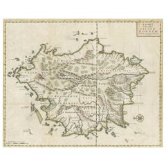
Old Antique Map of Borneo 'Kalimantan Indonesia, Sabah Malaysia & Brunei'
Located in Langweer, NL
Antique map titled 'Kaart van het Eyland Borneo'. Original antique map of the island of Borneo. Published 1724-1726 by Joannes van Braam and Gerard Onder de ...
Category
Early 18th Century Antique Paper Maps
Materials
Paper
$1,528 Sale Price
20% Off
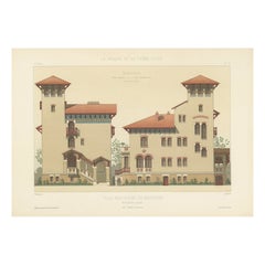
Old Architectural Design Print of Villa Boulevard de Boulogne, Chabat, c.1900
Located in Langweer, NL
Antique print titled 'Villa Boulevard de Boulogne (Seine) Mr. L. Magne, Architecte'. This print depicts the design of a villa in France. Originates from 'La Brique et La Terre Cuite'...
Category
20th Century Paper Maps
Materials
Paper
$119 Sale Price
20% Off
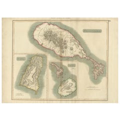
Hand-Colored Map of West India Islands: St. Christopher's, St. Lucia and Nevis
Located in Langweer, NL
This map, titled "West India Islands," was published by John Thomson & Co. in 1821 as part of *Thomson's New General Atlas.* The map offers detailed depictions of three key islands i...
Category
1820s Antique Paper Maps
Materials
Paper
$553 Sale Price
20% Off
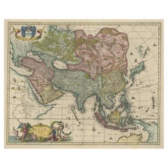
Antique Map of Asia and the East Indies and Korea as a Peninsula, ca.1660
Located in Langweer, NL
Antique map titled 'Asiae nova delineatio'. Decorative map of Asia and the East Indies. The map shows Korea as a peninsula. In China the Great Wall is depicted, as well as a long str...
Category
17th Century Antique Paper Maps
Materials
Paper
$2,387 Sale Price
20% Off
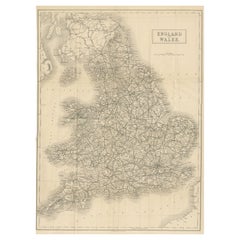
Antique Folding Map of England and Wales
Located in Langweer, NL
Antique map titled 'England and Wales'. Original folding map of England and Wales. Publishes by A. & C. Black, circa 1890.
Category
Late 19th Century Antique Paper Maps
Materials
Paper
$401 Sale Price
20% Off
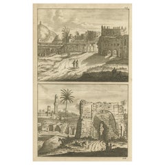
Antique Print of Alexandria in Egypt, 1698
Located in Langweer, NL
Antique print with two views of Alexandria, Egypt. This print originates from 'Reizen van Cornelis de Bruyn, door de vermaardste deelen van Klein Asia, de eylanden Scio, Rhodus, Cypr...
Category
17th Century Dutch Antique Paper Maps
Materials
Paper
$229 Sale Price
20% Off
Antique Map of Senegal, West Africa
Located in Langweer, NL
Original antique map titled 'Carta del Senegal'. Antique map of Senegal, West Africa. This map originates from 'Compendio della storia generale dei viaggi (..)'. Published by De la Harpe...
Category
Mid-18th Century Antique Paper Maps
Materials
Paper
$343 Sale Price
20% Off
Antique Decorative Coloured Map Marocco, Algeria and Tunis, 1882
Located in Langweer, NL
The maps is from the 1882 atlas by Blackie & Son and offers a detailed view of the North African regions as understood in the late 19th century.
**Map of Morocco, Algeria, and Tun...
Category
1880s Antique Paper Maps
Materials
Paper
$238 Sale Price
20% Off
18th Century Map of French Pyrenees Region of France
Located in Haddonfield, NJ
An antique map titled "Principatus Benearnia, La Principaute De Bearn" created by the renowned Dutch cartographer Willem Janszoon Blaeu.
It depicts the Principality of Bearn, a histo...
Category
1880s Danish Baroque Antique Paper Maps
Materials
Wood, Paper
Large Original Antique Map of the The Windward Islands. 1894
Located in St Annes, Lancashire
Superb Antique map of The Windward Islands
Published Edward Stanford, Charing Cross, London 1894
Original colour
Good condition
Unframed.
Free shipping
Category
1890s English Antique Paper Maps
Materials
Paper
Antique Map Showing the Locations of Native American Tribes in 1899
Located in Langweer, NL
Antique map titled 'Map showing the Indian Reservations within the Limits of the United States'. Large folding map of the United States showing the Indian Reservations. The present m...
Category
Late 19th Century Antique Paper Maps
Materials
Paper
$620 Sale Price
20% Off
Antique Map of the Sunda Islands Sumatra, Java, Malay Peninsula & Borneo (1739)
By Isaak Tirion
Located in Langweer, NL
Antique map titled 'Nieuwe kaart van de Sundasche Eilanden als Borneo, Sumatra en Groot Iava & c'. Detailed map of the Sunda Islands, Southeast Asia, extending from the tip of Cambod...
Category
Mid-18th Century Antique Paper Maps
Materials
Paper
$698 Sale Price
21% Off
Antique County Map, Surrey, English, Framed Lithograph, Cartography, Victorian
Located in Hele, Devon, GB
This is an antique lithography map of Surrey. An English, framed atlas engraving of cartographic interest, dating to the mid 19th century and later.
Superb lithography of Surrey an...
Category
Mid-19th Century British Victorian Antique Paper Maps
Materials
Paper
Large Original Antique Map of The Greek Islands. 1894
Located in St Annes, Lancashire
Superb Antique map of The Greek Islands
Published Edward Stanford, Charing Cross, London 1894
Original colour
Good condition
Unframed.
Free shipping
Category
1890s English Antique Paper Maps
Materials
Paper
Old Prints of Costumes of Hungary, Tyrol, Sweden, Romania, Holland, Etc., Ca1875
Located in Langweer, NL
Antique costume print including many different costumes including costumes of Hungary, Tyrol, Sweden and others.
This print originates from 'Blätter für Kostümkunde. Historische ...
Category
1870s Antique Paper Maps
Materials
Paper
$210 Sale Price
20% Off
Original Antique Map of Southern India and Ceylon 'Present-Day Sri Lanka'
Located in Langweer, NL
Antique map titled 'Suite de la Carte de l'Indoustan (..) - Vervolg van de Kaart van Hindoestan (..)'. Original antique map of Southern India and Ceylon (present-day Sri Lanka). This...
Category
Mid-18th Century Antique Paper Maps
Materials
Paper
$802 Sale Price
20% Off
Old Map of the Great Lakes and Upper Mississippi Valley, Northern America, c1780
Located in Langweer, NL
Antique map titled 'Partie Occidentale du Canada'.
A fine example of Rigobert Bonne and Guilleme Raynal's 1780 map of the Great Lakes and upper Mississippi Valley.
A map of c...
Category
1780s Antique Paper Maps
Materials
Paper
$787 Sale Price
20% Off
Print of the Solemn Celebration Sapan Giacche in Pegu, Burma 'Myanmar', 1725
Located in Langweer, NL
Antique print, titled: 'Fete Solennelle de Pegu appelee Sapan Giacche'
This plate shows the Solemn celebration called Sapan Giacche in Pegu or Bago, the capital of the Bago Regio...
Category
1720s Antique Paper Maps
Materials
Paper
$324 Sale Price
20% Off
1987 "The Ian Fleming Thriller Map" by Aaron Silverman and Molly Maguire
Located in Colorado Springs, CO
Presented is an original “Ian Fleming Thriller Map,” which features the travels of MI6 Agent 007, James Bond, from author Ian Fleming’s series of fourteen spy novels. The pictorial m...
Category
1980s American Modern Vintage Paper Maps
Materials
Paper
Antique Map of Granada Spain – Hand-Coloured Tassin Engraving 1651
Located in Langweer, NL
Antique Map of Granada Spain – Hand-Coloured Tassin Engraving 1651
This beautiful hand-coloured engraved map depicts the historic Kingdom of Granada in southern Spain, created by th...
Category
Mid-17th Century French Antique Paper Maps
Materials
Paper
Large Sea Chart of the British Islands, 1918
Located in Langweer, NL
Antique map titled 'The British Islands'.
Large sea chart of the British Islands. It shows Ireland, Scotland, England, the Shetland Islands and part of Fra...
Category
1910s Vintage Paper Maps
Materials
Paper
$534 Sale Price
20% Off
Original Antique Print of the Women of Tonga Tabu, c.1836
Located in Langweer, NL
Antique print titled 'Wohnung der Frauen des Palu'. Old print with a view of the hut of the women of Tonga Tabu. This print originates from 'Entdeckungs, Reise der Franzosischen Corv...
Category
19th Century Antique Paper Maps
Materials
Paper
$248 Sale Price
20% Off
Antique Dutch Map of the Twelve Tribes of Israel – After Ezekiel, circa 1730
Located in Langweer, NL
Antique Dutch Map of the Twelve Tribes of Israel – After Ezekiel, circa 1730
This uncommon early 18th-century Dutch map is titled "Ontwerp en Erfdeeling van’t Land Kanaan, volgens h...
Category
Early 18th Century Dutch Antique Paper Maps
Materials
Paper
Antique Print with Coastal Views of Islands Near The American Coast by Cook
Located in Langweer, NL
Antique print America titled 'Gezigten der Landen van de West-Kust van Amerika, ten westen van Cook's Voyage'. Coastal views of various islands of the American coast, near Cook's riv...
Category
19th Century Antique Paper Maps
Materials
Paper
$362 Sale Price
20% Off
Antique Map of the Bay of Cordes and Surroundings by Hawkesworth, 1774
Located in Langweer, NL
Antique print titled 'Baye et Havre de Cordes (..)'. Four maps on the one sheet of; Cordes Bay, Port Famine, Woods Pay, Port Gallant, Fortescue Bay, Chile based on the voyage of John...
Category
18th Century Antique Paper Maps
Materials
Paper
$106 Sale Price
20% Off
Antique Print of Designs for Pembroke House Whitehall, London, England, 1725
Located in Langweer, NL
Antique print titled 'Elevation of the Right Honourable the Lord Herbert (..)'.
Designs for Pembroke House, front elevation and plans of the principal storey and the attic storey o...
Category
18th Century Antique Paper Maps
Materials
Paper
Antique Map of the Province of Zuid-Holland by Keizer & De Lat, 1788
Located in Langweer, NL
Antique map titled 'La Sud Hollande (..)'. Uncommon antique map of the province of Zuid-Holland, the Netherlands. This map originates from 'Nieuwe Natuur- Geschied- en Handelkundige ...
Category
18th Century Antique Paper Maps
Materials
Paper
Pl. XLII Villa a Fontenay-Sous-Bois, Chabat, C.1900
Located in Langweer, NL
Antique print titled 'Villa A Fontenay-Sous-Bois, Mr. Ed. Jandelle-Ramier, Architecte'. This print depicts the design of a villa in France. Originates from 'La Brique et La Terre Cui...
Category
20th Century Paper Maps
Materials
Paper
$114 Sale Price
20% Off
Antique Print of a Section of Stratton Park, Hampshire, England, c.1770
Located in Langweer, NL
Antique print titled 'Section of Stratton Park'. Section of Stratton Park, Hampshire.
This print originates from 'Vitruvius Britannicus' by Colen Campbell. Artists and Engravers:...
Category
18th Century Antique Paper Maps
Materials
Paper
$343 Sale Price
20% Off
Antique Map of the Arabian Desert by Cellarius, 1731
Located in Langweer, NL
Antique map titled 'Arabia Petraea et Deserta.' Arabian desert with present day Israel, Jordania, Iraq. With decorative cartouche showing dromedaries. T...
Category
18th Century Antique Paper Maps
Materials
Paper
$167 Sale Price
20% Off
Antique Colourful and Decorative County Map of Bedfordshire, England, 1804
Located in Langweer, NL
Antique county map of Bedfordshire first published c.1800. Villages, towns, and cities illustrated include Bedford, Todington, and Potton.
Charl...
Category
Early 1800s Antique Paper Maps
Materials
Paper
$310 Sale Price
20% Off
Antique Map of Spain by Covens & Mortier, c.1740
Located in Langweer, NL
Antique map Spain titled 'L?Espagne dressée sur la Description qui en a eté faite par Rodrigo Mendez Sylva (..)'. Beautiful map of Spain with decorat...
Category
18th Century Antique Paper Maps
Materials
Paper
$501 Sale Price
20% Off
Granada 1902: A Cartographic Exploration of Andalusia's Mountainous Province
Located in Langweer, NL
This original antique map depicts the province of Granada, part of the autonomous community of Andalusia in southern Spain, as of 1902. The map features several important details:
I...
Category
Early 1900s Antique Paper Maps
Materials
Paper
$372 Sale Price
20% Off
Antique Plan of Emden in Germany by Guicciardini, 1612
Located in Langweer, NL
Antique map Emden titled 'Civitas Embda, eo modo situata cum essit controversia inter ipsam et suum Comitem anno'. Small plan of the city of Emden, Germany, Also depicted is part of ...
Category
17th Century Antique Paper Maps
Materials
Paper
$362 Sale Price
20% Off
Antique Map of Ambon Island in the Moluccas, Indonesia, c.1760
Located in Langweer, NL
Antique map Ambon titled 'Carte Particuliere de l 'Isle Amboine'. Old map showing Ambon, in the Moluccas Islands, better known as the Spice Islands. Ambon was the headquarters of the...
Category
18th Century Antique Paper Maps
Materials
Paper
$229 Sale Price
20% Off
Newfoundland and St. Pierre & Miquelon: Uncoloured French Map of circa 1820
Located in Langweer, NL
The map is titled "Île et Banc de Terre-Neuve avec les Îles St. Pierre et Miquelon", depicting Newfoundland and the French islands of St. Pierre and Miquelon. It is from the Petit Atlas National series.
Features:
- The map is divided into two sections:
1. The left side shows Newfoundland (Terre-Neuve) and its surrounding waters, including important locations such as the Île du Cap Breton and Grand Bank fishing areas.
2. The right side focuses on St. Pierre and Miquelon, a French overseas territory near Newfoundland.
- Administrative divisions and key geographic features, such as capes, bays, and towns, are labeled on the map.
Historical Context:
- This map is part of a collection meant to showcase France's overseas colonies and territories, including the small but significant St. Pierre and Miquelon, which has been under French control for centuries and was a critical fishing and trading hub.
- The Petit Atlas National series was typically published in the early 19th century, and this map likely dates from the same period, around 1815–1820.
Here the text transalated:
Here is the translation of the text from French to English:
---
**NOTICE.**
The islands of St. Pierre and Miquelon, the only remaining French possession in this part of America since the loss of Canada, are located a few miles from the southern coast of Newfoundland, which belongs to the English. Their relatively fertile soil is broken up by hills that give rise to small streams.
**Grande Miquelon**, the northernmost of the two islands, has a circumference of about 9 to 10 leagues. It offers a convenient port for fishing boats.
**Petite Miquelon**, to the south of Grande Miquelon, has a circumference of about 6 leagues. It is well-watered and well-wooded.
**Saint Pierre**, to the south-southwest of the two other islands, presents a somewhat similar appearance but is devoid of trees. Although it is the smallest of the three islands, it is the most important due to the size of its harbor, which can accommodate 30 to 40 ships of various sizes, and because of its favorable coastline for the preparation, preservation, and export of cod. On its eastern coast, at the bottom of a beautiful bay, lies the town of Saint Pierre, the only notable settlement on the three islands. It is the residence of a naval officer who, under the title of Commander, governs the colony.
The permanent population is about 2,000 souls, of which 800 reside in Saint Pierre. However, sailors come to the islands from the coasts of Brittany and Normandy during the cod fishing season on the Grand Banks of Newfoundland and the Gulf of St. Lawrence. In 1833, it was estimated that about 14,000 sailors were employed in this fishery, and the purchase of supplies required by the colony was valued at over one million francs.
---
This translation reflects the original notice describing the French islands of St. Pierre and Miquelon, with details about their geography, population, and economic activities related to the fishing industry.
People searching for maps or information about Newfoundland and the French islands of St. Pierre and Miquelon use the following keywords:
1. Newfoundland map...
Category
1820s Antique Paper Maps
Materials
Paper
$152 Sale Price
20% Off
Antique Map of the City of Verdun by Merian, c.1650
Located in Langweer, NL
Antique map titled 'Verdun'. Orginal antique map of Verdun, a small city in the Meuse department in Grand Est in northeastern France. This map originates from 'Topographia Germaniae'...
Category
17th Century Antique Paper Maps
Materials
Paper
$56 Sale Price
20% Off
Ancient Crossroads: Albania to Assyria in Antiquity, Published in 1880
Located in Langweer, NL
The map titled "ALBANIA, IBERIA, COLCHIS, ARMENIA, MESOPOTAMIA, BABYLONIA, ASSYRIA" portrays the ancient regions that would encompass parts of modern-day Eastern Turkey, Armenia, Aze...
Category
1880s Antique Paper Maps
Materials
Paper
Antique Map of the Province of Gelderland, the Netherlands, c.1690
Located in Langweer, NL
Antique map titled 'Ducatus Geldriae novissima descriptio'. Map of Gelderland, The Netherlands. Shows many cities (like Arnhem, Nijmegen, Eindhoven, Zutphen, Zwolle, etc), roads, riv...
Category
17th Century Antique Paper Maps
Materials
Paper
$476 Sale Price
20% Off
Rare Hand-Colored Map of Franche-Comté and Burgundy by Frederik De Wit c. 1688
Located in Langweer, NL
Title: Rare Hand-Colored Map of Franche-Comté and Burgundy by Frederik De Wit c. 1688
Description: This stunning 17th-century map, titled "Comitatus Burgundiae vulgo La Franche Comt...
Category
1680s Antique Paper Maps
Materials
Paper
Friesland, Groningen, Drenthe, Overijssel – Antique Map by Seb. Münster, 1574
Located in Langweer, NL
Friesland, Groningen, Drenthe, Overijssel – Antique Map by Sebastian Münster, 1574
This rare and finely colored woodcut map of Northern Netherlands depicts the provinces of Friesl...
Category
16th Century Antique Paper Maps
Materials
Paper
Map of the Margraviate and Electorate of Brandenburg by de Beaurain - ca.1750
Located in Langweer, NL
Historical Map of the Margraviate and Electorate of Brandenburg by Chevalier de Beaurain - Circa 1750
This impressive historical map, titled "Carte du Marquisat et Electorat de Br...
Category
1750s Antique Paper Maps
Materials
Paper
$515 Sale Price
20% Off
Antique Map of the Region of Cologne and Liege by Scherer, 1699
Located in Langweer, NL
Antique map titled 'Archpiescopatus Coloniensis (..) Episcopatus Leodiensis (..).' Detailed uncommon map of the Archbishopric of Cologne and the Bishopric of Liege/Luik. Source unkno...
Category
17th Century Antique Paper Maps
Materials
Paper
$214 Sale Price
20% Off
Old Map of the East Coast of Honshu with an Inset, Japan, c.1785
Located in Langweer, NL
Antique map titled ‘Part of Japan or Nippon'.
View of the Coast of Japan when we first saw it: The Hill a bearing West 3 miles distant. London Published by Allexer Hogg at the Kings Arms...
Category
1780s Antique Paper Maps
Materials
Paper
$210 Sale Price
20% Off
Antique Map of Martinique, Showing Roads, Houses, Sugar Plantations, etc. c.1750
Located in Langweer, NL
Antique map titled 'Carte de l'Isle de la Martinique'.
Detailed map of Martinique. Shows hilly terrain, forests, roads, houses, and even the sugar plantations. The island was to ...
Category
18th Century Antique Paper Maps
Materials
Paper
$1,432 Sale Price
20% Off
Pl. XX Villa Mon Caprice, Chabat, c.1900
Located in Langweer, NL
Antique print titled 'Villa mon Caprice Villers-Sur-Mer. Mr. E. Macé, Architecte'. This print depicts the design of a building in France. Originates from 'La Brique et La Terre Cuite...
Category
20th Century Paper Maps
Materials
Paper
$122 Sale Price
20% Off
Old Map of the Margraviate of Brandenburg by Giacomo Cantelli da Vignola, 1687
Located in Langweer, NL
Historical Map of the Margraviate of Brandenburg by Giacomo Cantelli da Vignola - 1687
This magnificent map, titled Marchesato, et Elettorato di Brandeburgo con una gran Porzione ...
Category
1680s Antique Paper Maps
Materials
Paper
$515 Sale Price
20% Off
Antique Map of Southern Asia with India, the Maldives, Ceylon and Arabia, c.1700
Located in Langweer, NL
Stunning Old Map of Asia.
Description: Two-sheet map of Asia, joined. The left part of this antique map is titled 'Partie occidentale d'une partie d'Asie ou sont les Isles de Zoco...
Category
Early 18th Century Antique Paper Maps
Materials
Paper
$3,342 Sale Price
20% Off
Antique Map of Greece, Albania, Macedonia and Parts of Turkey and Cyprus, c.1745
Located in Langweer, NL
Antique map titled 'Accurata Totius Archipelagi Et Graeciae Universae Tabula'.
Detailed map of Greece. Includes Albania, Macedonia and parts of Turkey and Cyprus. With compass rose...
Category
18th Century Antique Paper Maps
Materials
Paper
$811 Sale Price
20% Off
Limburg Cityscape 1580: Historical Copper Engraving by Braun and Hogenberg
Located in Langweer, NL
Title: Limburgum Oppidum Galliae Belgicae, vulgo Lympurch, gallicè, Lembor Dr.
Type: Print (Copper Engraving)
Circa 1580
Technique: Colored Copper Engraving
Medium: Handmade Paper
S...
Category
16th Century German Antique Paper Maps
Materials
Paper
Antique Map of France by Janssonius, c.1650
Located in Langweer, NL
Antique map titled 'Gallia Vetus'. Beautiful map of France based on Caesar's De Bello Gallico. In the columns to the left and right important tribes and people are described.
Art...
Category
17th Century Antique Paper Maps
Materials
Paper
$501 Sale Price
20% Off
Antique Map of the Duchy of Lüneburg, Lower Saxony, Germany
Located in Langweer, NL
Antique map titled 'Ducatus Luneburgensis (..)'. Map of the Duchy of Lüneburg in Lower Saxony, Germany. Published by J. Janssonius, circa 1664.
Jan Janssonius (also known as Johann ...
Category
Mid-17th Century Antique Paper Maps
Materials
Paper
$515 Sale Price
20% Off
Antique Map of Asia by Larousse, 1897
Located in Langweer, NL
Front: 'Carte Generale de l'Asie.' (General map of Asia). Rear: 'Asie.' (Asia, scenes of Asia, nature, plants and animals, people, costume).' This rare early lithographic print origi...
Category
19th Century Antique Paper Maps
Materials
Paper
$71 Sale Price
20% Off
Original Antique Hand-Colored Map of The East Indies and Southeast Asia, c.1644
Located in Langweer, NL
Antique map titled 'India quae Orientalis dicitur, et Insulae adiacentes'.
Old map of the East Indies and Southeast Asia showing the area between India in the West and parts of J...
Category
1640s Antique Paper Maps
Materials
Paper
$2,387 Sale Price
20% Off
Nice Decorative Black and White Small Antique Map of Europe, 'circa 1834'
Located in Langweer, NL
Antique French map titled 'Europe par A.H. Dufour'. Uncommon map of Europe.
Published by or after A.H. Dufour, circa 1834. Source unknown, to be d...
Category
Mid-19th Century Antique Paper Maps
Materials
Paper
$191 Sale Price
20% Off
Original Antique Map of the South Part of Italy with an Inset of Malta, 1882
Located in Langweer, NL
Embark on a captivating journey through the southern part of Italy with an original Antique Map from the esteemed 'Comprehensive Atlas and Geography of the World,' meticulously craft...
Category
1880s Antique Paper Maps
Materials
Paper
$200 Sale Price
20% Off
Original Antique Map or City Plan of Madrid, Spain. Circa 1835
Located in St Annes, Lancashire
Nice map of Madrid
Drawn and engraved by J.Dower
Published by Orr & Smith. C.1835
Unframed.
Free shipping
Category
1830s English Antique Paper Maps
Materials
Paper
Bay of Saint Helena: French Naval Chart by N.B. Ingénieur de la Marine, ca.1770
Located in Langweer, NL
Bay of Saint Helena: French Naval Chart by N.B. Ingénieur de la Marine, 18th Century
This meticulously detailed copper engraving, titled 'Carte de la Baye de Sainte Helene' (Map of the Bay of Saint Helena), was drawn by N.B., an engineer of the French Navy (*Ingénieur de la Marine*). The map was created based on the navigational observations of mariners and published in the 18th century, most likely in France. It offers a precise and practical representation of Saint Helena Bay, a crucial anchorage point in the South Atlantic Ocean.
Saint Helena Bay, located on the island of Saint Helena, was an important stopover for ships sailing between Europe and Asia, particularly for Dutch and British vessels during the Age of Exploration and the later colonial period. Its significance was further heightened when the island became the final exile location of Napoleon Bonaparte from 1815 to 1821.
The map shows the bay with impressive attention to detail, depicting the coastline with numerous soundings marked in French and English leagues (*Lieues Marines de France et d'Angleterre*), allowing navigators to gauge the water depth and avoid hazards. The bay’s natural topography, including hills and coastal elevations, is rendered in delicate engraving lines. A large central peak dominates the landscape, surrounded by rugged terrain, while a smaller inlet and river (*Riviere*) are also shown, highlighting the complex geography of the bay.
A decorative fleur-de-lis compass rose marks the left side of the chart, indicating orientation and providing a clear sense of direction for mariners. The map's clean and elegant design reflects the French cartographic tradition of combining functional navigation aids with aesthetic appeal.
The chart includes practical features such as scale indicators and coastal profiles that help sailors recognize the bay from a distance. The detailed soundings marked throughout the bay make this map an invaluable tool for understanding the navigational challenges of the area, particularly for large, heavily laden ships.
This rare chart belongs to a series of marine maps...
Category
1770s Antique Paper Maps
Materials
Paper
$133 Sale Price
20% Off
Mid 19th Century Map of the Black Sea with Decorative Vignettes, 1851
Located in Langweer, NL
Map of the Black Sea and contingent lands, including Turkey, Russia, Georgia, Azerbaijan, Bulgaria, Crimea and Armenia, with decorative vignettes views of Sebastopol, Varna, Odessa, Sinope, Constantinople and Silistria.
Fine antique map...
Category
Mid-19th Century Antique Paper Maps
Materials
Paper
$429 Sale Price
20% Off
Antique Map of the City of Berlin in Germany, '1847'
Located in Langweer, NL
Antique map titled 'Berlin'. Original antique map of the city of Berlin, Germany. This map originates from 'Abrégé de Géographie (..)' by Adrien Balbi. Published 1847.
Category
Mid-19th Century Antique Paper Maps
Materials
Paper
$143 Sale Price
20% Off
Recently Viewed
View AllMore Ways To Browse
Antique Wellington Chests
Antonio Cassi Ramelli
Archimede Seguso Birds
Art Deco Coasters
Art Deco Footballer
Art Deco Music Cabinet
Art Deco Waterfall Bedroom Furniture
Art Deco Waterfall Bedroom
Art Deco Whisky
Art Foulard
Art Nouveau Sunflower
Arts And Crafts Silver Coffee Pot
Asian Pink Bowl
Avesn Vase
Baccarat Carafe
Bakelite Bird
Bakelite Cocktail Picks
Bamboo Ikebana Vase
