Items Similar to Old Map of the Rhine & German Cities Incl Düsseldorf, Bonn, Köln, Etc., c.1730


Want more images or videos?
Request additional images or videos from the seller
1 of 5
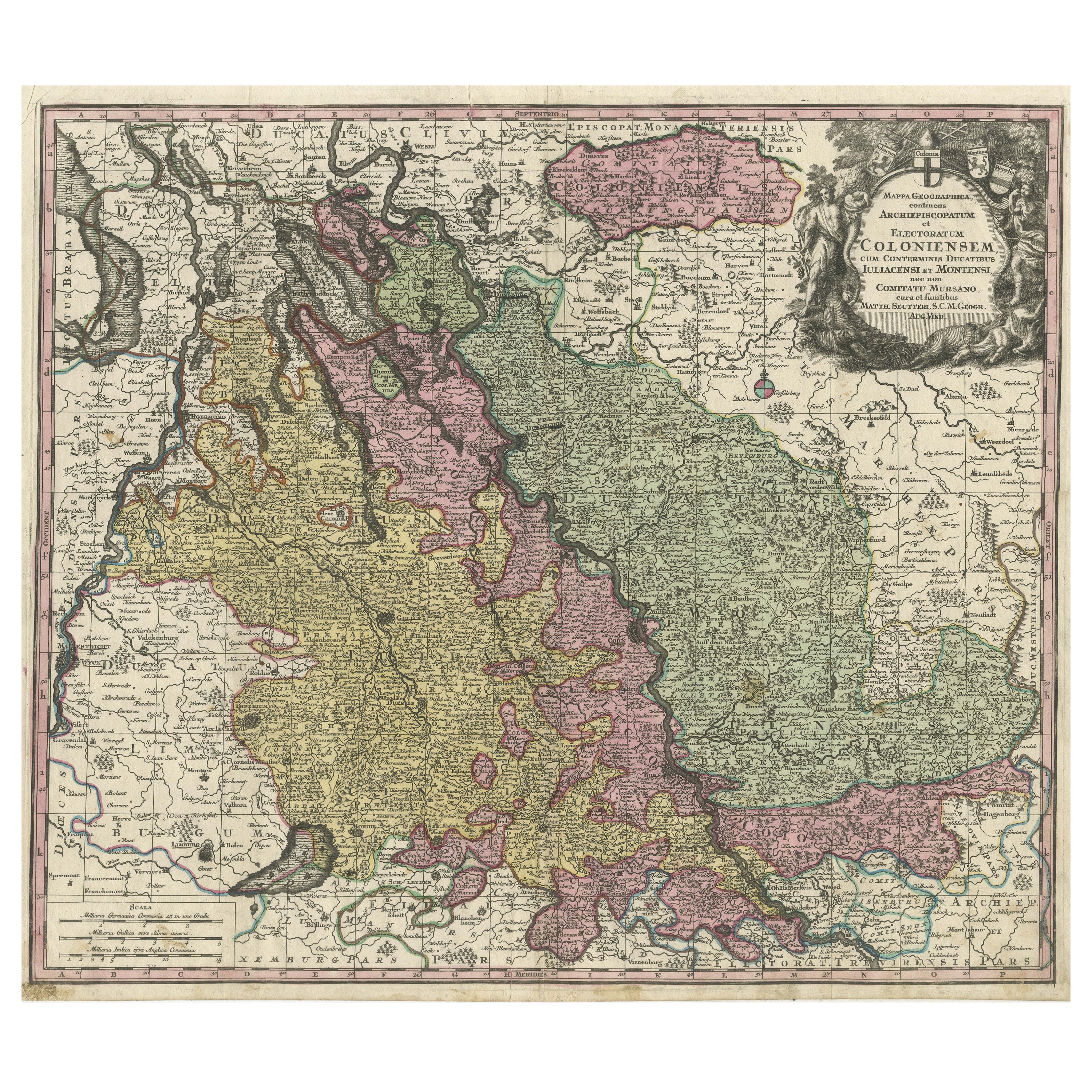
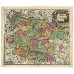
Old Map of the Rhine & German Cities Incl Düsseldorf, Bonn, Köln, Etc., c.1730
$939.34
$1,174.1820% Off
£699.15
£873.9420% Off
€784
€98020% Off
CA$1,286.67
CA$1,608.3320% Off
A$1,431.05
A$1,788.8220% Off
CHF 747.25
CHF 934.0720% Off
MX$17,414.42
MX$21,768.0220% Off
NOK 9,543.55
NOK 11,929.4420% Off
SEK 8,950.17
SEK 11,187.7120% Off
DKK 5,968.32
DKK 7,460.4020% Off
Shipping
Retrieving quote...The 1stDibs Promise:
Authenticity Guarantee,
Money-Back Guarantee,
24-Hour Cancellation
About the Item
Antique map Germany titled 'Mappa Geographica continens Archiepiscopatum et Electoratum Coloniensem (..)'.
This antique map depicts the Rhine river and many German cities including Düsseldorf, Bonn, Köln, Duisburg and more.
Artists and Engravers: Mattias Seutter (1678-1756) was an engraver, globe-maker and map publisher from Augsburg. He was a pupil of J.B. Homann in Nuremberg.
- Dimensions:Height: 20.67 in (52.5 cm)Width: 24.02 in (61 cm)Depth: 0 in (0.02 mm)
- Materials and Techniques:
- Period:1730-1739
- Date of Manufacture:circa 1730
- Condition:Wear consistent with age and use. Condition: Very good, general age-related toning. Please study image carefully.
- Seller Location:Langweer, NL
- Reference Number:Seller: BGI-00090 1stDibs: LU3054327234212
About the Seller
5.0
Recognized Seller
These prestigious sellers are industry leaders and represent the highest echelon for item quality and design.
Platinum Seller
Premium sellers with a 4.7+ rating and 24-hour response times
Established in 2009
1stDibs seller since 2017
2,502 sales on 1stDibs
Typical response time: <1 hour
- ShippingRetrieving quote...Shipping from: Langweer, Netherlands
- Return Policy
Authenticity Guarantee
In the unlikely event there’s an issue with an item’s authenticity, contact us within 1 year for a full refund. DetailsMoney-Back Guarantee
If your item is not as described, is damaged in transit, or does not arrive, contact us within 7 days for a full refund. Details24-Hour Cancellation
You have a 24-hour grace period in which to reconsider your purchase, with no questions asked.Vetted Professional Sellers
Our world-class sellers must adhere to strict standards for service and quality, maintaining the integrity of our listings.Price-Match Guarantee
If you find that a seller listed the same item for a lower price elsewhere, we’ll match it.Trusted Global Delivery
Our best-in-class carrier network provides specialized shipping options worldwide, including custom delivery.More From This Seller
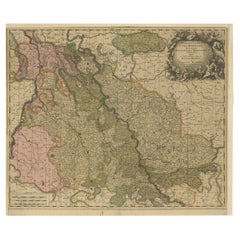
View AllAntique Map of both sides of the Central Rhine River, Germany
Located in Langweer, NL
Antique map titled 'Mappa Geographica continens Archiepiscopatum et Electoratum Coloniensem (..)'. Decorative map of region on either side of the Central Rhine River, showing Dusseld...
Category
Antique Mid-18th Century Maps
Materials
Paper
$517 Sale Price
20% Off
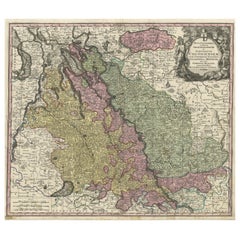
Antique Map of Cologne with the duchies of Jülich and Berg, Germany
Located in Langweer, NL
Antique map title 'Archiepiscopatus Coloniensis ducatibus Iuliacensi et Montensi (..)'. Original map of Cologne with the duchies of Jülich and Berg, Spa...
Category
Antique Late 17th Century Maps
Materials
Paper
$450 Sale Price
20% Off
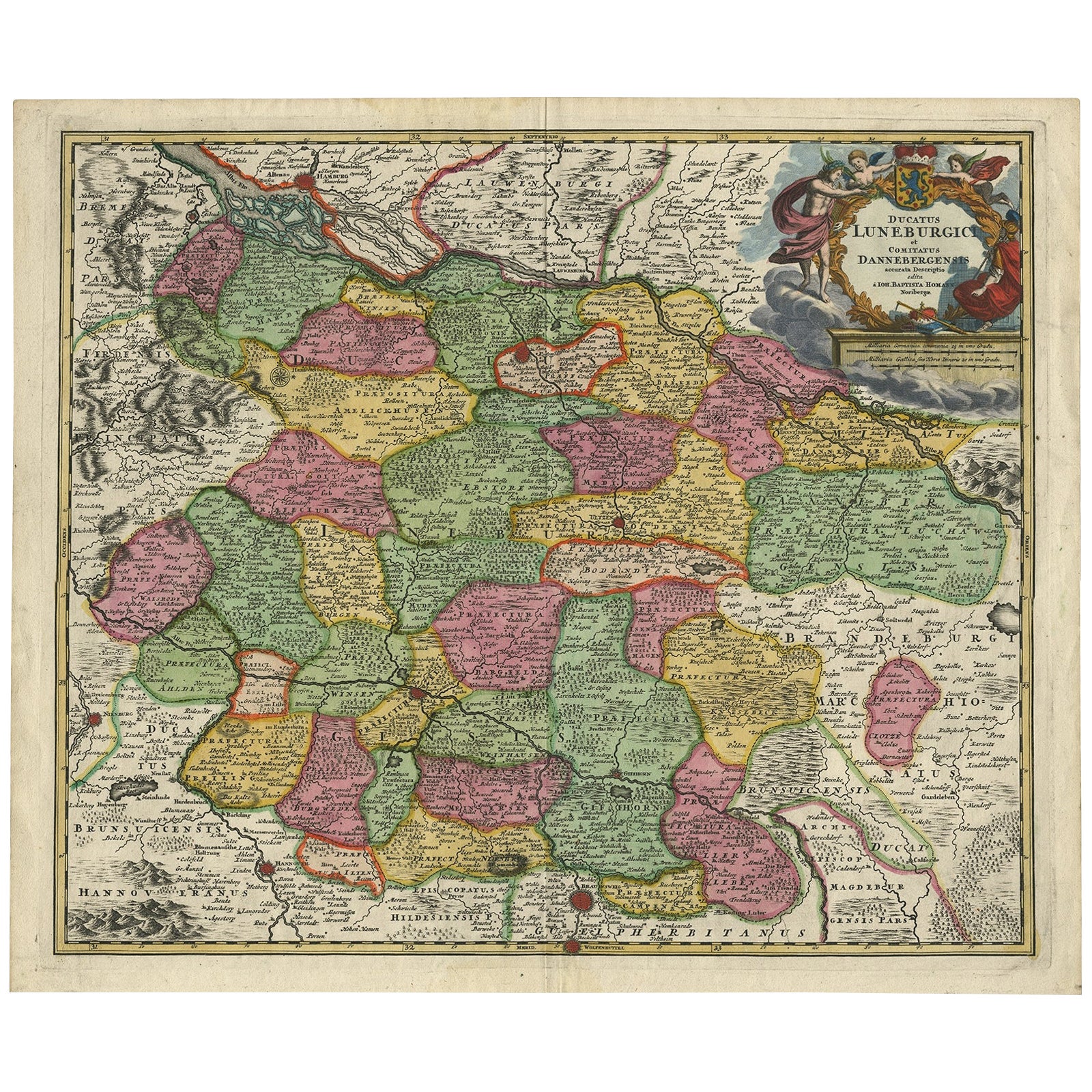
Regional Map of Germany, inc Hamburg, Luneberg, Hannover, Braunsweig etc, c.1720
Located in Langweer, NL
Antique map titled 'Ducatus Luneburgici et Comitatus Dannebergensis accurata Descriptio.'
This detailed regional map includes Hamburg, Luneberg, and as far south as Hannover, Bra...
Category
Antique 1720s Maps
Materials
Paper
$1,102 Sale Price
20% Off
Antique Map of the Westphalia region of Germany
Located in Langweer, NL
Antique map titled 'Circulus Westphaliae (..)'. Original old map of the Westphalia region, Germany. Published by Justus Danckerts, circa 1696.
Justus Danckerts I (11 November 1635 ...
Category
Antique Late 17th Century Maps
Materials
Paper

Antique Map of Northern Germany by M. Seutter, circa 1730
By Matthew Seutter
Located in Langweer, NL
Antique map titled 'Saxoniae Inferioris Circulus'. Old map of the northern part of Germany by M. Seutter. Covering the area of Lower Saxony, Mecklenburg-Vorpommern and Schleswig-Hols...
Category
Antique Mid-18th Century Maps
Materials
Paper

$565 Sale Price
20% Off
Antique Map of the Rhine and Moselle River Region in Germany and France, c.1680
Located in Langweer, NL
Antique map titled 'Tabula Geographica qui Pars Meridionalis sive Superior Rheni, Mosae et Mosellae (..).'
Detailed map of the Rhine and Moselle River regions and contigous parts...
Category
Antique 17th Century Maps
Materials
Paper

$527 Sale Price
20% Off
You May Also Like
18th Century Hand-Colored Homann Map of Germany, Including Frankfurt and Berlin
By Johann Baptist Homann
Located in Alamo, CA
An 18th century hand-colored map entitled "Tabula Marchionatus Brandenburgici et Ducatus Pomeraniae quae sunt Pars Septentrionalis Circuli Saxoniae Superioris" by Johann Baptist Homa...
Category
Antique Early 18th Century German Maps
Materials
Paper

17th Century Hand-Colored Map of a Region in West Germany by Janssonius
By Johannes Janssonius
Located in Alamo, CA
This attractive highly detailed 17th century original hand-colored map is entitled "Archiepiscopatus Maghdeburgensis et Anhaltinus Ducatus cum terris adjacentibus". It was published ...
Category
Antique Mid-17th Century Dutch Maps
Materials
Paper

Prussia, Poland, N. Germany, Etc: A Hand-colored 17th Century Map by Janssonius
By Johannes Janssonius
Located in Alamo, CA
This is an attractive hand-colored copperplate engraved 17th century map of Prussia entitled "Prussia Accurate Descripta a Gasparo Henneberg Erlichensi", published in Amsterdam by Joannes Janssonius in 1664. This very detailed map from the golden age of Dutch cartography includes present-day Poland, Latvia, Lithuania, Estonia and portions of Germany. This highly detailed map is embellished by three ornate pink, red, mint green and gold...
Category
Antique Mid-17th Century Dutch Maps
Materials
Paper

Hand Colored 18th Century Homann Map of Austria Including Vienna and the Danube
By Johann Baptist Homann
Located in Alamo, CA
"Archiducatus Austriae inferioris" is a hand colored map of Austria created by Johann Baptist Homann (1663-1724) and published in Nuremberg, Germany in 1728 shortly after his death. ...
Category
Antique Early 18th Century German Maps
Materials
Paper

1752 Vaugoundy Map of Flanders : Belgium, France, and the Netherlands, Ric.a002
Located in Norton, MA
Large Vaugoundy Map of Flanders:
Belgium, France, and the Netherlands
Colored -1752
Ric.a002
Description: This is a 1752 Didier Robert de Vaugondy map of Flanders. The map de...
Category
Antique 17th Century Unknown Maps
Materials
Paper

17th Century Nicolas Visscher Map of Southeastern Europe
Located in Hamilton, Ontario
A beautiful, highly detailed map of southeastern Europe by Nicolas Visscher. Includes regions of Northern Italy (showing the cities Bologna, Padua, and Venice), Bohemia, Austria (sho...
Category
Antique 17th Century Dutch Maps
Materials
Paper

$1,350 Sale Price
38% Off
More Ways To Browse
Antique Maps Of Sicily
Antique Celestial Maps
Antique Compass Maritime Compasses
Bengal Map
J C Walker Map
Map Of Ancient Greece
Ptolemy Map
Antique Marine Compass
Map Of Jerusalem
1820 World Map
Cyprus Antique Maps
Antique Ecuador
Antique Map Of Thailand
Antique Mississippi Map
Antique Ohio Maps
Burgundy Map
John Speed Maps
Antique Map Of Turkish Empire