Items Similar to Regional Map of Germany, inc Hamburg, Luneberg, Hannover, Braunsweig etc, c.1720
Want more images or videos?
Request additional images or videos from the seller
1 of 5
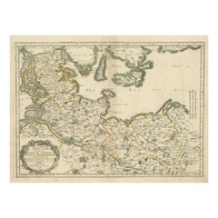
Regional Map of Germany, inc Hamburg, Luneberg, Hannover, Braunsweig etc, c.1720
About the Item
Antique map titled 'Ducatus Luneburgici et Comitatus Dannebergensis accurata Descriptio.'
This detailed regional map includes Hamburg, Luneberg, and as far south as Hannover, Braunsweig. The Aller and Elbe Rivers cut across the area. Fortified cities, small towns and monasteries fill the landscape along with topographical depictions of hills, mountains and forests. At the top right is a large title cartouche fringed by mythological figures with a coat of arms and scale of miles. Source unknown, to be determined.
Artists and Engravers: Following the long period of Dutch domination, the Homann family became the most important map publishers in Germany in the eighteenth century, the business being founded by J.B. Homann in Nuremberg about the year 1702. Soon after publishing his first atlas in 1707 he became a member of the Berlin academy of Sciences and in 1715 he was appointed Geographer to the Emperor. After the founder's death in 1724, the firm was continued under the direction of his son until 1730 and was then bequeathed to his heirs on the condition that it trades under the name of Homann Heirs. The firm remained in being until the next century and had a wide influence on map publishing in Germany. Apart from the atlases the firm published a very large number of individual maps. The Homanns produced a Neuer Atlas in 1714, a Grosser Atlas in 1737, and an Atlas Maior with about 300 maps in 1780. They also issued a special Atlas of Germany with full sized plans of principal cities, school atlases and an Atlas of Silesia in 1750 with 20 maps.
Condition: Good, given age. Original/contemporary hand coloring. Small rusty worm hole in image. A few small soft creases, mainly near the adges. Original middle fold as issued. Blank verso. General age-related toning and/or occasional minor defects from handling. Please study imagecarefully.
- Dimensions:Height: 20.67 in (52.5 cm)Width: 24.73 in (62.8 cm)Depth: 0 in (0.02 mm)
- Materials and Techniques:
- Period:1720-1729
- Date of Manufacture:circa 1720
- Condition:
- Seller Location:Langweer, NL
- Reference Number:
About the Seller
5.0
Platinum Seller
These expertly vetted sellers are 1stDibs' most experienced sellers and are rated highest by our customers.
Established in 2009
1stDibs seller since 2017
1,922 sales on 1stDibs
Typical response time: <1 hour
- ShippingRetrieving quote...Ships From: Langweer, Netherlands
- Return PolicyA return for this item may be initiated within 14 days of delivery.
More From This SellerView All
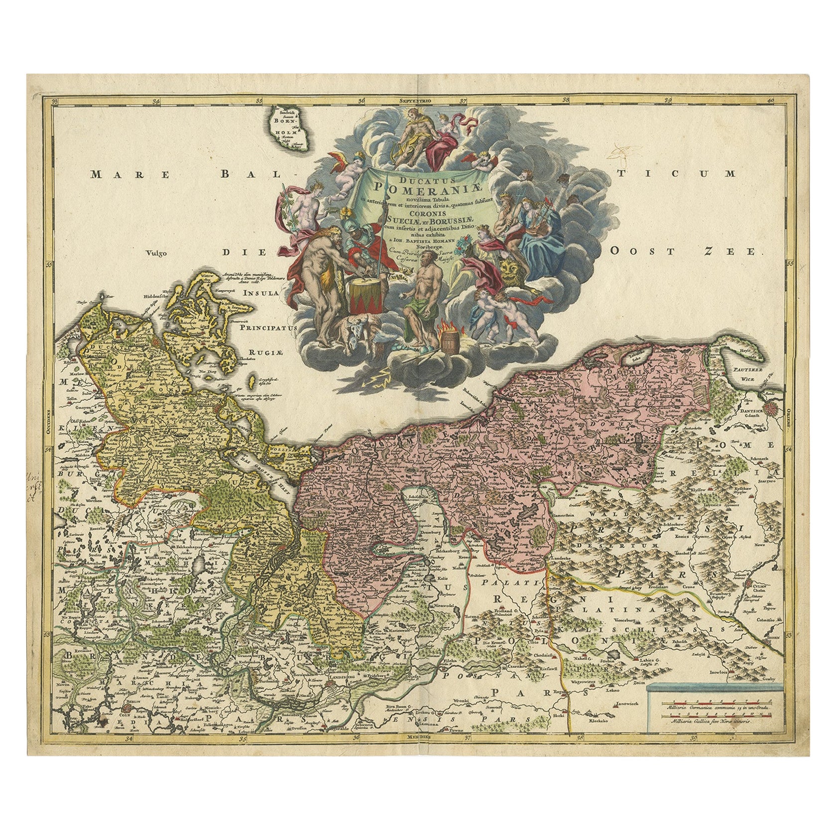
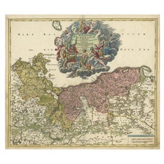
- Regional Antique Map of the Baltic, Extending from Stralsund to Dantzig, ca.1720Located in Langweer, NLAntique map titled 'Ducatus Pomeraniae (..)'. Regional map of the Baltic, extending from Stralsund and Rugia in the west to Dantzig and Culman on the Vistula in the east. Large carto...Category
Antique 1720s Maps
MaterialsPaper
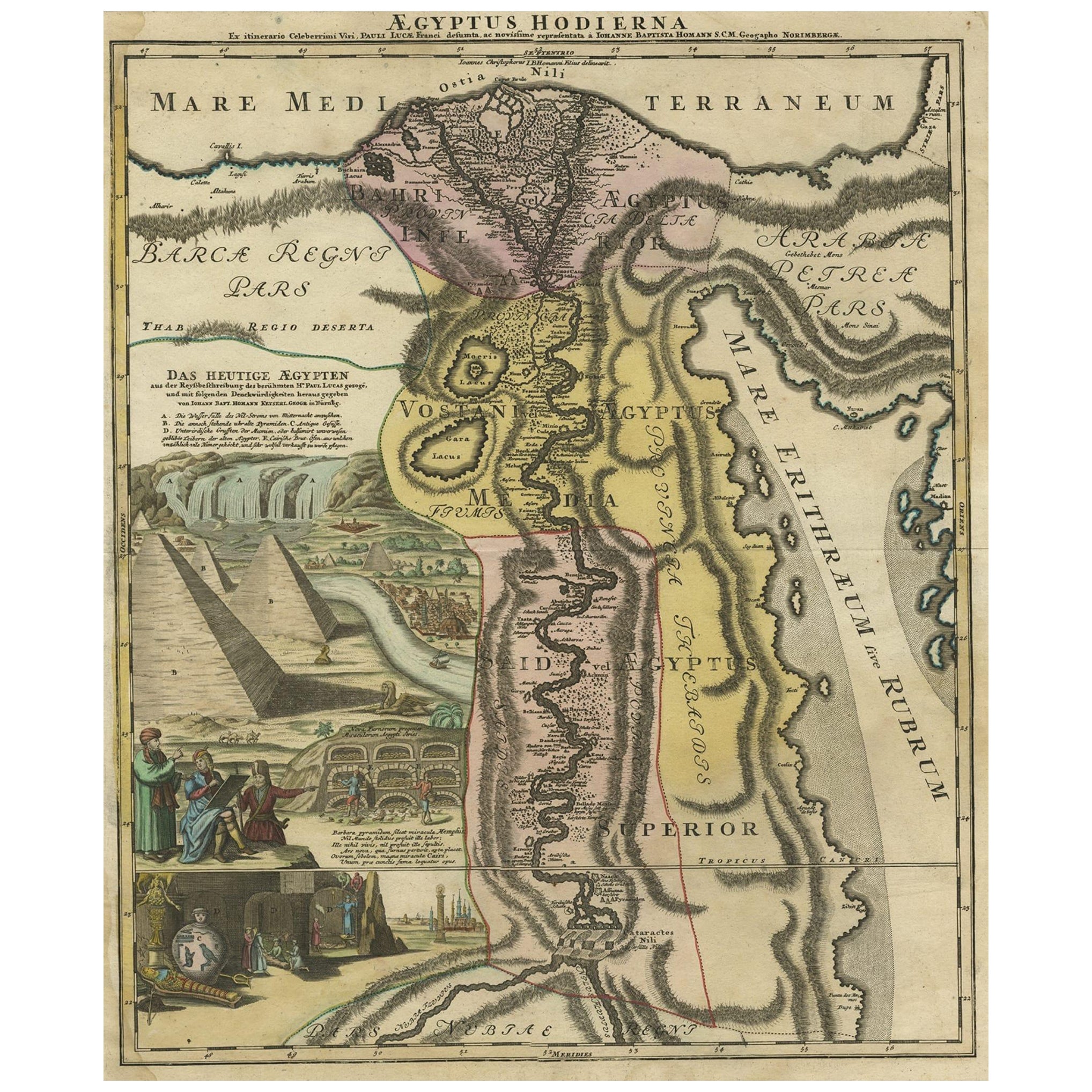
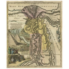
- Antique Map of Egypt and the Nile River with Sphinx, Pyramids, Etc, c.1720Located in Langweer, NLAntique map titled 'Aegyptus Hodierna Ex itinerario Celeberrimi (..)'. Original antique map of Egypt, focused on the Nile River Valley from the Mediterr...Category
Antique 18th Century Maps
MaterialsPaper
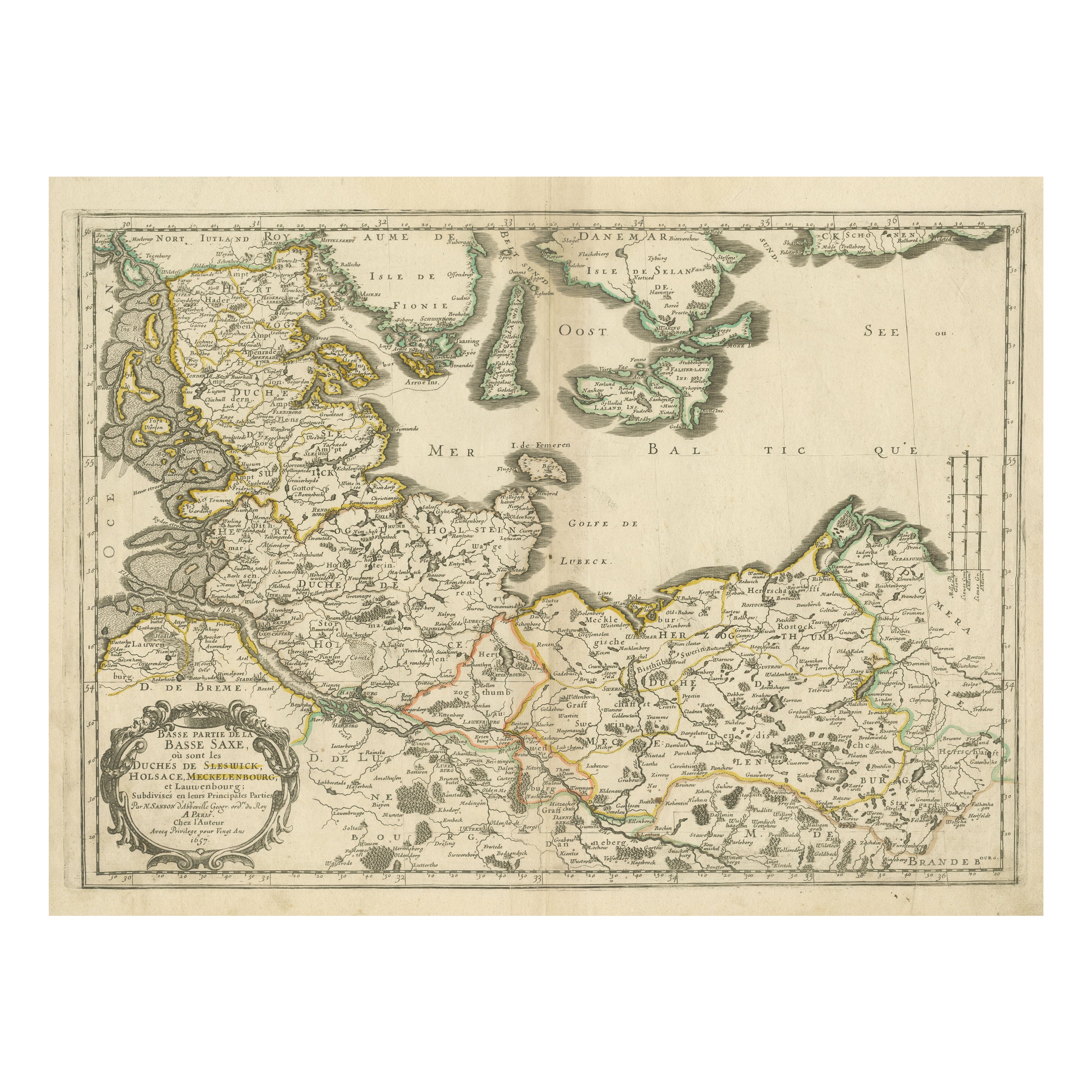
- Antique Map of Northern Germany, Including Schleswig-Holstein and HamburgLocated in Langweer, NLAntique map titled 'Basse Partie de la Basse Saxe ou sont les Duchés de Sleswick, Holsace, Meckelenbourg et Lauvenbourg (..)'. Original old map of northern Germany, including Schlesw...Category
Antique Mid-17th Century Maps
MaterialsPaper
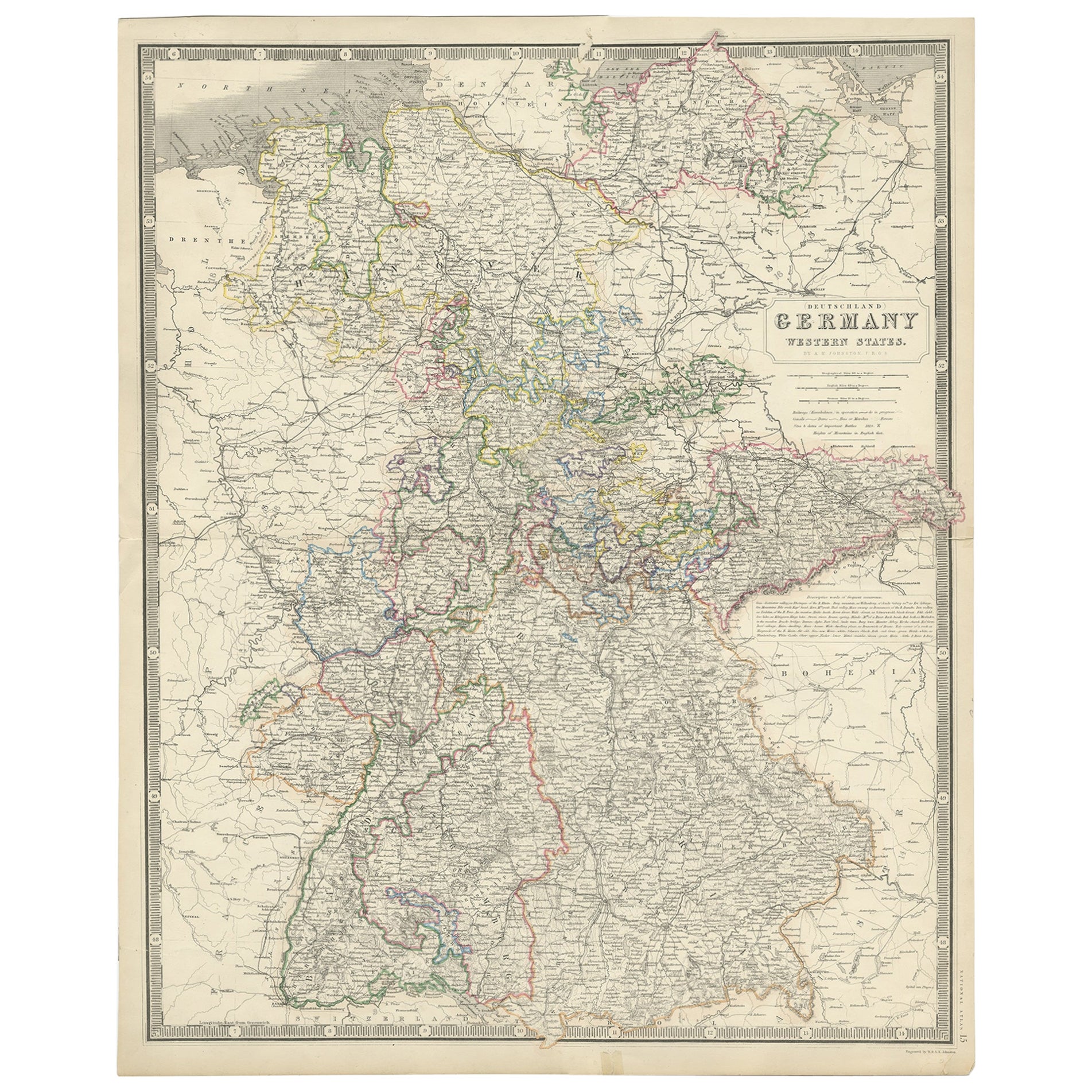
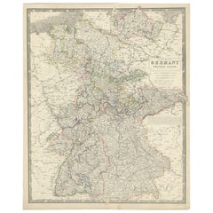
- Map of West Germany Incl Regions Wurtemberg, Bavaria, Hanover, Etc, c.1850Located in Langweer, NLAntique map titled '(Deutschland) Germany, Western States'. Map of West Germany depicting many regions including Wurtemberg, Bavaria, Hanover and others. This map originates from...Category
Antique 1850s Maps
MaterialsPaper
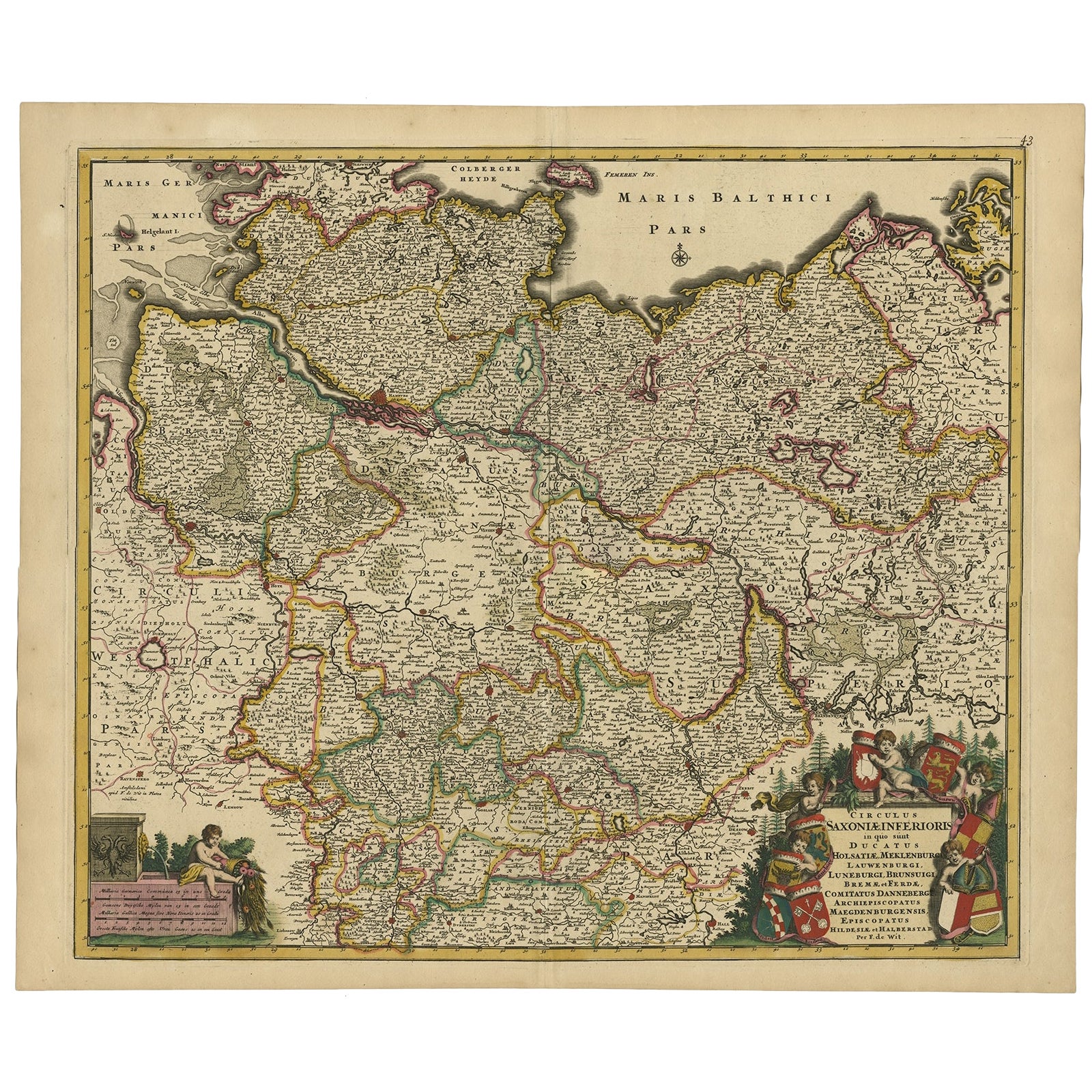
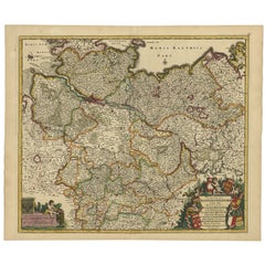
- Large Map of Germany with Berlin, Bremen, Hamburg, Osnabruck & Magdeburg, c.1680Located in Langweer, NLAntique map titled 'Circulus Saxoniae Inferioris in quo sunt Ducatus holsatiae, Meklenburg, Lauwenburgi, Luneburgi, Brunsuigi, Bremae et Ferdae (..)'. Large and detailed map fill...Category
Antique 1680s Maps
MaterialsPaper
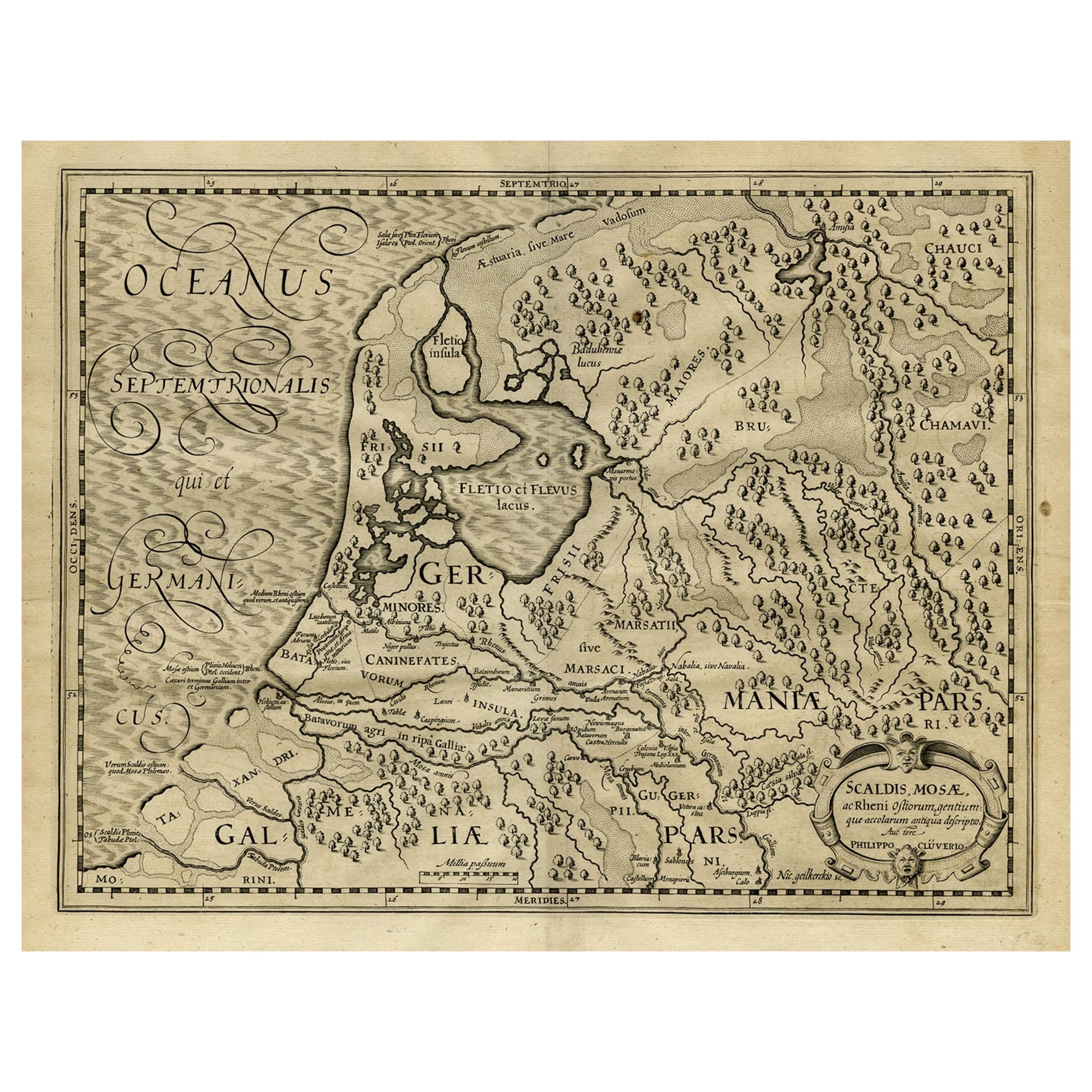
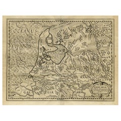
- Antique Latin Map of the Netherlands & Germany, Incl Roman Forts, Etc., 1631Located in Langweer, NLAntique map titled 'Scaldis Mosae, ac Rheni Ostiorum, gentiumque accolarum antiqua descriptio.' A Latin map of the Netherlands and Germany, showing all the major rivers as well a...Category
Antique 1630s Maps
MaterialsPaper
You May Also Like
- Prussia, Poland, N. Germany, Etc: A Hand-colored 17th Century Map by JanssoniusBy Johannes JanssoniusLocated in Alamo, CAThis is an attractive hand-colored copperplate engraved 17th century map of Prussia entitled "Prussia Accurate Descripta a Gasparo Henneberg Erlichensi", published in Amsterdam by Joannes Janssonius in 1664. This very detailed map from the golden age of Dutch cartography includes present-day Poland, Latvia, Lithuania, Estonia and portions of Germany. This highly detailed map is embellished by three ornate pink, red, mint green and gold...Category
Antique Mid-17th Century Dutch Maps
MaterialsPaper
- Antique Coaching Road Map, Devon, English, Regional Cartography, Georgian, 1720Located in Hele, Devon, GBThis is an antique coaching road map of Devon. An English, framed lithograph engraving of regional interest, dating to the early 18th century and later. Fascinating 18th century hig...Category
Antique Early 18th Century British Georgian Maps
MaterialsWood
- 17th Century Hand-Colored Map of a Region in West Germany by JanssoniusBy Johannes JanssoniusLocated in Alamo, CAThis attractive highly detailed 17th century original hand-colored map is entitled "Archiepiscopatus Maghdeburgensis et Anhaltinus Ducatus cum terris adjacentibus". It was published ...Category
Antique Mid-17th Century Dutch Maps
MaterialsPaper
- 18th Century Hand-Colored Homann Map of Germany, Including Frankfurt and BerlinBy Johann Baptist HomannLocated in Alamo, CAAn 18th century hand-colored map entitled "Tabula Marchionatus Brandenburgici et Ducatus Pomeraniae quae sunt Pars Septentrionalis Circuli Saxoniae Superioris" by Johann Baptist Homa...Category
Antique Early 18th Century German Maps
MaterialsPaper
- City View of Nuremberg, Germany: An 18th Century Hand-Colored Map by M. SeutterBy Matthew SeutterLocated in Alamo, CAAn 18th century hand-colored city view of Nuremburg, Germany entitled "Geometrischer Grundris der des Heiligen Römischen Reichs Freyen Stadt Nürnberg" by Matthaus Seutter from his "A...Category
Antique Mid-18th Century German Maps
MaterialsPaper
- Germany West of the Rhine: A Hand-colored 18th Century Map by de WitBy Frederick de WitLocated in Alamo, CAThis original 18th century hand-colored map of the county of Moers, Germany entitled "Illustrissimo Celsissmo Principi GUILIELMO HENRICO D.G. Arausionum Principi Domino suo Clementis...Category
Antique Early 18th Century Dutch Maps
MaterialsPaper


Recently Viewed
View AllMore Ways To Browse
Scale Map
German Furniture Hamburg
Large Scale Map
Topographical Map
Antique German Scales
Antique German Scale
School Maps
School Map
Antique Topographic Maps
Large City Maps
Coat Of Arms German
Antique School Map
Antique School Maps
J B Hill
Large Antique City Maps
Map Berlin
Berlin Maps
Large Original Antique City Plan