Items Similar to Original Antique Map of Central Asia by Smith, 1808

Want more images or videos?
Request additional images or videos from the seller
1 of 5
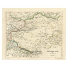
Original Antique Map of Central Asia by Smith, 1808
$226.84
$283.5520% Off
£170.03
£212.5420% Off
€192
€24020% Off
CA$311.64
CA$389.5520% Off
A$347.91
A$434.8920% Off
CHF 182.30
CHF 227.8820% Off
MX$4,258.82
MX$5,323.5220% Off
NOK 2,315.24
NOK 2,894.0520% Off
SEK 2,182.98
SEK 2,728.7220% Off
DKK 1,461.57
DKK 1,826.9720% Off
Shipping
Retrieving quote...The 1stDibs Promise:
Authenticity Guarantee,
Money-Back Guarantee,
24-Hour Cancellation
About the Item
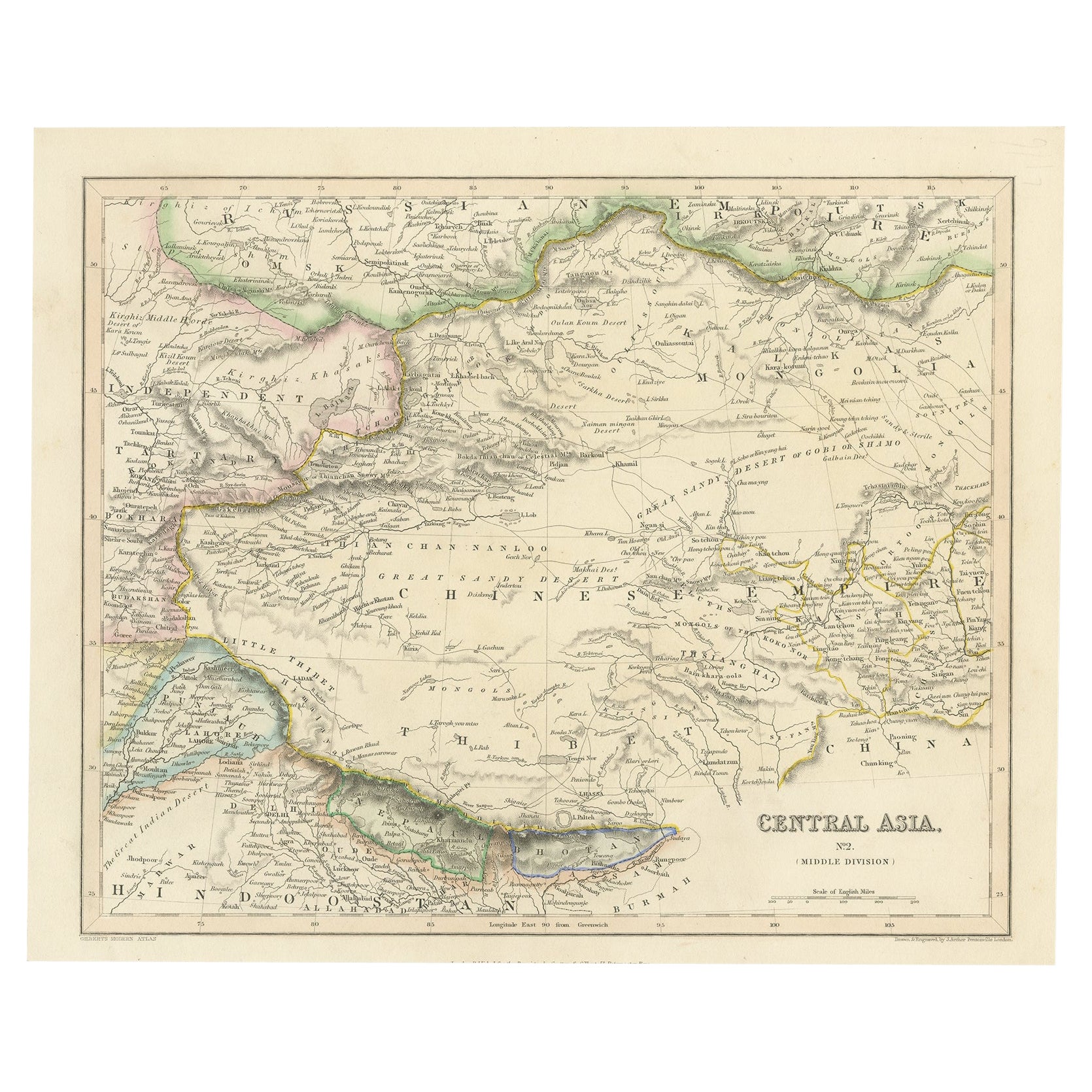
Antique map titled 'Central Asia'. Old map of central Asia originating from 'Smith's New General Atlas Containing Distinct Maps Of all the Principal Empires, Kingdoms, & States Throughout the World'.
Artists and Engravers: Published by C. Smith, London.
Condition: Good, general age-related toning. Please study image carefully.
Date: 1808
Overall size: 39.5 x 31.5 cm.
Image size: 35.5 x 26.5 cm.
We sell original antique maps to collectors, historians, educators and interior decorators all over the world. Our collection includes a wide range of authentic antique maps from the 16th to the 20th centuries. Buying and collecting antique maps is a tradition that goes back hundreds of years. Antique maps have proved a richly rewarding investment over the past decade, thanks to a growing appreciation of their unique historical appeal. Today the decorative qualities of antique maps are widely recognized by interior designers who appreciate their beauty and design flexibility. Depending on the individual map, presentation, and context, a rare or antique map can be modern, traditional, abstract, figurative, serious or whimsical. We offer a wide range of authentic antique maps for any budget.
- Dimensions:Height: 12.41 in (31.5 cm)Width: 15.56 in (39.5 cm)Depth: 0 in (0.01 mm)
- Materials and Techniques:
- Period:
- Date of Manufacture:1808
- Condition:
- Seller Location:Langweer, NL
- Reference Number:Seller: BGJC-0661stDibs: LU3054326299232
About the Seller
5.0
Recognized Seller
These prestigious sellers are industry leaders and represent the highest echelon for item quality and design.
Platinum Seller
Premium sellers with a 4.7+ rating and 24-hour response times
Established in 2009
1stDibs seller since 2017
2,511 sales on 1stDibs
Typical response time: <1 hour
- ShippingRetrieving quote...Shipping from: Langweer, Netherlands
- Return Policy
Authenticity Guarantee
In the unlikely event there’s an issue with an item’s authenticity, contact us within 1 year for a full refund. DetailsMoney-Back Guarantee
If your item is not as described, is damaged in transit, or does not arrive, contact us within 7 days for a full refund. Details24-Hour Cancellation
You have a 24-hour grace period in which to reconsider your purchase, with no questions asked.Vetted Professional Sellers
Our world-class sellers must adhere to strict standards for service and quality, maintaining the integrity of our listings.Price-Match Guarantee
If you find that a seller listed the same item for a lower price elsewhere, we’ll match it.Trusted Global Delivery
Our best-in-class carrier network provides specialized shipping options worldwide, including custom delivery.More From This Seller
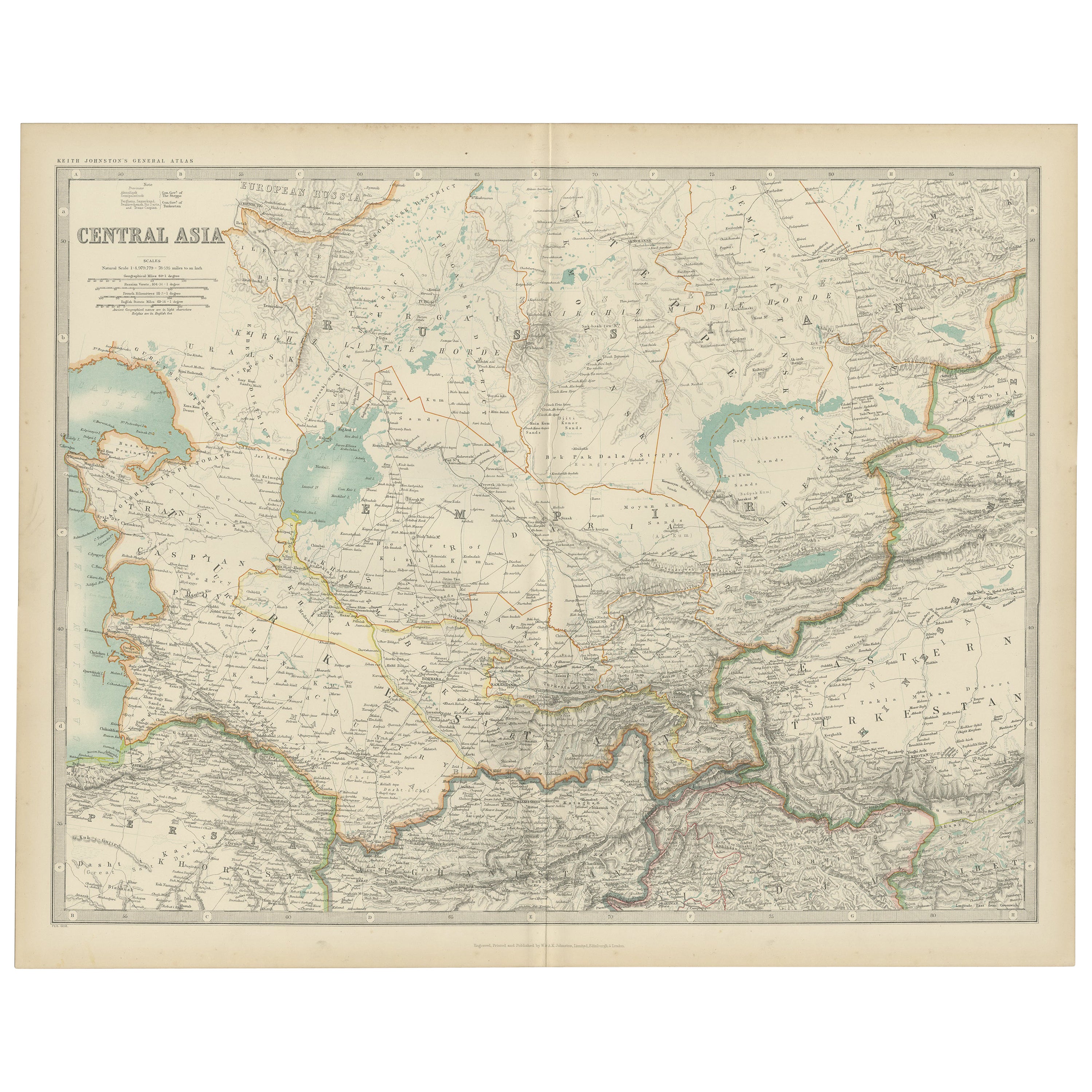
View AllAntique Map of Central Asia by Johnston '1909'
Located in Langweer, NL
Antique map titled 'Central Asia'. Original antique map of Central Asia. This map originates from the ‘Royal Atlas of Modern Geography’. Published by W. & A.K. Johnston, 1909.
Category
Early 20th Century Maps
Materials
Paper
$236 Sale Price
20% Off
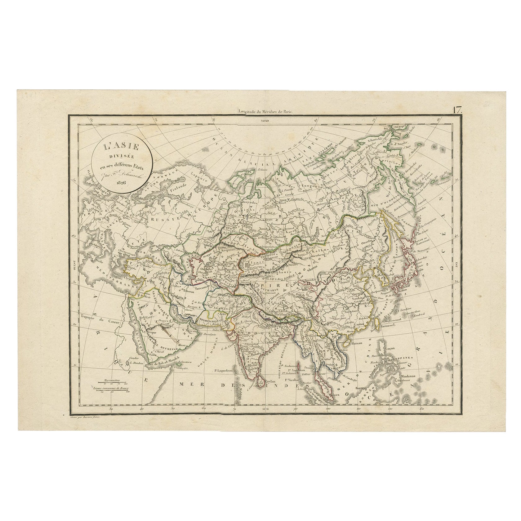
Antique Map of Asia by Delamarche, 1826
Located in Langweer, NL
Vaugondy's map plates and copyrights and later addes many plates from other sources as well. Charles Delamarche eventually passed control of the firm to his son Felix Delamarche (18t...
Category
Antique 19th Century Maps
Materials
Paper
$226 Sale Price
20% Off
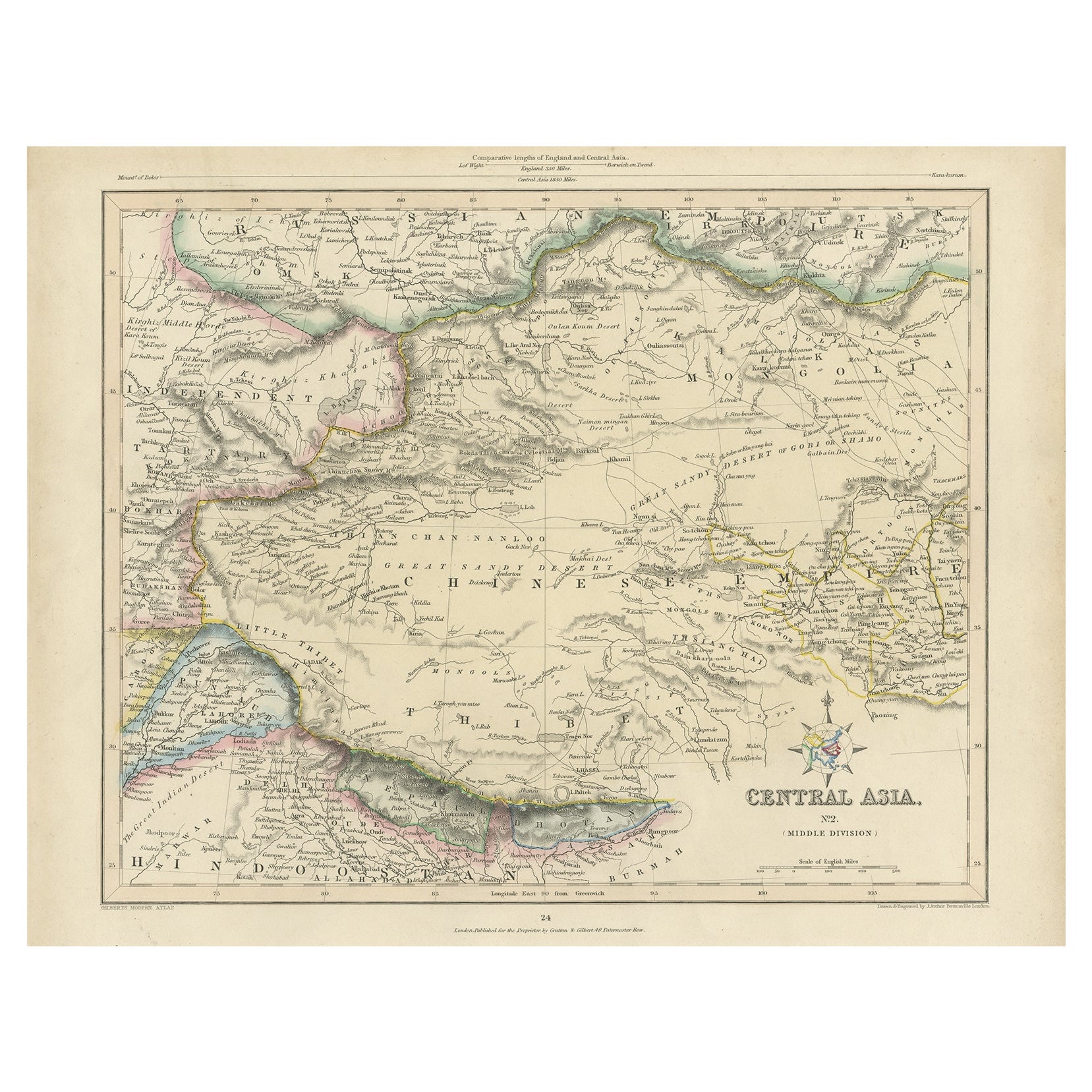
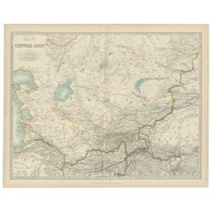
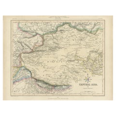
Antique Map of Central Asia, Finely Engraved, 1841
Located in Langweer, NL
Antique map titled 'Central Asia, Middle Division'. A finely engraved and attractive mid 19th Century map of Central Asia which was drawn and engraved by Joshua Archer and published ...
Category
Antique 19th Century Maps
Materials
Paper
$226 Sale Price
20% Off
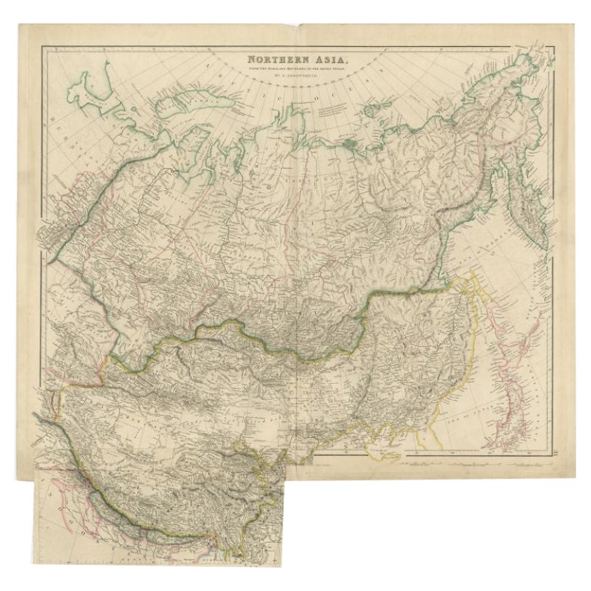
Antique Map of Northern Asia by Arrowsmith, 1834
Located in Langweer, NL
Antique map titled 'Northern Asia, from the Himalaya Mountains to the Arctic Ocean'. Large and detailed map of Northern Asia, taking in Mongolia, Tibet, Bhutan, Tartary, Siberia and ...
Category
Antique 19th Century Maps
Materials
Paper
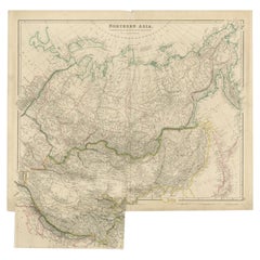
$245 Sale Price
20% Off
Steel Engraved Map of Central Asia Covering the Chinese Empire, Tibet Etc, C1843
Located in Langweer, NL
Antique map titled 'Central Asia (Middle Division)'.
Steel engraved map of Central Asia covering the Chinese Empire, Tibet and surroundings. This map originates from 'Gilberts Mo...
Category
Antique 1840s Maps
Materials
Paper
$245 Sale Price
20% Off
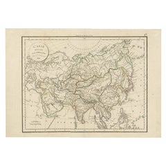
Antique Map of Asia by Lapie, 1842
Located in Langweer, NL
Antique map titled 'Carte de l'Asie'. Map of Asia. This map originates from 'Atlas universel de géographie ancienne et moderne (..)' by Pierre M. Lapie and...
Category
Antique Mid-19th Century Maps
Materials
Paper

$567 Sale Price
20% Off
You May Also Like
Original Antique Map of China, Arrowsmith, 1820
Located in St Annes, Lancashire
Great map of China
Drawn under the direction of Arrowsmith
Copper-plate engraving
Published by Longman, Hurst, Rees, Orme and Brown, 1820
Unfr...
Category
Antique 1820s English Maps
Materials
Paper

Super Rare Antique French Map of Chine and the Chinese Empire, 1780
Located in Amsterdam, Noord Holland
Super Rare Antique French Map of Chine and the Chinese Empire, 1780
Very nice map of Asia. 1780 Made by Bonne.
Additional information:
Type: Map
...
Category
Antique 18th Century European Maps
Materials
Paper

$584 Sale Price
32% Off
Large Original Antique Map of Asia by Sidney Hall, 1847
Located in St Annes, Lancashire
Great map of Asia
Drawn and engraved by Sidney Hall
Steel engraving
Original colour outline
Published by A & C Black. 1847
Unframed
Free shipping
Category
Antique 1840s Scottish Maps
Materials
Paper

Antique 1803 Italian Map of Asia Including China Indoneseia India
Located in Amsterdam, Noord Holland
Antique 1803 Italian Map of Asia Including China Indoneseia India
Very nice map of Asia. 1803.
Additional information:
Type: Map
Country of Manufacturing: Europe
Period: 19th centu...
Category
Antique 19th Century European Maps
Materials
Paper

$584 Sale Price
20% Off
1860 Large Map "Carte De La Siberie Russie D'asie, " Ric.R0001
Located in Norton, MA
Large 1860 map "Carte De La Siberie Russie D'Asie," R-0001
" Authentic" - 1860 map "Carte De La Siberie Russie D'Asie,"
Dimension: Paper: 68 cm W x 51 cm H ; Sight: 51cm W x 4...
Category
Antique 19th Century Unknown Maps
Materials
Paper

Original Antique Map of The Eastern Hemisphere by Dower, circa 1835
Located in St Annes, Lancashire
Nice map of the Eastern Hemisphere
Drawn and engraved by J.Dower
Published by Orr & Smith. C.1835
Unframed.
Free shipping
Category
Antique 1830s English Maps
Materials
Paper

More Ways To Browse
Relief Map
Antique Map Of Venice
Antique Map Of Georgia
Antique Nautical Charts
Hand Painted Antique Map
Antique Maps New Zealand
Antique Maps Persia
Map Railroad
Mariner Furniture
Vintage Glass Map
Antique Furniture Cyprus
Antique Linen Map
Caribbean Colonial Furniture
Antique Maps West Indies
California Island Map
Pirate Antique
Map Of Holy Land
Antique Blackwood Furniture