18th Century and Earlier Maps
to
2,337
2,903
64
2,970
26
12
1
1
2,970
2,281
475
3
290
34
10
126
10
37
9
2
5
4
3
3
2,956
30
20
3
3
348
114
91
81
52
2,970
2,970
2,970
59
21
13
12
12
Period: 18th Century and Earlier
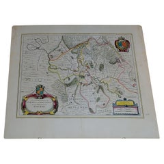
1656 "La Souverainete de Sedan et de Raucourt, et la Prevoste de Doncheri Ric004
Located in Norton, MA
1656 map entitled
"La Souverainete de Sedan et de Raucourt, et la Prevoste de Doncheri,"
Hand Colored
Ric0004.
Description:
Lovely map centered on Sedan and Doncheri an...
Category
Dutch Antique 18th Century and Earlier Maps
Materials
Paper
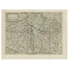
Antique Map of the Kingdom of Bohemia by Keizer & de Lat, 1788
Located in Langweer, NL
Antique map titled 't Koninkryk Bohemen (..)'. Uncommon original antique map of the Kingdom of Bohemia. This map originates from 'Nieuwe Natuur- Geschied- en Handelkundige Zak- en Re...
Category
Antique 18th Century and Earlier Maps
Materials
Paper
$331 Sale Price
20% Off
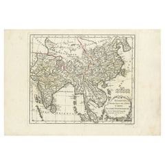
Antique Map of Southeast Asia by Dussy, 1778
Located in Langweer, NL
"Antique map titled 'Indostan presqu'isles de l'Inde, Chine, Tartarie Independante.' - A map of Asia: Hindustan, India and China. This map originates from 'Nouvel Atlas Portatif dest...
Category
Antique 18th Century and Earlier Maps
Materials
Paper
$208 Sale Price
20% Off
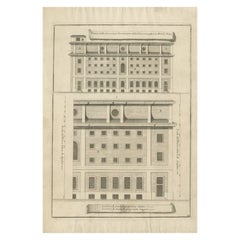
Antique Print of Ospizio Apostolico di San Michele by De Rossi, c.1710
Located in Langweer, NL
Antique print titled 'Fianco delle Carceri per Correzzione della Giouentu poste à S. Michele à Ripa'. Old print of the Ospizio di San Michele a Ripa Grande (Hospice of St Michael) or...
Category
Antique 18th Century and Earlier Maps
Materials
Paper
Rare Authentic Engraved Map of Large Part of Indonesia by Stavorinus, 1779
Located in Langweer, NL
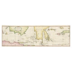
Antique map titled 'Carte de la Navigation de Batavia a Amboina'. Rare chart of Indonesia including Borneo, Java, Celebes, Ceram and more. This map originates from 'Voyage par le Cap...
Category
Antique 18th Century and Earlier Maps
Materials
Paper
$700 Sale Price
20% Off
Antique Map of France under the Reign of Charles VII by Zannoni, 1765
Located in Langweer, NL
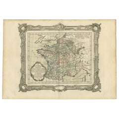
Antique map France titled 'La France sous le Règne de Charles VII (..)'.
Beautiful old map of France. This map originates from 'Atlas Historique de la ...
Category
Antique 18th Century and Earlier Maps
Materials
Paper
$150 Sale Price
20% Off
Antique Map of Northern India by Bonne, 1780
Located in Langweer, NL
Antique map titled 'Carte de la partie Supérieure de l'Inde (..)'. A fine example of Rigobert Bonne and Guilleme Raynal?s 1780 map of northern India. Covers the northern part of Indi...
Category
Antique 18th Century and Earlier Maps
Materials
Paper
Map of Southeast Asia, Extending from India to Tibet & Japan to New Guinea, 1640
Located in Langweer, NL
Antique map titled 'India quae Orientalis dicitur et Insulae adiacentes'.
Map of Southeast Asia, extending from India to Tibet to Japan to New Guinea. This map is one of the firs...
Category
Antique 18th Century and Earlier Maps
Materials
Paper
$2,512 Sale Price
20% Off
Antique Map of the Region of Vermandois and Cappelle, France by Janssonius, 1657
Located in Langweer, NL
Antique map of France titled 'Descriptio Veromanduorum - Gouvernement de la Cappelle'. Two detailed maps of France on one sheet.
The Vermandois map is centered on the Oyse and So...
Category
Antique 18th Century and Earlier Maps
Materials
Paper
$635 Sale Price
20% Off
Antique Map of the City of Enkhuizen by Guicciardini, 1625
Located in Langweer, NL
Antique map titled 'Die Stadt Enchuijsen, La ville denchuijsen'. Map of Enkhuizen, Noord-Holland, The Netherlands. Oiginates from the 1625 edition of 'Discrittione di tutti i Paesi B...
Category
Antique 18th Century and Earlier Maps
Materials
Paper
$289 Sale Price
20% Off
Antique Map of the Islands of Macian and Bacian by De Bry, 1619
Located in Langweer, NL
Antique map titled 'Delineatio Insularum Macian et Bacian'. Depicts the islands Macian and Bacian. Originates from 'Americae pars Undecima (..) by J.T. de Bry, 1619.
Artists and E...
Category
Antique 18th Century and Earlier Maps
Materials
Paper
$180 Sale Price
20% Off
Antique Map of the Maluku Islands by Van der Aa, 1714
Located in Langweer, NL
Antique Map Moluccas titled 'Les Isles Moluques'. Rare map of the Spice Islands made after a map engraved by Pieter van den Keere and published in the 1628 edition of the Mercator At...
Category
Antique 18th Century and Earlier Maps
Materials
Paper
$188 Sale Price
20% Off
Antique Print of Palazzo Barberino by De Rossi, c.1710
Located in Langweer, NL
Antique print titled 'Camino nella sala del Palazzo Barberino (..)'. Old print of a fireplace in the hall of Palazzo Barberino, Rome. This print originates from 'Studio d'architettur...
Category
Antique 18th Century and Earlier Maps
Materials
Paper
Pl. 11 Antique Print of the Mansion of Viscount Charlemont by Le Rouge, c.1785
Located in Langweer, NL
Antique print titled 'Plan de la Casine du Vicomte Charlemont a Marino'. Copper engraving showing the mansion of Viscount Charlemont in Marino. This print originates from 'Jardins An...
Category
Antique 18th Century and Earlier Maps
Materials
Paper
Antique Architectural Print of Palazzo Dei Conservatori by De Rossi, c.1710
Located in Langweer, NL
Antique print titled 'Finestra che serve per Nichia nel ripiano della scala del Palazzo (..)'. Old print of a window in Palazzo dei Conservatori, Rome. This print originates from 'St...
Category
Antique 18th Century and Earlier Maps
Materials
Paper
Pl. 40 Antique Print of Charlottenborg Palace, c.1790
Located in Langweer, NL
Antique print titled 'Facade du Château de Charlottenbourg'. Architecture print of Charlottenborg Palace, a large town mansion located on the corner of Kongens Nytorv and Nyhavn in C...
Category
Antique 18th Century and Earlier Maps
Materials
Paper
$113 Sale Price
20% Off
Antique Map of Turkey with Cyprus and Greece Islands by N. Sanson, circa 1652
Located in Langweer, NL
Antique map of Turkey, Anatolie with Cyprus and the Greece islands. Attractive scrolled title cartouche to top right corner. Blank verso.
Category
Antique 18th Century and Earlier Maps
Materials
Paper
Antique Map of the Rhineland and Lotharingen by Tirion, c.1740
By Isaak Tirion
Located in Langweer, NL
Antique map titled 'Nieuwe Kaart van de Opper en Neder Rhynse Kreits nevens het Hertogdom Lotharingen.' Attractive detailed map showing the Rheinland (Rhineland) and Lotharingen, Ger...
Category
Antique 18th Century and Earlier Maps
Materials
Paper
$258 Sale Price
20% Off
Antique Map of the Expedition of Govert Knol by Van Schley, 1765
Located in Langweer, NL
Antique map titled 'Plan de l' expédition de Mr. le Commiss. re Govert Knol, forti de Soerabaja, pour aller recévoir Pangerang Depati Anom. / Aftékening der Expeditie van de H. r Commiss. is Govert Knol , uyt Soerabaya , tot afhaalinge van Pangerang Depati Anom'. Map showing the expedition...
Category
Antique 18th Century and Earlier Maps
Materials
Paper
$113 Sale Price
20% Off
Antique Print of Richmond Place by Woolfe, c.1770
Located in Langweer, NL
Antique print titled 'Elevation of Sir Asgill's Villa at Richmond in Surry (..)'. Plan and facade of Richmond Place or Asgill House, Richmond, London. This print originates from 'Vit...
Category
Antique 18th Century and Earlier Maps
Materials
Paper
Antique Print of the Church of Leiden by Van Mieris, 1784
Located in Langweer, NL
Antique print titled 'Platte grond en opstal van de Nieuw Gefundeerde kerk, in de Waard te Leyden, van de z. zijde te zien'. Old engraving of the church of Leiden, the Netherlands. It shows a view and floorplan. This print originates from 'Beschryving der Stad Leyden (..)' by F. van Mieris...
Category
Antique 18th Century and Earlier Maps
Materials
Paper
$84 Sale Price
20% Off
Antique Map of South America Depicting Guayana, c.1780
Located in Langweer, NL
Antique map titled 'La Guyane Francopise avec partie de la Guyane Hollandoise: suivant les Operations et les Cartes recentes des Ingenieurs-Geographes Francois'. Antique map of South...
Category
Antique 18th Century and Earlier Maps
Materials
Paper
$331 Sale Price
20% Off
Antique Map of the Routes of Jean-françois de Galaup to Asia, 1787
Located in Langweer, NL
Antique map titled 'Suite de la Route des Vaisseaux Francois'. Antique map of the routes of Jean-François de Galaup to Asia (Jakarta, Indonesia). This map originates from 'World atla...
Category
Antique 18th Century and Earlier Maps
Materials
Paper
$322 Sale Price
20% Off
Antique Map of South America by Keizer & de Lat, 1788
Located in Langweer, NL
Antique map titled 'Kaartje van het Zuider-Deel van America'. Uncommon original antique map of South America. This map originates from 'Nieuwe Natuur- Geschied- en Handelkundige Zak-...
Category
Antique 18th Century and Earlier Maps
Materials
Paper
$379 Sale Price
20% Off
Antique French Map of Java, Indonesia by Chatelain, '1719'
Located in Langweer, NL
Antique map titled 'Carte de l'Ile de Java: Partie Occidentale, Partie Orientale, Dressee tout Nouvellement Sur Les Memoires Les Plus Exacts (..)'. This beautiful map of Java (Indone...
Category
Antique 18th Century and Earlier Maps
Materials
Paper
$2,654 Sale Price
20% Off
Colorful and Decorative Miniature Map of India, Ceylon by Bertius 1616
Located in Langweer, NL
Old 17th century miniature antique map of India - Ceylon from the 1616 edition of Jadocus Hondius Atlas by Petrus Bertius. Original copperplate engraving with hand coloring.
Carto...
Category
Antique 18th Century and Earlier Maps
Materials
Paper
$369 Sale Price
20% Off
Antique Map of the Artois Region 'France' by F. de Wit, circa 1680
Located in Langweer, NL
Antique map titled 'Tabula Comitatus Artesiae emendata'. Large map of the Artois region, France. Published by F. de Wit, circa 1680.
Category
Antique 18th Century and Earlier Maps
Materials
Paper
$511 Sale Price
25% Off
Antique Map of the Region of Soissons in France, 1737
Located in Langweer, NL
Untitled map of the region of Soissons, France. This map originates from 'Nieuw en beknopt Kaart-Boekje vertoonende de XVII. Nederlandse Provintien (..)'.
Artists and Engravers: A...
Category
Antique 18th Century and Earlier Maps
Materials
Paper
$121 Sale Price
20% Off
Antique Map of the Region of Perce and Blois by Janssonius, 1657
Located in Langweer, NL
Antique map of France titled 'Perchensis Comitatus - Comitatus Blesensis'. Decorative map of Perce region and the region of Blois. This map originates from 'Atlas Novus, Sive Theatru...
Category
Antique 18th Century and Earlier Maps
Materials
Paper
$325 Sale Price
20% Off
Detailed Original Antique Map of Thuringia, Germany by J. Janssonius, ca.1650
Located in Langweer, NL
Antique map titled 'Thuringiae Nova Descriptio.' Detailed map of Thuringia, Germany by J. Janssonius. With one cartouche, coat-of-arms and a mileage scale. With Erfurt in the centre....
Category
Antique 18th Century and Earlier Maps
Materials
Paper
$635 Sale Price
20% Off
Antique Map of the Northern Portion of the Philippines by J.N. Bellin, 1764
Located in Langweer, NL
Detailed map of the Northern portion of the Philippines, extending from Batanes and Babuyanes to Mindonoro and Masbate, and centered on Luzon. One of the most detailed maps of the pe...
Category
Antique 18th Century and Earlier Maps
Materials
Paper
$260 Sale Price
16% Off
Antique Map of Oberlausitz by Homann Erben, '1746'
Located in Langweer, NL
Antique map titled 'Geographische Verzeichnung des Budissinischen Creises (..) - Carte du Cercle de Budissin (..)'. Copper engraved map of Oberlausitz, a historical region of Saxony ...
Category
Antique 18th Century and Earlier Maps
Materials
Paper
$426 Sale Price
20% Off
Antique Print of the Rhine River, Leiden, The Netherlands, c.1800
Located in Langweer, NL
Antique print titled 'Rhyn gesigt langs de Tuynen by de Hoogewoerts Poort'. Old print depicting with a view on the Rhine river, the Netherlands. This print...
Category
Antique 18th Century and Earlier Maps
Materials
Paper
$161 Sale Price
20% Off
Original Copper Engraved Antique Print of a Chapel and Menagerie, c.1785
Located in Langweer, NL
Antique print titled 'Vue de la Chapelle et Menagerie'. Copper engraving showing a chapel and menagerie.
This print originates from 'Jardins Anglo-Chinois à la Mode' by Georg Lou...
Category
Antique 18th Century and Earlier Maps
Materials
Paper
$303 Sale Price
20% Off
Antique Map of the Region of Bourbonnais by Janssonius, circa 1640
Located in Langweer, NL
Antique map titled 'Bourbonois - Borbonium Ducatus'. Old map of the former region of Bourbonnais, France. It includes the cities of Bourbon, Moulins, Charenton, Brulles, Varennes and...
Category
Antique 18th Century and Earlier Maps
Materials
Paper
$474 Sale Price
20% Off
Antique Map of Italy by Keizer & de Lat, 1788
Located in Langweer, NL
Antique map titled 'Kaart van Italie (..)'. Uncommon original antique map of Italy. This map originates from 'Nieuwe Natuur- Geschied- en Handelk...
Category
Antique 18th Century and Earlier Maps
Materials
Paper
$310 Sale Price
25% Off
Antique Map of France by Mortier 'c.1730'
Located in Langweer, NL
Antique map titled 'Galliae Antiquae Tabula'. Original antique map of France in ancient times. Published by P. Mortier, circa 1730.
Category
Antique 18th Century and Earlier Maps
Materials
Paper
$1,066 Sale Price
25% Off
Fort Hollandois De Paliacate Nommé Le Fort De Gueldre, Bellin, 1751
Located in Langweer, NL
Antique print, titled: ?Fort Hollandois de Paliacate nommé le Fort de Gueldre?. Published for Antonine de Prevost d' Exile's Histoire generale des voyages. Artists and Engravers: Jac...
Category
Antique 18th Century and Earlier Maps
Materials
Paper
$113 Sale Price
20% Off
Antique Map of the Northern Coast of Africa and Southern Europe, circa 1745
Located in Langweer, NL
Antique map titled 'In Notitiam Ecclesiasticam Africae Tabula Geographica'. Very decorative hand-colored map of the northern coast of Africa, Spain, Italy and the Mediterranean with the islands of Sardinia, Corsica, Majorca, Minorca etc. Sicily features a smoking Mount Aetna. Embellished with three architectural cartouches...
Category
Antique 18th Century and Earlier Maps
Materials
Paper
$303 Sale Price
67% Off
Antique Map of the City of Harlingen by Janssonius, c.1657
Located in Langweer, NL
Antique map titled ‘Harlingen‘. This map depicts the city of Harlingen (Friesland, The Netherlands). Published by J. Janssonius, Amsterdam, c.1657.
Artists and Engravers: Johannes...
Category
Antique 18th Century and Earlier Maps
Materials
Paper
$398 Sale Price
20% Off
Antique Map of Juan Fernandez Island by Anson '1749'
Located in Langweer, NL
Antique map titled 'l'Ile de Juan Fernandes dans la Mer du Sud (..) - Het Eiland Juan Fernandes in de Zuid Zee (..)'. This map depicts Juan Fernandez Island in the Southern Sea. This...
Category
Antique 18th Century and Earlier Maps
Materials
Paper
$189 Sale Price
20% Off
Antique Map of the Baarderadeel Township, 1718
Located in Langweer, NL
Antique map Friesland titled 'Baardera Deel de Vierde Grietenije van Wester Goo (..)'. Old map of Friesland, the Netherlands. This map depicts the region of B...
Category
Antique 18th Century and Earlier Maps
Materials
Paper
$350 Sale Price
20% Off
Antique Map of St. Andries 'Heerewaarden' by Orlers, 1615
Located in Langweer, NL
Antique map titled 'Prata Inundata'. This map depicts the area between the Maas and Waal river (The Netherlands) during the siege of St. Andries and Voorne under command of prince Ma...
Category
Antique 18th Century and Earlier Maps
Materials
Paper
$169 Sale Price
20% Off
Antique Map of Java and Part of Borneo, Indonesia, c.1657
Located in Langweer, NL
Antique map titled 'Insulae Iavae cum parte insularum Boreno Sumatrae (..)'.
Beautiful map of the island of Java and part of Borneo, Bali, Madura and Sumatra. With decorative carto...
Category
Antique 18th Century and Earlier Maps
Materials
Paper
$2,607 Sale Price
20% Off
Rare Antique Map of the Route from Maiden Bridge to Dulverton, England, c.1720
By Bowen
Located in Langweer, NL
Antique map titled 'Bridgewater, Bruton'.
Double sided road strip map showing the route from Maiden Bridge to Dulverton, via Bruton, Weston Regis, Bridgewater and Dulverton. This map originates from 'Britannia Depicta or Ogilby Improv'd' by J. Owen and E. Bowen.
Artists and Engravers: The Owen and Bowen road strip maps were based on the far larger ones done by John Ogilby in the 1670s. Each map was finely engraved by Emanuel Bowen, who was one of the most renowned and prolific map makers of the 18th century. The maps also had the added feature of copius amounts of information, written by John Owen...
Category
Antique 18th Century and Earlier Maps
Materials
Paper
$132 Sale Price
20% Off
Decorative Print of Scheveningen in Holland, before the All Saints Flood, 1720
Located in Langweer, NL
Antique print titled 'In 't jaer van t'seventich ende vijftienhondert ghebeurdet hier t'Schevelinge (..)'.
View of the city of Scheveningen, the Netherlands, before the All Saint...
Category
Antique 18th Century and Earlier Maps
Materials
Paper
$616 Sale Price
20% Off
Antique Map of the City of Harlingen by Merian, c.1655
Located in Langweer, NL
Antique map titled 'Harlingen'. Original antique map of the city of Harlingen, Friesland, the Netherlands. With German legend. This map originates from 'Topographia Circuli Burgundic...
Category
Antique 18th Century and Earlier Maps
Materials
Paper
$82 Sale Price
20% Off
Antique Map of the City of Stavoren by Merian, 1659
Located in Langweer, NL
Antique map titled 'Staveren'. Original antique map of the city of Stavoren, Friesland, the Netherlands. This map originates from 'Topographia Germania Inferioris' by C. Merian. Publ...
Category
Antique 18th Century and Earlier Maps
Materials
Paper
$146 Sale Price
20% Off
Antique Map of the City of Alkmaar by Merian, 1659
Located in Langweer, NL
Antique map titled 'Alckmaer'. This print depicts the city of Alkmaar (The Netherlands). This print originates from 'Topographia Germaniae Inferioris (..)' by C. Merian. Artists and ...
Category
Antique 18th Century and Earlier Maps
Materials
Paper
$93 Sale Price
20% Off
Antique Map of the City of Enkhuizen by Merian, 1659
Located in Langweer, NL
Antique map titled 'Enckhuysen'. This print depicts the city of Enkhuizen, the Netherlands. This print originates from 'Topographia Germaniae Inferioris (..)' by C. Merian. Artists a...
Category
Antique 18th Century and Earlier Maps
Materials
Paper
$116 Sale Price
20% Off
Antique Map of the Bukhari and Surroundings by Bellin, 1749
Located in Langweer, NL
Antique map titled 'Carte de la Petite Bukharie et Pays Voisins'. Old map of the Bukhari (Sinkiang in north-western China) and neighboring countries. Artists and Engravers: Jacques-N...
Category
Antique 18th Century and Earlier Maps
Materials
Paper
$132 Sale Price
20% Off
Antique Map of Stavoren by Merian, c.1650
Located in Langweer, NL
Antique map titled 'Stavera'. Map of the city of Stavoren, Friesland. With German legend. Trimmed, originally published on one sheet with a map of Bolsward and Hindeloopen. Artists a...
Category
Antique 18th Century and Earlier Maps
Materials
Paper
$132 Sale Price
20% Off
'Waste Paper is Burned to Ashes', a Satire Print on the South Sea Bubble, 1720
Located in Langweer, NL
Antique print titled 'Des Kladpapieren Waerelds vuur in as verkeerd'. 'The world of waste paper is burned to ashes', a satire on the South Sea Bubble.
The oval central image shows a group containing kings, churchmen, rich and poor surrounding a globe. The four corner images are: (TL) the death of Adonis; (TR) the death of Bacchus; (BL) King Midas sitting at a table with his food turning into gold...
Category
Antique 18th Century and Earlier Maps
Materials
Paper
$407 Sale Price
20% Off
Antique Map of the Banda Islands by Commelin, 1646
Located in Langweer, NL
Plate 15: 'Afteeckeninge van 't Eyland Banda.' Depiction of the Banda Islands, Indonesia. Rare. This attrative plate originates from: 'Title: Waerachtigh verhael van de Schipvaerd op Oost-Indien Ghedaen by de acht Schepen in den jare 1598. van Amsterdam uyt-gezeylt, onder 't beleyd van den Admirael Jacob Cornelissoon van Neck...
Category
Antique 18th Century and Earlier Maps
Materials
Paper
$334 Sale Price
20% Off
Antique Print of the Ob River and Villages in Siberia, Russia, 1768
Located in Langweer, NL
Antique print titled 'Vue de Schorskarskoi - Pogost (..)'. Copper engraving of the Ob river and villages in Siberia. This print originates from volume 18 of 'Histoire generale des vo...
Category
Antique 18th Century and Earlier Maps
Materials
Paper
$208 Sale Price
20% Off
Antique Map of the Menaldumadeel Township 'Friesland' by Halma, 1718
Located in Langweer, NL
Antique map Friesland titled 'Menalduma Deel Wesentlyk vertoont (..)'. Old map of Friesland, the Netherlands. This map depicts the region of Menaldumadeel and includes cities and vil...
Category
Antique 18th Century and Earlier Maps
Materials
Paper
$312 Sale Price
20% Off
Antique Map of the Holy Land by Van Luchtenburg, c.1720
Located in Langweer, NL
Antique map titled 'Heylige Land verdeeld in de Twaalf Stammen Israels (..).' Highly detailed map of the Holy Land divided into 12 tribes of Israel...
Category
Antique 18th Century and Earlier Maps
Materials
Paper
$132 Sale Price
20% Off
Antique Map of Oostergo by Tirion, 1744
Located in Langweer, NL
Antique map titled 'Oostergo'. Original antique map of Oostergo, part of the province of Friesland, the Netherlands. Published 1744. Artists and Engravers: Isaak Tirion (1705 in Utre...
Category
Antique 18th Century and Earlier Maps
Materials
Paper
$179 Sale Price
20% Off
Tomb of King Edward IV – Engraving of Vault & Effigy, St George’s Chapel, 1790
Located in Langweer, NL
Tomb of King Edward IV – Engraving of Vault & Effigy, St George’s Chapel, 1790
This rare and atmospheric antique engraving captures the tomb and burial vaul...
Category
English Antique 18th Century and Earlier Maps
Materials
Paper
$184 Sale Price
20% Off
Large Copper Engraved Map of the Coastline of Friesland and Terschelling, c.1670
Located in Langweer, NL
Antique print, titled: 'Dominii Frisiae Tabula, inter Flevum et Lavicum (…)'
This large copper engraved map details the coastline of Friesland and Terschelling. At east is a part...
Category
Antique 18th Century and Earlier Maps
Materials
Paper
$843 Sale Price
20% Off
