Mid-19th Century Maps
to
579
841
36
877
56
8
2
2,936
2,283
475
3
290
34
10
126
10
37
9
2
5
4
3
3
853
55
28
4
4
228
106
62
58
55
877
877
877
104
4
2
1
1
Period: Mid-19th Century
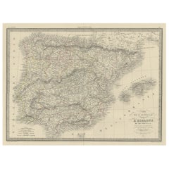
Antique Decorative Map of Portugal and Spain, 1842
Located in Langweer, NL
Antique map titled 'Carte de la Peninsule comprenant l'Espagne et le Portugal'.
Map of Spain and Portugal. This map originates from 'Atlas universel de géographie ancienne et mod...
Category
Antique Mid-19th Century Maps
Materials
Paper
$342 Sale Price
20% Off
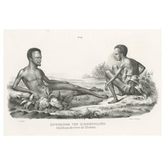
Old Print Depicting Inhabitants of Van Diemen's Land, Tasmania, Australia, c1845
Located in Langweer, NL
Antique print titled 'Bewohner von Diemensland, Habitans de terre de Diemen'.
This print depicts inhabitants of Van Diemen's Land, Tasmania/Australia. O...
Category
Antique Mid-19th Century Maps
Materials
Paper
$323 Sale Price
20% Off
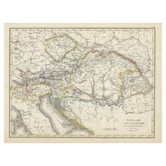
Original Antique Map of Austria from an Old Dutch School Atlas, 1852
Located in Langweer, NL
Antique map titled 'Het Keizerrijk Oostenrijk'.
Map of the Austrian Empire. This map originates from 'School-Atlas van alle deelen der Aarde' by Otto Petri...
Category
Antique Mid-19th Century Maps
Materials
Paper
$180 Sale Price
20% Off
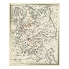
Antique Map of Russia in Europe and Poland from an d Old Dutch Atlas, 1852
Located in Langweer, NL
Description: Antique map titled 'Europeesch Rusland en Polen'.
Map of Russia in Europe and Poland. This map originates from 'School-Atlas van alle deelen der Aarde' by Otto Petri...
Category
Antique Mid-19th Century Maps
Materials
Paper
$114 Sale Price
20% Off
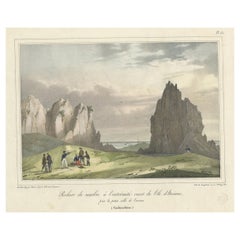
Old Print Depicting the Marble Mountain Rock of Hoi An, Vietnam, c.1840
Located in Langweer, NL
Description: Antique print Vietnam titled 'Rochers de marbre à l'extrémité ouest de l'Ile d'Hoïane, près de la petite ville de Tourane en Cochinchine'.
Old print depicting the marble mountain rock of Hoi An...
Category
Antique Mid-19th Century Maps
Materials
Paper
$323 Sale Price
20% Off
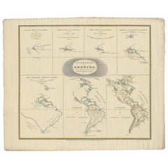
Interesting Antique Map of the Development of the Mapping of the America's, 1841
Located in Langweer, NL
Title: "De ontdekking van Amerika. Voorgesteld in eene reeks geschiedkundige kaarten".
Collection of hand-colored engraved maps by D. VEELWAARD on 1 sheet, "Dertiende aflevering,...
Category
Antique Mid-19th Century Maps
Materials
Paper
$1,188 Sale Price
20% Off
Hong Kong Chinese Temple Print – Antique Architectural View from 1856
Located in Langweer, NL
Description: Antique print titled ‘Chinese Temple Hong-Kong‘. View of the Chinese temple in Hong Kong. This print originates from 'Narrative of the expedition of an American squadron...
Category
Antique Mid-19th Century Maps
Materials
Paper
$275 Sale Price
20% Off
1859 Antique Swiss Panorama: Blackie's Detailed Map of Switzerland
Located in Langweer, NL
The "Antique Map of Switzerland" is a distinguished piece from 'The Imperial Atlas of Modern Geography', published in 1859 by the renowned cartographer W. G. Blackie. This map presen...
Category
Antique Mid-19th Century Maps
Materials
Paper
$207 Sale Price
30% Off
1859 Detailed Map of North West Germany with Bavaria Inset - Blackie's Atlas
Located in Langweer, NL
The "Antique Map of North West Germany" with an inset map of Bavaria is a distinguished piece from 'The Imperial Atlas of Modern Geography', published i...
Category
Antique Mid-19th Century Maps
Materials
Paper
$207 Sale Price
30% Off
Antique Map of the Shores of The Baltic Sea by W. G. Blackie, 1859
Located in Langweer, NL
Antique map titled 'The shores of The Baltic sea and of the Gulfs of Bothnia & Finland'. Original antique map of the Shores of the Baltic Sea. This map originates from ‘The Imperial ...
Category
Antique Mid-19th Century Maps
Materials
Paper
$166 Sale Price
20% Off
Antique Map of China by W. G. Blackie, 1859
Located in Langweer, NL
Antique map titled 'China'. Original antique map of China. This map originates from ‘The Imperial Atlas of Modern Geography’. Published by W. G. Blackie, 1859.
Category
Antique Mid-19th Century Maps
Materials
Paper
$237 Sale Price
20% Off
Antique Map of Australia and New Zealand by W. G. Blackie, 1859
Located in Langweer, NL
Antique map titled 'Australia and New Zealand'. Original antique map of Australia and New Zealand with inset map of the Torres Strait. This map originates from ‘The Imperial Atlas of...
Category
Antique Mid-19th Century Maps
Materials
Paper
$237 Sale Price
20% Off
Antique Map of Peru and Bolivia by W. G. Blackie, 1859
Located in Langweer, NL
Antique map titled 'Peru and Bolivia'. Original antique map of Peru and Bolivia. This map originates from ‘The Imperial Atlas of Modern Geography’. Publish...
Category
Antique Mid-19th Century Maps
Materials
Paper
$237 Sale Price
20% Off
Antique Map of La Plata, Chili, by W. G. Blackie, 1859
Located in Langweer, NL
Antique map titled 'La Plata, Chili, Paraguay, Uruguay and Patagonia'.
Original antique map of La Plata, Chili, Paraguay, Uruguay and Patagonia with inset m...
Category
Antique Mid-19th Century Maps
Materials
Paper
$237 Sale Price
20% Off
Set of 2 Antique Maps of Russia in Europe by W. G. Blackie, 1859
Located in Langweer, NL
Antique map titled 'Russia in Europe'. Original antique map of Russia in Europe with inset maps of the Russian Empire in Europe, Asia and America and the acquisition of Russia since ...
Category
Antique Mid-19th Century Maps
Materials
Paper
$380 Sale Price / set
20% Off
1859 Vintage Maps of England and Wales: Blackie's Imperial Geographic Detail
Located in Langweer, NL
The "Antique Map of England & Wales" from 'The Imperial Atlas of Modern Geography', published by W. G. Blackie in 1859, is an original antique map that provides a detailed depiction ...
Category
Antique Mid-19th Century Maps
Materials
Paper
$380 Sale Price / set
20% Off
Antique Map of South Pacific Ocean by W. G. Blackie, 1859
Located in Langweer, NL
Antique map titled 'South Pacific Ocean'. Original antique map of South Pacific Ocean with inset Map of Tahiti. This map originates from ‘The Imperial Atlas of Modern Geography’. Pub...
Category
Antique Mid-19th Century Maps
Materials
Paper
$237 Sale Price
20% Off
Antique Map of Asia by Balbi '1847'
Located in Langweer, NL
Antique map titled 'Asie'. Original antique map of Asia. This map originates from 'Abrégé de Géographie (..)' by Adrien Balbi. Published 1847.
Category
Antique Mid-19th Century Maps
Materials
Paper
$190 Sale Price
20% Off
Antique Map of India and Southeast Asia by Balbi '1847'
Located in Langweer, NL
Antique map titled 'India en deçà et au delà du Gange'. Original antique map of India and Souteast Asia. This map originates from 'Abrégé de Géographie (..)' by Adrien Balbi. Publish...
Category
Antique Mid-19th Century Maps
Materials
Paper
$142 Sale Price
20% Off
Antique Map of the British Isles by Balbi '1847'
Located in Langweer, NL
Antique map titled 'Iles Britanniques'. Original antique map of the British Isles. This map originates from 'Abrégé de Géographie (..)' by Adrien Balbi. ...
Category
Antique Mid-19th Century Maps
Materials
Paper
$142 Sale Price
20% Off
Antique County Map, Lancashire, English, Framed Lithography, Cartography, C.1860
Located in Hele, Devon, GB
This is an antique lithography map of Lancashire. An English, framed atlas engraving of cartographic interest, dating to the mid 19th century and later.
Superb lithography of Lanca...
Category
British Victorian Antique Mid-19th Century Maps
Materials
Glass, Wood, Paper
Antique Map Showing the Division and Distribution of Birds by Johnston '1850'
Located in Langweer, NL
Antique map titled 'Geographical division and distribution of birds over the world and birds of Europe'. Original antique map showing the geographical ...
Category
Antique Mid-19th Century Maps
Materials
Paper
$190 Sale Price
20% Off
Antique Map Showing the Division and Distribution of Mammals by Johnston '1850'
Located in Langweer, NL
Antique map titled 'Geographical division and distribution of mammiferous animals of the orders rodentia and ruminantia over the globe'. Original antique map showing geographical div...
Category
Antique Mid-19th Century Maps
Materials
Paper
$190 Sale Price
20% Off
Antique Map Showing the Division and Distribution of Mammals by Johnston '1850'
Located in Langweer, NL
Antique map titled 'Geographical division and distribution of mammiferous animals of the orders quadrumana, edentata, marsupialia & pachydermata'. Original antique map showing the ge...
Category
Antique Mid-19th Century Maps
Materials
Paper
$154 Sale Price
35% Off
Antique Map Showing the Division & Distribution of Carnivora by Johnston '1850'
Located in Langweer, NL
Antique map titled 'Geographical division and distribution of carnivorous animals'. Original antique map showing the geographical division and distribution of carnivora. This map ori...
Category
Antique Mid-19th Century Maps
Materials
Paper
$190 Sale Price
20% Off
Antique Rain Map of the World by Johnston '1850'
Located in Langweer, NL
Antique map titled 'Hyetographic or Rain Map of the World'. Original antique rain map of the world. This map originates from 'The Physical Atlas of Natural Phenomena' by A.K. Johnsto...
Category
Antique Mid-19th Century Maps
Materials
Paper
$190 Sale Price
20% Off
Antique Map Showing the Distribution of the Currents of Air by Johnston '1850'
Located in Langweer, NL
Antique map titled 'Geographical Distribution of the Currents of Air'. Original antique map showing the distribution of the currents of air. This map originates from 'The Physical At...
Category
Antique Mid-19th Century Maps
Materials
Paper
$190 Sale Price
20% Off
Antique Map of the River Systems of America by Johnston, '1850'
Located in Langweer, NL
Antique map titled 'The River Systems of America showing the boundaries and comparative extent of the river basins'. Original antique map of the river systems of America. This map or...
Category
Antique Mid-19th Century Maps
Materials
Paper
$190 Sale Price
20% Off
Antique Map of the River Systems of Europe and Asia by Johnston '1850'
Located in Langweer, NL
Antique map titled 'The River Systems of Europe and Asia showing the boundaries and comparative extent of the river basins'. Original antique map of the river systems of Europe and A...
Category
Antique Mid-19th Century Maps
Materials
Paper
$190 Sale Price
20% Off
Antique Tidal Chart of the British Seas by Johnston, '1850'
Located in Langweer, NL
Antique map titled 'Tidal Chart of the British Seas showing the progress of the wave of high water'. Original antique tidal chart of the British Seas. This map originates from 'The P...
Category
Antique Mid-19th Century Maps
Materials
Paper
$190 Sale Price
20% Off
Antique Map of Bas-Rhin ‘France’ by V. Levasseur, 1854
Located in Langweer, NL
Antique map titled 'Dépt. du Bas Rhin'. Map of the French department of Bas-Rhin, France. Part of the Alsace wine region surrounding Strasbourg. This mountainous area on the west ban...
Category
Antique Mid-19th Century Maps
Materials
Paper
$166 Sale Price
20% Off
Antique Map of Loire ‘France’ by V. Levasseur, 1854
Located in Langweer, NL
Antique map titled 'Dépt. de la Loire'. Map of the French department of Loire, France. This area of France is part of the Loire Valley wine growing region...
Category
Antique Mid-19th Century Maps
Materials
Paper
$190 Sale Price
20% Off
Antique Map of the Mountain Chains of Europe and Asia by Johnston '1850'
Located in Langweer, NL
Antique map titled 'The Mountain chains of the Europe and Asia '. Original antique map of the mountain chains of Europe and Asia. This map originates from 'The Physical Atlas of Natu...
Category
Antique Mid-19th Century Maps
Materials
Paper
$190 Sale Price
20% Off
Antique Map of China and Japan by Wyld '1845'
Located in Langweer, NL
Antique map titled 'Map of the Empires of China and Japan'. Original antique map of China and Japan. This map originates from 'An Atlas of the World, Comprehending Separate Maps of i...
Category
Antique Mid-19th Century Maps
Materials
Paper
$213 Sale Price
40% Off
Antique Map of Turkey in Europe by Wyld, '1845'
Located in Langweer, NL
Antique map titled 'Turkey in Europe'. Original antique map of Turkey in Europe. This map originates from 'An Atlas of the World, Comprehending S...
Category
Antique Mid-19th Century Maps
Materials
Paper
$190 Sale Price
20% Off
Antique Map of Europe by Wyld '1845'
Located in Langweer, NL
Antique map titled 'Europe'. Original antique map of Europe. This map originates from 'An Atlas of the World, Comprehending Separate Maps of its ...
Category
Antique Mid-19th Century Maps
Materials
Paper
$142 Sale Price
20% Off
Antique Map of France in Departments by Wyld '1845'
Located in Langweer, NL
Antique map titled 'France in Departments'. Original antique map of France. This map originates from 'An Atlas of the World, Comprehending Separate Maps of its...
Category
Antique Mid-19th Century Maps
Materials
Paper
$190 Sale Price
20% Off
Antique Map of New South Wales 'Australia' by Wyld '1845'
Located in Langweer, NL
Antique map titled 'British Settlements in New South Wales'. Original antique map of New South Wales, Australia. This map originates from 'An Atlas of ...
Category
Antique Mid-19th Century Maps
Materials
Paper
$237 Sale Price
20% Off
Antique Map of Turkey in Asia by Wyld '1845'
Located in Langweer, NL
Antique map titled 'Map of Turkey in Asia'. Original antique map of Turkey in Asia. This map originates from 'An Atlas of the World, Comprehendin...
Category
Antique Mid-19th Century Maps
Materials
Paper
$190 Sale Price
20% Off
Antique Map of the Kingdom of the Netherlands by Wyld '1845'
Located in Langweer, NL
Antique map titled 'Holland & Belgium formerly Kingdom of the Netherlands'. Original antique map of the Kingdom of the Netherlands. This map originates from 'An Atlas of the World, C...
Category
Antique Mid-19th Century Maps
Materials
Paper
$190 Sale Price
20% Off
1840 Map of the City of Washington Published by William M. Morrison
Located in Colorado Springs, CO
This map, printed in 1840, is a detailed representation of Washington, D.C. in the mid-19th century. The map shows block numbers, wards, and government buildings as well as details o...
Category
American Federal Antique Mid-19th Century Maps
Materials
Paper
Antique Map of Egypt and Arabia Petraea by Lowry, '1852'
Located in Langweer, NL
Antique map titled 'Egypt and Arabia Petrea'. Original map of Egypt and Arabia Petraea. This map originates from 'Lowry's Table Atlas constructed and engraved from the most recent Au...
Category
Antique Mid-19th Century Maps
Materials
Paper
$95 Sale Price
20% Off
Antique Map of New South Wales by Lowry, '1852'
Located in Langweer, NL
Antique map titled 'New South Wales north'. Original map of New South Wales, Australia. This map originates from 'Lowry's Table Atlas constructed and e...
Category
Antique Mid-19th Century Maps
Materials
Paper
$95 Sale Price
20% Off
Antique Map of India, Afghanistan, Balochistan and surroundings by Lowry, '1852'
Located in Langweer, NL
Antique map titled 'India, Afghanistan, Beloochistan, Birmah & C'. Four individual sheets of India, Afghanistan, Baluchistan and surroundings. This map originates from 'Lowry's Table...
Category
Antique Mid-19th Century Maps
Materials
Paper
$237 Sale Price / set
20% Off
Antique Map of Nubia and Abyssina by Lowry, 1852
Located in Langweer, NL
Antique map titled 'Nubia and Abyssina'. Two individual sheets of Nubia and Abyssina. This map originates from 'Lowry's Table Atlas constructed and engraved from the most recent auth...
Category
Antique Mid-19th Century Maps
Materials
Paper
$142 Sale Price / set
20% Off
Antique Map of the Region of the Bay of Bengal by Lowry, 1852
Located in Langweer, NL
Two individual sheets of the region of the Bay of Bengal. This map originates from 'Lowry's table Atlas constructed and engraved from the most recent aut...
Category
Antique Mid-19th Century Maps
Materials
Paper
$142 Sale Price / set
20% Off
Antique Map of West Africa by Lowry, 1852
Located in Langweer, NL
Antique map titled 'West Africa'. Three individual sheets of West Africa. This map originates from 'Lowry's table Atlas constructed and engraved from the most recent authorities' by ...
Category
Antique Mid-19th Century Maps
Materials
Paper
$237 Sale Price / set
20% Off
Antique Map of Turkey in Asia by Lowry '1852'
Located in Langweer, NL
Antique map titled 'Turkey in Asia, Georgia & Western Persia'. Two individual sheets of Turkey in Asia. This map originates from 'Lowry's Table Atlas constructed and engraved from th...
Category
Antique Mid-19th Century Maps
Materials
Paper
$142 Sale Price / set
20% Off
Antique Map of the Southern Hemipshere by Lowry '1852'
Located in Langweer, NL
Antique map titled 'Perspective Projection of The World on the horizon of London'. Original map of the southern hemisphere.
This map originates from 'Lowry's Table Atlas constructe...
Category
Antique Mid-19th Century Maps
Materials
Paper
$142 Sale Price
20% Off
Antique Map of Northern Asia by Lowry, 1852
Located in Langweer, NL
Antique map titled 'North Asia'. Original map of Northern Asia. This map originates from 'Lowry's Table Atlas constructed and engraved from the most recent authorities' by J.W. Lowry...
Category
Antique Mid-19th Century Maps
Materials
Paper
$95 Sale Price
20% Off
Antique Map of Russia in Asia by Tallis, '1851'
Located in Langweer, NL
Antique map titled 'Russia in Asia'. Map of Russia in Asia. Showing vignettes of a polar hunting scene, Skorskarskoi Pagost, Troitsk and Kamchatkan Dogs. Originates from 'The Illustr...
Category
Antique Mid-19th Century Maps
Materials
Paper
$261 Sale Price
20% Off
Antique Map of New South Wales by Tallis, circa 1851
Located in Langweer, NL
Antique map titled 'New South Wales'. Decorative and detailed map of New South Wales which was drawn and engraved by J. Rapkin (vignettes by H. Warren ...
Category
English Antique Mid-19th Century Maps
Materials
Paper
$332 Sale Price
20% Off
Antique Map of Asia by Lapie, 1842
Located in Langweer, NL
Antique map titled 'Carte de l'Asie'. Map of Asia. This map originates from 'Atlas universel de géographie ancienne et moderne (..)' by Pierre M. Lapie and...
Category
Antique Mid-19th Century Maps
Materials
Paper
$570 Sale Price
20% Off
Antique Map of India and Ceylon by Lapie, 1842
Located in Langweer, NL
Antique map titled 'Carte de l'Inde en deca et au dela du Gange'. Map of India and Ceylon (Sri Lanka). This map originates from 'Atlas universel de géographie ancienne et moderne (.....
Category
Antique Mid-19th Century Maps
Materials
Paper
$522 Sale Price
20% Off
Antique Map of the region near Annesley Bay by Wagner, 1870
Located in Langweer, NL
Antique print titled 'Map of the Country between Annesley Bay and Senafe'. Map of the region near Annesley Bay (Gulf of Zula, Bay of Arafali), Eritrea, Africa. The bay is located abo...
Category
Antique Mid-19th Century Maps
Materials
Paper
$166 Sale Price
20% Off
Antique Map of Ariège ‘France’ by V. Levasseur, 1854
Located in Langweer, NL
Antique map titled 'Dépt. de l'Ariège'. Map of the French department of Ariege, France. This area of France is known for its production of semi-soft and mild cheeses, such as Bethmal...
Category
Antique Mid-19th Century Maps
Materials
Paper
$171 Sale Price
20% Off
Antique Map of Haute Loire ‘France’ by V. Levasseur, 1854
Located in Langweer, NL
Antique map titled 'Dépt. de la Haute Loire'. Map of the French department of Haute Loire, France. This area of France is part of the Loire Valley wine gro...
Category
Antique Mid-19th Century Maps
Materials
Paper
$190 Sale Price
20% Off
Antique Map of Du Nord ‘France’ by V. Levasseur, 1854
Located in Langweer, NL
Antique map titled 'Dépt. du Nord'. Map of the French department of Nord, France. This area is known for its production of Maroilles, a cow's milk cheese. This cheese is produced in ...
Category
Antique Mid-19th Century Maps
Materials
Paper
$190 Sale Price
20% Off
Antique Map of Moselle ‘France’ by V. Levasseur, 1854
Located in Langweer, NL
Antique map titled 'Dépt. de la Moselle'. Map of the French department of Moselle, France. This area, part of the Alcase-Lorraine wine region, is known for its production of wines by...
Category
Antique Mid-19th Century Maps
Materials
Paper
$171 Sale Price
20% Off
Antique Map of Morbihan ‘France’ by V. Levasseur, 1854
Located in Langweer, NL
Antique map titled 'Dépt. du Morbihan'. Map of the French department of Morbihan, France. This map originates from ‘Atlas National de la France Illustré’. Published by A. Combette, P...
Category
Antique Mid-19th Century Maps
Materials
Paper
$171 Sale Price
20% Off
Recently Viewed
View AllMore Ways To Browse
Bavarian Porcelain Vases
Beer Tankard
Bjorn L
Black Cabinet With Flowers And Birds
Black Tansu Chest
Blue Morpho
Blue Opaline Crystal Vases
Bow Front Buffet
Boy And Girl Statues
Brass Donkey
Brass Hound
Bread Oven
Bronze Atlas Sculpture
Bronze Door Stop
Bronze Shakespeare Sculpture
Buddha Bell
Bull Terrier
Butlers Chest
