Hand-Painted Maps
to
1
13
4
17
3
1
1
1
8
9
15
7
4
3
3
10
5
5
5
5
17
17
17
1
1
1
Technique: Hand-Painted
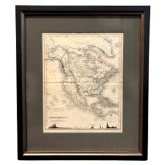
1846 "North America" Map, Engraved by I. Dower
Located in Colorado Springs, CO
Presented is an original 1846 map of “North America.” The map was drawn and engraved by I. Dower and published in London by Orr & Company. The map depicts North America, to include G...
Category
1840s English Victorian Antique Hand-Painted Maps
Materials
Paper
Colored wall map of the WORLD
By Chambon
Located in ZWIJNDRECHT, NL
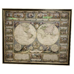
“Mappe Monde, contenant les Parties Connues du Globe Terrestre”
CHAMBON, Gobert-Denis (France, 17.. - 1781)
Paris, Longchamps et Janvier, 1754
Size H. 115 x W. 145 cm.
Gobert-Denis Chambon made copper engraving after the work of Guillaume De L’Isle, published in 1754 by Jean Janvier and S.G. Longschamps.
A huge wall map of the world in two hemispheres printed on two sheets, depicting the Eastern and Western hemispheres supported by two male figures, decorated at the bottom right and left with two celestial hemispheres (boreal and southern) and at the bottom in the middle with an armillary sphere, in addition.
This map is most notable for its depiction of the Sea of Japan labeled "Mer de Corée" and of "Mer de L'Ouest" or Sea of the West - a great sea, easily the size of the Mediterranean, to flow from the then-known Strait of Juan de Fuca...
Category
Mid-18th Century French French Provincial Antique Hand-Painted Maps
Materials
Wood, Paper
$28,477 Sale Price
20% Off
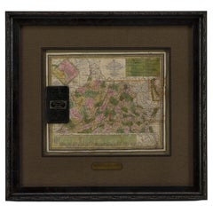
1837 Mitchell's "Tourist's Pocket Map of the State of Virginia" by J.H. Young
Located in Colorado Springs, CO
This is J. H. Young's pocket map of the Virginia, which shows county development current to 1835. The map was engraved by E. Yeager and F. Dankworth and published by S. A. Mitchell. ...
Category
1830s American Antique Hand-Painted Maps
Materials
Paper
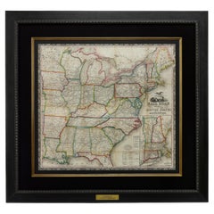
1866 Ensign & Bridgman's Rail Road Map of the United States
Located in Colorado Springs, CO
Presented is an 1866 issue of “Ensign & Bridgeman’s Rail Road Map of the United States, showing Depots & Stations.” First published in 1856, this is the third edition, following anot...
Category
1860s American Late Victorian Antique Hand-Painted Maps
Materials
Paper
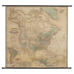
1868 "Lloyd's Topographical Railway Map of North America..." Hanging Wall Map
Located in Colorado Springs, CO
Presented is “Lloyd's Topographical Railway Map of North-America, or the United States Continent in 1900.” This map was published by J. T. Lloyd, in New York, in 1868. A large, hangi...
Category
1860s American Late Victorian Antique Hand-Painted Maps
Materials
Linen, Paper
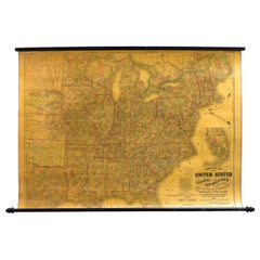
1863 "Lloyd's New Map of the United States, the Canadas, and New Brunswick"
Located in Colorado Springs, CO
Presented is “Lloyd's New Map of the United States, the Canadas and New Brunswick, From the latest Surveys, Showing Every Railroad & Station Finished to June 1863, and the Atlantic and Gulf Coasts.” A large, Civil War-era hanging map of the United States and adjacent territories, this map covers the area from the Atlantic Ocean and extends as far west as the 103 meridian, to “Dacotah,” Nebraska, Kansas, "Indian Territory," and Texas. The southern continuation of Florida is shown in an inset map along the right margin. This map was published by J. T. Lloyd, in New York, in 1863. According to the publisher’s marking at lower right, this map was originally issued in two states: "in Sheets, Colored" for 50 cents, and "Varnished nicely, with Rollers" for $1.
Throughout the map, the counties are colored and the towns and cities well labeled. A reference key in the bottom margin provides symbols for railroads, turnpikes and wagon roads, state capitals, cities and towns, and village post offices. As emphasized in the map’s title, this map is especially notable for the countless railway lines and stations depicted, with distances noted between points, listing “every railroad and finished station to June 1863.” Additionally, two shipping agents and their routes are drawn out of New York City. The map includes details of the steamship routes into New York and Philadelphia from Liverpool and on to California and Oregon via an overland Nicaraguan trek, presumably to assist gold rush emigrants.
This expansive and impressive map depicts the eastern half of the United States in the third year of the Civil War. In order not to recognize the legitimacy of the Confederate States of America, each state is shown in the same manner as the Union states. The only indication that the American Civil War was in progress when this map was published is a printed notice that Gideon Wells, Secretary of the Navy, wishes to acquire a quote on 100 copies of Lloyd’s Mississippi River map...
Category
1860s American Antique Hand-Painted Maps
Materials
Linen, Wood, Paper
17th Century Framed Map of Ancient France Titled "Typus Galliae Veteris"
Located in Dallas, TX
Decorate an office or a library with this elegant historic map. Crafted in the Netherlands circa 1630, this beautifully framed antique map with pr...
Category
17th Century Dutch Baroque Antique Hand-Painted Maps
Materials
Glass, Giltwood, Paper
English Engraved Hand Colored Map of the North Eastern United States, circa 1817
Located in Charleston, SC
English copper engraved hand colored map of the North Eastern United States matted under glass in a gilt frame, Early 19th Century. Drawn and Engraved for Thomson's New General Atlas...
Category
1810s English George III Antique Hand-Painted Maps
Materials
Glass, Giltwood, Paint, Paper
Very Large Hand-Drawn View of St Iago Cape Verde, by Frederici, 1783
Located in Amsterdam, NL
Johann Christian Friderici [= Frederici] (Heldburg 1766 - Cape Town 1804)
Prospect van het eyland, en de rheede van St. Iago. Geteekend van Johann Christian Friderici / Verbeelding van de inwoonders op St Iago
(View of the island, and the roadstead of St. Iago. Drawn by Johann Christian Friderci / Depiction of the inhabitants on St Iago)
?Porto Praia, Cape Verde...
Category
Late 18th Century Cape Verdean Dutch Colonial Antique Hand-Painted Maps
Materials
Paper
Extremely Large Hand-Drawn Manuscript Map of Surinam, 1830, History of Slavery
Located in Amsterdam, NL
A unique large hand-drawn map of Surinam by Albrecht Helmut Hiemcke (German, 1760-1839)
?
'Colonie Surinaame', 1830
A large hand-drawn and coloured map of the colony of Suri...
Category
Mid-19th Century Surinamer Antique Hand-Painted Maps
Materials
Paper
Framed 17th Century Map of Cumberland, England by John Speed, 1610
By John Speed
Located in Middleburg, VA
A fascinating and richly detailed antique map of Cumberland County in northwest England, drawn and published by the celebrated English cartographer John Spe...
Category
Early 17th Century English British Colonial Antique Hand-Painted Maps
Materials
Copper, Gold Leaf
Mid-18th Century Hand Drawn English Farm Map on Vellum, circa 1740s
Located in San Francisco, CA
Mid-18th century hand drawn English farm map on Vellum circa 1740s
Henry Maxted & Isaac Terry, Surveyors.
A Map of a Farm in the Parish of Blean in the County of KENT: Belonging to Mrs Elizabeth Hodgson circa 1743.
A beautiful hand drawn map...
Category
Mid-18th Century English Antique Hand-Painted Maps
Materials
Lambskin
17th Century Map of Denmark by French Cartographer Sanson, Dated 1658
Located in Copenhagen, K
17th century map of Denmark by French cartographer Sanson.
Nicolas Sanson (20 December 1600-7 July 1667) was a French cartographer, termed by some the creator of French geography an...
Category
17th Century French Antique Hand-Painted Maps
Materials
Paper
1856 U.S. Coast Survey Map of Chesapeake Bay and Delaware Bay
Located in Colorado Springs, CO
Presented is U.S. Coast Survey nautical chart or maritime map of Chesapeake Bay and Delaware Bay from 1856. The map depicts the region from Susquehanna, Maryland to the northern Outer Banks in North Carolina. It also shows from Richmond and Petersburg, Virginia to the Atlantic Ocean. The map is highly detailed with many cities and towns labeled throughout. Rivers, inlets, and bays are also labeled. Various charts illustrating more specific parts of the region are marked on the map using dotted lines. The lines form boxes, and the corresponding chart number and publication date are given. Extensive triangulation surveys were conducted the length of Chesapeake Bay and are illustrated here. Hampton Roads, Virginia is labeled, along with the James, York, and Rappahannock Rivers, which were all extensively surveyed.
The chart was published under the supervision of A. D. Bache, one of the most influential and prolific figures in the early history of the U.S. Coast Survey, for the 1856 Report of the Superintendent of the U.S. Coast Survey. Alexander Dallas Bache (1806-1867) was an American physicist, scientist, and surveyor. Bache served as the Superintendent of the U.S. Coast Survey from 1843 to 1865. Born in Philadelphia, Bache toured Europe and composed an important treatise on European Education. He also served as president of Philadelphia's Central High School and was a professor of natural history and chemistry at the University of Pennsylvania. Upon the death of Ferdinand Rudolph Hassler, Bache was appointed Superintendent of the United States Coast Survey.
The Office of the Coast Survey, founded in 1807 by President Thomas Jefferson and Secretary of Commerce Albert Gallatin...
Category
1850s American Antique Hand-Painted Maps
Materials
Paper
French Framed Copper Engraved Hand Colored Map of Carolina & Georgia, Circa 1757
Located in Charleston, SC
French copper engraved hand colored map of Carolina & Georgia matted under glass with a painted frame, mid-18th century
Category
1750s French Louis XV Antique Hand-Painted Maps
Materials
Glass, Wood, Paint, Paper
Four 18th Century Engraved and Hand-Colored Maps by Weigel
By Christoph Weigel
Located in Copenhagen, K
Small collection of four engraved maps of Italy, Balkan and of Central Asia.
Two are of Italy, one Corsica and Northern Italy and the other of the Southern Italian boot...
Category
18th Century German Antique Hand-Painted Maps
Materials
Paper
Antique Framed Pen and Ink on Fabric Map of Cornwall from Early 19th Century
Located in Los Angeles, CA
This English fabric map of Cornwall, rendered in pen-and-ink, showcases exquisite hand-drawn details and charming faded sepia tones. Encased in a classic frame, this piece elegantly ...
Category
Early 19th Century English Antique Hand-Painted Maps
Materials
Walnut, Fabric
Related Items
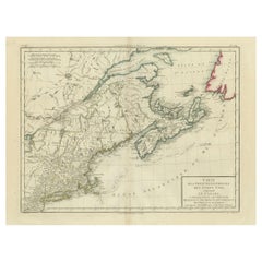
Antique Map of the Northeastern United States and Canada by Tardieu, 1802
Located in Langweer, NL
This antique map titled "Carte de la Partie Septentrionale des Etats Unis," created by Pierre Antoine Tardieu, depicts the northeastern part of the United States and parts of Canada....
Category
Early 1800s Antique Hand-Painted Maps
Materials
Paper
$531 Sale Price
20% Off
H 16.34 in W 22.25 in D 0.01 in
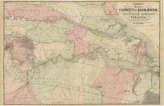
1862 Johnson's Map of the Vicinity of Richmond & Peninsular Campaign, Virginia
Located in Langweer, NL
Title: 1862 Johnson's Map of the Vicinity of Richmond & Peninsular Campaign, Virginia
Description: This 1862 map titled "Johnson's Map of the Vicinity of Richmond and Peninsular Cam...
Category
1860s Antique Hand-Painted Maps
Materials
Paper
$303 Sale Price
20% Off
H 18.12 in W 27.96 in D 0.01 in
Small Map of the United States, circa 1870
Located in Langweer, NL
Antique map titled 'Amérique septe. Physique'. Small map of the United States. lithographed by C. Callewaert brothers in Brussels circa 1870.
Category
Mid-19th Century Belgian Antique Hand-Painted Maps
Materials
Paper
Large Antique Map of the State of Texas, 1861
Located in Langweer, NL
Antique map titled 'Johnson's New Map of the State of Texas' Large map of Texas, shows railroads, wagon roads, the U.S. Mail Route, rivers, ports, ...
Category
Mid-19th Century American Antique Hand-Painted Maps
Materials
Paper
Map Exploring The World, Midi Format
Located in New York, NY
A compelling exploration of the ways that humans have mapped the world throughout history - now in a compact new edition
Map: Exploring the World brings together more than 250...
Category
21st Century and Contemporary Hand-Painted Maps
Materials
Paper
Original Antique Map of North America by Dower, circa 1835
Located in St Annes, Lancashire
Nice map of North America
Drawn and engraved by J.Dower
Published by Orr & Smith. C.1835
Unframed.
Free shipping
Category
1830s English Antique Hand-Painted Maps
Materials
Paper
Antique Map of North America, 1821
Located in Langweer, NL
Antique map of America titled 'Carte de l'Amerique septentrionale'. Scarce map of North America, shortly after the Louisiana Purchase and the first ...
Category
19th Century French Antique Hand-Painted Maps
Materials
Paper
Framed 1839 Hand Colored Map of the United States
Located in Stamford, CT
Framed hand colored map of the United States of America from 1839. Newly framed in a giltwood frame.
Category
1830s American American Classical Antique Hand-Painted Maps
Materials
Giltwood, Paper, Glass
Monumental Framed Medieval Facsimile Map Of The World Fra Mauro Wood Wall Panel
Located in Forney, TX
A remarkable palatial nearly 7.5ft x 7.5ft facsimile of the important Map of the World (circa 1450) by Fra MauroFra Mauro (Italian; circa 1400–1464), featuring a solid wood framed hi...
Category
Early 20th Century Medieval Hand-Painted Maps
Materials
Linen, Wood, Paper
$2,950
H 88.25 in W 90.25 in D 2 in
Antique Map of The United States of North America, Pacific States, 1882
Located in Langweer, NL
The map is from the same 1882 Blackie Atlas and focuses on the Pacific States of the United States of America during that period. Here are some details and historical context about t...
Category
1880s Antique Hand-Painted Maps
Materials
Paper
$237 Sale Price
20% Off
H 14.97 in W 11.03 in D 0 in
1830 Mexico and United States Framed Map
Located in Stamford, CT
Map of North America published circa 1830. Map shows United States into Canada. Mexico extending into the upper California territory. Texas appears in name but prior to the period of...
Category
1830s American American Classical Antique Hand-Painted Maps
Materials
Glass, Wood, Paper
Antique Map of the United States by Balbi '1847'
Located in Langweer, NL
Antique map titled 'Etats-Unis'. Original antique map of the United States. This map originates from 'Abrégé de Géographie (..)' by Ad...
Category
Mid-19th Century Antique Hand-Painted Maps
Materials
Paper
$189 Sale Price
20% Off
H 9.06 in W 11.23 in D 0.02 in
Previously Available Items
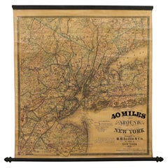
1870 "40 Miles Around New York" by H. H. Lloyd, Hanging Map on Original Rollers
Located in Colorado Springs, CO
This is an antique hanging map, “40 Miles Around New York,” published by H. H. Lloyd in New York in 1870. Presented on its original wooden rollers, this small-scale lithographed wall map is centered on Manhattan and its surrounding counties. Throughout the map, the counties are colored and the towns and cities well labeled. A reference key in the bottom margin provides symbols for railroads, railroad stations, proposed railways, aqueducts and canals, cemeteries, blacksmith shops, wheelwrights, grist mills, and sawmills. This map is especially notable for the countless railway lines and stations depicted, with distances in miles noted between stations. Lloyd’s “40 Miles Around New York” was first issued in 1867 as a folding pocket map.
This map offers interesting insight about the map trade of the times, revealing the competitive nature of print publishing. In the lower margin, Lloyd warns customers of another, similar sounding named map business, presumably map dealer and known rival J. T. Lloyd. He states, “reasons that are well known to many compel us to state that we have no relationship and never had any business connection whatever with another party who advertises ‘Lloyds Maps.’” He also reminds his customers against potential fraud, stressing “We do not collect money in advance for Maps which have never been, and can never be, published. Our agents are not allowed to collect before delivery in any case.”
Henry Huggins Lloyd was born in Blandford, Massachusetts, in 1828. With his brothers, James Lloyd and Myron Lloyd, he worked as H. H. Lloyd & Co., mapmakers and maps publishers based in New York City. H. H. Lloyd & Co. had an impressive map output, especially during the Civil War. He issued maps of coastal cities and harbors, military maps of the northern and southern states, maps of key battle states like Virginia and New York, as well as larger United States maps...
Category
1870s American Late Victorian Antique Hand-Painted Maps
Materials
Linen, Wood, Paper
H 31 in W 28.75 in D 1 in
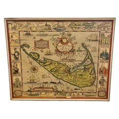
Tony Sarg Hand Colored Whimsical Map of Nantucket, circa 1926
By Tony Sarg
Located in Nantucket, MA
Antique Tony Sarg Hand Colored Whimsical Map of Nantucket, circa 1926, a decorative colored folk art tourist map of Nantucket Island by Tony Sarg (Nantucket: 1880 - 1942) depicting g...
Category
1920s American Folk Art Vintage Hand-Painted Maps
Materials
Paint
Vintage Whimsical Map of Nantucket Island by Fred Gardner, 1933.
Located in Nantucket, MA
Vintage Whimsical Map of Nantucket Island by Fred Gardner, 1933, a classic tourist map from the golden age of poster art, etched and printed by the young Fred Gardner on Nantucket Island, and then in this example hand colored by him and inscribed as a present to a friend. The map shows the three islands of the Nantucket archipelago, with place names and visual accents, as well as a Nantucket "coat-of-arms" of a sailor and harpooneer flanking a whale oil barrel with inscription of the island's purchase by Bartholomew Gosnold in 1609, anthropomorphic winds blowing out of the Northwest and Northeast, compass rose, ships, breaching white whale and a soaring seagull, hand signed, dated and copyrighted "(c) Fred H. Gardner, '33" in the lower left, and hand inscribed across the bottom "To Francey: Wishingf you many more enjoyable visits on this quaint island. "Freddy" August 17, 1934."
The map remains in excellent condition, with the colors bold and strong with no fading whatsoever. It is mounted in a mat and gilded frame that appears from the 1970s or so.
Fred Gardner, while not from Nantucket, was descended from an old island family, and summered here all his life. He was one of the first major collectors of scrimshaw, and a serious student of Nantucket history. He was a young art student when he created this map, inspired by those of his friends Austin Strong...
Category
1930s American Folk Art Vintage Hand-Painted Maps
Materials
Paper
1856 Hanging "Map of the United States from the Latest Authorities"
Located in Colorado Springs, CO
Presented is a scarce American wall map of the United States by Ensign, Bridgman, and Fanning in 1856. As the title suggests, the map covers the United States from the Atlantic Ocean, west to Minnesota, Nebraska, Kansas Territory, Indian Territory and Texas. Inset maps in the lower right include a “Map of the Western Portion of the United States” and the “Southern part of Florida.”
This is a classic map of the “Manifest Destiny” era, showing rapid westward expansion and new territories. Even the cartouche is symbolic of America’s evolution into a world superpower. A prominent bald eagle proudly perches atop the globe, implying dominance. Behind him, a bustling port city filled with trade ships...
Category
1850s American Antique Hand-Painted Maps
Materials
Linen, Wood, Paper
Mid-Century Illuminated Replogle World Floor Globe in Wood and Glass, Chicago
Located in Haddonfield, NJ
American 1950's back light green painted floor globe by Replogle, Mid-Century Modern.
Remarkable and charming Chicago made world globe featur...
Category
Mid-20th Century American Mid-Century Modern Hand-Painted Maps
Materials
Steel
1858 "Mitchell's New National Map Exhibiting the United States" Hanging Wall Map
Located in Colorado Springs, CO
Presented is a beautifully engraved, large hanging wall map of the United States, Mexico, and West Indies by Samuel Augustus Mitchell. The map depicts the entire nation from the Atlantic to the Pacific Ocean. It also included inset maps of the “World on Mercator's Projection” and the “World on Globular Projection,” an inset of the Hawaiian Islands, distance and population tables, and more. First published in 1856, “Mitchell’s New National Map” was one of the most commercially successful maps of its time, regularly amended to update the changing territorial and state borders of the West. This specific map was published in Philadelphia in 1858.
The map presents a compelling picture of an evolving American West, capturing the fluidity of pre-Civil War territorial boundaries. Much changed in the few years surrounding the publication of this map as the 1850s were characterized by the drawing of territorial boundaries, the creation of new states, continued relocation campaigns against Native Americans, and the rise and fall of small-scale territorial rebellions.
On this map we see New Mexico in its late 1850s form, with a lower strip labeled Arizona. The same year as the publication of this map, the New Mexico territorial legislature adopted a resolution in favor of the creation of the Arizona Territory...
Category
1850s American Antique Hand-Painted Maps
Materials
Paper
H 84 in W 80.5 in D 6 in
Antique Framed Hand Colored Map of the Americas by Frederick De Wit, circa 1675
By Frederick de Wit
Located in Morristown, NJ
Frederick De Wit (Dutch, 1629-1706), "Novissima et Accuratissima totius Americae Descriptio", hand-colored map engraving of North and South America with California depicted as an island, decorated with images of Native Americans and indigenous flora and fauna, framed under glass, 19.5"h x 23"l (sheet), 22.5"h x 1.75"d x 26"w (frame), From the collection of an NY corporation.
A fine example of De Wit’s map of the Americas, first published ca. 1675. This map is fascinating. It was the first Dutch map to include all five Great Lakes; Lac Superieur (Lake Superior), Lac des Puans (Lake Michigan), Mare Dulce (Lake Huron...
Category
1670s Dutch Baroque Antique Hand-Painted Maps
Materials
Glass, Wood, Giltwood, Paint, Paper
H 22.5 in W 26 in D 1.75 in
English Map of West Indies with a Gilt Wood Frame Under Glass, Late 19th Cent
Located in Charleston, SC
English hand colored accurate map of the West Indies with a foliage gilt wood and gesso frame under glass, Late 19th century. Long West from London.
Category
Late 19th Century English Victorian Antique Hand-Painted Maps
Materials
Gesso, Glass, Giltwood, Paint, Paper
H 13.75 in W 16.75 in D 0.75 in
Pocket Globe John and William Cary, London, 1791
By Cary’s
Located in Milano, IT
John and William Cary
Pocket globe
London, 1791
The pocket globe is contained in its original case, which itself is covered in shark skin.
Few and slight gaps in the original p...
Category
1790s English George III Antique Hand-Painted Maps
Materials
Shagreen, Paper
Rare Near & Middle East Map by G.W. Bacon & Co. LTD, London, circa 1880
Located in San Francisco, CA
Rare Near & Middle East Map by G.W. Bacon & Co. LTD, London circa 1880
Though the map is in it's original folded condition (see final pic), this wi...
Category
Late 19th Century English Antique Hand-Painted Maps
Materials
Paper
H 30.75 in W 40.75 in D 0.2 in
Roggeveen's Hand Colored Chart of Cape Cod and the Islands, 1675
By Arent Roggeveen
Located in Nantucket, MA
Pascaert van Nieu Nederland Van Hendrick Christiaens Eyland tot Staten hoeck of Cabo Cod, by Arent Roggeveen, published in circa 1675, an extremely rare first edition chart printed o...
Category
1670s Dutch Other Antique Hand-Painted Maps
Materials
Paper
Antique Map of England by N. Visscher II, 1694
Located in Langweer, NL
Beautiful hand-colored map showing England, The island of Man and a part of Scotland. This highly decorative rare map of the late 17th century is equipped with a large allegoric titl...
Category
Late 17th Century Antique Hand-Painted Maps
Recently Viewed
View AllMore Ways To Browse
Bavarian Porcelain Vases
Beer Tankard
Bjorn L
Black Cabinet With Flowers And Birds
Black Tansu Chest
Blue Morpho
Blue Opaline Crystal Vases
Bow Front Buffet
Boy And Girl Statues
Brass Donkey
Brass Hound
Bread Oven
Bronze Atlas Sculpture
Bronze Door Stop
Bronze Shakespeare Sculpture
Buddha Bell
Bull Terrier
Butlers Chest
