16th Century Prints
to
61
71
4
76
Height
to
Width
to
5,212
9,596
5,514
880
1,209
1,731
1,680
202
80
209
260
250
312
413
698
371
226
76
2
1
1
1
11
3
2
1
1
76
76
76
2
2
1
1
1
Period: 16th Century
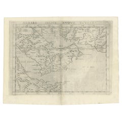
16th Century Map of Saudi Arabia, the Persian Gulf and Red Sea, ca. 1574
Located in Langweer, NL
Ptolemaic map of the Arabian Peninsula based on the 1548 map of Giacomo Gastaldi. It covers nearly all of the peninsula, but does not include the head of the Red Sea. The coastlines ...
Category
Antique 16th Century Prints
Materials
Paper
$440 Sale Price
20% Off
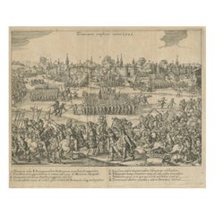
Capture of Tournai by Parma's Forces, 1581: Siege and Conquest of the City
Located in Langweer, NL
This detailed engraving depicts the capture of Tournai by the forces of the Duke of Parma in 1581. The scene shows the siege and conquest of the city with meticulous illustrations of...
Category
Antique 16th Century Prints
Materials
Paper
$270 Sale Price
20% Off
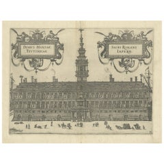
Rare 1582 Copper Engraving of Hanseatic House, Antwerp by Guicciardini
Located in Langweer, NL
"Rare 1582 Copper Engraving of Hanseatic House, Antwerp by Guicciardini"
This copper engraving, published in 1582 by Christoph Plantin in Antwerp, presents the impressive Hanseatic ...
Category
Antique 16th Century Prints
Materials
Paper
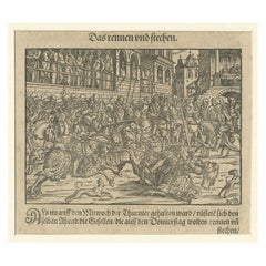
Original 16th Century Engraving of a Medieval Tournament, ca.1578
Located in Langweer, NL
Antique print titled 'Das rennen und stechen'.
Engraving of a Medieval tournament. This print originates from 'Thurnier Buch. Von Anfang, Ursachen, ursprung und herkommen (..)' b...
Category
Antique 16th Century Prints
Materials
Paper
$332 Sale Price
25% Off
Antique Print of a Spanish Bullfight by A. Stradanus, 1576
Located in Langweer, NL
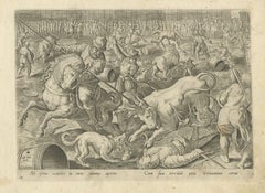
Antique print titled 'Sit ferns exardet in circo tarus aperto, Cum sua terribili petit irritamina cornu'. No. 18 by A. Stradanus depicting a bull fight in Spain. Published in 1576.
Category
Antique 16th Century Prints
Materials
Paper
Duke of Parma’s 1585 Ship Bridge Plan: Siege of Antwerp Engineering Print
Located in Langweer, NL
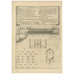
This is an original engraved print from 1585, depicting the construction plans for the ship bridge built by the Duke of Parma during the Siege of Antwerp in the Eighty Years' War.
...
Category
Antique 16th Century Prints
Materials
Paper
$260 Sale Price
20% Off
Fin de la Guerre: The Behemoth of the Siege of Antwerp, 1585
Located in Langweer, NL
This print depicts the Antwerp warship Fin de la guerre, a massive vessel constructed during the Siege of Antwerp (1584-1585).
It is a copperplate-engraved oblique profile of the D...
Category
Antique 16th Century Prints
Materials
Paper
$596 Sale Price
20% Off
Capture of Limburg by Spanish Forces under Duke of Parma, 1578 - Engraving
Located in Langweer, NL
This engraving illustrates the capture of Limburg by Spanish forces under the command of Alexander Farnese, Duke of Parma, in 1578 during the Eighty Years' War. The scene vividly dep...
Category
Antique 16th Century Prints
Materials
Paper
$270 Sale Price
20% Off
Antique Print of the City of Rome, Italy by Münster, C.1580
Located in Langweer, NL
Antique print titled 'Abbildung der Statt Rom/wie sie under Keyser Vespasiano und zu Plinii zeiten gewesen'. Woodcut of ancient Rome. This print originates from Munster's Cosmographi...
Category
Antique 16th Century Prints
Materials
Paper
$521 Sale Price
20% Off
Antique Map of the City of Visby 'Sweden' by F. Hogenberg, 1598
Located in Langweer, NL
This is a wonderful bird's-eye plan/view of the oldest city in Sweden.
Visby, the largest city on the island of Gotland was an important Viking city and the main centre of the Hanseatic League...
Category
Antique 16th Century Prints
Materials
Paper
$2,282 Sale Price
20% Off
Antique Map of Southeast Asia by Ortelius '1587'
Located in Langweer, NL
Antique map titled 'Indiae Orientalis Insularumque Adiacientium Typus'. Ortelius includes early European depictions of both Japan and China and is the first to name Formosa (Taiwan). The Philippines and East Indies or Spice Islands are shown based upon Portuguese and Spanish sources, and before their penetration by the Dutch. Japan is shown in kite form, as a large oval island...
Category
Antique 16th Century Prints
Materials
Paper
$4,612 Sale Price
20% Off
Antique Map of England by Mercator/Hondius, circa 1600
Located in Langweer, NL
Antique map titled 'Westmorlandia, Lancastria, Caernvan, Denbigh, Flint, Merionidh, Dalopia cum issulis Mania et Anglesey'. Original antique map of England...
Category
Antique 16th Century Prints
Materials
Paper
$885 Sale Price
20% Off
Rare Early Plate of a Virgin Woman from Naples, Italy in 16th Century Costume
Located in Langweer, NL
Description: Antique print, titled: 'CXLVI. Virgo Neapolitana in Italia' - This rare early plate shows a virgin woman from Naples, Italy in 16th century costume. From: 'Habitus praec...
Category
Antique 16th Century Prints
Materials
Paper
$270 Sale Price
20% Off
Original Antique Ptolemaic Map of the Region of Thailand and Malaysia
Located in Langweer, NL
Antique map titled 'Tabula Asiae XI'. Based on the interpretations of Solinus and Munster, this Ptolemaic map covers the region roughly of Thailand and Malaysia. An oddly shaped (Mal...
Category
Antique 16th Century Prints
Materials
Paper
$531 Sale Price
20% Off
View of Frankenberg: Braun & Hogenberg's Historic Bird's-Eye Map, 1599
Located in Langweer, NL
The antique print titled 'Francenbergum, vel ut alij Francoburgum Hassiae Opp', published by Braun & Hogenberg around 1599, is a remarkable historical ...
Category
Antique 16th Century Prints
Materials
Paper
$465 Sale Price
20% Off
Antique Town Plan of Emden ‘Germany’ by Braun & Hogenberg, 1597
Located in Langweer, NL
Antique map titled 'Embdena (..)'. Old, antique bird's-eye view plan of Emden, Germany. This bird's-eye view from the southwest over the Dollart shows Emden, which developed from a trading settlement in the 7th/8th centuries into a city as late as late 14th century. In 1494 it was granted staple rights, and in 1536 the harbour was extended. In the mid-16th century Emden's port was thought to have the most ships in Europe. Its population then was about 5,000, rising to 15,000 by the end of the 16th century. The Ems flowed directly under the city walls, but its course was changed in the 17th century by the construction of a canal. Emden has canals within its city limits, a typical feature of Dutch towns, which also enabled the extension of the harbour. Emden's first herring company was founded in 1553, and in 1595 Emden was created a Free Imperial City under the protection of Holland.
Published by Braun...
Category
Antique 16th Century Prints
Materials
Paper
Ernest the Iron of Austria - Antique Engraving by Gaspar Oselli, 1569
Located in Langweer, NL
Antique print titled ''Ernestus Ferreus Arch'.
**Ernest the Iron (1377-1424)**
Background: Ernest the Iron, also known as Ernst der Eiserne, was a member of the House of Habsburg....
Category
Antique 16th Century Prints
Materials
Paper
$922 Sale Price
20% Off
Map of East Frisian Islands & Northwestern Tip of Germany, Ostfriesland, c.1595
Located in Langweer, NL
Antique map titled 'Frisia Orientalis'. Beautiful map of east Frisian islands and the northwestern tip of Germany, Ostfriesland. With people in local costumes. Ornamented inset of the Eems estuary. Based on a manuscript map...
Category
Antique 16th Century Prints
Materials
Paper
$1,630 Sale Price
20% Off
Old Antique Map of the Province of Friesland, the Netherlands, c.1580
Located in Langweer, NL
Antique map titled 'Frisia Occidentalis'. Old map of the province of Friesland, the Netherlands. This map is also known as the 'Pauwenkaart' ('peacock map'), referring to the peacock next to the inset map. Based on a manuscript map...
Category
Antique 16th Century Prints
Materials
Paper
$885 Sale Price
20% Off
Rare Print of Sigebert I 'c.535 – c.575', the Germanic King of Austrasia, 1569
Located in Langweer, NL
Antique print, titled: 'Sigibertus I Metensis Rex (…)'
Original and very rare antique print showing a full length portrait of Sigebert I (c. 535 – c. 575), the Germanic king of...
Category
Antique 16th Century Prints
Materials
Paper
$922 Sale Price
20% Off
Portrait of Abraham Ortelius Engraved by Philippe Galle, first published in 1579
Located in Langweer, NL
Title: Portrait of Abraham Ortelius Engraved by Philippe Galle, first published in 1579, featured in the *Theatrum Orbis Terrarum*.
Description: This is a meticulously detailed portrait of Abraham Ortelius (1527–1598), the renowned Flemish cartographer, geographer, and creator of the first modern atlas, Theatrum Orbis Terrarum. This copperplate engraving, crafted by the master engraver Philippe Galle (1537–1612), was first published in the 1579 edition of Ortelius’s groundbreaking work.
The image presents a bust-length profile of Ortelius facing to the left, emphasizing his austere yet intellectual presence. He is depicted wearing formal attire typical of the late Renaissance period, including a richly textured doublet with a fur-lined collar and a finely detailed ruff around his neck. His aged, yet determined face, with a pointed beard and furrowed brow, symbolizes his deep dedication to the study of geography and cartography.
Surrounding the portrait is an elaborate architectural and floral frame, characteristic of late 16th-century Mannerist designs, which conveys a sense of both intellectual grandeur and artistic sophistication. At the top of the frame is a "Chi Rho" symbol, representing Christ, and emphasizing the religious underpinnings of Ortelius's worldview. The Latin inscription below the portrait reads:
"Spectandum dedit Ortelius mortalib. orbem, Orbi spectandum Galleus Ortelium"
("Ortelius gave the world to be seen by mortals, Galleus gave Ortelius to be seen by the world.")
This suggests the lasting legacy of Ortelius’s work in mapping the known world and how Galle, through his engraving, immortalized Ortelius himself.
About the Engraver: Philippe Galle (1537–1612) was a prominent Flemish engraver and publisher, known for his precision and technical skill in copperplate engraving. Galle often worked with leading figures of his time, producing prints that highlighted important cultural, intellectual, and political figures. His engraving technique involved etching intricate lines and textures onto a copperplate, which would then be inked and pressed onto paper to produce highly detailed prints. His collaboration with Ortelius on this project further solidified his reputation as a master engraver.
Why Ortelius was Important: Abraham Ortelius is celebrated as one of the founders of modern cartography. His atlas, *Theatrum Orbis Terrarum* (Theatre of the World), published in 1570, was the first to gather a comprehensive collection of maps into a single, standardized volume. This work marked a turning point in the history of geography by establishing a modern understanding of world mapping. Ortelius also significantly contributed to geographic knowledge by incorporating information from various cartographers, which helped to unify mapmaking practices across Europe.
Ortelius's work not only aided navigators and explorers but also influenced scholars and rulers in their understanding of the world. His reputation extended well beyond his home in Antwerp, making him one of the most respected intellectuals of his time.
Keywords: Abraham Ortelius portrait, Philippe Galle engraving, 1579 Theatrum Orbis Terrarum, Renaissance cartography, Ortelius atlas, historical cartographer portrait, copperplate engraving, Mannerist engravings...
Category
Antique 16th Century Prints
Materials
Paper
$549 Sale Price
20% Off
Antique Map of Westfalia, Germany by Mercator/Hondius, circa '1620'
Located in Langweer, NL
Antique map titled 'Westfalia cum dioecelsi Bremensi'. Original antique map of Germany. Published by Mercator/Hondius, circa '1620'
17th Century antique detailled map of Westphali...
Category
Antique 16th Century Prints
Materials
Paper
$885 Sale Price
20% Off
16th Century School of Fontainebleau Engraving
By Master F.G.
Located in New York, NY
This 16th century French engraving illustrates an episode in the Trojan War – although the actual one illustrated is in question. According to recent scholarship, it depicts the corp...
Category
French Renaissance Antique 16th Century Prints
Materials
Paper
German Antique Print of a Military Scene, circa 1600
Located in Langweer, NL
Original antique woodcut of a military scene. Source unknown, to be determined.
Artists and Engravers: Anonymous.
Condition: Good, general age-rel...
Category
Antique 16th Century Prints
Materials
Paper
$92 Sale Price
20% Off
Original Antique Print of Limbourg in present day Belgium, Published circa 1580
Located in Langweer, NL
Antique print titled 'Lympurch - Limburgum Oppidum (..)'. Attractive bird’s eye view of Limbourg in present day Belgium. Limbourg (or Limburg) is a city and municipality of Wallonia ...
Category
Antique 16th Century Prints
Materials
Paper
$819 Sale Price
20% Off
Antique Map of Douai 'France' by Braun & Hogenberg, circa 1575
Located in Langweer, NL
Beautiful map in excellent condition. This map depicts the city of Douai (France) and originates from 'Civitates Orbis Terrarum'.
Category
Antique 16th Century Prints
Materials
Paper
Antique Map of Asia Minor, Region of the Nile and Region of the City of Carthage
Located in Langweer, NL
Three antique maps on one sheet titled 'Natoliae quae olim Asia Minor [with] Aegypti recentior descriptio [with] Carthaginis Celeberrimisinus Typus'. The first map covers Asia Minor,...
Category
Antique 16th Century Prints
Materials
Paper
$465 Sale Price
20% Off
Rare 1592 Woodcut of Exotic Animal from Sebastian Münster's "Cosmographia"
Located in Langweer, NL
Title: Rare 1592 Woodcut of Exotic Animal from Sebastian Münster's "Cosmographia"
Description: This intriguing woodcut, published in Basel in 1592, is from Sebastian Münster's gr...
Category
Antique 16th Century Prints
Materials
Paper
Superb Antique Map of the Province of Gelderland, the Netherlands, ca.1575
Located in Langweer, NL
Antique map titled 'Gelriae, Cliviae, Finitimorumque Locorum Verissima Descriptio Christiano Schrot. Auctore'.
This superb map is Ortelius' first plate covering Gelderland. It is b...
Category
Antique 16th Century Prints
Materials
Paper
$1,164 Sale Price
20% Off
Adam and Eve Engraving by Johann Sadeler circa 1579
Located in Doylestown, PA
A rare engraving titled “IN ADAM OMNES MORIUNTUR” (All die in Adam) by Johann Sadeler after a work by Maerten de Vos, depicting Adam taking the forbidden fruit from Eve. Signed and...
Category
Dutch Renaissance Antique 16th Century Prints
Materials
Paper
Antique Original Map of the City of Deventer, the Netherlands, 1588
Located in Langweer, NL
Antique map titled 'Liberae et Hanseaticae urbis Daventriensis delineatio'.
Original bird's eye plan of the Dutch hanseatic city Deventer, on the situated IJssel river. This map ...
Category
Antique 16th Century Prints
Materials
Paper
$736 Sale Price
20% Off
Rare Attractive Antique Map of Asia, India, Sri Lanka, Maldives, 1599
Located in Langweer, NL
Original Antique map of Asia, India, Ceylon (Sri Lanka), Maldives by Rosaccio / Ruscelli in attractive coloring.
Title: Calecut Nuova Tavola
Year: 1599
Relief shown pictorially.
...
Category
European Antique 16th Century Prints
Materials
Paper
$698 Sale Price
20% Off
Battle of Kauwenstein Dijk, 1585: Siege of Antwerp Engraving with Latin Legend
Located in Langweer, NL
The 'Battle for the Kauwenstein Dijk', engraved and titled Pugna in Aggerere Covenstio Anno 1585, depicts a significant battle during the Siege of Antwerp on 26 May 1585.
The engraving illustrates the fierce combat around the Kauwenstein embankment, where the Spanish forces under the Duke of Parma attempted to cut off supplies to the city of Antwerp, leading to intense fighting.
The scene vividly portrays soldiers engaged in close combat, naval forces in the background, and smoke rising from the battlefield as cannon fire and musket shots fill the air. The embankment, partially breached, is a focal point, showing the chaotic nature of the battle as forces from both sides converge.
At the top, the title is inscribed in Latin, and a detailed legend (A-O) at the bottom provides further explanations about various parts of the battle, referencing key locations, troops, and actions. The detailed precision of the engraving reflects the high level of craftsmanship typical of 16th-century military engravings...
Category
Antique 16th Century Prints
Materials
Paper
$270 Sale Price
20% Off
Antique Print of the City of Groningen, The Netherlands, by Münster, c.1600
Located in Langweer, NL
Antique print titled 'Groeninga'. View of the city of Groningen, the Netherlands. This map originates from 'Cosmographia' published by Münster.
Artists and Engravers: Sebastian Münster...
Category
Antique 16th Century Prints
Materials
Paper
$251 Sale Price
20% Off
Siege of Antwerp: Duke of Parma’s Strategic Ship Bridge over the Scheldt, 1585
Located in Langweer, NL
This engraving, titled *Pons Antverpianus Scaldi impositus*, represents the famous ship bridge constructed by the Duke of Parma over the Scheldt River during the Siege of Antwerp in ...
Category
Antique 16th Century Prints
Materials
Paper
$270 Sale Price
20% Off
Marcantonio Raimondi 'Pupil of, Antique Engraving, Italy, Mid-16th Century
Located in Chatham, ON
A very rare - finest quality - mid 16th century Italian Renaissance engraving (after Raphael) by an anonymous pupil of MARCANTONIO RAIMONDI (1480-...
Category
Italian Renaissance Antique 16th Century Prints
Materials
Paper
Antique Map of the Artois Region of France by Ortelius, 'circa 1590'
Located in Langweer, NL
Antique map titled 'Artesia'. Original antique map of the Artois region, France. Published by A. Ortelius, circa 1590.
Category
Antique 16th Century Prints
Materials
Paper
$559 Sale Price
20% Off
Original Antique Print of Huy in present day Belgium, Published circa 1580
Located in Langweer, NL
Antique print titled 'Huum Opp. Condrusorum Caput (..)'. Attractive bird’s eye view of Huy in present day Belgium. The view shows the city from the northeast. Huy, a municipality of ...
Category
Antique 16th Century Prints
Materials
Paper
$819 Sale Price
20% Off
Original Antique Bird's-Eye View of Colmar, Alsace, France, 1552
Located in Langweer, NL
Antique map titled 'La Paincture de la cité de Colmar & du pais circonuoisin'.
Original antique bird's-eye view of Colmar, Alsace, France. This map originates from 'La Cosmograph...
Category
Antique 16th Century Prints
Materials
Paper
$614 Sale Price
20% Off
Rare and Very Old Antique Map of South East Asia, Published circa 1574
Located in Langweer, NL
A very fine impression of this map of the Malay Peninsula, Sumatra, Java, with Singapore denoted as 'Cinca Pula'.
Highly distorted and inaccurate map by Girolamo Ruscelli after J...
Category
Antique 16th Century Prints
Materials
Paper
$1,118 Sale Price
20% Off
Coloured Antique Map of Sicily, Sardinia, Corfu, Elba, Malta and Zerbi (Jerba)
Located in Langweer, NL
Antique map titled 'Insularum Aliquot Maris Mediterranei Descriptio'. A very attractive example of Ortelius' map combining, on one page, maps of the islands of Sicily, Sardinia, Corfu, Elba, Malta and Zerbi (Jerba, off the coast of Tunisia.) The maps detail fortifications on the islands and other major features. (Jerba, for instance, is shown connected to the mainland by a causeway.) The waters are attractively engraved and are sailed by ships. A shipwreck, north of Malta, indicates the point at which St. Paul is thought to have shipwrecked. Volcanoes are indicated in the Sicily map...
Category
Antique 16th Century Prints
Materials
Paper
$1,537 Sale Price
40% Off
Old Antique Print of the City of Groningen, The Netherlands, by Münster, c.1600
Located in Langweer, NL
Antique print titled 'Groeninga'. View of the city of Groningen, the Netherlands. This map originates from 'Cosmographia' published by Münster.
Artists and Engravers: Sebastian Münster...
Category
Antique 16th Century Prints
Materials
Paper
$316 Sale Price
20% Off
Daniae Regni & Oldenburg – Antique Maps of Denmark and Saxony by Ortelius, 1598
Located in Langweer, NL
Daniae Regni & Oldenburg – Antique Maps of Denmark and Saxony by Ortelius, 1584
This elegant antique map sheet features two detailed regional maps side by side: Daniae Regni Typus (...
Category
European Antique 16th Century Prints
Materials
Paper
$838 Sale Price
20% Off
Antique Print of the City of Rome, Italy by Münster, C.1580
Located in Langweer, NL
Antique print titled 'Abbildung der Statt Rom/wie sie von Romulo anfänge - Von Italia'. Woodcut of ancient Rome. This print originates from Munster's Cosmographia, one of the most in...
Category
Antique 16th Century Prints
Materials
Paper
$428 Sale Price
20% Off
Very Old Original Antique Map of The City of Douai in France, ca.1575
Located in Langweer, NL
Antique Map of Douai (France) titled 'Duacum, Catuacorum Urbs, tam situ, quam incolis, et litterarum studijs elegantissime ornata'.
This map depicts the city of Douai (France) an...
Category
Antique 16th Century Prints
Materials
Paper
$764 Sale Price
20% Off
Antique Map of Denmark by Münster '1588'
Located in Langweer, NL
Antique map titled 'Beschreibung des Königreichs Dennmarck (..)'. Early map of Denmark. This map originates from 'Cosmographey Oder beschreibung Aller Länder (..)' by Sebastian Münster.
Category
Antique 16th Century Prints
Materials
Paper
$256 Sale Price
20% Off
Antique Map of the Region Around the Nile and the City of Carthage
Located in Langweer, NL
Antique map titled 'Aegypti recentior descriptio - Carthaginis Celeberrimi sinus typus'. Two detailed regional maps by Ortelius. One map shows the region around the Nile, as far as A...
Category
Antique 16th Century Prints
Materials
Paper
$540 Sale Price
20% Off
Antique Print of Liège / Luik in Belgium by Braun & Hogenberg, 1575
Located in Langweer, NL
Antique print titled 'Leodium'. View of Liège / Luik, Belgium with surrounding hills and the city wall. With text explaining the origins of Liège, a cartouche expressing thanks to th...
Category
Antique 16th Century Prints
Materials
Paper
$1,248 Sale Price
20% Off
Late 16th Century Sheet with Copper Engravings of India, Pakistan, etc, 1598
Located in Langweer, NL
One sheet with two engraved maps, one on each site, and text in Italian. Late 16th century copper engravings in great condition, considering its age.
"Tavola Decima Dell'Asia" - Tabula Asiae X" Plate X (10). Pakistan, Cashmir, Bangla Desh, North-India...
Category
Antique 16th Century Prints
Materials
Paper
$521 Sale Price
20% Off
Rare Original 16th Century Antique Map of Greece, 1598
Located in Langweer, NL
Beautiful and rare antique map of Greece with Albania, Mecedonia, Romania, Dalmatia and the peninsula of Salento to the Golf of Taranto. Also clearly shown the islands of the Aegaian...
Category
Antique 16th Century Prints
Materials
Paper
$335 Sale Price
20% Off
Antique Hand-Coloured Map of India, Sri Lanka, Maldives, ca.1599
Located in Langweer, NL
Title: Tabula Asiae XI - 1599
Very old and decorative map of India, Sri Lanka and the Maledives. Put this map in a frame on the wall and amaze your visitors. This original engravi...
Category
Antique 16th Century Prints
Materials
Paper
$521 Sale Price
20% Off
Antique Print of the Battle with Troops of William of Orange in Amsterdam
Located in Langweer, NL
Antique print titled 'Wie die Burger von Amstelredam der Staten volck Wider auß der Statt treiben'. Original antique print showing the troops of William of Orange battling with the c...
Category
Antique 16th Century Prints
Materials
Paper
$456 Sale Price
20% Off
Antique Map of the Region of Boulogne and Peronne, France 'C.1590'
Located in Langweer, NL
Antique map titled 'Caletensium et Bononiensium (..)'.
Two detailed regional maps on one sheet. The first map shows Belgian and French Coastal region, from Estaples to Gruerlinge...
Category
Antique 16th Century Prints
Materials
Paper
$456 Sale Price
20% Off
Rare Early Plate of a Woman from Venice, Italy in 16th Century Costume, 1577
Located in Langweer, NL
Antique print, titled: 'CXXII. Veneta Mulier'
This rare early plate shows a woman from Venice, Italy in 16th century costume. From: 'Habitus praecipuorum populorum tam virorum qu...
Category
Antique 16th Century Prints
Materials
Paper
$447 Sale Price
20% Off
Beautiful Decorative Antique Map of the City of Dordrecht, the Netherlands, 1581
Located in Langweer, NL
Antique map titled 'Dordrecht'.
Map of the city of Dordrecht, the Netherlands. Bird's-eye plan view of the city, with many ships and two coats of arms in upper corners. This map ...
Category
Antique 16th Century Prints
Materials
Paper
$1,323 Sale Price
20% Off
Antique Map of the City of Bolsward, Friesland in The Netherlands, c.1598
Located in Langweer, NL
Antique map titled ‘Bolzvardia vetus in Frisia Foederis (..)’. Old map of the city of Bolsward, Friesland. Originally part of a sheet together with the cities of Stavoren, Harlingen ...
Category
Antique 16th Century Prints
Materials
Paper
$326 Sale Price
20% Off
Antique Map of Friesland with Elaborate Cartouche by Mapmaker Ortelius, c.1570
Located in Langweer, NL
Antique map titled 'Oost end West Vrieslandts beschrijvinghe. Utriusque Frisiorum Regionis Noviss: Descriptio. 1568.' Detailed map of Friesland, the Netherlands. Includes a larger co...
Category
Antique 16th Century Prints
Materials
Paper
$885 Sale Price
20% Off
Print of the Fortress Julaof Tokay, Hungary, Surrounded by Turkish Troops, c1580
Located in Langweer, NL
Antique print Hungary titled 'Contrafehtung der Festung Tokay'.
Birds eye view of the fortress Julaof Tokay, Hungary, surrounded with Turkish troops. Originates from a German edi...
Category
Antique 16th Century Prints
Materials
Paper
$260 Sale Price
20% Off
16th Century Antique Engraving by Sadeler Johann I "The beheading of St. Paul"
Located in Casale Monferrato, IT
Beautiful 16th century antique engraving with walnut briar frame. "The beheading of St. Paul" was engraved by Sadeler Johann I. Perfect conditions.
The Sadelers were a family of Flem...
Category
Belgian Antique 16th Century Prints
Materials
Paper
Very Old Original Hand-Colored Map of the Basel Region, Switzerland, Ca.1578
Located in Langweer, NL
Antique print titled 'Basiliensis territorii descriptio nova'.
Old map of the Basel region, Switzerland. Originates from 'Theatrum Orbis Terrarum' by A. Ortelius.
Artists and...
Category
Antique 16th Century Prints
Materials
Paper
$680 Sale Price
20% Off
Recently Viewed
View AllMore Ways To Browse
Antique Enamel Coffee Pot
Antique Glass Sugar Shakers
Antique Hand Painted Nippon
Antique Hunting Flasks
Antique India Sword
Antique Jacobean Chest
Antique Japanese Satsuma Tea Sets
Antique Japanese Shibayama
Antique Military Saddles
Antique Milk Glass Vase
Antique Nantucket Signs
Antique Oak Card Cabinet
Antique Pegasus
Antique Peugeot
Antique Red Transferware
Antique Salt Dishes
Antique Silver Grape Scissors
Antique Smiths Clocks
