Continental Europe Maps
to
4,203
5,169
5,522
199
5,168
1
2
2
2
1
2,845
2,005
318
1
179
12
1
68
3
3
3
2
3
1
5,150
17
11
10
8
457
190
86
81
52
5,169
5,169
5,169
104
59
20
14
13
Item Ships From: Continental Europe
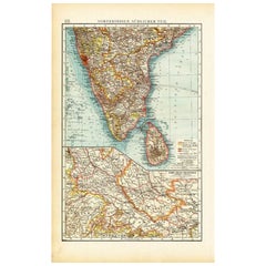
Antique Map of Southern India by Andree, 1904
Located in Langweer, NL
"Antique map titled 'Vorderindien, sudlicher Teil'. Map of India, southern part. This map originates from 'Andrees Allgemeiner Handatlas in 126 Haupt-Und 139 Nebenkarten', Bielefeld;...
Category
20th Century Continental Europe Maps
Materials
Paper
$69 Sale Price
20% Off
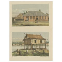
Antique Print of a Malayan Houses in Sumatra, Indonesia, 1881
Located in Langweer, NL
Antique print with a view of the place of the Sultan of Koetai and a Malayan house in Sumatra. This print originates from 'Reis in Oost- en Zuid-Borneo van Koetei naar Banjermassin (..)' by Carl Bock...
Category
19th Century Antique Continental Europe Maps
Materials
Paper
$247 Sale Price
20% Off
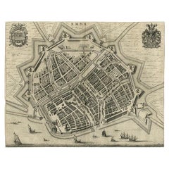
Antique Map of the City of Emden by Blaeu, 1649
Located in Langweer, NL
Antique map titled 'Emda'. Old map of the city of Emden, Germany. This map originates from 'Novum Ac Magnum Theatrum Urbium Belgicæ Liberæ ac Foederatæ' by J. Blaeu. Artists and Engr...
Category
17th Century Antique Continental Europe Maps
Materials
Paper
$486 Sale Price
20% Off
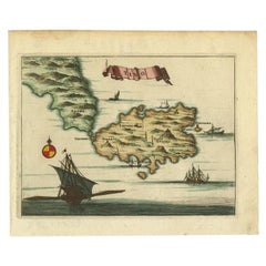
Antique Map of the Island of Tinos by Dapper, 1687
Located in Langweer, NL
Antique map titled 'Tino.' This original antique map shows the island of Tinos, Greece. Source unknown, to be determined.
Artists and Engravers: Made by 'Olfert Dapper' after an a...
Category
17th Century Antique Continental Europe Maps
Materials
Paper
$166 Sale Price
20% Off
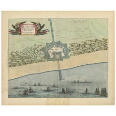
Antique Plan of Fort Mardyck Mardijk, France by S. Beaulieu, 1649
Located in Langweer, NL
Plan of Fort Mardyck (Fort Mardijk) and surroundings by Sébastian de Pontault Beaulieu. Mardyck is a former commune in the Nord department in northern France. It is an associated com...
Category
Mid-17th Century Antique Continental Europe Maps
Materials
Paper
$510 Sale Price
20% Off
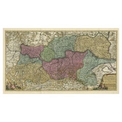
Spectacular Large Map of Upper and Lower Austria between Passau and Wien, c.1700
Located in Langweer, NL
Antique map titled 'Austriae Archiducatus pars superior in omnes ejusdem (..).'
Spectacular large map of Upper and Lower Austria between Passau and Wien with figurative cartouche a...
Category
Early 1700s Antique Continental Europe Maps
Materials
Paper
$1,556 Sale Price
24% Off
Antique Map of Southeast Asia by Larousse, 1897
Located in Langweer, NL
"Front: 'Carte Generale des Indes.' (General map of India / The Indies / Thailand / Malaysia). Rear: 'Empire des Indes.' (India; artefacts, architecture, design, ornaments).' This li...
Category
19th Century Antique Continental Europe Maps
Materials
Paper
$71 Sale Price
20% Off
Old Map of the French Department of Nièvre, France
By Victor Levasseur
Located in Langweer, NL
Antique map titled 'Dept. de la Nièvre'. Map of the French department of Nievre, France. Part of the prestiegous Burgundy or Bourgogne wine region this area is known for its producti...
Category
Mid-19th Century Antique Continental Europe Maps
Materials
Paper
$322 Sale Price
20% Off
Old Hand-Colored Print of the Guards of the King of France, 1890
Located in Langweer, NL
Antique print titled 'Gardes-du-Crops du Roi'.
Old print of the Guards of the King of France. This print originates from 'Histoire de la maison militaire du roi de 1814 à 1830 : ...
Category
1890s Antique Continental Europe Maps
Materials
Paper
$181 Sale Price
20% Off
Large Antique Map of New Guinea and New Britain Showing Capt. Cooks Tract, 1773
Located in Langweer, NL
Antique map titled 'A Chart of Captain Carteret's Discoveries at New Britain, with part of Captain Cooke's Passage thro Endeavour Streights, & of Captain Dampier's tract & discoverie...
Category
18th Century Antique Continental Europe Maps
Materials
Paper
$524 Sale Price
20% Off
Antique Map of China and Japan by Meyer, 1895
Located in Langweer, NL
Antique map titled 'China und Japan'. Map of China, Mongolia, Taiwan and Japan. With an inset map of Jiaozhou Wan near Qingdao, and another of the region around Hongkong, including Kanton and Macau, with small plans of Hong Kong and Kanton. This map originates from a 1885-1907 edition of a famous German encyclopedia titled 'Meyers grosses Konversations-Lexikon', published in Leipzig and Vienna. Meyers Konversations-Lexikon was a major German encyclopedia that existed in various editions from 1839 until 1984, when it merged with the Brockhaus encyclopedia. Several of the plates were also used in Dutch Encyclopedia's like Winkler Prins...
Category
19th Century Antique Continental Europe Maps
Materials
Paper
$81 Sale Price
20% Off
Detailed 18th-Century Map of Paris and Its Surrounding Regions by Johann Homann
Located in Langweer, NL
This map, titled “Agri Parisiensis Tabula particularis,” was created and published by the German cartographer Johann Baptist Homann (1664–1724), or his workshop, in Nuremberg. Homann...
Category
1720s Antique Continental Europe Maps
Materials
Paper
Imperial map of Northern Russia with Archangel, Lapland and Permia, c.1730
Located in Langweer, NL
Imperial map of Northern Russia with Archangel, Lapland, and Permia, c.1730
Description:
This intricately engraved and hand-colored map presents the northern reaches of the Russian ...
Category
Early 18th Century German Antique Continental Europe Maps
Materials
Paper
Colourful Old Detailed Map of Northern Carolina, United States of America
Located in Langweer, NL
Vintage map titled 'The Geographical Publishing Company's Premier Map of North Carolina'. Beautiful map of North Carolina. This map originates from Comme...
Category
Early 20th Century Continental Europe Maps
Materials
Paper
$276 Sale Price
20% Off
1811 John Cary Map of Lower Saxony - Featuring Bremen, Holstein, and More
Located in Langweer, NL
Title: "1811 John Cary Map of Lower Saxony - Featuring Bremen, Holstein, and More"
Description: This is an exquisite map of the Lower Saxony region, created by the renowned cartogra...
Category
1810s Antique Continental Europe Maps
Materials
Paper
Antique Map of Europe from an Old Dutch School-Atlas, 1852
Located in Langweer, NL
Antique map titled 'Europa'. Map of Europe. This map originates from 'School-Atlas van alle deelen der Aarde' by Otto Petri.
Artists and Engravers: Published by A. Baedeker (Otto...
Category
19th Century Antique Continental Europe Maps
Materials
Paper
$133 Sale Price
20% Off
Antique Map of the Koblentz Region by Moll, 1695
By Herman Moll
Located in Langweer, NL
Antique map Koblentz titled 'Coblentz'. Rare antique map of the Koblentz region in Germany. On verso, an antique map of the Mont Royal fortress, Germany. Originates from 'Thesaurus Geographicus. A New Body of Geography: or a Compleat Description of the Earth 'by H. Moll.
Artists and Engravers: Herman Moll...
Category
17th Century Antique Continental Europe Maps
Materials
Paper
$122 Sale Price
20% Off
Antique Map of Germany and Switzerland by Lowry, '1852'
Located in Langweer, NL
Antique map titled 'Germany and Switzerland'. Four individual sheets of Germany and Switzerland. This map originates from 'Lowry's Table Atlas constructed and engraved from the most ...
Category
Mid-19th Century Antique Continental Europe Maps
Materials
Paper
$238 Sale Price / set
20% Off
Antique Architectural Print of the Melville House in Fife, Scotland, 1725
Located in Langweer, NL
Antique print titled 'The Elevation of Melvin House in the Shire of Fyfe (..)'.
Old engraving of Melville House in Fife, Scotland. This print originates from 'Vitruvius Britannic...
Category
18th Century Antique Continental Europe Maps
Materials
Paper
$305 Sale Price
20% Off
Map of Styria by William Blaeu, 1645: A Masterpiece of 17th-Century Cartography
Located in Langweer, NL
This 1645 map, created by Willem Janszoon Blaeu, represents Styria (Steyrmark), a historical region in present-day Austria, located in the Alpine regions. Blaeu, one of the most sign...
Category
1640s Antique Continental Europe Maps
Materials
Paper
Antique Map of the Black Sea by Perthes, 1848
Located in Langweer, NL
Antique map titled 'Pontus Euxinus'. Old map of the Black Sea and surroundings originating from 'Orbis Terrarum Antiquus in usum Scholarum'. Artists and Engravers: Published by Justu...
Category
19th Century Antique Continental Europe Maps
Materials
Paper
$94 Sale Price
20% Off
Antique Map of Asia, 1846
Located in Langweer, NL
Antique map titled 'Asie'. Original antique map of Asia. Source unknown, to be determined.
Artists and Engravers: Alexandre Vuillemin (1812-188...
Category
19th Century Antique Continental Europe Maps
Materials
Paper
$74 Sale Price
20% Off
Old Map of Australia Showing The Routes of the Main Explorers, ca.1900
Located in Langweer, NL
Antique print, untitled. This map shows Australia with the routes of explorers in the continent and marking the furthest point reached.. Source unknown, to be determined.
Artists ...
Category
Early 1900s Antique Continental Europe Maps
Materials
Paper
$114 Sale Price
20% Off
Antique Map of the Region of Hokkaido, Island of Japan, 1812
Located in Langweer, NL
Antique map titled 'Karte von Jesso und Sagalien'. Old map of the region of the island of Yesso (Mororan, Hokkaido, Japan). This map originates from Volume 38 of 'Allgemeine geograph...
Category
19th Century Antique Continental Europe Maps
Materials
Paper
Original Antique Print of Crimean Costumes, Russia & Ukraine, ca.1880
Located in Langweer, NL
Antique print titled 'Die Krim - Trachten'.
Original antique print of Crimean costumes. Source unknown, to be determined.
Artists and Engravers: Anonymous.
Category
1880s Antique Continental Europe Maps
Materials
Paper
$123 Sale Price
20% Off
Ancient Realms of Northeast Africa: Arabia, Ethiopia, and Egypt, Published 1880
Located in Langweer, NL
This map, titled "ARABIA, AETHIOPIA, AEGYPTUS," illustrates the regions of ancient Arabia, Ethiopia, and Egypt.
Features that make this map interesting include:
1. **Geographical ...
Category
1880s Antique Continental Europe Maps
Materials
Paper
$448 Sale Price
20% Off
Antique Map of Italy by R. Bonne, circa 1780
Located in Langweer, NL
Beautiful map of Italy, Corsica, Sardinia and Sicily. Highly detailed, showing towns, rivers, some topographical features and political boundaries. Published by R. Bonne, circa 1780.
Category
Late 18th Century French Antique Continental Europe Maps
Materials
Paper
$286 Sale Price
20% Off
Rare Antique Map with Timor and Nearby Islands Plus an Inset of Hawaii, 1825
Located in Langweer, NL
Antique map titled 'Essai sur la Geographie de l'Ile Timor.'
A map showing Timor and the surrounding nearby islands (Floris, Sabrao, Solor, Lomblem, Panter, Ombai and Wetter. Wit...
Category
1820s Antique Continental Europe Maps
Materials
Paper
$810 Sale Price / set
20% Off
Antique Print of Jacobite Drinking Glasses by Gibb, 1890
Located in Langweer, NL
Antique print titled 'Three Jacobite drinking glasses'. Chromolithographic plate originating from 'The Royal House of Stuart. Illustrated By ...
Category
19th Century Antique Continental Europe Maps
Materials
Paper
$81 Sale Price
20% Off
Antique Map of Ille et Vilaine ‘France’ by V. Levasseur, 1854
Located in Langweer, NL
Antique map titled 'Dépt. d'Ille et Vilaine'. Map of the French department of Ille et Vilaine. France. Its coastal area is famous for its seafood, and especially its oysters. The reg...
Category
Mid-19th Century Antique Continental Europe Maps
Materials
Paper
$171 Sale Price
20% Off
Old Decorative Map of the West African Coast & St. Thomae Island, c.1600
Located in Langweer, NL
Antique map titled 'Guineae Nova Descriptio.'
This very decorative map shows the West African coast from Senegal (the 'Rio Senega' is the Senegal River) to Cape Lopez on the Gulf...
Category
Early 1600s Antique Continental Europe Maps
Materials
Paper
$1,382 Sale Price
20% Off
Scarce Middle East and Arabia Map Showing The Exodus of the Israelites, 1725
Located in Langweer, NL
Antique map titled 'Kaarte van de reize en togten der Israeliten in de woestyne, sedert der zelver uytgang uyt Egypten, tot den overtogt over de Jordaane.'
Scarce map of the Middle East and Arbabia. It shows the exodus...
Category
1720s Antique Continental Europe Maps
Materials
Paper
$1,046 Sale Price
34% Off
Hand Colored Antique Map of the Department of Haute-Vienne, France
By Victor Levasseur
Located in Langweer, NL
Antique map titled 'Dépt. de l'Ariège'. Map of the French department of Haute-Vienne, France. Haute-Vienne is home to the commune of Limoge, which makes oak barrels used...
Category
Mid-19th Century Antique Continental Europe Maps
Materials
Paper
$322 Sale Price
20% Off
Woodcut Map of the Rhine River Region Covering the Palatinate, Austria and Elsa
Located in Langweer, NL
Early Woodcut Map of the Rhine River Region Covering the Palatinate, Austria, and Elsass, ca. 1628
This early woodcut map, titled "Die ander Tafel des Rheinstromes/begriffen die Pfa...
Category
1620s Antique Continental Europe Maps
Materials
Paper
Antique Plan of Port-Vendres, Roussillon, France
Located in Langweer, NL
Antique map titled 'Plan de Port Vendre en Roussillon'. Original plan of Port-Vendres, Roussillon, France. This map originates from 'Le Petit Atlas Maritime (..)' by J.N. Bellin. Pub...
Category
Mid-18th Century Antique Continental Europe Maps
Materials
Paper
$324 Sale Price
20% Off
Antique Map of the Bay of Manila, Capital of the Philippines
Located in Langweer, NL
Antique map titled 'Abzeichnung des Meerbusens bey Manila'. Map of the Bay of Manila, capital of the Philippines. This map originates from a German edition of 'Voyage around the World...
Category
Mid-18th Century Antique Continental Europe Maps
Materials
Paper
$438 Sale Price
20% Off
1606 Hand-Colored Woodcut Map of Sumatra from Ramusio’s Delle Navigationi
Located in Langweer, NL
This is a fascinating woodcut map titled Taprobana, depicting the island of Sumatra, hand-colored, and published in Venice in 1606. The map originates from Giovanni Battista Ramusio’...
Category
Early 1600s Italian Antique Continental Europe Maps
Materials
Paper
Antique Map of North and Central America by Migeon '1880'
By J. Migeon
Located in Langweer, NL
Antique map titled 'Amérique Septentrionale'. Old map of North and Central America. With a decorative vignette of the Niagara Falls. This map originates from 'Géographie Universelle ...
Category
Late 19th Century French Antique Continental Europe Maps
Materials
Paper
$142 Sale Price
20% Off
Juan Fernandez Island Map – Antique Chilean Chart circa 1750
Located in Langweer, NL
Antique map titled 'Plan de la Côte du N.E. de l 'Ile de Juan Fernandes'.
Map of the northeast coast of the island of Juan Fernandez with Cumberland Bay, South America. In 1740 Ans...
Category
18th Century Antique Continental Europe Maps
Materials
Paper
$333 Sale Price
20% Off
Antique Map of the Sunda Islands Including Sumatra, Java, and Borneo, 1705
Located in Langweer, NL
Title: “Antique Map of the Sunda Islands Including Sumatra, Java, and Borneo”
This print is a beautifully detailed and relatively rare map of Western Indonesia, encompassing the reg...
Category
Early 1700s Antique Continental Europe Maps
Materials
Paper
$819 Sale Price
20% Off
Antique Map of the Coast of Southern Brazil by Bellin, c.1755
By Jacques-Nicolas Bellin
Located in Langweer, NL
Antique map titled ‘Suite de Bresil’. Map of the coast of southern Brazil, with Lagoa Mirim, and Uruguay (here named as Paraguay). This print originates from 'Histoire générale des V...
Category
18th Century Antique Continental Europe Maps
Materials
Paper
$93 Sale Price
20% Off
Antique Map of Southern India by Chatelain, c.1720
Located in Langweer, NL
"Antique map titled 'Carte Nouvelle des Terres de Cucan, de Canara, de Malabar, de Madura, et de Coromandel'. Map of the southern portion of India, originating from Chatelain's 'Atla...
Category
18th Century Antique Continental Europe Maps
Materials
Paper
$295 Sale Price
20% Off
Ornate Hand-Colored Map of Germany by John Tallis with Vignettes, ca. 1850
Located in Langweer, NL
Title: Hand-Colored Map of Germany by J. Tallis, ca. 1850
This beautifully hand-colored map of Germany, published by John Tallis & Co. around 1850, provides a comprehensive depictio...
Category
1850s Antique Continental Europe Maps
Materials
Paper
North & Central Africa & Arabia, Inset Map of Habesch 'Ethiopia & Eritrea', 1845
Located in Langweer, NL
Antique map titled 'Mittel- und Nord-Africa (östl. Theil) und Arabien'.
This map depicts North and Central Africa and Arabia with an inset map of Habesch (Ethiopia and Eritrea).
...
Category
1840s Antique Continental Europe Maps
Materials
Paper
$228 Sale Price
20% Off
Old Detailed Map of the Historical Regions of the Duchy of Saxony, Germany, 1680
Located in Langweer, NL
Antique map titled 'Circuli Saxoniae Superior Pars Meridionalis in qua sunt Ducatus Saxoniae, Comitatus Mansfeldiae, et Voitlandiae, Landgraviat Thuringiae, Marchionatus Misniae Prin...
Category
1680s Antique Continental Europe Maps
Materials
Paper
$686 Sale Price
20% Off
Pl. XXIV Villa Marguerite a Houlgate, Chabat, c.1900
Located in Langweer, NL
Antique print titled 'Villa Marguerite a Houlgate, Mr. E.M. Auburtin, Architecte'. This print depicts the design of a villa in France. Originates from 'La Brique et La Terre Cuite' b...
Category
20th Century Continental Europe Maps
Materials
Paper
$114 Sale Price
20% Off
Antique Map of the Gulf of Cambay, Gujarat, India, 1725
By Pieter Van Der Aa
Located in Langweer, NL
Antique map titled 'Le Golfe de Cambaye at la Rade de Suratt.' (The gulf of Cambay and the coast of Surat, India.) The Gulf of Khambhat, formerly known as the Gulf of Cambay, is an i...
Category
18th Century Antique Continental Europe Maps
Materials
Paper
Hand-Colored Print of Corporal Punishment with a Cangue (or Tcha), China, 1844
Located in Langweer, NL
Antique print titled 'Chine - Supplice du Tcha ou Kangue'.
View of corporal punishment with a cangue (or tcha). The cangue is a device that was...
Category
1840s Antique Continental Europe Maps
Materials
Paper
$171 Sale Price
20% Off
Map of Japanese Coast from Osaka to Tokyo & the Kyushu and Shikoku Islands, 1669
Located in Langweer, NL
Antique map titled 'De Land Reyse van Osacca to Iedo. De Water eyse van Nangasacqui tot Osacca.'
Two maps on one sheet. The top map shows the Japanese coast from Osaka to Tokyo (Jedo). The lower map shows the strait between mainland Japan and the two large islands...
Category
1660s Antique Continental Europe Maps
Materials
Paper
$1,382 Sale Price
20% Off
Antique Map of the West Indies and Central America by Lowry '1852'
Located in Langweer, NL
Antique map titled 'West Indies and Central America'. Original map of the West Indies and Central America. This map originates from 'Lowry's Table Atlas constructed and engraved from...
Category
Mid-19th Century Antique Continental Europe Maps
Materials
Paper
$95 Sale Price
20% Off
Spectacular View of the Siege of Jerusalem by King Nebuchadnezzar, ca.1730
Located in Langweer, NL
Antique print titled 'Belegering van Jerusalem door Nebucadnezar (..)'.
This original antique print shows the siege of Jerusalem by King Nebucha...
Category
1730s Antique Continental Europe Maps
Materials
Paper
$514 Sale Price
20% Off
Antique Geographical, Historical and Statistical Map of Massachusetts, 1822
Located in Langweer, NL
This attractive map of Massachusetts presents a finely detailed overview of the state in the first quarter of the 19th century.
Transportation ...
Category
1820s Antique Continental Europe Maps
Materials
Paper
$362 Sale Price
20% Off
Map of Languedoc by Willem Blaeu, Antique French Copper Engraving 1635
Located in Langweer, NL
Map of Languedoc by Willem Blaeu, Antique French Copper Engraving 1635
This fine antique map titled "Langvedoc" depicts the historical province of Languedoc in southern France and w...
Category
1630s Antique Continental Europe Maps
Materials
Paper
Map of Brittany and Western France by Gerard Valk, circa 1690
Located in Langweer, NL
Map of Brittany and Western France by Gerard Valk, circa 1700
This finely detailed antique map, titled *Praefectura Ducatus Britanniae, Quae Superior et Inferior*, was created aroun...
Category
Late 17th Century Dutch Antique Continental Europe Maps
Materials
Paper
Antique Map of Piedmont, Savoy and Liguria by Justus Danckerts, Amsterdam c.1690
Located in Langweer, NL
Map of Piedmont, Savoy and Liguria by Justus Danckerts, Amsterdam c.1690
This richly detailed and decorative map, titled *Tabula Generalis Ducatus Sabaudiae Principatus Pedemontii C...
Category
Late 17th Century Antique Continental Europe Maps
Materials
Paper
Decorative Hand-Coloured Antique Map of the Four Irish Provinces, Ireland, c1718
Located in Langweer, NL
Title: Regni Hiberniae Accurata Tabula per Hermanum Moll
Decorative map of the four Irish provinces, Ireland, 1718, by Christoph Weigel (with credit to Herman Moll), engraved by Mi...
Category
1710s Antique Continental Europe Maps
Materials
Paper
$810 Sale Price
20% Off
La Brique Seaside Villa – Maison au Bord de la Mer by P. Chabat, c.1900
Located in Langweer, NL
La Brique Seaside Villa – Maison au Bord de la Mer by P. Chabat, c.1900
This striking antique architectural lithograph features the elaborate façade of a seaside villa titled Maison...
Category
20th Century French Continental Europe Maps
Materials
Paper
$119 Sale Price
20% Off
Map of Gard France with Pont du Gard and Wine Regions by Vuillemin, 19th c
Located in Langweer, NL
Title: Map of Gard France with Pont du Gard and Wine Regions by Vuillemin, 19th c
Description:
This finely engraved 19th-century map of the department of Gard in southern France was...
Category
Mid-19th Century French Antique Continental Europe Maps
Materials
Paper
Map of Finistère France with Brest, Quimper and Brittany Coastline, 19th Century
Located in Langweer, NL
Map of Finistère France with Brest, Quimper and Brittany Coastline, 19th Century
Description:
This richly engraved 19th-century map of Finistère, the westernmost department of mainl...
Category
Mid-19th Century French Antique Continental Europe Maps
Materials
Paper
Antique Woodblock Print Map of Japan 'circa 1860'
Located in Langweer, NL
Original Japanese woodblock print map of Japan. Very large and fascinating map, rebacking with Japanese paper. Published circa 1860.
Category
Late 19th Century Antique Continental Europe Maps
Materials
Paper
$2,234 Sale Price
25% Off
Recently Viewed
View AllMore Ways To Browse
Vintage Industrial Bins
Vintage Liquor Labels
Vintage Utensil Holders
Vintage Wicker Wine Bottles
Vintage Wrought Iron Fire Screen
Viso Porcelain
Wall Mount Water Fountains
Wedding Cabinets and Armoires
Wedgwood Green Jasperware
Wedgwood Portrait
West German Pot
White Ceramic Garden Stool
White Ironstone China
White Lacquer Bar Cart
Woman With Water Jug
Wooden Chest 1800
Wooden Tea Cart
Worcester Jug
