Items Similar to Antique Plan of Fort Mardyck Mardijk, France by S. Beaulieu, 1649
Want more images or videos?
Request additional images or videos from the seller
1 of 9
Antique Plan of Fort Mardyck Mardijk, France by S. Beaulieu, 1649
About the Item
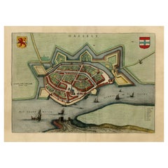
Plan of Fort Mardyck (Fort Mardijk) and surroundings by Sébastian de Pontault Beaulieu. Mardyck is a former commune in the Nord department in northern France. It is an associated commune with Dunkirk since it joined the latter in 1980.
- Dimensions:Height: 20.01 in (50.8 cm)Width: 23.82 in (60.5 cm)Depth: 0.02 in (0.5 mm)
- Materials and Techniques:
- Period:Mid-17th Century
- Date of Manufacture:1649
- Condition:Some small marginal tears. Please study image carefully.
- Seller Location:Langweer, NL
- Reference Number:
About the Seller
5.0
Platinum Seller
These expertly vetted sellers are 1stDibs' most experienced sellers and are rated highest by our customers.
Established in 2009
1stDibs seller since 2017
1,919 sales on 1stDibs
Typical response time: <1 hour
- ShippingRetrieving quote...Ships From: Langweer, Netherlands
- Return PolicyA return for this item may be initiated within 14 days of delivery.
More From This SellerView All
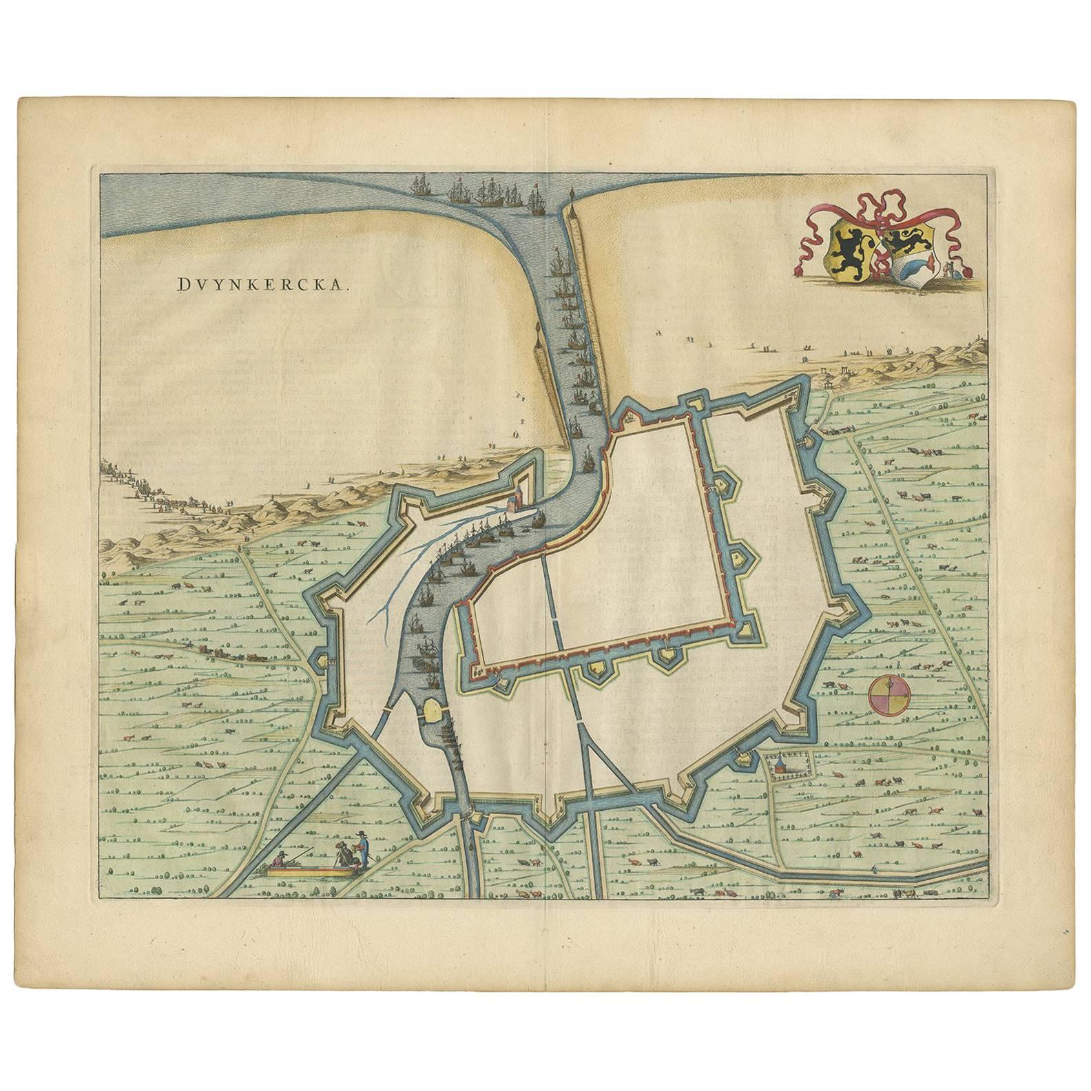
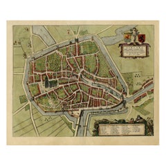
- Antique Map of Dunkirk 'France' by J. Blaeu, 1649Located in Langweer, NLAntique map titled 'Duynkercka'. Published by J. Blaeu, 1649. Dutch text on verso.Category
Antique Mid-17th Century Maps
MaterialsPaper
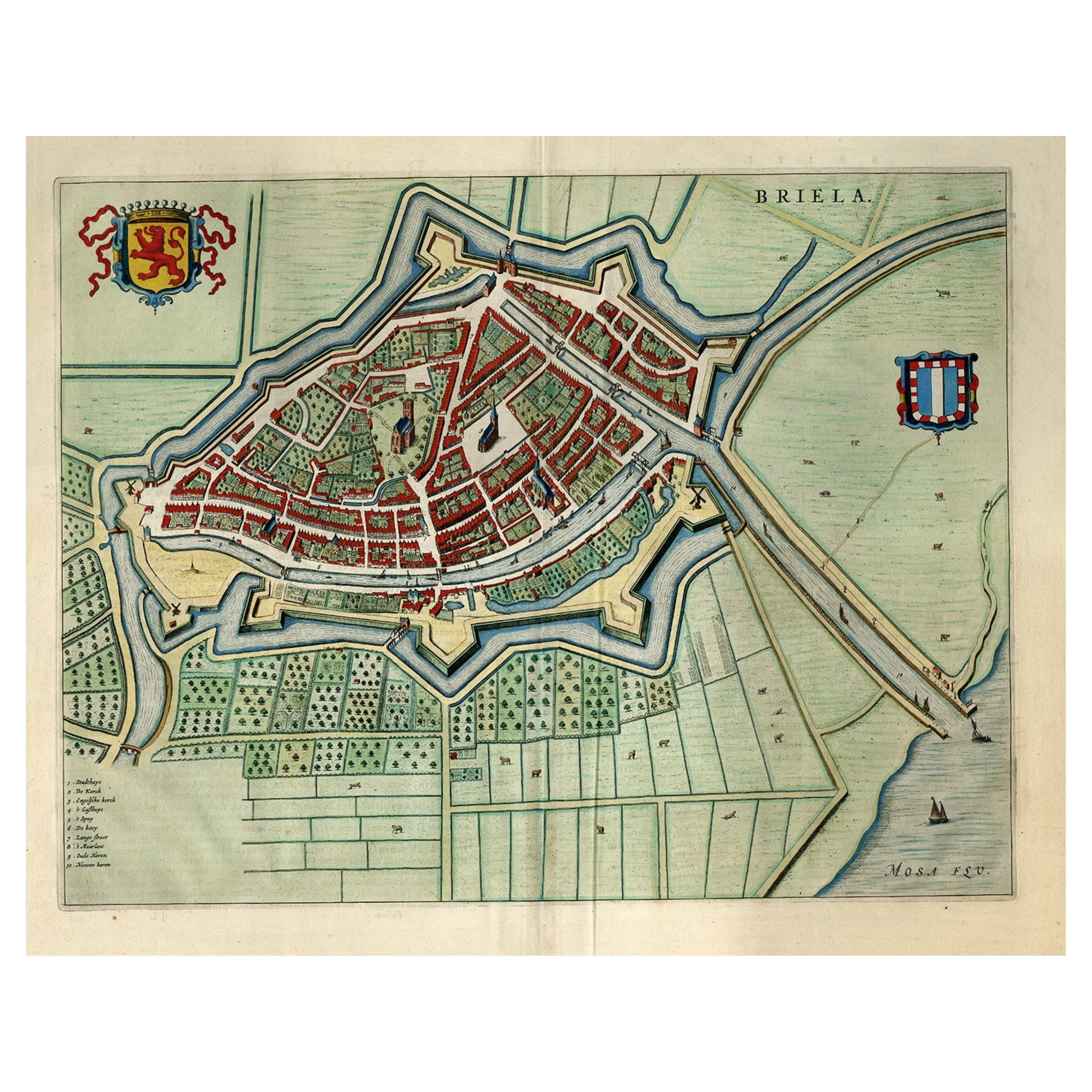
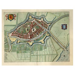
- Great Antique Bird's-Eye View Plan of Brielle by Blaeu in The Netherlands, 1649Located in Langweer, NLAntique print, titled: 'Briela.' Bird's-eye view plan of Brielle in The Netherlands. With key to locations and coats of arms. Text in Dutch on verso. This plan originates from the famous city Atlas: 'Toneel der Steeden' published by Joan Blaeu...Category
Antique 1640s Maps
MaterialsPaper
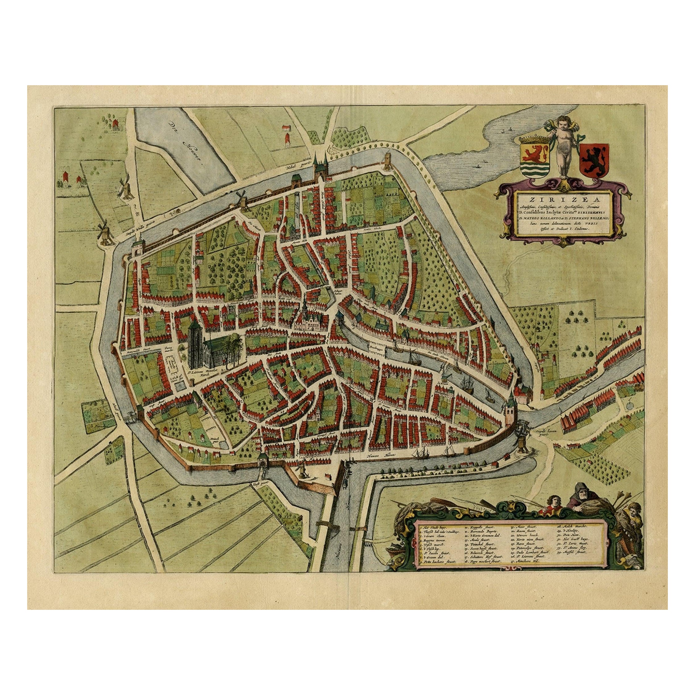
- Antique Bird's-eye View Plan of Zierikzee in Zeeland, The Netherlands, 1649Located in Langweer, NLAntique print, titled: 'Zirizea.' - A bird's-eye view plan of Zierikzee in The Netherlands, with key to locations and coats of arms. After Matheo Rollando and Stephano Bellemo. Latin tekst on verso. From the city Atlas: 'Toneel der Steeden' published by Joan Blaeu...Category
Antique 1640s Maps
MaterialsPaper
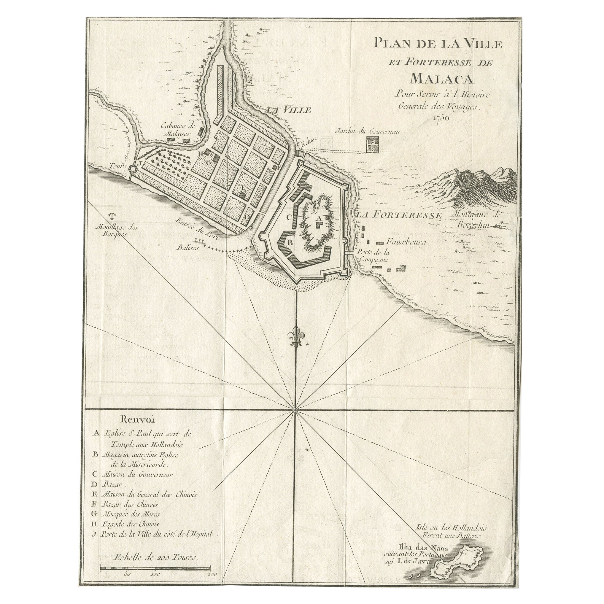
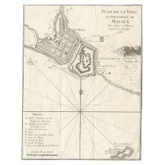
- Detailed Original Antique Plan of the City and Fort of Malacca, Malaysia, 1764Located in Langweer, NLDescription: Antique map titled 'Plan de la Ville et Forteresse de Malaca'. Detailed plan of the city and fort of Malacca on the southern Malay Peninsula, commanding the strategic st...Category
Antique 1760s Maps
MaterialsPaper
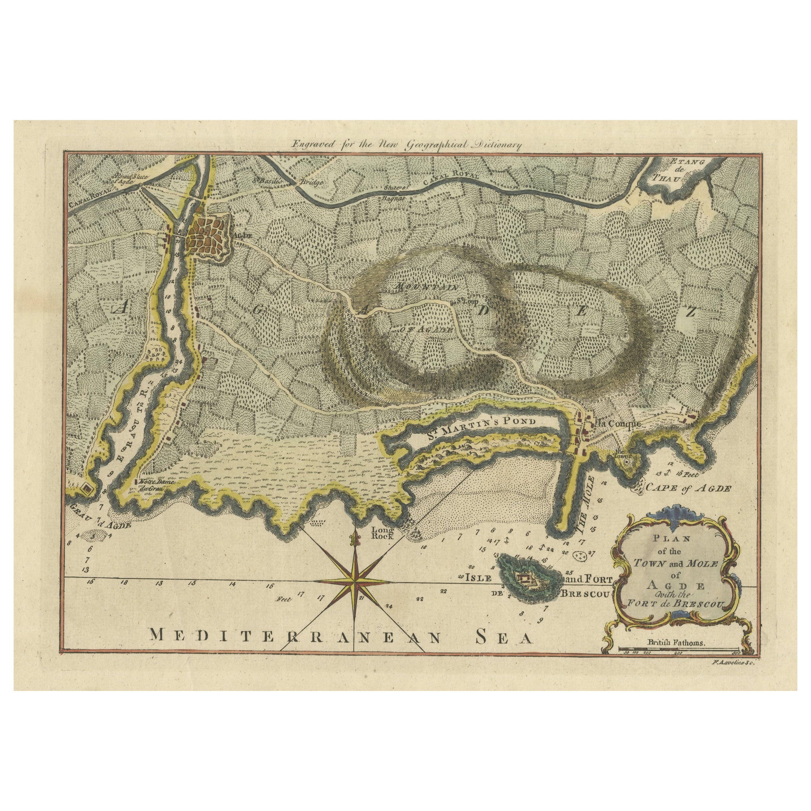
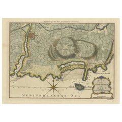
- Antique Map Plan of Town and Mole of CAP D'agde & Fort De Brescou, France, 1759Located in Langweer, NLAntique Plan titled 'Plan of the Town and Mole of Agde with the Fort de Brescou'. Antique town plan of Agde, engraved for the Geographical Dictionary, by Rol...Category
Antique Mid-18th Century Maps
MaterialsPaper
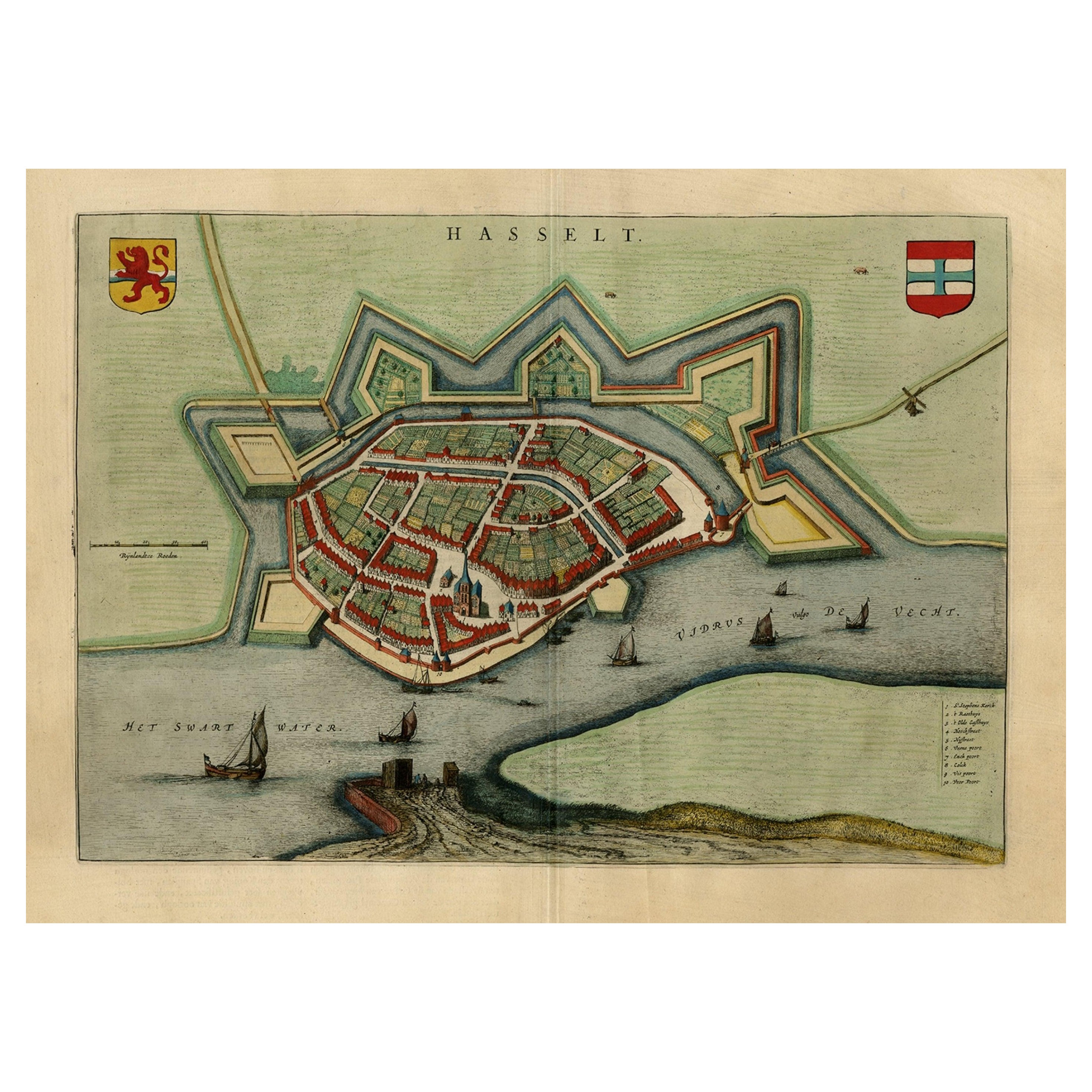
- Stunning Bird's-Eye View Plan of Hasselt by Blaeu in The Netherlands, 1649Located in Langweer, NLAntique print, titled: 'Hasselt.' Bird's-eye view plan of Hasselt in The Netherlands. With key to locations and coats of arms. Text in Dutch on verso. This plan originates from the famous city Atlas: 'Toneel der Steeden' published by Joan Blaeu...Category
Antique 1640s Maps
MaterialsPaper

You May Also Like
- Dutch Map and City Plan of La Roche-sur-Foron, France, 17th Century Hand ColoredBy Coenraet DeckerLocated in Alamo, CA"Rupes Allobrogum vulgo La Roche" by Dutch engraver Coenraet Decker (1650-1685) is from the atlas Theatrum Statuum Regiae Celestudinis Sabaudiae Ducis, published in 1682. This richly...Category
Antique Late 17th Century Dutch Maps
MaterialsPaper
- Catalogue of Engraved Views, Plans, Etc., Of New York City, 1st EdLocated in valatie, NYA catalogue of engraved views, plans, etc., Of New York City, (The Collection of Percy R. Pyne II). Privately Printed by The De Vinne Press, New York, 1912. Limited to 100 copies. Gr...Category
Early 20th Century American Books
MaterialsPaper
- Original Antique Map of France, Arrowsmith, 1820Located in St Annes, LancashireGreat map of France Drawn under the direction of Arrowsmith. Copper-plate engraving. Published by Longman, Hurst, Rees, Orme and Brown, 1820 Unframed.Category
Antique 1820s English Maps
MaterialsPaper
- 1844 French Antique Nautical Portolano of Golfe De St. Drely by Antoine RouxBy Antoine RouxLocated in Milan, ITAntique portolano, nautical map of Golfe De St. Drely engraved on a copper plate by Antoine Roux, Marseille France 1844, from his work Recueil des principaux plans des ports et de Ra...Category
Antique 1840s French Nautical Objects
MaterialsPaper
- Antique Map of Italy by Andriveau-Goujon, 1843By Andriveau-GoujonLocated in New York, NYAntique Map of Italy by Andriveau-Goujon, 1843. Map of Italy in two parts by Andriveau-Goujon for the Library of Prince Carini at Palazzo Carini i...Category
Antique 1840s French Maps
MaterialsLinen, Paper
- Original Antique Map of France, Sherwood, Neely & Jones, Dated 1809Located in St Annes, LancashireGreat map of France Copper-plate engraving by Cooper Published by Sherwood, Neely & Jones. Dated 1809 Unframed.Category
Antique Early 1800s English Maps
MaterialsPaper


Recently Viewed
View AllMore Ways To Browse
Northern France Map
Old Antique Compass
Map New Holland
Vienna Map
Map Of Vienna
Map Monde Antique
Arabian Map
Arabia Map
Egyptian Authentic Furniture
Middle East Map
Visscher Amsterdam
Columbia Antiques
Antique Fireplaces And Ranges
Historic Antique Maps
Map Railroad
Relief Map
Antique Victoria Australia
Antique Florida Collectibles