Continental Europe Maps
to
4,201
5,132
5,485
200
5,131
1
2
2
2
1
2,808
2,005
318
1
179
12
1
68
3
3
3
2
3
1
5,113
17
11
10
8
408
147
81
80
52
5,132
5,132
5,132
104
59
20
14
13
Item Ships From: Continental Europe
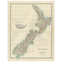
Antique Map of New Zealand, 1903, Featuring the North and South Islands and Alps
Located in Langweer, NL
Title: Antique Map of New Zealand, 1903, Featuring the North and South Islands and the Southern Alps
Description:
This antique map, titled "New Zealand," was engraved and published ...
Category
Early 20th Century Continental Europe Maps
Materials
Paper
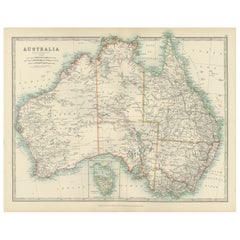
Antique Map of Australia, 1903, with Colonial Divisions and Detailed Topography
Located in Langweer, NL
Title: Antique Map of Australia, 1903, with Colonial Divisions and Detailed Topography
Description: This antique map, titled "Australia," was engraved and published in 1903 by W. & ...
Category
Early 20th Century Continental Europe Maps
Materials
Paper
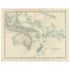
Antique Map of Oceania, 1903, Featuring the Pacific Islands and Australasia
Located in Langweer, NL
Title: Antique Map of Oceania, 1903, Featuring the Pacific Islands and Australasian Region
Description:
This antique map, titled "Oceania," was engraved and published in 1903 by W. ...
Category
Early 20th Century Continental Europe Maps
Materials
Paper
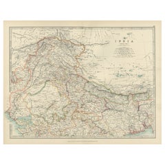
Antique Map of Northern India, Featuring Boundaries & Himalayan Detail, 1903
Located in Langweer, NL
Antique Map of Northern India, 1903, Featuring Provincial Boundaries and Himalayan Detail
This antique map, titled "India (Northern Sheet)," was engraved and published in 1903 by W....
Category
Early 20th Century Continental Europe Maps
Materials
Paper
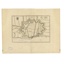
Antique Map of the City of Gorinchem by Merian, 1659
Located in Langweer, NL
Antique map titled 'Gorckum'. This print depicts the city of Gorinchem (or Gorcum/Gorkum, The Netherlands). This print originates from 'Topographia Germaniae Inferioris (..)' by C. M...
Category
17th Century Antique Continental Europe Maps
Materials
Paper
$93 Sale Price
20% Off
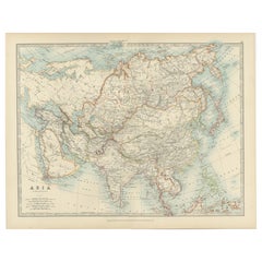
Antique Map of Asia with Intricate Provincial Boundaries, Published in 1903
Located in Langweer, NL
Title: Antique Map of Asia, 1903, with Intricate Provincial Boundaries and Coastal Features
Description:
This antique map, titled "Asia," was engraved and published in 1903 by the r...
Category
Early 20th Century English Continental Europe Maps
Materials
Paper
Antique Map of the World in two sheets, 1852
Located in Langweer, NL
Antique map titled 'The World on Mercator's Projection'. Two individual sheets of the world. This map originates from 'Lowry's table Atlas constructed and engraved from the most rece...
Category
Mid-19th Century Antique Continental Europe Maps
Materials
Paper
$238 Sale Price / set
20% Off
Circa 1659 Willem Blaeu Map: Southwestern Switzerland with Geneva & Lakes
Located in Langweer, NL
Circa 1659 Willem Blaeu Map: Southwestern Switzerland with Geneva & Lakes
This detailed map from circa 1659 by Willem Blaeu, titled "Das Wiflispurgergow," highlights the southwestern region of Switzerland.
It features significant landmarks such as Geneva, Lake Geneva (Lacus Lemannus), Lake Neuchatel, Lake Biel, Bern, Freiburg, and Lake Thuner.
Based on the work of Gerard Mercator, this map is published with Spanish text on the verso, dating from the period between 1659 and 1672.
Measuring 19.9 inches wide by 15.1 inches high, the map is rendered in full contemporary color on a bright sheet that bears a large watermark of the god Atlas.
The condition is excellent, with a sharp impression, short centerfold separations at the top and bottom margins, and an archivally repaired tear in the right margin.
Keywords:
- Willem Blaeu map
- Gerard Mercator
- 17th-century Switzerland map...
Category
1650s Antique Continental Europe Maps
Materials
Paper
$1,175 Sale Price
20% Off
Antique Map of Batavia and Surabaya by Winkler Prins, 1905
Located in Langweer, NL
Antique map titled 'Batavia en Soerabaja'. Detailed plan of Batavia (Jakarta) and Soerabaja (Surabaya), Indonesia. The plans include important places like Tandjoeng Priok, Oedjong, W...
Category
20th Century Continental Europe Maps
Materials
Paper
Original Antique Map of the Philippines, Malaysia, Indonesia, Singapore, c.1690
Located in Langweer, NL
Antique map titled 'Isole dell' Indie, diuise in Filippine, Molucche e della Sonda'.
Old map of the Philippines, Malaysia, Indonesia, Singapore, Northern Australia and contiguous i...
Category
1690s Antique Continental Europe Maps
Materials
Paper
$2,142 Sale Price
20% Off
Iberian Peninsula & Mediterranean Map: Western Roman Empire, by Tardieu, 1802
Located in Langweer, NL
Antique Map with Title: "Partie Occidentale de l'Empire Romain ou du Monde connu des Anciens"
Publication Details:
- Atlas Title: Nouvel Atlas Universel de Géographie Ancienne et M...
Category
Early 1800s Antique Continental Europe Maps
Materials
Paper
$514 Sale Price
20% Off
Antique Map of Cairo and Surroundings by Balbi '1847'
Located in Langweer, NL
Antique map titled 'Le Kaire'. Original antique map of Cairo and surroundings, Egypt. This map originates from 'Abrégé de Géographie (..)' by Adrien Balbi. Published 1847.
Category
Mid-19th Century Antique Continental Europe Maps
Materials
Paper
$142 Sale Price
20% Off
Detailed Map of the Madura Strait, between Java & Madura Island, Indonesia, 1825
Located in Langweer, NL
Antique map titled 'Plan du Détroit de Madura'.
Detailed map of the Madura Strait in Indonesia. The eastern part of the island Java with the city of Gresik and the western part o...
Category
1820s Antique Continental Europe Maps
Materials
Paper
$1,111 Sale Price
24% Off
Old Map of The Southern Part of Norway, Covering the Region Around Bergen, c1650
Located in Langweer, NL
Antique map titled 'Nova et Accurata Tabula Episcopatuum Stavangriensis et Asloiensis'.
Old map of the southern part of Norway, it covers the region around Bergen. Decorated with...
Category
1650s Antique Continental Europe Maps
Materials
Paper
$777 Sale Price
20% Off
Gallipoli Fortifications: A 1688 Engraved Bird’s-Eye Map by Mattheus Merian
Located in Langweer, NL
Gallipoli Fortifications: A 1688 Bird’s-Eye Map by Mattheus Merian
Description: This exquisitely detailed map of Gallipoli, crafted by the renowned engraver Mattheus Merian, offers ...
Category
1680s German Antique Continental Europe Maps
Materials
Paper
Decorative Original Antique Map of Normandy, France
Located in Langweer, NL
Original antique map titled 'Ducato D'Normandie Scala di Miglia d'Italia'. Very decorative map of Normandy, with a fine title cartouche featuring Leda ...
Category
Late 17th Century Italian Antique Continental Europe Maps
Materials
Paper
$895 Sale Price
20% Off
Engraved Large Map of The Kingdom of Portugal Original Handcolored, 1854
Located in Langweer, NL
Antique map titled 'Mappa Corografica do Reino de Portugal - Chorographical map of the Kingdom of Portugal divided into its Grand Provinces.'
Large map of...
Category
1850s Antique Continental Europe Maps
Materials
Paper
$1,043 Sale Price
20% Off
Antique Map of Bavaria, Bayern, with original Hand Coloring
Located in Langweer, NL
Antique map titled 'Bavariae Circulus atq Electoratus tam cum Adiacentibus quam insertis Regionibus'. Original old map of Bavaria, Bayern, Germany. The map stretches south to Innsbru...
Category
Late 17th Century Antique Continental Europe Maps
Materials
Paper
$447 Sale Price
20% Off
Antique Map of the Adour River, Near Bayonne, France
Located in Langweer, NL
Antique map titled 'Cours de la riviere de l'Adour depuis la mer jusqua Bayonne'. Original old map of the Adour river, near Bayonne, France. This map originates from 'Le Petit Atlas ...
Category
Mid-18th Century Antique Continental Europe Maps
Materials
Paper
$323 Sale Price
20% Off
Original Old Map of the Environs of Batavia in the Dutch East Indies (Indonesia)
Located in Langweer, NL
Antique map titled 'Carte des Environs de Batavia'. Map of the environs of Batavia (now Jakarta), Indonesia. This print originates from volume 8 of 'Histoire générale des voyages'. P...
Category
Mid-18th Century Antique Continental Europe Maps
Materials
Paper
$285 Sale Price
20% Off
Antique Map of Java in The Dutch East Indies, Now Indonesia, c.1690
Located in Langweer, NL
Antique map titled 'Insulae Iavae cum parte insularum Boreno Sumatrae (..)'.
Beautiful map of the Island of Java and part of Borneo, Bali, Madura and Sumatra. Artists and Engrave...
Category
17th Century Antique Continental Europe Maps
Materials
Paper
$2,619 Sale Price
20% Off
Antique Map of the Austro-Hungarian Monarchy, 1903, with Colorful Borderlines
Located in Langweer, NL
Title: Antique Map of the Austro-Hungarian Monarchy, 1903, with Colorful Provincial Borders
Description:
This antique map, titled "Austro-Hungarian Monarchy," was engraved and publi...
Category
Early 20th Century Continental Europe Maps
Materials
Paper
Antique Map of the Maluku Islands by Bellin, c.1750
By Jacques-Nicolas Bellin
Located in Langweer, NL
Antique map titled 'Carte Particuliere des Isles Moluques'. This map depicts the islands of Herij, Ternate, Tidor, Pottebackers, Timor, Machian and Bachian. The Moluccan islands were...
Category
18th Century Antique Continental Europe Maps
Materials
Paper
$119 Sale Price
20% Off
Antique Map of Belgium and The Netherlands with Delicate Pastel Coloration, 1903
Located in Langweer, NL
Antique Map of Belgium and The Netherlands, 1903, with Delicate Pastel Coloration
This antique map, titled "Belgium and The Netherlands," was engraved and published in 1903 by the d...
Category
Early 20th Century Continental Europe Maps
Materials
Paper
Antique Print of the Canton River and Other Views in China, 1858
Located in Langweer, NL
Antique print titled 'Canton River'. Three images on one sheet. The first image depicts a plan of Canton river. The second image depicts Commissioner Yeh. The third image depicts the...
Category
19th Century Antique Continental Europe Maps
Materials
Paper
$132 Sale Price
20% Off
Charming Miniature Map of Thrace or Thrake in Southeast Europe, 1685
Located in Langweer, NL
Antique map titled 'Thraciae Descriptio.'
Charming miniature map of Thrace, from the pocket atlas 'Introductionis in Universam Geographiam tam Veterem quam novam .. Acessit P. Be...
Category
1680s Antique Continental Europe Maps
Materials
Paper
$312 Sale Price
20% Off
Antique Map of Essex by Overton, circa 1710
Located in Langweer, NL
Antique map titled 'Essex, devided into Hundreds, with the most antient and fayre Towne Colchester (..)'. Map of Essex, England. Includes an inset town pl...
Category
Early 18th Century Antique Continental Europe Maps
Materials
Paper
$900 Sale Price
20% Off
Antique Map of the United States with inset map of the region of Mexico City
Located in Langweer, NL
Antique map titled 'Verein-Staaten von Nord-America, Mexico, Yucatan u.a.'. Very detailed map of the United States of America showing the Caribbean. With an inset map of the surround...
Category
Mid-19th Century Antique Continental Europe Maps
Materials
Paper
$819 Sale Price
20% Off
Antique Map of Europe, 1903, with Intricate Political Boundaries and Rich Detail
Located in Langweer, NL
Title: Antique Map of Europe, 1903, with Intricate Political Boundaries and Rich Detail
Description:
This antique map, titled "Europe," is a finely engraved and beautifully colored ...
Category
Early 20th Century Continental Europe Maps
Materials
Paper
Decorative Print of Costumes of Hungary, England, Germany Holland Etc., C.1875
Located in Langweer, NL
Antique costume print including many different costumes including costumes of Hungary, Holland and others. This print originates from 'Blätter für Kostümkunde. Historische und Volks-...
Category
1870s Antique Continental Europe Maps
Materials
Paper
$209 Sale Price
20% Off
Antique Map of Northern Africa from a Rare Dutch Atlas, 1825
Located in Langweer, NL
Antique map titled 'Africa'. Old map of the African continent originating from 'Atlas der Oude Wereld'.
Artists and Engravers: Published by C. Ph. Funke and W. van Boekeren, Gron...
Category
19th Century Antique Continental Europe Maps
Materials
Paper
$113 Sale Price
20% Off
Original Antique Map of Egypt in Frame by C. Weigel, circa 1720
Located in Langweer, NL
The map is an antique depiction of ancient Egypt, divided into its regions and nomes, also including areas like Troglodytica, Marmarica, and Ethiopia above Egypt. Christophorus Weige...
Category
Early 18th Century Antique Continental Europe Maps
Materials
Paper
$924 Sale Price
20% Off
Hand Colored Antique Map of the Department of Vaucluse, France
By Victor Levasseur
Located in Langweer, NL
Antique map titled 'Dépt de Vaucluse'. Map of the French department of Vaucluse, France. Vaucluse is the center of wine production in the southern Rhone. Some of the smartest wines in France can be found here. There is also a very strong movement towards the adoption of organic and biodynamic viticulture and natural wine making...
Category
Mid-19th Century Antique Continental Europe Maps
Materials
Paper
$323 Sale Price
20% Off
Large Chart of the Gambier Islands, Tuamotu Archipelago, French Polynesia
Located in Langweer, NL
Antique map titled 'Carte du Groupe des Iles Manga-Reva (Archipel Pomotou)'. Large chart of the Tuamotu Archipelago, French Îles Tuamotu, also called Paumotu, island group of French ...
Category
Mid-19th Century Antique Continental Europe Maps
Materials
Paper
$2,285 Sale Price
20% Off
Antique Map of a Bay of Borneo, Indonesia, c.1760
Located in Langweer, NL
Antique map titled 'La Baye de l'isle et Ville de Borneo'. Small map depicting a Bay of Borneo.
Artists and Engravers: Anonymous.
Condition: Good, general age-related toning. ...
Category
18th Century Antique Continental Europe Maps
Materials
Paper
Stunning Large Scale Antique Map of Martinique, Rare, Published 1758
Located in Langweer, NL
Antique map titled 'Carte Reduite de l'Isle de la Martinique Dressee au Depost des Cartes Plans et Journaux de la Marine.'
Superb, large scale chart of th...
Category
18th Century Antique Continental Europe Maps
Materials
Paper
$2,370 Sale Price
20% Off
Antique Map of the Holy Land by Delamarche, 1806
By Charles Francois Delamarche
Located in Langweer, NL
Antique map titled 'Judee ou Terre Sainte sous les Turcs.' This map shows the holy land under the Turcs. By Robert de Vaugondy, revised and published by ...
Category
19th Century Antique Continental Europe Maps
Materials
Paper
Antique Map of Hérault ‘France’ by V. Levasseur, 1854
Located in Langweer, NL
Antique map titled 'Dépt. de l'Hérault'. Map of the French department of Herault, France. This area is home to a wide variety of vineyards and is part of the larger Languedoc wine-gr...
Category
Mid-19th Century Antique Continental Europe Maps
Materials
Paper
$170 Sale Price
20% Off
Antique Map of the Hemelumer Oldeferd Township by Behrns, 1861
Located in Langweer, NL
Antique map titled 'Gemeente Hemelumer Oldephaert en Noordwolde'. Old map depicting the Hemelumer Oldeferd en Noordwolde township including cities and villages like Workum, Koudum, H...
Category
19th Century Antique Continental Europe Maps
Materials
Paper
$84 Sale Price
20% Off
Antique Map of the Tunquin River and Bay to Cacho, the Capital City, Siam, 1758
Located in Langweer, NL
Antique map titled ‘Kaart van den Loop der Rivier van Tonkin van Cacho tot aan de Zee / Carte du Cours de la Riviere de Tunquin Depuis Cacho jusqu'à la Mer J. v. Schley direx.’ Detailed map of the Tunquin River and Bay, extending north to Cacho, the capital...
Category
18th Century Antique Continental Europe Maps
Materials
Paper
$209 Sale Price
20% Off
Antique Map of Russia by N. Sanson, 1705
Located in Langweer, NL
A strongly engraved map of European Russia showing its political divisions, major topographical features, cities and towns. Extends to the Sea of Azov and the tip of the Caspian Sea ...
Category
Early 18th Century Antique Continental Europe Maps
Materials
Paper
$285 Sale Price
20% Off
Interesting Original Antique Hemisphere Map Showing the Latest Discoveries
Located in Langweer, NL
Antique world map titled 'A Map of the World from the best Authorities'. Detailed map of the World, showing tracks of Captain James Cook in his 3 voyages in great detail. The map is ...
Category
Late 18th Century Antique Continental Europe Maps
Materials
Paper
$1,047 Sale Price
20% Off
Antique Map of the Adriatic Sea and the Balkan by J. Janssonius, circa 1650
Located in Langweer, NL
Striking large-scale map of the Greater Balkans. Decorated with two large-scale cartouches, one showing two swordsman at odds with one another and the other ...
Category
Mid-17th Century Antique Continental Europe Maps
Materials
Paper
$900 Sale Price
20% Off
Algarve: A Tapestry of Sea and Sunlight in an Antique Map, 1903
Located in Langweer, NL
The image is a historical map of the Algarve, the southernmost region of Portugal. The map is titled "FARO. ALGARVE," indicating that it is centered around the city of Faro, which is...
Category
Early 1900s Antique Continental Europe Maps
Materials
Paper
$371 Sale Price
20% Off
Detailed Original Antique Map of India, Southeast Asia and the Far East, 1719
Located in Langweer, NL
Antique map titled 'Carte des Indes, de la Chine & des Iles de Sumatra, Java & c'.
Detailed map of India, Southeast Asia and the Far East, extending from Gujerat to the supposed "T...
Category
1710s Antique Continental Europe Maps
Materials
Paper
$1,666 Sale Price
20% Off
Antique Map of Overijssel by Visscher, c.1652
Located in Langweer, NL
Antique map titled 'Transisalania provincia vulgo Over-yssel'. Original antique map of the province of Overijssel, the Netherlands. Published by N. Visscher after N. ten Have, circa ...
Category
17th Century Antique Continental Europe Maps
Materials
Paper
$521 Sale Price
20% Off
Antique Original Map of the City of Deventer, the Netherlands, 1588
Located in Langweer, NL
Antique map titled 'Liberae et Hanseaticae urbis Daventriensis delineatio'.
Original bird's eye plan of the Dutch hanseatic city Deventer, on the situated IJssel river. This map ...
Category
16th Century Antique Continental Europe Maps
Materials
Paper
$749 Sale Price
20% Off
Dutch Municipality of Oldekerk in Groningen, The Netherlands, 1865
Located in Langweer, NL
Groningen: Gemeente Niekerk, Oldekerk.
These scarse detailed maps of Dutch Towns originate from the 'Gemeente-atlas' of Jacob Kuyper. This atlas of all towns in the Netherlands w...
Category
19th Century Antique Continental Europe Maps
Materials
Paper
$113 Sale Price
20% Off
Antique Map of the French Colony Martinique by V. Levasseur, 1854
By Victor Levasseur
Located in Langweer, NL
Antique map titled 'Colonies Françaises. Martinique, Amérique du Sud'. This map originates from ‘Atlas National de la France Illustré’. Published by A. Combette, Paris, 1854.
Category
Mid-19th Century Antique Continental Europe Maps
Materials
Paper
$190 Sale Price
20% Off
Original Antique Map of England with Hand Coloring
Located in Langweer, NL
Antique map titled 'Engand'. Original old map of England. Engraved by W. Milton. Published by John Mc. Gowan, circa 1829.
Category
Mid-19th Century Antique Continental Europe Maps
Materials
Paper
$209 Sale Price
20% Off
Antique Map of the West Indies and Ambon in Indonesia, 1900
Located in Langweer, NL
Two maps on one sheet titled 'De West-Indische Eilanden (Nederlandsch Gedeelte)' and 'Ambon, Leasi-Eilanden en Banda-Eilanden'. Old map of the Dutch West Indies and Ambon Island, Ind...
Category
20th Century Continental Europe Maps
Materials
Paper
$133 Sale Price
20% Off
Antique Map of the Island of Borneo by Janssonius, circa 1650
Located in Langweer, NL
Antique map titled 'Insula Borneo et Occidentalis pars Celebis cum adjacentibus Insulis'. Rare sea chart of the island of Borneo. Published by J. Janssonius, circa 1650.
Category
Mid-17th Century Antique Continental Europe Maps
Materials
Paper
$1,755 Sale Price
24% Off
Antique Print of the Ryukyu Islands in Japan, 1856
Located in Langweer, NL
Antique print titled ‘Lew Chew'. Lithograph of the Ryukyu Islands, from about 1829 until the mid-20th century, the islands' English name was spelled Luchu, Loochoo, or Lewchew. The R...
Category
19th Century Antique Continental Europe Maps
Materials
Paper
$157 Sale Price
30% Off
Antique Map of the Region of Blois by Janssonius, c.1650
Located in Langweer, NL
Antique map titled 'Description du Blaisois'. Old map of the region of Blois, France. It shows the city of Blois, Amboise, the Loire River and more.
Artists and Engravers: Johann...
Category
17th Century Antique Continental Europe Maps
Materials
Paper
$298 Sale Price
20% Off
Old Engraving of French Visiting Tomari, a Village in Far East Russia, 1797
Located in Langweer, NL
Plate: 'Costumes des Habitants de la Baie de Langle.' (Costumes of the inhabitants of Langle Bay, Russia).
Tomari (Russian: ??????) is a coastal town and the administrative cente...
Category
1790s Antique Continental Europe Maps
Materials
Paper
$322 Sale Price
20% Off
Antique Map of the Rivers and Mountains in Asia, c.1895
By Meyer
Located in Langweer, NL
Antique map titled 'Asien. Fluss- und Gebirgssysteme.' Map of Asia, showing river- and mountain systems. This map originates from 'Meyers grosses Konversations-Lexikon.', published in Leipzig and Vienna. Meyers Konversations-Lexikon was a major German encyclopedia that existed in various editions from 1839 until 1984, when it merged with the Brockhaus encyclopedia. Several of the plates were also used in Dutch Encyclopedia's like Winkler Prins...
Category
19th Century Antique Continental Europe Maps
Materials
Paper
$85 Sale Price
20% Off
Antique Map of Virginia, with Inset Map of the Northern Part of West Viriginia
Located in Langweer, NL
Antique map titled 'West Virginia'. Original antique map of Virginia, United States. With inset map of the 'Panhandle' or northern part of West...
Category
Late 19th Century Antique Continental Europe Maps
Materials
Paper
$276 Sale Price
20% Off
Sebastian Münster's 16th Century Map of the British Isles, ca.1590
Located in Langweer, NL
GREAT BRITAIN -- "ENGELLANDT mit dem anstossenden Reich Schottlandt so vorzeiten Albion und Britannia haben geheissen". (Basel, c. 1590).
Partly handcolored woodcut double-page map from S. Munster's 'Cosmographey'. 330 x 408 mm. (Lower margin cut short (touching the line), tiny hole in upper margin, sl. foxed/browned, lower right corner a bit thumbed).
Sebastian Münster's 16th Century Map of the British Isles from 'Cosmographia Universalis...
Category
16th Century Antique Continental Europe Maps
Materials
Paper
$609 Sale Price
20% Off
Antique Print of the Office of the Earl of Abercorn in Ireland or Scotland, 1770
Located in Langweer, NL
Antique print titled 'Elevation of the Earl of Abercorn's Offices (..)'.
Old engraving of the office of the Earl of Abercorn. James Hamilton, 8th Earl of Abercorn PC (Ire) (22 Oc...
Category
18th Century Antique Continental Europe Maps
Materials
Paper
$600 Sale Price
20% Off
Antique Map of Greece by J. Jansson, circa 1653
Located in Langweer, NL
This is an authentic antique map of the Greece by Jan Jansson. The map was published in Amsterdam, circa 1653. This striking 17th century map of Greece was based on “Totius Graeciae ...
Category
Mid-17th Century Antique Continental Europe Maps
Materials
Paper
$834 Sale Price
20% Off
Recently Viewed
View AllMore Ways To Browse
Vintage Industrial Bins
Vintage Liquor Labels
Vintage Utensil Holders
Vintage Wicker Wine Bottles
Vintage Wrought Iron Fire Screen
Viso Porcelain
Wall Mount Water Fountains
Wedding Cabinets and Armoires
Wedgwood Green Jasperware
Wedgwood Portrait
West German Pot
White Ceramic Garden Stool
White Ironstone China
White Lacquer Bar Cart
Woman With Water Jug
Wooden Chest 1800
Wooden Tea Cart
Worcester Jug
